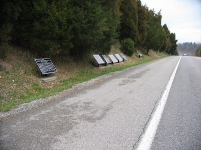
On Boonsboro / Shepherdstown Pike (State Highway 34), on the right when traveling west.
U.S.A. Horse Batteries and Reserve Artillery, Army of the Potomac. (September 17, 1862) Horse Batteries A, B and L (Consolidated) and M, 2nd U.S. Artillery, C and G (Consolidated) of the 3d U.S. Artillery, were established on the crown of the . . . — — Map (db m7060) HM
On Confederate Avenue at Dunker Church Road / Old Hagerstown Pike, on the right when traveling west on Confederate Avenue.
C.S.A. Jackson's Command Major General Thomas J. Jackson, Commanding. (September 17, 1862.) Jackson's Command was in order of battle at 5:30 a.m. Jackson's Division, commanded by J.R. Jones, in two lines, its right resting on the Hagerstown . . . — — Map (db m6276) HM
On Richardson Avenue, on the left when traveling east.
C.S.A. Jackson's Command, Anderson's Brigade, D.H. Hill's Division. Brigadier General Geo. B. Anderson, Commanding. Organization. 2d, 4th, 14th, and 30th North Carolina Infantry. (September 17, 1862.) On the night of September 16, 1862, . . . — — Map (db m6962) HM
On Cornfield Avenue, on the right when traveling west.
C.S.A. Jackson's Command, Ripley's Brigade, D.H. Hill's Division, Brigadier General R.S. Ripley, Commanding. Organization. 1st and 3rd North Carolina, 4th and 44th Georgia Infantry. (Septemer 17, 1862.) Late in the afternoon of September 16, . . . — — Map (db m5716) HM
On Harpers Ferry Road at Branch Avenue, on the right when traveling north on Harpers Ferry Road.
C.S.A. Field's Brigade, Hill's Light Division, Col. John M. Brockenbrough, 40th Virginia Infantry, Commanding. Organization. 40th Virginia Infantry, 47th Virginia Infantry, 55th Virginia Infantry, 22d Virginia Infantry. September 17, 1862. . . . — — Map (db m6762) HM
On Hagerstown Pike (State Highway 65), on the right when traveling north.
C.S.A. Jackson's Command. Early's Brigade, Ewell's Division. Brig. Gen. Jubal A. Early, Commanding. Organization. 13th 25th 31st 44th 49th 52d & 58th Virginia Infantry. September 16-17, 1862. No.1. On the night of the 16th, Early's Brigade . . . — — Map (db m7204) HM
On Cornfield Avenue, on the right when traveling east.
C.S.A. Jackson's Command. Hays' Brigade, Ewell's Division, Brigadier General Harry T. Hays, Commanding. Organization. 5th, 6th, 7th, 8th and 14th Louisiana Infantry. (September 17, 1862.) On the night of September 16, Hays' Brigade bivouacked in . . . — — Map (db m5662) HM
On Starke Avenue, on the right when traveling east.
(Main Tablet):C.S.A. Jackson's Division, Jackson's Command. Brigadier General J.R. Jones, Commanding. (September 17, 1862.) Early in the morning of the 17,th while in the position taken the evening before, Jackson's Division was subjected . . . — — Map (db m6152) HM
On Branch Avenue, on the left when traveling south.
U.S.A. Kanawha Division, Ninth Corps. Col. E.P. Scammon, 23d Ohio Infantry, Commanding. September 16-17, 1862. On the evening of September 16th the Kanawha Division was on the ridge east of the Antietam; Crook's Brigade north of the Burnside . . . — — Map (db m6599) HM
On Harpers Ferry Road, on the right when traveling north.
C.S.A. From noon, September 15, 1862, until driven from position late in the afternoon of the 17th, the right of the infantry line of the Army of Northern Virginia, held by Kemper's Virginia Brigade, was 265 yards due east of this point. Toombs' . . . — — Map (db m6771) HM
On Hagerstown Pike (State Highway 65), on the right when traveling south.
C.S.A. Lee's Brigade, Stuart's Cavalry Division, Brig. Gen. Fitzhugh Lee, Commanding. Organization. 1st, 3rd, 4th, 5th, and 9th Virginia Cavalry. (September 15-19, 1862.) The 3rd, 4th and 9th Virginia Cavalry of Lee's Brigade reached the field . . . — — Map (db m6175) HM
On Boonsboro Pike (State Highway 34), on the right when traveling east.
C.S.A. Longstreet's Command, Major General James Longstreet, Commanding. (September 14-16, 1862.) Longstreet's command, consisting of D.R. Jones' and Hood's Divisions and Evans' Brigade, with D.H. Hill's Division of Jackson's Command, withdrew . . . — — Map (db m7237) HM
On Boonsboro Pike (State Highway 34), on the right when traveling east.
C.S.A. Longstreet's Command. Maj. Gen. James Longstreet, Commanding. September 17, 1862. Early in the day several brigades of this command were sent to the vicinity of the Dunkard Church in support of Jackson's Command. At about 9:15 a.m. . . . — — Map (db m7240) HM
On Rodman Avenue, on the right when traveling south.
C.S.A. Longstreet's Command. Garnett's Brigade, Jones' Division, Brig. Gen. Richard B. Garnett, Commanding. Organization. 8th Virginia Infantry, 19th Virginia Infantry, 18th Virginia Infantry, 28th Virginia Infantry, 56th Virginia Infantry. . . . — — Map (db m6505) HM
On Dunker Church Road at Smoketown Road, on the right when traveling north on Dunker Church Road.
C.S.A Longstreet's Command Manning's Brigade, Walker's Division Col. Van H. Manning, Commanding Organization 3d Arkansas, 30th Virginia, 27th, 46th and 48th North Carolina September 17, 1862 About 10:20 A.M. the 30th Virginia, 46th and 48th . . . — — Map (db m5465) HM
On Smoketown Road, on the left when traveling west.
C.S.A. McLaws' Division, Longstreet's Command. Maj. Gen. Lafayette McLaws, Commanding. September 17, 1862. McLaws' Division left Harper's Ferry on the forenoon of September 16th, crossed the Potomac at Blackford's Ford about daybreak of the . . . — — Map (db m6895) HM
On Mansfield Avenue, on the left when traveling east.
U.S.A. Meade's Division, First Army Corps, Maj. Gen. George G. Meade, Commanding. September 17, 1862. Meade's Division formed at about 6:30 a.m. in the following order: Seymour's Brigade on the left and in advance, Magilton's and Anderson's . . . — — Map (db m5915) HM
On Mansfield Avenue, on the left when traveling east.
U.S.A. Meade's Division, First Army Corps, Maj. Gen. George G. Meade, Commanding, September 16, 1862. Meade's Division crossed the Antietam at the Sumner Bridge at 2 p.m. Sept. 16, and moved in a westerly direction toward the position of the . . . — — Map (db m5913) HM
On Harpers Ferry Road at Branch Avenue, on the right when traveling north on Harpers Ferry Road.
C.S.A. Munford's Brigade, Stuart's Cavalry Division, Brig. Gen. Thomas T. Munford, Commanding. Organization 2nd Virginia Cavalry, 7th Virginia Cavalry, 12th Virginia Cavalry. (September 16-18, 1862.) The 2nd and 12th Virginia Cavalry reached . . . — — Map (db m6765) HM
Near Old Burnside Bridge Road, on the left when traveling east.
U.S.A. Ninth Army Corps Brig. Gen. Jacob D. Cox, Commanding. September 15-16, 1862. The Ninth Corps moved from Fox's Gap in South Mountain by the Sharpsburg Road, on the morning of September 15 and in the evening encamped in rear of the extreme . . . — — Map (db m6446) HM
Near Old Burnside Bridge Road, on the left when traveling east.
U.S.A. Ninth Army Corps. Brig. Gen. Jacob D. Cox, Commanding. September 17, 1862. On the morning of the 17th, Durell's Battery D, Pennsylvania Light Artillery took position on the ridge to the right of Benjamin's and both engaged the Confederate . . . — — Map (db m6447) HM
On Branch Avenue, on the left when traveling south.
U.S.A. Ninth Army Corps. Fairchild's Brigade, Rodman's Division. Col. H.S. Fairchild, 89th New York Infantry, Commanding. Organization. 9th New York Infantry (Hawkins' Zouaves), 89th New York Infantry, 103d New York Infantry. (September 17, . . . — — Map (db m6609) HM
Near Old Burnside Bridge Road, on the left when traveling east.
U.S.A. Ninth Army Corps Ferrero's Brigade, Sturgis' Division. Brigadier General Edward Ferrero, Commanding. Organization. 51st New York Infantry, 51st Pennsylvania Infantry. 21st and 35th Massachusetts Infantry. September 17, 1862. On the . . . — — Map (db m6444) HM
On Branch Avenue, on the left when traveling south.
(Main Tablet): U.S.A. Ninth Army Corps. Brig. Gen. J.D. Cox, Commanding. September 17, 1862. On the morning of the 17th, the Ninth Army Corps was in position behind the ridges on the east bank of the Antietam. At 1 p.m., Sturgis' . . . — — Map (db m6557) HM
On Dunker Church Road / Old Hagerstown Pike at Mondell Road, on the right when traveling north on Dunker Church Road / Old Hagerstown Pike.
U.S.A. Patrick's Brigade, First Army Corps. On the night of September 16, 1862, Patrick's Brigade of Doubleday's Division bivouacked in line of battle on the east side of this road, facing west. This tablet marks the left of the brigade line, . . . — — Map (db m5826) HM
On Boonsboro Pike (State Highway 34), on the right when traveling east.
C.S.A. Reserve Artillery, Army of Northern Virginia, Brig. Gen. William N. Pendleton, Commanding. September 16-18, 1862. A portion of the Reserve Artillery took part in the battle of September 16-17; The rest was posted at the fords, in the . . . — — Map (db m7231) HM
On Richardson Avenue, on the left when traveling east.
U.S.A. Richardson's Division, Second Army Corps, Maj. Gen. Israel B. Richardson, commanding September 17, 1862. Richardson's Division crossed the Antietam at Pry's Ford about 9:30 a.m. and advanced to the ravine behind the high ground . . . — — Map (db m5502) HM
On Smoketown Road, on the right when traveling north.
U.S.A. Ricketts' Division, First Army Corps, Brig. Gen. James B. Ricketts, Commanding. September 16, 1862. Ricketts' Division crossed the Antietam at the Sumner Bridge on the afternoon of Sept. 16, and moved in a westerly direction toward the . . . — — Map (db m7189) HM
On Cornfield Avenue, on the right when traveling west.
U.S.A. Ricketts' Division, First Army Corps, Brig. Gen. Jas. B. Ricketts, Commanding. (September 17, 1862.) Rickett's Division moved from its bivouac in the Poffenberger Woods, early in the morning of the 17th. Duryea' Brigade moving south . . . — — Map (db m5704) HM
On Mansfield Avenue, on the left when traveling south.
U.S.A. Ricketts’ Division, First Army Corps, Brig. Gen. James B. Ricketts, Commanding. September 17, 1862. Ricketts’ Division, on the left of the First Corps, formed for attack at 6 a.m., in the following order: Hartsuff’s Brigade in advance, . . . — — Map (db m5934) HM
On Branch Avenue, on the left when traveling south.
U.S.A. Rodman's Division, Ninth Army Corps. Brig. Gen. Isaac P. Rodman, Commanding. (September 17, 1862.) At daybreak on the 17th, Rodman's Division, supported by Ewing's Brigade of the Kanawha Division, was in position south east of Burnside . . . — — Map (db m6697) HM
On Dunker Church Road / Old Hagerstown Pike at Smoketown Road, on the right when traveling north on Dunker Church Road / Old Hagerstown Pike.
(First Tablet):U.S.A. Second Army Corps. Major General E.V. Sumner, Commanding. (September 17, 1862.) At daybreak of the 17th the three divisions of the 2d Corps were east of the Antietam: Sedgwick's Division moved, crossed the Antietam . . . — — Map (db m6322) HM
On Hagerstown Pike (State Highway 65), on the right when traveling north.
U.S.A. Second Army Corps, Gorman's Brigade, Sedgwick's Division, Brig. Gen. Willis A. Gorman, Commanding. Organization. 15th Massachusetts Infantry, 1st Minnesota Infantry, 34th New York Infantry, 82d New York Infantry, Massachusetts . . . — — Map (db m7173) HM
On Hagerstown Pike (State Highway 65), on the right when traveling north.
U.S.A. Second Army Corps Dana's Brigade, Sedgwick's Division Brig. Gen. N.J.T. Dana, Commanding. Organization. 19th Massachusetts Infantry, 20th Massachusetts Infantry, 7th Michigan Infantry, 42nd New York Infantry, 59th New York Infantry, . . . — — Map (db m7178) HM
On Richardson Avenue, on the left when traveling east.
U.S.A. Second Army Corps. Weber's Brigade, French's Division. Brig. Gen. Max Weber, Commanding. Organization. 1st Delaware Infantry, 5th Maryland Infantry, 4th New York Infantry. September 17, 1862. Weber's Brigade, forming the advance of . . . — — Map (db m6956) HM
On Richardson Avenue, on the left when traveling east.
U.S.A. Second Army Corps. Caldwell's Brigade, Richardson's Division. Brig. General John C. Caldwell, Commanding. Organization 5th New Hampshire, 81st Pennsylvania, 7th, 61st, and 64th New York Infantry. (September 17, 1862) Caldwell's Brigade . . . — — Map (db m5539) HM
On Richardson Avenue, on the left when traveling east.
U.S.A. Second Army Corps Meagher's Brigade, Richardson's Division, Brig. Gen. Thomas F. Meagher, Commanding Organization 29th Massachusetts Infantry 63rd New York Infantry 69th New York Infantry 88th New York Infantry September 17, 1862 . . . — — Map (db m5521) HM
On Richardson Avenue, on the left when traveling east.
U.S.A. Second Army Corps, Brooke's Brigade, Richardson's Division Col. John R. Brooke, 53rd Pennsylvania Infantry, Commanding. Organization. 2nd Delaware Infantry, 52nd New York Infantry, 57th New York Infantry, 66th New York Infantry, 53d . . . — — Map (db m5541) HM
On Dunker Church Road / Old Hagerstown Pike at Cornfield Avenue, on the right when traveling north on Dunker Church Road / Old Hagerstown Pike.
U.S.A. Sedgwick's Division, Second Army Corps, Maj. Gen. John Sedgwick, Commanding. September 17, 1862. Sedgwick's Division crossed the Antietam at Pry's Ford at 7:45 a.m. and, advancing from the East Woods in column of Brigades, Gorman's . . . — — Map (db m6050) HM
On Richardson Avenue, on the left when traveling east.
Early in the morning the 20-pounder Parrott gun batteries of Taft, Langer, von Kleiser and Wever, First New York Artillery, were in position on the ridge east of the Antietam and north of Boonsboro Pike; Battery E (Benjamin's) 2nd U.S. and Battery . . . — — Map (db m5564) HM
On Richardson Avenue, on the left when traveling east.
The Battle opened at daylight between Hooker's Corps and the Confederate divisions of Jackson and Ewell and raged in the East Woods, in Miller's Cornfield and on either side of the Hagerstown Pike about one third of a mile north of the Dunkard . . . — — Map (db m168212) HM
On Richardson Avenue, on the left when traveling east.
U.S.A. September 17, 1862 (Continued) French's Division, following Sedgwick across the Antietam, on reaching the East Woods wheeled to the left, drove the Confederate outposts from the Roulette Buildings and about 9:30 a.m., engaged the brigade . . . — — Map (db m168213) HM
On Richardson Avenue, on the left when traveling east.
The left of the Union line was held by Burnside's (Ninth) Corps. The battle opened there about 10 a.m. by an unsuccessful attempt of the 11th Connecticut Infantry, supported by Crook's Brigade, to carry the stone bridge over the Antietam, about a . . . — — Map (db m5579) HM
On Cornfield Avenue, on the right when traveling west.
U.S.A. Sixth Army Corps Major General W.B. Franklin, Commanding. (September 17, 1862.) The Sixth Corps marched from its bivouac near Rohersville, in Pleasant Valley, at 5:30 a.m. of the 17th and reached the field shortly before noon. Smith's . . . — — Map (db m5776) HM
U.S.A. Sixth Army Corps Brooks' Brigade, Smith's Division Brig Gen. W.T.H. Brooks, Commanding Organization 2nd, 3rd, 4th, 5th, and 6th Vermont Infantry September 17, 1862 Brooks' Brigade left its camp in Pleasant Valley at 6 a.m., of the 17th, . . . — — Map (db m5479) HM
On Smoketown Road, on the right when traveling west.
U.S.A. Slocum's Division, Sixth Army Corps. Maj. Gen. Henry W. Slocum, Commanding. September 17, 1862. Slocum's Division followed Smith's in its march from near Crampton's Pass on the morning of the 17th, and, upon reaching the field, occupied . . . — — Map (db m6001) HM
On Smoketown Road, on the right when traveling west.
U.S.A. Smith's Division, Sixth Army Corps, Maj. Gen. William F. Smith, Commanding. (September 17, 1862.) Smith's Division left camp between Crampton's Pass and Rohrersville, in Pleasant Valley, at 5:30 a.m., of the 17th, crossed the Antietam at . . . — — Map (db m6027) HM
On Hagerstown Pike (State Highway 65), on the right when traveling south.
C.S.A. Stuart's Cavalry Division. Maj. Gen. J.E.B. Stuart, Commanding. September 16-19, 1862 On the night of the 16th, Fitzhugh Lee's Brigade of Stuart's Division was in position behind the hill about 650 yards northwest of this point, . . . — — Map (db m6178) HM
Near Old Burnside Bridge Road, on the left when traveling east.
U.S.A. Sturgis' Division, Ninth Army Corps. Brig. Gen. Samuel G. Sturgis, Commanding. September 17, 1862. On the night of September 16th, Sturgis' Division bivouacked on the eastern slope of the ridge bordering the east bank of the Anitetam to . . . — — Map (db m6445) HM
On Boonsboro / Shepherdstown Pike (State Highway 34), on the right when traveling west.
U.S.A. Third Brigade, Cavalry Division. Col. Richard H. Rush, 6th Pennsylvania Cavalry, Commanding. Organization. 4th and 6th Pennsylvania Cavalry. (September 17, 1862.) The Third Brigade supported Battery A, (Tidball's) 2d U.S. Artillery in its . . . — — Map (db m7019) HM
On Dunker Church Road / Old Hagerstown Pike at Cornfield Avenue, on the right when traveling north on Dunker Church Road / Old Hagerstown Pike.
U.S.A. Twelfth Army Corps. Goodrich's Brigade, Greene's Division Col. William B. Goodrich, 60th New York Infantry, Commanding, Organization. 3d Delaware Infantry, Purnell Legion Maryland Infantry, 60th New York Infantry, 78th New York Infantry. . . . — — Map (db m6113) HM