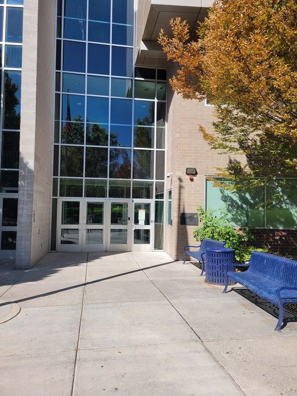
During the Walker Indian War in 1853 161 settlers on big cottonwood creek built a fort at this location. The fort enclosed four acres, but was not needed as the Indians proved to be friendly. — — Map (db m254949) HM
Ross Hame, also known as the historic William Harvey and Sarah Seegmiller
Ross House, was constructed 1922-1923. William Harvey Ross was president
of the Gunnison Valley Sugar Company and a business partner to famed
chewing gum industrialist . . . — — Map (db m255711) HM
Eastward 200 to 500 yards on Spring Creek's northern side in 1847, 2 or 3 men built temporary winter shelters called dugouts only months after entering Salt Lake Valley in July.
After arriving, LDS pioneers explored the valley and discovered . . . — — Map (db m255710) HM
In a deep hollow south of 3900 South, Uriah Nephi Smart built his tannery in 1880. This two story building was thirty feet wide and one hundred feet long. It was built of adobe bricks, which were made from clay taken from a bank north of the . . . — — Map (db m273350) HM
This mill was established on this site in 1878, by Rasmus Christian Knudsen, a millwright and master joiner from Alborg, Denmark. In 1864, he immigrated to Utah with his wife and two small children, walking across the plains, so that his family . . . — — Map (db m272805) HM
(Caption top left)
Hober C. Kimball home at Black Rock Beach. ca. 1880s. Photo courtesy the Utah State Historical Society
(Caption top center)
Black Rock Beach, ca. 1940s
Photo courtesy of the Utah State Historical . . . — — Map (db m255382) HM
In Commemoration of the First Communities Established on the West Side of Salt Lake Valley and the First Major Industry of Utah.
In 1853 Abraham Coon, an early Mormon pioneer, explored a canyon in the Oquirrh Mountains on the west side of . . . — — Map (db m35077) HM
The Empress Theatre was built in 1917 by the Western Theatre Corporation. Originally a burlesque theater for the local miners, the theater soon began showing silent movies. The Empress is one of four theaters that were erected along Magna's Main . . . — — Map (db m301472) HM
From 1881 to 1893 Garfield Beach was the most famous and finest recreation resort on the shores of Great Salt Lake, with its railroad station, lunch stand, restaurant, bath houses and pier leading to the dance pavilion, and with the pioneer . . . — — Map (db m254733) HM
Looking Back in Time
Look around. Visible fragments of bygone era wait for the eyes to discover. Pieces of a giant jigsaw puzzle, these "scattered bits of time," give form to present visitas showing a path that flows forward from over a . . . — — Map (db m254640) HM
The Magna Community Baptist Church is the first and only Protestant
church building constructed in Magna, and for over 70 years it has served an important role in the religious affairs of the community. The original one-room section of this church . . . — — Map (db m301471) HM
Settlers came to this part of the valley around 1850 to farm and stock range. It was known as Pleasant Green and was part of the Brighton Ward of the Salt Lake Stake.
Traveling so far to meetings presented a problem, so members met in private . . . — — Map (db m35086) HM
In 1876 President Brigham Young called the women of the Relief Society to gather and store wheat to be used in times of need. Pleasant Green Relief Society was organized in 1879, Charlotte Hirst, President. June 24, 1885, a rock granary built on . . . — — Map (db m35076) HM
Front:
Added Station
Jul. 1, 1861 – Nov. 20, 1861
By:
Midvale City
James Stretesky •
Gene I. Glover Family •
Richard Grant Thayne •
Utah Westerners Foundation •
Carl Gustaze “Gus” Carlson Family
Pony Express Trail . . . — — Map (db m199490) HM
Early in 1849 the Pioneers of Union settled 1½ miles South-East of here, water, grass, wood and clay were abundant, Silas Richards first Bishop and school teacher arrived November 4, 1949. In 1853-54 Union Fort was built on ten acres donated by . . . — — Map (db m150037) HM
The historic bricks of this garage were moved here from the original 2-story home that Archibald Gardner built across the street from the Robert Gardner home.
Robert records in his journal: "We moved back to Mill Creek [into the home nearby . . . — — Map (db m284139) HM
Construction Began December 1862. Built of Stucco Adobe by Edward Pugh, An 1853 Pioneer to Utah. Patterned After Brigham Young's Beehive House. — — Map (db m291533) HM
To commemorate the first building in the valley outside of Salt Lake City erected for the purpose of religious and educational instruction. Built 1853. Erected by the Priesthood of the Millcreek Ward, July 26, 1931. — — Map (db m255840) HM
Was erected by Robert Gardner and his sons, Archibald, Robert and William, on Warm Springs Stream, in Salt Lake City, October, 1847, where three boards were sawed. The Mill was moved to this site in 1848, producing the first commercial lumber in . . . — — Map (db m150254) HM
Utah's first sawmill was erected near this site with machinery that Robert Gardner, Jr. hauled across the plains with great difficulty. This sawmill produced most of the lumber that built the earliest structures in this valley.
Robert Gardner, . . . — — Map (db m275731) HM
The Home
This 1848 home and the former mill nearby are the namesake of Mill Creek Canyon and Mill Creek City. This home and site are architecturally and archaeologically significant as Utah's earliest remaining examples of adobe residential . . . — — Map (db m275759) HM
Near this site in 1869 opened Holladay's first general store, called the Big Cottonwood Cooperative, built by an association headed by LDS Church bishop David Brinton, the blacksmith at this intersection's southeast corner. Elsewhere and here, . . . — — Map (db m254947) HM
Robert Gardner, Jr. House and Mill Site
The Robert Gardner, Jr. House and Mill Site, constructed in 1848, is architecturally and historically significant as the earliest remaining example of the hall-parlor house type,
earliest extant . . . — — Map (db m284140) HM
In this vicinity at early Holladay's western reaches (south to Big Cottonwood Creek, west a quarter mile, and northward) dozens of pioneers settled in spring 1849. Some of Holladay's first-year settlers left the original village center after . . . — — Map (db m254945) HM
"Travel the Golden Pass, open July fourth (1850). Immigrants coming into the valley
may now avoid the difficult routes over Big and Little Mountains by taking the new
route. Several thousand dollars have been spent by the proprietor." So ran part . . . — — Map (db m273356) HM
This one-and-a-half story Victorian Eclectic style house was constructed in circa 1895 by James Perry Freeze. Freeze was an early LDS pioneer and active in local business, church, and civic affairs. He purchased 184 acres in 1881 for $7,800 and . . . — — Map (db m275743) HM
Swiss Immigrant, Christian Berger and his family, came to Utah in the John Ross Mormon Pioneer Company in 1860. Berger homesteaded 160 acres west of State Street between Poplar Street and 48th South. After living two years in a dugout, the family . . . — — Map (db m249475) HM
This house, built about 1900 for John P. Cahoon, is the finest example of residential Victorian architecture in Murray City. Cahoon was the principal founder of one of the first commercial brick manufacturing plants in Utah in 1878. Incorporated in . . . — — Map (db m272886) HM
Mahonri Moriancumer Cahoon
July 26, 1834 - Jan. 24, 1888
Kirtland Ohio 1834
Reynolds Cahoon requested that Joseph Smith give his newborn son a name and a blessing. The Prophet named Reynolds son Mohonri Moriancumer Cahoon, explaining that . . . — — Map (db m250045) HM
Built in 1909, the Murray LDS Second Ward Meetinghouse is
significant for its use as a religious and social venue for Murray
residents between the railroad tracks and the Jordan River, and from the north to the south boundaries of the city. The . . . — — Map (db m249477) HM
Gold, silver, copper, lead and zinc were found at Alta, Park City, and Tintic in the years 1864 to 1869. Since no smelting was done in the state or the surrounding area, smelters had to be built. Billy Morgan built the first smelter at 5189 South . . . — — Map (db m124034) HM
The pony express epoch began simultaneously April 3, 1860 with riders starting at St. Joseph, Missouri, and San Francisco, California. It was a 1966 mile journey and reduced the time of transmitting news across the country from approximately 21 to . . . — — Map (db m124033) HM
On this historic corner once stood the hub of the South Cottonwood community. The first settlers were principally Mormon convents from the southern states under the leadership of Amasa M. Lyman. On Thursday October 19, 1848 the company arrived in . . . — — Map (db m249468) HM
This area, 56th South and Vine Street, known as South Cottonwood, was one of the early religious and social centers for the Church in the Salt Lake Valley. To the north of here about 600 feet was a campground used by the stone haulers for the . . . — — Map (db m246475) HM
South Cottonwood Temple Granite Rest Camp
Since 1848 this area has been known as South Cottonwood and was one of the early religious and social centers for the pioneer in the Salt Lake Valley. Approximately 600 feet north of this site, was . . . — — Map (db m246477) HM
As early as 1845 Brigham Young advised the Saints to store grain. December 14, 1876 Bishop Joseph S. Rawlins asked the sisters living in this vicinity to store wheat. February 8, 1877 the first donations were received. A temporary bin was built . . . — — Map (db m246474) HM
The first known residents of the riverton area were the Yo No Indians, a poor tribe living along the Jordan River. Well worn trails extended from Utah Lake where various tribes wintered, to Bear Lake where they rendezvoused during the summer. Much . . . — — Map (db m291074) HM
The first known residents of the Riverton area were the Yo No Indians, a poor tribe living along the Jordan River. Well-worn trails extended from Utah Lake where various tribes wintered, to Bear Lake where they rendezvoused during the summer. . . . — — Map (db m291070) HM
In 1886 the Riverton Branch of the Church of Jesus Christ of Latter-day Saints purchased land for a tithing yard from Samuel L. Howard Sr. The land was located between 12400 and 12600 South and approximately 1200 West in Riverton. Paying their . . . — — Map (db m291072) HM
In 1886, the Riverton Branch of the Church of Jesus Christ of Latter-day Saints purchased choice land for a tithing yard from Samuel L. Howard Sr., located between 12400 and 12600 South, one mile northeast of this park. Members brought one tenth of . . . — — Map (db m291073) HM
A maturity milestone was reached August 8, 1886, when the Riverton Ward
of the Church of Jesus Christ of Latter-day Saints was organized with 138
members. Orrin P. Miller served as the first bishop. Plans were soon
underway for a new meeting . . . — — Map (db m291068) HM
In 1886 a "tithing yard" was established in Riverton on land purchased from Samuel L. Howard. Located on the brow of the bench (1150 West 12400 South) and sloping down the bank towards the river, the site was locally designated "Tithing Yard Hill." . . . — — Map (db m291075) HM
On 19 July 1847, scouts Orson Pratt and John Brown climbed the mountain and became the first Latter-day Saints to see the Salt Lake Valley. Due to illness, the pioneer camp had divided into three small companies. On 23 July, the last party, led by . . . — — Map (db m150080) HM
After 4 1/2 miles of fighting boulders and brush along streambed, Donner Party gave up here, and on August 22, 1846, climbed steep hill to southwest. A survivor wrote, "We doubled teams, almost every yoke in the train (of 23 wagons) being required . . . — — Map (db m41380) HM
The pioneers of East Millcreek built the log schoolhouse in 1854 on bench land above a creek, later named Millcreek. Drinking water was carried up the hill from the creek. Logs were brought from the nearby canyons, and members of the community . . . — — Map (db m273352) HM
Early Peoples: Mill Creek the Provider
In front of you, the willows, cottonwoods, and dogwoods all draw sustenance from
Mill Creek. People, too, have long come here for the gifts of fresh water in a dry land. For centuries, the Goshute tribe . . . — — Map (db m302383) HM
Genevieve Raine Curtis, a long-time champion of education, was born in 1879 and died in 1968. After obtaining her teaching certificate in 1896, Genevieve Curtis organized and taught kindergarten in her mother's basement. In the early 1900s, she and . . . — — Map (db m275766) HM
The chocolates once produced in this building won over 40 gold medals for excellence in international competitions. The J. G. McDonald Chocolate Company specialized in boxed chocolates and a chocolate drink intended to replace the "injurious use . . . — — Map (db m275764) HM
"Coming to the point of the ridge [Timpie Point]... I saw an expanse of water extending far to the North and East...The Salt Lake a joyful sight was spread before us. ...I had traveled so much in the vicinity of the Salt Lake that it had become . . . — — Map (db m254732) HM
This monument was erected July 23, 1933, and marks the last camp site of the first company of Mormon Pioneers, under the leadership of President Brigham Young, before entering the Salt Lake Valley, July 24, 1847. — — Map (db m41379) HM
On July 27, 1847, an exploring party of pioneers bathed near historic Black Rock. In 1851, the first recorded Fourth of July celebration was held here; 150 vehicles and 60 horsemen arrived from Salt Lake City. A huge, homemade flag was unfurled. . . . — — Map (db m254734) HM
Westward a few yards and seen today as a cemented waterway is part of what is said to be the 1849 Lower (or Church) Canal, dug to bring water from Spring Creek, and later from Big Cottonwood Creek, to land cleared for crops. It
was called Church . . . — — Map (db m254810) HM
Near this site for many years of 19th-century Holladay was located the "tithing yard" - a barn, corral, scales for weighing hay and grain, and a
storehouse for home produce and products. LDS pioneers who founded Holladay followed Church teachings . . . — — Map (db m255714) HM
Perhaps one of the longest living and prominent residents of the area, known as Parley’s Hollow, now officially Parley’s Historic Nature Park, was Joseph Dudler. About 1864, he settled in this location. Here he built his home. It was two stories, . . . — — Map (db m315863) HM
Early in 1870, Joseph Dudler, owner and operator of the inn which was on the ground level of his house, built a brewery in back of his house here in Parley’s Hollow. To provide for this, in addition to the brewery proper, located on adjacent . . . — — Map (db m315857) HM
In 1824-26 the first black man came into Utah Territory. He was a trapper for the Rocky Mountain Fur Company. His name was James Beckworth. In succeeding years many black people would follow to contribute to the development of Utah, socially and . . . — — Map (db m1379) HM
Parley's Creek, originally known by the Indian name Obit-Ko-Ke-Che Creek, was the largest stream of water which flowed from the Wasatch Mountains into the valley. This creek had beginnings high in the Wasatch Mountains to the north near what became . . . — — Map (db m123769) HM
After the opening of the Golden Pass Road through Parley's Canyon, the
canyon became more accessible for the cutting and hauling of wood to be
used in construction of homes and industrial ventures. Lamb's Canyon, near the top of the canyon was a . . . — — Map (db m273353) HM
From the arrival here of Brigham Young, Mormon pioneers regarded this peak as a symbol of the latter-day gathering of Israel. In August 1847 they raised an American flag upon it to demonstrate support for the mandate given through Isaiah to "lift ye . . . — — Map (db m234455) HM
President Gordon B. Hinckley has spoken of the mission of The Church of Jesus Christ of Latter-day Saints and its members, which is symbolized by Ensign Peak:
"This great pioneering movement of more than a century ago goes forward with . . . — — Map (db m234452) HM
The mansion, completed in 1901, was designed for Alfred W. and Elizabeth McCune by architect S. C. Dallas. Alfred McCune acquired great wealth through railroad, mining, and timber enterprises. In 1920, after the McCune's moved to Los Angeles, they . . . — — Map (db m132485) HM
"And he shall set up an ensign for the nations, and shall assemble the outcasts of Israel, and gather together the dispersed of Judah from the four corners of the earth….Lift ye up a banner upon the high mountain" (Isaiah 11:12; 13:2).
Long . . . — — Map (db m234451) HM
The Assembly Hall, constructed of granite
stone left over from the building of the
temple, was completed in 1880. It is a
place of public worship, in which visitors
are welcome. Although the building is used
mainly for conferences of Latter-day . . . — — Map (db m172067) HM
Built in 1845 of adobe brick. Architect: Truman O. Angell. Home of Brigham Young, second president, Church of Jesus Christ of Latter-day Saints & 1st Governor Territory of Utah. — — Map (db m172048) HM
Erected about 1852. Used as the executive offices of the Territory of Utah until 1855. Headquarters of Church of Jesus Christ of Latter-day Saints from the time it was finished until 1917 when the new church office building was complete.
For a . . . — — Map (db m172051) HM
The Church of Jesus Christ of Latter-day Saints constructed this building between 1914 and 1917 to serve as its headquarters. Prior to its completion, the office of the Church President was located just to the east between Brigham Young’s Lion . . . — — Map (db m35685) HM
Among the wagons that headed west with the Mormon pioneers were those carrying the historical records of The Church of Jesus Christ of Latter-day Saints. After storing in records in various locations around the city in 1855-1856 the Church built a . . . — — Map (db m223420) HM
Council Hall, originally called Old City Hall, was erected between 1864 and 1866 and was located on the corner of 120 East and 100 South. Key moments in Utah's early history took place in this historic building. In 1868, Brigham Young founded . . . — — Map (db m302390) HM
This monument marks the site of the Crismon Mill, the first grist mill built in the Territory of Utah. Built by Charles Crismon in the fall of 1847 this mill ground the wheat brought across the plains by the pioneers of 1847.
Vilate Kimball . . . — — Map (db m245948) HM
World renowned mining and metallurgical engineer, eminent business executive, benefactor and loyal friend of Utah and its people.
Guided by an inspired vision, he applied and developed processes for the beneficiation of low grade porphyritic . . . — — Map (db m72780) HM
In memory of Dr. Martha Hughes Cannon July 1, 1857 — July 10, 1932 Pioneer Doctor — First Woman State Senator in the U.S. Author of Utah sanitation laws Member of first State Board of Health Her office and home located near this . . . — — Map (db m146594) HM
This house was constructed in 1872 for Ebenezer Beesley, a native of England who came to Utah in 1859 at the age of 19. Ebenezer Beesley is known for his music activities serving as director of the Mormon Tabernacle Choir from 1880 to 1889, compiler . . . — — Map (db m302385) HM
Eliza R. Snow
Leader of Pioneer Women
January 21, 1804 - December 5, 1887
O My Father
The immortal poem – hymn, “O My Father” was written by the inspired poetess, Eliza R. Snow, sometime in the Spring of 1845 in . . . — — Map (db m35237) HM
From this point, looking northward, one has a clear view of ensign peak, a round hill, projecting up from the low range of which it is a part. On July 26, 1847, two days after the Mormon Pioneers entered this valley, Brigham Young and party climbed . . . — — Map (db m125020) HM
July 26, 1847, two days after the Mormon pioneers entered this valley Brigham Young and party climbed to this point and with the aid of field glasses made a careful survey of the mountains, canyons and streams. In the group were Heber C. Kimball, . . . — — Map (db m150534) HM
July 26, 1847, two days after the Mormon pioneers entered this valley Brigham Young and party climbed to this point and with the aid of field glasses made a careful survey of the mountains, canyons and streams. In the group were Heber C. Kimball, . . . — — Map (db m224778) HM
Dedicated July 26, 1996 by President Gordon B. Hinckley
The Church of Jesus Christ of Latter-day Saints
This park is the result of a public-private partnership between Salt Lake City and Ensign Peak Foundation.
About the Plaza . . . — — Map (db m225319) HM
The parent school or the University of Deseret, established November 11, 1850 in the home of John Pack, was located on this corner. Forty students enrolled the first year. Produce, lumber, etc. were taken for tuition and sold by Mr. Pack. Cyrus W. . . . — — Map (db m223394) HM
Ensign Peak has been a place for much flag-flying. Shortly after the coming of the Mormons in 1847, an American flag was flown from this summit. Early settlers may have also flown their special "flag of the kingdom" here. This "kingdom flag" was . . . — — Map (db m225193) HM
Fur trappers and traders were the first white men in this locality. William H. Ashley and men arrived in the spring of 1829.
The principal leaders were
James Bridger - Etienne Provost
Jedediah S. Smith
James Bridger, discoverer of . . . — — Map (db m124920) HM
"We believe in the literal gathering of Israel and…that Zion (the New Jerusalem) will be built upon the American continent" (Pearl of Great Price, Articles of Faith 1:10). Joseph Smith's prophetic statement set out the Latter-day Saint view on the . . . — — Map (db m234445) HM
The Gibbs-Thomas-Hansen House, built in 1895 for Gideon A. and Margaret T. Gibbs, is both historically and architecturally significant. Bought by the Thomas family in 1906, the house is the only residence associated with Elbert D. Thomas, who, as a . . . — — Map (db m35768) HM
This monument stands on the site of the original Gold Star Hill, which was dedicated in 1934 by The Utah Chapter of the American Gold Star Mothers. Formed in 1928 by a component of the Service Star Legion and originally composed of women whose . . . — — Map (db m245947) HM
At the founding of Salt Lake City in 1847, this city block was deeded to Heber C. Kimball, a friend of Brigham Young who served with him in the First Presidency of the LDS Church. Kimball was born in Vermont in 1801 and joined the church in New York . . . — — Map (db m155791) HM
Latitude 40°46'04" - Longitude 111°54'00" Altitude (sidewalk) 4327.27 Ft.Fixed by Orson Pratt assisted by Henry G. Sherwood, August 3, 1847, when beginning the original survey of “Great Salt Lake City,” around the “Mormon” Temple site designated by . . . — — Map (db m35007) HM
The gardens surrounding the Deuel family log cabin represent the native vegetation the Latter-day Saint pioneers found and the landscape they created during their early years in the Salt Lake Valley. For protection from wind and sun, they planted . . . — — Map (db m245951) HM
Old Folks Day was inaugurated in Salt Lake City in 1875, by Charles R. Savage, assisted by Edward Hunter, presiding Bishop of the Church of Jesus Christ of Latter-Day Saints, and George Goddard, since which time all persons seventy or more years of . . . — — Map (db m34998) HM
The corner of Main Street and South Temple have long been important in Utah history. Prior to construction of Hotel Utah in 1909-11, the Church of Jesus Christ of Latter-day Saints’ general tithing office, bishop’s storehouse, and the “Deseret . . . — — Map (db m35680) HM
In Honor Of
Brigham Young
and
The Pioneers
[ Second Plaque Mounted on the Monument: ]
The Names of the PIONEERS Who Arrived in this Valley,
July 24, 1847,
* Signifies Those Now Living. The Unmarked Ones Are All . . . — — Map (db m35317) HM
The Hotel Utah was the “Grande Dame” of hotels in the Intermountain West. For most of the 20th century. the hotel hosted Utah’s most distinguished visitors and was a focal point of local social activity. As one historian wrote, . . . — — Map (db m35747) HM
The Book of Mormon is another testament of Jesus Christ. In 1823, Joseph Smith was visited by a heavenly messenger named Moroni. He said that God had a work for Joseph to do. Moroni told him of a record hidden in a nearby hill that contained the . . . — — Map (db m276112) HM
God hears our prayers. In 1820, 14-year-old Joseph Smith had questions about which church to join. As he studied the Bible, he was prompted to pray for help. He went to a grove of trees near his home, and as he prayed, God the Father and the . . . — — Map (db m276133) HM
Heber C. Kimball, pioneer of 1847 and first counselor to Brigham Young, was allotted the land adjacent to this monument upon which to build homes for his family, the majority of whom arrived in 1848. He and Newel K. Whitney dedicated a plot of . . . — — Map (db m132484) HM
From 1847 to 1869 approximately 86,000 persons, mainly converts to the Church of Jesus Christ of Latter-day Saints, left their established homes to build anew in the valleys of the Rocky Mountains. About 6,000 were buried along the way. . . . — — Map (db m35212) HM
Constructed 1855-1856 as a residence for Brigham Young and his family, the Lion House takes its name from the recumbent lion carved by William Ward set on top of the front portico. The house was designed by Truman O. Angell and built of stuccoed . . . — — Map (db m173257) HM
Marriner Stoddard Eccles
September 9, 1890 - December 18, 1977
Businessman• Banker• Philanthropist
Marriner Stoddard Eccles stands among the most respected and admired leaders of Utah - an entrepreneur who profoundly influenced the . . . — — Map (db m302389) HM
Martha Hughes Cannon left a great legacy. A pioneer, medical doctor, prominent suffragist, author of Utah's sanitation laws, initiator and first member of the state board of health, founder of the first nursing school in Utah Territory and . . . — — Map (db m302386) HM
1323 entries matched your criteria. Entries 201 through 300 are listed above. ⊲ Previous 100 — Next 100 ⊳