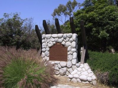
El Monte, on the bank of the San Gabriel River, played a significant part in California's early pioneer history. It was first an encampment on the Old Spanish Trail, an extension of the trail from Missouri to Santa Fe. By the 1850's some began . . . — — Map (db m162663) HM
San Rafael Rancho, first granted to José Maria Verdugo, Oct. 20, 1784.
Catalina Adobe built about 1828.
And, General Andres Pico oak tree camp site, before he surrendered to General John C. Fremont, 1847.
San Rafael Ranch . . . — — Map (db m128201) HM WM
Planted in 1901 by the R.W. Hamlins, early citrus growers, the Glendora bougainvillea is the largest growth of this exotic plant in the United States. The parent stock was brought to California by a whaling ship about 1870, and the vines survive as . . . — — Map (db m127847) HM
It was here in the home of parents Murry and Audree that Brian, Dennis, and Carl Wilson grew to manhood and developed their musical skills. During Labor Day weekend 1961, they, with cousin Mike Love and friend Al Jardine, gathered here to record a . . . — — Map (db m59320) HM
On this site, bubbling springs once flowed from their source in a deep water basin which has existed continuously since the Pleistocene Era. Prehistoric animals, Indians, and early Inglewood settlers were attracted here by the pure artesian water. . . . — — Map (db m126337) HM
This was the first National Forest in the State of California, second in the United States. Created by proclamation, December 20, 1892, by President Benjamin Harrison. The first name given to the forest was "San Gabriel Timberland Reserve." It was . . . — — Map (db m143501) HM
This house, built in 1868 by Saturnio Carrion, was restored in 1951 by Paul E. Traweek.
California Registered Historical Landmark No. 386. — — Map (db m127951) HM
This buiding, erected by the Gilroy family in 1876, this building was purchased in 1902 by George T. Webber, who operated it as the Western Hotel. The Lancaster Chamber of Commerce was organized in its dining room. Between 1905 and 1913, . . . — — Map (db m53028) HM
Created in 1932 for the rowing events of the Xth Olympiad, the Stadium was the first manmade rowing course in the United States. Its width allowed four teams to race abreast, eliminating additional heats and allowing oarsmen to enter the finals . . . — — Map (db m247818) HM
The 27,000-acre Rancho was once part of an 18th-century Spanish land grant to soldier Manuel Nieto. The Monterey-style adobe was constructed in 1844 and served the Temple and Bixby families as headquarters for large-scale cattle and sheep . . . — — Map (db m50988) HM
Dedicated to the firemen of the Los Angeles Fire Department - past, present and future - who, since 1871, by their courage and faithful devotion to duty have protected the lives and property of the citizens of Los Angeles from the ravages of . . . — — Map (db m51301) HM
This is the oldest existing house in Los Angeles. Built about 1818 by Don Francisco Avila, it was occupied briefly as American headquarters in 1847. Severely damaged in the earthquake of 1971, the house is now restored as an example of California . . . — — Map (db m133592) HM
Near this spot stood the Bella Union Hotel, long a social and political center. Here, on October 7, 1858, the first Butterfield Overland Mail stage from the East arrived 21 days after leaving St. Louis. Warren Hall was the driver, and Waterman . . . — — Map (db m59812) HM
This block is the site of:
First brick school house in Los Angeles known as School No. 1, built 1854-1855;
Butterfield Overland Mail Company office and corral, 1858-1861;
Office of U.S. Quartermaster, 1861;
Corral for camels from Fort . . . — — Map (db m164547) HM
In Honor
Homage to Our Mexican-American heroes,
veterans of America's wars.
Covered with glory, their ideals of service provide power to America, for peace and for human dignity. Long live America during this time of such power. . . . — — Map (db m153408) HM WM
This site was part of the lands originally granted to El Pueblo de la Reina de Los Angeles in 1781 by the King of Spain, Carlos III, under the Spanish Law of the Indies. The first plaza of the pueblo had been located to the southeast, closer to the . . . — — Map (db m120903) HM
Southern California's first newspaper, The Los Angeles Star, was founded in this block on May 17, 1851 and for many years exerted a major influence upon this part of the state. Suspended temporarily from 1864 to 1868, it continued later as an . . . — — Map (db m125413) HM
The Merced Theatre was built in 1870 and is one of the oldest structures erected in Los Angeles for the presentation of dramatic performances. It served as the center of theatrical activity in the city from 1871 to 1876. The theatre was built by . . . — — Map (db m120901) HM
This tablet commemorates the
one hundredth anniversary
of the erection of this church,
Our Lady Queen of Angeles.
Built in 1814 by the Franciscan
Fathers, restored and enlarged in 1912,
Right Reverend Thomas James Conaty
being Bishop . . . — — Map (db m113805) HM
The Pico House was built by Pio Pico, last Governor of California under Mexican rule, who lived almost the entire length of the nineteenth century from 1801 to 1894. This was the first three story building and the first grand hotel in Los Angeles. . . . — — Map (db m120902) HM
This was the site of Saint Vincent's College from 1868 to 1887. The college, now Loyola University, was founded by the Vincentian Fathers in 1865 and was the first institution of higher learning in Southern California. — — Map (db m121001) HM
The Hebrew Benevolent Society of Los Angeles (1854), first charitable organization in the city, acquired this site from the city council by deed of April 9, 1855. This purchase of a sacred burial ground represented the first organized community . . . — — Map (db m122688) HM
Designed as the largest enclosed structure without columns in the world by noted California architects Robert Clements & Associates, this Art Deco building, constructed between 1938 and 1941 by the WPA, is the largest and second-oldest Navy Reserve . . . — — Map (db m147662) HM
Spanish colonization of California began in 1769 with the expedition of Don Gaspar de Portolá from Mexico. With Captain Don Fernando Rivera y Moncada, Lieutenant Don Pedro Fages, Sgt. José Francisco Ortega, and Fathers Juan Crespí and Francisco . . . — — Map (db m115177) HM
This dwelling, built in 1849 by Don Vincente de la Osa, was a favored stopping place for the numerous travelers on El Camino Real. It stands on land that is part of the one-square-league Rancho El Encino granted in 1845 by Governor Pio Pico to three . . . — — Map (db m131161) HM
One-half of this structure, then in use as a barn, was rented by Cecil B. DeMille as the studio in which was made the first feature-length motion picture in Hollywood, “The Squaw Man”, in 1913. It was originally located at the corner of Selma and . . . — — Map (db m118836) HM
Presented to the citizens of Los Angeles County in December 1916 by Captain Allan Hancock with a request that the scientific
features be preserved.
First historic reference to the tar pools recorded in the diary of Gaspar de Portolá on August . . . — — Map (db m126874) HM
Spanish-Mexican period.
Declared Historic Cultural Monument No. 7 by the Cultural Heritage Board, Municipal Art Department, City Of Los Angeles.
In Commemoration of the
Andres Pico Adobe,
Oldest Existing Adobe Home
in the San . . . — — Map (db m165325) HM
Oldest portion built about 1834 by ex-Mission Indians. Enlarged by Eulogio de Celis in 1846. Upper story added by Romulo Pico in 1874. Restored by Mr. & Mrs. M.R. Harrington in 1930. — — Map (db m126815) HM
Founded in 1797 by Father Fermin Francisco Lasuen.
We honor those men of faith, courage and vision who guided the founding of the mission and also those who have preserved it for posterity. — — Map (db m169607) HM
A replica of one in Cordoba, Spain; was built around 1812-1814 and was part of the water system in San Fernando Mission garden.
100 years later this garden was the property of Mr. Leslie C. Brand, who donated a part of it to Los Angeles for a . . . — — Map (db m130560) HM
El Alisal, built by Charles F. Lummis, writer, editor, founder Southwest Museum.
Declared Historic Cultural Monument No. 68 by the Cultural Heritage Board, Municipal Arts Department, City of Los Angeles.
second marker: . . . — — Map (db m163698) HM
In 1893 the Southern Pacific Railroad Company completed its 4,720-foot wharf which served as a deep water port for the Los Angeles area. After San Pedro became Los Angeles' official harbor in 1897, shipping activity at Port Los Angeles declined. . . . — — Map (db m50984) HM
In 1887, the State Board of Forestry established the nation's first experimental forestry station. Located in Rustic Canyon, the station tested exotic trees for planting in California, established plantations for management studies, and produced . . . — — Map (db m119875) HM
Originally part of the San Fernando Mission lands, this ranch was purchased by David Wark Griffith, revered pioneer of silent motion pictures, in 1912. It provided the locale for many western thrillers, including "Custer's Last Stand", and was the . . . — — Map (db m122861) HM
The first known commercial structure on the shore of San Pedro Bay was built here in 1823 by the trading firm of McCulloch & Hartnell to store cattle hides from the San Gabriel and San Fernando Missions. Richard Henry Dana described this adobe hide . . . — — Map (db m127026) HM
In 1923 the Marine Transport Industrial Workers Union 510, a branch of the Industrial Workers of the World (IWW), called a strike that immobilized 90 ships here in San Pedro. The Union protested low wages, bad working conditions, and imprisonment of . . . — — Map (db m157331) HM
Commonly referred to as the Great White Steamer, the ship was specially built by William Wrigley to serve his Catalina Island as a passenger ferry. She was christened on May 23, 1924. During World War II, she was requisitioned for use as a troop . . . — — Map (db m113426) HM
In 1852 German immigrant Augustus W. Timms obtained Sepulveda's Landing on the mudflats near here. He built a wharf, added a warehouse, corral and other facilities to service shipping and running of stages to Los Angeles. Timms was a pioneer in . . . — — Map (db m50976) HM
[This site was designated California Historical Landmark No. 1006 on May 11, 1992.
There are three rock and concrete bases which had displayed four different markers. The markers are now missing. The following marker was never placed:] . . . — — Map (db m184724) HM
At midnight on January 1, 1967, undercover LAPD officers raided the Black Cat Tavern in Silver Lake. 14 men were beaten, dragged outside, and arrested. Six men were charged with lewd conduct for same-sex kissing. Outrage over the raid spurred . . . — — Map (db m233806) HM
This stadium was originally completed in 1923. It was partially redesigned and enlarged for the 1932 Olympic Games. Both designs were by architects John & Donald B. Parkinson. The Coliseum has witnessed many important sports, political, and . . . — — Map (db m116751) HM
Dedicated on September 4, 1880, this original building of the University of Southern California has been continuously in use for educational purposes since its doors were first opened to students on October 6, 1880, by the university's first . . . — — Map (db m126924) HM
Watts Towers
California Historical Landmark No. 993
Unconventional Life, Unconventional Art
Simon Rodia has been referred to as a visionary and a man of great passion. A self-taught laborer from Italy, he had a singular goal in . . . — — Map (db m51953) HM
Beneath this park rest the stone foundations and floor tiles of the historic adobe where Mexican General Andres Pico and U.S. Lieutenant Colonel John C. Fremont signed the Treaty of Cahuenga on January 13, 1847. Signing the Treaty ended the . . . — — Map (db m126025) HM
Here was made the Treaty of Cahuenga by
General Andrés Pico, commanding forces for
Mexico, and Lieutenant - Colonel J. C. Frémont,
U.S. Army, for the United States. By this treaty,
agreed upon January 13th, 1847, the United States
acquired . . . — — Map (db m250254) HM
This is the terminus of the Los Angeles-Owens River Aqueduct, which brings water 338 miles from the eastern slopes of the Sierra Nevada to the City of Los Angeles. Begun in 1905, the great aqueduct was completed November 5, 1913. The Mono Craters . . . — — Map (db m164815) HM
On November 5, 1913, 40,000 people gathered here to witness the dedication of the Los Angeles - Owens River Aqueduct. The terminus of a 233-mile long engineering marvel, the Cascades were the site of William Mulholland‘s famous speech: “There it is, . . . — — Map (db m165409) HM
This Cemetery, earlier known as Morningside Cemetery, is the oldest non-sectarian cemetery in San Fernando Valley. It was used from the early 1800's until 1939. It was legally abandoned in 1959. In this same year Mrs. Nellis S. Noble donated the . . . — — Map (db m157885) HM
These venerable oak trees were topped by the Franciscan friars to furnish fuel for the nearby lime kilns that provided mortar for the building of the Mission San Fernando Rey de Espana. These fused rocks were taken for their preservation, from the . . . — — Map (db m144163) HM
Marked this day March 20 1976, as a California Historical Spanish Colonial Landmark “In 1776 Portola encamped at the springs, part of the Rancho San Vicente - Santa Monica, known as the: 1. Junipero Serra Springs; 2. El Berrendo; 3. San Gregorio; . . . — — Map (db m122157) HM
Established at Wilmington in 1862, Drum Barracks became the United States military headquarters for Southern California, Arizona, and New Mexico. A garrison and base for supplies, it was a terminus for camel pack trains operated by the army until . . . — — Map (db m85152) HM
Old Trapper's Lodge is one of California's remarkable twentieth century folk art environments. It represents the life work of John Ehn (1897-1981), a self-taught artist who wished to pass on a sense of the Old West. Derived from personal . . . — — Map (db m149170) HM
On November 24, 1793, English explorer George Vancouver, commander of an expedition to determine the extent of settlement of the northwest coast of America, named this rocky promontory, Point Dume, after his Franciscan friend, Father Francisco . . . — — Map (db m123039) HM
Designed by Stiles O. Clements in 1929, this Spanish Colonial Revival home contains the best surviving examples of decorative ceramic tile produced by Malibu Potteries. During its short existence from 1926 to 1932, Malibu Potteries made an . . . — — Map (db m118362) HM
Designed by City Engineer A.L. Harris, this pier was constructed by the City of Manhattan beach during the years 1917-1920. The roundhouse building was added a year later. Harris' innovative design featured a rounded end to the pier, which helped it . . . — — Map (db m114457) HM
This tablet was erected by Walter P. Temple and blessed by Right-Reverend John J. Cantwell, Bishop of Monterey and Los Angeles, July 31, 1921, to commemorate the founding of Mission San Gabriel Archangel, on this ground, at Old Mission by Rev. . . . — — Map (db m154575) HM
The towns of Hynes and Clearwater, later incorporated as Paramount, were the center of the hay and dairy industry in Los Angeles and Orange Counties from the 1920s through the 1960s. Considered the “Milk Shed of Los Angeles”, Paramount . . . — — Map (db m128218) HM
Built in 1908, the David B. Gamble House is a tribute to the genius of architects Charles Sumner Greene and Henry Mather Greene. Its design represents a unique California lifestyle and is a masterpiece of American craftsmanship. In 1966 it was made . . . — — Map (db m59811) HM
Grace Nicholson, a noted collector and authority on American Indian and Asian Art and artifacts, supervised the design of her combination gallery and museum which was completed in 1929. It has been called an outstanding example of 1920s revival . . . — — Map (db m59818) HM
Considered Elmer Grey's outstanding design, the Pasadena Playhouse, an excellent example of Spanish Colonial Revival architecture, opened on May 18, 1925. The first in America to stage Shakespeare's 37 plays, the Playhouse has provided the theatre . . . — — Map (db m126948) HM
Completed about 1854 and restored in 1939, this was the family home of Don Ygnacio Palomares, who with Don Ricardo Vejar was granted Rancho San José in 1837 by Governor Juan B. Alvarado. — — Map (db m128910) HM
The Los Angeles County Fairgrounds was one of 15 temporary assembly centers established during World War II pursuant to Executive Order 9066, signed by President Franklin D. Roosevelt on February 19, 1942.
The U S. Army confined at this site . . . — — Map (db m165492) HM
On the slopes below and west of this plaque stood the quarters of Portuguese whalemen who put out through the surf in boats under oars and sail to harpoon passing gray whales to be towed ashore where the blubber was stripped and "tried out" in large . . . — — Map (db m50975) HM
This marker locates the site near which the Indians and early California settlers came to obtain their salt, which at many times was more valuable than gold. — — Map (db m50973) HM
Established in 1851, on the spot where Henry Dalton’s land
grant showed "the American graveyard”, Savannah was the
first public burial site used by settlers who came to the
San Gabriel Valley by wagon train. Many of these pioneers
were . . . — — Map (db m127025) HM
Erected during mission days, 1792-1805. Second oldest adobe in this region. Originally 'L'-shaped, it is now only half its original size. In 1859, it became the property of Don Jean Vigare. In early 1860’s became San Gabriel's first bakery, and was . . . — — Map (db m127641) HM
San Gabriel Mission was founded by Fr. Pedro Benito Cambon (statue above right) and Fr. Angel Fernandez de la Somera (statue above left) on Sept. 8, 1771 in nearby Montebello by the Rio Hondo River, and moved to this location in 1775. This . . . — — Map (db m139099) HM
This was the site of ‘Los Robles’, the 400 acre estate of Governor George Stoneman. Here in 1880 President Rutherford B. Hayes was entertained. The first schoolhouse in the San Gabriel Valley, California's first tennis club, and the first municipal . . . — — Map (db m127644) HM
Originally located in the upper story of El Molino Viejo, these volcanic tufa millstones ground grain for the Indian community of Mission San Gabriel. The stones were turned by water flowing from nearby canyons. When the mill fell into disuse, the . . . — — Map (db m129132) HM
The 185-foot concrete St. Francis Dam, part of the Los Angeles aqueduct system, stood 1½ miles north of this site. On March 12, 1928, the 185-foot high concrete dam collapsed just before midnight, sending 12½ billion gallons of water roaring down . . . — — Map (db m143722) HM
This site was the location of a combination store, post office, telegraph office, tavern, and stage depot accommodating travelers during the Kern River gold rush in the early 1850s. A regular stop for Butterfield and other early California stage . . . — — Map (db m154273) HM
Francisco Lopez made California’s first authenticated gold discovery on March 9, 1842. While gathering wild onions near an oak tree in Placerita Canyon he found gold particles clinging to the roots of the bulbs. The San Fernando placers and nearby . . . — — Map (db m154261) HM
California's first oil refinery operated on a commercial scale, erected 1876. Restored by the Standard Oil Company of California in 1930 as a memorial to D. G. Scofield and his pioneer associates of the California Star Oil Works company, a . . . — — Map (db m165742) HM
On this site stands CSO-4 (Pico #4), California's first commerically productive well. It was spudded in early 1876, under the direction of Demetrius G. Scofield, later to become first president of Standard Oil Company of California, and was . . . — — Map (db m157684) HM
Mentryville, named after Charles Alexander Mentry, who drilled California's first successful commercial oil well in 1876, was one of the first oil towns in the state. Mentry's restored home, barn and Felton School remain on the site where the . . . — — Map (db m165661) HM
In Placeritas Canyon, March 1842, Francisco Lopez y Arballo, while gathering wild onions from around an old oak, discovered gold particles clinging to the roots of the bulbs. It is estimated that $80,000 in gold was discovered as a result of this . . . — — Map (db m154259) HM
Approximately one-half mile south of this point was the adobe headquarters of Rancho San Francisco, originally built about 1804 as a granary of Mission San Fernando. The rancho was granted to Antonio de Valle in 1839. Here, in January 1850, William . . . — — Map (db m30667) HM
One of the world’s most famous wells, Alamitos No. 1, was started on March 23, 1921, and completed June 25, 1921, at a depth of 3,114 feet, flowing 590 barrels of oil a day.
This discovery well led to the development of one of the most . . . — — Map (db m2476) HM
Near this site, on January 3, 1847, was fought the Battle of the Rio San Gabriel between American forces commanded by Capt. Robert F. Stockton, U.S. Navy Commander-in-Chief, Brig. Gen. Stephen W. Kearney, U.S. Army, and Californians commanded by . . . — — Map (db m218759) HM
During the United States occupation of California during the Mexican-American War, La Mesa served as a campsite for the Californio forces under General Castro in the summer of 1846. The last military encounter on the California front was fought . . . — — Map (db m121401) HM
Following the Mexican War, Pío Pico, last Mexican governor, acquired 9,000-acre Rancho Paso de Bartolo and built here an adobe home that was destroyed by the floods of 1883-1884. His second adobe casa, now known as Pío Pico Mansion, represents a . . . — — Map (db m50933) HM
Greek George, born in Smyrna as George Caralambo, came to this country as a camel driver for the United States Government in 1857. Naturalized -- George Allen in 1867.
Died Sept. 2, 1913 at Old Mission.
Historical marker . . . — — Map (db m157793) HM
Paradox Hybrid Walnut Tree
Planted in 1907 as an experiment for the
University of California.
California Registered Historical
Landmark No. 681.
Dedicated 1963
By Whittier area community beautiful
Grand Parlor Native . . . — — Map (db m241036) HM
The March 11, 1889 Act of the California Legislature authorized the establishment of a school for juvenile offenders. Dedication and laying of cornerstone was done by Governor R.W. Waterman on February 12, 1890. Officially opened as "Whittier State . . . — — Map (db m162164) HM
The former Fred C. Nelles School for Boys was the oldest school for juvenile
offenders in the State of California. Originally named the Reform School for
Juvenile Offenders when it opened on July 1, 1891, the name was subsequently
changed to . . . — — Map (db m207789) HM
Dating prior to the 1860s, the Wassama Roundhouse was reconstructed in 1985 on the location of the previous four houses. In 1903, the third roundhouse was built using portions of the center pole from the two earlier houses. The Roundhouse served . . . — — Map (db m299229) HM
The home of "Lord" Charlie Snowden Fairfax, pioneer and political leader of the 1850's, served California as an assemblyman (1853), Speaker of the Assembly (1854), and Clerk of the State Supreme Court (1856). Fairfax, a descendent of Scottish barons . . . — — Map (db m143401) HM
The first paper mill on the Pacific Coast was built here in November 1856 by Samuel Penfield Taylor using water power and later steam. It was replaced in 1884 by a larger steam-powered mill nearby which was closed by the depression of 1893 and . . . — — Map (db m291092) HM
The Remillard Brick Company, of which the Green Brae Brick Kiln is the only surviving structure, was by 1900 the largest brickmaking firm on the Pacific Coast. The kiln is one of the few remaining examples of the Hoffman type kiln in the U.S. and . . . — — Map (db m63983) HM
Two miles west is the old saw mill, from which the city of Mill Valley acquired its name. It was constructed in the 1830's by John Reed, grantee of the Rancho Corte De Madera Del Presidio. The creek waters furnished the motive power for the mill, . . . — — Map (db m91858) HM
The Outdoor Art Club was designed in 1904 by Bernard Maybeck; internationally known American architect. Particularly notable for its unusual roof truss system, the building exemplifies Maybeck's creative use of natural materials. The Club, founded . . . — — Map (db m143402) HM
The mill was constructed in the 1830's by John Reed and was one of the first saw mills in Northern California.
The mill site was utilized in May 1890 to conduct a public land auction of land parcels that signaled the founding of the City of Mill . . . — — Map (db m143523) HM
A shingled shed now protects the ruins of Camilo Ynitia’s adobe home from further weather damage. Dating from the late 1830’s this structure represents a period when the Wiwok were abandoning their traditional dwellings in favor of more sheltered . . . — — Map (db m143486) HM
1063 entries matched your criteria. Entries 301 through 400 are listed above. ⊲ Previous 100 — Next 100 ⊳