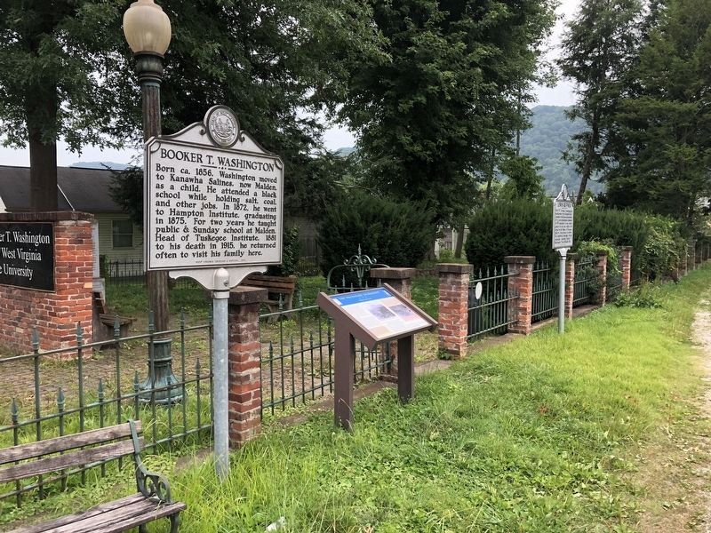
By Devry Becker Jones (CC0), July 31, 2021
The Necessary Ingredient Marker
| On Malden Drive (County Route 60/6) at Cypress Drive, on the right when traveling south on Malden Drive. Reported permanently removed. |
| On McCorkle Avenue at 86th Street, on the right when traveling south on McCorkle Avenue. |
| On MacCorkle Avenue (West Virginia Route 61) 0.1 miles east of 100th Street, on the right when traveling north. |
| On McCorkle Avenue (West Virginia Route 61) 0.1 miles east of 100th Street. |
| On McCorkle Avenue at 86th Street, on the right when traveling south on McCorkle Avenue. |
| On McCorkle Avenue at 86th Street, on the right when traveling south on McCorkle Avenue. |
| On McCorkle Avenue (West Virginia Route 61) 0.1 miles east of 100th Street, on the right when traveling east. |
| On MacCorkle Avenue Southeast (Route 61) 0.1 miles east of 100th Street, on the right when traveling east. |
| On McCorkle Avenue 0.1 miles east of 100th Street, on the right when traveling east. |
| On 21th Street at 2nd Avenue on 21th Street. |
| On 21th Street at 2nd Avenue on 21th Street. |
| On 21th Street at 2nd Avenue on 21th Street. |
| On 21st Street east of 1st Avenue ( Route 25), on the right when traveling east. |
| On 21st Street near 1st Avenue ( Route 25), on the right when traveling east. |
| On 21st Street at 2nd Avenue, on the right when traveling east on 21st Street. |
| On 21st Street east of 1st Avenue ( Route 25), on the right when traveling east. |
| On 20th Street at 2nd Avenue, on the right when traveling west on 20th Street. |
| On 20th Street at 2nd Avenue, on the right when traveling west on 20th Street. |
| On 2nd Avenue south of 21st Street, on the right when traveling south. |
| On Center Street (West Virginia Route 25) at 1st Avenue ( Route 25), on the right when traveling north on Center Street. |
| On North Pinch Road (County Route 47) close to Reunion Road, on the left when traveling north. |
| On Clifton Avenue (West Virginia Route 61) west of Center Drive, on the right when traveling west. |
| On Midland Trail (U.S. 60) east of Montgomery Bridge ( Route 6), on the right when traveling east. |
| On Oakes Avenue just north of 7th Avenue, on the right when traveling north. |
| On 7th Avenue at Oakes Avenue, on the right when traveling west on 7th Avenue. |
| On Oakes Avenue just north of 7th Avenue, on the right when traveling north. |
| On MacCorkle Avenue (U.S. 60) just west of Ashby Avenue, on the right when traveling east. |
| On MacCorkle Avenue (U.S. 60) at Oakes Avenue, on the left when traveling west on MacCorkle Avenue. |
| On Oakes Avenue just north of 7th Avenue, on the right when traveling north. |
| On MacCorkle Avenue SW (U.S. 60) at G Street, on the right when traveling east on MacCorkle Avenue SW. |
| On Oakes Avenue just north of 7th Avenue, on the right when traveling north. |
| On 7th Avenue at Ashby Avenue, on the right when traveling east on 7th Avenue. |
| On 7th Avenue at Ashby Avenue, on the left when traveling east on 7th Avenue. Reported damaged. |
| On Kanawha Terrace at Walnut Street, on the right when traveling east on Kanawha Terrace. |
| On Kanawha Terrace at Hudson Street, on the left when traveling east on Kanawha Terrace. |
| On 2nd Street just north of 6th Avenue, on the right when traveling south. |
| On Winfield Road (West Virginia Route 817) 0.2 miles north of U.S. 60, on the right when traveling north. |
| On Kanawha Terrace at Lee Street, on the right when traveling east on Kanawha Terrace. |
| On MacCorkle Avenue (U.S. 60) at Pfaff Street, on the right when traveling west on MacCorkle Avenue. |
| On 6th Avenue just east of 2nd Street, on the left when traveling east. |
| On MacCorkle Avenue (U.S. 60) at Hudson Street, on the right when traveling west on MacCorkle Avenue. |
| On 6th Avenue at West Main Street, on the right when traveling south on 6th Avenue. |
| On B Street 0.1 miles south of 4th Street, on the right when traveling south. |
| On MacCorkle Ave (U.S. 60) 0.4 miles east of Sattes Bridge. |
| On Paint Creek Road (Local Route 83) at Exit 74 (Interstate 77) on Paint Creek Road. |
| On Paint Creek Road (Local Route 83) at Exit 74 (Interstate 77) on Paint Creek Road. |
| On Childress Road (West Virginia Route 214) at Little Coal River road, on the right when traveling west on Childress Road. |
| On McClellan Highway (West Virginia Route 10) just south of Reubens Branch Road, on the left when traveling south. |
| On Court Avenue (State Highway 3) 0.1 miles east of May Street, on the left when traveling east. |
| On Court Avenue (West Virginia Route 3) at Orchard Street (County Route 3/63), on the right when traveling west on Court Avenue. |
| On Lynn Avenue (West Virginia Route 3) east of State Street, on the right when traveling west. |
| On Lynn Avenue (West Virginia Route 3) just west of First Street. |
| On Court Avenue at Market Street on Court Avenue. |
| On Court Avenue at Main Street, on the right when traveling west on Court Avenue. |
| On Lynn Avenue (West Virginia Route 3) at State Street, on the right when traveling west on Lynn Avenue. |
| On Riverview Avenue (Route 10) 0.2 miles east of Hartland Haul Road, on the left when traveling east. |
| On Big Harts Creek Road (County Route 19) at Riverview Avenue ( Route 10), on the left when traveling north on Big Harts Creek Road. |
| On Dixie Highway (West Virginia Route 16) just south of Sangamore Fork Road, on the left when traveling south. |
| On Old Turnpike Road (County Route 19/40) at Laurel Run Road, on the right when traveling north on Old Turnpike Road. |
| On U.S. 19, on the right when traveling north. |
| On Strouds Creek (County Road 11) 0.1 miles north of Webster Road (State Route 20), on the left when traveling north. |
| On Craigsville Road (West Virginia Route 20) 2.2 miles south of West Webster Road in Craigsville ( Route 55). |
| On Turnpike Road (West Virginia Route 39) at Route 129, on the right when traveling east on Turnpike Road. |
| On Carnifex Ferry Crossing (County Route 23) 1 mile south of Summersville Lake Road ( Route 129), on the right when traveling south. |
| On Carnifex Ferry Crossing (County Route 23) 1.1 miles south of Summersville Lake Road, on the left when traveling south. |
| On Carnifex Ferry Road (County Route 23) 1.1 miles south of Summersville Lake Road ( Route 129), on the right when traveling south. |
| On Carnifex Ferry Crossing Road at County Route 23, on the right when traveling south on Carnifex Ferry Crossing Road. |
| On Carnifex Ferry Crossing Road 1.3 miles south of State Route 129, on the right when traveling west. |
| On Carnifex Ferry Crossing Road 1.3 miles south of Route 129, on the right when traveling west. |
| On Summersville Lake Road (West Virginia Route 129) at Whitewater Road (County Route 9), on the right when traveling south on Summersville Lake Road. |
| On Carnifex Ferry Crossing (County Route 23) 1 mile south of Summersville Lake Road, on the left when traveling south. |
| On Carnifex Ferry Crossing Road 1.3 miles south of Route 129, on the right when traveling south. |
| On Carnifex Ferry Crossing (County Route 23) 1 mile south of Summersville Lake Road ( Route 129), on the right when traveling south. |
| On West Virginia Route 129 at Whitewater Road (County Route 9), on the left when traveling south on West Virginia Route 129. |
| On Carnifex Ferry Crossing (County Route 23) 1.1 miles south of Summersville Lake Road, on the left when traveling south. |
| On Carnifex Ferry Crossing Road. |
| On Carnifex Ferry Crossing (County Route 23), on the left when traveling north. |
| On Summersville Lake Road just west of Carnifex Ferry Crossing Road (County Route 23), on the left when traveling east. |
| On Summersville Lake Road (West Virginia Route 129) 0.2 miles west of Whitewater Road (Local Route 9), on the right when traveling west. |
| On West Virginia Route 20, on the right when traveling south. |
| On West Virginia Route 20 just south of County Road 13, on the right when traveling north. |
| On Turnpike Road (West Virginia Route 39) east of Euclid Avenue, on the right when traveling east. |
| On Old U.S. 19 just east of U.S. 19, on the left when traveling south. |
| On Mountaineer Expressway (U.S. 19) near Whippoorwill Road, on the right when traveling south. |
| On Hilltop Drive 0.1 miles west of Mountaineer Expressway (U.S. 19), on the right when traveling north. |
| On Summersville Lake Road (West Virginia Route 129) 2.6 miles east of Turnpike Road ( Route 39), on the left when traveling east. |
| On West Virginia 41, on the right when traveling north. |
| On Summerville Lake Road (State Highway 129) 0.6 miles south of Whitewater Road (County Route 9), on the left when traveling south. Reported missing. |
| On Main Street (West Virginia Route 41), on the right when traveling east. |
| On Main Street at Church Street, on the right when traveling east on Main Street. |
| On Main Street (West Virginia Route 41) at Church Street, on the right when traveling east on Main Street. |
| On Main Street (West Virginia Route 41), on the right when traveling east. |
| On Arbuckle Road (West Virginia Route 39) 0.1 miles west of U.S. 19, on the right when traveling east. |
| On Main Street (West Virginia Route 41), on the right when traveling north. |
| On Summersville Lake Road (West Virginia Route 129) 0.3 miles west of Reservoir Street, on the right when traveling west. |
| On Main Street, on the right when traveling east. |
| On Summersville Lake Road (West Virginia Route 129) 0.1 miles south of Whitewater Road (County Route 9). |
| On Summersville Lake Road (West Virginia Route 129) 2.6 miles west of U.S. 19, on the right when traveling east. |
503 entries matched your criteria. Entries 401 through 500 are listed above.
⊲ Previous 100 —
The final 3 ⊳
