Near this spot, the British under Howe, forded the Bronx River and attacked the right wing of Washington’s Army located above on Chatterton Hill.
Erected by Act of Congress May 18, 1926.
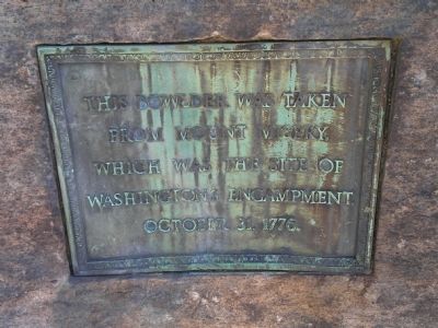
This bowlder was taken . . . — — Map (db m310585) HM
On the foggy dawn of June 20, 1780, Patriot Captains McDowell and Falls led their cavalry along the Tuckaseegee Road
towards the Loyalist camp. The horsemen advanced to within 30 yards of the Loyalist encampment before they were discovered, . . . — — Map (db m231956) HM
"In memory of those men who died in
the Battle of Piqua, August 8, 1780,
the largest Revolutionary War battle
West of the Alleghenies." — — Map (db m35288) HM
In the first three days of July 1863, 165,000 soldiers converged on Gettysburg, leaving their mark forever on its land, buildings, and people. Like sparks from a bonfire, fights strayed far outside the town. One encounter took place in . . . — — Map (db m27035) HM
Deep in the Wilderness Across the Bay lies Erie. In 1812, Erie was a small village of about 400 people and 100 homes. In those days, Erie was surrounded by wilderness and barely accessible by land. Everything was in short supply. Crude, often . . . — — Map (db m129959) HM
has been designated a
National Historic Landmark
This site possesses national significance as an
outstanding representation of the development of a
national system of medical and residential benefits
for disabled volunteer veterans. . . . — — Map (db m314498) HM
Mile 90.2 AHP
Word of the treaty signed in December 1814, was slow to reach the countryside south of New Orleans, LA. Before dawn on January 8, 1815, General Andrew Jackson’s American troops were waiting for a British attack. Commanded . . . — — Map (db m114922) HM
(side 1)
This monument honors
Patriots who assembled
at this site in the Cause of
American Freedom in 1775
American Patriots
at the Battle
Second Virginia Regiment
Commanded by
Colonel William Woodford,
of . . . — — Map (db m211239) HM
The Federal forces of Brig. Gen. John Buford, Brig. Gen. David Gregg, and Col. Thomas Devin (whose command held the area around St. James Church) had almost encircled the Confederates, though none of the Union commanders had planned it so. Unknown . . . — — Map (db m4418) HM
Several hundred yards behind you, in the copse of trees, is the site of the St. James Church. Union soldiers tore down the small brick structure for materials to make their quarters during the winter of 1863-1864, when the Army of the Potomac . . . — — Map (db m289354) HM
In front of you is second location where the original church building stood after the Civil War. The first location was east of here and across the Civil War-era Halifax Road (now Acorn Drive). It was built around 1820 and first known as Hubbard's . . . — — Map (db m13793) HM
War Watchers from Washington D.C., came with picnic provisions to Centreville, Virginia on Sunday, July 21, 1861, in the hopes of witnessing the final battle of the nascent rebellion. These curiosity seekers came by carriage, buggy and . . . — — Map (db m283112) HM
In the fall of 1861, Fairfax County found itself between two large armies. Confederate Gen. Joseph E. Johnston and his army occupied the Centreville area. The Federal army, still regrouping after the devastating defeat at the First Battle of . . . — — Map (db m260975) HM
In 1870 the Vermont Legislature commissioned a painting for the State House by artist Julian Scott to commemorate the valor of the state's Civil War soldiers. The Battle of Cedar Creek, in which more Vermont regiments were under fire than any . . . — — Map (db m78349) HM
Late in the afternoon of June 14, 1863, the 57th North Carolina Infantry charged from behind you and swept by in line of battle. The regiment formed the left Confederate flank in the attack on the fortified Union camp called West Fort, about a mile . . . — — Map (db m258583) HM
"Unless this force were driven back, the day was lost." General Jubal A. Early, C.S.A. Standing here about noon during the battle, you would have seen Union troops under Gen. Henry Birge pursuing Gen. Clement Evans' Georgians from right . . . — — Map (db m159187) HM
During the First and Second Battles of Fredericksburg, the Confederates occupied Marye’s Heights, a defensive position enhanced by a sunken road and stone wall on the eastern slope. On 13 Dec. 1862, during the first battle, Lt. Gen. James . . . — — Map (db m1672) HM
On 28 September 1864, elements of Maj. Gen. Benjamin F. Butler’s Army of the James crossed the James River to assault the Confederate defenses of Richmond. At dawn on 29 September, 6 regiments of U.S. Colored Troops fought with exceptional valor . . . — — Map (db m181439) HM
On October 10, 1863, Confederate Gen. Robert E. Lee, anticipating an offensive that became known as the Bristoe Station Campaign, sent a division of Confederate horsemen led by Gen. J.E.B. Stuart north from Madison on a raid.
Confederate . . . — — Map (db m289718) HM
Invasion rocked the United States during the second year of the American Civil War. In September 1862 Confederate General Robert E. Lee launched his army into Maryland - the North. Lee's first target became Harpers Ferry. He ordered "Stonewall" . . . — — Map (db m7924) HM
On August 2, 1867, 51 men of Company C, 27th Infantry under the command of Captain James Powell and Lieutenant John Jenness are assigned to the wood cutting detail. Fourteen of these men escort a wood train toward the fort. Another 13 are . . . — — Map (db m87375) HM
When the American War of Independence began, the new British colonies of East and West Florida did not seek separation from England. East Florida remained comparatively free from serious fighting throughout the course of the Revolutionary War. In . . . — — Map (db m41222) HM
To commemorate
the Battle of Fort Griswold
fought September 6, 1781,
this tree
was planted in historic earth
from the thirteen original colonies.
by Minneapolis Chapter,
Daughters of the American Revolution.
Tablet placed . . . — — Map (db m229542) HM
I was impressed by the natural beauty of the spot and thought it should be secured as a park to be enjoyed by all the people of the city.
William McMurray, President, William McMurray & Co., coffee and spice dealers, St. . . . — — Map (db m241223) HM
The July 28, 1862, Battle of Moore's Mill opened about one-eighth mile south along the Moore's Mill-Galbreath Mill road, near today's State Road JJ. This area then was heavily timbered.
Lying in ambush east of the road were about 260 . . . — — Map (db m207957) HM
To aid Lieutenant General John Burgoyne’s British army stalled at Saratoga, Lieutenant General Sir Henry Clinton sailed from New York with 3,000 British, German, and Loyalist soldiers and a flotilla of warships. On the morning of October 7, 1777, . . . — — Map (db m166275) HM
(Same text on both front and back): As a border slave state that remained in the Union, Kentucky was sharply divided in its loyalty during the Civil War. The state provided many troops to both sides at Shiloh; approximately 6,500 to the . . . — — Map (db m22024) HM
By 1835, tensions between those in Mexico who supported republican ideals and the centralist Mexican government had escalated into all-out war. Seeking their independence, Texan revolutionaries won the town of San Antonio de Béxar from . . . — — Map (db m188616) HM
— Fought here June 11, 12, 1864 —
Confederate Gens. Wade Hampton, Fitzhugh Lee
and Thomas L. Rosser, victors over
Federal Gens. P.H. Sheridan and G.A. Custer
5000 Confederates, 8000 Federal
Casualties Confederate 612, Federal 1,007 . . . — — Map (db m271470) HM
On May 2, 1863, as the tail end of Stonewall Jackson's flanking column neared the Wellford place, Union infantry launched an attack. They struck Jackson's rearguard (the 23rd Georgia) a half-mile to the north, at Catharine Furnace. From there, they . . . — — Map (db m11432) HM
On June 1, 1866, Irish-American revolutionaries called Fenians invaded Canada as part of an attempt to strike at Britain and support the creation of an independent Irish republic. The next morning Canadian militiamen from
the Queen's Own . . . — — Map (db m271722) HM
Zur Erinnerung an die Schlacht zwischen Gustav Adolf und Wallenstein 1632
Gustav Adolf, der „Löwe aus Mitternacht“, landete am 6. Juli 1630 auf Usedom, zog von Sieg zu Sieg und schlug am 17. September 1631 den Feldherrn . . . — — Map (db m295859) HM WM
Battle of the Atlantic 1939–1945 The Long Campaign The main routes of the Merchant Navy convoys across the Atlantic, supported by the Royal Navy, RAF and the armed forces of many allied nations. — — Map (db m314107) WM
following the Battle of Selma, April 2, 1865. This occupation protected the hotel from the arson and looting in the first 24 hours that destroyed much of downtown. In the next week Wilson methodically burned the huge military/industrial complex that . . . — — Map (db m80792) HM
One-half mile from here, past Crescent Harbor marina, is the Fort Site Unit of Sitka National Historical Park, where you can learn about Tlingit Indians, totem poles, and the Battle of Sitka.
Visit the National Park's Tlingit-Ahna-Hit . . . — — Map (db m308359) HM
On May 10, 1862, Confederates defeated the Union navy in one of only two Civil War gunboat fleet engagements on the Mississippi River, ramming and sinking two Union ironclads, Cincinnati and Mound City. A reinforced Union armada routed the . . . — — Map (db m36320) HM
Near this site, on January 3, 1847, was fought the Battle of the Rio San Gabriel between American forces commanded by Capt. Robert F. Stockton, U.S. Navy Commander-in-Chief, Brig. Gen. Stephen W. Kearney, U.S. Army, and Californians commanded by . . . — — Map (db m218759) HM
In defense of American Independence at the Battle of Ridgefield April 27, 1777 died Eight Patriots who were laid in this ground companioned by Sixteen British Soldiers Living, their enemies, Dying their guests, in honor of service and sacrifice this . . . — — Map (db m23396) HM
British General Tryon’s Raid on Danbury occurred on April 26, 1777. The beginning of the 1777 campaign was the first British invasion and the only pitched battle in Connecticut. Following the burning of Danbury the British troops marched . . . — — Map (db m23412) HM
On Wednesday, May
25, 1864, a fierce battle
was fought between
Union Major General
Joseph Hooker's 20th
Corps and Confederate
Major General Alexander
P. Stewart's division. It
occurred around a church
located at this crossroads,
known as . . . — — Map (db m142916) HM
Lt. Gen. J. B. Hood’s A.C. [CS], having marched from the Etowah River, reached New Hope Ch., May 25, 1864, in time to halt Gen. J. W. Geary’s (2d) div., 20th A.C. [US], which had detoured near Owens’ Mill enroute to Dallas by New Hope. Checked by . . . — — Map (db m20840) HM
The Site of The Battle Of Corydon entered on The National Register of Historic Places on July 9, 1979 by United States Department of Interior in cooperation with the Indiana Department of Natural Resources Division of Historic . . . — — Map (db m242683) HM
Here the Federal line extending from the South turned East along a rail fence forming a V. General Mouton's Division charged this line in the bloodiest part of battle. In this, the first Confederate charge, General Mouton was killed and the gallant . . . — — Map (db m105307) HM
On May 21, 1863, a two-story building near this site housing Young’s store and the Plains Masonic Lodge was the center of a battle between Colonel William R. Miles’ Legion comprised of Confederate troops from Louisiana and units of General C.C. . . . — — Map (db m93475) HM
December 14, 1814 - desperate delaying action by a small squadron of five American gunboats, a tender, and one dispatch boat under the command of Lt. Thomas ap Catesby Jones. Facing them was a large flotilla of armed British barges carrying about . . . — — Map (db m99357) HM
Also called by the Confederates the battle of Nerson's Woods or Franklin. In the Teche campaign the Federals followed the retreating Confederates from Bisland. Units of the Federal army under Gen. C.C. Grover landed from transports on Grand Lake and . . . — — Map (db m85070) HM
Erected by the Patriotic Order
Sons of America of Maryland,
In the year of the
National Star-Spangled Banner Centennial
1914.
This building, known as the
Battle Ground Methodist Episcopal Church,
was occupied by General Stricker, . . . — — Map (db m115241) HM
On February 22, 1864, Col. Jeffrey Forrest, commanding a Confederate cavalry brigade, was killed in action in this vicinity, near the extinct town of Prairie Mount. Born in 1838, Forrest was the younger brother of Lt. Gen. Nathan Bedford Forrest, . . . — — Map (db m102744) HM
In this vicinity on February 22, 1864, Benjamin Grierson ordered McCrillis' Federal brigade into a line of battle opposite Col. Barteau's Confederate brigade of Forrest's cavalry corps. Barteau's men, from the ridge east of the railroad, advanced as . . . — — Map (db m102742) HM
On May 1, 1863, Confederate forces under Brig. Gen. John Bowen clashed with elements of two Union corps commanded by Maj. Gen. U.S. Grant. The battle began around midnight near the Shaifer House four miles west of town. At dawn, the Federals . . . — — Map (db m35542) HM
Due to the heat and decomposition of the bodies the day after the battle, Union Col. Oden Guitar ordered a mass grave dug.
Elijah Hopper of Co. F, 9th Missouri Militia, stated in a 1908 letter, "We collected our dead - both sides - after the . . . — — Map (db m207959) HM
This homestead was the center, Bloomfield Road the left flank, and Perryville Road the right flank, of the Union forces commanded by Brig. Gen. John H. McNeil. A sharp, bloody attack by Confederates led by Gen. Joe Shelby from the command of Gen. . . . — — Map (db m307169) HM
Here on December 23, 1776 was fought the Battle of Ironworks Hill. This diversionary tactic aided Washington to capture Trenton. — — Map (db m35868) HM
At this site during the Battle of Springfield on June 23, 1780, the Americans, consisting of Continental Dragoons and the militia of this and surrounding neighborhoods, under Colonel “Light Horse” Harry Lee, Colonel Matthias Ogden, and . . . — — Map (db m7358) HM
In honor of the American soldiers who lost their lives in defense of our newly formed nation at the Battle of Connecticut Farms 7 June 1780 We dedicate this flagpole to all American Servicemen and Women who served their country during the last . . . — — Map (db m6928) HM
[Tablet on South Side of Monument]
Here the Battle of Oriskany was fought
On the sixth day of August, A.D. 1777
Here British invasion was checked and thwarted
Here General Nicholas Herkimer, intrepid leader
Of the American forces . . . — — Map (db m32119) HM
In memory of the Officers and Men of the Regular Army of the United States who fell in battle during the War of the Rebellion. This monument is erected by their surviving comrades. — — Map (db m22803) HM
General John Stark with New Hampshire, Vermont and Massachusetts Militia defeated and captured an expeditionary force sent by General Burgoyne and commanded by Colonel Baum. This was one of the first decisive victories in the War of the Revolution. — — Map (db m13918) HM
At this point occurred the defeat of Colonel
Breyman, who commanded a force of 600 men sent
by General Burgoyne to reinforce Colonel Baum.
Colonel Seth Warner and his regiment of Vermont
Rangers "Green Mountain Boys" distinguished
themselves . . . — — Map (db m13920) HM
Battle of Averasboro March 16, 1865 --------------- [ Right of Monument: ] In memory of our Confederate Dead who fell upon that day. ---------------- [ Back of Monument: ] The hearts that were true to their country and God shall . . . — — Map (db m161953) HM
"Old Hampton is playing a bluff game and if he don't mind Sherman will call him." — Confederate cavalry private
Early on March 18, 1865, Confederate cavalry commander Lt. Gen. Wade Hampton deployed Col. George Dibrell's . . . — — Map (db m286237) HM
In memory of all the American Indians who gave their lives at this place, including members of the following tribes. Chippewa Ottawa Delaware Potawatami Miami Shawnee Mingo Wyandot Dedicated August 20, 1994 . . . — — Map (db m85707) HM
The British battle line was formed almost parallel with and a little north of this street by Major John Butler, the commander, and Sayenqueraghta, chief of the Senecas. After advancing in formation for a mile to about 100 yards south of the British . . . — — Map (db m56393) HM
The Battle of Germantown occurred at Cliveden, the country home of Pa. Chief Justice Benjamin Chew, on Oct. 4, 1777. A British regiment occupied Cliveden and defended it from full assault by the colonials. Over 70 soldiers died on these grounds. . . . — — Map (db m12373) HM
(Front Text):
During this battle of Nov. 30, 1864, Confederate commander Charles J. Colock, by ordering that a nearby field of grass be set ablaze, delayed approaching
Federal troops and gave the Confederates time to collect additional . . . — — Map (db m15780) HM
Following the disastrous battles of the Rosebud and Little Big Horn (Custer) in Montana in June, 1876, the Sioux, save Gall and Sitting Bull with 400 lodges who went to Canada and Crazy Horse and his band, in the main, started to drift back to . . . — — Map (db m183413) HM WM
Front In memory of the men who fought here October 5, 1862 BATTLE OF DAVIS BRIDGE Poor is the nation that has no heroes Shameful is the nation that has them and forgets. CONFEDERATE Back Duty is the . . . — — Map (db m62459) WM
Here on December 19,1862, Confederate forces under the command of Gen. Nathan B. Forrest fought Union forces commanded by Colonel Adolph Engelmann. After a cavalry charge was repulsed, the Confederate artillery forced the retreat of the Federals, . . . — — Map (db m62188) HM
At this site the last battle of the Civil War, known as Palmito Hill, was fought by Confederate troops under Colonel John S. (Rip) Ford and Union Forces on May 13, 1865, 34 days after Lee's surrender at Appomattox. — — Map (db m118442) HM
Within a few minutes the Battle of San Jacinto was over. According to General Houston's report 630 Mexicans lay dead on the field, 208 were wounded and 730 were taken prisoners. Money, arms and equipment were captured. The Texans had 9 killed and 30 . . . — — Map (db m125906) HM
Here, on May 10, 1864, as part of Butler’s Bermuda Hundred Campaign, 3400 Federals and 2000 Confederates fought the Battle of Chester Station. This monument is erected in their memory by the Chester Station Camp #1503. Sons of Confederate . . . — — Map (db m17092) HM
As it maneuvered against Lt. Gen. Jubal A. Early’s Army of the Valley, Maj. Gen. Philip H. Sheridan’s U.S. Army of the Shenandoah marched south from Halltown, reaching Berryville on 3 Sept. 1864. Finding part of Brig. Gen. George Crook’s corps . . . — — Map (db m1781) HM
While Robert E. Lee won the Battle of Reams Station, preventing the Federals from destroying more of the Petersburg (& Weldon) Railroad, and keeping much of his supply line intact, the Confederate victory was one in a series of tactical Southern . . . — — Map (db m13791) HM
McDowell gathered his forces here, July 18, 1861, to attack Beauregard, who lay west of Bull Run. From here a part of the Union army moved north to cross Bull Run and turn the Confederate left wing, July 21, 1861. This movement brought on the battle. — — Map (db m40320) HM
"Fall in' was the 'death-knell' to many a brave and loyal heart in the Irish Brigade of the Army of the Potomac on that ever memorable dark 13th of December, 1862." — Pvt. William McCarter
On December 13, 1862, . . . — — Map (db m297664) HM
In Honor of French Soldiers
Who Fought on this Ground and
Died for the Independence of
The United States
Jacob Colin, Hussar killed in battle Oct. 3, 1781 • Pierre Didier, killed in battle Oct. 3, 1781 • Denis Jacob, Corporal, died of his . . . — — Map (db m265961) WM
This is the site of Gaines’s Mill, which gave its name to the Battle of June 27, 1862. Here A. P. Hill’s advance guard, following Porter, came in contact with the Union rearguard. After a short action the Unionists withdrew to a position on . . . — — Map (db m287292) HM
Half a mile south is Boatswain Creek. The battle that was begun at Gaines’s Mill by A. P. Hill, following Porter’s rear guard, culminated at the Union position on Boatswain Creek. There A. P. Hill and Longstreet, moving eastward, and Jackson coming . . . — — Map (db m14998) HM
Although the best known fighting on July 1, 1862, occurred across the road to the west, half of the battlefield is situated here, in front of the West House. Union infantrymen of General Darius Couch’s division occupied the far forward slope of . . . — — Map (db m15209) HM
Here Franklin, aided by Richardson, held the passage of White Oak Swamp against Jackson while the Battle of Glendale raged near by, June 30, 1862. A fierce duel went on all afternoon between the Union batteries here and Jackson’s guns on the north . . . — — Map (db m3723) HM
(preface) For almost ten months beginning in mid-June 1864, the Army of the Potomac besieged the cities of Petersburg and Richmond from the east and south. Gen. Ulysses S. Grant ordered the Union fortifications extended west Petersburg . . . — — Map (db m257627) HM
From this spot March 9, 1862, observers anxiously awaited the outcome of one of the most famous naval battles of all time – between the Confederate ironclad Virginia (formerly USS Merrimack) and the Union ironclad Monitor. After four hours . . . — — Map (db m180514) HM
Here was fought the Battle of Petersburg, April 25, 1781. The Southside Militia, 1000 strong and commanded by Baron Steuben and General Muhlenberg, made a brave resistance to 2500 British Regulars under Phillips and Arnold. — — Map (db m6540) HM
"At 4:15 p.m. … a strong column broke through the skirmish line connecting our right with the Jerusalem plank road and ... swept steadily down through the woods toward our left until it reached within 200 yards of the railroad." . . . — — Map (db m275790) HM
In April 1864 Grant ordered Brig. Gen. George Crook to cut the Virginia & Tennessee RR in Southwest Virginia. Near Cloyd’s Mountain, five miles north of Dublin, on 9 May Crook battled Confederate defenders commanded by Brig. Gen. Albert G. Jenkins. . . . — — Map (db m41409) HM
Just to the west took place the Battle of Cloyd's Mountain, May 9, 1864. The Union General Crook, raiding to destroy the Virginia and Tennessee Railroad (N.&W.), met and repulsed General A. G. Jenkins, who was mortally wounded. — — Map (db m41410) HM
Devoid of trees in 1862, this hill afforded Gen. Thomas J. "Stonewall" Jackson's troops their first good look at Front Royal and the deployments of the Union garrison here. Approaching from the south on the Gooney Manor Road (now Browntown Road), . . . — — Map (db m256809) HM
As the May 5, 1862, Battle of Williamsburg raged along the Bloody Ravine and in front of Fort Magruder, the Union commander sought to turn the flank of the Confederate defenses. Gen. Joseph Hooker was convinced that the right flank was unoccupied . . . — — Map (db m77991) HM
Colonel James A. Mulligan’s Union command of 1,800 men encamped on these heights on the night of July 23-24, 1864. When Confederate cavalry drove Union cavalry back toward Kernstown on the morning of the 24th, Mulligan deployed two cannon on this . . . — — Map (db m154717) HM
First land battle between the North and South here, June 3, 1861. Confederates under Col. Porterfield were dislodged by Federal troops from Gen. McClellan's army under Col. Kelley. The old covered bridge here was used by both armies. — — Map (db m211563) HM
In August of 1921, 7000 striking miners led by Bill Blizzard met at Marmet for a march on Logan to organize the southern coalfields for the UMWA. Reaching Blair Mt. on August 31, they were repelled by deputies and mine guards, under Sheriff Don . . . — — Map (db m49915) HM
Seeking to gain a foothold in Western Virginia from which to conduct military operations, Gen. John B. Floyd, C.S.A. with approx. 1,800 troops established Camp Gauley here on the Patterson Farm about one mile from Carnifex Ferry.
Gen. William . . . — — Map (db m20876) HM
La Bataille De Passchendaele
(Octobre-Novembre 1917)
Pour prendre la crête de Passchendaele, les
Canadiens ont affronté, avec un courage
et une ténacité hors du commun, le feu
nourri d'un ennemi aguerri, fermement
campé en . . . — — Map (db m267091) HM WM
Marker front, upper plaque:
“Follow Me”
2nd Marine Division
United States Marine Corps
Battle of Tarawa
November 20, 1943
To our fellow Marines who gave their all!
The world is free because of you!
God rest your souls . . . — — Map (db m85150) WM
On the second day of the fight, we were reinforced...which ended one of the hardest and best fought battles known."
Joseph Anderson
Early in the afternoon of September 3, . . . — — Map (db m71590) HM
Slemons’ brigade, riding in advance of the rebel army, was first spotted at 1 p.m. by pickets here at the Russellville Junction. After the pickets had sounded the alarm, a cavalry patrol rode here to verify the pickets report. Despite much shooting . . . — — Map (db m99144) HM
Through Shut In Gap passed the most direct route from the Arcadia Valley to Fredericktown. Advance elements of the rebel army rode through the gap undetected and were not spotted until they approached a Union picket post at the Russellville . . . — — Map (db m99142) HM
A section of Montgomery's Battery, two 3-inch Ordnance Rifles, under Lt. Simonton, helped drive the rebels back into Shut-In Gap and held them there until fighting ceased at sunset on the 26th. Early the next morning, Simonton's guns, positioned in . . . — — Map (db m38441) HM
22691 entries matched your criteria. Entries 401 through 500 are listed above. ⊲ Previous 100 — Next 100 ⊳
Thin black lines indicate changes in relevance. Between each pair of lines entries are ordered geographically but all have the same relevance.
* Inflectional forms of words are their plurals, singulars, and possessives as well as gramatical tenses and similar variations.