620 entries match your criteria. Entries 401 through 500 are listed.⊲ Previous 100 — Next 100 ⊳
Delaware Public Archives Historical Markers
The Delaware Historical Marker Program began in 1931 and the Delaware Public Archives (DPA) has administered the program since 1990. The State of Delaware has erected more that 680 historical markers which represent Delawareans’ shared history.
By Pete Skillman, April 26, 2024
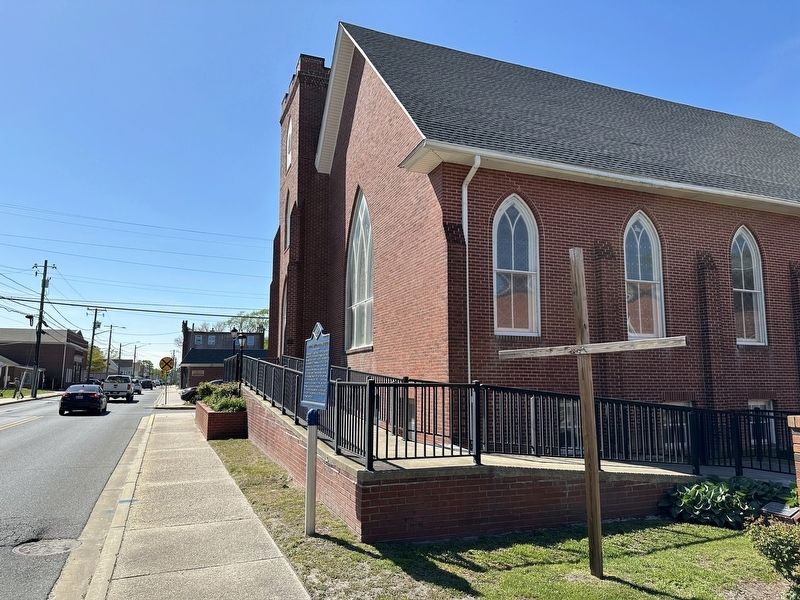
St. Stephen's United Methodist Church Marker wide view
On East State Street east of North 1st Street, on the right when traveling west.
St. Stephen's UMC was formed in 1964 through the merger of Mt. Olive Methodist Protestant and First Methodist Church creating a unified congregation of approximately 800 members. In 1889, Mt. Olive incorporated and a church located at the corner of . . . — — Map (db m268227) HM
On State Street (Delaware Route 54) at 6th Street, on the right when traveling west on State Street.
The town of Delmar was established soon after the Delaware Railroad reached this area in 1859. Although fire devastated Delmar in 1892 and 1901, the town continued to build and grow. Incorporated on March 9, 1899, Delmar became known as the . . . — — Map (db m168192) HM
On E. Railroad Avenue close to Main Street ( Road 16), on the right when traveling south.
Ellendale’s Railroad Square was a major rail junction and a beehive of economic activity in Sussex County. The first section of the Junction and Breakwater Railroad from Harrington to Milford was completed in 1859. In March 1860, the Company’s . . . — — Map (db m38647) HM
On Cedar Creek Road (Delaware Route 30) at Isaacs Road, on the left when traveling south on Cedar Creek Road.
Born on August 22, 1889 near Greenwood, John Sudler Isaacs attended school until the sixth grade when he began working full time on the family farm. Although Isaacs started his career as a tenant farmer, he displayed a keen entrepreneurial spirit . . . — — Map (db m169914) HM
On Main Street (Delaware Route 16) near McCauley Avenue, on the right when traveling east.
This area began as forest and swamp bridging
the Divide between the Chesapeake and Delaware
Bays. European Contact made it a province of
fur traders and hunters. In the 18th century,
farming and timbering pushed back the swamp.
With the . . . — — Map (db m37196) HM
On Lighthouse Road (Delaware Route 54) near Coastal Highway ( Route 1) when traveling south.
This stone monument, erected April 26, 1751, marks the eastern end of the Transpeninsular Line surveyed 1751-1751 by John Watson and William Parsons of Pennsylvania and John Emory and Thomas Jones of Maryland. This line established the east-west . . . — — Map (db m1234) HM
On Omar Road (County Route 54), on the right when traveling east.
In the 17th century, the colony of Maryland was founded as a refuge for Catholics and members of other religious faiths then subject to persecution. Many of the early settlers of this region, then a part of Maryland, were Presbyterians who had been . . . — — Map (db m122258) HM
On Omar Road (County Road 54) at Vines Creek Road (State Route 26), on the right when traveling west on Omar Road.
The roots of this congregation can be traced to the late 1700’s, when Methodist pioneers such as Francis Asbury and Freeborn Garrettson visited this area to propagate the faith. Meetings were held in the open air and in private residences. By 1816 a . . . — — Map (db m38381) HM
On Powell Farm Road (County Road 365), on the left.
The roots of African-American Methodism in this area can be traced to the late 18th century when Methodism pioneers such as Francis Asbury and Freeborn Garrettson traveled locally organizing black “classes” for worship. Over time some groups chose . . . — — Map (db m37844) HM
On Clayton Avenue (County Route 401), on the right when traveling south.
A "society" of the African Methodist Episcopal Church was established in this area by the 1830's. The first church was purchased in 1857. On February 28, 1890 land was purchased at this site for the purpose of construction of a new church. Annual . . . — — Map (db m37323) HM
On Main Street (County Road 54) at Reed Street, on the right when traveling west on Main Street.
After adventurous service as a sea captain during the late 19th and early 20th centuries, Captain Ebe Townsend Chandler returned to his hometown of Frankford and purchased what is now known as the Captain Chandler House in 1918. Built by Captain . . . — — Map (db m190329) HM
On Clayton Avenue / Main Street (County Route 54) near Frankford Avenue, on the right when traveling south.
In 1819, a group of Methodists purchased a parcel of land north of present-day Frankford. A frame chapel was erected, and on March 4, 1820, the members of the congregation met there to elect trustees and formally organize themselves as Antioch . . . — — Map (db m37256) HM
On Lowes Crossing Road (County Route 61), on the right when traveling east.
By the 1840’s, a group of local Methodists were meeting nearby in Jones School. Desiring a permanent place of worship, the congregation built a church in 1857
at a site one-half mile west of here. In 1861, Jacob Jones and his wife, Love . . . — — Map (db m48566) HM
On Bethesda Road (County Road 326) near Stockley Road (County Road 432), on the right when traveling north.
During the late 18th century many of the residents of this area embraced the Methodist faith. Meetings were often held in the homes of church members. The origin of the Bethesda congregation can be traced to February of 1832, when trustees purchased . . . — — Map (db m60762) HM
On Speedway Road (Local Road 325) 0.1 miles east of Bethesda Road (County Road 326), on the right when traveling east.
Built in 1949 by businessman and auto racing pioneer Melvin L. Joseph, many racing legends got their start at Georgetown's half mile dirt oval. The Delaware Stock Car Racing Association sanctioned the first race at the speedway on March 18, 1950. . . . — — Map (db m244390) HM
On Shortly Road (County Road 431), on the right when traveling north.
In 1865 the Maryland Conference of the Methodist Protestant Church established a “mission” or charge circuit in Sussex County. At the time local members of that faith were meeting nearby in Rogers School. Services were held in the schoolhouse . . . — — Map (db m283482) HM
On The Circle (U.S. 9) at Bedford Street and Market Street, on the left on The Circle.
The future home of Sussex County’s seat of government was a sparsely populated rural area when the 76 acres which would become the Town of Georgetown were purchased on May 9, 1791. Located “near the centre” of the country at a place known as . . . — — Map (db m245095) HM
On East Market Street (U.S. 9) at North Railroad Avenue, on the right when traveling south on East Market Street.
In 1827 the Delaware legislature authorized a lottery for the purpose of funding the construction of “an Academy and Masonic Hall.” Land was purchased in 1840, and construction commenced the following year. The building was formally dedicated on . . . — — Map (db m427) HM
On Seashore Highway (State Route 404) (State Road 18), on the left when traveling west.
Site of the first community college in the State of Delaware. Formerly William C. Jason High School, this college was created by the Delaware General Assembly in 1966 and opened the doors to students in September 1967. Because of its central . . . — — Map (db m49022) HM
On West Pine Street, on the right when traveling north.
Born in Georgetown on July 1, 1833, Torbert attended local schools prior to his appointment to the West Point Class of 1855. After the outbreak of the Civil War he rose rapidly in rank, serving as a regimental and brigade commander of New Jersey . . . — — Map (db m39375) HM
On West Market Street at Love Lane on West Market Street.
George Alfred Townsend, famous Civil War newspaper correspondent, journalist and author, was born on this block on January 30, 1841. Townsend’s novels and poetry reflect his deep love for his native region. His best-known historical novel, The . . . — — Map (db m38692) HM
On East market Street (State Route 404) (U.S. 9), on the right when traveling west.
Site of town purchased May 9, 1791 from Abraham Harris, Rowland Bevins,and Joshua Pepper, and laid out for county-seat of Sussex County in accordance with Act of General Assembly of January 29, 1791. Named
Georgetown in honor of George Mitchell, . . . — — Map (db m49083) HM
On April 11, 1903, the commissioners of the
Town of Georgetown held a public meeting to
organize a fire company for the community.
The effort was in response to the demands of
businessmen and homeowners who had experienced
rising insurance . . . — — Map (db m48860) HM
On North Bedford Street, on the right when traveling south.
In 1859 a petition was submitted to the Lewes Presbytery requesting the creation of a Presbyterian Church in Georgetown. The congregation was organized the following year. Meetings were first held in the Sussex County Courthouse. The church was . . . — — Map (db m48861) HM
In 1857 efforts to extend a rail line from Harrington to the harbor at Lewes were initiated. Though the line was completed to Milford in 1859, additional work was delayed until 1867. By 1868 the rails had reached Georgetown. With extension of the . . . — — Map (db m38697) HM
On East Market Street (US 9) (Delaware Route 404), on the right when traveling east.
In the spring of 1891, Rev. Louis A. Bennett was directed to establish a Methodist Protestant Church in
Georgetown. His efforts were successful, and a frame church was completed the following year on the northwest corner of East Market and King . . . — — Map (db m49013) HM
On Seashore Highway (Delaware Route 18/404) 0.1 miles east of County Road 522, on the right when traveling east.
Hebron M.P. church is one of nine rural Methodist Protestant Churches founded in Sussex County prior to 1888. It is the only known rural M.P. church in Sussex County to have undergone minimal alteration since its construction. The church exemplifies . . . — — Map (db m199246) HM
On McColleys Chapel Road (County Road 213) just south of Redden Road, on the right when traveling south.
McColley's Chapel was built and dedicated in 1858 as a Methodist Church. Congregation members had previously worshipped in a small house on the opposite side of the road. James Redden, a member of the board of trustees, sold the property to the . . . — — Map (db m190325) HM
On South Bedford Street, on the right when traveling south.
Constructed in 1791 at the direction of the State Legislature, this structure served as the seat of Sussex County government until 1837, when it was sold and moved to this location to make way for the construction of the present County . . . — — Map (db m243003) HM
On West Railroad Avenue near East Adams Street, on the left when traveling north.
The roots of African-American Methodism in this community can be traced to the organization of a black “class” within the local Methodist society in the 1790’s. By the 1830’s a group of residents had affiliated themselves with Bishop Richard Allen’s . . . — — Map (db m49017) HM
On The Circle (U.S. 9) at Bedford and Market Streets, on the left on The Circle.
The conflicting claims of the proprietors of Maryland and Pennsylvania resulted in a lengthy and sometimes violent dispute concerning the ownership and boundaries of Sussex County. Residents who had been Marylanders before the controversy was . . . — — Map (db m245096) HM
On The Circle (U.S. 9) at Bedford and Market Streets, on the left on The Circle.
This event draws thousands as winning and losing candidates joining in celebration on the Thursday following each general election. Poor traveling conditions and interest in the outcome of political contests may have resulted in an extended stay . . . — — Map (db m426) HM
On Airport Road at Stevenson Lane, on the right when traveling east on Airport Road.
In the late 19th and early 20th Centuries. Delaware did not have a comprehensive state-wide education system. By 1915, Delaware schools were ranked among the poorest in the country. Worse yet, African American students often attended dilapidated . . . — — Map (db m243080) HM
On Sand Hill Road at Huff Road, on the right when traveling north on Sand Hill Road.
Methodism first came to this area in the late 18th century when circuit riding preachers traveled through the countryside spreading the message of their faith. For a number of years residents of this neighborhood worshipped in local homes and . . . — — Map (db m225427) HM
On East Pine Street near Academy Street, on the right when traveling north.
Incorporated on June 21, 1794, St. Paul’s
P.E. Church is the oldest organized church
in Georgetown. Prior to completion of the
first church building, services were held in
the Sussex County Courthouse. In 1805, a
special lottery sanctioned . . . — — Map (db m49011) HM
On The Circle (U.S. 9) at Bedford and Market Streets, on the left on The Circle.
In 1835 a lottery was authorized to raise funds to replace the frame structure which had served as Courthouse since 1791. Construction of the new building began in 1837 following the sale and relocation of the original Courthouse to its present . . . — — Map (db m245094) HM
This locally famous landmark was constructed in 1836 by Joshua S. Layton and Caleb B. Sipple, builders of the Sussex County Courthouse across the Square. It replaced a frame Public House that had stood on the site. County courts were held here . . . — — Map (db m38694) HM
On West Market Street close to Front Street, on the right when traveling west.
This home takes its name from the many judges who have lived in it. The Judges was built circa 1809 by Peter Robinson, who served as Secretary of State for Delaware under three governors and was appointed Associate Justice for Sussex County in 1832. . . . — — Map (db m38696) HM
On North Race Street, on the right when traveling north.
This congregation’s beginnings can be traced to a visit from Methodist pioneer Francis Asbury to a gathering of farm families at the home of Abraham Harris on September 24, 1779. A prominent local landowner, Mr. Harris later conveyed a substantial . . . — — Map (db m49020) HM
On Seashore Highway (State Road 18), on the right when traveling east.
Named after the first African-American
president of Delaware State College, the
school opened in October 1950. Funds were
provided in the will of H. Fletcher
Brown a local philanthropist, and by the
State General Assembly. Initially Jason . . . — — Map (db m49021) HM
On East Market Street (U.S. 9) just east of The Circle (U.S. 9), on the right when traveling east.
On March 16, 1920, Sussex County's members of the Delaware General Assembly held a conference in Georgetown to hear opinions for and against women's suffrage. Suffragists and anti-suffragists organized similar gatherings throughout the state that . . . — — Map (db m190431) HM
On Gravel Hill Road (State Road 30), on the right when traveling north.
The origin of this congregation can be traced to the organization of “Johnson’s Society” in the 1830’s. Meetings were held in private homes and the local school. On July 3, 1852, trustees were elected to supervise the building of the first church. A . . . — — Map (db m38635) HM
On Seashore Highway (Delaware Route 404) near Cokesbury Road (County Road 529), on the right when traveling east.
A Methodist meeting house was erected nearby circa 1803. In December of that year, the lot on which the building stood was conveyed to trustees on the condition that they finish and maintain the structure as a church and school. The building was . . . — — Map (db m285297) HM
On Seashore Highway, on the right when traveling west.
Governor John Collins was born on March 1, 1776 in Nanticoke Hundred on his family farm at Collins Mill Pond. Collins, a member of the Democratic-Republican party, served as Delaware's 22nd Governor from January 16, 1821 until his death on April 16, . . . — — Map (db m261659) HM
On Dupont Boulevard (U.S. 113) south of Gov. Stockley Road (County Road 432), on the right when traveling south.
Constructed in 1948 by Wilbert Rogers, Stockley Tavern is the oldest and one of the last continually operating tap houses in Delaware. Originally called Stockleyville Tavern, the business advertised as the "Television Bar" because it was the first . . . — — Map (db m232976) HM
On Saint Johnstown Road 0.1 miles south of Beach Highway ( Route 16), on the left when traveling south.
In the spring of 1779, Methodist pioneer Francis Asbury visited this area to spread the message of his faith. His efforts were successful and resulted in the organization of a local society of Methodists. Early meetings were held in the homes of . . . — — Map (db m38650) HM
On North 1st Street (County Road 589) east of Red Pine Drive, on the right when traveling north.
Built in 1922 with support from philanthropist Pierre S. du Pont, Greenwood School 222-C was part of a statewide network of schools for children of color. Serving first through sixth grades, it was the only school for Black children in the area. . . . — — Map (db m306588) HM
On Harbeson Road (Delaware Route 5) near Hollymount Road (County Road 48), on the right when traveling north.
In 1881 the Nanticoke Indian people constructed
this church to provide a place to join for religious
devotions. Known as “Johnson’s Chapel,” the church
was affiliated with the Methodist Protestant
denomination. On March 27, 1884, the land . . . — — Map (db m37564) HM
On Beaver Dam Road (County Road 285), on the right when traveling south.
During the late 17th and early 18th centuries,
a great number of settlers came to this area
from the lower Eastern Shore counties of
Maryland and Virginia. They brought many
elements of their culture including an
affiliation with the . . . — — Map (db m38196) HM
On Sycamore Road, on the right when traveling east.
On June 6, 1890, Benjamin H. Elliot and his wife, Sarah Ann Hastings Elliot, donated this land and building materials for the construction of Epworth Methodist Episcopal Church. They had previously donated land for the site of Sycamore Public . . . — — Map (db m284941) HM
Named after William C. Jason, the second President of State College for Colored Students (now Delaware State University), Jason Beach was a recreational destination for people of color from the 1930s through the early 1970s. Along with use as a . . . — — Map (db m200985) HM
On Seaford Highway (Business U.S. 13) near Mount Zion Road, on the left when traveling north.
This congregation was organized in 1809. Services were held in a structure that was first known as Elzey Moore's Meeting House, and later renamed Wesley Chapel. With the closing of Wesley in 1852, the congregation was divided. On January 8, 1853, . . . — — Map (db m4539) HM
On Chipmans Pond Road (County Road 465) at Christ Church Roads (County Road 465A) on Chipmans Pond Road.
This Federalist served as the governor of Delaware between 1805-1808. He was born in Laurel in 1752, attended Old Christ Church, and is buried in this churchyard. Mitchell was commissioned as adjutant of militia 1775, promoted captain in 1776, . . . — — Map (db m39779) HM
On Chipmans Pond Road (County Road 465) at Christ Church Road (County Road 465A) on Chipmans Pond Road.
Established on Broad Creek in 1770 as a "Chapel of Ease" of Stepney Parish, Maryland on land purchased by a levy of 80,000 pounds of tobacco. Building completed by Robert Holston in 1772 at a cost of £510. — — Map (db m39778) HM
On Philips Hill Road (County Road 472), on the right when traveling west.
In 1865, Reverend Isaac Adkins of the Methodist Protestant Church began to conduct services in Dorothy School House. The congregation was formally organized the following year. Meetings continued to be held in the school until 1873, when . . . — — Map (db m61577) HM
On West Market Street (Delaware Route 24) at Poplar Street, on the left when traveling west on West Market Street.
In 1801 there was a great revival of religion amoung the residents of the area. The growing appeal of the Methodist movement resulted in hundreds of new members for the church. A class was formed in the Laurel area, and in 1802 a church was . . . — — Map (db m11816) HM
On South Central Avenue (Business U.S. 13) 0.1 miles south of Market Street ( Route 24), on the right when traveling south.
In the fall of 1831, Reverend Thomas Pearson came to Laurel to assist with the establishment of a Methodist Protestant congregation in the community. With its founding, the church became one of the first of this denomination in Delaware. Early . . . — — Map (db m4430) HM
On West 6th Street (Local Road 70), on the right when traveling east.
On June 23, 1800, a charter was issued by the
Grand Lodge of Maryland for Lodge No. 31 in
“Laurel Town.” The first Worshipful Master of
the Lodge was Jesse Green (1766-1834). A Maryland
native who moved to Delaware in the 1790s, he
was a . . . — — Map (db m60600) HM
The origin of this congregation can be traced to the formation of a local society of the Methodist Episcopal Church in 1842. Known as the Oak Grove Society, the group held its first meetings in an old dwelling that was located approximately one-half . . . — — Map (db m245584) HM
On South Central Avenue (Alternate U.S. 13) 0.1 miles south of 8th Street, on the left when traveling south.
This site was originally part of a tract known as "Bachelor's Delight". From 1711 to 1768 it was included in a 3,000 acre Nanticoke Indian Reservation, authorized by an act of the Maryland Assembly. A village known as "Laurel" existed as early as . . . — — Map (db m4423) HM
On Mount Pleasant Road (County Road 493) near Sharptown Road (State Route 24), on the left when traveling north.
The origin of this church can be traced to the organization of a local society of Methodists in 1778. The first meetings of the group, then known as the Broad Creek Society, were held in the homes of its members. On October 19, 1779, Methodist . . . — — Map (db m60624) HM
On West 6th Street (County Road 492) just east of Webb Avenue, on the left when traveling west.
The Paul Laurence Dunbar School educated African American students in Laurel in grades 1-11 from 1921-1965. Constructed as part of philanthropist Pierre S. du Pont's school rebuilding program, the Dunbar School replaced a small wood-framed school in . . . — — Map (db m198843) HM
On Dogwood Lane, on the right when traveling south.
The roots of local Methodism can be traced to the
late 18th century, when Bishop Francis Asbury and
others visited this area to spread the message of
their faith. By the 1820s there was a growing
movement within the Methodist Episcopal . . . — — Map (db m60465) HM
On Old Stage Road (County Road 68) near Calfant Drive, on the right when traveling north.
In 1865 the Maryland Conference of the Methodist Protestant Church established a “mission” or charge circuit in southwestern Sussex County. At the time local members of that faith were holding meetings in Sharp’s school, a one room school house . . . — — Map (db m168193) HM
On East 6th Street just east of Spruce Street, on the right when traveling east.
In the 1830s the oldest portion of this structure, a one-room house, is believed to have been built. The house was enlarged significantly in the 1850s with the addition of a slightly taller story-and-a-half center portion and a full two-story . . . — — Map (db m164980) HM
On Delaware Avenue 0.1 miles north of Market Street ( Route 24), on the right when traveling north.
Here was Laurel's ancient "Wading Place", a ford for Native Americans and colonial settlers. Broad Creek crosses this fall in its flow to the Nanticoke River and Chesapeake Bay. For centuries, the Nanticoke Indians, an Algonquin people, lived in the . . . — — Map (db m11817) HM
On Savannah Road (Business U.S. 9) just north of Beebe Avenue, on the left when traveling north.
In 1916, two brothers, Drs. James Beebe, Sr. and Richard C. Beebe, had a shared vision to bring modern-day medicine to Southern Delaware. The Beebe brothers started the first hospital in Sussex County on Savannah Road in Lewes. The hospital began as . . . — — Map (db m190352) HM
On Savannah Road at Sussex Drive, on the right when traveling south on Savannah Road.
As a community-owned, not-for-profit hospital, Beebe Hospital depends on the generous support of individuals, foundations, and businesses. In 1921, Mr. and Mrs. Benjamin F. Shaw were responsible for the first major philanthropic gift to Beebe . . . — — Map (db m199263) HM
On Johnson Avenue just east of Dupont Avenue, on the right when traveling east.
Block House Pond, a natural spring-fed pond, has provided fresh water, ice, and recreation to the City of Lewes for several centuries. The pond was likely named for a nearby blockhouse built to protect Lewes in the 1670s, where the town residents . . . — — Map (db m232744) HM
On Coastal Highway (Delaware Route 1), on the left when traveling south.
Originally known as Broadkill Hundred, after creek of that name, kill being Dutch work for creek. Name changed by General Assembly 1833 when Georgetown Hundred was set off. In 1835 Act was repealed, and Broadkiln Hundred embraced same territory as . . . — — Map (db m36881) HM
On Robinsonville Road (County Road 280B) west of Robinsonville Road (County Road 277), on the left when traveling west.
On February 9, 1838, a meeting was held at the Angola Schoolhouse for the purpose of formally organizing a Methodist Episcopal Church to serve the needs of local residents. On that same day the congregation's newly-elected trustees received a deed . . . — — Map (db m232972) HM
On Log Cabin Hill Road (Local Road 247) just west of Local Road 281, on the right when traveling west.
Named for the river branch which runs along its northwest edge, Cool Spring Presbyterian Church was established circa 1726. Many of its members were Ulster Scots who had come to America from Ireland seeking religious freedom and economic . . . — — Map (db m150096) HM
This house was the home of Colonel David Hall (1752-1817), patriot of the Revolution and Governor of Delaware. Devoted to the struggle for American Independence, he enlisted in the Continental Army in 1776 and was commissioned as a Captain in the . . . — — Map (db m38011) HM
Located on the eastern end of the Delaware Breakwater, this brown conical structure was built in 1885. The tower is composed of four tiers of cast iron plates lined with two feet of brick. It is twenty-two feet in diameter at the base and is set . . . — — Map (db m39378) HM
A temporary light was established on the south end of the recently completed National Harbor of Refuge Breakwater on January 1, 1902. It was replaced in 1908 by a three-story frame lighthouse. A series of storms damaged the structure, resulting in . . . — — Map (db m39374) HM
On Shipcarpenter Street near 2nd Street, on the left when traveling north.
The land upon which this house now stands was acquired in 1675 by Helmanus Wiltbank, a prominent early resident and property owner of Lewes. The oldest portion of the present structure is believed to have been constructed by Cornelius Wiltbank . . . — — Map (db m48936) HM
On Pilottown Road (Delaware Route 267) close to Rodney Ave..
A native and lifelong resident of this community, Henry Fisher (1735-1792) was one of Delaware's foremost leaders in the struggle for American Independence. His prominence as a skilled pilot and his firm support of the Patriot cause resulted in his . . . — — Map (db m39377) HM
In 1840, Israel United Methodist Church formed in the Belltown community west of Lewes. Israel established a cemetery in 1854 and formally incorporated in 1877. The congregation rebuilt the church in 1890 and again in 1916. Over time, the 1916 . . . — — Map (db m227870) HM
On Front Street near West Market Street, on the left when traveling north.
Under orders from Peter Stuyvesant the Dutch erected Fort At Hoorn Kil (Lewes Creek) 1659 but were soon dispossessed by the Marylanders. Here was also a communistic settlement established in 1662 by Mennonites from Holland under Peter Cornelis . . . — — Map (db m38194) HM
On Savannah Road (U.S. 9) north of Donovan Road/N. Atlantic Drive ( Route 263), on the right when traveling north.
Under orders from Peter Stuyvesant the Dutch erected Fort at Hoorn Kil (Lewes Creek) 1659 but were soon dispossessed by the Marylanders. Here was also a communistic settlement established in 1662 by Mennonites from Holland under Peter Cornelius . . . — — Map (db m152856) HM
On Savannah Road (U.S. 9) south of Nassau Commons, on the right when traveling south.
The Dutch in 1673 established a court in Hoorn Kil for the inhabitants “on the east and west sides of Cape Henlopen unto Bomties (Bombay) Hook.” Governor Andros of New York in 1676 established an English court at Whorekill, the jurisdiction of which . . . — — Map (db m19408) HM
On Savannah Road (U.S. 9) north of Sussex Drive, on the right when traveling south.
Here lived Ryves Holt, colonial chief justice; and four governors, David Hall, who commanded a Delaware regiment in the Revolution, Daniel Rodney and Caleb Rodney, sons of John Rodney, and Ebe W. Tunnell; also Colonel Henry Fisher, Revolutionary . . . — — Map (db m19409) HM
On Savannah Road (U.S. 9) south of 3rd Street & Kings Highway, on the right when traveling north.
On north side of town was Zwaanendael, first Dutch settlement on Delaware soil. Founded 1631 on creek, named by settlers Hoorn Kil in honor of town of Hoorn in Holland. Colony was destroyed by Indians same year. DeVries, a director of company which . . . — — Map (db m19407) HM
On Kings Highway (U.S. 9N), on the right when traveling north. Reported permanently removed.
The origin of this church can be traced to the earliest days of Presbyterianism in America. A congregation was established here in 1692 under the leadership of the Reverend Samuel Davis. The steady flow of immigrants from Scotland and Ireland . . . — — Map (db m38573) HM
On Kings Highway (U.S. 9) north of Washington Avenue, on the right when traveling north.
During early American Presbyterianism, this congregation formed in 1692 under the Reverend Samuel Davis and grew with Scottish and Irish immigrants. On part of this site, they built a small frame church in 1707, replaced by a brick one in 1728. . . . — — Map (db m315340) HM
On Shipcarpenter Street, on the left when traveling north.
Responsible for establishing aids for the navigation of our nation’s waterways, the United States government initiated the use of manned lightships or “floating lighthouses" in 1820. These vessels addressed many needs. They could be placed in . . . — — Map (db m19312) HM
On Pilottown Road near Harborview Road, on the right when traveling east.
This house is believed to have been built by Samuel Paynter, a carpenter who purchased this property in 1737. Following its completion, the house and surrounding land was sold in 1741 to Luke Shields, a prominent bay and river pilot. The close . . . — — Map (db m48920) HM
On West 3rd Street at Shipcarpenter Street, on the right when traveling west on West 3rd Street.
The Atlantic Menhaden is a small herring-like fish found in the coastal waters of the Eastern United States. Used by Native Americans to fertilize crops, these oily fish were also used by European settlers to produce fuel for lamps. In the mid-19th . . . — — Map (db m268272) HM
In 1680, Governor Andros authorized
the erection of a court house of logs
to cost 5000 pounds of tobacco.
Near this wall was the second building
used from 1740 to 1791, when the county
seat was moved to Georgetown.
The church rented building . . . — — Map (db m37347) HM
On Robinsonville Road (Local Road 277) 0.1 miles north of Long Lane, on the left when traveling north.
Rabbit's Ferry School educated Native American and African American students of the Robinsville area from 1920-1965. Built in 1919 through Pierre S. du Pont's school rebuilding program, the school served students in grades 1-8 and later, grades 1-6. . . . — — Map (db m150097) HM
On 2nd Street near Mulberry Sreet, on the right when traveling east.
In this house lived Ryves Holt
Chief Justice
of “Three Lower Counties On Delaware,”
1745 to 1763
Member of Assembly
of “Three Lower Counties On Delaware,”
1734-1737, 1742-1744, 1746-1755,
And Speaker of Assembly . . . — — Map (db m221639) HM
On Pilottown Road just east of Ocean View Boulevard, on the right when traveling east.
St. George AME church was established prior to 1880 on land donated by Peter Lewis, a free black shipbuilder and AME church delegate. Initially, congregants met at the Old Bethel Meeting House, but soon acquired a corn crib to hold services in on . . . — — Map (db m150098) HM
On 2nd Street near Market Street, on the left when traveling north.
In 1680, the Justices of the County petitioned Governor Edmond Andros for the right to grant lands. Under this authority, a lot of ground at this location was reserved for “publick use.” Many of the settlers who came to this area . . . — — Map (db m38630) HM
On Shipcarpenter Street 0.1 miles north of Route 267, on the left when traveling north.
Known as the “Great White Hurricane,” the Blizzard of 1888 was one of the most devastating weather events in recorded history. Affecting coastal states from Virginia to Maine, this paralyzing storm resulted in widespread death and destruction. With . . . — — Map (db m19316) HM
On Front Street (Delaware Route 267) 0.1 miles Savannah Road (U.S. 9). Reported permanently removed.
In March of 1813, the Royal Navy established a blockade of the Delaware Bay and River. The British squadron, under the command of Commodore John P. Beresford, RN, took up stations off Lewes and the Delaware Capes, and began to conduct raids along . . . — — Map (db m19308) HM
On Front Street at Neils Alley, on the right when traveling west on Front Street.
In March 1813, the Royal Navy under the command of Commodore John P. Beresford established a blockade of the Delaware Bay and River, conducting raids along the coast to disrupt maritime commerce and shipping. On this location was one of two . . . — — Map (db m244907) HM
The War of 1812 had a major impact on the town of Lewes and surrounding area. The naval blockade that was initiated by the British in March of 1813 lasted for most of the next two years. With maritime commerce limited, the local economy suffered. . . . — — Map (db m30358) HM
On Eagle Point Drive, on the right when traveling south.
Located within this neighborhood, a short distance south of here, is the burial ground of the Coursey and Daisey families, members of the Nanticoke Indian tribe.
The graveside is unmarked except for a family tombstone noting the site.
It . . . — — Map (db m104206) HM
On Savannah Road (U.S. 9) at 3rd Street, on the right when traveling east on Savannah Road.
This building was constructed in 1898 by the Sussex Trust Title and Safe Deposit Company. It was opened in October of that year, and continued to serve as the Lewes branch of the bank until being replaced by a new structure on Second Street in 1911. . . . — — Map (db m37396) HM
In 1769, an international scientific effort was organized to observe a transit of Venus in order to determine the size of the solar system. This rare event, when Venus passes in front of the Sun's disk, makes such calculations possible when measured . . . — — Map (db m228456) HM
620 entries matched your criteria. Entries 401 through 500 are listed above. ⊲ Previous 100 — Next 100 ⊳