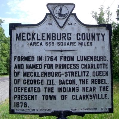
By Bernard Fisher, June 13, 2010
Mecklenburg County Marker (reverse)
GEOGRAPHIC SORT Title Sort Marker Number Sort Marker Number Sort for Trails Publication Order Sort Publication Order Sort A Erected Year Sort Most Viewed Sort Most Recent-Interest Sort Most Recently Changed Sort SEE FAQ #33 FOR DESCRIPTIONS
On Barnesville Highway (U.S. 15) 0.2 miles south of Wheatland Road (County Route 640), on the right when traveling south.
On Barnesville Highway (U.S. 15) at Jackson-Vaughan Road (County Route 607), on the right when traveling south on Barnesville Highway.
On Barnesville Highway (U.S. 15) 0.3 miles north of Jackson-Vaughan Road (County Route 607), on the right when traveling south.
On Barnesville Highway (U.S. 15) 0.3 miles north of Jackson-Vaughan Road (County Route 607), on the right when traveling south. Reported permanently removed.
On Barnesville Highway (U.S. 15) 0.2 miles north of Cannery Lane, on the left when traveling north. Reported damaged.
On Kings Highway (U.S. 360) west of Barnesville Highway (U.S. 15), on the right when traveling west.
On Preston Avenue (U.S. 250) 0.2 miles south of Grady Avenue (U.S. 250), on the left when traveling north.
On Monticello Avenue (Virginia Route 20) north of Blenheim Avenue, on the right when traveling north.
On East Market Street west of 5th Street NE, on the right when traveling east.
On Main Street near 5th Street SE, in the median.
On Fontaine Avenue (Old U.S. 29) at Appletree Road, on the right when traveling east on Fontaine Avenue.
On Long Street (Bypass U.S. 250) north of High Street (Business U.S. 250), on the right when traveling west.
On Watson Avenue just east of Park Street, on the left when traveling east.
On East Jefferson Street at Farm Lane, on the left when traveling east on East Jefferson Street.
On John W. Warner Parkway at Bypass U.S. 250, on the right when traveling south on John W. Warner Parkway.
Paid Advertisement
On East High Street at 4th Street NE, on the right when traveling east on East High Street.
On East High Street at Park Street, on the right when traveling east on East High Street.
On East Jefferson Street at Park Street, on the right when traveling west on East Jefferson Street.
On McIntire Road at Perry Drive, on the right when traveling north on McIntire Road.
On Rose Hill Drive at Henry Avenue, on the left when traveling north on Rose Hill Drive.
On West Main Street (Business U.S. 250) at 7th Street, on the right when traveling east on West Main Street.
On 4th Street NW at Commerce Street, on the left on 4th Street NW.
On Preston Avenue just south of 10th Street NW, on the left when traveling north.
On West Main Street (Business U.S. 250) at 13th Street and near Jefferson Park Avenue, on the left when traveling east on West Main Street.
On Wertland Street at 12½ Street NW, on the right when traveling east on Wertland Street.
On East Market Street just west of Riverside Avenue, on the left when traveling east.
On Battlefield Boulevard South (Virginia Route 168) north of Albermarle Drive, on the right when traveling north. Reported permanently removed.
On Shell Road at George Washington Highway (Business U.S. 17), on the right when traveling east on Shell Road.
On Shell Road at Owens Terrace, on the right when traveling south on Shell Road.
On Library Drive at Shea Drive, on the left when traveling north on Library Drive.
On Battlefield Blvd S at St. Brides Road West, on the right when traveling south on Battlefield Blvd S.
Paid Advertisement
On Dismal Swamp Canal Trail 0.8 miles south of George Washington Highway (U.S. 17), on the right when traveling south.
On Old U.S. 17, on the right when traveling south.
On Airline Boulevard (U.S. 58) 0.1 miles east of Ahoy Drive, on the right when traveling west.
On Homestead Road 0.2 miles south of South Military Highway (U.S. 460), on the right when traveling south.
On West Hundred Road (Virginia Route 10) at Old Stage Road, on the right when traveling east on West Hundred Road.
On East Hundred Road (Virginia Route 10), on the right when traveling west. Reported missing.
On U.S. 1 0.1 miles south of West Hundred Road ( Route 10), on the right when traveling north.
On East Hundred Road (Virginia Route 10) at Point of Rocks Road, on the right on East Hundred Road.
On U.S. 1 0.2 miles north of Leighworth Boulevard, on the right when traveling north.
On North Enon Church Road (Virginia Route 618) at Bermuda Hundred Road, on the right when traveling north on North Enon Church Road.
On U.S. 1 0.1 miles north of Osborne Road, on the right when traveling south.
On Centralia Road (Virginia Route 145) just west of Chester Road ( Route 144).
On Iron Bridge Road (Virginia Route 10) west of Branders Bridge Road, on the right when traveling east.
On U.S. 1 at Wonderview Drive, on the right when traveling north on U.S. 1.
On U.S. 1 at County Route 288, on the right on U.S. 1.
On U.S. 1 0.4 miles north of Old Bermuda Hundred Road, on the right when traveling north.
Paid Advertisement
On East Hundred Road (Virginia Route 10) 0.1 miles west of Allied Road, on the right when traveling west.
On East Hundred Road (Virginia Route 10) at Allied Road, on the right when traveling west on East Hundred Road.
On U.S. 1 0.1 miles north of Osborne Road, on the right when traveling south.
On U.S. 1 at Route 288 (State Route 288), on the right on U.S. 1.
On U.S. 1 0.4 miles north of Mangowood Road, on the right when traveling north.
On West Hundred Road (Virginia Route 10) at Old Stage Road, on the right when traveling east on West Hundred Road.
On Iron Bridge Road (Virginia Route 10) at Wagners Way, on the right when traveling west on Iron Bridge Road.
On State Park Road 0.2 miles north of State Park Road ( Route 780), on the right.
On Winterpock Road (Route 621) at Beach Road ( Route 655), on the right when traveling south on Winterpock Road.
On River Road (Route 602) at Eppes Falls Road, on the left when traveling west on River Road. Reported permanently removed.
On River Road (Virginia Route 602) at Eppes Falls Road, on the right when traveling east on River Road.
On Iron Bridge Road (Virginia Route 10) at Krause Road, on the right when traveling east on Iron Bridge Road.
On River Road (Virginia Route 602) 0.2 miles east of Reedy Branch Road, on the left when traveling east.
On Beach Road (Virginia Route 655) at State Park Road on Beach Road.
On River Road (Virginia Route 602) at Cedar Creek Road, on the right when traveling east on River Road.
On River Road (Virginia Route 602) at Cedar Creek Road, on the left when traveling west on River Road. Reported permanently removed.
Paid Advertisement
On River Road (Virginia Route 602) east of Cedar Creek Road, on the right when traveling east.
On Beach Road (Virginia Route 655) at State Park Road, on the left when traveling south on Beach Road.
On U.S. 1 0.4 miles north of Happy Hill Road, on the right when traveling north.
On U.S. 1 0.3 miles north of Happy Hill Road, on the right when traveling north.
On U.S. 1 0.4 miles north of Happy Hill Road, on the right when traveling north.
On Carter G Woodson Avenue 0.1 miles south of Mathews Jefferson Drive, on the left when traveling south.
On Fleet Street (State Highway 36) at Chesterfield Avenue (State Highway 36), on the right when traveling north on Fleet Street. Reported missing.
On East River Road at Matthews Jefferson Drive, on the right when traveling east on East River Road.
On East Hundred Road (Virginia Route 10) 0.1 miles west of Enon Church Road, on the right when traveling west.
On East Hundred Road (Virginia Route 10) 0.1 miles west of Enon Church Road, on the right when traveling west.
On Pickett Avenue (Virginia Route 600) at Ferndale Avenue, on the right when traveling south on Pickett Avenue.
On Midlothian Turnpike (U.S. 60) at Robious Road, on the right when traveling west on Midlothian Turnpike. Reported missing.
On Hugenot Springs Road 0.1 miles north of Midlothian Turnpike (U.S. 60), on the left when traveling north.
On Midlothian Turnpike (U.S. 60) 0.2 miles west of Hugenot Road, on the right when traveling west.
On Midlothian Turnpike (U.S. 60) at Robious Road, on the right when traveling west on Midlothian Turnpike. Reported missing.
On Hull Street Road (U.S. 360) at North Bailey Bridge Road, on the right when traveling west on Hull Street Road.
Paid Advertisement
On Westfield Road west of Railroad Avenue, on the left when traveling east.
On Midlothian Turnpike (U.S. 60) 0.2 miles east of Johnston Willis Drive, on the right when traveling east.
On Midlothian Turnpike (U.S. 60) at Grove Road, on the right when traveling east on Midlothian Turnpike.
On Midlothian Turnpike (U.S. 60) 0.2 miles east of Coalfield Road, on the right when traveling east. Reported missing.
On Westfield Road just west of Railroad Avenue, on the left when traveling west.
On Midlothian Turnpike (U.S. 60) 0.1 miles east of Salisbury Drive, on the right when traveling east.
On Old Buckingham Road 0.1 miles west of Warminster Drive, on the right when traveling west.
On Midlothian Turnpike (U.S. 60) 0.2 miles east of Coalfield Road, on the right when traveling east.
On Midlothian Turnpike (U.S. 60) at Coalfield Road ( Route 754), on the right when traveling east on Midlothian Turnpike.
On Moseley Road (Virginia Route 605) 0.4 miles north of Skinquarter Road ( Route 603), on the left when traveling north.
On Midlothian Turnpike (U.S. 60) at Moorefield Park Drive, on the right when traveling west on Midlothian Turnpike. Reported permanently removed.
On Midlothian Turnpike (U.S. 60) 0.2 miles west of Tuxford Road, on the right when traveling west.
On River Road (Virginia Route 36) at Winfred Avenue, on the right when traveling east on River Road.
On River Road (Virginia Route 36) west of Winfree Avenue, on the left when traveling west.
On U.S. 1 north of Arrowfield Road, on the right when traveling north. Reported permanently removed.
On U.S. 1 at Cogbill Road, on the right when traveling north on U.S. 1.
Paid Advertisement
On U.S. 1 0.1 miles north of Norcliff Road, on the right when traveling north. Reported missing.
On U.S. 1 at Gwynn Avenue, on the right when traveling north on U.S. 1.
On U.S. 1 at Gwynn Avenue, on the right when traveling north on U.S. 1.
On U.S. 1 0.4 miles south of Chippenham Parkway ( Route 150), in the median.
On South Providence Road near Midlothian, on the right when traveling north.
︽
2743 entries matched your criteria. Entries 401 through 500 are listed above.
⊲ Previous 100 —
Next 100 ⊳