THE HISTORICAL
MARKER DATABASE
“Bite-Size Bits of Local, National, and Global History”


17812 entries match your criteria. Entries 401 through 500 are listed. ⊲ Previous 100 — Next 100 ⊳


Historical Markers and War Memorials in New York

 
By Howard C. Ohlhous, November 5, 2011
Inn of Jacob Crounse Marker & the Inn
401 ► New York, Albany County, Guilderland — Inn of Jacob Crounse — Reported permanently removed
Built 1833. Midway tavern where horses were changed on Schoharie-Albany Stage Coach Route — — Map (db m49512) HM
402 ► New York, Albany County, Guilderland — Jacob Van Aernam —
Jacob Van Aernam 1723 - 1813 Capt. 3rd Albany Regiment Leader of Patriot forces in the Helderberg region during American Revolution Lived on farm here — — Map (db m44020) HM
403 ► New York, Albany County, Guilderland — Knower House —
Est. as hat factory about 1800 by Benjamin Knower Gov. William L. Marcy Married Cornelia Knower in this house — — Map (db m49446) HM
404 ► New York, Albany County, Guilderland — Palatine Road —
c. 1712 First Road West By German Refugees To Schoharie Valley — — Map (db m49555) HM
405 ► New York, Albany County, Guilderland — Red Men’s Hall —
Formerly used as Baptist church, 1850-66; Catholic church: temperance hall. — — Map (db m220466) HM
406 ► New York, Albany County, Guilderland — Rose Hill 1842 — John P. Veeder 1809-1878 —
Appointed Draft Commissioner by President Lincoln to investigate naval operations. — — Map (db m220468) HM
407 ► New York, Albany County, Guilderland — Schoolcraft House —
Built Circa 1840 By John L. Schoolcraft U.S. Congressman 1848-1852 Albany Banker and Whig Leader Delegate to the 1860 National Convention — — Map (db m65410) HM
408 ► New York, Albany County, Guilderland — Site of Hamilton Union Church —
Site of Hamilton Union Church Octagonal building used also as a school house built by Hamilton Mfg. Society about 1797 — — Map (db m116759) HM
Paid Advertisement
409 ► New York, Albany County, Guilderland — The Vale of Tawasentha —
Iroquois name for a burial ground near mouth of the Normanskill Creek. — — Map (db m142822) HM
410 ► New York, Albany County, Guilderland — 1163 — Van Bael Patent —
Purchased 1672 from Mohawks. Sold to Symon Veeder 1683 & Omie Lagrange 1686. Disputed by Patroons & reduced to 1000 acres by 1775 arbitration. — — Map (db m280783) HM
411 ► New York, Albany County, Guilderland — 46 — West Shore Route — Historic Transportation —
NY West Shore & Buffalo RR ran near here 1883. Freight and passenger service from Weehawken, NJ to Buffalo, NY. Later part of CSX system. — — Map (db m280779) HM
412 ► New York, Albany County, Guilderland — Wildehausen —
Site of an Indian Village Nearby Stream Called Wildehausekill or "Indian House Creek" — — Map (db m66751) HM
413 ► New York, Albany County, Guilderland, McKownville — William McKown —
1763-1843. Began McKownville building inn, tavern, dam & barns nearby for opening of Great Western Turnpike 1800. Town Supervisor 1813-1824 — — Map (db m255234) HM
414 ► New York, Albany County, Guilderland Center — Freeman House —
Said to have been erected 1734 later the home of Barent Mynderse, Lieut. in War of Revolution — — Map (db m49721) HM
415 ► New York, Albany County, Guilderland Center — House Built 1802 —
By Nicholas V. Mynderse sold to Michael Frederick who ran it as a tavern for many years — — Map (db m49720) HM
416 ► New York, Albany County, Knox — Dutch Barn —
Built Circa 1800 For Palatine German Settler Jacob Sholtes 1761-1852 By Grandson Jacob 1817-1891 — — Map (db m62841) HM
417 ► New York, Albany County, Knox — Knieskem Farm —
Settled by Hendrick Knieskem about 1750 — — Map (db m54208) HM
Paid Advertisement
418 ► New York, Albany County, Knox — 1255 — Knox Cave —
Vast Passages Explored as Early as 1835. Acquired by Northeastern Cave Conservancy. Subject of Lore & Scientific Research. Located Nearby. — — Map (db m306878) HM
419 ► New York, Albany County, Knox — Knox School #5 —
Knox School District #5 was formed in 1822. This school was built in 1898, restored by Kiwanis, & placed on the National Register in 2005. — — Map (db m52395) HM
420 ► New York, Albany County, Knox — Knoxville Academy —
Incorporated 1837 Chartered Regents 1842-1869 Faced Military Training Ground 1776 — — Map (db m58862) HM
421 ► New York, Albany County, Knox — 227 — Palatine Trail —
Road Used For Travel West to Schoharie Valley. As Early as 1767, the Town of Knox Began To Grow Around This Path.
— — Map (db m223348) HM
422 ► New York, Albany County, Knox — Pillbox Factory —
In 1806 Nathan Crary established the pillbox industry in Knox. His factory was behind this farmhouse, where he lived. — — Map (db m73576) HM
423 ► New York, Albany County, Knox — Sand Farm —
Sand Farm Settled by Christian Zandt in 1787 — — Map (db m57937) HM
424 ► New York, Albany County, Knox — 226 — Toll Gate #3 —
Old Albany and Schoharie Plank Road Passed Here Between 1849 and 1866. Wagons on Wood Planks Said To Make a Thunderous Noise — — Map (db m91049) HM
425 ► New York, Albany County, Knox — Town of Knox —
Established Feb. 22, 1822 Formed from Town of Berne Pillbox capital 1806-1906 First Town Supervisor was Malachi Whipple — — Map (db m49450) HM
426 ► New York, Albany County, Knox — Town of Knox War Memorial —
Dedicated to the men and women of the Town of Knox who served in the armed forces during our country's times of need. — — Map (db m153233) WM
Paid Advertisement
427 ► New York, Albany County, Knox — Whipple Farm —
Settled by Malachi Whipple of Conn. about 1793. In 1820 farm won premium as model farm in Albany County — — Map (db m49447) HM
428 ► New York, Albany County, Latham — Buhrmaster Barn — ca 1850 —
Moved from River Road - 1912 Moved from Troy Schenectady Road - 1988 Dedicated August 30, 1989 Friends of Pruyn House & Town of Colonie — — Map (db m310867) HM
429 ► New York, Albany County, Latham — Buhrmaster Barn —
This barn is typical of 19th century barns in Colonie. It was used on the Buhrmaster farm near the Mohawk River and was relocated to this site in 1988. — — Map (db m310871) HM
430 ► New York, Albany County, Latham — Cemetery Site —
Revolutionary War Soldiers Abraham L. Witbeck Lucas I. Witbeck Albany Co. Militia 4th Reg. Entrance Beneath Alt. Rt. 7 — — Map (db m305131) HM
431 ► New York, Albany County, Latham — NY-20 — Gen. Henry Knox Trail —
Through this place passed Gen. Henry Knox in the Winter of 1775 - 1776 to deliver to Gen. George Washington at Cambridge the train of artillery from Fort Ticonderoga used to force the British Army to evacuate Boston . . . — — Map (db m23447) HM
432 ► New York, Albany County, Latham — Latham —
. . . — — Map (db m75495) HM
433 ► New York, Albany County, Latham — Operation Hero — Hosam Deen Rukieh — September 22, 1969 - December 10, 1994 —
Hosam Deen, pilot for U.S. CHECK, crashed his plane on this site on December 10, 1994, at 2:28 am. In doing so, he spared many lives in our community. This memorial is dedicated to him and his love for aviation. — — Map (db m256792) HM
434 ► New York, Albany County, Latham — Pruyn House —
The 182-acre farm of Casparus F. Pruyn was acquired from patroon Stephen Van Rensselaer II in 1825. Pruyn was land agent and manager of the patroon's vast estate in upstate New York. The house's "high style" of architecture reflects the influence . . . — — Map (db m246249) HM
435 ► New York, Albany County, Latham — Smoke House —
In the 19th century, farm families preserved most meats by "smoking." The raw meats (like hams) were suspended above a slow-burning wood fire to flavor and "cure" the meat. Salted meats were smoked at temperatures high enough to dry them of . . . — — Map (db m310886) HM
Paid Advertisement
436 ► New York, Albany County, Latham — The Henkes Family —
Although the Pruyn family was an early owner of this property, the Henkes family lived here for nearly 90 years, the longest among its many occupants. After the death of Casparus F. Pruyn in 1846, ownership of the Pruyn House property passed . . . — — Map (db m310875) HM
437 ► New York, Albany County, Latham — Tool Museum —
Built in the mid-19th century, this utility building with adjoining privy was used to store wood for the fireplaces in Pruyn House. The privy was used into the 1940's. — — Map (db m310866) HM
438 ► New York, Albany County, Latham — Verdoy School —
This one-room schoolhouse opened in 1910 and served the students in the vicinity of Verdoy near the present Albany International Airport into the 1950s. It was then used as a storage facility. In 1996, it was donated to the Town of Colonie and . . . — — Map (db m310846) HM
439 ► New York, Albany County, Latham, Newtonville — Pruyn House 1830 —
Farm of Casparus F. Pruyn land agent for last Patroon Purchased and restored by the Town of Colonie, 1983 National Historic Register — — Map (db m310842) HM
440 ► New York, Albany County, Loudonville — Historic Loudonville —
Once called Ireland's Corners. Named in 1871 for Gen. John Campbell, 4th Earl of Loudoun. Commander of His Majesty's forces - French & Indian Wars — — Map (db m142982) HM
441 ► New York, Albany County, Loudonville — Historic Loudonville —
Once called Ireland's Corners, named in 1871 for General John Campbell, 4th Earl of Loudoun, Commander of His Majesty's forces during the French and Indian Wars. — — Map (db m306935) HM
442 ► New York, Albany County, Loudonville — Loudon Green Veterans Memorial —
Dedicated to those brave men and women who have served in the United States Armed Forces in time of war and peace since 1775 in the cause of freedom and democracy. — — Map (db m306933) WM
443 ► New York, Albany County, Loudonville — Loudonville —
Settled ca. 1800. Part of Van Rensselaer Manor. Many historic homes listed on State and National Registers — — Map (db m142467) HM
444 ► New York, Albany County, Loudonville — Old Turner Farm —
Once a 99 Acre Farm of VanRensselaer Tenant Farmer Pvt. Peter Turner, 5th. Co. Revolutionary War Soldier Served: 1781 to 1783 A National Register Property — — Map (db m268948) HM
Paid Advertisement
445 ► New York, Albany County, Loudonville — The Crossings Through the Ages —
The Ice Age The earth has seen many long periods of global cooling commonly known as the Ice Age. At least four of these events have occurred during the last two million years. The last one began about 100,000 years ago. It is called the . . . — — Map (db m269246) HM
446 ► New York, Albany County, Loudonville — Tribal Nations Today — Albany County's history includes several contemporary Native American tribes —
Delaware Tribe The Delaware Tribe of Indians is one of the descendant organizations of the Lenape (meaning "people") whose aboriginal homeland was centered along the Delaware and Hudson Rivers in the Northeastern United States. At the top of . . . — — Map (db m308552) HM
447 ► New York, Albany County, Loudonville, Colonie — General Henry Knox —
In appreciation to General Henry Knox Commander of Artillery Continental Army American Revolution Through this place in the winter of 1775-76 passed General Henry Knox to deliver the train of artillery captured at Fort Ticonderoga to . . . — — Map (db m306934) HM WM
448 ► New York, Albany County, Loudonville, Colonie — Native Americans —
In appreciation to those Native Americans who lived in this region traveling and hunting the Loudonville Esker for ten millenia while maintaining its pristine state. — — Map (db m306932) HM
449 ► New York, Albany County, Medusa — Medusa War Memorial —
Lest We Forget In recognition of All who served and died For our Country — — Map (db m136059) WM
450 ► New York, Albany County, Medusa — The Medusa Fire — May 25, 1932 —
The fire destroyed 7 houses, the Methodist Church, and Goff's Store. — — Map (db m136058) HM
451 ► New York, Albany County, Menands — Albany Rural Cemetery Soldiers’ Lot —
[ Left Column ] Civil War Dead An estimated 700,000 Union and Confederate soldiers died in the Civil War (1861-1865). As the death toll rose, the U.S. government struggled with the urgent but unplanned need to bury fallen Union troops. . . . — — Map (db m268793) HM WM
452 ► New York, Albany County, Menands — Al-Tro Park —
Al-Tro Park In the 19th and early 20th centuries the Hudson River Islands offered places of escape and amusement to residents of Albany and Troy. In the early 20th century, this was the location of Al-Tro Park, an amusement park on what was . . . — — Map (db m307514) HM
453 ► New York, Albany County, Menands — Arent van Curler & Fr. Isaac Jogues at the Flatts in 1643 — Schuyler Flatts Cultural Park —
[Main Text] In the first half of the 17th Century, European settlements and exploration of northeastern North America increased, as did their contact with Native American peoples. The Mohawk Iroquois and the Huron of Canada were mortal . . . — — Map (db m268781) HM
Paid Advertisement
454 ► New York, Albany County, Menands — Col. John Mills —
Col. John Mills Born Jan25, 1782 Killed at Sacketts Harbor May 29,1813 Albany Republican Artillery Organized by Col. John Mills July 4, 1809 Remains removed to Albany 1844 Reinterred May 30, 1880 Erected by the State . . . — — Map (db m269693) HM
455 ► New York, Albany County, Menands — Grand Army of the Republic Memorial 1861-1865 —
In Memory of Our Fallen Comrades 1861-1865 Chas. Fish · GrandJno. Flagel · Er'st Flake · I. Freeman · E. H. French · Jno. R. Frink · H. Gardner · G. T. Gates · Jas. Gillen · J. H. Gilson · J. S. Girling · S. E. . . . — — Map (db m269061) WM
456 ► New York, Albany County, Menands — Historic Albany Rural Cemetery — Est. 1841 —
Burial site of Pres. Arthur, governors, statesmen and private citizens. Noted for it’s natural beauty, sculptures & architecture. — — Map (db m37463) HM
457 ► New York, Albany County, Menands — Honor Roll —
Vietnam James J. Angelides Killed in action September 16, 1966 Honor Roll Men who served in the World War from Menands, N.Y. Edward J. Anderson · D. Leo Anderson · William g. Anderson · William Ball · Arthur E. Bates · . . . — — Map (db m268613) WM
458 ► New York, Albany County, Menands — Hudson River Islands —
Hudson River Island and I-787 overlay - This section of Interstate Route 787 and the Mohawk-Hudson Bike-Hike Trail are located on several islands that used to exist along the west bank of the Hudson River. Some of the channels of the Little . . . — — Map (db m307540) HM
459 ► New York, Albany County, Menands — President Chester A. Arthur Gravesite —
A Fine Farewell as President Chester A. Arthur is Laid to Rest In 1864, the president's father, Revered William Arthur, purchased a plot for his family in this South Ridge area of Albany Rural Cemetery then known as Sunset Lawn. The first . . . — — Map (db m285981) HM
460 ► New York, Albany County, Menands — Saint Agnes Cemetery — Medal of Honor Recipient Burial Place —
Saint Agnes Cemetery has been placed on the National Register of Historic Places by the United States Department of the Interior 2008 — — Map (db m62357) HM
461 ► New York, Albany County, Menands — Schuyler Flatts —
Oldest Schuyler house in America. Erected prior to 1660. Rebuilt 1670 by Richard van Rensselaer member of the patroon’s family. Purchased in 1672 by Philip Pieterse Schuyler and owned by that family for more than two and a half centuries. Early . . . — — Map (db m268883) HM
462 ► New York, Albany County, Menands — Schuyler Flatts Cultural Park —
The story of Schuyler Flatts begins with the land. Amidst rich natural resources fed by the flow of the Hudson River, this fertile flood plain offered people an attractive place to settle. Thousands of years of continuous occupation has made this . . . — — Map (db m269635) HM
Paid Advertisement
463 ► New York, Albany County, Menands — Schuyler Flatts in the French & Indian War — New York State French & Indian War Commemoration. — Schuyler Flatts Cultural Park —
As you read this sign, imagine what the area was like a little over 250 years ago. To the east stood the Schuyler family home with its great barn, with the military road running between it and the west bank of the Hudson River. To the west was a . . . — — Map (db m269109) HM
464 ► New York, Albany County, Menands — The African Burial Ground at St. Agnes Cemetery — Schuyler Flatts Cultural Park —
On June 5, 2005 a construction project across from the Schuyler Flatts Cultural Park unknowingly disturbed an undocumented cemetery. Archaeologists from Hartgen Archaeological Associates investigated the scene, uncovering 13 sets of human remains. . . . — — Map (db m268619) HM
465 ► New York, Albany County, Menands — The Colonial & Revolutionary Wars — Schuyler Flatts Cultural Park —
During the colonial wars (1689 - 1763), Albany with its strategic Mohawk and Hudson river transportation routes was the starting point for invasions of French-held territory in the Great Lakes, Canada, and the Champlain Valley. In response, the . . . — — Map (db m268740) HM
466 ► New York, Albany County, Menands — The Native People — Schuyler Flatts Cultural Park —
[Left Side] In September 1609 when Henry Hudson sailed up the river, which was later named for him, he did not arrive in an empty land. Native people had been living on the Upper Hudson River for more than 12,000 years. The people that . . . — — Map (db m268721) HM
467 ► New York, Albany County, Menands — The Old Schuyler Burying Ground — Schuyler Flatts Cultural Park —
A plot of land was set aside north of this lane to serve as a burial ground for the Schuyler family. Colonel Philip Schuyler's gravestone dated 1758 is the earliest and grandest of the remaining stones a stone tablet set on pillars. He was the . . . — — Map (db m268621) HM
468 ► New York, Albany County, Menands — The Superintendent's 1899 House Design Contrasts with Cemetery —
”... Classical form stands in deliberate contrast to the cemetery's carefully designed, irregular landscape.” - Eugene J. Johnson, renowned author and professor, reflection upon visiting the house [ Main Text . . . — — Map (db m268813) HM
469 ► New York, Albany County, Menands — Troy Steel & Iron Co. —
This was once the site of Troy Steel and Iron Company's blast furnace on Beeaker or Hillhouse Island. This island no longer exists; the tidal waters forming several islands on the west shore of the Hudson River were mostly filled in the 1960's with . . . — — Map (db m226374) HM
470 ► New York, Albany County, Menands — V.F.W. Memorial Center —
Dedicated February 26, 1956 to the memory of those men of Menands who gave their lives in the service of their country. World War I John G. Jenkins · Edward G. Rossell World War II Hiland G. Batcheller Jr. · Donald Gough · James . . . — — Map (db m268608) WM
471 ► New York, Albany County, New Salem — Meeting House —
Meeting House on this site 1847-1859 built by the Religious Society of Friends also known as the Quakers — — Map (db m263658) HM
Paid Advertisement
472 ► New York, Albany County, New Salem — New Salem School —
Built in 1903, a second room was added in 1941, and the school closed in 1960. The first New Salem school was built about 1823. — — Map (db m276309) HM
473 ► New York, Albany County, New Salem — 191 — Punkintown —
New Salem once known as "Punkintown." Legend says a sow & her litter could live in the "punkins" that grew here because they were so big. — — Map (db m279158) HM
474 ► New York, Albany County, New Salem — Rev. Harmanus Van Huysen Home —
Original part built c. 1816. Revolutionary War Captain. Served 3 area churches from 1794-1825. His descendants lived in home until 1922. — — Map (db m136073) HM
475 ► New York, Albany County, New Scotland — Bender Melons —
Home of Bender Melons. Famed "Benders" developed by Charles Bender in 1900 on this New Scotland Farm sold throughout U.S. — — Map (db m310893) HM
476 ► New York, Albany County, New Scotland — David Allen House —
Land leased From Patroon c.1779. Original House Is Stone. Wood Sections Added Later. Occupied by The Allen Family over 100 Years. — — Map (db m97288) HM
477 ► New York, Albany County, New Scotland — Early Mission —
Founded 1787 by Suffolk Presbytery Incorporated 1789 1st church 1791 Original frame standing — — Map (db m142748) HM
478 ► New York, Albany County, New Scotland — Hotaling / Pound House —
Built by Capt. Thomas Rogers c.1820. Home of Aaron Hotaling. owned for over 50 years by the family of Arthur Pound, state historian, poet & author. — — Map (db m142764) HM
479 ► New York, Albany County, New Scotland — 280 — Lime Kiln Farm —
Named for Stone Kilns used to make lime. First farmed 1842. Miller Family farmed here over 100 years beginning in 1905. — — Map (db m97287) HM
480 ► New York, Albany County, New Scotland — Locust Vale School —
New Scotland School District No. 11. Built about 1827 and closed 1939. Moved to Meadowdale from Tygert Road During the 1940's. — — Map (db m255235) HM
Paid Advertisement
481 ► New York, Albany County, New Scotland — Matthew Bullock —
Introduced English Short Horn cattle into Albany County about 1815 and won premiums at fairs — — Map (db m143041) HM
482 ► New York, Albany County, New Scotland — New Scotland Church —
. . . — — Map (db m142757) HM
483 ► New York, Albany County, New Scotland — New Scotland War Memorial —
Presented to the Town of New Scotland, by the citizens of the Town of New Scotland, with stones gathered by the youth of the town. Dedicated to those who served and consecrated by those who gave their lives defending this flag and . . . — — Map (db m142767) WM
484 ► New York, Albany County, New Scotland — 72 — Patriot Burials — New Scotland Cemetery and Adjacent Churchyard —
At least 11 veterans of the Revolutionary War interred here ca. 1795-1849. — — Map (db m256231) HM
485 ► New York, Albany County, New Scotland — Pioneer Geologists —
In Memory of those Pioneer Geologists whose researches in the Helderbergs from 1819 to 1850 made this region classic ground. Among them Amos Eaton · the John Gebhards Sr. & Jr. · James Hall · William W. Mather · Lardner Vanuxem · James . . . — — Map (db m291636) HM
486 ► New York, Albany County, New Scotland — 1075 — Samuel Dickson — 1807 - 1858 —
Born in New Scotland Hamlet served community as physician elected to Congress 1855 - 1857 opposed expansion of slavery — — Map (db m256053) HM
487 ► New York, Albany County, Newtonville — Historic Newtonville — Reported permanently removed
Site of first Baptist church, 1852 Rev. William Arthur, preacher. Father of 21st President Chester Alan Arthur 1881 -1885 — — Map (db m142458) HM
488 ► New York, Albany County, Preston Hollow — Potter Hollow Schoolhouse —
1853 – 1954 District 19 First trustees: Valentine Fero, Daniel Deyo, Silas M. Reeve — — Map (db m213077) HM
489 ► New York, Albany County, Preston-Potter Hollow — 1787 Baptist Church —
Baptist Church formed as "First Church of Rensselaerville." Proposed first Am. Baptist Missionary Society and Natl. Baptist Assembly, 1801. Church built, 1846. — — Map (db m241630) HM
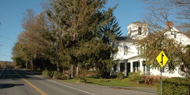
490 ► New York, Albany County, Preston-Potter Hollow — Turnpike —
Schoharie To Athens Chartered in 1802 And Much Used in Early Days — — Map (db m278677) HM
491 ► New York, Albany County, Preston-Potter Hollow, Preston Hollow — Dr. Samuel Preston —
Settled here in 1789 and gave his name to Preston Hollow. He built the first sawmill and gristmill — — Map (db m131419) HM
492 ► New York, Albany County, Preston-Potter Hollow, Preston Hollow — Whipping Post —
For town located on farm of Lawrence Faulk who settled here, in 1790 and died in 1838. — — Map (db m131416) HM
493 ► New York, Albany County, Rensselaerville — Baptist Church —
Organized Aug. 19, 1796. First ministers: Truman Beeman Ephraim Crocker Reuben Winegar Jr. Present church built in 1836 — — Map (db m136128) HM
494 ► New York, Albany County, Rensselaerville — Episcopal Church —
Organized February 20, 1811 by Rev. Samuel Fuller, who built church in 1815 and served as Rector for thirty-one years — — Map (db m136121) HM
495 ► New York, Albany County, Rensselaerville — Federal Library —
This first library was organized March 13, 1798, with 186 subscribers and 200 books. Dissolved 1832. — — Map (db m136123) HM
496 ► New York, Albany County, Rensselaerville — Hamlet of Rensselaerville —
Settled in 1787. Historic District on the National and New York State Registers of Historic Places — — Map (db m136109) HM
497 ► New York, Albany County, Rensselaerville — Hans Winegar —
From Stockbridge, Mass. second settler in the village built a log home on the site of the village in 1788 — — Map (db m136114) HM
498 ► New York, Albany County, Rensselaerville — Presbyterian Church —
Organized 1792. This third church built by Ephraim B. Russ and dedicated 1843. George Goodyear, Pastor. — — Map (db m136124) HM
499 ► New York, Albany County, Rensselaerville — Samuel Jenkins — The Father of Rensselaerville —
Known as Jenkin's Mills 1795-1896. First visited site in 1787, located 1788, built house and grist mill 1789. Died 1837 — — Map (db m136126) HM
500 ► New York, Albany County, Schenectady — The King’s Highway —
Military road during the French and Indian and Revolutionary Wars. — — Map (db m127558) HM

17812 entries matched your criteria. Entries 401 through 500 are listed above. ⊲ Previous 100 — Next 100 ⊳
 
 
CeraNet Cloud Computing sponsors the Historical Marker Database.
This website earns income from purchases you make after using our links to Amazon.com. We appreciate your support.
Paid Advertisement
Nov. 11, 2026
