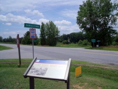
In June 1864, to deny Gen. Robert E. Lee the use of the South Side R.R. and the Richmond and Danville R.R., Gen. Ulysses S Grant sent Gen. James H. Wilson and Gen. August V. Kautz south of Petersburg on a cavalry raid to destroy track and rolling . . . — — Map (db m20168) HM
Nearby to the south stood Fort Christanna, a wooden structure built in 1714 under the auspices of Alexander Spotswood and the Virginia Indian Company. Members of the Meiponsky, Occaneechi, Saponi, Stuckenock, and Tutelo Indian tribes lived within . . . — — Map (db m20181) HM
Here the first courthouse of Brunswick County was built about 1732. In 1746, when the county was divided, the county seat was moved east near Thomasburg. In 1783, after Greensville County had been formed, the courthouse was moved to Lawrenceville. — — Map (db m20180) HM
The Virginia General Assembly established Brunswick County in 1720 to encourage English settlement between the fall line and French outposts west of the Blue Ridge Mountains. Until 1732, when Brunswick’s court was constituted, residents attended . . . — — Map (db m180055) HM
Southside Virginia Community College has two campuses: the Christanna Campus in Alberta, which opened in 1970, and the John H. Daniel campus in Keysville, which opened in 1971. The college is part of the statewide system of community colleges . . . — — Map (db m30868) HM
Southside Virginia Community College has two campuses: the Christanna Campus in Alberta, which opened in 1970, and the John H. Daniel Campus in Keysville, which opened in 1971. The college is part of the statewide system of community colleges . . . — — Map (db m180538) HM
A branch of the Nottoway, named for the huge fish once caught in it. William Byrd, returning from the expedition to survey the Virginia-North Carolina boundary line, camped on this stream in November, 1729. — — Map (db m62406) HM
According to local tradition, while Dr. Creed Haskins and several friends were on a hunting trip in Brunswick County in 1828, his camp cook, Jimmy Matthews, hunted squirrels for a stew. Matthews simmered the squirrels with butter, onions, stale . . . — — Map (db m107700) HM
While wooden trestle bridges were numerous in Brunswick County, the Meherrin River Bridge was one of a few truss bridges on the A&D between Pinners Point (at Portsmouth) and Danville. Built in 1893, the 150-feet long, through truss pin-connected . . . — — Map (db m94363) HM
A community of mills, warehouses, homes and stores sprang up with the construction of the Atlantic and Danville Railway in the 1890s. A combination freight and passenger station was located at Brodnax shown here in 1948. Bales of cotton, timber and . . . — — Map (db m94357) HM
Though many freed African Americans continued after the Civil War to work the same farms on which they had been slaves, many also left their homes in search of better opportunities elsewhere. Often the sick, elderly, and very young were left . . . — — Map (db m180524) HM
Until about 1967, the U.S. Postal Service used the railroads to handle mail on designated routes. The mail was handled in special railroad cars usually moved on passenger trains, designated as Railway Post Office (RPO) cars. The RPOs were actually . . . — — Map (db m94359) HM
The Thoroughbred is a horse breed synonymous with racing. All modem Thoroughbreds trace back to three stallions imported into England from the Middle East in the late 17th and early 18th centuries. English Thoroughbreds were imported into North . . . — — Map (db m94361) HM
Tobacco has long held a sacred and prominent role among the Indian tribes in the southeast. Well before Christopher Columbus returned with tobacco seeds from the Caribbean or Sir Walter Raleigh made smoking fashionable in Europe when he returned . . . — — Map (db m94362) HM
Did you know… A raindrop falling in the Meherrin River Watershed will travel over 200 miles before reaching the Atlantic?!
Watersheds are the collective web of tributaries and surrounding land draining to a common waterbody, such as a major . . . — — Map (db m94364) HM
According to local tradition, while Dr. Creed Haskins and several friends were on a hunting trip in Brunswick County in 1828, his camp cook, Jimmy Matthews, hunted squirrels for a stew. Matthews simmered the squirrels with butter, onions, stale . . . — — Map (db m20188) HM
Though many freed African Americans continued after the Civil War to work the same farms on which they had been slaves, many also left their homes in search of better opportunities elsewhere. Often the sick, elderly and very young were left . . . — — Map (db m30873) HM
Mecklenburg County. Formed in 1764 from Lunenburg, and named for Princess Charlotte, of Mecklenburg-Strelitz, queen of George III. A small army under the command of rebel Nathaniel Bacon destroyed the town of the Occaneechee Indians near . . . — — Map (db m30875) HM
Nellie Pratt Russell, educator, attended Howard
University and was one of six incorporators of
Alpha Kappa Alpha Sorority, the first Greek
letter organization founded by African American
women. The sorority, established in 1908, . . . — — Map (db m107412) HM
In June 1864, to deny Gen. Robert E. Lee the use of the South Side R.R. and the Richmond and Danville R.R., Gen. Ulysses S. Grant sent Gen. James H. Wilson and Gen. August V. Kautz south of Petersburg on a cavalry raid to destroy track and rolling . . . — — Map (db m289877) HM
The ordinary that stood on this site catered to travelers on the north-south stage road as early as 1750. During the American Revolution local warehouses were burned by British Colonel Tarleton, and legend says that it was from that occurrence that . . . — — Map (db m20164) HM
Late in the afternoon of May 15, 1864, Union Gen. August V. Kautz and his cavalry division rode into Lawrenceville, the Brunswick County seat. They were on the second leg of a two-part, two-week-long expedition to destroy railroad bridges and depots . . . — — Map (db m62400) HM
In 1714, at Governor Alexander Spotswood’s urging, the Virginia General Assembly funded the Virginia Indian Company, charged with building a fort on the banks of the Meherrin River in what would become Brunswick County. The fort would provide . . . — — Map (db m20197) HM
Nearby to the south stood Fort Christanna, a wooden structure built in 1714 under the auspices of Alexander Spotswood and the Virginia Indian Company. Members of the Meiponsky, Occaneechi, Saponi, Stuckenock, and Tutelo Indian tribes lived within . . . — — Map (db m20184) HM
In 1714, working through the Virginia Indian Company, Gov. Alexander Spotswood initiated the construction of First Christanna on a bank of the Meherrin River. This fort served several important purposes. The Indian Company received a monopoly . . . — — Map (db m180523) HM
A Fort Called Christ-Anna
You are standing at the site of Fort Christanna, a colonial fort laid out in 1714 by Virginia’s Governor Alexander Spotswood. The fort was built on a tract of land set aside in 1714 for a trading post, as well as a . . . — — Map (db m20199) HM
Alexander Spotswood (1676-1740) was Governor of Virginia from 1710 to 1722. Born in Africa of a Scottish family, he had distinguished himself at the Battle of Bleinheim and was wounded. He was appointed to the governor’s position in Virginia in . . . — — Map (db m20200) HM
The story of Native Americans after Jamestown's founding in 1607 is a tragic one. At that time the Siouan Indians of Virginia probably numbered 6,300 people. By 1714, when Fort Christanna was established, they were in difficult circumstances, being . . . — — Map (db m20198) HM
Oak Grove School was originally a one-room log building located here on the grounds of Oak Grove Baptist Church. Between 1923 and 1924, for the sum of $3,000, a new, three-room school was built on the same site. The school is an example of . . . — — Map (db m180530) HM
Erected in loving memory of the Rev. Jesse C. Byrd D.D. as builder of present structure and pastor of Oak Grove 1943 - 1964 by the members. — — Map (db m180531) HM
Saint Paul’s College began as a small parochial school founded by a newly ordained Episcopal deacon, the Rev. James Solomon Russell. Born into slavery, Russell attended seminary school in Petersburg. Within a year of graduation he had managed . . . — — Map (db m30870) HM
Saint Paul's College was established in 1883 by the Venerable James Solomon Russell (1857-1935) as an Episcopal mission school to serve the black community of Southside Virginia. Born into slavery in Mecklenburg County, Russell was educated at . . . — — Map (db m20187) HM
Saint Paul's College began as a small parochial school founded by a newly ordained Episcopal deacon, the Rev. James Solomon Russell. Born into slavery, Russell attended the Bishop Payne Divinity School in Petersburg. Within a year of graduation, . . . — — Map (db m180528) HM
In 1924 the National Society of the Colonial Dames of America in the Commonwealth of Virginia acquired three and three-quarters acres of land on which the fort was presumed to have been built, then erected a monument of concrete embedded with . . . — — Map (db m20202) HM
Dedicated to all the men from Brunswick County, VA. who made the supreme sacrifice while serving their country and to all who served with honor.
World War I
Wright, Thomas L. Sgt. •
Bland, Charlie Pvt. •
East, John W. Pvt. • . . . — — Map (db m180526) WM
Among the earliest of the more than a dozen
Julius Rosenwald Schools built in Brunswick
County, Saint Paul’s Chapel School was constructed
as a one-teacher standard plan in 1920 under
the initial wave of Tuskegee Institute-administered building . . . — — Map (db m107433) HM
The Brunswick Circuit, established in 1773 by Robert Williams, is likely the oldest Methodist circuit in America. It extended from Petersburg south into North Carolina, and became known as “the cradle of Methodism in the South.” By 1776, the . . . — — Map (db m60671) HM
According to local tradition, while Dr. Creed Haskins and several friends were on a hunting trip in Brunswick County in 1828, his camp cook, Jimmy Matthews, hunted squirrels for a stew. Matthews simmered the squirrels with butter, onions, stale . . . — — Map (db m60672) HM
Near here stood Mason's Chapel, one of the earliest Methodist churches in southern Virginia. The first Virginia conference, May, 1785, was held here or nearby; Bishop Asbury presided. The conference of 1801 was held here. The present Olive Branch . . . — — Map (db m60673) HM
At Birch's Bridge (very near this bridge) the second William Byrd and his party crossed the river, in September, 1733, on their way to inspect Byrd's land holdings in North Carolina. Byrd wrote an account of this trip which he called “A . . . — — Map (db m62403) HM
According to local tradition, while Dr. Creed Haskins and several friends were on a hunting trip in Brunswick County in 1828, his camp cook, Jimmy Matthews, hunted squirrels for a stew. Matthews simmered the squirrels with butter, onions, stale . . . — — Map (db m20186) HM
Dinwiddie County. Area 521 Square Miles. Formed in 1752 from Prince George, and named for Robert Dinwiddie, Governor of Virginia 1751-1756. General Winfield Scott was born in this county, and in it took place the battle of Five . . . — — Map (db m62404) HM
A few hundred yards east is the site of Ebenezer Academy, founded in 1793 by Bishop Asbury, the first Methodist school established in Virginia. It passed out of the hands of the church but remained a noted school for many years. — — Map (db m62405) HM
Jubal A. Early Homeplace Circa 1814 has been designated Virginia Historic Landmark and placed on the National Register of Historic Places 1997 — — Map (db m87173) HM
Roanoke County. Area 305 Square Miles. Formed in 1838 from Botetourt and Montgomery, and probably named for Roanoke River. General Andrew Lewis lived here. The city of Roanoke is known as the Gate City of the South.
Franklin . . . — — Map (db m58381) HM
Ferrum (Latin for iron) developed ca. 1892 along the new Roanoke and Southern Railway linking Roanoke, VA, and Winston-Salem, NC, known as the "Punkin Vine" line. The village became a regional shipping hub early in the 20th century. St. James . . . — — Map (db m271771) HM
Here stood Taylor’s Store, established in 1799 by Skelton Taylor, a lieutenant in the Bedford County militia during the Revolutionary War. After Franklin County was formed, Taylor became a militia captain and overseer of the poor. His store and . . . — — Map (db m65624) HM
Oral tradition denotes this as the Sparks Cemetery. While the cemetery contains 41 fieldstone grave markers, a geophysical survey discovered a total of 83 graves. Only one stone bears an inscription, which includes the date of August 1823. The . . . — — Map (db m307375) HM
Near this place, on land occupied since the
1780s by the Early family, Confederate General
Jubal Early was born in 1816, The General
practiced law in Franklin County and served in
the Mexican War before the Civil War. Early
fought in more . . . — — Map (db m65625) HM
Booker T. Washington was born a slave on the nearby Burroughs plantation on April 5, 1856. He was graduated from Hampton Institute in 1875 where he became an instructor. Because of his achievements as an educator, he was selected to establish a . . . — — Map (db m65611) HM
"...my whole life has largely been one of surprises. I believe that any man's life will be filled with constant, unexpected encouragements of this kind if he makes up his mind to do his level best each day of his life—that is, tries to make each day . . . — — Map (db m137945) HM
Booker T. Washington, the renowned African-American leader and educator, was born into slavery on this plantation and freed here after the Civil War ended. At this national monument, you can learn about his childhood in slavery, living here with . . . — — Map (db m137933) HM
A slave has died.
As in Africa, mourners keep all-night vigil, chanting loudly and praying. When the next day's work is done, friends of the dead slave gather from surrounding farms. Then the long procession marches out—songs and shouts, . . . — — Map (db m209518) HM
Tobacco farmers used barns such as this to cure dark-leaf tobacco used for chewing tobacco. The tobacco plant was harvested in late August or early September, split down the middle, and hung upside down on sticks that were placed across poles inside . . . — — Map (db m307374) HM
Booker Taliaferro, his mother Jane, elder brother John Henry, younger sister Amanda, aunt Sophia, uncle Monroe, and cousin Sally were freed here in 1865. You can walk down to the site of emancipation, where the "Big House" was located. You can . . . — — Map (db m137943) HM
Tobacco was the only crop grown on this farm that was sold for cash or bartered for goods. Corn, vegetables, and animals were raised to feed the people on the plantation. If a crop failed or if the tobacco barn burned down during the curing process, . . . — — Map (db m137944) HM
To the slave, the forest offered more than hunting, fishing, or food. The woods were a place to meet, to rest, even to worship, away from the owner's gaze.
Today, as in Booker Washington's childhood, half of this farm is forest. A 1½-mile . . . — — Map (db m137982) HM
This is the childhood home of Jubal Anderson Early, who was born on November 3, 1816. He graduated from the U.S. Military Academy at West Point in 1837 and served as a lieutenant in the Seminole War in Florida before resigning in 1838. He practiced . . . — — Map (db m87172) HM
The simple buildings Washington remembered are gone, but the patterns of hills, fields, and woods remain. Reconstructed buildings now recreate some of the scenes Washington knew as a child. The park brochure, available inside the visitor center, . . . — — Map (db m298743) HM
The Burroughs' farm was one of many tobacco plantations that dominated the 1800s landscape of Southside Virginia. Cash or credit from a few acres of tobacco financed the purchase of necessities and some luxuries. Subsistence crops of corn, wheat, . . . — — Map (db m298744) HM
When Booker lived here as a child with his family, about ten enslaved people of African descent worked and lived on this plantation. The enslaved worked every day, for long hours, in heat and cold. They worked to keep the farm profitable, so the . . . — — Map (db m137978) HM
At 9 years old, Booker took his first breath of freedom here. He described the moment when he and his family were freed from slavery in his autobiography:
"My mother, who was standing by my side leaned over and kissed her . . . — — Map (db m298745) HM
September 1861. Half the slaves of the South live, labor, and die on small farms like this, worked by fewer than 20 slaves. Slaves build barns, fix houses, clear fields, work gardens, fed animals, weave cloth, and sweat out the toughest domestic . . . — — Map (db m209517) HM
Here through the Maggoty Gap, the Great Wagon Road from Philadelphia to Georgia, known locally as the Carolina Road, passes through the Blue Ridge. Originating as the Great Warrior Path of the Iroquois centuries before, the path was frequently used . . . — — Map (db m63203) HM
On December 13, 1974, Worth Harris Carter, Jr. opened the first Carter Bank & Trust at this location. Operating under the name of First National Bank of Rocky Mount, the branch opened with eight employees. From these humble beginnings, Carter Bank & . . . — — Map (db m259212) HM
With the entire park sitting at 6.5 acres, 5.5 acres was donated to the town in 2006 by T. Keister Greer, a Rocky Mount attorney, and his wife Elizabeth. The park land sits adjacent to “The Grove” (now “The Early Inn”), which served as the Greer . . . — — Map (db m307376) HM
Ten miles southwest is Ferrum, named for iron mines nearby. Ferrum College was established by the Virginia Conference of the Methodist Church in 1913 through the influence of its Woman’s Society of Christian Service. It became a junior college . . . — — Map (db m63206) HM
Here at the house and ordinary of Col. James Callaway, proprietor of the Washington Iron Works, the first Franklin County court met to organize the new county on Monday, Jan. 2, 1976. The iron works had been established here by 1773 by Col. John . . . — — Map (db m65984) HM
Near here stood a stockade erected by Capt. Nathaniel Terry and garrisoned by men under his command. Washington made “Terry’s Fort” a link in his chain of forts and inspected it in the fall of 1756. — — Map (db m63202) HM
Franklin County. Welcome to Franklin County, the eastern gateway to The Crooked Road, a journey through Southwest Virginia's musical heritage that winds through the Appalachian Mountains for 265 miles. Franklin County has always been a cultural . . . — — Map (db m71564) HM
(Northwest side)
To the memory of
The Confederate Dead
of Franklin County
1861-1865
(Northeast side)
Co. B 57th Va. Inf.
Co. C 57th Va. Inf.
Co. G 57th Va. Inf.
Co. D 58th Va. Inf. . . . — — Map (db m259208) WM
One in a class of 200 built by International Railway Car Company, Kenton, Ohio between December, 1968 and
February, 1970. The “P” denotes pool service and meant the caboose could travel any portion of the N & W System.
Before air brakes, . . . — — Map (db m71566) HM
This place was established as the county seat when Franklin County was formed. The first court was held in March, 1786. The first (log) courthouse was replaced in 1831. In 1836 the town consisted of 30 dwellings and a number of business houses. . . . — — Map (db m65950) HM
Honoring these African American veterans of the American Civil War born in Franklin County. These USCT served in the U.S. military 1863 - 1866
Pvt John Adams •
Pvt Archibald Allen •
Pvt James Arnold •
Pvt Edward Arrington •
Pvt . . . — — Map (db m298671) WM
Here stands the furnace and ironmaster’s house of the Washington Iron Works, Franklin County’s first industry. Originally established in 1773 by Col. John Donelson, father-in-law of President Andrew Jackson, the iron plantation was acquired in 1779 . . . — — Map (db m65983) HM
Franklin County. Area 697 Square Miles. Formed in 1785 from Henry and Bedford and added to from Patrick. Named for Benjamin Franklin. General Jubal A. Early lived in this county.
Henry County. Area 444 Square . . . — — Map (db m63193) HM
In 1860, the Burroughs owned four horses which they sheltered in a barn similar to this. Besides serving as the family's transportation, they pulled plows through fields and hauled wagonloads of cured tobacco leaves to the factory. Washington . . . — — Map (db m298748) HM
Booker took an interest in farm animals as a result of his required daily chores. He gathered chicken eggs as one of his first morning tasks, fed the pigs, visited the cows, and cleaned out animal stalls and enclosures.
Appalachian Power Company built Smith Mountain and Leesville Dams between 1960 and 1963 to generate hydroelectric energy. West of Smith Mountain Dam, the waters of the Roanoke and Blackwater Rivers formed Smith Mountain Lake, covering 20,600 acres . . . — — Map (db m104438) HM
This boulder marks the
landed estate of
Patrick Henry
where he lived from
1778 to 1784
Erected by the Patrick Henry Chapter
Daughters of the American Revolution
1922 — — Map (db m301181) HM
Constructed in 1947-1948 in the town of Bassett in Henry County, Virginia, the school officially opened in 1949. It is an excellent example of a two-story Georgian-Revival style school built after World War II. It is the last school to be . . . — — Map (db m205768) HM
Chatmoss was one of about 50 Hairston family
plantations in Virginia, North Carolina, and
Mississippi. This vast network encompassed tens
of thousands of acres and was worked by
thousands of enslaved African Americans. Alcey
and Samuel Harden . . . — — Map (db m104503) HM
George Waller (1734-1814) and his wife, Anne Winston Waller (1735-1839), established their plantation at Waller’s Ford on the Smith River near here about 1770. George Waller helped establish Henry County, serving as one of its first justices and as . . . — — Map (db m103819) HM
Once located to the south was Leatherwood, the plantation of Patrick Henry, governor of Virginia and great orator of the American Revolution. Henry is especially famous for his “Liberty or Death” speech made in 1775 in Saint John’s Church in . . . — — Map (db m104505) HM
Three miles southwest is Belleview, home of Major John Redd, a pioneer in this section. Redd served in the Indian Wars and in the Revolution, being present at the siege of Yorktown in 1781. — — Map (db m104510) HM
Since 1949, the Petty family has been a permanent fixture in NASCAR, helping to define and grow the sport for the past seven decades. The Petty family's involvement began as a family business with the patriarch, Lee, who won three championships, . . . — — Map (db m290189) HM
Henry County. Located in the foothills of southern Virginia, Henry County is named for Patrick Henry (1736-1799), Revolutionary leader and governor of the Commonwealth of Virginia. Henry lived in the county from 1779 to 1784. The General . . . — — Map (db m58373) HM
H. Clay Earles (1913-1999) opened Martinsville Speedway in 1947 with seating for 750. The National Association for Stock Car Auto Racing (NASCAR) first raced here in 1948. Martinsville Speedway was one of eight tracks to host the inaugural 1949 . . . — — Map (db m7741) HM
North Carolina. North Carolina was one of the original thirteen states. The first settlement was made on Roanoke Island, 1585, but was not permanent. Settlers from Virginia occupied the Albemarle region before 1663, in which year the colony . . . — — Map (db m304867) HM
Near here, on Matrimony Creek, William Byrd pitched his camp, November, 1728, while determining the Virginia-North Carolina boundary line. — — Map (db m58372) HM
Henry County. Area 444 square miles. Formed in 1776 from Pittsylvania, Governor of Virginia. Henry lived in the county 1779-1784.
Patrick County. Area 485 square miles. Formed in 1790 from Henry, and . . . — — Map (db m290185) HM
295 entries matched your criteria. The first 100 are listed above. Next 100 ⊳