87 entries match your criteria.
Historic New York State Historical Markers
One hundred thirty-nine large format Historical Area Markers were erected statewide during the 1960s. Some are duplicates placed in different areas. Some carry variations of text found on other markers within the same region. The area markers usually do not commemorate specific individuals or events, since these are already memorialized by smaller State Historical Markers.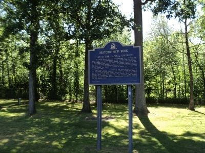
By Bill Coughlin, June 27, 2012
Historic New York Marker
| 1 ► New York, Albany County, Glenmont — This is the Capital District — Historic New York — |
| On Interstate 87, on the right when traveling south. | |||
| 2 ► New York, Allegany County, Bolivar — This Is Oil Country! — Historic New York — |
| On Main Street (New York State Route 417) at Liberty Street, on the right when traveling south on Main Street. | |||
| 3 ► New York, Broome County, Corbettsville — Binghamton and Upper Susquehanna — Historic New York — |
| Near Interstate 81 at milepost 1. | |||
| 4 ► New York, Cattaraugus County, Yorkshire — Upper Cattaraugus Valley — Historic New York — |
| On New York State Route 16, 0.2 miles south of New York State Route 39, on the left when traveling south. | |||
| 5 ► New York, Cayuga County, Brutus — The Erie Canal — Historic New York — |
| On New York State Route 31 at West Brutus Street, on the right when traveling east on State Route 31. | |||
| 6 ► New York, Cayuga County, Port Byron — The Erie Canal — Historic New York — |
| Near New York Thruway (Interstate 90) 25.4 miles east of Ridge Road (New York State Route 414), on the right when traveling east. | |||
| 7 ► New York, Chautauqua County, Mayville — Chautauqua Lake Region — Historic New York — |
| On East Chautauqua Street (New York State Route 430) at South Erie Street (New York State Route 394), on the right when traveling east on East Chautauqua Street. | |||
| 8 ► New York, Chemung County, Chemung — The Sullivan-Clinton Campaign — 1779 — Historic New York — |
| On Wyncoop Creek Road (County Road 3) just south of Main Street (County Road 60), on the right when traveling south. | |||
| 9 ► New York, Chenango County, Afton — Unadilla Region — Historic New York — |
| On New York State Route 7. | |||
| 10 ► New York, Columbia County, Ghent — Columbia County — Historic New York — |
| On Taconic State Parkway, 0.5 miles north of New York State Route 217, on the right when traveling north. | |||
| 11 ► New York, Erie County, Angola — Western New York — Historic New York — |
| On New York State Thruway / AMVETS Memorial Highway (Interstate 90 at milepost 443). | |||
| 12 ► New York, Erie County, Buffalo, Black Rock — The Pan-American Exposition — Historic New York — |
| Near Nottingham Terrace east of Elmwood Avenue. | |||
| 13 ► New York, Erie County, Clarence — Niagara Frontier — Historic New York — |
| Near Governor Thomas E. Dewey Thruway (Interstate 90 at milepost 412), 10.6 miles west of Alleghany Road (New York State Route 77), on the right when traveling west. | |||
| 14 ► New York, Essex County, Ticonderoga — Fort Ticonderoga — Historic New York — |
| On Sandy Redoubt, on the right when traveling east. | |||
| 15 ► New York, Fulton County, Broadalbin — Johnson Hall - 1763 — Johnstown — Historic New York — |
| On New York State Route 29, on the right when traveling east. | |||
| 16 ► New York, Fulton County, Johnstown — Johnson Hall - 1763 — Johnstown — Historic New York — |
| On North William Street (New York State Route 29) near W. Main Street (New York State Route 67), on the right when traveling north. | |||
| 17 ► New York, Genesee County, Corfu — The Holland Purchase — Historic New York — |
| Near Governor Thomas E. Dewey Thruway (Interstate 90 at milepost 397), 4.3 miles east of Alleghany Road (New York State Route 77), on the right when traveling east. | |||
| 18 ► New York, Genesee County, LeRoy — Seneca Indian Country — Historic New York — |
| Near NY Thruway (Interstate 90), on the right when traveling west. | |||
| 19 ► New York, Greene County, Hannacroix — Catskill Mountains — Historic New York — |
| Near New York Thruway (U.S. 87), on the right when traveling south. | |||
| 20 ► New York, Hamilton County, Blue Mountain Lake — The Adirondacks — Historic New York — |
| On New York State Route 30, on the right when traveling north. | |||
| 21 ► New York, Hamilton County, Speculator — The Adirondacks — Historic New York — |
| On New York State Route 30, on the right when traveling north. | |||
| 22 ► New York, Herkimer County, Frankfort — Steuben Memorial — Historic New York — |
| Near NY Thruway (U.S. I-90), on the right when traveling west. | |||
| 23 ► New York, Herkimer County, Frankfort — Utica Area — Historic New York — |
| On NY Thruway (U.S. I-90), on the right when traveling west. | |||
| 24 ► New York, Herkimer County, Little Falls — Herkimer Little-Falls Area — Historic New York — |
| On Interstate 90, 1 mile east of New York State Route 169, on the right when traveling east. | |||
| 25 ► New York, Herkimer County, Little Falls — Site of The Battle of Oriskany — August 6, 1777 — Historic New York — |
| On NY Thruway (U.S. I-90), on the right when traveling west. | |||
| 26 ► New York, Jefferson County, Watertown — Watertown Region — Historic New York — |
| On Interstate 81, on the right when traveling north. | |||
| 27 ► New York, Lewis County, Bonaparte — The French Emigres — Historic New York — |
| On New York State Route 3 west of Richardson Rd, on the right when traveling east. | |||
| 28 ► New York, Livingston County, Mount Morris — The Genesee Valley — Historic New York — |
| Near Genesee Expressway (Interstate 390 at milepost 38), 4.7 miles north of Sonyea Road (New York State Route 36). | |||
| 29 ► New York, Livingston County, Sonyea — Site of the Groveland Shaker Community — Historic New York — |
| On Moyer Road at Brill Drive, on the left when traveling south on Moyer Road. | |||
| 30 ► New York, Madison County, Canastota — The Erie Canal — Historic New York — |
| On NYS Thruway (U.S. 90) 4 miles west of N Peterboro Street (New York State Route 13). | |||
| 31 ► New York, Monroe County, Rochester — Irondequoit Bay — Historic New York — |
| On Empire Boulevard (New York State Route 404) at Wilbur Tract Road, on the right when traveling west on Empire Boulevard. | |||
| 32 ► New York, Monroe County, Scottsville — Genesee Valley — Historic New York — |
| Near Governor Thomas E. Dewey Thruway (Interstate 90 at milepost 366), 12.6 miles Interstate 490, on the right when traveling east. | |||
| 33 ► New York, Montgomery County, Amsterdam — This is Mohawk Country — Historic New York — |
| On Riverview Drive, on the right when traveling west. | |||
| 34 ► New York, Montgomery County, Fonda — Mohawk Area — Historic New York — |
| On New York State Route 5, on the right when traveling east. | |||
| 35 ► New York, Montgomery County, Fultonville — Herkimer Home - 1764 — Three miles east of Little Falls on Route 5-S — Historic New York — |
| On New York State Thruway (Interstate 90 at milepost 184), on the right. | |||
| 36 ► New York, Montgomery County, Fultonville — Johnson Hall - 1763 — Historic New York — |
| On Interstate 90. | |||
| 37 ► New York, Montgomery County, Fultonville — Mohawk Area — Historic New York — |
| On Interstate 90, 7 miles east of New York State Route 30, on the right when traveling east. | |||
| 38 ► New York, Montgomery County, Fultonville — Mohawk Area — Historic New York — |
| On NY Thruway (U.S. I-90), on the right when traveling west. | |||
| 39 ► New York, Montgomery County, Fultonville — Site of The Battle of Oriskany — August 6, 1777 — Historic New York — |
| On New York State Thruway Westbound (Interstate 90 at milepost 184), on the right when traveling west. | |||
| 40 ► New York, Niagara County, Youngstown — Old Fort Niagara — Historic New York — |
| Near Scott Avenue. | |||
| 41 ► New York, Oneida County, Oriskany — Site of The Battle of Oriskany — August 6, 1777 — Historic New York — |
| On Memorial Drive near State Route 69 (New York State Route 69), on the right when traveling north. | |||
| 42 ► New York, Oneida County, Remsen — Steuben Memorial — Historic New York — |
| On New York State Route 12 north of Plank Road, on the right when traveling north. | |||
| 43 ► New York, Oneida County, Remsen — Utica Area — Historic New York — |
| On New York State Route 12 north of Plank Road, on the right when traveling south. | |||
| 44 ► New York, Oneida County, Rome — The Erie Canal - July 4, 1817 — Historic New York |
| Near Fort Bull Road. Reported missing. | |||
| 45 ► New York, Oneida County, Verona — Site of the Battle of Oriskany — Historic New York — |
| On Interstate 90, 3 miles east of New York State Route 365, on the right when traveling east. | |||
| 46 ► New York, Oneida County, Verona — The Oneida Country — Historic New York — |
| On Interstate 90, 3 miles east of New York State Route 365, on the right. | |||
| 47 ► New York, Oneida County, Westmoreland — Steuben Memorial — Historic New York — |
| On New York State Thruway - East (Interstate 90) west of New York State Route 233, on the right when traveling east. | |||
| 48 ► New York, Oneida County, Westmoreland — Utica Area — Historic New York — |
| On New York State Thruway - East (Interstate 90) west of New York State Route 233, on the right when traveling east. | |||
| 49 ► New York, Onondaga County, Manlius — The Erie Canal - Canvass White — Historic New York — |
| On Minoa Road at Manlius Center Road (New York State Route 290), on the left when traveling south on Minoa Road. | |||
| 50 ► New York, Onondaga County, Syracuse — Syracuse Area — Historic New York — |
| Near NYS Thruway - Warners Rest Area. | |||
| 51 ► New York, Onondaga County, Syracuse — Syracuse Area — Historic New York — |
| On Interstate 90, 1 mile west of New York State Route 233, on the right when traveling east. | |||
| 52 ► New York, Ontario County, Victor — Seneca Indians — Historic New York — |
| Near Governor Thomas E. Dewey Thruway (Interstate 90 at milepost 353), 9.2 miles east of Genesee Expressway (Interstate 390), on the right when traveling east. | |||
| 53 ► New York, Orleans County, Gaines — The Lake Plain — Historic New York — |
| Near Ridge Road (New York State Route 104) 0.5 miles west of Oak Orchard Road (New York State Route 98), on the right when traveling east. | |||
| 54 ► New York, Otsego County, Milford — Upper Susquehanna — Historic New York — |
| On New York State Route 992G. | |||
| 55 ► New York, Rockland County, Sloatsburg — Ramapo Valley — Historic New York — |
| On New York State Thruway (Interstate 87), on the right when traveling north. | |||
| 56 ► New York, Saratoga County, Clifton Park — This is the Way North — Historic New York — |
| On Interstate 87, on the right when traveling north. | |||
| 57 ► New York, Schenectady County, Pattersonville — Johnson Hall – 1763 — Johnstown — Historic New York — |
| On New York Thruway (U.S. I-90), on the right when traveling west. | |||
| 58 ► New York, Schoharie County, Middleburgh — The Timothy Murphy Trail — Historic New York — |
| On New York State Route 30, on the right when traveling south. | |||
| 59 ► New York, Seneca County, Waterloo — Memorial Day — Historic New York — |
| On West Main Street (U.S. 20) at Park Place, on the right when traveling west on West Main Street. | |||
| 60 ► New York, Seneca County, Waterloo — The Finger Lakes — Historic New York — |
| Near NYS Thruway - Junius Ponds Rest Area. | |||
| 61 ► New York, St. Lawrence County, De Kalb — The St. Lawrence Plain — Historic New York — |
| On U.S. 11, 0.2 miles west of East De Kalb Road, on the right when traveling north. | |||
| 62 ► New York, St. Lawrence County, Hammond — The Chippewa Bay Area — Historic New York — |
| On New York State Route 12. | |||
| 63 ► New York, St. Lawrence County, Hammond — The Thousand Islands — Historic New York — |
| On New York State Route 12, 1 mile north of Oak Point Road, on the left when traveling north. | |||
| 64 ► New York, St. Lawrence County, Massena — St. Lawrence River and Massena — Historic New York — |
| Near New York State Route 37, 0.5 miles west of Whalen Road. | |||
| 65 ► New York, St. Lawrence County, Massena — The Empire State — Historic New York — |
| On New York State Route 37, 0.5 miles east of Haverstock Road, on the right when traveling west. | |||
| 66 ► New York, Steuben County, Cohocton — Cohocton Valley — Historic New York — |
| Near South Main Street (New York State Route 415) 0.4 miles south of Mill Street, on the left when traveling south. | |||
| 67 ► New York, Steuben County, Erwin — Clinton-Sullivan and the Iroquois — Historic New York — |
| On Southern Tier Expressway (Interstate 86) 0.8 miles west of Victory Highway (New York State Route 417), on the right when traveling west. | |||
| 68 ► New York, Suffolk County, Dix Hills — Central Long Island — Historic New York — |
| On Long Island Expressway (Interstate 495), on the right when traveling west. | |||
| 69 ► New York, Suffolk County, Dix Hills — Central Long Island — Historic New York — |
| On Long Island Expressway (Interstate 495), on the right when traveling east. | |||
| 70 ► New York, Sullivan County, Roscoe — The Catskill Mountains — Historic New York — |
| On the Route 17 Quickway at the Roscoe Rest Area,, 2.8 miles east of Exit 94 (Old Route 17), on the right when traveling east. | |||
| 71 ► New York, Ulster County, Lake Katrine — Kingston Area — Historic New York — |
| On New York Thruway (Interstate 87), on the right when traveling south. | |||
| 72 ► New York, Ulster County, Lake Katrine — The Senate House – 1676 — Clinton Avenue, Kingston — Historic New York — |
| On New York Thruway (U.S. I-87), on the right when traveling south. | |||
| 73 ► New York, Ulster County, Malden — Hudson Valley — Historic New York — |
| On New York Thruway (Interstate 87) south of County Route 34, on the right when traveling south. | |||
| 74 ► New York, Ulster County, Modena — Newburgh Area — Historic New York — |
| Near New York Thruway (Interstate 87 at milepost 66), on the right when traveling south. | |||
| 75 ► New York, Ulster County, Plattekill — Newburgh Area — Historic New York — |
| On New York State Thruway (Interstate 87), on the right when traveling north. | |||
| 76 ► New York, Ulster County, Plattekill — Washington’s Headquarters — Liberty and Washington Streets, Newburgh — Historic New York — |
| On New York State Thruway (Interstate 87), on the right when traveling north. | |||
| 77 ► New York, Ulster County, Saugerties — Catskill Mountains — Historic New York — |
| On New York State Thruway (Interstate 87), on the right when traveling north. | |||
| 78 ► New York, Ulster County, Shandaken — Catskill Mountains - Shandaken Area — Historic New York — |
| On New York State Route 28 at Mt. Pleasant Road, on the right when traveling west on State Route 28. | |||
| 79 ► New York, Ulster County, Wallkill — Washington’s Headquarters — Liberty and Washington Streets, Newburgh — Historic New York — |
| On New York State Thruway (Interstate 87 at milepost 66) near the Route 32 overpass, on the right when traveling south. | |||
| 80 ► New York, Warren County, Glens Falls — Glens Falls Area — Historic New York — |
| On Interstate 87, on the right when traveling north. | |||
| 81 ► New York, Warren County, Glens Falls — The Battles of Saratoga - 1777 — Historic New York — |
| On Interstate 87, on the right when traveling south. | |||
| 82 ► New York, Warren County, Lake George — Lake George — Historic New York — |
| On Adirondack Northway (U.S. 87 at milepost 55) when traveling south. | |||
| 83 ► New York, Warren County, Silver Bay — Lake George — Historic New York — |
| On Lake Shore Drive (U.S. 9N), on the left when traveling south. | |||
| 84 ► New York, Westchester County, Katonah — Bedford House — On Route 22 near Katonah — Historic New York — |
| Near Jay Street (New York State Route 22) 0.1 miles south of Beaver Dam Road. | |||
| 85 ► New York, Westchester County, Yonkers — 11 — Westchester County — Historic New York — |
| Near Governor Thomas E. Dewey Thruway (Interstate 87 at milepost 6), on the right when traveling north. | |||
| 86 ► New York, Yates County, Himrod — The Finger Lakes — Historic New York — |
| On New York State Route 14, 0.2 miles north of Randall Road. | |||
| 87 ► New York, Yates County, Penn Yan — Historic New York — The Finger Lakes — |
| On New York State Route 54, on the right when traveling south. | |||