1771 entries match your criteria. Entries 201 through 300 are listed.⊲ Previous 100 — Next 100 ⊳
Ohio Historical Society / The Ohio History Connection Historical Markers
Markers of the more than 1,800 Ohio Historical Markers Program administered by the Ohio Historical Society, now called The Ohio History Connection, and formerly known as the Ohio State Archaeological and Historical Society.
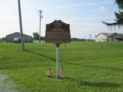
President Abraham Lincoln's assassination on April 14, 1865, created a national tragedy, and the nation mourned as his body was transported by rail from Washington, D.C. back to Springfield, Illinois, where he would be buried. On its way the Funeral . . . — — Map (db m84945) HM
Rev. George Messenger and his congregation built
the first Universalist Church on this site. It was
dedicated during a state convention of Universalists
in Woodstock in June 1844. In 1893, Rev. John A.
Carpenter was instrumental in erecting a . . . — — Map (db m85116) HM
(Side A)
Warren Cushman was a respected painter, sculptor, photographer, musician, and inventor. He created the towering Cushman monument in Woodstock’s Rush Township cemetery and is believed to have shown his painting “Spanish . . . — — Map (db m84931) HM
[Marker Front]:
Asa Bushnell, former Governor of Ohio, encouraged by the light grade of the land, decided to establish the Springfield, Troy, and Piqua Railway (ST&P) in July 1904. The interurban traction line utilized sixty-pound rail and . . . — — Map (db m13890) HM
The Old City Building and Market, also known as the Municipal Building or Marketplace, was designed by local architect Charles A. Cregar. It was completed in 1890 at a cost of $250,000. Vendors, who sold meats, fish, provisions, vegetables, and . . . — — Map (db m13309) HM
Daniel Arthur Rudd was born into slavery on August 7, 1854, in Bardstown, Kentucky. He became a newspaperman, lecturer, publicist, and tireless advocate for the Roman Catholic Church. After the Civil War Rudd moved to Springfield. Baptized and . . . — — Map (db m188163) HM
Davey Moore was the Featherweight Champion of the World from 1959 to 1963, punching his way to a 56-6-1 record while always admitting that "Only 10 seconds separate me from being champion or nothing." A tough little boxer with a powerful punch, he . . . — — Map (db m13277) HM
Robert Clayton Henry, the first African- American mayor of an Ohio city, was
born in Springfield, Ohio on July 16, 1921. He attended Springfield High
School and graduated in 1939. After high school, he attended Wittenberg
University and the . . . — — Map (db m103392) HM
A. B. Graham, superintendent of Springfield Township Rural schools in Clark County, established the "Boys and Girls Agricultural Experiment Club," which revolutionized agricultural education and non-formal youth development methods. The first . . . — — Map (db m13216) HM
The Ridgewood neighborhood, platted in 1914, was one of the first
fully planned and restricted suburbs in the United States. Its
innovative developer, Springfield native Harry S. Kissell, was among
a small group of nationally acclaimed real . . . — — Map (db m117567) HM
Pennsylvania House
David Snively built the Federal-style Pennsylvania House in 1839 along the newly constructed National Road. This tavern and inn was an important stopover for livestock drovers and pioneers traveling by foot, on horseback, or . . . — — Map (db m241911) HM
Listed on the National Register of Historic Places in 2009, the span is the oldest in Clark County a traveler can cross. It is also one of the oldest stone bridges in use in Ohio. Stone mason Samuel S. Taylor (1837-1930) built the culvert from . . . — — Map (db m135172) HM
Resting here among other pioneers are:
Obed Denham,
native of Plainfield, New Jersey, donor of this plot, founder of
Bethel in 1798, and pioneer abolitionist;
Thomas Morris,
antislavery leader, veteran state legislator, U.S. senator . . . — — Map (db m224989) HM
Colonel John J. Voll from Goshen, Ohio, was
the highest scoring ace of the 15th U.S. Army
Air Force in the Mediterranean theater of World
War II. As a Captain flying a P-51 Mustang
fighter plane, he was credited with twenty-one
aerial . . . — — Map (db m204969) HM
Side A In 1907, the Goshen School Building, later known as both Goshen Intermediate School and Sheila Green Elementary, was erected. The two-story, buff-colored, pressed-brick building was the first attempt at school consolidation in Goshen . . . — — Map (db m99433) HM
Founded in 1797 in the log cabin of the Reverend Francis McCormick, the Milford Methodist Church is the oldest of the denomination in the Northwest Territory and Ohio. Pioneer worshipers walked many miles through the wilderness to attend its circuit . . . — — Map (db m99541) HM
Henry Clark Corbin Henry Clark Corbin was born September 15, 1842 and reared here on the family farm along Colclazer Run near Laurel. He attended public school and the private Parker Academy in nearby Clermontville. After teaching school and . . . — — Map (db m99622) HM
Mt. Zion Chapel The Mount Zion Chapel of the Christian Church was built in 1872 on this hill adjacent to the members' cemetery outside of Clermontville. The site was part of a two-acre parcel that had been secured from the farm of William R. . . . — — Map (db m99887) HM
Prior to the Civil War, New Richmond citizens participated actively in the abolitionist movement and the Underground Railroad. In 1836, James G. Birney published The Philanthropist, an abolitionist newspaper, in New Richmond before moving . . . — — Map (db m99708) HM
The cast iron nameplate mounted on the walkway is one of two that were formerly located on the original Grant Memorial Bridge. The original steel truss structure was constructed from 1925-1927 by the Brookville Construction Company, Brookville, . . . — — Map (db m44952) HM
Hiriam Ulysses Grant was born in this one-story, timber frame home on April 27, 1822 to Jesse and Hannah Simpson Grant. The Grants settled in Point Pleasant the previous year, and Jesse took charge of the tannery located near the cottage. Now . . . — — Map (db m44829) HM
Utopia was founded in 1844 by followers of French philosopher Charles Fourier (1772-1837). Fourierism, based on utopian socialism and the idea of equal sharing of investments in money and labor, reached peak popularity in the United States about . . . — — Map (db m164258) HM
Side A Descendants of Lemuel Garrison Sr., a Revolutionary War soldier, were among the first Europeans to own and settle land at Garrison Corner (intersection of State Route 123 and Shawnee Trace) . Garrison Cemetery burials took place from . . . — — Map (db m121044) HM WM
Port William is the birthplace of Gilbert Van Zandt, quite possibly the youngest enlistee in the Union Army during the Civil War. Born on December 20, 1851, "Little Gib" joined the ranks of Company D, 79th Ohio Volunteer Infantry at the age of ten . . . — — Map (db m27836) HM
Built by people of the Adena or Hopewell cultures during the Early to Middle Woodland era (circa 800 B.C - 500 A.D), the Beam Farm Mound, 1200 feet northwest, has stood on the uplands overlooking Anderson Fork for two thousand years. Notable among . . . — — Map (db m121070) HM
Side A On August 9, 1968, a plane carrying 31 military passengers and crew members left the Clinton County Air Force Base for completion of an annual two-week active duty training held at Otis Air Force Base, Massachusetts. The transport . . . — — Map (db m227443) HM
The Clinton County Courthouse was dedicated October 22, 1919. The Cincinnati firm of Weber, Werner and Adkins designed the edifice and it is a local masterpiece that fuses the Beaux-Arts and Neo-Classical architectural styles. A grand marble . . . — — Map (db m227483) HM
Near this site in October 1786 General Benjamin Logan with an army of 700 Kentucky volunteers camped on their way to destroy seven Indian towns in the Mad River Valley. During the night a renegade deserted the camp to warn the Indians. The army . . . — — Map (db m121033) HM WM
Side A:
Clinton County was a major center of activity for the Shawnee, Miami, and Delaware Indians. Early traces and trails developed as Indians traveled from village to village; gathered flint, salt and gold; traded furs, mica, and feldspar; . . . — — Map (db m27827) HM
After World War II, colleges across the country struggled to house students following surges in enrollments made possible by the G.I. Bill. Wilmington College was no exception. The College's enrollment doubled compared to pre-war levels. On April . . . — — Map (db m121047) HM WM
Side A On April 18, 1964, reservists from the 302nd Troop Carrier Wing at the Clinton County Air Force Base (CCAFB) and 2nd Special Forces Group (Green Berets) of Fort Hayes, Columbus were to undergo an Operational Readiness Inspection. In . . . — — Map (db m121127) HM WM
Before and during World War II, the aviation industry was vulnerable
to adverse weather conditions, particularly thunderstorms. In 1945,
Congress mandated the nation’s first large-scale, scientific study of
thunderstorms. The Thunderstorm Project . . . — — Map (db m134868) HM
The 19th century saw a great migration of Quakers from the Carolinas and from eastern Ohio to southwestern Ohio. Attracted by rich soil and abundance of fresh water and springs, Quakers became the dominant religious group in the region. Clinton . . . — — Map (db m27837) HM
The Wilmington Public Library of Clinton County, one of 111 Carnegie libraries in Ohio, opened its doors to readers on June 30, 1904. A $12,500 gift from steel magnate and philanthropist Andrew Carnegie financed construction of the original . . . — — Map (db m225374) HM
Jonah’s Run Baptist Church.
The comingling of faiths in an area settled predominantly by
Quakers helps explain the origins of Jonah’s Run Baptist Church.
Ministered to by a Baptist preacher, the children and neighbors of
Daniel Collett . . . — — Map (db m141498) HM
First Paper Mill
The first paper mill in Ohio and the Northwest Territory was established in the valley below in 1807 by John Coulter of Virginia, Jacob Bowman and John Beaver of Pennsylvania. The mill was in St. Clair Township on the East . . . — — Map (db m62960) HM
(front)
In these fields, formerly the site of the Ellen Conkle farm, notorious Depression-Era desperado Charles Arthur "Pretty Boy" Floyd met his death at the hands of federal agents and members of the East Liverpool Police Department on . . . — — Map (db m39894) HM
Inventor, industrialist, and philanthropist, Harvey Samuel Firestone (1868-1938) was born on a nearby farm in 1868 and attended school in Columbiana. He founded the Firestone Tire and Rubber Company in 1900 and soon after developed a method for . . . — — Map (db m48139) HM
Joshua Dixon selected this site in 1805 as the center for Columbiana. The first local post office, established at this museum location in 1809, pioneered free mail delivery in 1837.
The museum, an early log home in the village, was moved here . . . — — Map (db m268) HM
Near this site on September 30, 1785, Thomas Hutchins, first Geographer of the United States, drove a stake: This was the "Point of Beginning" of the Geographer's Line for the survey of the first "Seven Ranges" of six-mile square townships in . . . — — Map (db m44155) HM
Fawcettstown, later to become East Liverpool, marked the first Ohio community to be encountered by early river travelers as they headed toward new challenges and new lives in the expanding nation. Indian canoes, flatboats, and steamboats carried . . . — — Map (db m49713) HM
(front)
Envisioned as a rural cemetery with careful attention to landscaping design and symmetrical lots, the Riverview Cemetery was established in 1883 on forty acres of land. The chapel was a gift to Riverview from the Grand Army of the . . . — — Map (db m49715) HM
For nearly a century, East Liverpool dominated the United States pottery industry. Drawn to easily accessible clay deposits and ready river transportation, British-born potter James Bennett established the first commercial pottery here in 1841. His . . . — — Map (db m49711) HM
"Thomas J. Malone Bridge"
This covered bridge stood in the 1870s over Middle Run, on State Route 154, between Lisbon and Elkton, Elkrun Township. It was converted to a storage shed and moved twice by the Elkrun Township Trustees. Mr. . . . — — Map (db m44754) HM
Land Ordinance of 1785. In April 1784, the Continental Congress adopted the Report of Government for the Western Territory, a broad plan drafted primarily by Thomas Jefferson for organizing the United States' new western lands that were ceded . . . — — Map (db m221421) HM
This circa 1840s log house, which now serves as a museum and home to the East Palestine Historical Society, was originally located at the corner of West Main and Walnut Streets. Some of its most notable and earliest residents were Dr. Robert . . . — — Map (db m111189) HM
About a mile south in St. Paul's Cemetery, the Reverend Father Edward J. Fenwick, "Pioneer Apostle of Ohio," organized the first Catholic parish in northern Ohio. The first mass was celebrated in the log house of Daniel McCallister. A century and a . . . — — Map (db m66536) HM
Southeast of this point are the Big and Little tunnels. They were links in the 73-mile Sandy and Beaver Canal which connected the Ohio River with the Ohio and Erie Canal. Shifts of Irish laborers worked night and day with hand drills and blasting . . . — — Map (db m66538) HM
Believed to have been constructed in 1866, this facility is one of the largest of its kind in the nation. The complex of 200 ovens was erected by the Leetonia Iron and Coal Company, later known as the Cherry Valley Iron Works, to supply fuel for . . . — — Map (db m221403) HM
Church Hill Bridge Road. This covered bridge, over Middle Run, Elkrun Township, Columbiana County, is the shortest covered bridge in the United States still standing on a once-used public highway, having a clear span of 19 feet and 3 inches. . . . — — Map (db m206008) HM
Side A:Teegarden-Centennial Covered Bridge
The Teegarden-Centennial Covered Bridge, constructed primarily of white oak is of Multiple King Post design spanning 67 feet. It was built nearly 100 years after the birth of the nation. . . . — — Map (db m66539) HM
Unserheim, meaning "Our Home" in German, is the name of this ante-bellum Queen Anne style home, which was placed on the National Register of Historic Places in 1998. From 1857-1878, it was home to Daniel Howell Hise, a Quaker and ardent . . . — — Map (db m65429) HM
1764. Lt.Col. Henry Bouquet with 1500 British regulars and American Militia penetrated the Ohio wilderness to crush Chief Pontiac’s Indian conspiracy.
Here at the forks of the Muskingum River during October and November, Bouquet subdued the . . . — — Map (db m3286) HM
In 1764, Colonel Henry Bouquet established the site of what is now Coshocton. In 1811, the county was founded and the town incorporated as the county seat. The Coshocton County Courthouse, the third on this site, was built between 1873 and 1875 by . . . — — Map (db m298) HM
William Green, President of the American Federation of Labor from 1924 until his death, 1852, began his amazing and strenuous climb to the top run of labor's ladder at age 16, in the Morgan Run Coal Mines in Coshocton County.
Born in Coshocton . . . — — Map (db m299) HM
Agricultural development and cultivation on steep lands led to severe
soil erosion in the nation in the 1920s and 1930s. In response, the
United States Department of Agriculture established the Soil Conservation
Service SCS) in 1935. The SCS . . . — — Map (db m225376) HM
George Washington Crile was born in 1864 at Chili, in Crawford Township, Coshocton County. Before embarking on his notable medical career, he graduated from Northwestern Ohio Normal School (now Ohio Northern University) at Ada, teaching for two . . . — — Map (db m15178) HM
This cemetery, established in 1810, is the final resting place of many of the founders of Plainfield and Linton Township. Besides the early date of its founding, it is notable for the number of armed forces veterans interred here, who represent . . . — — Map (db m15275) HM
Side A:
The acknowledged host of the Underground Railroad in Coshocton County was Prior Foster, a well respected African American who lodged fugitive slaves in his shanty at Harbaugh Corner. He fed, sheltered, and clothed them and then . . . — — Map (db m36227) HM
Served in the Continental Army under the command of General Washington. Appointed as Accountant of the War Department by Washington and served under Presidents Adams, Jefferson and Madison. For his services in the Continental Army, received a land . . . — — Map (db m227846) HM
In the early 1770s, Chief White Eyes (Koquechagachton) of the Delaware tribe founded White Eyes Town approximately two miles southeast of this marker on a plain near present day West Lafayette. A friend of the Moravian leader David Zeisberger, White . . . — — Map (db m15175) HM
On the banks on the Olentangy River, at the
bend where the stream turns southwest, is the
legendary site of Seccaium. This 17th century
village was located on the portage to the
Sandusky River, and was recognized by
Indians as a neutral . . . — — Map (db m80440) HM
The Plains lay south and west of the Sandusky
River, bounded by the Olentangy River on the
east and Tymochtee Creek on the west. The local
black prairie soils mark the extent of the
grasslands, which were uncommon in the dense
eastern . . . — — Map (db m94535) HM
For centuries this area was used by Indian
tribes as a hunting ground. Vast swamp forests
of elm, ash, beech, pin oak, and maple lay on all
sides. To the east, a large cranberry bog was
covered by water most of the year. Indian
hunting camps . . . — — Map (db m119771) HM
From 1942 until 1946, members of local churches and two railroad
auxiliaries operated a community-based free canteen for passing troops
on the platform of the Pennsylvania Railroad station. A grateful
region honored approximately 1.2 million of . . . — — Map (db m119779) HM
This Depot, dedicated on December 27, 1900, served as division headquarters for the Cleveland, Chicago, Cincinnati, and St. Louis railroad, commonly called the Big Four. Peak passenger usage occurred during and after World War I when 32 trains . . . — — Map (db m20370) HM
The Village of New Washington. Nicknamed "Dutchtown" for the many German families that settled in this area, New Washington was platted in 1833 by George Washington Meyers, who arrived in Cranberry Township in 1826. Prominent Austrian romantic . . . — — Map (db m179446) HM
Long known to the Indians for the mineral spring water, this land was purchased in 1819 by Samuel Knisley. After 1880 it was developed as a resort area by Dr. Jerome Bland, who also established a cattle and horse breeding farm. In 1930 the land . . . — — Map (db m94709) HM
Joseph Cahoon brought his family from Vergennes, Vermont, to Dover Township in 1810, and they established themselves as the first permanent settlers in what would become Bay Village, Ohio. The Cahoon house, called Rose Hill, was built in 1818 and . . . — — Map (db m240208) HM
Joseph Calhoon brought his family from Vergennes, Vermont, to Dover Township in 1810, and they established themselves as the first permanent settlers in what would become Bay Village, Ohio. The Calhoon house, called Rose Hill, was built in 1818 and . . . — — Map (db m134288) HM
Elizabeth Tyron Sadler started the Methodist Episcopal
Church in North Dover Township in June 1827, on land
owned by her father-in-law Christopher Sadler. Charter
members were the Rev. Eliphalet and Mrs. Margaret
Johnson and their daughter . . . — — Map (db m134266) HM
Laid out in 1814, Lakeside Cemetery became the first
public burying ground in Dover Township, an area
that now includes Bay Village, Westlake, and the
northern portion of North Olmsted. Reuben Osborn
1778-1860) arrived in Dover on October 10, . . . — — Map (db m134277) HM
The town of Bedford was settled in 1837. Early residents, Hezekiah and Clarissa Dunham donated the land that serves as Bedford Public Square. The Dunhams built one of the area's first homes in 1852, which stands at 729 Broadway with the letters H & . . . — — Map (db m137162) HM
On May 28, 1961, the Kol Israel Foundation, a
Cleveland organization of Holocaust survivors,
dedicated this monument in remembrance of the
attempted genocide against the Jewish people by
Nazi Germany during World War II. The monument
is . . . — — Map (db m137158) HM
Known as the “village Cemetery,” this was Berea’s main burial
ground from 1834 to the 1880s. However, in 1886, the Cleveland
Stone Co. purchased quarries adjacent to the cemetery, where
Coe Lake is today. Quarrying had already . . . — — Map (db m134166) HM
In 1845, Baldwin Institute, one of the first schools in the area open to all students regardless of gender, race, or creed, was chartered. The wealth generated by the sandstone and grindstone industries of Berea allowed John Baldwin to found the . . . — — Map (db m3536) HM
A find example of the district school building common to Ohio int he early years of the twentieth century. This two-room, red-brick schoolhouse was completed in 1913. Accommodating elementary school children in east Berea and adjacent areas of . . . — — Map (db m3532) HM
For more than ninety years, this area was the heart and soul of Berea's sandstone quarries. In the early 1830s, John Baldwin discovered that the area's sandstone deposits made superb grindstones and building stones. in the 1840s, thriving sandstone . . . — — Map (db m5516) HM
The Berea Union Depot, a significant hub in the railroad activities of northeast Ohio from the time of its construction in 1876 until its closing in 1958, is an unusual, but well-designed example of Victorian Gothic Architecture. With the . . . — — Map (db m997) HM
Seven original members, who were staunch abolitionists, organized the First Congregational Church of Berea in the nearby Union School House on June 9, 1855. These members publicly articulated opposition to slavery and their desire for a church with . . . — — Map (db m3539) HM
On this site the Lyceum Village and the Berea Seminary were established in 1837 by John Baldwin, Jame Giruth, Henry O. Sheldon, and Josiah Holbrook. Their vision was to create the first in a connected series of Lyceum Villages. The Villages were . . . — — Map (db m3538) HM
This “little gem of a stone church,” built and
dedicated in 1893, is constructed of locally quarried,
rusticated Berea sandstone blocks. A Celtic cross at
the top of the west wall represented the areas of
Great Britain from which . . . — — Map (db m134169) HM
The photograph looks north to the buildings on East Bridge Street, which constituted the northern boundary of Berea’s sandstone quarries around 1895. The photographer stood approximately where you are standing.
“Gradually the water came, . . . — — Map (db m3548) HM
The ARK in Berea is the first structure in Cuyahoga County to incorporate sustainable building concepts from the Earth Summit in Rio de Janeiro in 1992. Hand built in 1994 as a work of art by environmental artists David and Renate Jakupca, it is a . . . — — Map (db m23221) HM
The Triangle, one of the most historic places in Berea, has been the center of the city’s civic life since the mid-19th century. Just beneath lie the solid layers of the famous Berea Sandstone that brought prosperity to Berea durign its early years. . . . — — Map (db m53428) HM
The Aloha Corporation is the world’s longest continuously operating family-focused payroll service provider. It was founded in 1967 by computer programmer Chet Ahola, known at the time as a “computer” (not a machine, but a person who computes) and . . . — — Map (db m137183) HM
In 1811, Colonel John Breck sent Seth Paine to survey a new
township of the Western Reserve. Travelling from Massachusetts,
the Paine family journeyed by wagon pulled by a team of oxen,
a trip that took them forty-two days. For his . . . — — Map (db m137187) HM
With its favorable seasons and fertile soils, the northern Ohio frontier attracted settlers to the Western Reserve from the beginning of the nineteenth century. With a well-established agricultural heritage, “truck farming” became popular as wagons . . . — — Map (db m230488) HM
The Chagrin River was named for Francois Seguin, a Frenchman who traded with Native Americans in Northeast Ohio circa 1742. The "High Falls" of the Chagrin River primarily attracted settlers from New England (circa 1833) seeking a location with . . . — — Map (db m103458) HM
In July 25, 1965, near 10,000 spectators traveled to the Cleveland Metroparks Polo Field to witness the first-ever North American horse show jumping grand prix — the Cleveland Grand Prix. The event gave birth to the multi- million-dollar sport . . . — — Map (db m103457) HM
Formed by erosion of Cleveland shale and cascading 48 feet, making it the tallest waterfall in the county, the Cataract Falls of Mill Creek powered the gristmill and sawmill built by William Wheeler Williams and Major Wyatt in 1799. The mills, . . . — — Map (db m21071) HM
The Sarah Benedict House is a rare survivor of the once fashionable Upper Prospect neighborhood that included "Millionaires Row" on adjacent Euclid Avenue. Sarah Rathbone Benedict had this Queen Anne-inspired house built in 1883, when she was 68, . . . — — Map (db m11821) HM
[side A] Howard Daniels, who lived from 1815-1863, was a noted architect and landscape gardener. Over the course of his life, he designed six Ohio and New York cemeteries, including Woodland that began in 1852 when he laid out 20 of its 60 . . . — — Map (db m21002) HM
In 1907, the Templin-Bradley Company’s Children’s Flower Mission was developed in response to the Cleveland Public Schools Horticulture Program, supplying seed packets for 1 cent each — commonly referred to as Penny Packet Seeds. This . . . — — Map (db m136909) HM
'Abdu'l-Bahá (1844-1921) visited Cleveland on His historic journeys to Europe and North America to proclaim the message of His Father, Bahá'u'liáh, Prophet-Founder of the Bahá'í Faith. Together they suffered 40 years of imprisonment and exile, which . . . — — Map (db m17950) HM
When radio station WJW disc jockey Alan Freed (1921-1965) used the term "rock and roll" to describe the uptempo black rhythm and blues records he played beginning in 1951, he named a new genre of popular music that appealed to audiences on both . . . — — Map (db m17955) HM
1771 entries matched your criteria. Entries 201 through 300 are listed above. ⊲ Previous 100 — Next 100 ⊳