111 entries match your criteria. The first 100 are listed. ⊳
Butterfield Overland Mail Historical Markers
The Butterfield (or Southern) Overland Mail was a mail and passenger stage service from St. Louis, Missouri, and Memphis, Tennessee, to San Francisco, California. It operated from September, 1858 to March, 1861 and is considered the nation’s first transcontinental mail service. This series includes markers about the Butterfield Overland Stage that generally follow the route of the mail line. The route was designated a National Historic Trail in 2023.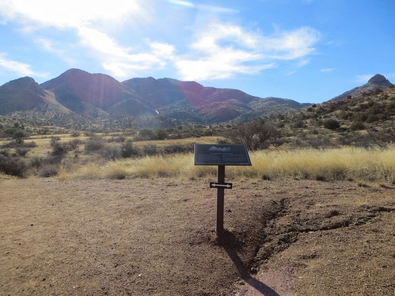
By Bill Kirchner, January 8, 2017
The Butterfield Overland Mail Marker
| 1 ► Arizona, Cochise County, Bowie — The Butterfield Overland Mail — |
| Near Fort Bowie Trail, 0.6 miles south of Apache Pass Road. | |||
| 2 ► Arizona, Cochise County, Bowie — The Stage Station Ruin — |
| Near Fort Bowie Trail, 0.6 miles south of Apache Pass Road. | |||
| 3 ► Arizona, Cochise County, Cochise — Sulphur Springs — |
| On Birch Road, 3.1 miles east of U.S. 191, on the right when traveling east. | |||
| 4 ► Arizona, Cochise County, Dragoon — Dragoon Springs Stage Stop — Land of Legends — Coronado National Forest — |
| On North Old Ranch Road. | |||
| 5 ► Arizona, Yuma County, Yuma — The All-important Colorado River Crossing — Juan Bautista de Anza National Historic Trail — |
| Near Prison Hill Road, 0.5 miles north of Harold C. Giss Parkway. | |||
| 6 ► Arkansas, Benton County, Garfield — The Butterfield Overland Mail Route — |
| Near Military Park Road (County Road 65). | |||
| 7 ► Arkansas, Benton County, Lowell — Original Site of Bloomington (Mudtown) Arkansas — |
| On Jackson Place at McClure Avenue (Route 923), on the left when traveling north on Jackson Place. | |||
| 8 ► Arkansas, Benton County, Lowell — The Butterfield Stagecoach Road — Established 1858 — |
| On Jackson Place at McClure Avenue (Route 923), on the right when traveling north on Jackson Place. | |||
| 9 ► Arkansas, Benton County, Rogers — Cross Hollows — |
| On South Old Wire Road (County Road 83) 0.2 miles north of Dogwood Drive/Cross Hollows Road (County Road 1189), on the left when traveling north. | |||
| 10 ► Arkansas, Benton County, Rogers — The Butterfield Overland Mail In Arkansas — |
| On South 1st Street north of West Elm Street, on the right when traveling north. | |||
| 11 ► Arkansas, Crawford County, Van Buren — The Butterfield Stage Route — |
| On Main Street at South 3rd Street, on the right when traveling east on Main Street. | |||
| 12 ► Arkansas, Pope County, Pottsville — 27 — Potts Inn / Butterfield's Overland Mail — |
| On 2nd Street at East Ash Street, on the left when traveling north on 2nd Street. | |||
| 13 ► Arkansas, Sebastian County, Fort Smith — First Butterfield Overland Mail Coach — |
| On Rogers Avenue at South 4th Street, on the right when traveling south on Rogers Avenue. | |||
| 14 ► Arkansas, Washington County, Fayetteville — Butterfield Stage Route — |
| On College Avenue (U.S. 71) at Center Street, on the right when traveling north on College Avenue. | |||
| 15 ► Arkansas, Washington County, Springdale — Fitzgerald's Station — |
| On Old Wire Road (State Highway 265) south of Dodd Avenue, on the right when traveling north. | |||
| 16 ► California, Fresno County, Firebaugh — 10 — Andrew Davidson Firebaugh — Firebaugh's Ferry — |
| On Q Street at 15th Street, on the left when traveling south on Q Street. | |||
| 17 ► California, Fresno County, Humphreys Station — Humphrey Station — |
| On Tollhouse Road at Pittman Hill Road, on the right when traveling east on Tollhouse Road. | |||
| 18 ► California, Fresno County, Kerman — 488 — Site of Fresno City — |
| On Whitesbridge Avenue (California Route 180) 0.3 miles west of James Road, on the left when traveling west. | |||
| 19 ► California, Kern County, Bakersfield — 137 — Gordons Ferry — California Historic Landmark — |
| On China Grade Loop, on the right when traveling south. | |||
| 20 ► California, Kern County, Bakersfield — 588 — Kern River Slough — |
| On Panama Road, 0.7 miles east of Cottonwood Road, on the right when traveling east. | |||
| 21 ► California, Kern County, Bakersfield — 539 — Posey Station of Butterfield Overland Mail Lines — |
| On Bakersfield-Glennville/Granite Road at Round Mountain Road, on the left when traveling south on Bakersfield-Glennville/Granite Road. | |||
| 22 ► California, Kern County, Mettler — 540 — Sinks of the Tejon — |
| On David Road at North Wheeler Ridge Road, on the right when traveling east on David Road. | |||
| 23 ► California, Kings County, Laton — 270 — Kingston — |
| On Douglas Avenue, 0.3 miles west of 12¾ Avenue, on the right when traveling west. | |||
| 24 ► California, Los Angeles County, Elizabeth Lake — Butterfield Overland Mail — and Havilah Coachline — |
| On Elizabeth Lake Road, 0.2 miles east of Ranch Club Road, on the left when traveling east. | |||
| 25 ► California, Los Angeles County, Los Angeles, Downtown Los Angeles — 656 — Bella Union Hotel Site — |
| On North Main Street north of Temple Street, on the right when traveling north. | |||
| 26 ► California, Los Angeles County, Los Angeles, Downtown Los Angeles — 744 — Historical Site — Butterfield Stage Station — The Mirror Building — |
| On South Spring Street at West Second Street, on the right when traveling south on South Spring Street. | |||
| 27 ► California, Los Angeles County, Los Angeles, Encino — 689 — De La Osa Adobe — Los Encinos State Historical Monument — |
| Near Moorpark Street at La Maida Street, on the right when traveling east. | |||
| 28 ► California, Los Angeles County, Los Angeles, Granada Hills — Lopez Station — |
| On Rinaldi Street, 0.3 miles west of Interstate 405, on the right when traveling west. | |||
| 29 ► California, Los Angeles County, Los Angeles, Studio City — 151 — Campo de Cahuenga — Original Adobe — |
| Near Lankershim Boulevard, 0.1 miles north of the Hollywood Freeway (U.S. 101), on the left when traveling north. | |||
| 30 ► California, Los Angeles County, Santa Clarita, Newhall — 688 — Lyons Station — |
| Near Sierra Highway, 0.2 miles south of Newhall Avenue, on the right when traveling south. | |||
| 31 ► California, Merced County, Los Banos — 141-5 — Lone Willow Station — |
| On Delta Road at McDonald Road, on the right when traveling north on Delta Road. | |||
| 32 ► California, Riverside County, Corona — 638 — Old Temescal Road — |
| On Temescal Canyon Road, 0.9 miles south of Interstate 15, on the right when traveling south. | |||
| 33 ► California, Riverside County, Corona — 188 — Site of Butterfield Stage Station — |
| Near Pronio Circle. | |||
| 34 ► California, Riverside County, Temecula — Dripping Springs Watering Hole — |
| On Vail Oak Road north of Route 79, on the right when traveling north. | |||
| 35 ► California, San Bernardino County, Chino — Site of the Battle of Chino — |
| On Eucalyptus Avenue near Pipeline Avenue, on the right when traveling west. | |||
| 36 ► California, San Bernardino County, Rancho Cucamonga — Red Hill — City of Rancho Cucamonga Historic Point of Interest — |
| On Foothill Boulevard (Route 66) at Vineyard Avenue, on the right when traveling west on Foothill Boulevard. | |||
| 37 ► California, San Diego County, Anza-Borrego Desert State Park — 472 — Box Canyon — |
| On Great Southern /Overland Stage Route of 1849 (County Route S2), on the right when traveling east. | |||
| 38 ► California, San Diego County, Anza-Borrego Desert State Park — 639 — Palm Spring — |
| On Vallecito Creek Road south of County Road S2. | |||
| 39 ► California, San Diego County, Anza-Borrego Desert State Park — 793 — San Felipe — |
| 40 ► California, San Diego County, Blair Valley — 647 — Butterfield Overland Mail Route — |
| Near an un-named desert road, 0.5 miles east of Great Overland Stage Route (County Route S2). | |||
| 41 ► California, San Diego County, Julian — 304 — Vallecito Stage Station — |
| Near Great Southern /Overland Stage Route of 1849, on the right when traveling east. | |||
| 42 ► California, San Diego County, Julian — 304 — Vallecito-Butterfield Stage Station — 19 Miles — |
| On California Route 78, on the right when traveling west. | |||
| 43 ► California, San Diego County, Oak Grove — 502 — Oak Grove Stage Station — |
| On State Highway 79 at milepost 49.4, on the right when traveling south. | |||
| 44 ► California, San Diego County, Warner Springs — 311 — Warner Ranch House — |
| On San Felipe Road (County Highway 52) 0.7 miles east of Highway 79, on the left when traveling east. | |||
| 45 ► California, San Mateo County, San Mateo — First Business Structure — Historic House — |
| On South El Camino Real at 2nd Street, on the right when traveling north on South El Camino Real. | |||
| 46 ► California, Santa Clara County, Gilroy — Butterfield Overland Stage — |
| On Monterey Road at Hornlein Court, on the right when traveling north on Monterey Road. | |||
| 47 ► California, Santa Clara County, Hollister — Bell Station — |
| Near Pacheco Pass Highway (State Highway 152) east of Kaiser Aetna Road (unsigned), on the left when traveling east. | |||
| 48 ► California, Santa Clara County, Morgan Hill — [Morgan Hill] Centennial Project — A History Trail — Dedicated November 10, 2006 — |
| On Monterey Road (California Route 82). | |||
| 49 ► California, Santa Cruz County, Santa Cruz — The Butterfield Stage stopped here. — Charley Parkhurst — |
| On Portola Drive east of 35th Avenue, on the right when traveling east. | |||
| 50 ► California, Tulare County, Fountain Springs — 648 — Fountain Springs — |
| On Avenue 56 (County Route J22) at Old Stage Coach Road, on the right when traveling east on Avenue 56. | |||
| 51 ► California, Tulare County, Fountain Springs — Old Stage Road — |
| On Avenue 56 (County Route J22) at Old Stage Coach Road, on the right when traveling east on Avenue 56. | |||
| 52 ► California, Tulare County, Lindsay — 471 — Butterfield Overland Mail Route — |
| On Fremont Drive, 0.1 miles south of Hermosa Street, on the left when traveling south. | |||
| 53 ► California, Tulare County, Porterville — 473 — Tule River Stage Station — |
| On N. Main Street (California Route J29) at W. Henderson Avenue on N. Main Street. | |||
| 54 ► California, Tulare County, Visalia — Butterfield Overland Mail — |
| On East Main Street west of North Church Street, on the left when traveling east. | |||
| 55 ► Missouri, Barry County, Cassville — Butterfield Overland Mail in Missouri - 1858-1861 — |
| On Main Street (State Road Y) at 7th Street, on the left when traveling north on Main Street. | |||
| 56 ► Missouri, Benton County, Warsaw — Butterfield Overland Mail in Missouri — 1858-1861 — |
| On Van Buren Street at Main Street, on the right when traveling north on Van Buren Street. | |||
| 57 ► Missouri, Christian County, Clever — Butterfield Overland Mail in Missouri — 1858-1861 — |
| On Highway ZZ, 0.1 miles north of Honeysuckle Road, on the left when traveling north. | |||
| 58 ► Missouri, Greene County, Springfield, Downtown Springfield — 18 — Butterfield Overland Stage — |
| On Park Central North at Olive Street, on the left when traveling south on Park Central North. | |||
| 59 ► Missouri, Lawrence County, Aurora — Butterfield Overland Mail in Missouri — 1858-1861 — |
| On State Highway 39 at Farm Road 2035, on the left when traveling south on State Highway 39. | |||
| 60 ► Missouri, Lawrence County, Aurora — Smith Station — |
| On Farm Road 2020, 0.3 miles east of Farm Road 1212, on the right when traveling east. | |||
| 61 ► Missouri, Moniteau County, Tipton — Tipton — Butterfield Overland Mail Terminus — |
| On U.S. 50 west of Walnut Street, on the left when traveling west. | |||
| 62 ► Missouri, Morgan County, Syracuse — Butterfield Overland Mail in Missouri - 1858-1861 — |
| On Front Street (U.S. 50) east of Washington Street, on the right when traveling east. | |||
| 63 ► Missouri, St. Louis, Downtown — Speedy Delivery — |
| Near Walnut Street east of Memorial Drive, on the left when traveling east. | |||
| 64 ► New Mexico, Doña Ana County, Anthony — Butterfield Trail/Espejo's Expedition — /On the Camino Real — |
| Near Interstate 10. | |||
| 65 ► New Mexico, Doña Ana County, Las Cruces — La Mesilla — |
| On State Road 28 at State Road 292, on the right when traveling south on State Road 28. | |||
| 66 ► New Mexico, Doña Ana County, Mesilla — Butterfield Overland Trail — South Central Region — |
| On Calle de Guadalupe, on the left when traveling north. | |||
| 67 ► New Mexico, Doña Ana County, Mesilla — La Posta de Mesilla — |
| On Calle De San Albino south of Calle de Parian, on the right when traveling south. | |||
| 68 ► New Mexico, Luna County, Deming — First Road to Southern California — |
| On U.S. 180 at milepost 145 at Butterfield Trail, on the right when traveling north on U.S. 180. | |||
| 69 ► Oklahoma, Atoka County, Atoka — Historic Butterfield Trail in Indian Territory — 1857-1861 — |
| Near North Mississippi Avenue (U.S. 69) 0.8 miles north of West Liberty Road (U.S. 75), on the right when traveling north. | |||
| 70 ► Oklahoma, Bryan County, Kenefic — Nail's Crossing — Butterfield Overland Mail — |
| Near Nails Crossing Road, on the right when traveling west. | |||
| 71 ► Oklahoma, Le Flore County, Spiro — Skullyville — |
| On Spring Road, 0.2 miles north of County Road 22A, on the left when traveling north. | |||
| 72 ► Oklahoma, Oklahoma County, Oklahoma City, Central Oklahoma City — Butterfield Overland Stage — The Red River Journey — |
| Near Nazih Zuhdi Drive west of North Laird Avenue. | |||
| 73 ► Texas, Coke County, Blackwell — 1973 — Fort Chadbourne — |
| On U.S. 277 at Fort Chadbourne Road, on the right when traveling north on U.S. 277. | |||
| 74 ► Texas, Coke County, Blackwell — 4983 — Southern Overland Mail, 1858-1861 — (Butterfield Stage) — |
| On U.S. 277, 0.2 miles north of Texas Highway 70, in the median. | |||
| 75 ► Texas, Coke County, Bronte — 4374 — Route of the Southern Overland Mail Line — |
| On U.S. 277, 1.6 miles north of Texas Highway 70, on the right when traveling north. | |||
| 76 ► Texas, Coke County, Bronte — 4983 — Southern Overland Mail, 1858-1861 — (Butterfield Stage) — |
| On State Highway 158, 0.5 miles east of 7 Mile Hill Road, on the right when traveling east. | |||
| 77 ► Texas, Cooke County, Gainesville — 590 — Butterfield Overland Stage Line — |
| On North Grand Avenue (Farm to Market Road 372) at Frontage U.S. 82 Frontage Road, on the right when traveling north on North Grand Avenue. | |||
| 78 ► Texas, Crane County, Girvin — 2567 — Horsehead Crossing, C.S.A. — (about 10 mi. NW) — |
| On U.S. 67/385, on the right when traveling south. | |||
| 79 ► Texas, Culberson County, Pine Springs — Butterfield Overland Mail — The Pinery Station — |
| Near U.S. 62/180, 0.2 miles east of Entrace to Guadalupe Mountains National Park, on the left when traveling east. | |||
| 80 ► Texas, Culberson County, Pine Springs — 7929 — Ruins of "The Pinery" or "Pine Spring" Stage Stand — |
| On U.S. 180/62, on the left when traveling east. | |||
| 81 ► Texas, Culberson County, Pine Springs — The Airmen — |
| On U.S. 180/62, on the left when traveling east. | |||
| 82 ► Texas, Culberson County, Van Horn — 7926 — Van Horn Wells — (One-Half Mile West) — |
| On U.S. 90, 10.5 miles south of Interstate 10, on the right when traveling south. | |||
| 83 ► Texas, El Paso County, El Paso — 15036 — Butterfield Overland Mail — |
| Near Cottonwoods Drive, 0.8 miles north of Global Reach Drive. | |||
| 84 ► Texas, El Paso County, El Paso — 4031 — Pioneer Plaza — |
| On South El Paso Street, on the right when traveling north. | |||
| 85 ► Texas, Grayson County, Sherman — 11905 — Butterfield Overland Mail Route Through Grayson County — |
| On Lamar Street (State Highway 56) east of Crockett Street, on the left when traveling east. | |||
| 86 ► Texas, Grayson County, Sherman — Stone from Old Ox Mill — |
| On Lamar Street (State Highway 56) near Travis Street, on the left when traveling east. | |||
| 87 ► Texas, Grayson County, Whitesboro — Diamond Station — Butterfield Overland Mail Stage Stop — |
| On West Main Street (State Highway 56) 1.1 miles east of U.S. 82, on the right when traveling west. | |||
| 88 ► Texas, Jack County, Jacksboro — 588 — Butterfield Stage Line — |
| On South Main Street (U.S. 281) at Hull Street, on the right when traveling south on South Main Street. | |||
| 89 ► Texas, Jack County, Jacksboro — 2009 — Fort Richardson — |
| On South Main Street (U.S. 281), on the right when traveling south. | |||
| 90 ► Texas, Jones County, Abilene — Butterfield Trail — |
| On US 83/277 Southbound Frontage Road, 0.7 miles south of Private Road 314, on the right when traveling south. | |||
| 91 ► Texas, Jones County, Abilene — Fort Phantom Hill — Post on the Clear Fork of the Brazos — |
| Near Farm to Market Road 600, 2 miles north of Farm to Market Road 1082, on the right when traveling north. | |||
| 92 ► Texas, Jones County, Abilene — 2004 — Fort Phantom Hill — |
| On Farm to Market Road 600, 2 miles north of Farm to Market Road 1082, on the left when traveling north. | |||
| 93 ► Texas, Loving County, Mentone — 9460 — Route of Old Butterfield Stagecoach Road — |
| On State Highway 302, 0.4 miles west of Pecos Street (County Road 300), on the right when traveling west. | |||
| 94 ► Texas, Pecos County, Fort Stockton — 4757 — Site of Comanche Springs — |
| On Spring Drive near East 1st Street. | |||
| 95 ► Texas, Pecos County, Girvin — 2564 — Horse Head Crossing on the Pecos River — |
| On Horse Head Road, 3.1 miles north of Farm to Market Road 11, on the right when traveling north. | |||
| 96 ► Texas, Reeves County, Pecos — 1473 — Emigrants' Crossing — (20 mi. SE) — |
| On East 1st Street at South Cedar Street (U.S. 285), on the left when traveling west on East 1st Street. | |||
| 97 ► Texas, Reeves County, Pecos — 4071 — Pope's Crossing — |
| On U.S. 285 at County Route 453, on the right when traveling north on U.S. 285. | |||
| 98 ► Texas, Shackelford County, Albany — 584 — Butterfield Overland Mail — |
| Near U.S. 180, 1.8 miles east of Bluff Creek Road (County Road 201), on the right when traveling east. | |||
| 99 ► Texas, Shackelford County, Albany — 4958 — Smith's Station — |
| Near Chimney Creek Ranch Road (County Road 220) 2.3 miles south of U.S. 180, on the right when traveling south. | |||
| 100 ► Texas, Taylor County, Merkel — 756 — Castle Peak — (2.6 Miles WSW) — |
| On Farm to Market Road 1235 south of County Road 302, on the right when traveling south. | |||
111 entries matched your criteria. The first 100 are listed above. The final 11 ⊳