917 entries match your criteria. The first 100 are listed. Next 100 ⊳
Mississippi State Historical Marker Program Historical Markers
Markers of the Mississippi state historical marker program administered by the Mississippi Department of Archives and History. It includes state markers installed by previous state departments and agencies. This series does not include markers of the Mississippi Freedom Trail, Mississippi Blues Trail, Mississippi Country Music Trail, and Mississippi Mound Trail, which have their own series categories.
On Trails End Road west of North Palestine Road, on the right when traveling south.
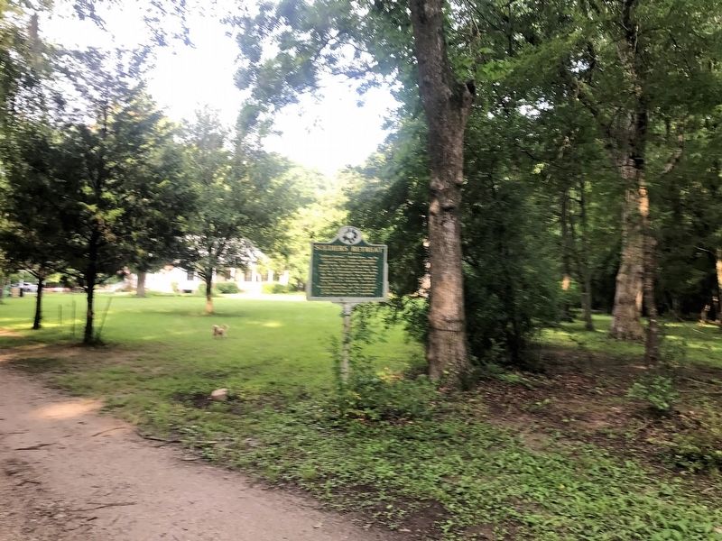
"Soldiers Retreat," located here, was the home of Ferdinand Leigh and Magdaline Claiborne. F.L. Claiborne (1772-1815) moved to the Mississippi Territory from Virginia in 1807 and served as Brig. Gen. with the 1st Mississippi Volunteers during the . . . — — Map (db m105260) HM
On Franklin Street at North Wall Street, on the left when traveling east on Franklin Street.
Site of the printery of “father of Mississippi journalism.” Printed first book in state, 1799. Became first public printer and in 1802 founded famed newspaper, “Mississippi Herald.” — — Map (db m70851) HM
On Cemetery Road, 0.2 miles north of Maple Street, on the right when traveling north.
Jackson State University was founded here in 1877 in the former U.S. Marine Hospital. Known as the Natchez Seminary, the school was founded by the American Baptist Home Mission Society and the Mississippi Baptist Convention Association led by H.P. . . . — — Map (db m143710) HM
On Main Street at South Canal Street, on the left when traveling west on Main Street.
Built ca. 1836, this structure, a National Historic Landmark, is a fine example of the Greek Revival style. A Banker’s House attached to the rear insured security & gives the structure an unusual and practical plan. — — Map (db m79346) HM
On Liberty Road at St Catherine Street and Devereaux Drive (Business U.S. 61), on the left when traveling north on Liberty Road.
Site of the South's second largest slave market in the 19th century. Enslaved people were also once sold on city streets and at the landing at Natchez Under the Hill. Natchez slaves were freed in July, 1863, when Union troops occupied the city. The . . . — — Map (db m37433) HM
On D A Biglane Street at South Canal Street, on the right when traveling east on D A Biglane Street.
Occupied 1716-circa 1800 by successive French, British, Spanish and American garrisons during struggle for control of the Miss. River Valley. Nucleus of early settlements in the Natchez District.
Mississippi Department of Archives and . . . — — Map (db m126797) HM
On Lower Woodville Road, 0.5 miles south of John R. Junkin Road (U.S. 84), on the right when traveling south.
Here are buried the families of Winthrop Sargent, 1st Gov. of the Mississippi Territory, and Seargent S. Prentiss, Congressman. "Let no monumental marble deface with its mock dignity the patriot's grave." — — Map (db m103804) HM
On Saint Catherine Street west of Orange Avenue, on the left when traveling west.
First Catholic church in the Mississippi valley with entire congregation of Afro-American descent. Its school has been continually educating youth since 1890. — — Map (db m103798) HM
On Jefferson Street at North Union Street on Jefferson Street.
This was the first Methodist congregration in Natchez formed in the early 1800s, and the 1st building was constructed in 1807. The 1st Sunday School south of Philadelphia, Pa., was organized here in 1829. — — Map (db m29749) HM
On Hutchins Landing Road east of Brick Quarters River Road, on the right when traveling east.
Erected, 1968, by Descendants of the New Jersey Settlers Organization (formed 1940) in memory of settlers of 1772, including Captain Amos Ogden. The Swayzes, Thorns & others now rest in the Kingston Cemetery — — Map (db m103816) HM
On Hutchins Landing Road, 0.3 miles east of Hillside Plantation Road, on the left when traveling east.
Erected, 1968, by Descendants of the New Jersey Settlers Organization (formed 1940) in memory of settlers of 1772 & their descendants who rest in Caleb King & Daniel Farrar Cemetery, Kingston Plantation. — — Map (db m104044) HM
On Co-Lin Circle west of Campus Drive, on the left when traveling west.
An early American feminist writer and champion of women's rights, Murray (1751-1820) was also instrumental in fostering the Universalist Church in America. Murray lived for two years at Oak Point Plantation on this site. She died on July 6, 1820, . . . — — Map (db m103817) HM
On Jefferson Street west of North Rankin Street, on the right when traveling west.
Oldest building in Natchez. Standing before 1789. Operated as a tavern, stage stop, and mail station at the end of Natchez Trace. Now owned and restored by the Pilgrimage Garden Club of Natchez. — — Map (db m127081) HM
On Hutchins Landing Road, 0.3 miles east of Hillside Plantation Road, on the right when traveling east.
S.E. 1 mile is site of Old Jersey Settlement now known as Kingston. Here settlers from New Jersey organized first Protestant church in Mississippi with Samuel Swayze as pastor. — — Map (db m104043) HM
On U.S. 61 at Kingston Road, on the right when traveling north on U.S. 61.
E. 8 mi. Settled, 1773 by N. Jersey pioneers led by Richard and Samuel Swayze. Latter formed Congregational church, reputedly the first Protestant church in state. — — Map (db m120192) HM
On John R. Junkin Drive (U.S. 84) 0.6 miles east of South Canal Street, on the right when traveling east.
Explored, 1540-1, by De Soto. Colonized first by French, 1699. Became a colony of British, 1763; Spanish, 1779. Territory organized by U.S., 1798. Became 20th. state, 1817. — — Map (db m103799) HM
On S. Broadway St at Bontura Street, on the right when traveling south on S. Broadway St.
First settled by French, 1716-29. Lasting growth came with Britain, 1763-1779, and Spain, 1779-98. Cotton and trade made it commercial and cultural capital of Old South. — — Map (db m4479) HM
Established in 1822 on a ten acre tract, this cemetery grew into a park notable for its variety of 19th century iron and marble work. People of all walks of life are buried within the cemetery. — — Map (db m50659) HM
On South Union Street near Ravenna Lane, on the left when traveling west.
An outstanding example of Colonial Revival architecture, Ravennaside, built 1902, was the home of Roane Fleming Byrnes (1890-1970) and headquarters for her efforts in the creation and development of the Natchez Trace Parkway, the 444-mile National . . . — — Map (db m103821) HM
On Saint Catherine Street west of Abbott Street, on the right when traveling west.
On April 23, 1940, 209 African Americans died in a fire at the Rhythm Club, located at this site. An overflow crowd, which included civic and cultural leaders, had come to hear the Walter Barnes Orchestra of Chicago. Considered among America's most . . . — — Map (db m103794) HM
On S. Broadway Street, on the right when traveling south.
Noted African-American author of Native Son and Black Boy was born in 1908 near Natchez, where he spent his early childhood. His lifelong quest for freedom led him to Paris, France, where he died in 1960. — — Map (db m10059) HM
On Madison Street east of North Union Street, on the left when traveling east.
Rose Hill is the oldest black baptist congregation in the state, with origins dating to 1837. This 1908 building replaces the first wooden church and contains a 1912 Moller pipe organ. Randle Pollard was the first official pastor, serving from . . . — — Map (db m105229) HM
On John R. Junkin Drive (U.S. 84) at Lower Woodville Road, on the right when traveling east on John R. Junkin Drive.
S. ½ mi. is grave of orator & statesman who came from Maine to Natchez in 1827 & won fame in law & politics, serving with distinction in legislature & in Congress. — — Map (db m103801) HM
On Main Street west of South Pearl Street, on the left when traveling west.
Chartered in 1809 as the only bank in Mississippi Territory and given a monopoly as the official state bank in 1818. It occupied this site in 1826 but was supplanted by Planters' Bank in 1831. Closed solvent. — — Map (db m70854) HM
Near Aldrich Street near Old Devereaux St, on the left when traveling west.
William St. John Elliot, a wealthy planter, died in
1855. He willed his mansion. D'Evereux Hall, to the
Catholic church to become a boys' orphanage. His
widow, Anna Elliot, who wanted the house to remain
in her family, purchased the estate from . . . — — Map (db m226716) HM
On Morgantown Road at T Waring Bennett Jr. Road, on the left when traveling north on Morgantown Road.
On January 21, 1905, a number of families from struggling farming communities near Bologna, Italy, left Genoa bound for New York aboard the S.S. Montevideo. Many of these families ventured south, some settling in this area near St. . . . — — Map (db m105231) HM
In 1837 Natchez was designated the See of the Roman Catholic Church in Mississippi. In 1842 Bishop J. M. Chanche began construction of this structure, the only church built as a cathedral in Mississippi. — — Map (db m103791) HM
On State Street at Pearl Street, on the left when traveling east on State Street.
Congregation organized in 1817. The Sanctuary was built in 1828-29 and enlarged in 1851. The Romanesque Revival rear addition was built in 1900 in honor of Joseph Stratton, Pastor, 1843-1903. The church and its companion manse on South Rankin Street . . . — — Map (db m19027) HM
On U.S. 61 south of Forest Plantation Road, on the right when traveling north.
Home and grave of William Dunbar (1749-1810), Scot settler who surveyed the boundary line between the USA and Spain-1798 and led 1st exploration of LA Purchase 1804. World-famed scientist and inventor in Miss. Territory. — — Map (db m103857) HM
On Jefferson Street near North Doctor Martin Luther King Jr. Street, on the left when traveling west.
Acquired 1868 by Zion Chapel whose minister Hiram R. Revels became the first black U.S. Senator and first president of Alcorn State University. Originally built in 1858 as the Second Presbyterian Church. — — Map (db m103793) HM
On Martin Luther King Junior Road (Mississippi Route 555) at Airport Road (Mississippi Route 554), on the right when traveling south on Martin Luther King Junior Road.
Oldest Presbyterian Church
in S.W. Organized. Feb. 25, 1807
as Salem Church. Here, Mar. 6,
1816 Mississippi Presbytery
was formed. Name changed
in 1827 to Pine Ridge Church. — — Map (db m244195) HM
On U.S. 61 at Hutchins Landing Road, on the right when traveling south on U.S. 61.
On December 1, 1863, Confederate Brig. Gen. Wirt Adams moved his cavalry from Gallatin to retake Natchez. Finding the city heavily fortified with Union infantry and heavy artillery, Adams moved south of Natchez to Ellis's Cliff, eight miles west of . . . — — Map (db m103788) HM
On U.S. 61 near Natchez Trace Parkway, on the right when traveling north.
Deep cut here is part of famed Indian trail taken over by U.S., 1803. Until the coming of steamboats, it was post route, & chief artery of travel between Natchez & Nashville. — — Map (db m143324) HM
On Jefferson College Street near U.S. 61, on the right when traveling north.
Here, on April 22, 1815, over 200 citizens of the Old Natchez District entertained General Andrew Jackson on his return from the victory over the British at the Battle of New Orleans, January 8, 1815. — — Map (db m105788) HM
On Jefferson College Street north of U.S. 61, on the right when traveling north.
Scientist-historian (1803-51). Lived ¼ mi. S.E. Research on yellow fever brought first quarantine in Old S.W. at Natchez, 1844. Author of scholarly book on the discovery and settlement of Mississippi Valley. — — Map (db m105397) HM
Near Natchez Trace Parkway (at milepost 5.1), 3.3 miles south of U.S. 61. Reported missing.
First school for women chartered by Mississippi Legislature located here. Elizabeth Roach led in organization. School was important from 1818-1843. — — Map (db m87231) HM
On Jefferson College Street north of U.S. 61, on the right when traveling north.
N. 200 yd. Founded 1802. Mississippi's oldest school. Received the first charter to be conferred for any purpose by legislature of Mississippi Territory. — — Map (db m105790) HM
On Jefferson College Street north of U.S. 61, on the right when traveling north.
Territorial capital 1802-17. Statehood constitutional convention held here in 1817. Legislature met here until 1820. During its great days, it was known as the "Versailles" of the territory. — — Map (db m105353) HM
On U.S. 61 at Morgantown Road, on the left when traveling west on U.S. 61.
Site of first Methodist camp meeting in state, Dec. 14-17, 1804. Led by Learner Blackman, Nathan Barnes, Lorenzo Dow, and Randal Gibson. — — Map (db m105847) HM
On Huggins Road (County Highway 514) 0.5 miles east of County Road 529, on the left when traveling west.
A.B. Dilworth (1814-1894) served in the Mississippi House of Representatives (1846-1850), secretary of state (1855-1860), and state auditor (1861-62). During the Civil War, Dilworth served as quartermaster general in Iuka and negotiated the release . . . — — Map (db m155403) HM
On New Hope Road (County Road 513) 0.4 miles west of U.S. 45, on the right when traveling west.
New Hope Presbyterian Church was organized in 1838 when six members began meeting in a school house near Troy, later renamed Danville. Rev. James B. Stafford served as the first pastor or the church from 1838 to 1854. The first sanctuary was a log . . . — — Map (db m155410) HM
On Bitner Road at Scenic Lake Drive, on the right when traveling north on Bitner Road. Reported missing.
Only extant redan of six built in 1862 by U.S. troops as outer defense south and west of town. Taken on Oct. 3, 1862, by C.S. forces after fierce fighting. Battle resumed on Oct. 4, but C.S. troops forced to withdraw. — — Map (db m66613) HM
On North Fulton Road, 0.3 miles north of South Tate Street (Mississippi Route 145), on the left when traveling north.
Site of Battery Williams. On Oct. 4 the cannonade from here devastated the Confederate troops attacking Battery Robinette. The advance failed, forcing Gen. Van Dorn to withdraw his forces. — — Map (db m50324) HM
S. 3/10 mi. to rear of school. Of unique circular design, about 50 ft. in diameter, this pit was one of series built in 1862 as second line of defence against U.S. troops advancing from Shiloh. — — Map (db m50318) HM
On Westview Drive at Cemetery Drive, on the right when traveling west on Westview Drive.
Earliest evidence of Corinth's
settlement. Oldest cemetery
in city with first burial
dated 1842. The city owned
the site from 1874 to 1940
when deeded to City Cemetery
Association, endowed by
Shelby H. Curlee. — — Map (db m220000) HM
On N Fillmore Street, on the left when traveling north.
Began 1854 as Cross City. Proximity to Tennessee River and the railroads made it of great strategic value during Civil War. Battle of Corinth fought here, Oct. 3-4, 1862. — — Map (db m21305) HM
On Main Street (State Highway 145) at Fillmore Street (State Highway 145), in the median on Main Street.
Began 1854 as Cross City. Proximity to Tennessee River and the railroads made it of great strategic value during the Civil War. Battle of Corinth fought here, Oct. 3-4, 1862. — — Map (db m66533) HM
On County Road 106 north of County Road 187, on the right when traveling north.
Organized before 1848. Here in 1853 M.P. Lowery was ordained & in 1885 John Allen was dubbed "Private". Town destroyed in Civil War & abandoned because R.R. by-passed it. — — Map (db m155237) HM
Corinth's oldest church bldg.; erected 1871 by Cumberland Presbyterian Church, the First church est. in Corinth. 1906~1976 served as Fillmore St. Pres. Ch. Now used as chapel by First United Methodist Church. — — Map (db m28472) HM
On South Tate Street (Mississippi Route 145) south of Cardinal Drive, on the left when traveling south.
In 1934, a group of local businessmen and farmers
met in the back of a furniture store in Corinth
and created the Alcorn County Electric Power
Association (ACEPA). Chartered on January 17,
1934, ACEPA began operations on June 1.
With local . . . — — Map (db m219996) HM
On N. Fillmore Street (State Highway 145) at Linden Street, on the left when traveling north on N. Fillmore Street.
W. 1/2 mi. Now Confederate Park. Here, Oct. 5, 1862, during Battle of Corinth, occurred a C.S.A. charge as heedless of cost as those of Pickett at Gettysburg and Light Brigade at Balaclava. — — Map (db m66738) HM
On Jackson Street north of Childs Street, on the right when traveling south.
Built about 1857 for Hamilton Mask. Used in Civil War as Hq. of Generals Braxton Bragg, H.W. Halleck, and John B. Hood. Donated to Corinth in 1960 by S.H. Curlee family. — — Map (db m66558) HM
On Jackson Street, on the right when traveling south.
Site of hq. of Gen. Ulysses Simpson Grant in June, 1862. In mid-July Grant removed to plantation home of F. E. Whitfield, Sr., about 1 mi. S. of Corinth. — — Map (db m238370) HM
On N. Polk Street (State Highway 145) at Woodlawn Drive, on the right when traveling north on N. Polk Street.
Founded in 1879 by the Milton B. Henry family on land sold by the Chickasaws to the U.S. government in 1832. Henry purchased 160 acres in 1856. Robert Henry Young, an infant grandson of M.B. Henry, was the first person buried here. The Henry . . . — — Map (db m66591) HM
On Fillmore Street, on the right when traveling south.
Site of hq. of Gen. Albert Sidney Johnston, April 1~4, 1862. After his death at Shiloh, April 6, body was brought here where it lay in state, April 7, 1862. — — Map (db m29280) HM
On Fillmore Street (State Highway 145) north of Bunch Street, on the right when traveling north.
Built in 1857 for Judge W.H. Kilpatrick. Used in Civil War as headquarters of General Leonidas Polk. Bought in 1866 by Mrs. Thomas Quincy Martin and occupied continuously by her descendants. — — Map (db m66557) HM
On Polk Street north of Bunch Street, on the right when traveling north.
Built in 1857 by William L. Duncan, the Duncan House was the headquarters of Confederate general P.G.T. Beauregard after the Battle of Shiloh. In June 1862, Union general William Rosecrans made the house his headquarters during the Battle of . . . — — Map (db m155235) HM
On County Route 364 at County Route 356, on the right when traveling north on County Route 364.
E. 9 mi. Founded 1836 as seat of “Old” Tishomingo, including present Alcorn & Prentiss counties. Named for battle of San Jacinto. Courthouse dates from 1854. Lost county seat, 1870. Home of Sen. E.W. Carmack. — — Map (db m77399) HM
On Main Street (State Highway 2) at College Street (County Highway 512), on the right when traveling east on Main Street.
Settled in 1840 as New Hope. Name changed to Kossuth in 1853 to honor Hungarian patriot Louis Kossuth. Home of Col. M.P. Lowery, found of Blue Mountain College. A skirmish occurred here during the Civil War. Alcorn Agricultural High School was . . . — — Map (db m155411) HM
On State Highway 24/33 at East Howard Street (State Highway 48), on the left when traveling north on State Highway 24/33.
Began as Spanish relay post. Was known prior to 1824 as Elysian Fields, or Amite Courthouse. Chartered in 1880. After 1884, new town, springing up on railroad, gradually absorbed old site. — — Map (db m96426) HM
On State Highway 33 north of Church Street, on the left when traveling north.
Named Dayton in 1884 in honor of David Day who gave the R.R. right-of-way. In 1917, Foster Creek Lumber & Mfg. Co. mill & town of Stephenson est. here. In 1934, named for L.O. Crosby who bought the vast co. holdings. — — Map (db m96180) HM
On Captain Gloster Drive (State Highway 24) at State Highway 33, on the left when traveling east on Captain Gloster Drive.
On Mar. 11, 1884, Gloster City was chartered. Named for Capt. Arthur W. Gloster, R.R. engin. Located on watershed of Amite & Miss. Rivers. Elev. 435 Ft. On Apr. 6, 1935, a tornado hit the town killing 9 residents. — — Map (db m96030) HM
On Main Street (State Highway 24) east of Broad Street, on the right when traveling east.
The State's oldest courthouse, built in 1839-41, replaced the building located on this historic square. Seat of Amite County, formed Feb. 24, 1809. Listed on the National Register of Historic Places. — — Map (db m92615) HM
On Clinic Street east of Old Jackson Rd. (Mississippi Highway 569), on the right when traveling east.
Locally known as the Little Red School House, the Amite Female Seminary was established in 1853 by Rev. Milton S. Shirk. The school's curriculum included music, literature, history, mathematics, modern languages, philosophy, science and physical . . . — — Map (db m92629) HM
On North Church Street, 0.1 miles Main Street (Mississippi Highway 24/48), on the left when traveling north.
On November 16, 1864, Union cavalry under Col. Benjamin Marsh captured a small Confederate force at Liberty. Marsh had hoped to capture Brig. Gen. George Hodge, but he escaped. The next day, Brig. Gen. Albert Lee reinforced the Federals with 1,700 . . . — — Map (db m92730) HM
On North Church Street, 0.1 miles north of Main Street (Mississippi Highway 24/48), on the left when traveling north.
Erected on land donated in 1868 by the Liberty Masonic Lodge, this Confederate monument was designed and built by A.J. Lewis. The shaft is inscribed with the names of 279 Amite County Confederate soldiers who died during the Civil War. Dedicated in . . . — — Map (db m92709) HM
On Gillsburg Road Avenue (State Highway 584) north of West Borden Avenue, on the right when traveling north.
Herbert Lee, a 42-year-old dairy farmer in the Amite County area, became a member of the NAACP in the early 1950s. In the fall of 1961, Lee began transporting voting rights activists within the Pike and Amite County area. On September 25, 1961, . . . — — Map (db m92564) HM
On Main Street (State Highway 24) at Broad Street, on the right when traveling east on Main Street.
Founded 1809 and chartered 1828. Site of first Confederate monument in state, 1871. Here Gail Borden conducted condensed milk experiments. Dr. Tichenor's antiseptic was also originated here. — — Map (db m92616) HM
On Walnut Drive at North Church Streeet, on the left when traveling north on Walnut Drive.
Founded as the Liberty Colored Church in March 1870 after fifteen black members requested letters of dismissal from Liberty Baptist Church to organize their own congregation. Under the leadership of their first pastor, Rev. Fred Stirling, these . . . — — Map (db m92617) HM
On County Road 3041, 0.1 miles north of State Route 35, on the left when traveling north. Reported damaged.
Established before the Civil War,
this cemetery was part of a large
plantation owned by Boley J. and
Annie Traweek Conner. The earliest
burial is that of Burwell Traweek,
a veteran of the War of 1812. The
cemetery also contains the graves
of . . . — — Map (db m244502) HM
On West Washington Street (Business Mississippi Route 12) west of North Jackson Street, on the left when traveling west.
Founded 1833; named after Chateaubriand's Indian heroine. Buried in county are 1st senator, Gordon Boyd, and 1st representative, Wm. Dodd, who named the county seat after Thaddeus Kosciusko. — — Map (db m140800) HM
On Tipton Street at East South Street, on the right when traveling north on Tipton Street.
Opened in 1925, the Attala County Training
School stood here. The school provided
vocational education for African American
students. Built mainly with local labor
and funds, the school also received
assistance from the Rosenwald Fund. . . . — — Map (db m244504) HM
On East Washington Street at North Huntington Street, on the right when traveling west on East Washington Street.
"Redbud Springs" in Indian days. Later named for Polish-American patriot. Chartered, 1836. On Natchez Trace near geographical center of state. Trade activity gave it title, "Beehive of the Hills." — — Map (db m140798) HM
On South Jackson Street at West Jefferson Street, on the left when traveling north on South Jackson Street.
The Mississippi Federation of Women’s Clubs was founded here on May 25, 1898. Organized by Mrs. Fannie Clark Coleman of Kosciusko, charter clubs included Clarksdale, Jackson, Verona, Sallis, Okolona, Vicksburg, and Meridian. Mrs. D.N. Hebron was . . . — — Map (db m72683) HM
On Mississippi Route 12 at Mississippi Route 429, on the right when traveling east on State Route 12.
South 4 mi. Founded, 1846. Here, July 22, 1855, first Mississippi Lutheran Synod was organized. The Rev. G.H. Brown, pastor, served as first Synod president. — — Map (db m140802) HM
On Mississippi Route 7, 0.2 miles north of Main Street, on the left when traveling east.
On October 14, 1862, Confederate Gen. John Pemberton assumed command in Mississippi and east Louisiana. Eleven days later, Gen. Ulysses Grant became commander of Union forces in the region. Over the next 8 1/2 months, their forces fought for control . . . — — Map (db m84782) HM
On Lake Street, 0.1 miles south of Roger Street, on the right when traveling north.
Pioneer television producer was born in Dr. Wells' house, which once occupied this site. Coe shows such as "Marty", "The Trip to Bountiful", and "Days of Wine and Roses" set standards for 1950s live TV drama. Producer of stage and film hits "A . . . — — Map (db m154859) HM
On State Highway 1, 1.1 miles north of Lake Vista Road, on the left when traveling north.
In the early morning hours of March 31, 1912, William Fisher Johnson (1876~1916) helped rescue flood victims after swollen rivers and lakes in Bolivar County caused a levee break just south of Beulah. According to Walter Sillers, using his gas . . . — — Map (db m154838) HM
On South Chrisman Avenue at Ruby Street, on the right when traveling south on South Chrisman Avenue.
Amzie Moore (1911-1982), a local Civil Rights leader, built this house
in 1941. An army veteran, Moore also worked for the U.S. Postal
Service. After returning from WWII, Moore dedicated himself to the
civil rights movement, co-founding the . . . — — Map (db m90074) HM
On Cotton Row at North Sharpe Avenue, in the median on Cotton Row.
Named for President Grover Cleveland. Founded along Jones Bayou and Yazoo and Mississippi Valley R.R. in 1886. Downtown historic area listed in National Register of Historic Places in 1999. — — Map (db m90069) HM
On South Court Street at South Sharpe Street, on the right when traveling east on South Court Street.
A Cleveland High School graduate, Bowen (D-Miss.) served five terms in Congress (1973-1983). As chair of the Cotton, Rice, and Sugar Subcommittee and a member of the House Agriculture, Foreign Affairs, and Merchant Marine and Fisheries Committees, . . . — — Map (db m89935) HM
On South Court Street at North Bolivar Avenue, on the right when traveling west on South Court Street.
While leading his orchestra at a dance on this site c. 1905, Handy was
unable to perform requested blues numbers. A local band stepped in
and stole the show. "My enlightenment came in Cleveland. That night
an American composer was born," he . . . — — Map (db m89932) HM
On North Fifth Avenue at South Court Street, on the right when traveling south on North Fifth Avenue.
In 1926 the Hill Demonstration School opened for grades one through six, with kindergarten classes added in 1929. This laboratory-style school for Delta State student teachers had an initial enrollment of twenty-five and was housed in the basement . . . — — Map (db m90127) HM
On West Sunflower Road (State Highway 8) at A.K. Eckles Lane, on the right when traveling west on West Sunflower Road.
Lily Margaret Wade (1912-1995) was a standout on Cleveland High
School’s girls basketball team and Delta State’s women’s basketball
team. Compiling a CHS coaching record of 453-89-6, she began
coaching the Lady Statesmen in 1973, winning the AIAW . . . — — Map (db m90125) HM
On East Sunflower Road (State Highway 8) 0.2 miles east of North Davis Avenue (U.S. 278), on the right when traveling east.
Founded in 1937 by parents, Cleveland First Baptist Church, and community leaders to provide an education for children of Chinese descent who were excluded from area schools by the 1927 US Supreme Court decision, Gong Lum v. Rice. Students . . . — — Map (db m90066) HM
On South Sharpe Avenue at Shelby Street, on the right when traveling south on South Sharpe Avenue.
Four railroad depots have operated here since Cleveland was incorporated in 1886. The first depot—two Yazoo & Mississippi Valley RR cars tied together and parked on a side track—disappeared when a prankster hooked it to an outgoing . . . — — Map (db m89937) HM
On Coahoma Street at North 5th Avenue, on the right when traveling east on Coahoma Street.
A plan for relief of postwar Europe, suggested by Mississippi native
Will Clayton, was first announced here May 8, 1947, by Under
Secretary of State Dean Acheson at a meeting of the Delta Council. — — Map (db m90126) HM
On East Main Street (State Highway 444) at East Park North (Old State Highway 61), on the right when traveling west on East Main Street.
First settled in early 1850's by Col. James Brown. Named for an early settler, Robert Duncan, and incorporated in 1890. Andrew Jackson Donelson, nephew of Pres. Jackson, owned a plantation near here. — — Map (db m154858) HM
On State Highway 1, 0.6 miles north of Avondale Road, on the left when traveling north. Reported missing.
After months of rainfall a swollen Mississippi River broke the levee at Mound Landing, some 2½ miles west, on April 21, 1927. The flood waters caused widespread destruction and loss of life in seven states. The breadth of the disaster focused . . . — — Map (db m154836) HM
On U.S. 278 at West Mound Bayou Drive, on the right when traveling north on U.S. 278.
From 1935 to 1942, Alpha Kappa Alpha Sorority established mobile health clinics to provide medical care to black people in the Delta. Dr. Dorothy Ferebee, a member of the sorority, was the project's director. Primarily based in Mound Bayou, the . . . — — Map (db m89762) HM
On North Edwards Avenue at West Martin Luther King Jr. Drive, on the right when traveling north on North Edwards Avenue. Reported permanently removed.
Largest U.S. Negro town; settled July 12, 1887 by ex-slaves of Joe Davis, who conceived idea before Civil War: Isaiah T. Montgomery (member of 1890 state convention) & his cousin, Benjamin T. Green. — — Map (db m89761) HM
On Main Street (State Highway 1) north of Vorhees Street, on the right when traveling north.
Built in 1879, this vernacular Carpenter Gothic structure is the oldest extant church in Bolivar County. Congregation organized by 1875 under Bishop Wm. M. Green. Listed in Register of Historic Places. — — Map (db m154854) HM
On Main Street (State Highway 1) 0.1 miles north of State Highway 8, on the right when traveling north.
A native of Bolivar County, Mildrette Netter was born in 1948. A graduate of West Bolivar High School, she excelled in sports, especially track and field. At Alcorn State University, she earned a track scholarship. During the 1968 Summer Olympics in . . . — — Map (db m154855) HM
On Main Street (State Highway 1) at Dr Martin Luther King Street, on the right when traveling north on Main Street.
Bolivar County's second brick courthouse stood here, 1889 to 1923, when foundation gave was to flood seep-water. First brick courthouse, at Prentiss, was destroyed in 1862 by Federals & later covered by Miss. waters. — — Map (db m154840) HM
On South Broadway Street at West 2nd Avenue (State Highway 32), on the left when traveling north on South Broadway Street.
This site witnessed the opening by rail in 1884 of Miss.'s last frontier, the Delta. The depot, built ca. 1901 by the Yazoo & Miss. Valley R.R., became a public library in 1977 and Miss. Landmark in 1988. — — Map (db m154856) HM
First settler in what is now Calhoun City. Born 1776. Left S. Carolina in 1817 for Alabama. Came to Mississippi in 1840. Pioneer, politician, patriot, planter. Died October 20, 1855. Buried on old homesite ½ mi. NW. — — Map (db m107543) HM
On Mississippi Route 7 at Avalon Road (County Road 41), on the right when traveling south on State Route 7.
John S. Hurt (1893-1966) was a
pioneer blues and folk guitarist.
Self-taught, Hurt rarely left his
home at Avalon, where he worked
as a farmer. Although he recorded
several songs in 1928, including
"Avalon Blues" and "Frankie,
he lived in . . . — — Map (db m160396) HM
On U.S. 82 at Lexington Street, on the right when traveling west on U.S. 82.
Home of James Z. George & Hernando D. Money. Friends and neighbors; buried here in Evergreen Cemetery. Both statesmen served long in public life as lawyers, jurists, and U.S. senators. — — Map (db m170284) HM
On Lexington Street just south of Magnolia Street, on the left when traveling north.
Chartered in 1838, Carrollton Lodge No. 36 is among the oldest Masonic lodges in the state. Built in 1899, the lodge hall is the second oldest in Mississippi in continuous use. Prominent citizens of Carroll County who were members include U.S. . . . — — Map (db m229039) HM
917 entries matched your criteria. The first 100 are listed above. Next 100 ⊳