917 entries match your criteria. Entries 101 through 200 are listed.⊲ Previous 100 — Next 100 ⊳
Mississippi State Historical Marker Program Historical Markers
Markers of the Mississippi state historical marker program administered by the Mississippi Department of Archives and History. It includes state markers installed by previous state departments and agencies. This series does not include markers of the Mississippi Freedom Trail, Mississippi Blues Trail, Mississippi Country Music Trail, and Mississippi Mound Trail, which have their own series categories.
By Mark Hilton, April 5, 2021
View from Malmaison Marker towards U.S. Highway 82.
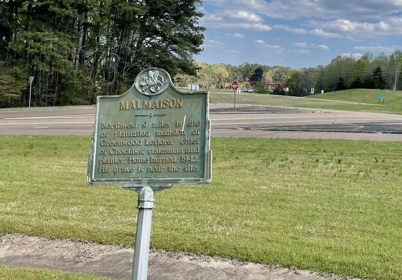
On U.S. 82 at Lexington Street, on the right when traveling west on U.S. 82.
Northwest 9 miles is site of plantation mansion of Greenwood Leflore, chief
of Choctaws, statesman and planter. Home burned, 1942. His grave is near the site. — — Map (db m170285) HM
On George Street (Mississippi Route 17) south of McCain Street, on the right when traveling south.
The Carroll County Tabernacle
was established in 1922 when
T.N. Bloodworth donated nearly
two acres of land to organize a
Methodist revival meeting place.
Funds were raised in 1929 to
erect a meeting place that could
seat 1.000 attendees. The . . . — — Map (db m170283) HM
On County Road 430, 1.1 miles east of County Road 16, on the left when traveling east.
The Applewhite Cemetery, dating
from before the Civil War, was
established by James Applewhite
(1792-1872), a Methodist minister.
Included among the burials here,
the earliest of which is 1856,
are veterans of the War of 1812,
Civil War, and . . . — — Map (db m219768) HM
On Alternate U.S. 45 at Egypt Road (County Road 406), on the right when traveling north on U.S. 45Alternate .
During a raid in the winter of 1864-65, Union Brig. Gen. Benjamin Grierson's cavalry encountered Confederates at Egypt Station on the Mobile & Ohio R.R. The Confederate force included a large number of former Union prisoners of war released on . . . — — Map (db m107541) HM
On West Madison Street (Mississippi Route 8) at South Huddleston Street, on the right when traveling east on West Madison Street.
Estab. in 1909, this is one of Mississippi's oldest community libraries and its first Carnegie library. School superintendent L.B. Reid secured money from Andrew Carnegie Foundation for this facility. — — Map (db m107610) HM
On North Jackson Street at West Hamilton Street, on the right when traveling south on North Jackson Street.
On Natchez Trace. Named for Sam Houston, friend of Joel Pinson, donor of site. Made county seat at creation of Chickasaw Co., Feb. 9, 1836. In 1909 state's first Carnegie library built here. — — Map (db m107556) HM
On North Church Street (Mississippi Route 245) north of Raspberry Street, on the right when traveling south.
In this vicinity on February 22, 1864, Benjamin Grierson ordered McCrillis' Federal brigade into a line of battle opposite Col. Barteau's Confederate brigade of Forrest's cavalry corps. Barteau's men, from the ridge east of the railroad, advanced as . . . — — Map (db m102742) HM
On Mississippi Route 41, 0.9 miles north of Old Highway 41 (Road 133), on the right when traveling north.
On February 22, 1864, Col. Jeffrey Forrest, commanding a Confederate cavalry brigade, was killed in action in this vicinity, near the extinct town of Prairie Mount. Born in 1838, Forrest was the younger brother of Lt. Gen. Nathan Bedford Forrest, . . . — — Map (db m102744) HM
Near Park Lane Drive at South Church Street (Route 245).
As a station on the Mobile and Ohio Railroad, Okolona was the site of a large hospital during the Civil War. In 1862, following the battle of Shiloh, hundreds of wounded Confederates were brought here by train. Those who died were buried in this . . . — — Map (db m102747) HM
On Park Lane Drive south of Adams Avenue, on the left when traveling north.
Founded as Rose Hill 1845. Chartered as Okolona 1850. Named for Chickasaw Indian brave. Scene for three Civil War battles. First Mississippi Cavalry, C.S.A., was organized and equipped here. — — Map (db m102748) HM
On East Monroe Avenue (Mississippi Route 41) east of South Carter Street, on the right when traveling west.
Founded as Rose Hill 1845. Chartered as Okolona 1850. Named for Chickasaw Indian brave. Scene for three Civil War battles. First Mississippi Cavalry, C.S.A., was organized and equipped here. — — Map (db m102749) HM
On North Church Street (Mississippi Route 245) at Laster Drive, on the right when traveling south on North Church Street.
The Okolona Normal and Industrial School was founded in 1902 by Dr. Wallace A. Battle. It educated African Americans through high school and provided industrial training for young adults. At its peak, the school's enrollment topped two hundred . . . — — Map (db m102740) HM
On West Main Street at North Gatlin Street, on the right when traveling west on West Main Street.
Throughout the Civil War, Confederate forces were stationed in Okolona, taking advantage of the agriculturally rich prairie region. With a large supply depot, the town was the object of Union Raids at least twice. On February 22, 1864, Maj. Gen. . . . — — Map (db m102746) HM
On Main Street at Mississippi Highway 15, on the right when traveling west on Main Street.
Chartered February 16, 1884, upon the arrival of the Canton, Aberdeen, & Nashville Railroad, and named for the company's president, William K. Ackerman. Since 1896 County Seat of Choctaw County. — — Map (db m51200) HM
On Mississippi Route 15, 0.1 miles South Pickle Street, on the right when traveling south.
First established as the Ackerman Colored School in the late 1920s, this school was part of the county board of education's plan to consolidate nearly thirty smaller community-based schools from 1931 to 1958. The school's name was changed to the . . . — — Map (db m140791) HM
On State Highway 12 at Fentress-Panhandle Road, on the right when traveling east on State Highway 12.
On Yockanookany, 1/2 mi. S., was built in 1836 water mill of W.R. Coleman of Fairfield Co. S.C., first white settler after Choctaw cession in Treaty of Dancing Rabbit Creek. — — Map (db m51198) HM
On South Commerce Street at East Main Street, on the left when traveling south on South Commerce Street.
James Plemon "J.P." Coleman was born in 1914 in Ackerman. A graduate of George Washington University, he served as district attorney for the Fifth Judicial District from 1940 to 1946 and as a judge from 1947 to 1950. Coleman served as a Mississippi . . . — — Map (db m140790) HM
On South Commerce Street at East Main Street, on the left when traveling south on South Commerce Street.
A fourth generation Choctaw countian, Ray Mabus grew up in Ackerman. In 1987 he was elected governor, the youngest in more than 150 years. Appointed Secretary of the Navy in 2009, he served until 2017, the longest tenure since WWI and the third . . . — — Map (db m140788) HM
Near Lebannon Road, 0.2 miles north of South Union Road, on the right when traveling north.
Begun in 1840 by Rev. William A.
Gray. First building destroyed
by tornado in 1883 and
rebuilt on same site in 1887.
Known for its campmeetings,
held here annually since before
the Civil War. — — Map (db m244510) HM
On Mississippi Route 12, 1.4 miles west of Scott Road, on the right when traveling west.
Established ca. 1836, Shiloh Methodist Church was disbanded by 1875. Remaining members joined other churches in area, including Mt. Airy, Chestnut Grove, and Bethel. Frederick and Margaret Crawford Bagwell, early settlers of Choctaw County are . . . — — Map (db m140785) HM
On South Union Road, 0.1 miles west of Lebannon Road, on the right when traveling west.
Church begun 1865. Campmeeting begun 1872 on land
donated by William Parham
Pollard, 1830s pioneer. Summer
worshippers camped in wooden
tents surrounding the tabernacle.
Cemetery dates to 1840. — — Map (db m244505) HM
On State Highway 413 at LeFleur Circle, on the left when traveling east on State Highway 413.
President pro tem of the state Senate, 1857-65. Defeated by W. McWillie in governor’s race, 1857. Delegate to Charleston Dem. Convention, 1860. Son and grandson of Rev. soldiers. House moved here, 1981, and restored. — — Map (db m87486) HM
On Concord-Bethsalem Road, 0.1 miles north of Highpoint-Weir Road.
Begun ca. 1839 by Rev. James
Martin. Present building of
virgin pine erected in early
1840s. Known as “a mother of
churches,” it supported a session house, a school, and an
annual campmeeting. — — Map (db m244513) HM
Built 1878. this was the home of Col. John Weir (1833-1900), who was twice wounded during the Civil War. Col. Weir, for whom the town of Weir was named, established a water and saw mill complex near here in 1870. Descendants of John and Emily Weir . . . — — Map (db m205434) HM
On Gladney Road, 0.1 miles west of McGee-Thompson Road, on the left when traveling west.
Established 1841, this cemetery
served both Concord Baptist Church
and the now extinct community of
New Prospect, founded in the early
1830s. The church moved to a new
location in 1876. Among those
buried here are Dr. Robert Brown,
New . . . — — Map (db m244512) HM
On Grand Gulf Road, 1.1 miles north of Frazier Road, on the left when traveling north.
The town of Grand Gulf was burned by Admiral David Farragut's men in 1862 and occupied by Porter's Mississippi Squadron on May 3, 1863. The Union occupation followed Confederate Brig. Gen. John Bowen's evacuation of the town after the Battle of Port . . . — — Map (db m105718) HM
On Grand Gulf Road, 1.2 miles north of Frazier Road, on the left when traveling north.
After crossing the Mississippi River and fighting the battle of Port Gibson April 30 - May 1, 1863, Gen. U.S. Grant moved to capture Grand Gulf as a base of operations against Port Hudson, Louisiana. Capturing Grand Gulf on May 3, Grant learned that . . . — — Map (db m105723) HM
On Old Port Gibson Road (State Highway 462) 0.5 miles south of Moulder Road, on the right when traveling north.
After U.S. Grant had planned much of his campaign at Mrs. Bagnell’s, four miles west, he arrived at Rocky Springs on May 7. He remained until May 10, allowing the XV Corps to cross the Mississippi and rejoin the army. McClernand’s XIII Corps arrived . . . — — Map (db m87358) HM
On ASU Drive west of Alcorn Avenue, on the left when traveling west.
Established May 13, 1871, as Alcorn Univ. of Miss on site of Oakland College. Hiram Revels, first president. Reorganized 1878 as Alcorn A. & M. Oldest land-grant college for Negroes in the United States. — — Map (db m117954) HM
On Church Street (U.S. 61) south of Carroll Street, on the right when traveling south.
About 14 miles west at the mouth of Bayou Pierre is the old river port settled by Peter Bryan Bruin in 1788. It was visited by Aaron Burr in 1807. Grant landed there in Vicksburg Campaign of 1863. — — Map (db m103797) HM
On Walnut Street at Farmer Street, on the right when traveling east on Walnut Street.
Built by Samuel and Jacob, prominent Jewish businessmen, this complex forms an unusual group of consecutively constructed buildings of various architectural styles. This house, built in 1901, replaced an earlier one used by Gen. U.S. Grant as his . . . — — Map (db m103796) HM
On Main/Market Street at Carroll Street/Rodney Road, on the right when traveling south on Main/Market Street.
On May 1, 1863, Confederate forces under Brig. Gen. John Bowen clashed with elements of two Union corps commanded by Maj. Gen. U.S. Grant. The battle began around midnight near the Shaifer House four miles west of town. At dawn, the Federals . . . — — Map (db m35542) HM
On Rodney Road, 4.2 miles west of Church Street (U.S. 61), on the right when traveling west.
Following the arrival of Presbyterian missionaries in 1801, Joseph Bullen and James Smylie organized the Bayou Pierre Church at this site in 1807. After part of the congregation formed the Bethel Church southwest of here in 1824, the remaining . . . — — Map (db m70394) HM
On Market Street at Old Mill Road, on the right when traveling south on Market Street.
Established on January 27, 1802, by first General Assembly. Claiborne County was the fourth
county organized in the Mississippi Territory. Carved from Jefferson County (formerly Pickering County), of the Old Natchez District, the county was named . . . — — Map (db m103802) HM
On Old Port Gibson Road (Mississippi Route 462) at Old U.S. 61, on the left when traveling north on Old Port Gibson Road.
As Logan's division marched west toward Grand Gulf on May 3, 1863, M. M. Crocker's division moved toward Hankinson's Ferry. At Kennison Creek, one mile north, the road was blocked by two Confederate brigades. After a spirited skirmish, the . . . — — Map (db m103822) HM
On Farmer Street at Orange Street, on the right when traveling north on Farmer Street.
Founded in 1867 by freedmen. Moved to this site ca. 1896. Played a vital role in the Civil Rights Movement in Port Gibson. Beginning in 1965, the NAACP held meetings here to promote boycotts of local white merchants, who subsequently filed suit. In . . . — — Map (db m103805) HM
On Church Street (U.S. 61) at Walnut Street on Church Street.
Second oldest Presbyterian Church in Old Southwest. Org. April, 1807, as Bayou Pierre Church. Moved to Port Gibson 1827. Zebulon Butler first resident pastor, 1827-60. Present structure built 1859. — — Map (db m103807) HM
On Church Street/Blues Highway (U.S. 61) at Jackson Street, on the right when traveling north on Church Street/Blues Highway. Reported missing.
E. 1 block is birthplace of Irwin Russell. In a short life of 26 years he won fame with his poems in Negro dialect. Author of “Christmas Night in the Quarters” and other poems. — — Map (db m244216) HM
On Church Street (U.S. 61) at Walnut Street on Church Street.
Incorporated in 1811, Port Gibson was first settled by Samuel Gibson, who acquired property along Bayou Pierre from the Spanish in 1788. First known as Gibson's Landing. Port Gibson, selected as the Claiborne County seat in 1803, had the state's . . . — — Map (db m103803) HM
On Grand Gulf Road at U.S. 61, on the right when traveling east on Grand Gulf Road.
W. 2 mi. Built about 1800 by George W. Humphreys, Birthplace of Benjamin Grubb Humphreys (1808-82). Brigadier General, C.S.A. Governor of Mississippi from 1865 to 1868. — — Map (db m103800) HM
On Ingleside Karnac Ferry Road at Shiloh Road, on the right when traveling west on Ingleside Karnac Ferry Road.
On the afternoon of May 3, 1863, Union Gen. U.S. Grant rode west past this intersection to Grand Gulf while Gen. John A. Logan's division turned north toward Vicksburg. Logan was in pursuit of the Confederate force that had abandoned Grand Gulf . . . — — Map (db m173365) HM
On Gunn Drive (U.S. 11) at Old Mill Creek Road, on the right when traveling north on Gunn Drive.
Center of early trade on Chickasawhay River with Gulf Coast. Served during Civil War as location of hospital and prison camp and temporary refuge of the State Government. — — Map (db m84213) HM
On U.S. 11 at County Route 286, on the right when traveling north on U.S. 11.
Running along the west side of this highway to Pachuta & unchanged in its old course. Was original route between Mobile and Paulding, former county seat & prosperous antebellum town in Jasper Co. — — Map (db m100974) HM
On Mississippi Route 50 at Fagan Boulevard, on the right when traveling west on State Route 50.
Named for Mary Holmes of Rockford, Illinois, who dedicated her life to education, this school was founded in Jackson in 1892 by the Presbyterian Church (U.S.A.) Board of Missions for Freedmen as a seminary for African American women. Mary Holmes . . . — — Map (db m107537) HM
On Alternate U.S. 45, 0.5 miles south of Truman Creek Road, on the right when traveling north.
Constructed ca. 100 B.C.-A.D. 400 for the burial of high-status members of an unknown local tribal group. An associated village site lies across the highway to the Southwest. — — Map (db m107534) HM
On State Highway 45, on the right when traveling north.
E. 10 mi. Plantation home built c. 1852 by Geo. H. Young. Octagonal cupola. Gen. N.B. Forrest visited here during the Civil War. National Fox Hunters Assn. organized here. — — Map (db m50160) HM
On Commerce Street at East Broad Street, on the left when traveling south on Commerce Street.
County seat of Clay (formerly Colfax ) County. Chartered November 20, 1858, one year after the arrival of the Mobile and Ohio Railroad. — — Map (db m50298) HM
On Delta Avenue at 1st Street, on the right when traveling north on Delta Avenue.
In 1909 steel magnate Andrew Carnegie was contacted by local women's club member Liliian Waddell about sponsoring a public library. In 1911 the Carnegie Foundation gave $10,000 to the city of Clarksdale to build and equip a public library, with the . . . — — Map (db m89927) HM
On Sunflower Avenue at 1st Street, on the right when traveling south on Sunflower Avenue.
Founded 1868 at crossing of Indian trails and on possible route of De Soto's expedition. Chartered 1882. Coahoma co-county seat, 1892; sole seat since 1936. Home of Gov. Earl Leroy Brewer. — — Map (db m89925) HM
On Martin Luther King Boulevard, 0.1 miles west of Yahoo Avenue, on the right when traveling west.
In the late 1880s a group of African Americans established the Macedonia Missionary Baptist Church near the Sunflower River, under the leadership of their first pastor Minister A. O. Gaston. The church would be moved to this location in 1918, . . . — — Map (db m90063) HM
On West 2nd Street at Riverside Avenue, on the right when traveling east on West 2nd Street.
Harvey Brown Heidelberg was born in Shubuta, Mississippi, on March 7, 1883. Educated in the Shubuta school system and at Southern University in Greensboro, Alabama, Millsaps College in Jackson, and the University of Michigan, he began his career in . . . — — Map (db m89928) HM
On Yazoo Avenue at Martin Luther King Boulevard, on the right when traveling north on Yazoo Avenue.
Established in 1880 as Haven Memorial and
renamed Haven UMC in 1968, the church was
completed in 1923. Clarksdale's first low-income daycare was opened here in 1965
by Lilian Johnson. In 1958, Rev. Theodore
Trammel and Dr. Aaron Henry hosted . . . — — Map (db m174126) HM
Built in 1916, this Italian style villa was designed by Memphis
architect Bayard Cairnes and was the home of local attorney J.W.
Cutrer and his wife Blanche Clark Cutrer, daughter of Clarksdale
founder John Clark. Named Belvoir by the Cutrer . . . — — Map (db m89922) HM
On Delta Avenue, 0.1 miles north of 1st Street, on the right when traveling south.
Originally named Kehilath Jacob, Clarksdale’s first synagogue was
built here in 1910. In celebration of the new temple, a Torah was
shipped from New York City and carried to the temple by members of
the congregation. In 1929, a larger temple was . . . — — Map (db m89923) HM
On Issaquena Avenue at Blues Alley, on the right when traveling south on Issaquena Avenue.
"Father of the Blues" composer and family lived at this site 1903-05. In
Clarksdale Handy was influenced by Delta blues which he collected
and later published as well as his own famous and influential music. — — Map (db m89929) HM
On Blues Highway (U.S. 49/61) at Farrell-Eagles Nest East, on the right when traveling north on Blues Highway.
General, US Senator and
State Governor Founder
of state levee system,
which opened Delta for
cultivation. His plantation home
"Eagle's Nest" is 3 ml. E. — — Map (db m235162) HM
On U.S. 61, 0.3 miles south of Old Pumping Station Road, on the right when traveling north.
On February 3, 1863, Union forces blasted the Mississippi River levee to enable flotilla to use Moon Lake and the Yazoo Pass in a futile effort to reach Vicksburg by way of the Coldwater, Tallahatchie, and Yazoo rivers. Federal forces were stopped . . . — — Map (db m170401) HM
On U.S. 49 at State Route 1, on the right when traveling south on U.S. 49.
The Hernando de Soto expedition to explore and claim the Southeast for Spain crossed the Mississippi River on June 18, 1541, at a point in northwestern Mississippi between Sunflower Landing in Coahoma County to the south and Bass Landing in DeSoto . . . — — Map (db m107620) HM
On 2nd Street at Webb Street, on the left when traveling north on 2nd Street.
Known originally as Farrar's Point, this town was incorporated in 1852. Its name was later changed to Friars Point to honor an early settler and legislator, Robert Friar. Coahoma county seat 1850-1930. — — Map (db m170390) HM
On Rozell Street east of Sheriff Ridge Avenue, on the right when traveling east.
According to local tradition,
New Prospect M. B. Church was
established in the mid 1860s by
a former slave named Katherine
Armistead. New Prospect began as
Independence Church, in which
Methodists and Baptists shared
the sanctuary, each . . . — — Map (db m160395) HM
On State Highway 322 at U.S. 49, on the right when traveling west on State Highway 322.
On this site in 1944, the Hopson Planting Co. and International Harvester, revolutionized modern cotton farming by introducing the first commercially produced mechanical cotton picker. — — Map (db m89921) HM
On West Railroad Avenue at West Marion Avenue, on the right when traveling south on West Railroad Avenue.
On August 5, 1942, a southbound train collided with a westbound bus, killing fifteen bus passengers and injuring many more. The Greyhound bus, traveling from New Orleans to Jackson, stopped at the east side of the Marion Avenue railroad crossing to . . . — — Map (db m50894) HM
On Caldwell Drive (U.S. 51) at West Gallatin Street, in the median on Caldwell Drive.
Named for chief engineer of first Jackson - New Orleans railway. Last spike driven here on March 31, 1858. Town was raided by Grierson in 1863. Shipping point for cattle, truck crops, and lumber. — — Map (db m50893) HM
On Caldwell Drive (U.S. 51) at Downing Street, in the median on Caldwell Drive.
Mississippi State College for Women, first state-supported college for women in the U.S. was founded in 1884 through the efforts of Mrs Peyton, a citizen of Hazelhurst. — — Map (db m50892) HM
On Lake Mike Connor Road at Yates Road, on the left when traveling south on Lake Mike Connor Road.
Covington County was established in 1819, and the county seat was located here in 1829. This courthouse square has been the site of three courthouses, built in 1829, 1854, and 1894. The last courthouse was burned by arson in 1904. After the county . . . — — Map (db m110966) HM
On Elm Street south of Southern Street, on the right when traveling south.
Founded in 1900 by the North Mississippi
Baptist Educational Convention, the
Baptist Industrial College was the first
school in De Soto County to offer
instruction through grade twelve to
African Americans, and one of the
earliest private . . . — — Map (db m170272) HM
A native of Tennessee, Sam Powel
(1821-1902), a Mexican War veteran,
was Colonel or the 29th Tennessee
Infantry. After the Civil War, he
moved to Hernando, where he served
as a circuit judge. Mississippi
representative and senator . . . — — Map (db m170276) HM
On U.S. 51 south of West Commerce Street, on the right when traveling south.
Formed after Chickasaw
Cession of 1832 as town
of Jefferson. Incorporated
in 1837 and named for
Spanish explorer DeSoto.
County seat and site of
oldest academy in Cession. — — Map (db m170275) HM
On West Oak Grove Road, 0.3 miles west of College Street, on the left when traveling west.
Hernando Central School was the first black
school built in DeSoto County during the
equalization period, when the state tried to
preserve segregation by more fairly distributing
resources to black and white schools. Designed
by architect Walk . . . — — Map (db m170273) HM
On West Oak Grove Road at College Street, on the right when traveling west on West Oak Grove Road.
Initially designated as the “Graveyard
Donation." the Springhill Cemetery was
established in 1836 with the founding of DeSoto
County. The cemetery is the burial site of
early county and city officials. African
Americans, members of mutual . . . — — Map (db m170270) HM
Created in 1911 by an act of the Mississippi Legislature, as an agricultural boarding school. Set on 320 acres of donated land. Students from across the United States, Mississippi and several foreign countries have been educated here. In 1996 FCAHS . . . — — Map (db m50077) HM
On Elks Lake Road at Dixie Barn Road on Elks Lake Road.
Citizens of the Dixie community built this structure 1/4 mile southeast of this site in the 1930s to serve as a cafeteria during the Depression era. The log cabin has also served as a meeting place, music hall and classroom. In 2003 the cabin was . . . — — Map (db m56534) HM
On Spencer Street at Milton Barnes Avenue, on the right when traveling north on Spencer Street.
On this site stood the old Mount
Zion Baptist Church, demolished in
1993. Known locally as "The Cvil
Rights Church", the church hosted
a "Freedom School” in 1964 and
many mass meetings during the
Civil Rights Movement. Dr. . . . — — Map (db m118478) HM
On Bonhomie Road, 0.2 miles south of W.S.F. Tatum Boulevard, on the left when traveling south.
These buildings are the remnants of
Bonhomie, a company-owned sawmill town
that thrived from 1915 to 1938. The Tatum
Lumber Company established a mill here
in 1915, drawing laborers and their
families to the area. During its height,
Bonhomie . . . — — Map (db m175897) HM
On Southern Mississippi Drive east of North 31st Street, on the left when traveling east.
The Mississippi Normal College,
now the University of Southern
Mississippi, was established in 1910.
The Demonstration School opened in
1926 during the time when the college
was called the State Teachers College
(1924-1940). The school taught . . . — — Map (db m118399) HM
On East Sixth Street west of New Orleans Street, on the left when traveling west.
The East 6th Street USO Club was built
in early 1942 under the umbrella of the
United Services Organization (USO).
This T-shaped, wood-frame building
included an auditorium, stage, lobby,
restrooms, dressing rooms, and meeting
rooms. Built for . . . — — Map (db m118393) HM
On East Sixth Street west of Mobile Street, on the right when traveling west.
This building, opened in 1921, under the leadership of W.H. Jones, was one of the first modern brick schools in Miss. for blacks. Its alumni have served the state and nation with distinction. — — Map (db m118458) HM
On Broadway Drive (U.S. 11) at Richburg Road, on the right when traveling south on Broadway Drive.
Defeated Jake Kilrain for
heavyweight championship
in a 75 round fight on
July 8, 1889, at Richburg,
3 miles southwest of this
spot. This was the last
official bare-knuckle bout. — — Map (db m175891) HM
On North Main Street at College Street, on the left when traveling north on North Main Street.
Under the direction of Principal J.T. Wallace, this building was Hattiesburg's High School from 1922 to 1959. Built in 1911, the structure acquired its present form when enlarged and remodeled in 1921 to the designs of Robert E. Lee, the city's . . . — — Map (db m39906) HM
On South 28th Avenue at Pinehills Drive, on the right when traveling south on South 28th Avenue.
Established in 1935 during the
Great Depression and known as
Hattiesburg Homestead. Originally
had 25 small farms, each having a
standardized house, fruit trees,
and outbuildings. Some original
buildings still stand. Large lots,
abundant . . . — — Map (db m243148) HM
On Eatonville Road, 0.5 miles west of J.C.Bryant Road, on the left when traveling west.
Organized October 3, 1818.
First pastor,
Norvell Robertson, was a
Revolutionary soldier.
Eight charter members were
of the Granberry, Robertson
and Lee families. — — Map (db m175734) HM
This schoolhouse was established
in the Arena community of Jackson
County by Richard Roberts in the
1890s. Serving grades one through
twelve, the curriculum consisted
of reading, writing and arlthmetic.
The Roberts Schoolhouse closed . . . — — Map (db m118441) HM
On East Fifth Street east of J D Randolph Street, on the right when traveling east.
Organized in 1882 in a wood frame structure on the present site. In 1926, the original building was damaged in a storm. The present structure was built in 1930. The congregation provided food and shelter for Hattiesburg's flood victims in 1963 and . . . — — Map (db m118455) HM
On Monroe Road, 0.2 miles south of Bay Springs Road when traveling south.
Vernon Dahmer (1908-1966), a farmer, businessman, and Civil Rights leader widley known for his belief that "if you don't vote, you don't count" was killed here defending his home and family from a gunfire and firebomb attack on January 10, 1966. . . . — — Map (db m176297) HM
E. 1 mi. Founded 1906 as S. Miss. College. Operated by Bapt. as Miss. Woman's College 1911-40. Coeducational 1953. Name changed to honor William Carey, 18th century English missionary. — — Map (db m39896) HM
On West Pine Street (U.S. 11) at Forrest Street on West Pine Street.
In 1880 near the banks of Gordon Creek, this lawyer, railroad builder and Confederate veteran selected the site for Hattiesburg. Incorporated in 1884, the town was named for Hardy's wife, Hattie Lott. — — Map (db m40050) HM
On U.S. 49, 0.8 miles north of Newton Field Road, in the median.
Area to south, originally part of French Louisiana, became West Florida under England and Spain. After West Florida Revolution annexed by U. S. and in 1812 was added to the Mississippi Territory. — — Map (db m39002) HM
On Sunrise Heights east of Sunrise Road, on the right when traveling east.
1889, W. R. Melton donated a
one-acre tract of land at this site
"for the cause of Religion and
Schools.” The school located here,
which served the Sunrise community,
was a one-room schoolhouse. Zion's
Hill Baptist Church (now Sunrise
Baptist . . . — — Map (db m175643) HM
On Oak Street at Summer Street, on the right when traveling east on Oak Street.
In 1898, E.E. Bolen established a nursery and orchard company in George County. Other wholesale nurseries were established in the early 1900s. The production of ornamental plants, trees and shrubs has since become a thriving commercial industry in . . . — — Map (db m56545) HM
Near River Street, 0.1 miles east of McLeod Avenue, on the right.
In November 1864, Union Brig. Gen. John
Davidson led an expedition from Baton
Rouge toward the Mobile & Ohio R.R. On
December 10, part of his force crossed
the Chickasawhay River and met two
Confederate cavalry regiments at McLeods
Mill. . . . — — Map (db m122344) HM
On Main Street (Mississippi Route 63) at Dietz Avenue, on the right when traveling east on Main Street.
Born in Crystal Springs, Byron Patton
Harrison (1881-1941) came to Leakesville
and taught in the local high school from
ca. 1900 until 1902, when he opened
his first law practice near this area.
Appointed as the town's first Marshall, . . . — — Map (db m122345) HM
On Old Avera Road, 0.1 miles south of Kate James Road, on the right when traveling north.
The Clark Cemetery was established by
W.M.B. Clark (1809-1881) in 1879 with
the burial of С.С. McInnis, born in 1804.
It is the final resting place of a number
of Greene County businessmen, legislators,
county officials and . . . — — Map (db m122334) HM
On U.S. 51 at Camp McCain Road, on the right when traveling north on U.S. 51.
First U.S. Army Division to achieve "Expert Infantry" recognition while training here at Camp McCain November, 1943 to July, 1944.
Distinguished World War II Service in European Theater Campaigns:
Northern France • Ardennes-Alsace
Rhineland • . . . — — Map (db m89898) HM
On U.S. 51 at Camp McCain Road, on the right when traveling north on U.S. 51.
Established 1942 as a training facility for the United States Army during the Second World War and used until 1946. Named for Carroll Co. Miss. native, Major-General Henry Pinckney McCain (1861-1941). — — Map (db m89901) HM
On James H. Biddy Road south of Willis Road, on the right when traveling south.
The “Golden Acorn” Div. was reactivated at Camp McCain, Miss., Dec. 15, 1942, and trained here in 1943. The Div. distinguished itself in the Ardennes, Rhineland & Central Europe during the Battle of the Bulge, assault of the Sauer, Moselle & Rhine . . . — — Map (db m219774) HM
On Loop State Highway 333 at E J Henry Road, on the right when traveling north on State Highway 333.
Main defensive position on Yalobusha River line held by Gen. Pemberton in fall of 1862 to repel Gen. Grant, whose army of 25,000 was moving to attack Vicksburg. — — Map (db m89894) HM
On College Boulevard east of South Line Street, on the right when traveling east.
Lawyer, soldier statesman.
Maj. Gen. in Confederate
Army. U. S. Senator from
1885 to 1898. Made home
here from 1871 to death.
House built shortly before
outbreak of Civil War. — — Map (db m173961) HM
On Dr Martin Luther King Jr Boulevard at Sunset Drive (State Route 8), on the right when traveling north on Dr Martin Luther King Jr Boulevard.
Established July 4, 1836
by union of the towns of
Pittsburg and Tullahoma.
Federal plans to attack
Confederates here stopped
by Gen. Van Dorn's raid on
Holly Springs, Dec., 1862. — — Map (db m173958) HM
Near L D Boone Airport Road, 0.7 miles north of Old Highway 7 (State Route 332), on the left when traveling north.
The Grenada Army Air Field was built
with civilian labor in 1942. It served
the 443rd Air Support Command, 63rd
Troop Carrier Group, 877th Airborne
Engineering Battalion, 10th Troop
Carrier Group, and 809th Air Force Unit.
Following the war, . . . — — Map (db m173915) HM
917 entries matched your criteria. Entries 101 through 200 are listed above. ⊲ Previous 100 — Next 100 ⊳