One of the most visible and longstanding programs of the THC is the Historical Markers Program. This program, which began in the late 1940s, has erected nearly 2,000 markers commemorating sites, persons, and events significant in Tennessee history. ... The markers program is an effective means of introducing highway travelers to Tennessee history.
Moving to McKenzie, Forrest's Brigade captured the 100 - man garrison. Here they spent Christmas Eve, while working parties completed destruction of 4 miles of trestles and bridge between the forks of the Obion River. Other parties completed . . . — — Map (db m52174) HM
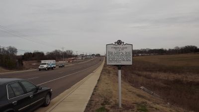
James Monroe McKenzie, entrepreneur and philanthropist, was born in February 12, 1818. In 1860 he donated land for the depot and freight office where the Nashville and Northwestern Railroad crossed the Memphis and Ohio Railroad, resulting in the . . . — — Map (db m81369) HM
Originally founded in 1923 as the black "County Training School" at Smyrna, Tennessee. It was moved to McKenzie in 1927, and named "Webb High School" in honor of John L. Webb. With over 1900 alumni, this school, under the leadership of J. L. Seets . . . — — Map (db m52177) HM
Near this site, in 1842, Bethel
College had its beginning as Bethel
Seminary, founded by the West
Tennessee Synod of the Cumberland
Presbyterian Church. The college
continued here in McLemoresville
until 1872, when it was moved to
McKenzie. . . . — — Map (db m194269) HM
The home of R.E.C. Dougherty stood on the foundations of the house to the north. Here, as Chairman, he held the first meeting of the Carroll County Court, March 11, 1822. Members were, Daniel Barcroft, John Bone, Banks W. Burrow, Edward Gwin, John . . . — — Map (db m51405) HM
Forrest's Brigade, re-armed, and re-equipped with material and horses captured from the Federal storehouses which they had plundered, passed through here enroute to Lexington and their re-crossing of the Tennessee River at Clifton. — — Map (db m51406) HM
First used as Post No. 2 by the 1785 surveyors, a town was later established on November 14, 1823, at John Christmas McLemore's Bluff, on the South Fork of the
Obion River. Goods were shipped down the river until 1854. Buckeye Point, 1 mile east, . . . — — Map (db m52130) HM
On the old McKenzie Road one mile north stands the historic home of Major Jack Hillsman, Civil War veteran, son of pioneer Reddick Hillsman from North Carolina who helped organize Carroll County in 1821. The two-story house, completed in 1869, was . . . — — Map (db m52192) HM
About 1 mile S.W., at the home of a daughter, Mary Johnson Stover, Andrew Johnson died in 1875. He had been a senator from Tennessee; governor of Tennessee; military governor under Federal occupation; vice-president of the United States and 17th . . . — — Map (db m157912) HM
Carter County’s railroad history is the story of three trains – the East Tennessee and Western North Carolina, better known as Tweetsie (1881-1951); the Southern Railroad (1911-1940); and the North American Rayon Steam Engine (1936-1992). The . . . — — Map (db m46561) HM
Cedar Grove Cemetery was originally established as a "colored cemetery" in the early nineteenth century on a tract of land adjacent to a trail that became known as Gap Creek Road. The remote and rocky terrain often required the use of dynamite to . . . — — Map (db m81370) HM
This bridge over Doe River was built early in 1882 at a cost to the county of $3000 for the bridge and $300 for the approaches. The site was chosen by J.J. McCorkle, Wiley Christian and H.M. Rentfro. The committee were Thomas E. Matson, Engineer, . . . — — Map (db m46706) HM
These stones are from the foundation of the academy established Sept. 13, 1806, with Maj. George Duffield, Chairman, Nathaniel Taylor, George Williams, Alexander Doran & John Greer, Trustees. In 1807, Andrew Taylor, Abraham Henry and Reuben Thornton . . . — — Map (db m46607) HM
This independent semi-professional barnstorming Negro baseball team consisted of young men from Elizabethton, Johnson City, Kingsport, Greeneville, Middle Tennessee, Kentucky, Bristol, and Martinsville, Virginia. Because of segregation, their . . . — — Map (db m157901) HM
The Tipton family cemetery, it stood near the homesite of Samuel Tipton (1752-1833) and Susannah Reneau (1767-1853). Col. John Tipton, father of Samuel, deeded it to him in 1784. The house was later the home of a nephew, Isaac P. Tipton, whose . . . — — Map (db m81371) HM
Buffalo Creek Christian Church organized here in 1830. In 1867 Buffalo Male & Female Institute was established by Rev. W.G. Barker on land given by Joshua Williams. Josephus Hopgood of Ky. purchased it in 1875, naming it Milligan College in 1882, . . . — — Map (db m157861) HM
100 yards upstream at a falls stood an old powder mill, where Mary McKeehan Patton made powder for the soldiers who went to King's Mountain, Oct. 7, 1780. Michael Hyder, Sr., signer of the Halifax Petition in 1776 lived here and is buried on the . . . — — Map (db m157864) HM
Bringing Sabine Hill Back to Life Sabine Hill remained in the Taylor family through the latter 1940s. In August 1936, W. Jeter Eason with the Historic American Buildings Survey (HABS) visited Sabine Hill and took detailed photographs . . . — — Map (db m174641) HM
Built about 1818 by Mary (“Polly”) Patton Taylor, widow of Gen. Nathaniel Taylor, of the War of 1812. Both are buried in the cemetery nearby. Among their great-grandsons were Governors Alfred A. and Robert L. Taylor, of Tennessee, and Nathaniel . . . — — Map (db m46387) HM
Born in this house. After attending Washington College and Princeton, graduated from U.S. Naval Academy; serving in the Navy until May 1, 1862, he was appointed brigadier general, U.S. Volunteers. His most conspicuous service was a raid into East . . . — — Map (db m46749) HM
In this neighborhood, on Sept. 26, 1780, Rev. Samuel Doak conducted religious services for the frontiersmen from Virginia and North Carolina, including the Watauga and other settlements in what is now Tennessee, upon the start of their decisive . . . — — Map (db m47152) HM
“The Mansion” was built before 1780 by John Carter and his son Landon. John Carter was chairman of the Watauga Association, a court of five men elected by the settlers of the Watauga Count in May 1772, “to govern and direct for the . . . — — Map (db m47102) HM
"Happy Valley" and Sabine Hill (1778-1853) In 1778, during the Revolutionary War, Andrew Taylor traveled from Virginia to what would later become eastern Tennessee. Taylor settled near this location on the Powder Branch of Buffalo . . . — — Map (db m174640) HM
In this valley, March 17, 1775, the Transylvania Company, led by Richard Henderson, John Williams and Nathaniel Hart, bought from the Cherokee, led by Chief Oconostota, all the lands between the Kentucky and Cumberland Rivers. Over 20 million acres . . . — — Map (db m47196) HM
Understanding Early Inhabitants East Tennessee has been the site of continuous human occupation for thousands of years. Archaeology is an important tool for understanding the early inhabitants of Sabine Hill. Through the study of . . . — — Map (db m174639) HM
400 yards northward and ½ mile northeast of the mouth of Gap Creek, stood Watauga Fort. Here, July 21, 1776, the settlers under Captain James Robertson repulsed the Cherokees under Old Abraham of Chilhowee, and Lt. John Sevier rescued . . . — — Map (db m47187) HM
Here, March 19, 1775, at the Sycamore Shoals, the Watauga Association, Charles Robertson, Trustee, bought from the Cherokee, with Oconostota as chief, lands along the Watauga, Holston and Great Canaway (now New) Rivers. The consideration for the . . . — — Map (db m47180) HM
[Front] Established 1796 named in honor of
Landon Carter
Treasurer of Washington and Hamilton Districts. Speaker of the first State of Franklin Senate, later its Secretary of State, also Lieutenant Colonel of the Washington . . . — — Map (db m45948) HM
6.5 miles northwest, at the mouth of Brush Creek, is a mill built by Jeremiah Dungan in 1779, and continuously operated since then. East of it was a stone fort erected by pioneers of the Watauga Settlement.
Dungan and other pioneers are buried . . . — — Map (db m45997) HM
The Edmund Williams family, pioneers of
the area. owned the original log cabin at
this site. Owner Joshua Williams (1808-1895)
enlarged the house and in 1866 gave land
for Buffalo Institute. Now Milligan College,
it was established by Col. W. . . . — — Map (db m157849) HM
Range School was in operation prior to Oct. 29, 1843. It began as a common school with classes held in a log sheep barn donated by Jonathan Range. In 1901, a one-room frame building was constructed near the original site. A brick building was . . . — — Map (db m53528) HM
On this site in 1796, Braxton Lee and family settled on 640 acres of land along the Cumberland River. In 1807 Lee was commissioned captain of the 20th Tennessee Regiment, Davidson Militia and served as Justice of the Peace for many years. Many early . . . — — Map (db m165440) HM
Located on this three-acre site, the original
42' x 48' brick structure was completed in 1869
at a cost of $12,000. The first-floor offices
and the courtroom on the second floor of the
original structure are still in use today. The . . . — — Map (db m165958) HM
In 1885 J.T. Mosely deeded this property for use as a school or church for African Americans in the Neptune Community. To enhance the quality of public education for African Americans in rural Cheatham County, school officials built Neptune School . . . — — Map (db m151795) HM
Richard and Hazel Head moved their family to Cheatham County in 1966 so their daughter,
Pat, could play basketball. A 1970 graduate of Cheatham County Central High School and a
1975 graduate of the University of Tennessee-Martin, Pat played in the . . . — — Map (db m165476) HM
In the year 1790, Benjamin Darrow began operating a cotton gin and grist mill along
Sycamore Creek, In 1835, on the site of the old Darrow Mill, Robert and Edward Cheatham
along with Samuel Watson erected a powder mill which operated until the . . . — — Map (db m151807) HM
The son of C. Hyde and Vina (Hale) Stump, Thomas Jefferson Stump was born in Cheatham County on February 18, 1870 and was educated in Cheatham and Dickson Counties. On October 27, 1895, he married Henrietta Dozier. They had two sons. Stump engaged . . . — — Map (db m151786) HM
Across the river are the remains of an 800-year old town built by ancient Native American Indians. Almost surrounded by the river, it was also guarded by a high palisade wall. A large temple mound and several smaller mounds surrounded an open plaza. . . . — — Map (db m143825) HM
4.1 mi. northwest, at The Narrows, Montgomery Bell, pioneer industrialist, ironmaster, philanthropist and turfman, built a forge in 1818. Power was obtained by tunneling water through the hill at the top of the Narrows to a point below it where the . . . — — Map (db m143827) HM
Attacking this place at dawn, the Confederate cavalry battalion of Maj. N.N. Cox killed one Federal soldier, captured three officers and 33 enlisted men of "B" Co., 49th Illinois Infantry, and dispersed the rest. They burned the railroad station and . . . — — Map (db m84787) HM
The campus includes the sites of predecessors Henderson Male and Female Institute (1869-1885), West Tennessee Christian College (1885-1897), Georgie Robertson Christian College (1897-1907), and National Teachers Normal and Business College . . . — — Map (db m84788) HM
The town of Henderson was begun on this street in 1860. First known as Dayton, the town's name was changed to Henderson Station during the Civil War. In 1860, Polk Bray opened the first store. Confederates led by A.B. Crook captured the railroad . . . — — Map (db m148495) HM
The Jacks Creek community was settled in the 1820s in Henderson (now Chester) County. It furnished men to the 13th Infantry, 18th Newsome's and 21st Wilson's Calvary units, C.S.A., and was the site of a skirmish 1 mi. N on Sept. 12, 1863, and an . . . — — Map (db m84789) HM
Founded by Rev. & Mrs. A. A. Myers in 1890. First classes held in basement of Congregational Church on site of present Cumberland Gap School; later moved 1/2 mile west to Harrow Hall. Operated as a division of its successor, Lincoln Memorial . . . — — Map (db m80233) HM
The cornerstone for Virginia, Kentucky, and Tennessee is on Three States Peak. The first Virginia - North Carolina (later Tennessee) boundary at this point was surveyed in 1779 by Dr. Thomas Walker and Col. Richard Henderson. The present line and . . . — — Map (db m200623) HM
First explored, 1750; Long Hunters used it until 1760, and Daniel Boone in 1769, cutting the Wilderness Trail through it in 1775. Hosts of pioneers followed even before the road was built in 1796. Postal service was established in 1795 and a post . . . — — Map (db m80232) HM
"If you come through this misery alive... I want you to do something for all those mountain people who have been shut out of the world all these years." These words of President Abraham Lincoln to General O. O. Howard in 1863 proved to be the . . . — — Map (db m35760) HM
On August 3, 1916, record rainfall caused Thompson's Mill Dam to fail, sending a wall of water down the Barren Creek, that destroyed five other dams and killing 24 person, including three entire families. The Barren Creek Dam failure caused the . . . — — Map (db m148785) HM
The 1791 Holston Treaty prohibited settlers from entering the Cherokee lands in the Powell Valley, but Tennesseans holding North Carolina land grants moved into the area. President Washington directed the pioneers to leave the valley. Captains . . . — — Map (db m142725) HM
Butler's Landing Daniel Boone, on his trip to the Western Territory in 1773, followed the old game and Indian trail to where two creeks flowed into the Cumberland River. He referred to them as the Twin or Double Creeks in his journal. On this . . . — — Map (db m74336) HM WM
Free Hill(s), a historic Black community, was established northeast of Celina before the Civil War by former slaves of Virginia Hill. Hill brought her slaves from North Carolina to then Overton County, purchased 2,000 hilly and rough acres, settled . . . — — Map (db m74274) HM
On the knoll 400 yards to the east is the house, built between 1780 and 1782 by this Pennsylvania Quaker, who reportedly migrated here to avoid military service. At the time of its building, this territory was part of Washington District of North . . . — — Map (db m157353) HM
Hermitage Springs was first called Trace because of its location in Big Trace Creek valley. The community existed of only a few scattered residences and a small log church that became known as the Hermitage Springs Church of Christ. Established . . . — — Map (db m177398) HM
Born in a house which stood just across the creek, on Dec. 5, 1901, she was educated at Ward Belmont College, in Nashville, and after further musical study in Washington and New York, she became one of the outstanding operatic sopranos of her day. . . . — — Map (db m40736) HM
Born two miles west April 1891, Arrowood was one of the first American soldiers to be decorated for bravery in World War I. The French government, on Nov. 14, 1917, awarded him the Croix de Guerre for the rescue of several men under his . . . — — Map (db m40735) HM
Tennessee
Cocke County
Established 1797, named in honor of Senator William Cocke (1796, 1797, 1799 to 1805)
An officer of the Revolutionary Army; one of the leaders of the State of Franklin and member of the Legislature of the . . . — — Map (db m40739) HM
Born in Newport on October 13, 1870, Hooper was a successful Cocke County attorney.
He was elected governor and served two terms, 1911-15. His election is attributed to the influence of fusion, the coalition of the prohibition factions of both . . . — — Map (db m61778) HM
Side A
* Jefferson County *
Established 1792: named in honor of
Thomas Jefferson
Secretary of State; formerly member of the Continental Congress; principal author of the Declaration of Independence; later Governor of . . . — — Map (db m81373) HM
Born in a house 500 yards south, he attended W & L University and V.M.I. Enlisted in the French Foreign Legion, August, 1914: incapacitated for infantry service by wounds, May 1915. Transferring to the French Air Force, he helped found the . . . — — Map (db m28228) HM
Located .2 mi. east on the Big Pigeon River is a strategic crossing used by the Cherokees. In Aug. 1782, Gen. Charles McDowell of Burke Co., North Carolina, raised an army of five hundred mounted militia from Morgan District to cross the mountains, . . . — — Map (db m61779) HM
About 2 miles northeast, south of the mouth of Cosby’s Creek, William Whitson, Jr., established a fort on the east bank of Pigeon River in 1783. It was an important frontier outpost, since there was a ford there, and the west bank of the river was . . . — — Map (db m58404) HM
This fort, one of only two known remaining blockhouses in Tennessee, was built about 1787 by James Swaggerty for protection from the Indians. Located on land of his Uncle Abraham Swaggerty, it consists of three levels. The cantilevered structure was . . . — — Map (db m61780) HM
On June 24, 1863, Union forces under Rosecrans overpowered Confederate defenders on Hoover's Gap, commanded by Stewart, Bate, and Bushrod Johnson. This was the beginning of Bragg's withdrawal to Chattanooga. Unknown soldiers who fell in the battle . . . — — Map (db m26052) HM
Originally the site of a pioneer cemetery, many early residents are buried here. In 1866, returned Confederate soldiers, under the leadership of Maj. William Hume and David Lawrence, collected and reinterred here the bodies of soldiers who fell at . . . — — Map (db m24162) HM
Near here, on Garrison Fork, this fort was established, about 1793, for the protection of settlers and travelers to and from the southwest. Until its abandonment, about 1804, it was an important stopping place and administrative center. — — Map (db m26050) HM
Born in Washington, Feb. 16, 1840, where his father, Harvey Magee Watterson, was in Congress, he spent most of his boyhood in a house 100 ft. W. Subsequently Confederate soldier, journalist and political leader, he founded the Louisville . . . — — Map (db m81375) HM
From here, Maj. Gen. W.S. Rosecrans marched his reorganized army against Bragg's Army of Tennessee, in the Shelbyville-Wartrace-Tullahoma area. Fainting with his Reserve Corps and cavalry against Shelbyville, he drove through Hoover's Gap with his . . . — — Map (db m185615) HM
Hereabouts, on June 20, 1941, Maj. Gen. George S. Patton, Jr., personally led his 2nd Armored Division across several fords of Duck River, quickly surrounding and defeating his maneuver opponents in the Manchester vicinity, thus proving that modern . . . — — Map (db m24968) HM
General "Hap" Arnold, WW II Commander of the Army Air Forces, is commemorated by the Air Force research and development installation bearing his name. In 1944, he directed long range planning for air research and development to maintain this . . . — — Map (db m25920) HM
About 1/2 mi. S.W. are remains of stone fortification and moat of ancient and unknown origin. One theory is that it was built by a party of 12th Century Welch voyagers who entered the country via the Gulf of Mexico. Near here also was the capital of . . . — — Map (db m24967) HM
Around 2,000 years ago, Native Americans built a rock and earthen wall around a 50-acre hilltop plateau situated between the Duck and Little Duck Rivers. Here in 1966, archaeological investigations recovered artifactual and radiocarbon data . . . — — Map (db m166938) HM
Maneuvering in this vicinity, June, 1941, the 2nd Armored Division, USA, commanded by Maj. Gen. George Smith Patton, Jr., gave the first demonstration in America of the mobility and decisive power of armor in large-scale combat operations. Maneuver . . . — — Map (db m24969) HM
Coffee County
Established 1836; named in honor of
Major General John Coffee
soldier, surveyor, and close friend of Andrew Jackson. Tennessee troops under his command took a decisive part in the New Orleans Campaign, December 23, 1814 to . . . — — Map (db m150467) HM
Withdrawing to this area after the Battle of Murfreesboro, Gen. Braxton Bragg established his command post near here. Other units went into defensive winter quarters at Bell Buckle, Shelbyville & Wartrace. Here they remained until late June, 1863, . . . — — Map (db m81378) HM
Jane (Jennie) Baillet
1834 - 1918
Emma Adell Baillet
1838 - 1926
Affa Ann Baillet
1850 - 1934
This house was the home of Jane, Emma, and Affa Baillet whose family purchased the property . . . — — Map (db m81379) HM
Originally established in 1926 for training the Tennessee National Guard, this became a Federal training area, Jan. 10, 1941. It was named for Lt. Gen. N.B. Forrest, CSA. Units training here included the 8th, 33rd, 79th & 80th Inf. Divs., 17th . . . — — Map (db m24446) HM
Coffee County
Established 1836; named in honor of
Major General John Coffee
Soldier, surveyor and close friend of Andrew Jackson. Tennessee troops under his command took a decisive part in the New Orleans Campaign, December 23, 1814 to . . . — — Map (db m81380) HM
1 mile SW are buried 407 unknown Confederates. Many of these died in one of the hospitals established here when Tullahoma was headquarters for the Army of Tennessee during the first six months of 1863, following the Battle of Murfreesboro and . . . — — Map (db m24296) HM
Born near here, 1818. Was the only governor of Confederate State of Tennessee. In Congress 1849-51; elected governor, 1857-59-61. When U.S. forces captured Nashville, joined staff of Army of Tennessee for remainder of War. Fled to Mexico, 1865; . . . — — Map (db m61914) HM
South of here, at Bobo's Crossroads, Col. Starnes, 4th Tennessee Cavalry, CSA, then commanding Forrest's Old Brigade, was killed in a skirmish while his brigade was screening the withdrawal of the Army of Tennessee from Tullahoma to the Chattanooga . . . — — Map (db m24188) HM
In the second floor of the original Methodist Episcopal Church here, the first county court met. March 12, 1872, with Isaac Johnson Chairman, and Commissioners W.N. Beasley, John F. Sinclair, J.F. Robertson, David A. James, Asa Dean, Frank F. Wood, . . . — — Map (db m156333) HM
Robert H. "Bob" White was born in Crockett County 10 miles west of this site. He served 15 years as Tennessee's first official State Historian. He had previously served as a college teacher and a consultant to many departments of state government as . . . — — Map (db m52977) HM
3½ miles west, this town, first called Harris' Bluff, later Harrisburg, was the first to be incorporated (Oct. 18, 1821) in west Tennessee. In 1833, the electors for the surrounding four counties delivered their returns here. Industries . . . — — Map (db m52999) HM
With 1874 land grants, Needham Moore, D.H. James, and James Alexander Cox, all descendants of Moses Cox, for whom Coxville was named, the original — trustees established the Cox's Chapel Church of Christ and Cemetery. All three are interred here . . . — — Map (db m180305) HM
Coming to this region from his native Maryland in 1867, David Brandenburg established here the first large-scale strawberry-growing operation in Tennessee. The industry has now become an important factor in the produce economy of the mid-South. — — Map (db m53032) HM
One mile due north is the grave of this veteran of the Revolutionary War who enlisted in 1776, wintered at Valley Forge, served in numerous battles, afterwards fought Indians, and was honorably discharged at Pittsburgh. He moved to what is now . . . — — Map (db m56291) HM
Thomas Sharp Spencer first visited Middle Tennessee in 1776. In the spring of 1778 he became the first Caucasian to clear land, build a cabin, and grow corn in the area. The following winter he resided in a giant hollow sycamore tree south of . . . — — Map (db m84367) HM
Opened in November 1942, one of the first prisoner of war camps during World War II, Camp Crossville housed over 1,500 German and Italian prisoners of war. Designated for officers, the camp held General Pietro Gazzeri, one of the Italian army's . . . — — Map (db m150187) HM
Cumberland Homesteads was one of the largest of
about 100 New Deal Subsistence Homesteads
Communities built to aid “needy, yet worthy
families” with jobs, training, and the purchase
of homes. Architect W. M. Stanton designed the
layout and the . . . — — Map (db m150305) HM
Men of the Civilian Conservation Corps' Company 3464 built this unsuspended bridge
between 1935 and 1940, for a 30-acre impoundment of Byrd's Creek. Three thousand five hundred and fifty cubic yards of dirt and rock were excavated and the core, . . . — — Map (db m157786) HM
In 1817, John Kemmer purchased land here and built Kemmer Stand, a wayside inn, at the intersection of Burke Road. It was two-story, two-section structure that housed many travelers traversing the Cumberland Plateau. At the crest of this hill lies . . . — — Map (db m18194) HM
During the Civil War, Richard Lafayette Flynn and his wife, Ezyiphia, ran an Underground Railroad stop in Cumberland County on Big Laurel Creek assisting Unionist refugees, slaves who had escaped, and soldiers, including Andrews' Raiders, from . . . — — Map (db m184526) HM
Pleasant Hill Was incorporated in 1903. Pleasant Hill Academy, a secondary school, was founded here in 1884 by the American Missionary Association of the Congregational Churches to provide an education for the young people of the Cumberland Plateau. . . . — — Map (db m69229) HM
The house of his birth, Feb. 18, 1796, was on this site. Graduate of Nashville's Cumberland College, 1814, he was a state senator in 1817 and Member of Congress, 1827 to 1841, when appointed Secretary of War. He was nominated for the Presidency by . . . — — Map (db m151191) HM
Jackson Boulevard follows the contour of the 408-acre Belle Meade Plantation Deer Park, established by John Harding in 1833 or 1834. The park became a favorite picnic spot for Nashvillians. By 1854, it held approximately 200 deer and 14 buffalo. A . . . — — Map (db m163928) HM
In this neighborhood, late in the evening of his decisive defeat at Nashville, Hood reorganized his army for withdrawal southward. Lt. Gen. Stephen D. Lee's Corps, supported by Chalmers' Cavalry Division, covered the withdrawal, fighting . . . — — Map (db m54043) HM
In the spring of 1810, Alexander Wilson, noted author, naturalist, and known as the "Father of American Ornithology", visited this area while on a horseback trip over the Natchez Trace to the Mississippi River. While here he lodged with the pioneer, . . . — — Map (db m193470) HM
Two blocks west is the grave of this renowned frontiersman and Goodlettsville’s first citizen. Coming first to the Cumberland Settlements in 1770, he returned in 1780 and built his fort one-half mile north on Mansker’s creek. He repeatedly fought . . . — — Map (db m2428) HM
In 1843, Goodlettsville Cumberland Presbyterian Church was organized near Mansker Creek and was originally known as Mansker Creek Congregation. In January 1848, the church moved to the present location and burned in 1901. The present edifice was . . . — — Map (db m2583) HM
Here, near Mansker’s Lick, Casper Mansker established a station of the Cumberland Settlements in 1780. The road connecting with Nashboro was built in 1781. John Donelson and his family moved here after abandoning his Clover Bottom Station, following . . . — — Map (db m2375) HM
1457 entries matched your criteria. Entries 101 through 200 are listed above. ⊲ Previous 100 — Next 100 ⊳