[Written on the initial marker, provided for context]
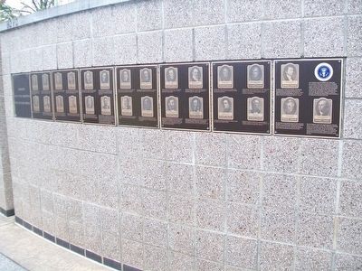
Our Constitution names the President of the United States the Commander in Chief of all the Armed Forces. Presidents who have served in our military are displayed on the following . . . — — Map (db m92400) HM WM
On Montrobles Place east of Los Robles Avenue, on the left when traveling east.
This was the site of ‘Los Robles’, the 400 acre estate of Governor George Stoneman. Here in 1880 President Rutherford B. Hayes was entertained. The first schoolhouse in the San Gabriel Valley, California's first tennis club, and the first municipal . . . — — Map (db m127644) HM
Near Washington Street near Yount Street, on the left when traveling north.
In 1870, the year in which the Groezinger Winery (now Vintage 1870) was built, these flags: the California Bear flag (note how much more primitive in design it is in contrast with the present day version) and the American flag (then with 37 stars) . . . — — Map (db m103540) HM
On Wolfsen Road at 4th Street, on the right when traveling west on Wolfsen Road.
From a narrow, two story brick house in the 1850s, to an expansive hotel with a 167 foot frontage, the Franco American Hotel became one of the largest and finest inns in Northern California. Started by the Frenchman Leon Marniesse in 1855, the hotel . . . — — Map (db m70084) HM
On 13th Street Northwest at K Street Northwest, on the right when traveling north on 13th Street Northwest. Reported permanently removed.
"going into the country"
This urban oasis exists because President Andrew Jackson needed water. The site of excellent springs (a rare commodity in the early city when everyone was dependent on private wells), . . . — — Map (db m29594) HM
On 13th Street Northwest at K Street Northwest (U.S. 29), on the right when traveling north on 13th Street Northwest.
"Going into the country"
This urban oasis exists because President Andrew Jackson needed water. The site of excellent springs (a rare commodity in the early city, when everyone was dependent on private wells), . . . — — Map (db m211818) HM
On Prospect Street Northwest just east of Bank Alley Northwest, on the right when traveling west.
James Wormley, born a free African American in 1819, worked in his family's Hackney carriage business and became a prominent businessman and advocate for education. Georgetown spent $70 on African American education in 1862. After the war, the . . . — — Map (db m234902) HM
On P Street Northwest at Logan Circle Northwest, on the left when traveling east on P Street Northwest.
The house at #4 Logan Circle, built in 1878, was the 1880's home of Senator John A. Logan. In the Civil War, Logan's military valor helped to save the Union. In the postwar era, Logan lived here as a political leader deeply committed to achieving . . . — — Map (db m153985) HM
On Logan Circle Northwest just north of P Street Northwest, on the right when traveling south.
The house at #4 Logan Circle, built in 1878, was the 1880's home of Senator John A. Logan. In the Civil War, Logan's military valor helped to save the Union. In the postwar era, Logan lived here as a political leader deeply committed to achieving . . . — — Map (db m195513) HM
On Broad Street at Ben Hill Street on Broad Street.
Bellevue, home of United States Senator Benjamin Harvey Hill (1823-1882), was built in 1854-55 and typifies the Greek Revival architecture popular in the Old South. Jefferson Davis and other Confederate celebrities were frequent guests here. At the . . . — — Map (db m36996) HM
On Ben Hill Street at McLendon Circle, on the left when traveling north on Ben Hill Street.
Benjamin Harvey Hill, one of the first to proclaim the New South industrial rather than agricultural, was born at Hillsborough, Jasper County, Sept. 14, 1823. Reared on a farm at Long Lane, Troup County, graduated with first honors at the . . . — — Map (db m37158) HM
On Downey Street at Wetherell Street, on the right when traveling north on Downey Street. Reported permanently removed.
Herbert Hoover’s distinguished uncle, Laban Miles, owned this house from 1875-1886, and Herbert would have visited the Miles family here on many occasions. In 1878 Laban Miles moved his family to the Oklahoma Territory where he had been appointed . . . — — Map (db m162578) HM
On Old Georgetown Road (Maryland Route 187) 0.1 miles south of Tilden Lane, on the right when traveling south.
In 1878, after meeting President Hayes at the White House, Henson returned to the Riley plantation to find it much diminished — a scene common after the end of slavery in the South. Upon recognizing Henson, the Widow Riley exclaimed: "Why, . . . — — Map (db m174661) HM
On Park Avenue, 0.4 miles west of South Chestnut Street, on the right when traveling north.
Rutherford B. Hayes
1822—1893
19th President of the United States
In 1879, things were different when the sitting President Rutherford B. Hayes and his friend General William Tecumseh Sherman stopped at the Junction Depot near Second and . . . — — Map (db m223033) HM
On U.S. 302, 0.3 miles east of Mt Clinton Road, on the right when traveling east.
Abel Crawford and son, Ethan Allen Crawford, built the first Crawford House in 1828. It was run by Ethan's brother, Thomas, until sold in 1852. Fires in 1854 and 1859 destroyed the original inn and a replacement. Col. Cyrus Eastman erected the . . . — — Map (db m75236) HM
While his father Capt. John Porter, U.S.N.
Commanded the Portsmouth Navy Yard.
Graduated West Point, July 1845
Distinguished himself and was wounded in War with Mexico
1846-1847.
Instructor of Artillery and Cavalry
West Point . . . — — Map (db m94764) HM
Built in 1879.
Named for the seven U.S. Presidents who attended services here: Ulysses S. Grant, Rutherford B. Hayes, James A. Garfield, Chester A. Arthur, Benjamin Harrison, William McKinley, and Woodrow Wilson.
Deconsecrated in 1953, . . . — — Map (db m14049) HM
Chief Justice, Territory of New Mexico, 1879-1882
Territorial Governor of New Mexico, 1889-1893
L. Bradford Prince's contributions to New Mexico and its people spanned more than forty years of service. He is described by historians as every . . . — — Map (db m185109) HM
On Madison Avenue just south of East 131st Street, on the left when traveling north.
Fred R. Moore - Publisher/Editor, 1858 - 1943
Served as messenger to five Secretaries of the Treasury during the Grant, Hayes, Arthur & Cleveland administrations.
1905 - Became editor of Colored American Magazine
1905 - Appointed . . . — — Map (db m210040) HM
[Mural is on both sides of brick walls on the northern end of town that lie on both sides of the street:]
Wellsville Revitalization Committee Picnic
"Riverside"
Presbyterian Church, USA
525 Riverside Ave.
Founded April 5, 1831 . . . — — Map (db m156060) HM WM
On North Franklin Street just north of East William Street (U.S. 36).
In the mid-19th century
Mrs. Joan Hills Murray conducted
a school in this building.
Among her students was
Rutherford B. Hayes. although
generally known as
“Mrs. Murray’s School” this
edifice was originally built
for Sophia Moore in 1821 as . . . — — Map (db m228240) HM
On East Williams Street (U.S. 36) east of North Sandusky Street. Reported permanently removed.
President
Hayes
Memorial
This tablet marks the birthplace
of
Rutherford B. Hayes
Nineteenth President of
The United States
Born October 4th, 1822
Placed by The Delaware City Chapter
Daughters of American Revolution . . . — — Map (db m241651) HM
On West William Street (U.S. 36) at South Sandusky Street, on the left when traveling west on West William Street.
1817 • Rutherford and Sophia Hayes move to Delaware from Dummerston, Vermont
July 1822 • Rutherford Hayes dies from a fever
October 4, 1822 • Rutherford Birchard Hayes is born in the family home at 17 East William Street
1823 • The Hayes . . . — — Map (db m239852) HM
On East William Street (U.S. 36) east of North Sandusky Street, on the right when traveling west.
At this site on October 4, 1822, Rutherford B. Hayes was born to Sophia Hayes. Hayes’ father, Rutherford, had passed away from a fever three months prior to the birth of his son. The Hayes family were renters on the property, originally owned by . . . — — Map (db m151640) HM
On West Willam Street (Marysville Road) (U.S. 36) at North Franklin Street, on the right when traveling west on West Willam Street (Marysville Road).
William Street United Methodist Church.
The first Methodist class in Delaware was organized
in 1818, later to become William Street United
Methodist Church. The first church building was
dedicated in 1824 directly across N. Franklin . . . — — Map (db m169863) HM
On Granville Street at Columbus Street, on the left when traveling east on Granville Street.
Side A:
Sunbury, Ohio
“An Ohio Stagecoach Town from 1820-1873”
From its beginning in 1816, Sunbury was destined to be a stagecoach town. Anticipating large numbers of stagecoach travelers in Sunbury, the town's founder, Lawrence . . . — — Map (db m18304) HM
On West Broad Street (Old National Road) (U.S. 40) west of South Roys Avenue, on the left when traveling west.
Camp Chase was named in honor of Salmon P. Chase, former governor of Ohio and Secretary of the Treasury in President Abraham Lincoln’s Cabinet.
In July 1861, a small prison was erected at Camp Chase to handle the influx of political prisoners . . . — — Map (db m135244) HM
The Ohio Agricultural and Mechanical College grew out of the Cannon Act of March 22, 1870. “But let it be started,” Governor Rutherford B. Hayes told the Legislature in 1873, “with the intention of making it a great State . . . — — Map (db m16944) HM
On Broad Street (U.S. 40) at High Street, on the right when traveling east on Broad Street.
General Ulysses S. Grant • General Philip Sheridan • Edwin M. Stanton • James A. Garfield • Rutherford B. Hayes • Salmon P. Chase • General William T. Sherman — — Map (db m9895) HM
In 1877, Burton Village merchants purchased this ten-pound Parrott gun from the War Department in Washington, D.C. The cannon is said to have been fired at Lookout Mountain, Tennessee, during the Civil War.
The inauguration of Rutherford B. . . . — — Map (db m122771) HM
On South Detroit Street at West Chillicothe Avenue, on the left when traveling south on South Detroit Street. Reported damaged.
Distinguished citizen, legislator, public servant, and historian born in Bellefontaine, January 23, 1840. A Civil War hero, he was promoted to brigadier general at only 25 years of age. Admitted to the bar in 1866, he practiced in Bellefontaine . . . — — Map (db m75545) HM
On Detroit Road (Ohio Route 254), on the right when traveling north.
A progressive farmer, physician, and legislator, Norton S. Townshend had a residence in Avon from 1830 until his death.
His introduction of field drainage tile significantly increased the productivity of Avon farming.
A well educated country . . . — — Map (db m96124) HM
On Diamond Street at Park Street South, on the left when traveling south on Diamond Street.
Side A: John Sherman 1923-1900
Born in Lancaster, Fairfield County, John Sherman moved to Mansfield to practice law and was elected to Congress in 1854 as one of the first Republicans. In 1861, Sherman was elected to the U.S. Senate. . . . — — Map (db m20684) HM
On 6th Street at Walnut Street, on the right when traveling east on 6th Street.
Side A: Birthplace of Lucy Ware Webb Hayes
First Lady Lucy Ware Webb Hayes was born in this four-room Federal Vernacular house in 1831. Well educated for her time, she attended local schools, took classes in the preparatory department of Ohio . . . — — Map (db m14655) HM
On Cleveland Avenue at McKinley Parkway on Cleveland Avenue.
In honor of Grover Cleveland 22nd President of the United States and President-Elect for the Term 1893 - 1897 and William McKinley Governor of Ohio 1892 - 1896. Later 24th President of the United States 1897 - 1901. Mourners at the Funeral of their . . . — — Map (db m91955) HM
On North Park Street north of Croghan Street, on the right when traveling south.
The Junquindundeh of the Indians, and the Lower Sandusky of the Revolutionary War and War of 1812.
An old neutral town of the Eries used as a refuge on the destruction of the Huron commonwealth by the Iroquois in 1650.
Westernmost . . . — — Map (db m31731) HM
On Cleveland Avenue just north of Buckland Avenue, on the left when traveling north.
Stimulating and Inspiring - these words not only describe the garden but also Al and Diane Gorman, who are known for their dedication to our community. For over 16 years Al served as the Chief Executive Officer of Memorial Health Care System . . . — — Map (db m185156) HM
Has been designated a Registered National Historic Landmark under the provisions of the Historic Sites Act of August 21, 1935. This site possesses exceptional value in commemorating and illustrating the history of the United States. U.S. Department . . . — — Map (db m59354) HM
On Hayes Avenue at Buckland Avenue on Hayes Avenue.
Spiegel Grove was purchased in 1845 by Rutherford B. Hayes’s uncle Sardis Birehard. He named it for the reflecting pools of water which collect after a rainfall. “Spiegel” is the German word for mirror.
Birehard completed the . . . — — Map (db m100714) HM
On Hayes Avenue at Buckland Avenue on Hayes Avenue.
The twenty-five acre estate Spiegel Grove was the home of Rutherford Birchard Hayes, the 19th president of the United States. Spiegle Grove received its name from the German word "spiegel," meaning mirror, describing pools that collect beneath the . . . — — Map (db m59825) HM
On South Washington Street (Ohio Route 100/231) at East Market Street (Ohio Route 18/101), on the right when traveling north on South Washington Street.
General Gibson believed the two most
important things in life were piety and
patriotism. In his creed they were linked
in indissoluble union. His piety was broad
enough to include every creed, his patriotism
wide enough to cover . . . — — Map (db m195296) HM WM
On Mahoning Avenue, 0.3 miles north of West Market Street, on the right when traveling south.
This ornate Victorian/Italianate house was constructed in 1871 as the home of Henry Bishop Perkins, Sr., a civic, business, and political leader of the Western Reserve. During the 19th and early 20th century political figures such as U.S. Grant, . . . — — Map (db m65450) HM
This covered bridge is the one remaining covered bridge in Josephine County. It was constructed by Elmer J. Nelson in 1920 as part of the new Pacific Highway project at a cost of $21,128.65. It was built on Josephine County’s first donation land . . . — — Map (db m63153) HM
On Church Street, 0.1 miles west of 4th Avenue North, on the left when traveling east.
On this site stood the Maxwell House Hotel built by John Overton in 1859. It was destroyed by fire on Christmas Day, 1961. After wartime use as a barracks, hospital and prison, it was formally opened as a hotel in 1869. Presidents Andrew Johnson, . . . — — Map (db m24145) HM
President Rutherford B. Hayes laid its cornerstone in 1877. Designed by Treasury Department architect W.A. Potter, it was occupied in 1882 by collectors of customs and internal revenue, U.S. courts, and Nashville's main post office. Addition to rear . . . — — Map (db m147164) HM
On Mechanic Street east of 24th Street, on the right when traveling west.
The present Tremont House is the third Galveston hotel to bear the name. The island's first Tremont House was built by the firm of McKinney and Williams in 1839 on the southwest corner of Postoffice and Tremont Streets.
An impressive two-story . . . — — Map (db m117389) HM
On West Austin Street at North Vale Street, on the right when traveling west on West Austin Street.
Oldest hotel in East Texas. Frame part built in 1850’s; brick wing added 1864. Among famous guests during river port days of Jefferson were presidents Grant and Hayes, and poet Oscar Wilde.
Restored 1961-63 by Jessie Allen Wise Garden Club. . . . — — Map (db m110989) HM
On Harry Byrd Highway (Virginia Route 7) at North Hill Lane, on the right when traveling east on Harry Byrd Highway.
Three miles north in July 1864, General Jubal Early’s army, returning from his raid on Washington, was attacked by Federal units which forced a passage of the river. On July 18, Colonel Joseph Thoburn led his troops against the Confederates but was . . . — — Map (db m138516) HM
On Main Street (Virginia Route 645) at Richards Lane, on the right when traveling south on Main Street.
Built by Harrison G. Otis. A popular resort hotel during the last quarter of the 19th century, offering health of the 19th century mineral water from its Paradise Spring and the finest in southern cuisine. Presidents Arthur, Grant, Hayes, Roosevelt, . . . — — Map (db m112196) HM
On Valley Pike (U.S. 11) north of Water Plant Road, on the right when traveling north.
Following the successful Confederate surprise attack, Union forces from the 8th and 19th corps formed battle lines across the woods and fields in front of you, in the hopes of slowing the overwhelming Southern assault moving in this direction. . . . — — Map (db m158565) HM
Near Battle Park Drive, 0.4 miles west of Saratoga Drive, on the left when traveling west.
From this position near the Hoge Run creek bed, you have a view similar to that of the Confederate sharpshooters as they saw the Union defensive line along the stone wall by Pritchard's Lane. (Note that the creek bed has been significantly . . . — — Map (db m159170) HM
Near Battle Park Drive, on the right when traveling west.
The First Battle of Kernstown, fought by 10,000 Americans on March 23, 1862, was the first battle waged in the Shenandoah Valley. Throughout the morning, sixteen Union cannon crowned the knolls of Pritchard’s Hill (the high ground immediately north . . . — — Map (db m2169) HM
Near Redbud Road (County Route 661), on the right when traveling east. Reported permanently removed.
"To stop was death. To go on was probably the same; but on we started again." Col. Rutherford B. Hayes, U.S.A. Red Bud Run is as wide and boggy today as it was in 1864. During their attack, the men of the Eighth Corps sank into the . . . — — Map (db m3159) HM
Near Redbud Road, on the right when traveling east. Reported permanently removed.
"The order was to walk fast, keep silent, until within about one hundred yards of the guns, and then with a yell to charge at full speed." Col. Rutherford B. Hayes, U.S.A. At noon on September 19, Union General Sheridan's Sixth and . . . — — Map (db m224318) HM
On Bernard Road, 0.1 miles east of Mathews Lane, on the right when traveling east.
Explore Fort Monroe
400+ Years of History
For over 400 years the point of land known as Old Point Comfort, which now includes Fort Monroe has served as a strategic site at the mouth of the Chesapeake Bay. From its use by Virginia . . . — — Map (db m166579) HM
On Cleburne Boulevard (Virginia Route 100) at International Boulevard (County Route 790), on the right when traveling south on Cleburne Boulevard.
Here on May 9, 1864, was fought the Battle of Cloyd's Farm in which more than 800 gallant men were killed.
Rutherford B. Hayes & William McKinley later presidents of the United States engaged in this battle as officers of the Union . . . — — Map (db m162942) HM
Near Thompson Memorial Drive (Virginia Route 311) at Kessler Mill Drive.
On June 21, 1864, two future presidents marched with Major General David Hunter’s Army of Western Virginia on its retreat from Lynchburg to West Virginia by way of Hanging Rock and the old New Castle Turnpike.
Colonel Rutherford Birchard . . . — — Map (db m15101) HM
On Brownsburg Turnpike (Virginia Route 252) at Hays Creek Road (Virginia Route 724), on the left when traveling south on Brownsburg Turnpike.
On May 26, 1864, Union Gen. David Hunter marched south from Cedar Creek near Winchester to drive out Confederate forces, lay waste to the Shenandoah Valley, and destroy the railroads at Lynchburg. His raid was part of Gen. Ulysses S. . . . — — Map (db m182682) HM
On Battle Park Drive at Saratoga Drive, on the right when traveling west on Battle Park Drive.
The nearly three-hundred-year-old farm in front of you was the site of two major battlefields—First and Second Kernstown—as well as the opening scenes of the Second Battle of Winchester and several smaller engagements. The Hoge family . . . — — Map (db m159184) HM
Near Battle Park Drive, on the right when traveling west. Reported permanently removed.
Colonel James A. Mulligan’s Union command of 1,800 men encamped on these heights on the night of July 23-24, 1864. When Confederate cavalry drove Union cavalry back toward Kernstown on the morning of the 24th, Mulligan deployed two cannon on this . . . — — Map (db m154717) HM
On Battle Park Drive, 0.5 miles west of Saratoga Drive, on the right when traveling west.
Colonel James A. Mulligan's Union command of 1,800 men encamped on these heights on the night of July 23, 1864, when Confederate cavalry drove Union cavalry back toward Kernstown on the morning of the 24th, Mulligan deployed two cannons on the . . . — — Map (db m159178) HM
On National Avenue (State Highway 7), on the right when traveling east.
Near here Early, facing east, took his last position on September 19, 1864. About sundown he was attacked and driven from it, retreating south. Presidents Rutherford B. Hayes and William McKinley served in this engagement on the Union side. — — Map (db m2656) HM
Located across Kanawha River from this point was Civil War camp for Union Army, 1862-64. Site had 56 cabins and parade grounds for 23rd Ohio Vol. Inf. commanded by Col. Rutherford B. Hayes and Lt. William McKinley, future United States presidents. — — Map (db m50397) HM
On West Dupont Avenue (Local Route 60/12) north of West 15th Street, on the right when traveling north.
Site of the largest Civil War camp
in the Kanawha Valley, it was named
for Union Col. A. Sanders Piatt of
the 34th Ohio (Zouaves). Location
along present-day U.S. Route 60 and
the Kanawha River was of strategic
importance to troops of both . . . — — Map (db m137854) HM
On Mt. View Drive at Sheridan Circle, on the right when traveling east on Mt. View Drive.
At the top of the hill is the site of an earthwork fort built by Union soldiers in 1863. During the battle of Sept. 13, 1862, Confederate artillery fired on Charleston from this place. Hayes and McKinley, future presidents, served at the fort. — — Map (db m178789) HM
On Kanawha Boulevard at Court Street on Kanawha Boulevard.
"I direct you to have guns in readiness to fire on Charleston. If rebels come in here Charleston shall be destroyed, for it is the work of disloyal citizens." - Gen. Eliakim P. Scammon, May 112, 1863, to Col. Rutherford B. Hayes. Union . . . — — Map (db m59139) HM
On Kanawha Boulevard at Court Street, on the right when traveling south on Kanawha Boulevard.
Camp White, the main Union camp at Charleston, was located directly across the Kanawha River from here. Col. Rutherford B. Hayes, 23rd Ohio Infantry, occupied the camp and Charleston in March 1863. He ordered his men to build a fort on top of the . . . — — Map (db m59521) HM
Near this site on May 1, 1862, Battle of the Henry Clark House occurred. Lt. Col. Rutherford B. Hayes’ 23rd Ohio Vol. Inf. engaged Confederates under Col. Walter Jenifer. Captain Richard B. Foley, commanding the “Flat Top Copperheads,” the “eyes and . . . — — Map (db m42173) HM
On South Mineral Street just south of Carskadon Lane, on the left when traveling south.
Born in Hampshire County in 1837, the son of a slave owner, he fled Virginia after secession but was elected the youngest member of the Constitutional Convention in 1861. He later served as US assessor, a presidential elector for Grant and Hayes, . . . — — Map (db m196549) HM
On Joel L. Smith Drive at Jersey Avenue, on the right when traveling north on Joel L. Smith Drive.
Alfred Beckley built a mill along
Piney Creek (1838-1840) to spur
economic growth on his wilderness
landholdings. Union Commander and future U.S. President Rutherford
B. Hayes visited site in 1862. It
was destroyed in the 1878 flood . . . — — Map (db m138152) HM
On Seneca Trail (Route 219) 0.4 miles south of Kumbrabow Forest Road (County Route 219/16), on the right when traveling south. Reported unreadable.
Following success at Rich Mountain in July 1861, Federal troops under Gen. Joseph Reynolds built Camp Elkwater to deter Confederates from returning. Fortifications here blocked the narrow valley floor and a turnpike leading to the Virginia Central . . . — — Map (db m239333) HM