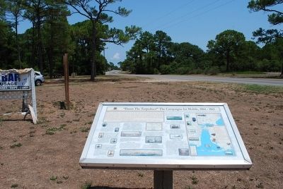
On Fort Morgan Road (Alabama Route 180) 1.2 miles west of Dune Road, on the right when traveling west.
(preface)
"Damn the Torpedoes!" is a familiar battle cry, but there's more to the story! The Mobile Civil War Trail is your guide to military movements and the way of life on and around Mobile Bay in the closing two years of the Civil . . . — — Map (db m87247) HM
“Damn The Torpedoes!” is the familiar battle cry, but there’s much more to the story! The Mobile Bay Civil War Trail is your guide to military movements and the way of life on and around Mobile Bay in the closing two years of the Civil War. Stand . . . — — Map (db m81853) HM
On South Royal Street south of Government Street, on the left when traveling south.
"Damn the Torpedoes!" is a familiar battle cry, but there's more to the story! The Mobile Civil War Trail is your guide to military movements and the way of life on and around Mobile Bay in the closing two years of the Civil War. . . . — — Map (db m87288) HM
On Freedom Farm Road (County Route 59) 0.3 miles south of Route 21, on the right when traveling south.
(obverse)
Representing 10,300 acres with 73 buildings, and 14 structures, the Furman Historic District, encompassing Old Snow Hill Road, Wilcox County Road 59, Burson Road, and AL 21, was placed on the National Register of Historic Places . . . — — Map (db m68184) HM
On February 4, 1861, 2nd Lt. George Bascom, and his detachment of 54 men encamped two hundred yards east of here. Bascom’s mission was to find Cochise, recover a kidnapped boy and return livestock assumed taken by the Chiricahua Apaches. . . . — — Map (db m42008) HM
[Written on the initial marker, provided for context]
Our Constitution names the President of the United States the Commander in Chief of all the Armed Forces. Presidents who have served in our military are displayed on the following plaques. . . . — — Map (db m92389) HM WM
On Louisiana Street at West Markham Street, on the right when traveling north on Louisiana Street.
Capital Hotel was opened on this site in 1877. General and Mrs. Ulysses S. Grant visited Little Rock on April 15, 1880. They were guests of this hotel. — — Map (db m192231) HM
On Main Street west of South Algiers Street, on the right when traveling east.
This hostelry originally built in 1855 by J. L. Sperry of Sperry Flour fame and his partner John Perry. Among early guests whose names appear on old register are Mark Twain, Horatio Alger, Thomas H. Lipton, Henry Ward Beecher, the Rothchilds General . . . — — Map (db m143521) HM
On Highway 145 at Road 400, on the right when traveling west on Highway 145.
Once a part of Mariposa and Fresno Co, this area was traversed by local Indians, fur traders, explorers and gold seekers. The first settlement in what is now Madera County was 16 miles up the Fresno River where James D. Savage located his store, . . . — — Map (db m52241) HM
On Charles (Main) Street (State Highway 140) at 5th Street, on the left when traveling south on Charles (Main) Street.
Built in 1859 by John F. McNamera, destroyed by fire in 1866, rebuilt in 1867 by Herman Schlageter, Presidents Grant & Garfield stayed here, Walter & Clarice Robinson acquired ownership in 1963. — — Map (db m298382) HM
Near Washington Street near Yount Street, on the left when traveling north.
In 1870, the year in which the Groezinger Winery (now Vintage 1870) was built, these flags: the California Bear flag (note how much more primitive in design it is in contrast with the present day version) and the American flag (then with 37 . . . — — Map (db m103540) HM
California’s oldest hotel in continuous operation. Among its century-old archives are names of such notables as Presidents Grant, Harrison, Cleveland; Authors Mark Twain, Bret Harte; Boxers Corbett, Fitzsimmons, actor Gilbert Barry and highwayman . . . — — Map (db m48213) HM
The Sacramento Pioneer Association was founded by men who came to California before 1850 and wished to preserve the memories of the epochal events in the Gold Rush and the earliest days of Sacramento. They purchased much of Pioneer Grove from the . . . — — Map (db m14108) HM
This rancho was a grant from the Mexican goverment to Jose, Maria, Mejia and Juan Perez Pacheco made November 4, 1843 and signed by Manuel Micheltorena, Mexican governor of the Californias.
The grant contained eleven square . . . — — Map (db m247293) HM
Co. E 4th Infantry
Enlisted 1849 • Discharged 1854
Served under Lieut. U.S. Grant
Pioneer packer and rancher
Married Mary J. Fragley 1864
They had a family of nine children:
James, Charles, Alice, Lillian, Helena,
William, Gertrude, . . . — — Map (db m70268) HM
By April 1873, months of peace talks to end the Modoc War had gone nowhere. General E.R.S. Canby found himself caught between President Grant’s Indian Peace Policy and the desire of some settlers to have the Army eliminate the Modoc band. The . . . — — Map (db m63211) WM
On Sonora Road at Dent Street, on the left when traveling west on Sonora Road.
Knight's Ferry was founded by Captain William Knight, a member of Fremont's expedition of 1844. This town was a center of great mining activity and was a distributing point for the mother lode country.
In 1854 the first sawmill and flour . . . — — Map (db m42195) HM
On State Highway 120 at milepost 16.4 at Kennedy Road, on the left when traveling west on State Highway 120.
Picturesque mining center and trading post, 1849, once called Dentville. Early ferry to the southern mines; county seat 1862-72; rare wooden covered bridge reputedly designed by U. S. Grant, brother-in-law of the Dent brothers, 1854; old flour mill, . . . — — Map (db m178066) HM
Along this loop trail, information signs help acquaint you with the General Grant and other notable trees in this impressive sequoia grove. For a more detailed story, purchase the self-guiding brochure at the Grant Grove Visitor Center or from a . . . — — Map (db m82384) HM
On N Reservation Drive, on the right when traveling north.
Home of the Tule River Yokuts, founded in 1873 by Executive Order of President Ulysses Grant. Totaling 56,396 acres, elevation range from 900 to 7,500 feet.
The reservation is governed by the Tule River Tribal Council consisting of nine elected . . . — — Map (db m119158) HM
Near U.S. 285 just north of U.S. 50, on the right when traveling south.
With its rich farmland, natural hot springs, and proximity to busy mining districts, Poncha Springs seemed poised for prosperity. By 1880 the town of 3,000 was receiving eight daily stagecoach arrivals, the Denver & Rio Grande Western tracks were . . . — — Map (db m281068) HM
On Blake Street, on the right when traveling south.
The First National Bank of Denver made its first home here in 1866, with a building constructed for a cost of $45,000. The bank stayed at this location for 10 years, enlarging rooms, installing fancy gas lights, and in 1875, adding a third floor . . . — — Map (db m27508) HM
On Main Street (State Highway 279) at Spring Street on Main Street.
[Three panels on this marker describe the history of Central City, Colorado]
[Panel 1]
Heritage Tourism
Central City is a hidden gem set high in the mountains above the thriving front range hustle and bustle. A trip to Central . . . — — Map (db m51828) HM
On Harrison Avenue (U.S. 24) just north of East 6th Street, on the right when traveling north.
[English] It started back in 1860, when gold was discovered in California Gulch. Thousand's of prospectors soon arrived, and within five years, more than $4 million in gold. By 1880, Leadville had more than 30,000 . . . — — Map (db m289792) HM
On East Main Street (Business Interstate 25) at North Maple Street, on the right when traveling west on East Main Street.
The first stage line began running past this spot in early 1861, before Trinidad developed. Stages carrying passengers and mail took about two weeks between Independence, Missouri, and Santa Fe. Trinidad's first stage stop, located directly across . . . — — Map (db m280687) HM
On University Street just west of Nevada Avenue, on the right when traveling west.
Welcome to Colorado. You have reached a traditional jumping-off point — one used for centuries by people traveling into this region. Native Americans passed this way seasonally on their way to and from hunting grounds. Spanish explorers marched . . . — — Map (db m280682) HM
On Main Street at Main Street, on the right when traveling north on Main Street.
Dorence Atwater grew up in the Terryville section of Plymouth. He enlisted in the union Army in 1861 and was captured by Confederate forces in 1863. In February 1864, he was moved to the infamous Andersonville prison camp in Georgia, . . . — — Map (db m28053) HM
On West Pine Street, on the right when traveling north.
Born in Georgetown on July 1, 1833, Torbert attended local schools prior to his appointment to the West Point Class of 1855. After the outbreak of the Civil War he rose rapidly in rank, serving as a regimental and brigade commander of New Jersey . . . — — Map (db m39375) HM
On Federal Street (Delaware Route 5) near Coulter Street, on the right when traveling south.
Born in Milton on January 19, 1845, he was the son of merchant Robert H. Carey and his wife, Susan. Educated in local schools, he later attended Union College and received his law degree from the University of Pennsylvania. An active supporter of . . . — — Map (db m37728) HM
Near A Street Northeast east of Frederick Douglas Court Northeast, on the left when traveling east.
Orator - Publisher - Statesman
Precursor of the Civil Rights Movement
An ex-slave who rose to world renown as an abolitionist and who served in high government posts under presidents Grant through Cleveland, Frederick Douglass resided in this . . . — — Map (db m69264) HM
On E Street Northwest west of 15th Street Northwest, on the right when traveling west.
”. . . Now I shall plant, if at all, more for the public than for myself.”
John Quincy Adams, diary entry for July 5, 1826, shortly before beginning the first major planting program at the White House. Massachusetts . . . — — Map (db m61677) HM
On 17th Street Northwest at F Street Northwest, on the right when traveling south on 17th Street Northwest. Reported permanently removed.
During the Civil War this building was Headquarters of the United States Army. Major General Winfield Scott, Major General Halleck and later Lieutenant General U.S. Grant had their offices here. It also housed the Bureau of Military Justice, . . . — — Map (db m133739) HM
On Main Drive Northwest 0.1 miles west of 12th Street Northwest, on the right when traveling east.
The home of Thomas Carberry was later sold to James Donald Cameron, former Secretary of War under President Grant. When the U.S. government acquired property here for the Army hospital in 1905, the small stream running through the property was . . . — — Map (db m143703) HM
Near Old North Way Northwest north of Library Walk Northwest, on the right when traveling north.
Old North was the University's main building from 1795 until the completion of the Healy building in 1879. During this period, it was not uncommon for the President of the United States to visit the University for commencement exercises, or for . . . — — Map (db m255242) HM
On P Street Northwest at Logan Circle Northwest, on the left when traveling east on P Street Northwest.
The house at #4 Logan Circle, built in 1878, was the 1880's home of Senator John A. Logan. In the Civil War, Logan's military valor helped to save the Union. In the postwar era, Logan lived here as a political leader deeply committed to achieving . . . — — Map (db m153985) HM
On Logan Circle Northwest just north of P Street Northwest, on the right when traveling south.
The house at #4 Logan Circle, built in 1878, was the 1880's home of Senator John A. Logan. In the Civil War, Logan's military valor helped to save the Union. In the postwar era, Logan lived here as a political leader deeply committed to achieving . . . — — Map (db m195513) HM
On P Street Northwest at Logan Circle Northwest, on the left when traveling east on P Street Northwest.
In November 1860, Abraham Lincoln's election as the nation's first Republican President ignited Southern fears that the country's new balance of political power threatened the institution of slavery in America. Within months, eleven Southern states . . . — — Map (db m153987) HM
On P Street Northwest west of Logan Circle Northwest, on the left when traveling east.
In the Civil War, General John Logan's gallantry earned him mythical stature among the soldiers he led in battle. The memoir of a fellow Union officer depicts Logan's unique inspirational impact:
"When General Grant would ride . . . — — Map (db m153988) HM
On Pennsylvania Avenue Northwest at 14th Street Northwest (Highway 1), on the right when traveling west on Pennsylvania Avenue Northwest.
Site of
Joshua Tennison's Hotel 1818. John Strother 1821. Basil Williamson 1824. Frederick Barnard 1828. Proprietor of Mansion Hotel, Azariah Fuller American House 1833. City Hotel 1843. Willard's Hotel 1847-1901.
Distinguished Guests . . . — — Map (db m6618) HM
On 14th Street Northwest at Pennsylvania Avenue Northwest, on the right when traveling south on 14th Street Northwest.
"This hotel, in fact, may be much more justly called the center of Washington and the Union than either the Capitol, the White House, or the State Department...."
Nathaniel Hawthorne, Civil War reporter for The Atlantic . . . — — Map (db m211824) HM
On 14th Street Northwest (U.S. 1) at Pennsylvania Avenue Northwest, on the right when traveling south on 14th Street Northwest. Reported permanently removed.
"This hotel, in fact, may be much more justly called the center of Washington and the Union than either the Capitol, the White House, or the State Department...."
Nathaniel Hawthorne, Civil War reporter for the Atlantic . . . — — Map (db m10905) HM
On 4th Street Southeast south of Independence Avenue Southeast, on the right when traveling south.
The Presbytery of the Potomac organized the Capitol Hill Presbyterian Church on April 11, 1864 and installed its organizing pastor, the Reverend John Chester, D.D.
This Gothic style building was designed by Washington architect Emil . . . — — Map (db m116128) HM
On 1st Street Southwest at Garfield Circle Southwest on 1st Street Southwest.
The Peace Monument
By Franklin Simmons, 1878
The Peace Monument, also called the Naval Monument, was erected to commemorate the naval deaths at sea during the Civil War. At the top of the 44-foot monument, Grief, sometimes called . . . — — Map (db m110449) HM
On 3rd Street Southwest north of Maryland Avenue Southwest, on the right when traveling north. Reported missing.
“Although a soldier by profession, I have never felt any sort of fondness for war, and I have never advocated it, except as a means of peace,” General Ulysses S. Grant.
Hiram Ulysses Grant, mistakenly listed as Ulysses Simpson Grant on United . . . — — Map (db m29459) HM
On N Street Southwest east of 4th Street Southwest.
Washington's schools and playgrounds were legally segregated from 1862 until 1954. But that didn't stop kids of all backgrounds from playing together. "We didn't understand racial disharmony," said Southwester Gene Cherrico of his childhood on . . . — — Map (db m130916) HM
On Wharf Street Southwest west of District Square Southwest, on the left when traveling north.
Gen. Ulysses S. Grant used this side-wheel steamer as his private dispatch boat, and it hosted the Hampton Roads Conference, President Lincoln's unsuccessful attempt to negotiate an end to the Civil War. — — Map (db m112443) HM
On SW 134th Avenue at SW 170th St, on the right when traveling west on SW 134th Avenue.
Side 1
David Levy Yulee was born at St. Thomas, West Indies, in 1810. He attended school in Virginia from 1819 until 1827 when he went to Micanopy to work on one of the plantations of his father, Moses Elias Levy. He studied law and was . . . — — Map (db m97513) HM
Near West 7th Street just west of Myrtle Avenue, on the right when traveling west.
1 • Mount Vernon Red Maple Planted in honor of the Founders of the City of Sanford, Florida on February 10, 1992. This red maple has been grown from seeds collected at Mount Vernon, President George Washington's beloved home on the . . . — — Map (db m214875) HM
On Marine Street 0.1 miles south of St. Francis Street/Avenida Menendez, on the right when traveling south. Reported permanently removed.
The houses on this post are known as the Officers' Quarters. St. Francis Barracks commanding officer from 1875 to 1883, Brevet Brig. Gen. Frederick Dent, lobbied for this construction. Dent allegedly asked First Lady Julia Dent Grant, his sister, . . . — — Map (db m131196) HM
On Florida 13 at Cordova Street, on the left when traveling east on Florida 13.
(Front):In memory of a distinguished American soldier, citizen of St. Augustine, Fla. Born December 4, 1818. Died December 30, 1885. His courage in battle was conspicuous; His devotion to duty unfailing; His ability recognized by three . . . — — Map (db m220164) HM
On Sunrise Boulevard at Mansion Boulevard on Sunrise Boulevard.
DeBary HallBuilt in 1871 by Baron Frederick de Bary. Born 1815 in Germany of Belgian descent, de Bary came to New York in 1840 as agent for Mumm's Champagne. His estate of many hundred acres here in Florida was a hunting and fishing preserve . . . — — Map (db m46164) HM
On East Main Street at Elliott Street, on the left when traveling east on East Main Street.
Near this site on November 7, 1864 General Sherman received orders from President Lincoln and General Grant to proceed with his plans to march his army from Atlanta to the sea. Thus, the infamous March to the Sea originated in Kingston. This action . . . — — Map (db m35011) HM
On West Court Square at North Court Square, on the left when traveling west on West Court Square.
In Memory of
William Thomas Overby
Confederate Hero.
Enlisted May 31, 1861, Co. A. 7th Ga. Infantry. Wounded at Second Manassas Aug. 30, 1862. Then joined Co. D, 43rd Batln. Mosby's Rangers.
Raided within Federal lines to . . . — — Map (db m70865) HM WM
On Old Plantation Road north of Schoolhouse Lane, on the right when traveling north.
Chartered by the State of Georgia to be trustworthy stewards of the island, the Jekyll Island Authority has been very active in the preservation of the National Historic Landmark District. The rehabilitation of Crane Cottage and Cherokee in . . . — — Map (db m115119) HM
Near Cove Road (Georgia Route 341) south of Gordon Street.
In 1898 the Spanish-American war allowed the South to demonstrate its loyalty and honor under fire. At first, secretary of war Russell A. Alger, was concerned that Southerners would not support the war due to bitterness over losing the Civil War. He . . . — — Map (db m82710) HM
On Gordon Street at Rosencrans Avenue (unopened), on the right when traveling west on Gordon Street.
Rosencrans, born in Delaware County, Ohio, graduated from West Point in 1842 and joined the engineers. He resigned from the U.S. Army in 1845 and became an architect and civil engineer. He commanded the Army of the Cumberland, which was defeated at . . . — — Map (db m82727) HM
Near Red Belt Road south of Lee-Gordon Mill Circle.
Following the Federal victories at Lookout Mountain and Missionary Ridge in November, 1863, the Confederate army withdrew to Dalton, Georgia. The Federal Army at Chattanooga conducted periodic patrols into Walker County to forage and for . . . — — Map (db m76188) HM
On Fort Defiance Road, on the right when traveling south.
Long known to the Indian who used the two great rivers as his highways for trade and war, this junction of the Ohio and the Mississippi was first sighted by Europeans when Marquette and Joliet glided past in 1673. Ten years later La Salle explored . . . — — Map (db m19390) HM
On Shelby Avenue east of North Second Division Street, on the right when traveling east.
May 1861 - Captain, Illinois Adjutant General's office
April 1865 - General-in-chief armies of the United States
"The art of war is simple enough. Find out where your enemy is. Get at him as soon as you can. Strike as hard as you can . . . — — Map (db m188543) HM WM
On Shelby Avenue east of North Second Division Street, on the right when traveling east.
In 1859 the Mattoon Union Agricultural Fairgrounds, encompassing a 90-acre rectangle north and west of this location, was established by the Union Agricultural Fair Association, an organization of Mattoon men. The Union Fairgrounds consisted of . . . — — Map (db m188562) HM
On North Kedzie Boulevard at West Palmer Square, on the right when traveling north on North Kedzie Boulevard.
The section of the boulevard system north of Humboldt Park dates to the late 1870s, when the park first opened. As a result, this entire portion—present-day Kedzie and Logan boulevards and Logan and Palmer squares—originally was called Humboldt . . . — — Map (db m273243) HM
On Belmont Avenue east of 25th Avenue, on the right when traveling west.
[First tablet on the left:]
American Civil War
April 12, 1861 April 26, 1865
Initiating the conflict between the industrial based north and agriculturally based south was the southern bombardment of Fort Sumter on April 12, 1861. This . . . — — Map (db m245161) WM
The American Civil War was a major war between the United States (the "Union") and eleven southern slave states that declared their secession and formed the Confederate States of America, led by President Jefferson Davis. The Union, led by President . . . — — Map (db m272008) HM
Ulysses & Rosie
Ulysses S. Grant was famous for his love of horses. He also had more pets in the White House than any other president, including a gamecock, a parrot, several dogs, and a multitude of horses and ponies. But if you wandered . . . — — Map (db m294090) HM
Near Park Street (Illinois Route 156) at South Library Street, on the left when traveling east.
William R. Morrison, destined to be elected a Colonel during the American Civil War, was of Scotch-Irish descent, born on September 14, 1824. Although raised on a farm, upon his father's remarriage following the death of William's mother, they . . . — — Map (db m136540) HM
William M. Ager •
William Bargrett •
William Bowers •
John P. Buchanan •
William H. Bush •
William H. Albertson •
James Alexander •
John Barnett •
Henry C. Bowman •
David Barnett •
Samuel Brelsford •
James O. Campbell • . . . — — Map (db m161526) WM
On Federal Avenue south of 1st Street NW, on the right when traveling south.
Pleasant Hill, La.
O. A. Wilson, Co. B. 32d Iowa,
Died of wounds received at
Pleasant Hill, La. 1864.
Samuel Robins, Co. B. 32d Iowa,
Killed by a falling building
at Eastpoint, Miss. Jan. 22, 1865.
Lieut. W. C. . . . — — Map (db m89718) WM
With Kansas City becoming a focal point of trade and transportation, the Fort Scott and Gulf Railroad company saw the need for an amusement park to entertain the booming population in the area. The company purchased forty acres to establish Merriam . . . — — Map (db m46898) HM
On Grant Avenue at Riverside Drive, on the left when traveling north on Grant Avenue.
[Battles listed chronologically]
Palo Alto : Resaca de la Palma : Monterey : Cerro Gordo : Contreras : San Antonio : Cherubusco : Vera Cruz : Molino del Rey : Chapultepec : City of Mexico
Belmont ∙ Fort Henry ∙ Fort Donelson . . . — — Map (db m81734) WM
On Esplanade Street at Delaware Street, on the left when traveling north on Esplanade Street.
The law firm of Sherman, Ewing and McCook was on the 2nd floor of a wooden building located in front of this pedestal. All four partners in the firm became general officers in the Union Army during the Civil War. The most famous member of the firm . . . — — Map (db m42154) HM
On Westvaco Road (U.S. 51/62), on the right when traveling south.
Fort Jefferson (also known as Camp Crittenden) was the second of two Union Army posts established in Ballard County in September 1861, following the Confederate occupation of Columbus. Fort Jefferson was first established during the American . . . — — Map (db m18493) HM
On Westvaco Road (U.S. 51/62), on the right when traveling south.
One of first Kentucky positions, Fort Jefferson, occupied by Union troops after Confederate seizure of Columbus, Sept. 1861. From this base, Gen. U.S. Grant directed demonstration against Columbus, Jan. 1862. Troops from here joined in capturing . . . — — Map (db m18519) HM
On Elm Street (U.S. 51/62), on the right when traveling south.
Jan. 1862, Brig. Gen. U.S. Grant sent 5,000 USA troops from Cairo as a demonstration against Columbus, a Confederate stronghold on the Miss. River. Combined forces led by Brig. Gen. J.A. McClernand from Ft. Jefferson at Wickliffe through here to . . . — — Map (db m18487) HM
On Greenup Street north of 6th Street, on the right when traveling north.
From 1859 to 1873 this was the home of Jesse Root and Hannah (Simpson) Grant, parents of General Ulysses S. Grant, 18th President of the United States. Jesse served as the Postmaster of Covington from 1866 to 1872. Gen. Grant's sister, Mary, . . . — — Map (db m174671) HM
Near Old Wilderness Road 0.1 miles south of Camp Wildcat Road (Sheltowee Trace).
(Marker #1)
The Navy In The Mountains
Needing men with military training and political connections to the region, President Lincoln called upon two Navy officers to help organize the war effort in eastern Kentucky.
William . . . — — Map (db m84338) HM
On McKee Road (U.S. 421) 1.3 miles south of Big Hill Road (State Road 21), on the right when traveling north.
(Front): A log tavern down this lane was by 1830s an overnight stop on the Old State Road from Cumberland Gap to Lexington. The older half of building dates back to ca. 1800. During Civil War, Jones Tavern was alternately held by Confederate . . . — — Map (db m30986) HM
On North Spalding Avenue (Kentucky Route 55) at West Walnut Street ( Route 55), on the left when traveling north on North Spalding Avenue.
General Order No. 6, Department of the Army of Ohio, ordered General George H. Thomas, one of the Union Army's most capable generals, to establish his headquarters at Lebanon, Kentucky by November, 1861.
His headquarters were on the second . . . — — Map (db m271704) HM WM
On North 5th Street north of Park Avenue, on the right when traveling east.
On this spot, September 6, 1861, Gen. U.S. Grant read proclamation to citizens of Paducah announcing that the Union Army was taking possession of town "to defend you" against Confederate attack. The "enemy" had taken "possession of and planted his . . . — — Map (db m154943) HM
On North 8th Street (Business U.S. 45) at North H C Mathis Drive (U.S. 45), on the right when traveling east on North 8th Street.
Paducah, Kentucky
McCracken county seat, founded by Gen. William Clark of Lewis and Clark Expedition at confluence of Ohio and Tennessee Rivers. Named for legendary Indian Chief Paduke. Home of Vice Pres. Alben Barkley and birthplace of Irvin . . . — — Map (db m146587) HM
Union Gen. U.S. Grant occupied Paducah on Sept. 6,1861, building a pontoon bridge across the Ohio River to the Illinois shore. Ft. Anderson was built and named after Kentuckian and Ft. Sumter commander Maj. Robert Anderson. Attacked March 25 and . . . — — Map (db m49754) HM
On Richard Roof Drive 0.1 miles west of Fisher Road ( Highway 724), on the right when traveling south.
Welcome to Paducah Ky.
Founded by Gen. William Clark, 1827, at confluence of Tennessee, Ohio Rivers. Named for legendary Chickasaw Indian Chief Paduke. County seat McCracken County. Home Vice President Alben W. Barkley, this airport named in . . . — — Map (db m158861) HM
On U.S. 65 at Ingram Street, on the right when traveling north on U.S. 65.
In early 1863 Federal General U.S. Grant dug a canal here connecting the Mississippi River and Lake Providence. This attempt to use bayous and rivers to bypass Vicksburg failed. — — Map (db m90201) HM
On Lake Street (U.S. 65) 0.2 miles north of Huggins Street, on the right when traveling north.
In early 1863, Union troops commanded by Gen. U.S. Grant dug a canal connecting the Mississippi River and Lake Providence. They camped in an area known as "Soldiers' Rest," which provided a temporary home. — — Map (db m89783) HM
On Eighth Street (State Highway 158) at Main Street (Alexandria-Colfax Highway) (State Highway 8), on the right when traveling north on Eighth Street.
Grant Parish was formed in 1869 from parts of Winn and Rapides parishes by Act 82 of the Louisiana legislature and named for President U.S. Grant.Colfax, incorporated in 1878, was named for Vice President Schuyler Colfax. Once known as Calhoun's . . . — — Map (db m136239) HM
On Jackson Street south of Seventh Street, on the right when traveling south.
Mary King Fulford was a childhood sweetheart of U.S. Grant in Georgetown, Ohio. After her marriage to John D. Fulford, they moved to Memphis, then in 1845 to Thibodaux. She cared for seven children, of whom several died in childhood, and played a . . . — — Map (db m113377) HM
Near Old Highway 80 East at Stafford Drive, on the left when traveling south.
During the summer of 1862, the Federals’ first attempt to bypass Vicksburg by digging a canal across DeSoto Peninsula failed. By January, 1863, the Federals had reoccupied the Louisiana shore opposite Vicksburg. Gen. U.S. Grant ordered work on the . . . — — Map (db m84467) HM
Near Old Highway 80 East at Stafford Drive, on the left when traveling south.
This canal was the third attempt by the Union armies to route gunboats around Vicksburg. Excavation was begun in January 1863, by order of General Grant with two regiments and 1,200 Negro laborers. Two dredge boats were used in February but were . . . — — Map (db m84469) HM
Near Old Highway 80 East at Stafford Drive, on the left when traveling south.
In 1862, powerful Confederate guns along Vicksburg’s high bluffs kept the Mississippi River closed to Federal shipping. Union leaders decided the army should take the city by land to gain control of the river. But General Thomas Williams had a . . . — — Map (db m84468) HM
On State Highway 602 at Crescent Plantation Drive, on the right when traveling east on State Highway 602.
During the Civil War, Crescent was the home of Dr. D.M. and Elizabeth DeMoss Dancy. The house was built in 1832.
When Gen. U.S. Grant's Federal forces occupied Madison Parish, an officer and several soldiers came to Crescent with orders to burn . . . — — Map (db m89054) HM
On April 15, 1865 General Robert E. Lee surrendered to Brigadier General Ulysses Grant. At Fort Buhlow, soldiers quickly fled home, feeling that the end of the war was near. With the threat of a Union advance northward, Brigadier General Joseph . . . — — Map (db m148002) HM
On State Highway 605 0.5 miles south of State Highway 888, on the right when traveling south.
At the time of the Civil War, Franklin Plantation was owned by Dr. Allen T. Bowie. Other planters of this prosperous section of Louisiana owned more property and grew more bales of cotton, but Dr. Bowle's mansion was the grandest. A Confederate from . . . — — Map (db m137160) HM
On Winthrop Street at Wyman Street, on the right on Winthrop Street.
Charlotte Holand Vance Morrill could hold a grudge. When in 1869, her husband Lot lost his seat in the U.S. Senate to Hannibal Hamlin, she blamed James G. Blaine, who from then on she refused to allow in her house. Lot Morrill served . . . — — Map (db m186078) HM
On West Street at Calvert Street, on the right when traveling west on West Street.
"Induced by a dispatch from General Grant, I join you at Fort Monroe as soon as I can come." Lincoln to Secretary Seward, 9:00 am, February 2, 1865 (sent in cipher). February 2, 1865: President Abraham Lincoln arrived at the Annapolis & . . . — — Map (db m38081) HM
On English Avenue 0.2 miles south of Mapes Road, on the right when traveling north.
George Gordon Meade was born on December 31, 1815, during his parents’ temporary residence in Cadiz, Spain. After arriving in the United States, he attended boarding schools in Philadelphia and Baltimore. He graduated from the U.S. Military Academy, . . . — — Map (db m17010) HM
459 entries matched your criteria. The first 100 are listed above. Next 100 ⊳