717 entries match your criteria. Entries 201 through 300 are listed.⊲ Previous 100 — Next 100 ⊳
Alabama Historical Association Historical Markers
The Alabama Historical Association began sponsoring historical markers as early as 1950 and a standing AHA marker committee was created in 1952. There are now more than 500 markers recognizing the state’s long and diverse past. The distinctive design has a deep blue background with text portrayed in gold letters. The insignia at the top is the Alabama flag. The Alabama Historical Commission also has a similar marker program (and separate HMDb series) which has a circular medallion at the top of the marker with an outline of the state inside.
On Church Street at South Street, on the right when traveling south on Church Street.
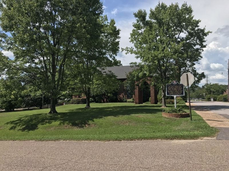
This parish established 1830.
Third oldest in Alabama diocese.
Church consecrated in 1843 by
Leonidas Polk, Bishop of Louisiana,
(later a Confederate general).
Here Nicholas H. Cobbs was chosen
first Bishop of Alabama in 1844. . . . — — Map (db m33747) HM
On Alabama Route 61 at State Street (Alabama Route 14), on the right when traveling north on State Route 61.
was founded here at Salem Church
by 15 messengers from seven
missionary societies.
They met to promote missions,
education and closer cooperation
among Baptist churches of Alabama. — — Map (db m203651) HM
On Alabama Route 60 at County Road 59, on the right when traveling east on State Route 60.
One of state's notable academies.
Called “Rugby” of the South.
It prepared exceptional number
of Alabama leaders.
Founded by Dr. Henry Tutwiler,
one of state's foremost educators.
Closed upon his death.
One of first schools to . . . — — Map (db m203636) HM
On Alabama Route 61 south of Beech Street, on the right when traveling south.
Rev. J. Bancroft, presiding elder, and Rev. J. A. Moore, minister. called meeting of members in 1883 including the names: Hobson, Holcroft, Walker, Scott, Huggins, Moore, True, Sadler. Turpin.
Building committee consisted of Mr. Will Sadler, Mr. . . . — — Map (db m203655) HM
On Alabama Route 61 at Beech Street, on the right when traveling south on State Route 61.
Church organized in 1848
by Rev. Thomas Chilton.
(See other side for charter members)
Sanctuary stands as built in 1849
with original columns of solid poplar.
Education building added in 1959.
Baptist . . . — — Map (db m203652) HM
On Alabama Route 61 at Cemetery Street, on the right when traveling north on State Route 61.
Organized November 16, 1844 under Presbytery of South Alabama by the Rev. Thomas Witherspoon and 21 charter members.
Petition to Presbytery signed by T. A. Borden, Anne Borden, Wm. Ervin, Eliza Ervin, Mrs. Rebeccah Hanna, A. & S. Hardin, Mrs. . . . — — Map (db m203657) HM
On County Road 12 west of State Route 69, on the right when traveling west. Reported damaged.
Discover of the antibiotic, Aureomycin
Son of a beloved country doctor, he carried a dedicated spirit to the frontiers of science
Having won degrees at Alabama, Auburn, Missouri, Harvard and Cornell, he taught at Cornell, . . . — — Map (db m38191) HM
On County Road 12 west of State Highway 69, on the right when traveling west.
1834 - Organized as mission by Rev. Caleb S. Ives for settlers coming here to the Canebrake from Atlantic Seaboard
1844 - made parish of Diocese of Alabama
1851 - this site selected
1853-54 - this building erected — — Map (db m38188) HM
On Kirkland Street, on the right when traveling north.
Created in 1819 by Alabama Territorial Legislature. Named for Patrick Henry of Virginia, colonial statesman and orator: “Give me liberty or give me death.” This area ceded by Creek Indian Nation in 1814 under Treaty of Ft. Jackson. Had . . . — — Map (db m60682) HM
On Alabama Route 27, 0.2 miles west of U.S. 431, on the right when traveling west.
On this site stood the Henry County Peanut Oil Mill, the first
of its kind in Alabama. It was built in July 1916 by two
entrepreneurial Abbeville businessmen-Robert Newman and Mike
Sachar, a Russian Jewish immigrant.
Owners of the new Abbeville . . . — — Map (db m174715) HM
On County Road 25 at County Road 225, on the right when traveling south on County Road 25.
Founded by Laura L. Ward. Building designed and constructed by Jim McCauley on land given by Glass Maybin. Classes began Sept., 1917. Principals who served school were: J. H. Jackson, W. R. Rosser, Felix Blackwood, Sr., and William B. Ward, Sr. . . . — — Map (db m71809) HM
On Walden Drive (Alabama Route 41) at Mills Street, on the left when traveling north on Walden Drive.
Organized in 1891 as Enon Baptist Church, the church was also formerly known as First Baptist Church of Kinsey and Kinsey Baptist Church of Christ. The present name was adopted in 1907. Organizational services were overseen by Rev. Ephraim . . . — — Map (db m235048) HM
On County Road 90, 0.1 miles east of Alabama Route 73, on the right when traveling east.
Ebenezer Baptist Church is the oldest church on the northern end of Sand Mountain. Its origins date back to an 1850s log church and school called Gordon Chapel. Renamed Ebenezer, the church became a member of the Tennessee River Baptist Association . . . — — Map (db m156122) HM
On County Road 326 at County Road 99, on the right when traveling east on County Road 326.
In 1905. the Methodist Episcopal Church. South. authorized Dr. Frank Gardner and his wife, Annie, to begin Flat Rock School In 1911, Flat Rock High School formally opened. It was the only high school on Sand Mountain north of Albertville. The North . . . — — Map (db m156167) HM
On South Andrews Street at Martin Street, on the right when traveling north on South Andrews Street. Reported missing.
In September 1868, J. J. Beeson, a missionary for the Tennessee River Association, organized First Baptist Church. At the time, it was affiliated with Center Point Baptist Church. The congregation initially met in a building used by several other . . . — — Map (db m246850) HM
On South Scott Street north of East Charlotte Avenue, on the left when traveling north.
Robert E. Jones, Jr.
In 1946, Robert E. Jones, Jr. was elected to serve in the U.S. House of Representatives to fill Alabama’s 5th Congressional District seat vacated by John J. Sparkman’s election to the U.S. Senate. Elected to 15 . . . — — Map (db m100042) HM
Planter, tavern operator, newspaper editor, legislator, and land developer, he sought in vain to have the Jackson County seat moved from Bellefont to the settlement that bore his name. After his death in 1863, his widow reached an agreement in 1868 . . . — — Map (db m22260) HM
Near Veterans Drive (Alabama Route 35) north of Lee Highway (U.S. 72), on the right when traveling north.
Robert T. Scott, born in 1800 into a prominent North Carolina family who originally settled in Maryland, founded the Alabama town that bears his name. Between 1848 and 1858, he acquired 1,240 acres of choice land in the heart of Jackson County. . . . — — Map (db m166957) HM
On East Maple Avenue at North Houston Street, on the right when traveling east on East Maple Avenue.
In late December 1863, Union Maj. Gen. John A. Logan established his Fifteenth Army Corps headquarters in Scottsboro, Alabama. On January 11, 1864, by command of Gen. Logan, Brig. Gen. Hugh Ewing, commanding the Fourth Division, was ordered to guard . . . — — Map (db m100044) HM
On Old Mount Carmel Road (County Route 85) at Ohio Avenue, on the left when traveling west on Old Mount Carmel Road.
During the Reconstruction Period following the Civil War, a freedmen’s community was established in this area called Averyville, named for the Pennsylvania minister and successful businessman Charles Avery, a longtime and faithful champion of Negro . . . — — Map (db m108803) HM
Side A One of the Five Lower Towns established by the Chickamauga Cherokees in 1782 under the leadership of Dragging Canoe. Territorial Governor William Blount reported to the Secretary of War in 1792 that: “Crow Town lies on the north . . . — — Map (db m28473) HM
On Lee Highway/John T. Reid Parkway (State Highway 2/72) at County Road 7, on the left when traveling west on Lee Highway/John T. Reid Parkway. Reported missing.
Created by an Act of the Legislature on December 7, 1821, Decatur County was comprised of portions of Madison and Jackson Counties. "Old Woodville," two miles north along County Highway 7, was designated as the County Seat. An 1823-‘24 completed . . . — — Map (db m246851) HM
Organized September 5, 1818 in home of Isaac Brown 3 miles west of Elyton. Met in homes and schoolhouse near Old Jonesboro until 1824. First building erected on site now the 14th Street entrance to Cedar Hill cemetery. Canaan Association (now . . . — — Map (db m37218) HM
On 14th Street South (State Highway 150) south of Fairfax Avenue, on the right when traveling south.
In 1840 he published his study, History of Rise and Progress of the Baptists in Alabama.
Also an evangelist and missionary.
In 1818 moved to Alabama from Carolinas, organizing five churches in vicinity.
President of Alabama Baptist . . . — — Map (db m27025) HM
On Arlington Avenue at 19th Street South, on the right when traveling west on Arlington Avenue.
This house was built in 1906 by architect William E. Benns for H. W. Sweet at a cost of $10,000. The house uniquely blended the Queen Anne and Neo-Classical architectural styles, featuring two identical pedimented entrance porticos supported by . . . — — Map (db m27024) HM
On Eastern Valley Road south of Elrie Boulevard, on the right when traveling south.
Thomas McAdory Owen, son of Dr. William Marmaduke
Owen and Nancy Lucretia McAdory Owen, was born
here on December 15, 1866, at the home of his maternal
grandparents, Thomas and Emily McAdory. A University
of Alabama graduate and lawyer, Owen . . . — — Map (db m215738) HM
On 8th Avenue West at 3rd Street West, on the right when traveling west on 8th Avenue West.
On September 4, 1963, Graymont Elementary
School was the first public school in Birmingham
to be racially integrated. Two brothers, nine and
eleven years old, accompanied by their father,
James Armstrong, along with Reverend Fred . . . — — Map (db m153229) HM
On Old Leeds Road (County Road 64) 0.3 miles south of Mill Springs Road, on the left when traveling south.
Evalina Brown Spencer founded Highlands Day School in 1958, expanding a daycare she operated in her family's backyard. In 1962, Highlands moved from rented space in St. Luke's Episcopal Church to this site, on land donated by Joseph and Virginia . . . — — Map (db m201032) HM
On 2nd Avenue South, on the right when traveling north.
Founded in 1841 at Marion in Perry County by Alabama Baptists, Howard College was named for British prison reformer John Howard.
The liberal arts college moved to this site in 1887 and relocated to its present campus in Homewood, Alabama in . . . — — Map (db m26693) HM
On Richard Arrington, Jr. Blvd North north of 3rd Avenue North.
The county seat of Jefferson County was moved from Elyton to Birmingham in 1873. On this site stood the first Courthouse in the City of Birmingham. The Italianate style structure was designed by architect W. K. Ball. Completed in 1875, the . . . — — Map (db m27095) HM
Territorial legislature designated home of Maj. Moses Kelly (in Jones Valley) as site of first court in this area of Alabama, 1818.
After creation of Jefferson County, 1819, court held at Carrollsville (Powderly) until county seat established . . . — — Map (db m25743) HM
On Highland Avenue South, on the right when traveling west.
Dr. Mortimer Harvie Jordan and his wife, Florence E. Mudd, constructed their home between 1906 and 1908. After service in the Confederate army, Jordan studied medicine in Cincinnati and New York (under Alabama's famous gynecologist, Dr. J. Marion . . . — — Map (db m26743) HM
On Shannon Oxmoor Road at Shades Creek Circle, on the right when traveling west on Shannon Oxmoor Road.
First blast furnace in Jefferson County erected near this site (1863) by Red Mountain Coal and Iron Co. Destroyed (1865) by Federal troops: rebuilt (1873) and second furnace added. Successful experimental run made in Furnace No. 2 (1876) using . . . — — Map (db m27280) HM
On Cumberland Drive east of 4th Avenue South, on the right when traveling east.
Roebuck Springs was the first large residential suburb in Birmingham where planning and development were tied to the automobile, and the first community in the city associated with a golf course development. The 1910 land plan was designed to . . . — — Map (db m26684) HM
On 7th Avenue South at 19th Street., on the right when traveling south on 7th Avenue South.
Front of Marker:
Opened as Alabama Medical College in 1859 in Mobile by Josiah C. Nott and other physicians as part of the University of Alabama. Closed by the Civil War in 1861 it reopened in 1868. Reorganized in 1897, it became the . . . — — Map (db m83838) HM
Birmingham’s first library was organized in 1886 and in 1891 became a subscription library for the general public. In 1908 the Birmingham Public Library Association established a free public library, and the City created an independent Library Board . . . — — Map (db m83856) HM
Near 1st Avenue North (U.S. 11) at 34th Street North, on the left when traveling east.
On March 3, 1899, the United States Pipe and Foundry Company was incorporated consolidating 14 iron and steel foundries in 9 states. One of these foundries, the Howard-Harrison Iron Company of Bessemer, was founded in 1889. In 1911, the Dimmick Pipe . . . — — Map (db m27526) HM
Gen. James H. Wilson, USA, having crossed the Tennessee River with a large force of well equipped cavalry, grouped them here at Elyton.
Their mission: to destroy Alabama's economic facilities for supporting the War.
From these headquarters he . . . — — Map (db m24358) HM
On 21st Way South south of Highland Avenue, on the right when traveling south.
Congregation Beth-El was founded in 1907 on Birmingham's north side. Its leadership came from Knesseth Israel, the city's Orthodox Jewish congregation. Beth-El was established as a modern. yet traditional congregation. Construction on the synagogue . . . — — Map (db m216067) HM
On Highland Avenue, on the right when traveling east.
Built during the Roaring Twenties, the Altamont
Apartments broke ground in 1924 and were
completed in 1925. Designed by architect Jacob E.
Sallte as an apartment/hotel, they were built
to attract affluent businessmen who desired
luxury, . . . — — Map (db m216069) HM
Samuel Massey and his brother - in - law, Duke William Glenn, first came to this Territory in February 1814 with Lt. Col Reuben Nash's Regt. South Carolina Volunteer Militia to help defeat the Creek Indians in the War of 1812. Samuel Massey returned . . . — — Map (db m25088) HM
On Old Springville Road / County Road 30, on the left when traveling north.
On Cahaba Mountain to the NW, springs form a fragile stream that grows as it carves through the steep, rocky terrain of Birmingham suburbs, flowing south on the Gulf Coastal Plain to the Alabama River, at the site of Alabama's first capital, . . . — — Map (db m25110) HM
On Lakeshore Drive at Sherman Circle, in the median on Lakeshore Drive.
Multiple purpose Christian university founded 1841 as Howard College by Alabama Baptists at Marion.
Moved to East Lake, Birmingham, 1887. Established on this campus 1957.
Acquired Cumberland School of Law, Lebanon, Tennessee 1961. . . . — — Map (db m27296) HM
On Main Street (U. S. Highway 11) at Parkway Drive, on the left when traveling east on Main Street (U. S. Highway 11).
A total of 243 houses and 44 duplex units were constructed from 1936 - 1938 at an overall cost of $2,661,981.26. Cahaba residents rented from the government until 1947, when the houses and duplexes were sold to individuals at prices ranging from . . . — — Map (db m26227) HM
Near Main Street (U.S. 11) at Raimond Muscoda Drive, on the left when traveling east.
Organized as Cahawba Baptist Church, 1821 Elder Sion Blythe, pastor Anderson Robertson, Sherwood Holley, deacons John Stovall, Jordan Williams, trustees.
Member of Canaan (now Birmingham) Baptist Association since its beginning in 1833. . . . — — Map (db m78805) HM
On Vestavia Drive east of Beaumont Drive, on the left when traveling east.
Vestavia Hills Baptist Church Vestavia Hills Baptist Church, constituted May 6, 1957, first met at Vestavia Hills City Hall. The church purchased the George Ward estate in 1958. On the property was Ward’s home, “Vestavia,” a replica . . . — — Map (db m83931) HM
On Lee Highway (U.S. 72) 0.7 miles west of County Road 583, on the left when traveling west.
Daniel White, native of North Carolina, purchased land here in 1818, a year before Alabama became a state. His home and stagecoach stop, "Wayside Inn" was a large two~ story log house located on the North side of the highway from this site. In 1834 . . . — — Map (db m29170) HM
On North Court Street, 0.1 miles north of Hermitage Drive, on the right when traveling north.
Built in 1840's, acquired 1857 by Edward Asbury O'Neal. Occupied various times during Civil War by Federals and Confederates. Edward A. O'Neal (1818-1890) attended LaGrange College; lawyer, Colonel of the 26th Alabama Regiment, C. S. A.; appointed . . . — — Map (db m153224) HM
Oldest state~supported
teacher college south of Ohio R.
1830 ~ opened as LaGrange College
(Methodist) at nearby Leighton.
First charted college in state.
1855 ~ moved here and re~named
Florence Wesleyan University.
Flourished until . . . — — Map (db m83970) HM
On Richards Street at Veterans Drive on Richards Street.
Moved here from Atlanta in 1889, this industry made Florence a household word throughout the South. It was the largest wagon factory in the South, reportedly second largest in U.S. with 250 employees and annual production of 12,000 wagons. World War . . . — — Map (db m35772) HM
Cavalry Commander under Andrew Jackson throughout War of 1812:
(Creek War, Pensacola, New Orleans).
Negotiated many treaties ceding Indian lands to U.S.
Made original surveys of Tennessee Valley. — — Map (db m35259) HM
McVay (1766~1851), South Carolina native, built a three room log house at head of Cox's Creek about 1818. Community later called Mars Hill. He was a member of Mississippi Territorial Legislature, delegate to convention of 1819 which framed . . . — — Map (db m35260) HM
On Military Road at Hermitage Drive on Military Road.
Built by Andrew Jackson, 1816~1820. Shortened by 200 miles the route from Nashville to New Orleans for movement of supply wagons and artillery.
Built with U.S. funds and troops.
Followed in part Doublehead's Road from Columbia, Tenn., to Muscle . . . — — Map (db m65290) HM
John McKinley (1780~1852), native of Virginia, prominent attorney, member of Cypress Land Company, built a large three story mansion near this site in 1820's which later burned. McKinley served in Alabama Legislature, U.S. Senate (1826~31); was . . . — — Map (db m28926) HM
On West Alabama Street at South Court Street, on the right when traveling west on West Alabama Street.
A County Older Than the State
Lauderdale County
created Feb. 6, 1818
by Alabama Territorial Legislature (Alabama became a state in 1819).
Named for Col. James Lauderdale, cavalryman under Gen. John Coffee and Andrew Jackson, War of . . . — — Map (db m35185) HM
On Florence Boulevard (U.S. 43) at Sweetwater Avenue, on the right when traveling east on Florence Boulevard.
Home of Major John Brahan, veteran War of 1812.
Major General, Alabama Militia, who owned 4,000 acres here. Built of bricks made on the place, marble mantels imported from Italy, boxwood hedge from London. Named for spring nearby.
Federal and . . . — — Map (db m28404) HM
On Lee Highway (U.S. 72) 0.2 miles west of County Road 69, on the right when traveling west.
Organized June 1818 near mouth of Blue Water Creek by Circuit Riders and became part of
Richland Circuit of Giles County, Tenn. Church later moved to Center Star (Originally known as Masonville) and named Driskel's Chapel until círca 1893, then . . . — — Map (db m156911) HM
On Alabama Route 64 at County Road 89, on the right when traveling west on State Route 64.
Established in 1894 as New Salem Presbyterian Church. Originally affiliated with the Cumberland Presbyterian Church, the first recorded meeting was held 1897, William White, Pastor.
The Church became affiliated with Presbyterian U.S.A. in 1907. . . . — — Map (db m86305) HM
On County Road 568 at County Road 51, on the left when traveling west on County Road 568.
The home-place of Bettie Anne Springer-Thornton lies 1.6 miles north on the east side of Lauderdale County Road 51. This home was originally a one-room log cabin, built between 1892 and 1894 by Levi Patrick Thornton. Two rooms and a dog-trot were . . . — — Map (db m141966) HM
Thousands of Cherokee Indians passed through Waterloo in the 1830s when they were forced by the U.S. government to move West on the "Trail of Tears". Most came by boat from Tuscumbia and camped here to await transfer to larger steamboats. During the . . . — — Map (db m84301) HM
On Sanderson Lane at WC Handy Avenue, in the median on Sanderson Lane.
(side 1)
Courtland Army Air Field (CAAF): Beginnings
Following the onset of WWII the Army Air Corps initiated an ambitious pilot training program. During its most active period, this program would train over 100,000 pilots per . . . — — Map (db m74409) HM
On Sanderson Lane at WC Handy Avenue, in the median on Sanderson Lane.
(side 1)
Courtland Army Air Field (CAAF): Facilities
At its greatest strength, CAAF was home to 4600 officers, enlisted servicemen, and cadets. During the war years it was the largest population center within Lawrence County. Over . . . — — Map (db m74411) HM
The Red Rovers Volunteer military company organized at Courtland 1835 to aid Texas in struggle for independence.
Commanded by Dr. Jack Shackelford, local physician, company derived its name from color of home spun uniforms, made by citizens . . . — — Map (db m84308) HM
On Court Street (County Route 460) at Market Street (Alabama Route 33), on the right when traveling east on Court Street.
Created by Territorial Legislature
in 1818 from lands ceded by
Cherokee and Chickasaw Indians
Named for U.S, Navy hero of War of 1812
Capt. James Lawrence
Fatally wounded, his famous command was
"Don't Give Up The Ship"
County . . . — — Map (db m69672) HM
On State Highway 20 (Alternate U.S. 72) at Bradley Street, on the right when traveling west on State Highway 20.
Built on this site in 1921, the store was a vital enterprise and local gathering place for African American residents of Town Creek and the surrounding rural communities. The Rev. O. C. Stanley owned and operated the business for more than six . . . — — Map (db m192089) HM
On West Thach Avenue at Mell Street, on the right on West Thach Avenue.
Used popularly since the founding of East
Alabama Male College in 1856, the name Auburn
University was made official by the Legislature
in 1960, in recognition of the school's second
century of service to the state and nation.
Originally . . . — — Map (db m183914) HM
On Donahue Drive, 0.3 miles south of West Samford Drive, on the right when traveling south.
On January 31, 1921, farmers gathered on the campus of Alabama
Polytechnic Institute (API), now Auburn University, to form the
Alabama Farm Bureau, now known as the Alabama Farmers Federation.
Former Alabama Extension Service Director Luther . . . — — Map (db m194773) HM
The first African American student entered the library to register at Auburn University at this site. Acting on a court order, Auburn president Ralph Brown Draughon accepted the application of Harold Franklin as the first African American student in . . . — — Map (db m90861) HM
Near Garden Drive, 0.1 miles west of South College Street (Alabama Route 15), on the left when traveling west.
This post oak started growth in 1850 and was 6 years old when East Alabama Male College was established. It was 33 years old when the Alabama Agricultural Station was established, 91 when the nation entered World War II, and over 100 when this site . . . — — Map (db m74430) HM
The Alpha Mu chapter of Sigma Alpha Epsilon was founded on June 15, 1878 at the Agricultural & Mechanical College of Alabama (now Auburn University). John E.D. Shipp came to Auburn as a student determined to organize a chapter at a time when . . . — — Map (db m66726) HM
Near North 5th Street north of Park Road, on the right when traveling north.
Opelika's Board of Parks and Recreation hired W.J. "Bill" Calhoun as its first director in 1951. His top priority was to develop a wooded area behind Northside School. Two adjacent parcels of land were donated by I.J. Scott, Sr. and Winston Smith . . . — — Map (db m210764) HM
On County Road 430, 0.6 miles south of County Road 248, on the left when traveling south.
Northern Boundary of:
British W. Florida 1764-83
Spanish W. Florida 1783-95
Mississippi Territory: 1798-1804
Washington County 1800-12
Clarke County 1812-15
Southern Boundary of:
British Illinois 1764-83
United States . . . — — Map (db m73532) HM
On South Jefferson Street at Market Street, on the right when traveling north on South Jefferson Street.
created Feb. 6, 1818 by Alabama Territorial Legislature from lands ceded by Cherokee Nation 1806 and by Chickasaw Nation in 1816. Named for creek (and its limestone bed), which runs through county.
Few settlers here until Indian treaties.
Athens . . . — — Map (db m29109) HM
On Cross Key Road (County Road 26) at Elkmont Road (State Highway 127), on the right when traveling south on Cross Key Road.
Members of the Barbee family donated this plot of land for the purpose of a community school around 1915. Three years later, a storm damaged the building and the school was relocated to nearby Sampson's Chapel. The Barbee family then deeded the . . . — — Map (db m154188) HM
On Bee Line Highway (U.S. 31), on the right when traveling south.
Hemmed in by superior forces Forrest's fast~moving cavalry raided and destroyed Union supply lines and strong points, captured 2,360 men, valuable stores.
By swift action, surprise and bluff Forrest disrupted Union military plans from Decatur to . . . — — Map (db m29104) HM
On Bee Line Highway (U.S. 31) at Thomas L Hammonds Road, on the right when traveling north on Bee Line Highway.
Generations of African~American families have worshiped here, beginning with services held under a brush arbor prior to the Civil War. In August of 1879, the land for the Oakland Methodist church was deeded to parishioners. In a wooden one-room . . . — — Map (db m29094) HM
On Wall Street (County Road 12) 0.7 miles east of Trone Road, on the right when traveling east.
On land donated by Ed Crosby, a group of African American community leaders had a well dug in January 1955 to provide the people of Gordonville with running water. The Well, the first black-owned water system in Alabama. Initially had just four . . . — — Map (db m207412) HM
On West Tuskeena Street (Alabama Route 21) at South Commerce Street (Alabama Route 97), on the left when traveling west on West Tuskeena Street. Reported missing.
Founded in 1820 by settlers from the Edgefield, Abbeville, and Colleton Districts of South Carolina on property purchased from the U.S. Land Office at Cahaba. Officially named Hayneville in 1831 to honor South Carolina Senator Robert Y. Hayne. . . . — — Map (db m68004) HM
On South Commerce Street (Alabama Route 97) south of Oak Street, on the right when traveling south.
On August 20, 1965, Jonathan Myrick Daniels, a 26-year-old
Episcopal seminarian from Keene, New Hampshire, was shot dead
at point blank range here. He was a graduate of Virginia Military
Institute and was attending Episcopal Theological School, . . . — — Map (db m147601) HM
On North Broad Street, 1 mile north of U.S. 80, on the right when traveling north.
Settled before 1820 by planters from South Carolina and Virigina. First called McGill's Hill, it was incorporated, 1832, as Lowndesboro in honor of William Lowndes. There was a brief skirmish here between Forrest's troops and Wilson's raiders, April . . . — — Map (db m70933) HM
On Alabama 21, 0.1 miles south of Langston Hughes Road, on the left when traveling south.
Organized in 1850 as Shiloh Baptist Church on the Pritchett
Plantation, later known as the R.D. Spann Place on Highway
21, North, 3 miles north of Hayneville. Primitive later added
to the name. Building originally constructed of logs, then
a . . . — — Map (db m217245) HM
On U.S. 80 at Trickum Cutoff Road, on the right when traveling west on U.S. 80.
The roots of this house of worship date to 1868 when 26 African American members of Mount Gilead Church left to form their own congregation. The present building was constructed in 1901, with several enlargements and renovations throughout the . . . — — Map (db m104068) HM
On County Route 69 near LittleTexas Road (County Route 71), on the right when traveling south.
The "Little Texas" Methodist Tabernacle and Campground, site of camp meetings since the 1850's. The Tabernacle - a place of worship - was built by black and white settlers of the area.
The original structure was made of hand-hewn timbers, wooden . . . — — Map (db m229084) HM
On County Route 69, on the right when traveling south.
Union Christian Church began in spring 1897, under a brush arbor approximately 4 miles northeast of this site. Two
acres were donated by future Congressman Charlie W. Thompson, of Tuskegee. Rev. John Allen Branch was the
first minister. The . . . — — Map (db m59636) HM
On Union Camp Road, 0.2 miles north of Cooper Lane, on the right when traveling north.
The camp on this site served as a military hospital, a camp of conscription and instruction, a supply depot, and a cemetery during the War Between the States. At one time, there were hundreds of headstones and rocks marking the final resting place . . . — — Map (db m73529) HM
On Old Federal Road (County Road 8), on the right when traveling west.
Unmarked grave in Cubahatchie Baptist Church Cemetery. Half-blooded Creek Indian, planter, soldier, Indian agent,
and historian, Stiggins lived on a nearby farm fronting the Federal Road from 1831 until his death. There he wrote "A . . . — — Map (db m60534) HM
On Alabama Route 199 at Old Chehaw Road, on the right when traveling north on State Route 199.
In July 1864, Union Gen. Wm. T. Sherman sent Maj. Gen. L.H. Rousseau
to Alabama with 2500 cavalry to cut the rail link remaining to
Confederates defending Atlanta: the West Point & Montgomery
Railroad. On 18 July, 3 Union units arrived at Chehaw . . . — — Map (db m223941) HM
On Lee Highway/John T Reid Parkway (U.S. 72) at Gurley Pike, on the right when traveling west on Lee Highway/John T Reid Parkway.
Located on land owned by John Gurley, pioneer settler, and named for him. His son, Capt. Frank B. Gurley, became a Confederate hero as a member of the 4th Ala. Cavalry. The settlement that developed around the water tank on Memphis and Charleston . . . — — Map (db m30574) HM
Near Ford's Chapel Drive at Autumn Drive, on the right when traveling north.
The Western Conference, Oct. 1-7, 1808 in Williamson County, Tenn., sent James Gwinn to the "great bend" of the Tenn. River. Gwinn organized at the home of Richard and Betsy Ford, the first Methodist Society of the six in the Flint Circuit. This . . . — — Map (db m78121) HM
On Huntsville Highway (U.S. 231/431) at Hunter Road, on the right when traveling south on Huntsville Highway.
In 1807, Major Thomas Freeman,
Deputy U.S. Surveyor, established a
marker here on the state line and
began surveying south toward the
middle of the state. This line, known
as the Huntsville Meridian, is the
reference for all property . . . — — Map (db m154301) HM
On U.S. 231/431, 1 mile south of Grimwood Road (County Road 100), on the right when traveling south.
Near here lived
John Williams Walker (1783-1823)
President of Alabama's First
Constitutional Convention 1819
and Alabama's first U.S. Senator
1819-1822. Walker County in northwest
Alabama, created 1823, was named in
his honor. Four . . . — — Map (db m154289) HM
On Franklin Street SE north of Lowe Avenue SE, on the left when traveling north.
In this house John Hunt Morgan was born June 1, 1825. This dashing cavalry leader of the Confederacy was killed at Greeneville, Tenn., Sept. 4, 1864. This house, built in 1823, was the home, 1849-1949, of the heirs of Stephen Neal, Madison . . . — — Map (db m32556) HM
On Poplar Avenue NW at Yukon Street NW, on the right when traveling west on Poplar Avenue NW.
After the Civil War, the future of African-Americans in the United States Army was in doubt. In July 1866, Congress passed legislation establishing two cavalry and four infantry regiments to be made up of African-American soldiers. The mounted . . . — — Map (db m75092) HM WM
On Greene Street Southeast at Eustis Avenue Southeast, on the left when traveling south on Greene Street Southeast.
On this site stood the Calhoun House, used as a Federal Courthouse, where desperado Frank James was tried and found not guilty, by jury trial, on April 25, 1884, for robbery of a government payroll near Muscle Shoals, Alabama, March 11, 1881. One of . . . — — Map (db m27771) HM
On Ivy Avenue SW at SW 1st Street, on the right when traveling south on Ivy Avenue SW.
Brahan Spring Park, formerly Beaty's Spring, was the site of Camp Beaty, the encampment of Andrew Jackson's army of volunteers and militia after their celebrated non-stop march of "32 miles in 5 hours" from Fayetteville, Tennessee on October 11, . . . — — Map (db m105131) HM
On Lincoln Street Southeast at Randolph Street Southeast, on the right when traveling north on Lincoln Street Southeast.
This church which had its origins in the Cumberland Presbyterian Church was first mentioned at a meeting of the Presbytery on April 7, 1812. It became known as First Cumberland Presbyterian Church of Huntsville, Alabama. In 1828 the first building . . . — — Map (db m27782) HM
717 entries matched your criteria. Entries 201 through 300 are listed above. ⊲ Previous 100 — Next 100 ⊳