On Strand Road (Road 106) 0.3 kilometers south of Wendell Avenue, on the left when traveling south.
What's in a name?
Portmarnock is names after St Marnock, a prominent missionary who founded a church in the area.
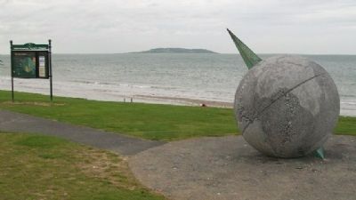
The Velvet Strand and Aviation History
It was from the Velvet Strand, on 24th of June 1930, that the famous Australian . . . — — Map (db m83440) HM
On Main Street (Leinster Route R405) 0.2 kilometers south of Maynooth Road (Leinster Route R405), on the right when traveling south.
By 1855 the Mass House which had served the people of Celbridge for over one hundred years was in a poor state of repair. It was situated in front of the present church. It was known as a Mass House as Mass was the only service allowed in it. . . . — — Map (db m143176) HM
On Maynooth Road (Leinster Route R405) at Shackleton Road, on the left when traveling south on Maynooth Road.
The Irish Poor Law System
The origins of the Irish Workhouse system lie in the Irish Poor Law Act passed by the parliament of the United Kingdom in 1838.
The Act, entitled an Act for the More Effectual Relief of the Poor in Ireland was . . . — — Map (db m143231) HM
On Main Street (Leinster Route R405) just west of Maynooth Road (Leinster Route R405), on the left when traveling south.
"Along the banks of that river, amid the groves and bowers of Swift and Vanessa, I grow convinced that I was right."
Henry Grattan
INTRODUCTION
Celbridge (Cill Droichid: 'Church by the Bridge' originally angicised to . . . — — Map (db m143210) HM
Tá Eastát Castletown, Cill Droichid i mbaile clúiteach Arthur Guinness agus tailte cúirtéireachta Jonathan Swift, údar Gulliver's Travels.
Lonnaithe sa stair chlúiteach seo, is é Castletown an teach mór ar stíl Phallaidiach is mó clú . . . — — Map (db m143409) HM
On Clane Road (Route R403) just west of Tea Lane, on the left when traveling west.
• The original Celbridge Manor was built at the beginning of the 18th century by Bartholemew Van Homrigh, a wealthy Dutch merchant, who was Purchaser of Provisions and Commissioner of Ordnance for the victorious forces of King William III.
• . . . — — Map (db m143209) HM
On Maynooth Road (Route R405) at Shackleton Road, on the left when traveling south on Maynooth Road.
Pray
for the souls
of all
poor and afflicted
whose bodies
have been laid
in this cemetery
since 1841
R.I.P.
—————————————
This Holy Ground is . . . — — Map (db m143226) HM
On Maynooth Road (Leinster Route R405) at Shackleton Road, on the left when traveling south on Maynooth Road.
Through this gate from 1841 onwards passed the
bodies of deceased inmates of the Celbridge Union
Workhouse on their way to burial in these
grounds. The Workhouse System conducted its
burials in a characteristically efficient manner
and . . . — — Map (db m143227) HM
On Main Street (Leinster Route R405) 0.2 kilometers south of Maynooth Road (Leinster Route R405), on the left when traveling south.
C Company, 1st Battalion,
Dublin Brigade, I.V.
Four Courts & Interned
in Stafford & Frongoch 1916
Unveiled by Cllr. Frank O'Rourke
21st February 2016 — — Map (db m143171) WM
On Main Street (Leinster Route R405) 0.2 kilometers south of Maynooth Road (Leinster Route R405), on the right when traveling south.
Erected by his numerous friends of all classes
and of all creeds in memory of
Sir Gerald Dease, K.C.V.O.
Born 17th July 1831, died 18th October 1903.
A man of stainless honour, who used his high position
and great . . . — — Map (db m143180) HM
On Main Street (Leinster Route R405) close to Maynooth Road (Leinster Route R405), on the left when traveling south.
The origins of our town
In ancient times there were five principal roads in Ireland. One of these roads was known as the "Slí Mhór". It extended from Dublin Bay to Galway Bay and forded the river Liffey in Celbridge just below where the Mill . . . — — Map (db m143545) HM
In 1740-41, famine spread across Europe, following a great frost[,] the so-called 'Black Spring'. Rivers froze, and water-powered mills that ground grain into flour stopped working. This led to a flour scarcity, hoarding by wholesalers, . . . — — Map (db m143165) HM
On Main Street (Leinster Route R408) just west of Mill Street (Leinster Route R148), on the right when traveling west.
Muiris Mac Gearailt a thóg 1176 : rinneadh méadh air ó am go ham ina dhiaidh sin. [?] dtús na 14ú aoise ba é príomháit chónaithe ghearaltach chill dara é, chuir "Tomás an Tsíoda" i dtreo cosanta in aghaidh na sasanach é i . . . — — Map (db m143158) HM
On Parson Street (Leinster Route R408) just west of Mill Street (Leinster Route R148), on the right when traveling south.
The Church of St. Mary's - a living centre of worship today - is also a monument to the Fitzgerald family whose history is permanently linked with the nearby Geraldine Castle. Originally built as a private chapel for the castle, in 1248 St. Mary's . . . — — Map (db m143157) HM
On Parson Street (Leinster Route R408) just west of Mill Street (Leinster Route R148), on the right when traveling south.
This Large East Window is unusual because it is made of wood and set in stone. During the restoration of 1770 this window was taken from the church of Laraghbryan, which had fallen into ruins[.] Note how the stonemason corrected the misspelling in . . . — — Map (db m143155) HM
On Rose Inn Street at The Parade, on the left when traveling south on Rose Inn Street.
Eaglais Mhuire
Tráth dá raibh, gnáth-eaglais ab ea Eaglais Mhuire, ceann de na heaglaisí is sine in Éirinn. Tar éis an iliomad blianta d'athchóiriú agus den fhorbairt chúramach a bheith críochnaithe, sa lá atá inniu ann tá Músaem . . . — — Map (db m136916) HM
On Kilkenny Street (Leinster Route R693) at Church Street (Leinster Route R694), on the left when traveling east on Kilkenny Street.
This graveyard is believed to have been in use from the 7th century. The earliest surviving memorials date from the 1630s. The graveyard contains 281 memorials but many more people are known to have been buried here. A map of all memorials is . . . — — Map (db m136967) HM
On High Street at William Street, on the right when traveling north on High Street.
Halla an Bhaile
Ó dá fhocal sa sean-Bhéarla, "tol" agus "sael", a chiallaíonn 'halla cánach', a thagann ainm an fhoirgnimh is suntasaí ar an tSráid Ard.
Tógadh Halla an Bhaile thart ar 1578 agus atógadh i 1761 é. D'fhreastail sé ar . . . — — Map (db m136706) HM
On The Parade just east of Butler Street/Rose Inn Street, on the left when traveling east.
Tholsel
High Street's most significant building, gets its name from the old English words "tol' and "sael" meaning the hall of taxes. The Tholsel was erected circa 1578 and re-built in 1761. It has served Kilkenny as a meeting place, a . . . — — Map (db m136798) HM
On High Street at Poyntz Lane, on the right when traveling north on High Street.
Ceantar an Bhaile Aird
Bhí tógáil ballaí baile ina-gné lárnach ag luathfhorbairt Chill Chainnigh, a bhí faoi thionchar na Normannach agus cuireadh tús leis thart ar an mbliain 1240. Tá ag Cill Chainnigh trí limistéar mhúrtha: . . . — — Map (db m136518) HM
On Patrick Street, 0.1 kilometers east of High Street/The Parade, on the left when traveling south.
OUR HERITAGE
The three highly successful Irish International Grand Prix held in Dublin's Phoenix Park between 1929 and 1931 led to races being held on street and road circuits throughout Ireland.
For those that could not afford a . . . — — Map (db m136790) HM
On High Street at St. Mary's Lane, on the left when traveling north on High Street.
Teach Martin Archer, a bhfuil a arnas le [illegible words] scríbhinne
Insignia Martin Archer...Kilkenniensis
—————————————
The house of Martin . . . — — Map (db m136515) HM
On Rose Inn Street (Leinster Route R887) just south of St Kieran's Street, on the right when traveling south.
Sir Richard Shee a thóg an teach déirce do bhoicht Chill Choinnigh 1581 agus d'fhág sé maoin le huacht aige 1603. Tugtaí iostas do dhaoine bochta ann go dtí an 19ú aois nuair a bhí droch - bhail air.
This almshouse was built . . . — — Map (db m136908) HM
On Rose Inn Street (Leinster Route 887) at The Parade, on the left when traveling south on Rose Inn Street.
Trach Capall Colles
Ba é Cumann Chill Chainnigh um Fhóirithint ar Ainmhithe a choimisiúnaigh an trach ólacháin aolchloiche seo in 1902, ar chostas caoga ocht punt agus cúig scilling. Ba é an tUasal Colles ó na hOibreacha Aolchloiche . . . — — Map (db m136903) HM
On High Street at William Street, on the right when traveling north on High Street.
Following the fire of 20th September 1985
this building was renovated under the
guidance of Cllr. Michael I. McGuinness
Mayor 1985-86 and Cllr. Margaret Tynan
Mayor 1986-87 and re-opened 19th Feb. 1987 — — Map (db m136787) HM
On the River Nore Bridge (Leinster Route R887) at John's Bridge, on the left when traveling west on the River Nore Bridge.
In Honour Of
all those
Kilkenny Citizens
who died
In Past Wars
or on service
with
The
United Nations
———————————
In Ómós
Shaoránaigh
uile
Chill . . . — — Map (db m136911) WM
On Main Street (National Road 7) at Rock Road, on the left when traveling east on Main Street.
The threshold and other rough stone
was salvaged from one of the last
thatched houses in the village.
It was demolished in the year 2000. — — Map (db m24721) HM
On McHugh Park (Local Road 397) at Cartron Road, on the left when traveling south on McHugh Park.
Brief History of Longford
Longford is a focal point of the northern midlands where the provinces of Leinster, Ulster and Connaught all converge. Longford, where history and literature, tradegy and triumph are all woven together, takes its . . . — — Map (db m27946) HM
On Main Street (National Road 63), on the left when traveling west.
Brief History of Longford
Longford is a focal point of the northern midlands where the provinces of Leinster, Ulster and Connaught all converge. Longford, where history and literature, tradegy and triumph are all woven together, takes its . . . — — Map (db m27498) HM
The Mouth of the Ford of Stones
The ancient name of Lanesborough is Béal Átha Liag which means “Mouth of the Ford of Stones”. Situated at the northern tip of Lough Ree, or Loch Rí - meaning the “Lake of . . . — — Map (db m27424) HM
On Ballymahon Street (National Road 63) at New Street, on the left when traveling north on Ballymahon Street.
[Northeast Face]
To Perpetuate the Memory
of the 284 Gallant Soldiers
of the County Longford
who fell in the Great World War.
This Cross was erected by
the generous subscriptions of
their sorrowing relatives,
comrades and . . . — — Map (db m27355) WM
Monasterboice — from Mainistir Bhuithe (the Monastery of Buithe)
This is the only early Irish monastery whose name incorporates the Irish word mainistir.
Monasterboice was founded by St Buite, who died around 520.
The . . . — — Map (db m24628) HM
Round Tower
The round tower was the Irish reaction to the Norse raids on monasteries in the 10th/11th century A.D. These tapering buildings, over 100 feet high, served as watch-towers, belfries, repositories for church valuables and as . . . — — Map (db m24693) HM
A 13th century reconstruction on the foundations of an earlier monastic building, used as a small parochial church after the monastery at Monasterboice had come to an end. It remains little of architectural interest. The east windows and most of . . . — — Map (db m24694) HM
At one time a church consisting of nave and chancel stood on this site. In the 13th century re-edification the west gable was moved back to add over two feet to the nave. The chancel having by this time disappeared, the plain round arch in the east . . . — — Map (db m24717) HM
Bective Abbey — from Mainistir Bheigthí (Abbey of Beigtheach)
This Cistercian abbey was founded in 1147 as a “daughter house” of Mellifont Abbey.
The community here was Anglo-Norman. In 1386 men of Irish birth . . . — — Map (db m24752) HM
On Local Road 154, on the right when traveling south.
Author of “The Red Flag”
which became the anthem of the
International Labour Movement
Born Rathniska, Kilskyre 1852
Died Lewisham, London 1929
Oh, grant me an ownerless corner of earth,
Or pick me a hillock of stones,
Or . . . — — Map (db m27347) HM
On Road 126 at Pelletstown Road, on the left when traveling north on Road 126.
Erected by the People of
Culmullen and District
to the memory of the Men and Women
of Wexford and Meath
who died for their Country
and lie buried in the surrounding area
There were two periods of intense
Rising activity around . . . — — Map (db m33354) HM
Donaghmore Church and Round Tower
A monastery was reputedly founded here in the 5th century by St Patrick, who placed it in the care of St Cassán, whose relics were venerated here. The Round Tower was not built until the 11th or 12th century. . . . — — Map (db m22542) HM
On Church Street at Main Street, on the left when traveling west on Church Street.
Close to the Courthouse along the western perimeter of the village green is Connell's House, the oldest house in Duleek. This building was in existence at the time of the famous Battle of the Boyne in 1690. — — Map (db m24793) HM
On Kingsgate at Station Road, on the right when traveling west on Kingsgate.
The Memorial Garden
is named after
Vol. Joe Coombes, Platin Road.
Vol. Noel Gallagher, Mountfield, Co. Tyrone
Vol. Harry McCormick, Prioryland, Duleek
and is in memory of
all those who dedicated their lives
to . . . — — Map (db m27220) HM
On Main Street (Road 150), on the right when traveling west.
Duleek Courthouse was built in 1838 by John Trotter as a sessions house for the Meath Grand Jury. It was designed by Francis Johnston. The main architectural features are the Doric door-case and fanlight, a simplified eaves pediment and corner . . . — — Map (db m24803) HM
On Church Street, on the right when traveling west.
The original house was built in 1795. It was built in three stages and was acquired by Fr John Kearney to accommodate the parish priest and the curate. It was re-roofed in 1993 and presides over the very elegant village green.
At the back of the . . . — — Map (db m24801) HM
On Church Lane at Dawe's Lane, on the left when traveling west on Church Lane.
One of the great churches of the 12th century, St. Mary's Abbey, was built by the Augustinians on lands presented to them by Hugh de Lacy, Overlord of Meath.
In the 1500s a massive square tower was built alongside the earlier round tower. The . . . — — Map (db m26384) HM
On Main Street (Road 150), on the right when traveling north.
William of Orange and Mary accepted the throne of England in 1698, supplanting King James II who took refuge with his ally and sponsor Louis XIV of France. The tensions between James and William would reach their highpoint in 1690 at the battle of . . . — — Map (db m24802) HM
On Kells Road (Local Route 164) at Navan Road, on the right when traveling north on Kells Road.
An introduction to Fordstown
Fordstown is named after the Norman-Irish Ford family, who lived in the area. One part of the townland is sometimes referred to as Ballaghboy. Today, Fordstown is a growing, vibrant community. ‘Fordstown Street . . . — — Map (db m27318) HM
Here rest the remains of
Silvester O'Dempsey Esq.
Who departed this life the 31 Dec. 1817
In the 70 year of his age
A Man
of the most steady Friendship
Unblemished Integrity extensive charity
And
Universal Benevolence
This frail . . . — — Map (db m26423) HM
On Headfort Place (Local Road 163) 0.05 kilometers east of Navan Road (National Road 3), on the right when traveling west.
Headfort Place was purposely widened and lined with trees in the 18th century to make it a suitable setting for its attractive Georgian houses. It is also here that a site for a parish church was donated to the Roman Catholic community by Lord . . . — — Map (db m27339) HM
On Headfort Place (Local Road 163) at Navan Road (National Road 3), on the right when traveling east on Headfort Place.
The courthouse, built in 1801, was designed by the prominent Irish architect Francis Johnston. Johnston also designed the General Post Office and Nelson's Pillar in Dublin, and Townley Hall, County Louth.
A Vantage Point to the Past . . . — — Map (db m27340) HM
On Cannon Street (Local Road 163), on the right when traveling west.
This tower is located on the grounds of St Columba's church and was built in the 10th century as part of the early Christian monastery. Such towers were referred to as a cloigteach meaning bell tower. Modelled on early Italian belfries, they were . . . — — Map (db m26440) HM
On Headfort Place (Local Road 163) at Navan Road (National Road 3), on the right when traveling east on Headfort Place.
This 9th century high cross, the cross of the gate of the Kells monastery, is one of five high crosses still surviving in Kells. The cross of the gate, currently at or near its original site, was a termon cross and signified that a fugitive could . . . — — Map (db m27341) HM
On Church Street at Market Street, on the left when traveling north on Church Street.
Diarmuld MacCarroll, High King of Tara, is said to have granted the dun of Cenannus to St Columcille in the 6th century for the purpose of establishing a monastery. This may explain why in 804 the Columban community on the island of Iona . . . — — Map (db m26444) HM
On Cannon Street (Road 163) at Suffolk Street, on the left when traveling west on Cannon Street.
Suffolk Street is an anglicisation of the ancient name Siofac, the meaning of which is today uncertain. The Annals of the Four Masters mentions a fire in 1156 burning the area of Kells from the cross of the gate to Siofoic. The name . . . — — Map (db m26424) HM
On Cannon Street (Road 163) at Suffolk Street, on the right when traveling west on Cannon Street.
This wall marks the boundary of the original monastery and was rebuilt in 1714. When part of the wall collapsed after heavy rains in 1997, it was discovered to have no foundation. It was rebuilt again in 1998, this time with reinforced bulwarks. — — Map (db m26402) HM
Erected
to the memory of the poor
interred here
during the operation
of the
English Poor Law System.
1838 - 1921.
R. I. P.
In the immediate aftermath
of the Great ‘Famine’, this mass
burial place was opened in 1851 for . . . — — Map (db m27326) HM
The tower, a mock lighthouse, was erected in 1791 by the First Earl of Bective in memory of his father Sir Thomas Taylor. The architect was Henry Baker who completed the design of the Kings Inns in Dublin after Gandon. The tower has an internal . . . — — Map (db m27324) HM
Within the great mound of Knowth there are two passage-tombs and around it, eighteen satellite tombs. The site remained a focal point for over 4,000 years. There is evidence of occupation from 3,000 B.C. to 1,200 A.D.
This project has been . . . — — Map (db m27219) HM
The Woodhenge/Pit circle
If you were here 4000 years ago in the Early Bronze Age you would be standing inside a large wooden enclosure. The passage tomb was no longer in use at this time but the site was still a focal point for ritual and . . . — — Map (db m22522) HM
Long established tradition tells that St. Patrick lit the Easter Fire on this Hill of Slane in 433. In doing so, he unwittingly disobeyed King Laoghaire at nearby Tara.
The inevitable confrontation had a happy outcome: Laoghaire's druid, Erk, . . . — — Map (db m22538) HM
Slane Abbey
It is believed that in 433 AD, the first Christian missionary to Ireland, later known as St. Patrick, lit a large celebration fire here on the Hill of Slane.
Soon after St Patrick, a monastery associated with St Earc was built . . . — — Map (db m22533) HM
The Hill of Tara is Ireland's most revered ancient landscape, a place where monuments, myths and memories combine to create an icon of national identity.
Tara was the chief pagan sanctuary of early Ireland, an arena for ceremony, burial . . . — — Map (db m92091) HM
The priory of Newtowntrim was founded in 1202 by Simon de Rochfort, Bishop of Meath, for a community of Augustinian canons (priests). As well as functioning as part of the monastery, the church became the cathedral for the diocese of Meath after . . . — — Map (db m27240) HM
On National Route N52 just west of National Route N62, on the left when traveling south.
The first All-Ireland hurling final...
was played on a field at this site on Sunday, 1 April 1888 between Thurles, the champions of Tipperary, and Meelick, a team drawn from the East Galway banks of the River Shannon.
Birr - then also known as . . . — — Map (db m143128) HM
On Emmet Street (National Route 52) at Oxmantown Mall, on the left when traveling north on Emmet Street.
Shortly after 8:00pm that evening a pioneering steam carriage designed and built by William Parsons, the Third Earl of Rosse, left the castle gates and drove at walking pace along Oxmantown Mall before turning the corner into Cumberland (now Emmet) . . . — — Map (db m33198) HM
Near Paul Quay (County Road R730) just north of King Street (County Road R733), on the right when traveling north.
U.S. Naval Air Station (NAS) Wexford, Ireland was one of five U.S. Naval air stations in Ireland during the First World War. The facility was located at Ferrybank, across from Wexford Harbour. Lieutenant Commander . . . — — Map (db m163986) HM
On National Route N81, 3 kilometers south of Leinster Route R756, on the left when traveling south.
Clocha an Phiobaíre
Tá 14 chloch mhóra eibhir, cuid acu ina seasamh agus cuid eile ina luí, so chiorcal cloch seo. Tá cloch mhór ina seasamh taobh amuigh den chiorcal ar an taobh thoir agus tá dhá chloch fhorimeallacha eile ar an . . . — — Map (db m135891) HM
On Church Lane, 0.3 kilometers north of Main Street (Leinster Route R747), on the right when traveling north.
Mainistir Bhealach Conglais
Ba é Diarmaid mac Murchú, an rí ar Laighean a bhain cáil amach dó féin nuair a thug sé na hAngla-Normannaigh go hÉirinn i 1169, a bhunaigh an mhainistir Chirstéirseach seo i 1148 mar chraobhtheach den . . . — — Map (db m135982) HM
On Main Street (Leinster Route R747) at Market Square, on the left when traveling east on Main Street.
To commemorate
the
heroism and sacrifices
of
Michael Dwyer
and
his faithful comrade,
Sam MacAllister,
and also
to perpetuate the memory
of those who participated
in the
Insurrectionary Movements
of
1798, 1803, . . . — — Map (db m135943) WM
On Main Street (Leinster Route R747) at Market Square, on the left when traveling east on Main Street.
In memory and honour of
Private Michael McGuinn,
Parkmore, Baltinglass,
And his comrades,
Killed in action at Niemba,
8th November 1960
While serving with the
United Nations Emergency Force
O.N.U.C. Congo,
"We . . . — — Map (db m135921) WM
Near Lake Drive, on the left when traveling south.
Named after a rebel scout who was beheaded here on 31st May 1798, but whose bravery saved c. 1000 men on Blackmore Hill. Ar dheis Dé go raibh a anam "May his soul be on the right hand of God" — — Map (db m117924) HM
On Local Route L4321, 1.2 kilometers east of National Route N81, on the right when traveling east.
Ciorcal Cloch le Claífort Chaisleán an Ridire
Baineann an láthair seo le ceann de na cineálacha séadchomharthaí searmanais is neamhghnáthaí in Éirinn. Ciorcal cloch a thugtar ar an láthair san áit ach i ndáirire baineann sé leis . . . — — Map (db m135894) HM
These terraces were commenced in 1843
by Richard 6th Viscount Powerscourt
The first stone was laid by Mervyn Wingfield his son
————————————— . . . — — Map (db m135677) HM
Here lies
Tiny
Pet of John Slazenger
A miniature long-haired
Dachsund
Died 1965
Aged 7
and
Teddy
The first pet of Mervyn
and Wendy Wingfield
Died accidentally
Aged 2 . . . — — Map (db m135692) HM
On Local Route L1011, 0.6 kilometers east of Leinster Route R115, on the left when traveling east.
This military cemetery was constructed by the German War Graves Commission between 1959 and 1961. It is located, by agreement with the Government of Ireland, in this peaceful setting of an abandoned quarry beside the Glencree River. On . . . — — Map (db m135698) HM WM
On Local Route L1011, 0.6 kilometers east of Leinster Route R115, on the left when traveling east.
The general layout of the cemetery is fan-shaped with eight curved pathways alongside which the graves are laid out. The remains are buried in pairs with two names, where these are known, on each flat grave slab. The average age of the . . . — — Map (db m135749) HM WM
An Ardeaglais
Is í seo an eaglais is mó i nGleann dá Loch agus tá sí ar cheann de na heaglaisí is mó ó luathré na Críostaíochta in Eirinn. Is faoi choimirce Pheadair agus Phóil a bhí sí i dtosach, ach éiríodh as a húsáid mar . . . — — Map (db m135830) HM
An Cloigtheach
Mar is léir as a n-ainm bhaintí leas as na foirgnimh seo le clog a bhualadh uathu d'fhonn na manaigh a ghairm chun urnaí. 100 troigh ar airde atá an cloigtheach seo agus bhíodh sé urlár adhmaid ann - táid imithe anois. . . . — — Map (db m135831) HM
On Leinster Route R757, on the right when traveling east.
An Geata
Anois tá tú ag dul isteach i seanmhainstir Ghleann dá Loch, a bhunaigh Caoimhín sa 6ú haois agus a bhí faoi bhláth, d'ainneoin ionradh a dhéanamh uirthi ó am go ham, go dtí sa 17ú haois. Ba é an geata dúbailte seo, an t-aon . . . — — Map (db m135788) HM
To the affectionate memory
of
Revd Edward Rowan
Born at Dungarvan 7th April 1830
Died 28th September 1893,
who as parish priest of Blackditches
for nineteen years.
This cross is erected by
the parishioners of . . . — — Map (db m135790) HM
On Leinster Route R757, on the left when traveling east.
St. Kevin's Road is a walk of about 30 kilometers which has two alternative starting points (Hollywood and Valleymount), reflecting the different directions from which pilgrims to Glendalough are likely to have come during the medieval period, . . . — — Map (db m135836) HM
'Teach na Sagart'
Foirgneamh beag ón 12ú haois is ea 'Teach na Sagart', scrín nó aireagai b fhéidir. Os cionn an dorais tá blúire d'fhardoras ar a bhfuil eaglaiseach nó rí greanta agus ab ar gach aon taobh de bachail ag duine acu . . . — — Map (db m135833) HM
On Wicklow Gap Road (Leinster Route R756), on the left when traveling west.
D'oscail Comhlacht Mianadóireachta Éireann (1824-1890) an Mianach Hero sa bhliain 1827. In 1833 osclaíodh an Hero Nua thall sa ghleann agus forbraíodh an t-urlár cóireála chun amhluaidhe ón ngleann a scaradh ón gcarraig fhuílligh roimh . . . — — Map (db m135872) HM
192 entries matched your criteria. Entries 101 through 192 are listed above. ⊲ Previous 100