Within this enclosure were buried 21 soldiers captured by the English at the battle of Queenston, Canada in the War of 1812 and died in hospital here while on their way to Boston for Exchange.
( stone below the marker )
Proudly . . . — — Map (db m204672) HM WM
Fort Sumner Park, located behind you acros North Street, began its history in 1775 during the Revolutionary War. Initially referred to as The Great Fort, and later, as The Citadel, it was commissioned in 1794 as the first . . . — — Map (db m186400) HM
This mask was found in 1977 during the excavation of the Portland Public Library at Elm and Congress Streets. It was the single-most important architectural detail of the former Elm Theater. The Elm Theater, which stood at its Elm Street site from . . . — — Map (db m185935) HM
Friends (Quaker) Meeting House, Corner of Federal and Pearl Streets. Famous abolitionist William Lloyd Garrison started the Maine anti-slavery movement with a speech given here in 1832. Garrison advocated "immediate emancipation without . . . — — Map (db m96520) HM
An early supporter of the Temperance cause and one of the first to "espouse the cause of the slave."
Thurston (1814-1900) helped freedom seekers in their flight from slavery, "at one time having the care of 30 fugitives, who were dispatched . . . — — Map (db m186462) HM
Mariner's Church Fore and Moulton Street location of Daniel Colesworthy's basement anti-slavery bookstore and printshop. In 1836 Colesworthy printed "Light and Truth From Ancient and Sacred History," a book by African American, Robert Benjamin . . . — — Map (db m96607) HM
Secondhand clothing store of Lloyd Scott, 44 Exchange Street. Scott became vice president of the Portland Union anti-slavery society in 1842. Secondhand clothing stores were essential to the Underground Railroad and became successful businesses for . . . — — Map (db m96623) HM
By the summer of 1866, Portland was the largest commercial shipping port in the nation. Industries sprouted up everywhere. Much of their was simply dumpted into rivers, streams, and directly into the Bay.
Few realized that we were . . . — — Map (db m186353) HM
Native Americans harvested this rich estuary, camping on Casco Bay islands to hunt, fish, and dig clams.
Prehistoric spear and harpoon points, fish bones, and shell heaps found on Casco Bay islands help trace ancient peoples' late winter, . . . — — Map (db m186360) HM
"Whe Ed Muskie laid out the nation's framework for proection of the human environment, it was the political equivalent of splitting the atom."
Leon G. Billings, . . . — — Map (db m186352) HM
Measuring nine feet across, this propeller is from the Tug Stamford which was built in 1951 as the Thomas Tracy, then renamed in 1971 to the Stamford. In 1998, the tug was acquired by the Portland Tugboat and Shipbuilding Co. of Portland, Maine, . . . — — Map (db m105980) HM
The Freedom Tree
with the vision of universal freedom
for all mankind
this tree is dedicated to
Capt. Henry Barrows
and all
Prisoners of War
and Missing in Action
1973
— — Map (db m186458) WM
This arch is all that remains of a Scarborough landmark business called The Danish Village. It was a first-class motel and restaurant built by Portland businessman Henry Rines. The 100-unit complex was probably the finest set of buildings ever . . . — — Map (db m186450) HM
In memory of Jim Durant founding member of Scarborough Police Volunteers in Police Services who died December 2006 from injuries sustained while directing traffic at an accident scene — — Map (db m186449) HM
The Freedom Tree
with the vision of universal freedom
for all mankind
this tree is dedicated to
Maj. Charles Greene, Jr.
and all
Prisoners of War
and Missing in Action
1973
— — Map (db m186457) WM
The Freedom Tree
with the vision of universal freedom
for all mankind
this tree is dedicated to
Maj. Robert Biss
and all
Prisoners of War
and Missing in Action
1973
— — Map (db m186456) WM
To the sons of Scarborough who died in the service of their country
★ World War I ★
Lucien T. Libby NG. •
Millard L. Gower NG. •
Rolland W. Seavey NG. •
John F. McKay •
Oega Wolters
★ World War II . . . — — Map (db m186455) WM
These sought not glory but their country's good
Carl ET Ahlquist •
Rudolph E Ahlquist •
Peter C Anderson •
Euchariste Archambault •
Clifton R Bryant •
Carl H Carter •
Raymond E Collins •
Irging D Corneally •
Guy A Cunningham . . . — — Map (db m186452) WM
In honor of
those who served
in the
War for the Union
1861 - 1865
"Yours has the suffering been
the memory shall be ours."
"Your silent tents of green
we deck with fragrant flowers." — — Map (db m107072) WM
This plaque was dedicated by Chapter 111 Alumni by former members of the Civilian Conservation Corps in memory of Franklin Delano Roosevelt and the members, who served at this post and other C.C.C. camps in Maine and throughout the United States . . . — — Map (db m55601) HM
Dedicated to the
men and women of
the Coast Artillery Corps
who defended Portland Harbor
at Fort Preble in five wars
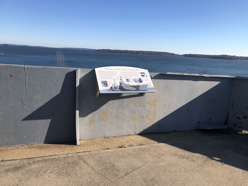
from 1808 through 1945 — — Map (db m55602) WM
Dedicated to the men and women of the Coast Artillery Corps who defended Portland Harbor at Fort Preble in five wars from 1808 through 1945. — — Map (db m186123) HM WM
The largest 17th century settlement in Cape Elizabeth - which included South Portland and Cape Elizabeth prior to 1895 - was established in 1658 near Spring Point. However, the onset of the French and Indian Wars in 1675 necessitated frequent . . . — — Map (db m55673) HM
In December, 1940, William Newell, president of Todd-Bath Iron, won a British contract to construct a seven-berth shipyard at Cushing Point and to build thirty 10,000-ton cargo vessels. On the mudflat site, Newell had constructed a cofferdam to . . . — — Map (db m186132) HM
Near this hallowed ground our earliest settlers erected in 1722 a garrison-meeting house for worship and protection. This was the beginning of the First Congregational Church of South Portland, which was established on November 10, 1734. . . . — — Map (db m55603) HM
Built on Hog Island Ledge, Fort Gorges was named after Sir Ferdinando Gorges, colonial proprietor of the Province of Maine. The fort's site allowed it to provide supplemental fire to both Forts Preble and Scammel. Its location at the head of the . . . — — Map (db m55627) HM
This area is the site of Fort Preble, also known as Fort Hancock during the Revolutionary War, a temporary fort. Fort Preble was begun in 1808 during the administration of Pres. Jefferson and completed before the War of 1812. It was named for . . . — — Map (db m55568) HM
This scenic point of land overlooking Portland Harbor, where Bug Light Park stands today, was once home to a sprawling World War II Shipyard that covered 140 acres of land, including over 60 buildings, and had the capacity to build up to 13 ships . . . — — Map (db m50474) HM
In memory
Morris P. Cates
Deputy Commissioner of Education
through whose untiring efforts
- Maine -
Vocational-Technical Institute
was established
in 1946
— — Map (db m55599) HM
Shipbuilding has been an important part of South Portland’s economy since colonial times. Small vessels built prior to the Revolutionary War were used for fishing and the coasting trade which ranged from the Kennebec River to Virginia. During the . . . — — Map (db m55678) HM
A major revival of shipbuilding took place here in the four years just prior to and during World War II. Cargo ships, the British Ocean series and the United States Liberty ships, were produced by the Todd-Bath Iron Shipbuilding . . . — — Map (db m186129) HM
In the mid-1800s, when South Portland was still a part of Cape Elizabeth, its waterfront appeared to be a continuous line of bustling yards building and repairing ships. From Butler on Turner's Island to Knight and Blanchard in Knightville to . . . — — Map (db m50413) HM
Todd-Bath Iron Shipbuilding Corp., 1940-1942
South Portland Shipbuilding Corp., 1941-1943
New England Shipbuilding Corp., 1943-1945
This is a complete list of the ships built by the emergency shipyards at South Portland, Maine, between . . . — — Map (db m50396) HM
When Rear Admiral Land, U.S. Maritime Commission Chairman showed President Roosevelt the Liberty ship plans, he remarked, "She'll carry a good load. She isn't much to look at though? A real ugly duckling." However, these simple but seaworthy ships . . . — — Map (db m50508) HM
This park memorial is dedicated to all families whose homes and heritages were destroyed in 1942 so a shipyard could be built during World War II
This area, known as Cushing’s Point at Ferry Village, consisted of many homes, some built by their . . . — — Map (db m84835) HM WM
We welcome you to our yard. You are now a member of our army of 25,000 men and women building the ships so urgently needed to carry war supplies to the fighting front.
New England Shipbuilding Corporation, Employee Handbook
With the . . . — — Map (db m55925) HM
We were all working there for one purpose: to get this country out of trouble. Everyone had one thing in mind: to produce and to win.
Bill Walton
Worker at New England Shipbuilding Corp.
Before there could be any British Ocean class or . . . — — Map (db m55737) HM
Each new ship strikes a blow at the menace to the Nation and for the Liberty of the Free People of the World…
President Franklin Delano Roosevelt
September 27, 1941
At the launching of the first Liberty ship, Patrick Henry from . . . — — Map (db m55922) HM
The U.S. Maritime Commission in the spring of 1941, called for the emergency construction of shipyards. William Newell received an order to develop another shipyard to the west of Cushing Point. Known as the West Yard, this facility had six . . . — — Map (db m186130) HM
During the war we all did our part to contribute. At first I worked at the shipyard as a welder. Then I served on board the Francis Retka, a Liberty ship we launched from the East Yard.
Frank Emery
Welder, 1941-1944, New England . . . — — Map (db m55765) HM
A Memorial to all soldiers, and sailors, and loyal women, who served gallantly and made great sacrifices in all wars for the independence and preservation of their country.
Gift of Gideon Marshall Tucker Vol. 16th Maine Regt. . . . — — Map (db m161834) WM
Steep Falls
1941 — 1945
In Grateful Tribute
To Those Who Served
In World War II
★Morris E. Ward
★Charles W. Gain, Jr.
Mark C. Baily · Robert A. Baily · Charles E. Baert · Frank L. Clark, Jr. · Elmore Cushman · . . . — — Map (db m161832) WM
English: Farm, tavern, dance hall, boarding house, post office, or library? First explored by Europeans in 1760, settlers came to Rangeley in the early 1800s to farm and to harvest the abundant timber in the mountains. Early . . . — — Map (db m148395) HM
English: Fishing frenzy changes Rangeley forever By the mid-1850s the "discovery" of Rangeley's large brook trout by outsiders forever changed the character of the community. Advertisements, articles, and exhibits on the trout . . . — — Map (db m148397) HM
A US Navy radio station here at Otter Cliffs served as the most important World War I facility for receiving transatlantic messages – including the first bulletin about the armistice. Alessandro Fabbri, a wealthy island resident and inventor, . . . — — Map (db m106555) HM
George B. Dorr, a gentleman scholar and lover of nature, devoted most of his adult life to the creation, maintenance, and expansion of Acadia National Park. The son of affluent Bostonians, Dorr first visited Mount Desert Island in 1868 and later . . . — — Map (db m106594) HM
Mount Desert Island's coastal waters have always held dangers for boats and ships - rocky shoreline, hidden ledges, and small islands that hide in the fog.
Since 1875, Egg Rock Lighthouse perched on the craggy island before you, has helped . . . — — Map (db m25481) HM
Agamont Park is named after the Agamont House, built by Tobias Roberts in 1857 as Bar Harbor's first hotel. It burned down in 1888. The unusual name was supposedly given by his granddaughter who called this hill on the water "Aqua . . . — — Map (db m78293) HM
A resident and lover of Mount Desert Island who commanded the United States Naval Radio Station upon this site from its establishment on August 28, 1917 until December 12, 1919.
At the end of the World War he was awarded the Navy Cross. His . . . — — Map (db m54436) WM
Two surviving Rodman/Dahlgren Cannon mounted on nearby Egg Rock in 1898 as part of the Coastal Defense Battery at Frenchman’s Bay, Bar Harbor.
This plaque honors those men and women who have fought in the defense of our country. — — Map (db m105401) HM WM
After being privately owned by several families such as the Rodicks and Pineos, the long period of arguments over its development and ideas to build a bridge to Bar Harbor lasted until John D. Rockefeller, Jr. quietly purchased the . . . — — Map (db m105932) HM
Cadillac Mountin is Acadia National Park's highest elevation and most comprehensive viewpoint. It is also the highest point on the United States Atlantic Coast (1,500 feet/466m). If you stood here alone at dawn you might be the first person in the . . . — — Map (db m54448) HM
Like small towns across America, Bar Harbor has endured its share of growing pains and seen many changes to the village streetscape since its permanent settlement by Europeans in 1763. Gone are the early settlers' homes, the old boarding houses, the . . . — — Map (db m184635) HM
The Criterion Theatre opened June 6, 1932 with a vaudeville and picture show. The building was built by George McKay at a cost of $150,000. The original Art Deco interior is one of its most outstanding features. The “flying” . . . — — Map (db m184667) HM
“What wondrous stories a water molecule could tell, of wild peaks visited on stormy nights, of quiet rivulets and raging rivers . . . peaceful fogs . . . glaciers . . . ” David Cavagnaro, Living Water
As you explore Acadia National Park, you will discover private property interspersed with park lands. Many large national parks, like Yellowstone and Grand Canyon, were carved from the public domain as single, vast tracts of land. Acadia, in . . . — — Map (db m54410) HM
Vessels of all types have plied the waters of Frenchman Bay for centuries. Five thousand years ago, indigenous people may have paddled dugout canoes into the bay to reach fishing grounds or hunt sea mammals and swordfish. More recently, Wabanaki . . . — — Map (db m25475) HM
This gated lodge was built in 1932 to keep motor vehicles off of John D. Rockefeller, Jr.’s carriage roads and out of Acadia’s interior. Rockefeller hired New York architect Grosvenor Atterbury to design the building in harmony with the natural . . . — — Map (db m77194) HM
When the ice that covered this land slowly melted, it dropped in its tracks great accumulations of gravel and rocks. Boulders transported and deposited by glaciers are called "erratics." Erratics are rounded and noticeably different in composition . . . — — Map (db m25491) HM
Rounded mountains, a deep lake, and sheer cliffs reveal this valley’s icy past. But long before glaciers sculpted Acadia’s surface, the granite foundation was forged deep in the Earth. Over 500 million years ago, colliding continents created a mass . . . — — Map (db m106544) HM
The Holy Redeemer Catholic Church was built in 1907 at a cost of $44,000 contributed almost entirely by the maids and workmen of the town. The church has its own patron, Saint Katharine Mary Drexel, canonized in 2000 during a . . . — — Map (db m184669) HM
Beneath the ocean’s surface lies a rugged seafloor much like the mountainous terrain around you. Over the last two million years, a series of glaciers scoured and shaped this land. The last of these icy bulldozers left a mound of rocky debris . . . — — Map (db m106584) HM
Frenchman Bay extends seven miles between Mount Desert Island and the Schoodic Peninsula, which lies beyond the Porcupine Islands. For centuries, humans have plied these bountiful waters to fish, trade, and enjoy the scenery. In the long struggle . . . — — Map (db m105628) HM
Since the early 1800s, Otter Creek has been the site of a fishing village with wharfs and fish houses on the waterfront and homes on the hills. Residents caught fish, dried them on racks along the cove, and shipped them to Boston and other cities. . . . — — Map (db m106553) HM
The recovery of the peregrine falcon is one of the great environmental success stories of our time. Although they once nested on the east face of Champlain Mountain above you, by 1964 peregrines had become extinct throughout the eastern United . . . — — Map (db m54409) HM
Sometimes air pollution obscures views like this from Cadillac Mountain and poses a threat to human health, Acadia’s water quality, and vegetation. A large percentage of the pollution comes from out of state. Converging air currents from the South . . . — — Map (db m105914)
Along Acadia National Park's rocky shores, there is only one sand beach. Over 15,000 years ago glacial ice carved out this valley. Melting glaciers and rising sea waters flooded it, creating a protected cove. A headland and a rock shelf offshore . . . — — Map (db m54411) HM
Explore the beach and discover a complex mix of marine life – and former lives – revealed in each handful of sand. As much as 70% of the sand consists of broken shells of mussels, sea urchins, barnacles, and periwinkles – signs of . . . — — Map (db m106590) HM
This spring was truly a magnificent one...wonderfully placed, with the mountains rising steeply up beside it, contrasting with the Great and Little Meadow lands on either side.
George B. Dorr, 1942
Like others before him, George B. . . . — — Map (db m54408) HM
As Acadia’s seasons change, so too does this view. Spring signals tightly wound ferns to unfurl their feathery foliage. Warming weather teases luna moths from their cocoons. As long summer days approach, bright green leaves of the birch trees . . . — — Map (db m105906) HM
Hearing the thunder here is all about timing. The best time to witness the boom and spray is two hours before high tide. If the ocean is calm or the tide is low, you may just hear gurgling. What causes the thunder? Over eons the restless forces of . . . — — Map (db m106582) HM
History
The founders of this parish named their congregation in honor of the Holy Saviour, Jesus, and in recognition of the first Christian mission, St. Sauveur, on the island by French Jesuits in 1613.
The Heartbeat of Life
God . . . — — Map (db m54407) HM
He laid the foundation of the National Park Service defining and establishing the policies under which its areas shall be developed and conserved unimpaired for future generations. There will never come an end to the good that he has done. — — Map (db m54441) HM
In October 1947 a series of fires lasting 26 days blazed across more than 25 square miles of Mount Desert Island. The fire seriously threatened Bar harbor, and transformed most of the landscape before you into an apparent wasteland. It consumed 170 . . . — — Map (db m25478) HM
The original Abbe Museum, which still exists at Sieur de Monts Spring, was founded by Dr. Robert Abbe, a surgeon from New York and a Bar Harbor summer resident, who assembled a collection of early Native American artifacts found in . . . — — Map (db m105929) HM
Frenchman Bay, in front of you, and other prominent names commemorate the region’s rich French heritage, “Acadia” stems from “Arcadia,” a term used by Giovanni Verrazano’s expedition to describe the Atlantic coast in 1524. . . . — — Map (db m105626) HM
Formerly the Veazie Cottage < Lower Marker : > This property has been placed on the National Register of Historic Places by the United States Department of the Interior — — Map (db m105933) HM
Established before 1790 holds in many unmarked and unknown graves the remains of those courageous men and women pioneers on the frontier of downeast Maine. Sea captains, fishermen and farmers, shipwrights and hotelmen, selectmen and legislators, . . . — — Map (db m54389) HM
The Village Green was originally the site of the 350-room Grand Hotel. Many stories have been told about the immature Boston boys and the cultured Philadelphia girls who socialized around the “fish pond” at the nearby Rodick House. . . . — — Map (db m105922) HM
Mrs. John S. Kennedy had the YWCA built in 1913 to provide housing for young women who came to town to work in the many summer cottages. It continues to provide housing for women to this day.
The Jesup Memorial Library was built . . . — — Map (db m105925) HM
856 entries matched your criteria. Entries 201 through 300 are listed above. ⊲ Previous 100 — Next 100 ⊳