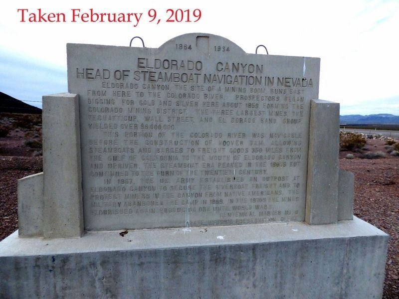
Eldorado Canyon runs east from here to the Colorado River and was the site of one of Nevada's mining booms. Prospectors began digging for gold and silver here, about 1859, forming the Colorado Mining District. The three largest mines, the . . . — — Map (db m29328) HM
The building of Hoover Dam was a ray of hope for a nation struggling
with hard times. Newsreel images of the high-scalers who worked the
canyon walls ignited public interest in the project.
"Scaling" is the process of removing loose rock . . . — — Map (db m111191) HM
Since 1935, Hoover Dam and Lake Mead have provided flood control, irrigation, drinking water, and power to communities in the desert. These resources have transformed the southwest into production farmland and thriving communities. The dam was . . . — — Map (db m31879) HM
In 1930, Michael McKeever set up a small tent house in Hermenway Wash slightly north of Government Survey Camp #1, where he was a government cook. Soon other workers started building homes nearby, and the area became known as McKeeversville. . . . — — Map (db m69447) HM
May all who cross the canyon on this memorial bridge travel their life journeys with the strength and inspiration found in the high ideals and heroic deeds of these brave humble men.
In Memory of these men of heroic sprit who overcame . . . — — Map (db m46836) HM
Legend has it there are many workers buried in Hoover Dam. However, due to the manner in which the Dam was constructed, this would have been impossible. "Puddlers" directed buckets of concrete over empty forms, released the concrete, and then used . . . — — Map (db m39488) HM
The Hoover Dam mascot only acted like he owned the dam,
but without a doubt, he owned the hearts of its workers.
The dog wandered freely around the job site; up ladders, over catwalks and
through tunnels. He even rode the open-air elevator . . . — — Map (db m111204) HM
The Hoover Dam construction crew’s mascot was found as a
puppy by workers at the construction camp. This dog traveled
to and from the dam site with them and spent his days visiting
the many work areas. On February 21, 1941, the life of this . . . — — Map (db m111203) HM
In 1938, Transcontinental and Western Air Lines, later Trans World Airlines, began serving Clark County, flying into Bullock Field in Boulder City. The airline believed that Boulder City would be a more lucrative market than nearby Las Vegas, and . . . — — Map (db m46833) HM
When the government built Boulder City, it didn't plan for children. But, as the Depression drove workers into southern Nevada to build Hoover Dam, workers brought their families with them. The new town and surrounding desert provided an exciting . . . — — Map (db m71106) HM
Those that came to Boulder City to work on the dam lived in harsh conditions. The oppressive heat of the summers and the unbearable cold of the winters took its toll on many. Even the most mundane chores were difficult in this inhospitable . . . — — Map (db m71107) HM
At the height of Hoover Dam construction, more than 7,000 men labored in Black Canyon. Some jobs were glamorous and exciting, such as the high scalers who swung over the canyon on ropes or the cableway operators who kept concrete buckets moving 24 . . . — — Map (db m39487) HM
Originally founded in 1931 as a community for the workers building Hoover Dam, Boulder City was the first planned community in southern Nevada. Designed by Saco Rienk DeBoer, it was a federal reservation. Only workers associated with the building or . . . — — Map (db m71903) HM
[ Front ]:
"The Old Man"
Francis Trenholm Crowe
Born: October 12, 1882
Died: February 26, 1946
World's Outstanding Builder of Dams
[ Right Side ]:
"We had 5,000 men in a 4000-foot canyon. The problem was to . . . — — Map (db m39485) HM
[ Front ]:
They endured the hardships so all of America might prosper
This Memorial was contributed by the men and women who built Hoover Dam to commemorate the 50th anniversary of its dedication
September 30, . . . — — Map (db m39486) HM
This cast steel turbine runner (water wheel), which is 14.2 feet in diameter and weighs over 34 tons, powered the N-7 generator at Hoover Dam Power Plant from 1944 to 1982. The function of a turbine runner is to convert the force of falling water, . . . — — Map (db m29248) HM
The Boulder Dam Hotel has been part of Boulder City history since its opening in 1933. Designed by Mort Wagner the hotel was built by Paul Stewart "Jim" Webb, Raymond Spilsbury, and Austin Clark. It is located in Cardenas Plaza - known today as . . . — — Map (db m39502) HM
Named for an 1890's railroad which was never built, Railroad Pass first became a destination after Professor Robert T. Hill discovered alunite in the area in 1908. A mining district was formed, but only small amounts of gold were found. Mines in the . . . — — Map (db m214462) HM
About two miles in front of you, the remains of the town of Callville lie buried in silt on the bottom of Lake Mead. Originally developed as a port on the Colorado River to supply goods to Mormon settlements, Callville had long been a desolate . . . — — Map (db m3917) HM
Originally known as Stage Field, this was an outlying airfield of Camp Ibis, one of the eleven camps established within the Desert Training Center, California-Arizonan Maneuver Area during World War II. Developed by General George S. Patton, Jr., . . . — — Map (db m78522) HM
This small spring, first used by Anasazi and Paiute people, also sustained the caravan that pioneered a pack route now known as the Old Spanish Trail. En route to Los Angeles from Santa Fe, trader Antonio Armijo, 60 men and 100 mules camped here on . . . — — Map (db m39470) HM
Ore deposits readily recognized in the faulted and folded limestone deposits of this district remained unworked until 1856, when the Mormons developed a single lead mine at Potosi—probably the oldest lode mine in Nevada.
Named for . . . — — Map (db m39471) HM
George Fayle moved to southern Nevada from Calico, California in 1904. He settled at Goodsprings Junction, which was later renamed for his wife Jean. In 1912, he moved to Goodsprings. He built the Pioneer Saloon in 1913, later building the Fayle . . . — — Map (db m39472) HM
On January 8, 1830, the first pack train to pass from Santa Fe, New Mexico to Los Angles crossed Las Vegas Valley. Antonio Armijo, a merchant in Santa Fe, commanded the train and roughly sixty men. The successful completion of the journey opened a . . . — — Map (db m29247) HM
Seeking Pay Dirt
In 1908, mining engineer Robert T. Hill staked a claim in Railroad Pass hoping to find gold deposits as rich as those in Goldfield to the north and Searchlight to the south. Hill reasoned that gold could surely be found at . . . — — Map (db m46738) HM
The name, "Arrowhead Trail" likely originated from the former San Pedro, Los Angeles, and Salt Lake Railroad's logo, an arrowhead. Prior to 1850, New Mexican trading caravans from Santa Fe en route to Los Angeles used this segment of the Old Spanish . . . — — Map (db m212309) HM
The man depicted on this monument is performing one of the most dangerous yet essential jobs in the construction of the (Boulder) Hoover Dam. Sitting in a bosun’s chair, hundreds of feet in the air, his job was to set charges and clear the loose . . . — — Map (db m24317) HM
Commissioner, Bureau of Reclamation, Department of the Interior, 1924-1936 whose life-time work culminated in construction of the Boulder Canyon project creating Lake Mead, named in his honor. — — Map (db m1313) HM
The United States of America will continue to remember that many who toiled here found their final rest while engaged in the building of this dam.
The United States of America will continue to remember the services of all who labored to clothe . . . — — Map (db m1311) HM
Founded in 1904 as Goodsprings Junction, a station on the San Pedro, Los Angeles, and Salt Lake Railroad, Jean received its current name in 1905 when the post office was opened. It was named in honor of Jean Fayle, the wife of George Fayle who had . . . — — Map (db m129575) HM
According to the early history of Elko, Nevada, this curfew and fire bell played a vital role for local citizenry. It often rang to signal disastrous fires, deaths of celebrities, and celebrations.
Harbinger of both good tidings and bad, the . . . — — Map (db m201468) HM
The first automobile road to connect Los Angeles and Las Vegas was the Arrowhead Trail Highway. Planned, promoted and built beginning in the second decade of the twentieth century, this was one of the named interstate highways of the Good Roads . . . — — Map (db m103380) HM
On January 30, 1905, near this site, workers drove the last spike that completed the railroad between Salt Lake City, Utah, and Los Angeles, California. This was the last "transcontinental" line to Southern California and one of the last lines . . . — — Map (db m156462) HM
Built in 1911, The Yellow Pine Mining Company Railroad was a twelve and a half mile long narrow gauge railroad connecting the town of Goodsprings with the Union Pacific Railroad here in Jean. The railroad was built using materials from the defunct . . . — — Map (db m107085) HM
The San Pedro, Salt Lake and Los Angeles Railroad bought Helen Stewart's Las Vegas Ranch in 1902, giving it control of the Las Vegas Springs and the water supply needed for the creation of Las Vegas in 1905. The railroad's subsidiary, the Las Vegas . . . — — Map (db m50274) HM
Bubbling artesian springs flowed here until they were exhausted in the middle of the 20th century, over-pumped to serve the city's growing population.
These springs and the creek they created gave life to the center of the valley. They erupted . . . — — Map (db m51043) HM
This WWII neighborhood was named for the Nevada Biltmore Hotel which opened nearby in 1942. A WWII housing shortage called for the construction of several hundred homes for military personnel and their families. The federal government approved the . . . — — Map (db m51057) HM
The Bow & Arrow Motel was originally installed in Downtown Las Vegas on Wyoming Avenue.
The Allied Arts Council donated the Bow & Arrow Motel sign to The Neon Museum in 2001. — — Map (db m145470) HM
John Steele, one of the original L. D. S. missionaries, secured a mail grant for the Las Vegas Mission. The documents to establish the Post Office, and, appointing William Bringhurst Postmaster, were brought from Salt Lake City by Benjamin H Hulse, . . . — — Map (db m29294) HM
Helen Jane Wiser Stewart
April 16, 1854 - March 16, 1926
"The First Lady of Las Vegas"
"It will only be for two years," Archibald promised his wife Helen in 1882, coaxing her away from civilized Pioche, Nevada to a ranch in
middle . . . — — Map (db m241368) HM
This Jerry's Nugget cabinet rotated atop a vertical tower of letters spelling "Nugget", advertising the popular North Las Vegas local's casino. Circa 1970s, the sign incorporates skeleton neon and hand lettering for lively day and night . . . — — Map (db m92471) HM
In 1855 Pres. Brigham Young appointed a company of men under the leadership of William Bringhurst to establish a colony at Las Vegas. The company left Salt Lake May 10 and arrived at Las Vegas June 14, 1855 and camped near this site. William . . . — — Map (db m234578) HM
Las Vegas had its beginning at this location on June 14, 1855, when thirty-two Mormon missionaries arrived from Utah under the leadership of William Bringhurst. They set to work establishing farm fields that summer, and began to build a 150-foot . . . — — Map (db m160162) HM
After founding Salt Lake City in 1847, the Mormon Church expanded its settlement westward. The Las Vegas Mission was established in June 1855 as an outpost roughly halfway between Salt Lake City and Southern California. Built alongside the Las Vegas . . . — — Map (db m50273) HM
Created in 1962 by architects Wayne McCallister and William Wagner and YESCO design staff. The three-story concave panel of interlocking neon "H" elements formed the corner bullnose for the casino's façade on Fremont Street. At the time, the . . . — — Map (db m92470) HM
Neon guitar signs became the symbol world-wide for the Hard Rock brand. This Las Vegas guitar sign is important because it was the flagship -- the first Hard Rock Café guitar in the world. It graced the corner of Paradise Road and Harmon Avenue . . . — — Map (db m145771) HM
In April 1855, Brigham Young, President of the Church of Jesus Christ of Latter day Saints, called thirty men to leave their families and possessions in the recently settled towns of Utah to serve a mission at the Las Vegas Springs. The verdant . . . — — Map (db m1419) HM
Panel one: The Neon Boneyard Park Sign
The lettering on a neon sign is often the most memorable design component. The Neon Boneyard Park sign includes hidden reference to this aspect of the grand history of Las Vegas signage. Each letter in . . . — — Map (db m71210) HM
Aladdin's Lamp was originally installed in 1966 at the Aladdin Hotel, 3667 Las Vegas Boulevard South.
Restored through a generous donation from Richard Schuetz and presented as a gift, with love, to Mayor Jan Laverty Jones and her children: . . . — — Map (db m64033) HM
On May 15, 1905, in this area, The City of Las Vegas was founded with the auction of lots in Clark's Las Vegas Townsite by San Pedro, Los Angeles & Salt Lake Railroad and Las Vegas Land & Water Company, predecessors of Union Pacific Railroad and . . . — — Map (db m47732) HM
This is a two sided marker
Side A:
Auction Site
At this site on May 15th 1905, the San Pedro, Los Angeles & Salt Lake Railroad auctioned off lots for the creation of the new city of Las Vegas. With 110 degree temperatures scorching . . . — — Map (db m47736) HM
The notorious Block 16, North First Street between Ogden and Stewart Avenues, was the only area in the Las Vegas Townsite, outside of hotels, where liquor could be sold, starting in 1905. The block quickly changed from its original liquor and . . . — — Map (db m47859) HM
The Chief Hotel Court sign was originally installed around 1940 at the hotel located at 1201 E. Fremont Street. Hotel architect was A. Lacey Worshwick.
Loaned and refurbished by the Tiberti Family.
Installed as part of the Neon Museum on . . . — — Map (db m64031) HM
This fairy-tale residence reflects the unique family that built it, whose roots stretch back to a pioneering Utah Mormon blacksmith, ranchers in Idaho and Nevada, and railroad workers in Las Vegas.
The life of Las Vegas pioneer Lucretia Tanner . . . — — Map (db m51052) HM
On May 15, 1905 Senator William Clark's railroad auctioned off lots to found the new town of Las Vegas. Block 20, between Second and Third and Carson and Bridger, was reserved for public purposes. In 1909 when the state legislature created Clark . . . — — Map (db m47822) HM
Built • 1927-28
Architect: Charles Alexander MacNelledge
Opened June 21, 1928
This building was Las Vegas' cultural center for many years. Its 700 seat auditorium and elegant Spanish motif lobby were used for films, plays, music recitals, . . . — — Map (db m47745) HM
Building Rededication
Honoring the 100th Year
Anniversary of the First Church
Built in Las Vegas
presiding
Honorable Mayor Oscar B Goodman
December 13, 2005 — — Map (db m47756) HM
This is a two sided marker
Side A:
Standing on Fremont Street today, it's hard to visualize the canvas tents with hand-painted wooden signs that lined this dusty street and served as hotels, saloons, shops and banks in the early 1900's. . . . — — Map (db m47754) HM
This is a two sided marker
Side A:
Gaming
Like most western frontier towns, gambling was prevalent in the backrooms of early Las Vegas saloons and other establishments. From its inception as a railroad town in 1905, the citizens . . . — — Map (db m47737) HM
Black entertainers were not allowed to stay at the Strip hotels where they performed in the 1940s and 1950s. Mrs. Harrison's boarding house offered fine accomodations for many of the era's most famous stars.
During one memorable week in . . . — — Map (db m51050) HM
The following text is from a missing 2005 Centennial Marker.
Fifth Street School
This graceful Mission-Style complex was built by the federal government in 1936 to replace the Las Vegas elementary school, which burned down in 1934. . . . — — Map (db m48196) HM
This light standard was placed at the entrance to the Las Vegas Union Pacific Railroad Station in 1937. The Depot was removed in 1970 to make way for the Union Plaza Hotel. Mr. Frank Scott, Chairman of The Board of Union Plaza Hotel preserved this . . . — — Map (db m47734) HM
Las Vegas was established as a railroad town in 1905; at the head of Fremont Street, the Mission-style depot represented the railroad's dominance over the economic and social life of the town for several decades. The streets of downtown were laid . . . — — Map (db m47860) HM
The tradition of “Senior Squares” was created one night in 1941 when two students pulled a prank and painted one of the cement slabs in front of the main steps of the original Las Vegas High School. Expressing innocence the next morning when called . . . — — Map (db m203381) HM
Commerce on the Westside was short lived, collapsing in 1905 when rival Las Vegas Townsite opened on the east side of the railroad tracks. In 1942, the Westside defined a new commercial district to serve the ethnic population of the area.
The . . . — — Map (db m51051) HM
Las Vegas High School
"Las Vegas Academy"
Has been placed on the
National Register
of Historic Places
By the United States
Department of the Interior
1931 — — Map (db m48197) HM
This is a two sided marker
Side A:
Las Vegas High School
As the population of Las Vegas increased throughout the 1920s and the construction of Hoover Dam was assured, many saw the need for a new high school. Principal Maude Frazier . . . — — Map (db m47886) HM
The Bureau of Indian Affairs (BIA) bought this ten-acre site in 1911 from Helen J. Stewart, former owner of the Las Vegas Ranch, to provide a home for the Southern Paiute Indians living in and near Las Vegas. With this purchase, the government . . . — — Map (db m51055) HM
Created by J.T. McWilliams in 1905, the Original Las Vegas Townsite was Las Vegas' first business and residential development.
J.T. McWilliams (photo top right) was hired to do survey work in and around the Las Vegas Valley for the San Pedro, . . . — — Map (db m51048) HM
Herman Moody, Las Vegas' first black career police officer, was raised in this house at 321 Van Buren Avenue, built by his parents (father Henry Moody pictured lower left) who came here in 1939.
As first African-American in Las Vegas to make a . . . — — Map (db m51053) HM
The first integrated hotel and casino in Las Vegas, the Moulin Rouge opened in May 1955. It is celebrated as a landmark of racial integration in Las Vegas and the United States.
Entertainers from the Las Vegas Strip and Hollywood flocked to . . . — — Map (db m51047) HM
This is a two sided marker
Side A:
Neon
Neon lighting, introduced in Paris in 1910, offered a brilliant, and efficient, alternative to the incandescent light bulb. In the United States, neon's popularity soared, used to advertise . . . — — Map (db m47755) HM
Opened in 1937 at 5th Street (Las Vegas Boulevard) and Garces, the Nevada Motel was the first auto court in Las Vegas to identify itself as a "motel". In its last years in business it operated in conjunction with the Sweetheart Wedding Chapel next . . . — — Map (db m64028) HM
On this site stood "Old Betsy," Las Vegas' first electric generator, which serviced the power needs of the new town. The generator, operated by the Consolidated Power and Telephone company, supplied electricity from 1906-1916. The company evolved . . . — — Map (db m47867) HM
Charles "Pop" Squires, often referred to as "the Father of Las Vegas" lived at this location, with his wife, Delphine, from 1931 until his death 1958.
Squires first arrived in the Las Vegas Valley in February 1905. He and his partners . . . — — Map (db m131061) HM
With gratitude to the Engelstad Family Foundation for its generous contribution to this Liberty Bell monument, and in recognition of the life and achievements of Ralph Louis Engelstad who personified the highest qualities of personal liberty. Just . . . — — Map (db m47828) HM
The Silver Slipper was originally installed on the grounds of the Last Frontier on Las Vegas Boulevard.
The Slipper was designed by Jack Larsen and built by Young Electric Sign Company. — — Map (db m92469) HM
Organized on 4 October 1908, St. Joan of Arc is the oldest Catholic Parish in Las Vegas. The first church, known as “Cottage Chapel,” was dedicated in 1910 and rebuilt at least twice before the present structure was erected. A memorial to the . . . — — Map (db m203385) HM
The Flame Restaurant sign was originally installed in 1961 on the roof of the restaurant at #1 Desert Inn Road.
Restored through a generous donation from Rich Travis.
Installed as part of the Neon Museum on July 8, 1997
Believed to . . . — — Map (db m64029) HM
The Morelli House is a classic example of Las Vegas, mid-century residential architecture. It was built in 1959 by the Sands Hotel orchestra leader, Antonio Morelli, and his wife Helen. Originally located at 52 Country Club Lane in the former . . . — — Map (db m69450) HM
This property
has been placed on the
National Register
of Historic Places
by the United States
Department of the Interior
United States Post Office
and Courthouse
c.1933 — — Map (db m47746) HM
As a founder of one of the pioneer families of Las Vegas, Ed Von Tobel came to the 1905 Las Vegas land auction and purchased a lot. He established a lumber company on Main Street in 1905 and then moved to this site in 1906. The hardware business . . . — — Map (db m47879) HM
Delphine Squires and the Mesquite Club sponsored suffrage speakers 1912-1914. Club met at the Las Vegas school on this site until 1915. — — Map (db m213132) HM
The first school in West Las Vegas opened with two rooms and two teachers for four grades.
From 1904 until 1923, children from McWilliams' Townsite crossed the railroad tracks to get to school in Clark's Townsite. This dangerous situation . . . — — Map (db m51054) HM
Opened in 1914 on ten acres of donated land, the cemetery was the unofficial veterans cemetery until 1989 and is the home of Veterans Memorial Circle
Woodlawn Cemetery
Is listed on the
National Register
of Historic Places — — Map (db m75589) HM
Until 1914, when the railroad donated land for a city cemetery, people buried the dead in small family plots or on public land just north of the railroad-owened Las Vegas Ranch, east of Las Vegas Boulevard.
In pre-railroad times, the Paiute . . . — — Map (db m51056) HM
Opened around 1931 by Mrs. Mattie "Jimmy" Jones, the Green Shack restaurant was a town landmark at this site. The restaurant opened in a Union Pacific Railroad barracks building that was moved here; in 1934 additions were made to the structure. For . . . — — Map (db m47894) HM
The City of Las Vegas Mayor and City Council
presents
An Art in Public Places Project by The City of Las
Vegas Arts Commission
In celebration of the Las Vegas Centennial
Sculpture by Steven Liguori
"Breaking Ground"
This 14' high . . . — — Map (db m47890) HM
Las Vegas' first tract subdivision, the Huntridge neighborhood was erected between 1941 and 1944 on land purchased in the 1920s by international businessman Leigh Hunt. After his death in 1931, Hunt's widow sold off large chunks of land. In December . . . — — Map (db m47893) HM
The Wengert residence was originally owned by Cyril S. and Lottie Wengert. Built in 1938, this Tudor Revival home was designed by Architect, H. Clifford Nordstrom, and was amongst the largest in Las Vegas. Prominent in Las Vegas social and business . . . — — Map (db m114796) HM
St James has been a vital force in meeting the needs of this underserved, segregated but expanding community.
The second Catholic Church in Las Vegas, St. James opened in 1940 in a small concrete building at H and Morgan streets (pictured . . . — — Map (db m51049) HM
1905 - 1908
City of Las Vegas
Diamond Jubilee
From within this area flowing artesian springs and wells provided the lifeblood to the valley and it settlers.
This abundant supply of water has been the most important asset in the . . . — — Map (db m47888) HM
The famous Las Vegas Springs rose from the desert floor here, sending two streams of water across the valley to nurture the native grasses, and create lush meadows in the valley near Sunrise Mountain. The natural oasis of meadow and mesquite forest . . . — — Map (db m131317) HM
965 entries matched your criteria. Entries 101 through 200 are listed above. ⊲ Previous 100 — Next 100 ⊳