Tule Springs is one of the few sites in the U.S. where evidence suggest the presence of man before 11,000 B.C.
Scientific evidence shows this area, once covered with sagebrush and bordered with yellow-pine forests, had many springs. These springs . . . — — Map (db m29960) HM
Lorenzi Lake, the dream of pioneer David G. Lorenzi, opened as a private resort in 1926, became the Twin Lakes Lodge in the 1940s, and a public park in 1966.
Arriving in southern Nevada in 1911, Lorenzi began building his park on 80 acres . . . — — Map (db m51044) HM
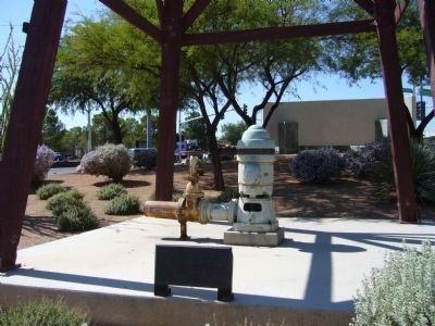
The three buildings on the site were constructed in 1949 as a part of Twin Lakes Lodge, a dude ranch surrounded by stables, a lake, rodeo grounds and a natural springs.
The buildings are on a portion of the 80 acre Lorenzi Resort originally . . . — — Map (db m69454) HM
Colorful Horseshoe Club owner Benny Binion and his family lived here from 1947 to 1989.
Originally built in 1942 by service station owner C.A. Morehouse, the home was one of the largest in Las Vegas with three bedrooms, several baths, a . . . — — Map (db m51045) HM
Here in the 1930s and 1940s, Korean immigrant Frank Kim raised melons, tomatoes, and onions. His devoted son, Frank Kim, Jr. became a pillar of the community.
From the early days of Las Vegas, Asian [...] considerable skill to make poor desert . . . — — Map (db m51046) HM
Few children traveled with the regular Spanish Trail caravans. The journey was long and dangerous. Young children were a burden and older ones were needed at home. Before 1841, families with children rarely moved to California. Those who mode the . . . — — Map (db m241715) HM
In 1843-1844 Capt. John C. Fremont explored the West. He named the Old Spanish Trail and the Great Basin - a vast region whose rivers drained inland, not to the sea. He first trekked to Oregon, then south through California, then back eastward . . . — — Map (db m241714) HM
Spanish Trail caravans wound between watering holes across the Mojave Desert. Mormon wagon trains followed much of the Spanish Trail, but since wagons could haul water and feed, this opened up short-cuts. The railroad broke new ground by building . . . — — Map (db m241717) HM
Life in the Las Vegas Valley in the 19th Century revolved around three ranches owned by 0.D. Gass/Archibald Stewart, Conrad Kiel and Jim Wilson.
The Gass/Stewart Ranch (1865-1905) was built on land developed earlier by the Mormons. The . . . — — Map (db m241716) HM
For centuries before the Spanish arrived in the Southwest, native peoples traded goods across the network of routes that became the Old Spanish Trail. The Spanish called all the first people "Indians", later identifying them as Pueblos, Apaches, . . . — — Map (db m241719) HM
For more than 150 years this ten-acre parcel preserved the ruts of the Old Spanish Trail between Las Vegas Springs and Mountain Pass.
When Spain owned the Southwest, Santa Fe and Los Angeles were the only two centers of government and . . . — — Map (db m241707) HM
Spanish Trail routes crossed deserts and mountain ranges far from Mexican settlements and government authorities. Horses and mules were in short supply to conduct the Santa Fe-Missouri trade opened in 1821 by Americans from Missouri. Outlaws and . . . — — Map (db m241725) HM
By 1855 wagon roads linked Utah to California. To ease the long trip between Los Angeles and Salt Lake City, the LDS church established an outpost at an oasis called, Las Vegas, along the Old Spanish Trail/Mormon Road.
Thirty missionaries . . . — — Map (db m241723) HM
The most dangerous section of the Old Spanish Trail crossed the Mojave Desert; it is extremely hot in the summer and without major rivers running through it. Springs and the Amargosa River (which drains into Death Valley) made it possible to . . . — — Map (db m241722) HM
During the Mexican War, Mormon men served as a special battalion in the U.S. Army. They left lowa in July 1846 and marched through the Southwest to San Diego, building roads and American outposts along the way. They fought the Battle of San . . . — — Map (db m241721) HM
Spanish Trail travelers through Clark County followed changing routes as they learned shortcuts and new sources of water, but the trail always connected watering holes. Spanish Trail pioneer Antonio Armijo and early fur trappers depended on the . . . — — Map (db m241712) HM
American Legion Post No. 60 Laughlin-Nevada proudly designates this Avenue of Flags in honor of all those who served honorably in the Armed Forces of the United States, protecting our country and assuring us that our flag will forever wave. . . . — — Map (db m37279) HM
After the United States government's successful experiment with camels in the west in 1857, entrepreneurs saw possibilities in the ungainly beasts for carrying supplies. In addition to the government's camels, which were sold off by 1864, two . . . — — Map (db m78520) HM
Pioneer and Founding Father of the Town of Laughlin. His vision in 1966 of the opportunities and growth for this area is what you see today. — — Map (db m37278) HM
In first times, there was chaos, and from the union of earth and sky was born the Great Spirit Matavilya.
Before he could teach his people all they needed to know about their world, he was killed by his sister, Frog Woman. It was then that his . . . — — Map (db m40308) HM
During the building of Davis Dam, the Nevada side of the river here became known as Tristate. In 1964, Don Laughlin was looking for an investment opportunity. He had sold his 101 Club in North Las Vegas, and flew over a closed saloon and motel . . . — — Map (db m46732) HM
In 1855 Congress authorized $30,000 for camels as frontier military beast of burden because of their adaptability to desert heat, drought, and food.
Lt. Edward F. Beale surveyed the wagon route from Fort Defiance, New Mexico, to the Colorado . . . — — Map (db m32822) HM
Seeking to open a land route between the Missions of Sonora and California, Fray Francisco Hermenegildo Garcés, OFM, a Franciscan Missionary priest and explorer, was the first European to enter the present boundaries of Nevada. He departed Mission . . . — — Map (db m84277) HM
On this site was one of the first rest-over businesses in the Virgin Valley. Here an early version of an adobe brick house was used as a small grocery store with a separate wash house that had shower and laundry facilities, and a way station . . . — — Map (db m46745) HM
Abram Woodbury, one of the first permanent settlers in Mesquite, built a new home here circa 1919 and opened a mercantile store. He also built overnight cabins for tourists and operated Mesquite's first gas station. Abram purchased gasoline by the . . . — — Map (db m46762) HM
Circa 1901"We lived in a lumber granary and the old rock house. We traded for this lot and built a sixteen-foot square room. I borrowed Jim's team and wagon and worked at the sawmill to get lumber for our first home." It was braced on rocks and . . . — — Map (db m46764) HM
Charles Hardy, one of the first settlers in Mesquite, used lumber he brought back from Mt. Trumbull and local adobe to build the original large central room of his home – the other rooms were added later. The room was used as a bedroom, living . . . — — Map (db m46941) HM
This site was the location of the first commercial dairy in Mesquite, which began operating circa 1941. The barn was used by over twenty families in the community. According to a schedule, they would drive their cows to the barn twice a day to milk . . . — — Map (db m46743) HM
In the 1940's the place to go was Leonard Patty's soda fountain and drug store. This was the first soda fountain in town and served up all the favorites for quenching thirst in those days, including phosphates and sodas of all varieties – . . . — — Map (db m46763) HM
The Egg Association formed circa 1929 as a local cooperative, selling and distributing local eggs to tourist oriented businesses, or to market in Las Vegas. High school boys studying agriculture were part of the enterprise. The Association built a . . . — — Map (db m46746) HM
This adobe brick building was built by Deloy Abbott circa 1932. Behind the house was another adobe building used as a chicken coop. Ervin Jones purchased the home in 1941 and lived here until his death. The house was later converted to a business. — — Map (db m46741) HM
Mesquite proved a total failure after several years labor. And today only a few ravines and sand-filled ditches mark the place where the village once stood. —LDS Church Historian Andrew Jensen, 1891.
The remoteness of the area, . . . — — Map (db m1448) HM
John Pulsipher purchased the Tent School (Marker #9) and moved it across the street to this location to use as a residence. The following year he built a large adobe brick one-room house with walls three adobes thick. The tent was then converted to . . . — — Map (db m46747) HM
… from weary travelers to women and their children who would come to visit … she never turned anyone away without feeding them. She would invite you to eat and then say ‘There’s plenty such as ’tis; … Bless her heart, it was as big as al . . . — — Map (db m1466) HM
Library
Circa 1941
The museum building started as a library and was one of only two National Youth Administration (NYA) projects in Nevada. Volunteers finished the building when NYA funds were diverted to the war effort. Clark . . . — — Map (db m46744) HM
This is the oldest standing house in Mesquite and was continuously used as a residence from 1894 until 2003. The original portion of the house dates from circa 1880 occupation when Mesquite Flats was temporarily settled. The large rocks made the . . . — — Map (db m46748) HM
Public Square, Circa 1894 • Tent Chapel and School, circa 1899.
When Mormon settlers came to Mesquite Flats in 1894, they designed the southeast corner of this block as the Public Square. It was a place where the community gathered for many . . . — — Map (db m1412) HM
Stretching for 130 miles across Clark County, this historic horse trail became Nevada’s first route of commerce in 1829 when trade was initiated between Santa Fe and Los Angeles. The trail was later used by the wagons of the “49ers” and . . . — — Map (db m1414) HM
Tithing Lot
Circa Late 1890s.
The southeast quarter of this block was originally owned by the Church of Jesus Christ of Latter Day Saints and was used as a tithing lot. Church members paid tithing in-kind donations of fruit, crops, etc., . . . — — Map (db m1282) HM
Virgin Valley was traveled by Jedediah Smith in 1826 and by Fremont in 1844.
The valley served as the right-of-way for the Old Spanish Trail (1829-1848) and for the Mormon road or southern route of travel to southern California.
The areas . . . — — Map (db m1279) HM
This is a two-story adobe building with a rock foundation. The walls are three adobes thick and there are six rooms on each floor. Abbott served as Bishop of the local congregation of the Church of Jesus Christ of Later-day Saints for 27 years. His . . . — — Map (db m46740) HM
It was under William Abbott’s supervision that Mesquite was founded on a firm foundation. —Howard Pulsipher, Mesquite Pioneer.
At the age of eight, William journeyed from his birthplace in Ogden, Utah, to Bunkervile, . . . — — Map (db m1447) HM
About 1922, J. H. Nicolaides overheard two state highway engineers talking about the new route Arrowhead Trail Highway would take in southern Nevada. Realizing a service station would be necessary at the crossing the road would make over the Muddy . . . — — Map (db m114821) HM
Rich in prehistoric, pueblo-type culture, and noted by the explorer Jedediah Smith in 1826, Moapa Valley is crossed by the Old Spanish Trail.
In 1865 Brigham Young sent 75 families to settle the area, to grow cotton for the people of Utah, and . . . — — Map (db m46780) HM
In 1869 Heleman Pratt, Wm. D. Kartchner and other L.D.S. Church members came to Overton; built adobe homes; planted vineyards and crops. In 1871 double taxation forced an exodus from Muddy Valley. Local investors acquired the land, resold to . . . — — Map (db m241359) HM
Existing today as a 30-mile series of adobe ruins, this “Lost City” was once the home of an ancient Anasazi Indian civilization. Beginning with the basketmakers (300 B.C.-A.D.700) & followed by the Pueblos (A.D.700-1150) this valley was . . . — — Map (db m145957) HM
The desire of the Mormon settlements for economic self-sufficiency led to mining by missionaries for lead. In 1856 Nathaniel V. Jones was sent to recover ore from the "Mountain of Lead" 30 miles southwest of the mission at Las Vegas Springs. About . . . — — Map (db m29366) HM
Stretching for 130 miles across Clark County, this historic horse trail became Nevada's first route of commerce in 1829 when trade was initiated between Santa Fe and Los Angeles. The trail was later used by the wagons of the "49'ers" and Mormon . . . — — Map (db m89437) HM
The Fairchild-Republic A-10 Thunderbolt II is the first Air Force aircraft designed specifically for close air support of ground forces. Affectionately called the Warthog, the single seat, twin engine A-10 is built around a 30MM Gatling gun. It has . . . — — Map (db m231055) HM
The F-117A is the first operational fighter designed to exploit low observable stealth technology. Pilots of the single seat, ground attack fighter are tasked to execute precision attacks against high value targets in the most dense threat . . . — — Map (db m231057) HM
The Thunderbirds transitioned from the F-16A/B to the F-16C/D Block 32 in 1991, as the team readied for the 1992 show season. Until the transition, the Thunderbirds were the last active-duty unit employing the F-16A/B. Then Thunderbirds #1, Lt Col . . . — — Map (db m231051) HM
It looked like a big, black wall of water. There were maybe two or three waves. all carrying something, vehicles upside down. Manuel Cortez, Las Vegas Review-Journal
On September 14, 1974, a flash flood roared down Eldorado Canyon . . . — — Map (db m92464) HM
Toward the Colorado River from this point runs El Dorado Canyon where occurred one of the biggest mining booms in Nevada history. Gold and Silver mines were developed here about 1859 and soon rich mines were developed. In the 1860's the canyon . . . — — Map (db m29326) HM
Toward the Colorado River from this point runs El Dorado Canyon where occurred one of the biggest mining booms in Nevada history. Gold and Silver mines were developed here about 1859 and soon rich mines were developed. In the 1860's the canyon . . . — — Map (db m29327) HM
Eldorado Canyon, the site of a mining boom, runs east from here to the Colorado River. Prospectors began digging for gold and silver here, about 1859, forming the Colorado Mining District. The three largest mines, the Techatticup, Wall Street, and . . . — — Map (db m92463) HM
The Techatticup Mine, located in 1861, was the most important mine in El Dorado Canyon. It produced millions of dollars in gold ore, and was originally served by steamboats on the Colorado River. The mine's name is taken from two Paiute words . . . — — Map (db m29331) HM
In 1940, Charley Kenyon and Art Schroeder located a cave above the Colorado River, about twelve miles northeast of this spot. In it were the remains of southern Nevada's last great renegade, Queho, who had been dead about six months. Queho had grown . . . — — Map (db m29332) HM
Established by Conrad Kiel in 1875, this was one of the only two major ranches in Las Vegas Valley throughout the 19th century. The Kiel tenure was marked by violence. Neighboring rancher Archibald Stewart was killed in a gunfight here in 1884. . . . — — Map (db m22414) HM
Dedicated to those stalwart pioneers who forged an oasis out of the desert sands
The St. Thomas Cemetery was established in the 1860s in the town of St. Thomas, Nevada. Anticipating inundation of the town by the waters of Lake Mead, the graves . . . — — Map (db m4040) HM
Las Vegans claimed to be the originators of this all-weather route between Los Angels and Salt Lake City. From the beginning, the Arrowhead Trail was a "grass roots" effort including promotion by various chambers of commerce and volunteer . . . — — Map (db m78741) HM
An atlatl is a throwing stick or a dart thrower used by ancient tribes to give more force to their darts or spears. It was usually a wooden stick about two feet long with a handhold on one end and a hook on the other end. A slot cut in the tail end . . . — — Map (db m72354)
Once part of a sand deposit that covered a vast area, these rocks have been subjected to a relentless attack by harsh winds, rain, heat and cold creating the many unusual formations that make up the Valley of Fire. — — Map (db m72357)
During the early 1860's, Brigham Young directed that settlements be built in the area known today as the Moapa Valley. The water from the Muddy River, and the rich soil of the Valley, made the land a prime agricultural area for southern Nevada. . . . — — Map (db m47027) HM
Fay Perkins Sr., was born in Overton, Nevada and spent his entire life in Moapa Valley. In 1924, Fay Perkins and his brother John Perkins reported to Governor James G. Scrugham that many ancient Indian ruins existed in the Moapa Valley. Governor . . . — — Map (db m145958) HM
John J. Clark was born in Canada in 1844.
He enlisted as a private in Company F of
the New York Infantry in 1862, serving
actively in the Civil War. After being shot
in the hand and contracting typhoid
fever, he was honorably discharged
6 . . . — — Map (db m32812) HM
This property is listed on the National Register of Historic Places. The Museum was built in 1935 by the Civilian Conservation Corps to display artifacts of prehistoric Native American cultures. — — Map (db m145956) HM
In 1864 Brigham Young called for settlers to colonize the Muddy (now Moapa) Valley. On January 8, 1865, eleven men and three women arrived and began the first settlement at St. Thomas, now covered by the waters of Lake Mead. Later other settlements . . . — — Map (db m145959) HM
This park, situated on the old Arrowhead Trail, was designated on March 26, 1935 as Boulder Dam-Valley of Fire State Park.
Though four state parks were established by concurrent legislation, Valley of Fire is considered Nevada's first state . . . — — Map (db m3432) HM
On August 30, 1869, Major John Wesley Powell landed at the mouth of the Virgin River, about 12 miles south of here, thus ending the first boat expedition through the Grand Canyon of the Colorado River.
The expedition left Green River City, . . . — — Map (db m46781) HM
Indians of a highly developed civilization lived throughout Moapa Valley from 300-1100 A.D. Several hundred ancient pithouses, campsites, rockshelters, salt mines and caves of "Anasazi" people make up what is commonly known as "Lost City." These . . . — — Map (db m241139) HM
The sandstone formations that are so prominent in the Valley of Fire are made of sand grains that are almost pure silica. This huge dome is the finest example in the area of such a deposit. The change from white to red in the base of the dome occurs . . . — — Map (db m72359)
These three cabins were built by the Civilian Conservation Corps (C.C.C.) soon after the Valley of Fire became a state park in 1935. They are constructed of native sandstone and were used for many years to shelter campers and travelers visiting the . . . — — Map (db m72360) HM
has been designated a National Natural Landmark
This site possesses exceptional value as an illustration of the Nation's Natural heritage and contributes to a better understanding of the environment.
1968
National Park Service . . . — — Map (db m3433) HM
This ruin appears to be a symbol of ancient times but was actually built in 1965 for the movie "The Professional." The main movie set, a Mexican hacienda, was located where the parking lot is now. Railroad ties can still be seen sticking out of the . . . — — Map (db m72358) HM
This historical marker commemorates the valor and service of pioneer scout Rafael Rivera, the first Caucasian of record to view and traverse Las Vegas valley. Scouting for Antonia Armijo's sixty man trading party from Abiquiu, N.M. in January 1830. . . . — — Map (db m29167) HM
A tribute to Siegfried Fischbacher and Roy Horn, known as Siegfried and Roy Masters of the Impossible.
Born in Germany, proud American citizens, as illusionists they brought magic to Las Vegas.
As conservationists, they protect . . . — — Map (db m193114) HM
On this site Benjamin “Bugsy” Siegel's original Flamingo Hotel stood from December 26, 1944 until December 14, 1993.
The hotel, which housed 77 rooms, including the notorious Mr. Siegel's “Bugsy Suite” or “Presidential Suite” as it was . . . — — Map (db m53373) HM
The Red Barn opened in 1958 as an antique store near Tropicana Avenue and Maryland Parkway. In 1961 the store was converted into a club that was the first coffeehouse in Las Vegas and a popular hangout among local college students. The Red Barn . . . — — Map (db m112138) HM
The Brahma Shrine is renowned throughout the Far East, to people of all faiths, as a place of prayer which in turn bestows prosperity and good fortune on those who come to visit and make their hopes and wishes known.
The casting ceremonies . . . — — Map (db m80192) HM
The lush Muddy River Valley, shown below, is dramatically changed from January 1865 when the town's namesake, Thomas Smith and nearly a dozen Mormon men and women arrived at the confluence of the Virgin and Muddy Rivers to build the community of . . . — — Map (db m241138) HM
Originally known as Mesquite Valley, this area was first crossed in the 1850s by the Kingston Cutoff by the Old Spanish Trail. The first settlers did not arrive until 1876, when Miguel Navares began mining salt for the nearby Ivanpah mines. The . . . — — Map (db m107136) HM
George Frederick Colton can be considered to be the father of Searchlight. The Searchlight claim made on May 6, 1897 was the earliest claim of importance in what became the Searchlight Mining District. He is also credited with providing the name of . . . — — Map (db m29333) HM
Gold was discovered near here in 1897. In July 1898, the Searchlight Mining District was organized and in October the post office opened. The boom peaked in 1907 and quickly faded along with the town. But the town never died, instead becoming the . . . — — Map (db m46736) HM
Initial discoveries of predominately gold ore were first made at this location on May 6, 1897. G. F. Colton filed the first claim, later to become the Duplex Mine. The Quartette Mining Company, formed in 1900, became the mainstay of the . . . — — Map (db m29369) HM
In 1946, Willie Martello came to Searchlight. He purchased the Wheatley Hotel, and remodeled it into a casino/restaurant. Renaming it the El Rey Club after a favored beer, Martello proceeded to change Searchlight history.
Martello's new club . . . — — Map (db m69446) HM
On 3 Aug 1970 a Navy P-3A
Orion crashed near here
with the loss of all
ten crewmen.
In Memory of
LT Timothy D. Bailing PPC •
LT Norman L. Johnson TACCO •
LTJG Henry J McGreevey CP •
ADJ1 Ambrose Ordonia FE •
ADJ! Johnny D Shelton FE . . . — — Map (db m46735) HM
“A gradual ascent [rough road], the latter portion in a ravine [of Clear Creek], to the top of a ridge [at Spooner Summit].”
- William Bartlett [Bartlett’s Guide], Aug 13, 1853
Guidebook Available
Trails West Inc. P.O. Box 12045 Reno . . . — — Map (db m224084) HM
Glen Hampton, a Forest Service employee and avid backcountry hiker had a dream – an environmentally sensitive trail encircling Lake Tahoe on the ridgetops, offering a challenging hike with breathtaking views of endless mountaintops, lakes, and . . . — — Map (db m229314) HM
Over the years, this canyon was used for lumbering, cattle and sheep grazing, as well as for its water resources. Today, it is part of Lake Tahoe Nevada State Parks’ Marlette-Hobart Backcountry Management Area.
With over a million visitors each . . . — — Map (db m229311) HM
This beautiful trail, with spectacular views of Lake Tahoe's high country, follows the route of an old flume and tunnel system that carried water from Marlette Lake to Virginia City. Originally built in 1877, the tunnel eventually collapsed and the . . . — — Map (db m229309) HM
Panel One:
in 1851, a free-for-all was happening in this forest
The Territorial government, in an effort to settle the area, was encouraging its residents to build lumber mills and harvest as much lumber as possible.
Then, only four . . . — — Map (db m227767) HM
Panel One: the lifestyle was rustic here at the summit
In 1860, French-Canadian entrepreneur Michele E. Spooner acquired about 640 acres of land with the idea of starting up a sawmill, a shingle mill and a hotel. He named the area . . . — — Map (db m227674) HM
Men working at the camp on Spooner Summit, or in even more remote forest locations, spent long days in isolation. When payday rolled around, the men were eager for social interactions and the comforts that “town” had to offer.
Some dared to . . . — — Map (db m227676) HM
Can You Imagine Tahoe Without Trees?
In 1883, Edward's Tourist Guide and Directory of the Truckee Basin boasted of a bountiful virgin forest at Lake Tahoe, "The [timber] supply may be said to be never ending....It is beyond the power of man . . . — — Map (db m228460) HM
Panel One:
The forest immediately around Virginia City and the Comstock Lode were quickly depleted of their timber. Eyes soon turned to the nearby Sierra Nevada Mountains east of Lake Tahoe for more wood.
Bust!
In the 1890s, the boom . . . — — Map (db m229047) HM
966 entries matched your criteria. Entries 201 through 300 are listed above. ⊲ Previous 100 — Next 100 ⊳