Named for Toussaint L’Ouverture, the Haitian
revolutionary. L’Ouverture Hospttal opened early
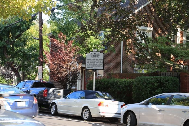
in 1864 near the Freedmen’s barracks in Alexandria
to serve sick and injured United States Colored
Troops (USCT). Designed by the U.S. Army, . . . — — Map (db m108153) HM
During the Civil War, 217 was the headquarters of the L'Overture Hospital. It was named after Tousaint L'Overture — Hispaniola's (Haiti) slave revolt leader. Patients were African American Union Soldiers & “contrabands” (escaped . . . — — Map (db m74279) HM WM
Alexandria, occupied by Union troops during the Civil War, became a refuge for African Americans escaping slavery. Before the war ended, about 50 former slaves founded the Shiloh Society, later known as Shiloh Baptist Church. Members held services . . . — — Map (db m91684) HM
During the Civil War, Alexandria's population swelled with more than 20,000 enslaved African Americans fleeing Confederate territory for safety behind Union lines. Initially called Contrabands because they were considered "property" taken during . . . — — Map (db m127734) HM
“Alexandria is ours,” declared Col. Orlando Wilcox of the 1st Michigan Vol. Inf. as his regiment captured the city on the morning of May 24, 1861. When Virginia's vote of secession became effective, Union forces immediately crossed the . . . — — Map (db m159) HM
“Alexandria is ours,” declared Col. Orlando Wilcox of the 1st Michigan Infantry as his regiment captured the city on the morning of May 24, 1861, one day after Virginia officially left the Union. Due to its strategic location on the . . . — — Map (db m152570) HM
Fort Ellsworth, one of 68 earthen forts built to protect Washington during the Civil War, was constructed in 1861. When completed, the fort had a perimeter of 618 yards and was an irregular Vauban-type star design of French origin. The fort was . . . — — Map (db m45046) HM
Here stood Fort Ellsworth, named for Colonel Elmer E. Ellsworth who was killed during the Union Army's occupation of Alexandria on May 24, 1861. Built in 1861, the fort had a perimeter of 618 yards and emplacement for 29 guns. — — Map (db m133932) HM
What is Succession?
The forest in this area of the Park is changing from primarily an evergreen (conifer) forest of white pine trees to a younger oak and hickory (deciduous) forest. The white pine forest began about 80 years ago . . . — — Map (db m150809) HM
Camp of the 44th New York Volunteer Infantry, also known as the "Ellsworth Avengers" and the "People's Ellsworth Regiment." The unit was raised in honor of Colonel Elmer E. Ellsworth, who was killed at the Marshall House Hotel on May 24, 1861, . . . — — Map (db m196) HM
In December 1863, Union Gen. William W. Averell’s 2,500 cavalrymen raided Salem, Virginia, to disrupt the Virginia and Tennessee Railroad supply line to Confederate Gen. James Longstreet, who was besieging Knoxville, Tennessee. After the raid, . . . — — Map (db m107979) HM
Australia Furnace, located just east of here, produced pig iron for the Tredegar Iron Works—“Ironmaker to the Confederacy”—during the Civil War. Ira and Edwin Jordan had begun constructing Australia Furnace in 1852; two years later, they put it in . . . — — Map (db m107981) HM
You are standing near the site of the Lucy Selina Furnace, which supplied the Confederacy with pig iron for the production of cannons, munitions, and rails during the Civil War. In 1827, two Scots-Irishmen, Col. John Jordan and John Irvine, built . . . — — Map (db m107982) HM
This furnace was built in 1827 by ironmasters John Jordan and John Irvine and was named for their wives. During the Civil War, iron produced here was used in the manufacture of Confederate Munitions. — — Map (db m46386) HM
During the Civil War, the Jackson River Depot was located here. It marked the western terminus of the Virginia Central Railroad, which extended 200 miles from Hanover Junction north of Richmond. Located just east of the Kanawha Pass of the Allegheny . . . — — Map (db m107980) HM
First called the Church by the Spring, Oakland Grove Church may have been organized as early as 1834, but it was officially established circa 1847 as a mission of Covington Presbyterian Church. A simple brick house of worship constructed during a . . . — — Map (db m46377) HM
In continuous use as a place of worship except for a period between 1861 and 1865 when it was used as a hospital for a contingent of General T.J. (Stonewall) Jackson's troops encamped nearby.
A monument in the churchyard marks the graves of . . . — — Map (db m46379) HM
William Henry Haynes, Sr. donated land for the Oakland Church and cemetery in 1811 to trustees James M. Montague, John P. Haynes, David Williamson and William H. Haynes, Jr. But the deed was not recorded until 1859. The original structure is said . . . — — Map (db m46378) HM
Jackson River Station
Around 1857, the Virginia Central Railroad completed the Jackson River Depot and was the terminus of the railroad for trains and travelers heading west. Travelers had to continue their travels by horseback or . . . — — Map (db m46385) HM
General Lee ordered all columns of his army from the Richmond and Petersburg trenches to rendezvous at this village on the Richmond & Danville Railroad. Here he hoped to obtain rations before continuing the march to North Carolina to join General . . . — — Map (db m18871) HM
Confederate Gen. Robert E. Lee ordered all of the Army of Northern Virginia's columns retreating west from Richmond and Petersburg to rendezvous at this courthouse village on April 4-5, 1865. Lee hoped that Richmond & Danville Railroad trains . . . — — Map (db m180224) HM
Patriot
Father John Bannister Tabb was born in Amelia County in 1845 at “The Forest”, the Tabb family plantation. A member of one of wealthiest families in Virginia, he was carefully schooled by private tutors until the age of 14, when . . . — — Map (db m35959) HM
Tabb was born in 1845 at "The Forest" here in Amelia County into one of Virginia's oldest and wealthiest families, and was destined for the life of a gentleman farmer. The American Civil War changed everything for young John. Despite failing . . . — — Map (db m180255) HM
This mortar belonged to the battery cammanded by Captain J.N. Lamkin. On July 30, 1864, at the “Crater”, the battery helped check the Union advance until Mahone came up. Four mortars were captured near Flat Creek in Lee’s Retreat, April . . . — — Map (db m18873) HM
Lee's army, retreating toward Danville, reached this place, April 4-5, 1865, only to find that the supplies ordered here had gone on to Richmond. The famished soldiers were forced to halt to forage. The result was that Lee, when he resumed the march . . . — — Map (db m18874) HM
Amelia County is largely indebted to one woman for bringing formal education and religion to African Americans after the Civil War. In 1865 Mrs. Samantha Jane Neil left her home in Pennsylvania to search for her husband’s body. He had been a . . . — — Map (db m20239) HM
Through early morning showers on April 6, 1865. Gen. Robert E. Lee's weary men and creaking wagons slogged west toward Farmville and expected rations. They passed through Deatonville, “a cluster of half-a-dozen brick farmhouses,” and . . . — — Map (db m117558) HM
During this day, the entire Confederate line would march west on the Rice-Deatonville Road toward Farmville. Constantly pressing Lee's rearguard, Union troops would fight a brief action at every turn. These delays would eventually lead to the . . . — — Map (db m28836) HM
Union cavalry under Gen. Henry E. Davies, Jr. left Gen. Philip H. Sheridan’s column near Jetersville on April 5, 1865, on a reconnaissance mission against the Army of Northern Virginia. Davies swept by here, rode through Paineville, and four Miles . . . — — Map (db m28834) HM
A portion of the Union army encountered Lee’s rearguard as the Southerners completed their night march around Grant's troops. This was also the scene of an April 5 engagement as Union cavalry returned from destroying a Confederate wagon train at . . . — — Map (db m28833) HM
This is the Hillsman House, used by the Unionists as a hospital in the engagement of April 6, 1865. From the west side of the creek the Confederates charged and broke through the Union infantry, but were stopped by the batteries along the . . . — — Map (db m8284) HM
Union forces assembled along this ridge while Confederate troops prepared on the opposite slope. Federal forces crossed Little Sailor’s Creek for a fierce battle which compelled many Southerners to surrender. The house served as a hospital for both . . . — — Map (db m11795) HM
While passing through this intersection, the Confederate column was attacked by Union cavalry. Consequently, part of Lee’s army, and the main wagon train, turned north onto the Jamestown Road while the main portion continued straight ahead to Rice’s . . . — — Map (db m11799) HM
Shortly before noon on April 6, 1865, elements of Union Gen. George Crook's cavalry division attacked Confederate Gen. Richard H. Anderson's infantry corps as it marched through this intersection. While most of the Army of Northern Virginia . . . — — Map (db m116967) HM
Lee found Union cavalry and infantry across his line of retreat at this station on the Richmond and Danville Railroad. Rather than attacking the entrenched Federals, he chose to change direction and begin a night march toward Farmville where . . . — — Map (db m18886) HM
Near here Lee, moving south toward Danville, in the afternoon of April 5, 1865 found the road blocked by Sheridan. He then turned westward by way of Amelia Springs, hoping to reach the Southside (Norfolk and Western) Railroad. — — Map (db m86137) HM
After evacuating Petersburg and Richmond on 2-3 Apr. 1865, Gen. Robert E. Lee's Army of Northern Virginia retreated west to Amelia Court House to obtain supplies and then turn south to North Carolina. On 6 Apr., however, when Maj. Gen. Philip H. . . . — — Map (db m155598) HM
Sheridan reached here on April 4, 1865 with cavalry and the Fifth Corps, and entrenched. He was thus squarely across Lee's line of retreat to Danville. On April 5, Grant and Meade arrived from the east with the Second Corps and the Sixth Corps. — — Map (db m10217) HM
From here Union cavalry moved north on April 5, 1865 to ascertain Lee's whereabouts. On the morning of April 6, the Second, Fifth and Sixth corps of Grant's army advanced from Jetersville toward Amelia Courthouse to attack Lee. — — Map (db m86139) HM
Three miles north is Amelia Springs, once a noted summer resort. There Lee, checked by Sheridan at Jetersville and forced to detour, spent the night of April 5-6, 1865. — — Map (db m10219) HM
As night began to fall here on, April 6, 1865, the hard fought battles of Little Sailor's Creek and the crossroads near the Marshall Farm draw to a close. Federal surgeons work by the little natural light that's still available. They are inside the . . . — — Map (db m10274) HM
Erected in memory of W. R. Turner, historian of Blackstone, Virginia, for his work to preserve the historic battlefields and routes of General Robert E. Lee’s retreat Centennial Year 1961 Piedmont Area Explorer Scouts B.S.A. Erected by . . . — — Map (db m239932) HM
Here Custer, commanding advance guard of an Army of the Potomac, struck and drove back Fitz Lee, left flank guard of Army of Northern Virginia, April 3, 1865. — — Map (db m6156) HM
When Gen. Robert E. Lee evacuated the Army of Northern Virginia from Petersburg and Richmond on April 2-3, 1865, he ordered the army’s wings to unite at Amelia Court House, where trains would meet them with food and other supplies. The army would . . . — — Map (db m6049) HM
April 3, 1865 As Lee's men continued their morning march toward Ameila Court House, cavalries skirmished around this church. Forced to withdraw, the armies continued a running battle that ended near Deep Creek. Namozine Church also served as a . . . — — Map (db m6071) HM
"The men pressed forward, holding their fire with wonderful self control till they were in plain site of the enemy almost face to face."
As the Federal troops realigned themselves after the creek crossing, and because of the shorter . . . — — Map (db m54473) HM
"We found a stream of muddy water a dozen feet wide..."
“The colonel’s clear voice sounded ‘ATTENTION’....Descending the hill; ‘Prepare to cross a marsh!’ was passed along the line....Three or four minutes later we found ourselves . . . — — Map (db m54474) HM
"There goes a chivalrous fellow. Let's give him three cheers."
Near this site were positioned Confederate forces commanded by General Joseph B. Kershaw. They were mainly from Mississippi and Georgia and were slightly dug in behind . . . — — Map (db m54471) HM
The 18th Georgia Battalion, acting as a heavy artillery unit, was originally formed in 1802 and served at the coastal defenses around Charleston, South Carolina. Moved to Virginia in May of 1864, it guarded the Richmond & Danville Railroad Bridge . . . — — Map (db m190487) HM
On 11 June 1864, about 800 yards east, the Botetourt Battery prevented the destruction of the Orange and Alexandria Railroad bridge across the Tye River. This bridge was an important part of the Confederate railroad network for the movement of . . . — — Map (db m10227) HM
Confederate Soldiers
1861 - 1865
To the memory of
The Sons of Amherst County
who from 1861 to 1865
upheld in arms the cause
of Virginia and the South,
who fell in battle
or died from wounds,
and survivors of the war
who as . . . — — Map (db m67324) WM
Patented in 1742 by John Bolling, Jr., the 2,735-acre Buffalo Lick Plantation tract along the James
River includes three notable historic sites. One
mile southeast stand the ruins of Mount Athos, the
home of William J. Lewis, an officer in . . . — — Map (db m46354) HM
During the Civil War, a line of trenches and
fortified artillery positions extending past
here were built late in 1863 to defend Lynchburg against attack from the north. Brig.
Gen. Francis T. Nicholls was responsible for
ensuring that the local . . . — — Map (db m156359) HM
From near his headquarters atop the rise in front of you, Lt. Gen. Ulysses S. Grant sent a message that jolted a nation. After finishing his meeting with Lee at the McLean House, Grant paused along the road and scribbled an unassuming note . . . — — Map (db m5914) HM
On April 12, 1865, Union Brig. Gen. Joshua Chamberlain watched the distant ridge as the Confederates prepared for the surrender. They formed into column, marched into the valley, then up the Richmond-Lynchburg Stage Road toward the village. As the . . . — — Map (db m5968) HM
As Lee’s Confederate Army retreated west, Federal forces blocked their way. Near this spot, Union artillery pieces commanded by Lieutenant James H. Lord and a cavalry brigade led by Brevet Brigadier General Charles Smith proved a strategic delay to . . . — — Map (db m169121) HM
The depression before you is the trace of the old Richmond-Lynchburg Stage Road. Gen. Robert E. Lee rode this route both to and from his meeting with Grant on April 9, 1865. His return to the army – as he passed towards his headquarters atop . . . — — Map (db m6004) HM
Two enslaved families lived in the structures behind the McLean House, across the field in front of you. Mary Ann raised three children here: Maria, Rachael, and another unnamed daughter. The second family consisted of Bettie Love Stewart (pictured . . . — — Map (db m234622) HM
On this spot were established the headquarters of the Army of Northern Virginia, General Robert E. Lee, C.S.A, commanding, from April 8th to April 11th, 1865. — — Map (db m15533) HM
Here on Sunday April 9, 1865, after four years of heroic struggle in defense of principles believed fundamental to the existence of our government Lee surrendered 9000 men the remnant of an army still unconquered in spirit. — — Map (db m169653) HM
Appomattox Invincibles Company A, 20th Battalion Virginia Heavy Artillery Formerly Company A, 44th Virginia Infantry Appomattox Greys Company H 18th Virginia Infantry Appomattox Rangers Company H, 2nd Virginia Cavalry Liberty . . . — — Map (db m29997) WM
Here, amidst the once-quiet streets and lanes of Appomattox Court House, Lee, Grant, and their tired armies enacted one of the great dramas in American history. “General, this is deeply humiliating; but I console myself with the thought . . . — — Map (db m15530) HM
This building, erected in 1892 when the county seat was moved to this location, should not be mistaken for the original, built in 1846 and destroyed by fire in 1892. Three miles northeast is old Appomattox Court House and the McLean House where Lee . . . — — Map (db m15514) HM
Here are buried eighteen Confederate soldiers who died April 8 and 9, 1865 in the closing days of the War Between the States. The remains of one unknown Union soldier found some years after the war are interred beside the Confederate dead. About 500 . . . — — Map (db m156470) HM
Near this site General Lee crossed the Appomattox River and proceeded up the hill to the McLean House where he met General Grant to draft the terms of surrender. April 9, 1865. — — Map (db m6006) HM
In 1865, the Lynchburg Stage Road crossed the river at a shallow ford at this point. The Confederate Infantry marched through here to surrender at Appomattox Court House on April 12, 1865. — — Map (db m169185) HM
In this village, General Lee and his Army of Northern Virginia surrendered to General Grant and the Army of the Potomac. The terms of their “gentlemen’s peace” inspired a new unity and a new purpose for our Nation.
The village of . . . — — Map (db m100993) WM
On April 11, 1865, the surrender of the Confederate Artillery took place here, totaling 61 cannons plus limbers and 13 caissons. The artillery stretched one-half mile along the Stage Road. — — Map (db m169622) HM
April 8, 1865 Union cavalry arrived early in the evening and captured three of Lee’s four supply trains. Advancing toward Appomattox Court House, they encountered the surplus Confederate wagons and artillery train. After a brief conflict, . . . — — Map (db m6075) HM
One of the last battles of the Civil War took place one mile west of here. After capturing Confederate supplies, General George Custer's cavalry charged through the woods into the cannon fire of Confederate General Reuben Lindsay Walker's troops. . . . — — Map (db m30041) HM
You are standing near the site of Appomattox Station Depot on the South Side Railroad. Here, on the afternoon of April 8, 1865, Union cavalrymen under Gen. George A. Custer dealt the Army of Northern Virginia a final blow. First, they captured . . . — — Map (db m156545) HM
Near this building stood the station of the South Side Railroad where, on April 8, 1865, three trains unloading supplies for the Army of Northern Virginia were captured by units of Sheridan’s Union cavalry under Gen. Geo. Custer. Significant for its . . . — — Map (db m203259) HM
Built in 1819, this was the first building in what would become the village of Appomattox Court House. The Clover Hill Tavern served travelers along the Richmond-Lynchburg Stage Road. For several decades, it offered the village’s only restaurant, . . . — — Map (db m5989) HM
Confederate Gen. Robert E. Lee’s Army of Norther Virginia began the retreat west from Richmond and Petersburg on April 3, 1865, with about 250 cannon. Two days later, at Amelia Court House, about a hundred of the least effective pieces were culled . . . — — Map (db m84749) HM
Buried here are nineteen men (out of perhaps 100) killed during the last two days of war in Virginia. These men were at first buried where they died – at hospitals or in farm fields and woodlots around Appomattox Court House. But in 1866, the . . . — — Map (db m5990) HM
For most of the war, Lee and his army had tormented their Northern enemies – at Gaines’ Mill, Manassas, Fredericksburg, Chancellorsville. But here, on April 9, 1865, the once-mighty Army of Northern Virginia found itself trapped. Lee faced . . . — — Map (db m15526) HM
Union Col. Henry Capehart commanded Gen. George A. Custer’s Third Cavalry Brigade on Custer’s left flank. On April 8, 1865, Capehart had only the 1st New York (Lincoln) an 1st and 2nd West Virginia regiments on hand, the 3rd West Virginia had . . . — — Map (db m84751) HM
Before and during the Civil War, educational opportunities in Rural Virginia were often limited. The wealthier families employed a tutor or sent their children to boarding academies such as the nearby Union Academy. In such schools students . . . — — Map (db m169313) HM
“It seems to me every one was more scared than ever, from the fact that we knew the war was nearly over, and we did not want to be killed at the end of the war.” Private John L. Smith, 118th Pennsylvania Late on the morning of . . . — — Map (db m5970) HM
Prior to midnight on April 8, 1865, with Federal troops closing in on three sides and the line of retreat along the Richmond-Lynchburg Stage Road blocked, General R. E. Lee held a Council of War with his ranking generals to discuss . . . — — Map (db m84563) HM
On this spot Lieutenant General Ulysses S. Grant, U.S.A. and General Robert E. Lee, C.S.A. met on the morning of April 10th, 1865. — — Map (db m15535) HM
The four-year effort to vanquish the Confederate Army of Northern Virginia came to its climax in the fields before you. “Legs will win the battle men …. They can’t escape, if you will keep up to it.” Maj. Gen. E.O.C.Ord, . . . — — Map (db m15516) HM
Son of (Francis & Maria Meeks,) Born March 2, 1843; and died in the defence of his country October 4, 1861 at Fairfax Court House Va. He was a member of the Appomattox Rangers, in which Company he served faithfully in the battles Bull Run and . . . — — Map (db m169635) HM
On the knoll before you, Lee and Grant held the second of their two meetings at Appomattox Court House. They met here on the morning of April 10. Grant hoped to enlist Lee’s support in urging the surrender of other Confederate armies, and Lee was . . . — — Map (db m5966) HM
A short distance inside these woods stood Robert E. Lee’s last headquarters. Here on April 8, 1865, he held his final council of war. Here on April 10 he issued his farewell order to his army. And from here, on April 12, he departed for home – . . . — — Map (db m5960) HM
Near this spot stood the apple tree under which General Robert E. Lee rested while awaiting the return of a flag of truce sent by him to General U.S. Grant on the morning of April 9, 1865. — — Map (db m30077) HM
At midday on April 9, 1865, General Robert E. Lee rode into this yard, dismounted, and disappeared into the McLean House. Grant, surrounded by generals and staff officers, soon followed. Dozens of officers, horses, and onlookers waited outside. . . . — — Map (db m5962) HM
The last Federal battery taken by the Confederates was captured by the North Carolina cavalry brigade of Brig. Gen. W.P. Roberts at this place. — — Map (db m5972) HM
At this place was fought the last skirmish
by Captain Wilson T. Jenkins of the 14th
North Carolina Regiment commanding 25
men of the 4th and 14th N.C. Regiments. — — Map (db m84748) HM
(Front)
Last at Appomattox
At this place the North Carolina Brigade of Brigadier-General W.R.Cox of Grimes Division fired The Last Volley 9 April 1865.
Major-General Bryan Grimes of North Carolina planned the last battle . . . — — Map (db m169452) HM WM
Nearby is buried Joel Walker Sweeney (ca. 1810-1860), the musician who redesigned this African instrument into the modern five-string banjo that is known today. Although slaves apparently added the fifth string to what had been a four-strong . . . — — Map (db m30076) HM
The 30-foot obelisk marks the Raine family cemetery. Erected in 1912 by C. Hunter Raine, the monument honors past family members, including C. Hunter’s father, Charles James Raine, who served as a captain in the Lee Battery of Virginia Artillery. . . . — — Map (db m36257) HM
(Front):Erected by C. Hunter Raine in loving memory of his father Chas. J. Raine captain of Lee Battery, Co. A, Virginia Artillery, C. S. A. Killed in the Battle of Mine Run Va., November 30th, 1863 and the members of the family buried . . . — — Map (db m15520) HM
In the last clash at Appomattox, some of the men who fought here at the Robertson House on April 9, 1865, were unfortunate enough to be among the last soldiers killed, wounded, or captured in combat. A few were later cited for bravery in the . . . — — Map (db m169288) HM
(preface)
After Union Gen. Ulysses S. Grant's forces broke through Confederate Gen. Robert E. Lee's lines at Petersburg on April 2, 1865, Lee ordered the evacuation of Petersburg and Richmond. The Army of Northern Virginia retreated west on . . . — — Map (db m169292) HM
General Grant used this lane to reach the McLean House where General Lee was waiting to discuss the turns of surrender. April 9, 1865 — — Map (db m156469) HM
4563 entries matched your criteria. Entries 101 through 200 are listed above. ⊲ Previous 100 — Next 100 ⊳