11588 entries match your criteria. The first 100 are listed. ⊳
Native Americans Topic
By Tim Carr, August 1, 2009
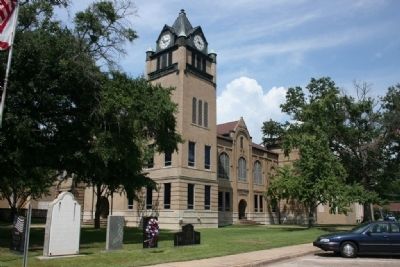
Autauga County Courthouse
| 1 ► Alabama, Autauga County, Prattville — A County Older Than the State, Autauga County — |
| On East 4th Street west of North Court Street, on the right when traveling west. | |||
| 2 ► Alabama, Autauga County, Prattville — Old Kingston Historical Cemetery — |
| On County Road 21, 0.1 miles south of County Road 40, on the left when traveling south. | |||
| 3 ► Alabama, Baldwin County, Bay Minette — Bottle Creek Site — |
| On Courthouse Square (U.S. 31) at Hand Avenue, on the left when traveling east on Courthouse Square. | |||
| 4 ► Alabama, Baldwin County, Blakeley — The Apalachee Village — |
| On Franklin Street, 0.4 miles north of Washington Avenue, on the right when traveling west. | |||
| 5 ► Alabama, Baldwin County, Blakeley — The Bottle Creek Site — Alabama Indigenous Mound Trail — |
| On Franklin Street, 0.4 miles north of Washington Avenue, on the right when traveling west. | |||
| 6 ► Alabama, Baldwin County, Daphne — City of Daphne — Incorporated July 8, 1927 — |
| On Main Street at Manci Avenue, on the right when traveling south on Main Street. | |||
| 7 ► Alabama, Baldwin County, Gulf Shores — Indian Village Achuse — |
| On Alabama Route 180 east of Gasque Lane, on the right when traveling west. | |||
| 8 ► Alabama, Baldwin County, Spanish Fort — Caisson Trace — |
| On Caisson Trace at Spanish Main Street, on the left when traveling west on Caisson Trace. | |||
| 9 ► Alabama, Baldwin County, Spanish Fort — Spanish Fort — |
| On Spanish Main Street north of Spanish Fort Boulevard (U.S. 31), on the right when traveling north. | |||
| 10 ► Alabama, Baldwin County, Stockton — First Creek War — Battles in Alabama & Baldwin County — |
| Near Alabama Route 225, on the left when traveling north. | |||
| 11 ► Alabama, Baldwin County, Stockton — Fort Mims And The Creek Indian War, 1813-14 — |
| On Fort Mims Road north of Boatyard Road (County Route 80), on the right. | |||
| 12 ► Alabama, Baldwin County, Stockton — Historic Stockton / Old Schoolyard Park — |
| On Alabama Route 59, on the right. | |||
| 13 ► Alabama, Barbour County, Batesville — Providence Methodist Church & Schoolhouse — |
| On U.S. 82 at County Route 79, on the right when traveling east on U.S. 82. | |||
| 14 ► Alabama, Barbour County, Eufaula — Chief Eufaula (Yoholo Micco) — In Life and Legend — Creek Heritage Trail — |
| On East Broad Street east of North Livingston Avenue. | |||
| 15 ► Alabama, Barbour County, Eufaula — Cotton and Creek Country — Creek Heritage Trail — |
| Near East Broad Street east of North Livingston Avenue. | |||
| 16 ► Alabama, Barbour County, Eufaula — Creek Indian Removal — |
| On Lake Drive, 0.4 miles east of Lakeside Drive, on the right when traveling east. | |||
| 17 ► Alabama, Barbour County, Eufaula — The City of Eufaula — Creek Heritage Trail — |
| On East Broad Street east of North Livingston Avenue, on the right when traveling west. | |||
| 18 ► Alabama, Barbour County, Eufaula — The Creek Town of Eufaula — Creek Heritage Trail — |
| On East Broad Street east of North Livingston Avenue, on the right when traveling west. | |||
| 19 ► Alabama, Barbour County, Eufaula — The Second Creek War in the Eufaula Area — Creek Heritage Trail — |
| On East Broad Street east of North Livingston Avenue, on the right when traveling west. | |||
| 20 ► Alabama, Barbour County, Eufaula — The Town of Irwinton — Creek Heritage Trail — |
| On East Broad Street east of North Livingston Avenue. | |||
| 21 ► Alabama, Barbour County, Louisville — Louisville and "Old Alabama" — Creek Heritage Trail — |
| On North Main Street (Alabama Route 51) 0.6 miles south of West Street, on the right when traveling south. | |||
| 22 ► Alabama, Barbour County, Louisville — The Battles of Hobdy's Bridge and Pea River — Creek Heritage Trail — |
| On North Main Street (Alabama Route 51) 0.6 miles south of West Street, on the right when traveling south. | |||
| 23 ► Alabama, Barbour County, Louisville — The Opening of the Second Phase of the Second Creek War — Creek Heritage Trail — |
| On North Main Street (Alabama Route 51) 0.6 miles south of West Street, on the right when traveling south. | |||
| 24 ► Alabama, Blount County, Blountsville — Blountsville — |
| On Main Street (U.S. 231) at Lee Street West, on the left when traveling north on Main Street. | |||
| 25 ► Alabama, Blount County, Oneonta — Blount County — A County Older Than the State — |
| On Second Avenue East (US Highway 231) at 4th Street North, on the right when traveling west on Second Avenue East (US Highway 231). | |||
| 26 ► Alabama, Bullock County, Union Springs — Indian Treaty Boundary Line — |
| On U.S. 29, on the right when traveling north. | |||
| 27 ► Alabama, Bullock County, Union Springs — Indian Treaty Boundary Line |
| On U.S. 82 at Greenwood Avenue, on the right when traveling west on U.S. 82. Reported damaged. | |||
| 28 ► Alabama, Butler County, Forest Home — The Butler Massacre / Fort Bibb — |
| On Pineapple Highway (Alabama Route 10) 0.8 miles west of Bibb Road (County Road 5), on the right when traveling west. | |||
| 29 ► Alabama, Butler County, Greenville — Butler County — A County Older Than The State — |
| On East Commerce Street (Alabama Route 10) at South Conecuh Street (County Route 45), on the left when traveling east on East Commerce Street. | |||
| 30 ► Alabama, Butler County, Greenville — Ogly-Stroud Massacre / Gary's Stockade — |
| On Sherling Lake Road (Road 44) 0.4 miles north of Ridge Road (County Road 54), on the right when traveling north. | |||
| 31 ► Alabama, Butler County, Greenville — Pioneer Cemetery — |
| On South Park Street at Deming Street, on the left when traveling south on South Park Street. | |||
| 32 ► Alabama, Butler County, Greenville — The Federal Road and The Palings / Fort Dale 1818 — |
| On Fort Dale Road (Alabama Route 185) 0.3 miles north of Sherling Lake Road, on the right when traveling south. | |||
| 33 ► Alabama, Calhoun County, Alexandria — Lincoyer — and The Battle of Tallasehatchee — |
| On McCullars Lane west of County Road 73, on the left when traveling west. | |||
| 34 ► Alabama, Calhoun County, Alexandria — Tallasseehatchee — Creek Indian War 1813-14 — Nov. 3, 1813 — |
| On U.S. 431, 2 miles north of State Route 144, on the right when traveling south. | |||
| 35 ► Alabama, Calhoun County, Jacksonville — Chief Ladiga Trail - Jacksonville — |
| Near Mountain Street Northwest west of Woodward Avenue Northwest. | |||
| 36 ► Alabama, Calhoun County, Jacksonville — Jacksonville, Alabama — “Gem of the Hills” — |
| On Mountain Street Northwest west of Woodward Avenue Northwest, on the left. | |||
| 37 ► Alabama, Calhoun County, Jacksonville — Site of Indian Trading Post — |
| On Public Square West (State Highway 21) at Ladiga Street Southwest, on the right when traveling south on Public Square West. | |||
| 38 ► Alabama, Calhoun County, Oxford — Archaic — 9,500 BC to 1,250 BC — Choccolocco Park Interpretive Trail — |
| On Leon Smith Parkway. | |||
| 39 ► Alabama, Calhoun County, Oxford — Better Understandings, New Friendships — Choccolocco Park Interpretive Trail — |
| Near Leon Smith Parkway. | |||
| 40 ► Alabama, Calhoun County, Oxford — Historic Oxford — |
| On Main Street at East Oak Street, on the right when traveling north on Main Street. | |||
| 41 ► Alabama, Calhoun County, Oxford — Mississippi Agriculture — AD 1000 to AD 1625 — Choccolocco Park Interpretive Trail — |
| Near Leon Smith Parkway. | |||
| 42 ► Alabama, Calhoun County, Oxford — Mississippi Earthen Mounds — AD 1000 to AD 1625 — Choccolocco Park Interpretive Trail — |
| Near Leon Smith Parkway. | |||
| 43 ► Alabama, Calhoun County, Oxford — Muscogee (Creek) Nation — Arbeka (Abihka) Ceremonial Ground — Choccolocco Park Interpretive Trail — |
| Near Leon Smith Parkway. | |||
| 44 ► Alabama, Calhoun County, Oxford — Muscogee (Creek) Nation — "Little Brother of War" — Choccolocco Park Interpretive Trail — |
| Near Leon Smith Parkway. | |||
| 45 ► Alabama, Calhoun County, Oxford — Muscogee (Creek) Nation — AD 1730 to AD 1832 — Choccolocco Park Interpretive Trail — |
| Near Leon Smith Parkway. | |||
| 46 ► Alabama, Calhoun County, Oxford — Paleoindian — 12,750 BC to 9,500 BC — Choccolocco Park Interpretive Trail — |
| Near Leon Smith Parkway. | |||
| 47 ► Alabama, Calhoun County, Oxford — Reconstructing the Cultural Landscape — Choccolocco Park Interpretive Trail — |
| Near Leon Smith Parkway. | |||
| 48 ► Alabama, Calhoun County, Oxford — The "Shattering" of the Mississippian World — AD 1540 to AD 1730 — Choccolocco Park Interpretive Trail — |
| Near Leon Smith Parkway. | |||
| 49 ► Alabama, Calhoun County, Oxford — The Choccolocco Creek Archaeological Complex — Alabama Indigenous Mound Trail — |
| Near Leon Smith Parkway. | |||
| 50 ► Alabama, Calhoun County, Oxford — The Muscogee (Creek) Nation Today — Choccolocco Park Interpretive Trail — |
| Near Leon Smith Parkway. | |||
| 51 ► Alabama, Calhoun County, Oxford — The Prehistoric, Protohistoric & Historic Periods — Choccolocco Park Interpretive Trail — |
| Near Leon Smith Parkway. | |||
| 52 ► Alabama, Calhoun County, Oxford — Welcome to the Choccolocco Park — Interpretive Trail — |
| Near Leon Smith Parkway. | |||
| 53 ► Alabama, Calhoun County, Oxford — Woodland — 1,250 BC to AD 1000 — Choccolocco Park Interpretive Trail — |
| Near Leon Smith Parkway. | |||
| 54 ► Alabama, Chambers County, LaFayette — Chambers County — |
| On Lafayette Street North (U.S. 431) just south of Alabama Avenue, on the right when traveling north. | |||
| 55 ► Alabama, Chambers County, LaFayette — Muscogee Indians — |
| On South LaFayette Street (U.S. 431) at East Alabama Avenue, on the right when traveling north on South LaFayette Street. | |||
| 56 ► Alabama, Chambers County, Lanett — 141-10 — Ocfuskooche Tallauhassee — |
| On State Line Road (County Route 212) 0.1 miles south of North State Line Road, on the right when traveling north. | |||
| 57 ► Alabama, Cherokee County, Cedar Bluff — Indian Village of Costa — |
| On Old Alabama Route 9 west of Sewell Ferry Road, on the right when traveling west. | |||
| 58 ► Alabama, Cherokee County, Centre — Cherokee County — |
| On Cedar Bluff Road at West Main Street (Business U.S. 411), on the right on Cedar Bluff Road. | |||
| 59 ► Alabama, Cherokee County, Centre — Cherokee County's Beginnings — |
| On Cedar Bluff Road (State Road 283) north of West Main Street (Business U.S. 411), in the median. | |||
| 60 ► Alabama, Cherokee County, Centre — Garrett Cemetery — |
| On College Street (Route 20) 0.1 miles south of South River Road, on the right when traveling north. | |||
| 61 ► Alabama, Cherokee County, Centre — Pathkiller - Childers - Garrett Ferry — |
| On College Street (County Route 20) 0.1 miles south of South River Road, on the right when traveling north. | |||
| 62 ► Alabama, Cherokee County, Centre — Turkey Town Council Site — |
| On West Main Street (Business U.S. 411) at College Street, on the left when traveling west on West Main Street. | |||
| 63 ► Alabama, Cherokee County, Gaylesville — Barry Springs Indian Stockade — |
| On County Route 99 at County Route 95, on the right when traveling north on County Route 99. | |||
| 64 ► Alabama, Cherokee County, Gaylesville — Chattooga — Former Capital of the Cherokee Nation — |
| On County Road 97, 0.2 miles north of Main Street (Alabama Route 68), on the left. | |||
| 65 ► Alabama, Cherokee County, Gaylesville — History of Taff, Alabama — |
| On Alabama Route 273 near County Road 81, on the left when traveling north. | |||
| 66 ► Alabama, Clarke County, Bashi — Choctaw Corner — |
| On Bashi Road (County Road 48) 5 miles west of Route 25, on the right when traveling west. | |||
| 67 ► Alabama, Clarke County, Claiborne — 93001517 — Dellet-Bedsole Plantation — C. 1850 — National Register of Historic Places — |
| On U.S. Highway 84 (U.S. 84) 1.9 miles west of Lena Landegger Highway (County Road 39), on the right when traveling west. | |||
| 68 ► Alabama, Clarke County, Coffeeville — The Mitchell Reserve — |
| On Alabama Route 69 at Hodge Road, on the right when traveling north on State Route 69. | |||
| 69 ► Alabama, Clarke County, Gainestown — Gainestown — |
| Near Walker Springs Road (County Road 29) at Madison Road (Route 33). | |||
| 70 ► Alabama, Clarke County, Gainestown — The Canoe Fight — |
| On Madison Road (County Road 33) at Tennessee Road, on the right when traveling north on Madison Road. | |||
| 71 ► Alabama, Clarke County, Grove Hill — Salt Pans and Furnaces — |
| On West Cobb Street at North Jackson Street (Alabama Route 295) on West Cobb Street. | |||
| 72 ► Alabama, Clarke County, Grove Hill — Turner Corncrib — |
| On West Cobb Street at South Jackson Street, on the right when traveling west on West Cobb Street. | |||
| 73 ► Alabama, Clarke County, Rockville — Central Salt Works — |
| Near Rockville Road (County Road 15) at Christian Vall Road, on the right when traveling south. | |||
| 74 ► Alabama, Clarke County, Rockville — Gravesite of Major Jeremiah Austill — |
| On Rockville Road (County Road 15) at Suel Road, on the right when traveling south on Rockville Road. | |||
| 75 ► Alabama, Clarke County, Suggsville — Fort Madison-Creek War 1812-13 — |
| On Bird Jackson Road (County Road 35) 5.9 miles south of Simmons Creek Road, on the left when traveling south. | |||
| 76 ► Alabama, Clarke County, Thomasville — Tallahatta Springs — |
| On Tallahatta Springs Road (County Road 44) 2.1 miles east of Elam Road (County Road 7), on the right when traveling east. | |||
| 77 ► Alabama, Clarke County, Whatley — Fort Sinquefield — |
| On Fort Sinquefield Road west of U.S. 84. | |||
| 78 ► Alabama, Clarke County, Whatley — Kimbell - James Massacre — ←½ mile— — |
| On U.S. 84 at County Road 22, on the right when traveling west on U.S. 84. | |||
| 79 ► Alabama, Clarke County, Whatley — Old Indian Trail — |
| On Old Line Road (County Road 35) 2 miles north of U.S. 84, on the right when traveling north. | |||
| 80 ► Alabama, Clarke County, Whatley — Old Line Road — |
| On Old Line Road (County Road 35) at U.S. 84, on the left when traveling south on Old Line Road. | |||
| 81 ► Alabama, Clarke County, Whatley — Whatley, Alabama — |
| On Main Street at Rickwood Drive, on the left when traveling east on Main Street. | |||
| 82 ► Alabama, Clay County, Ashland — Clay County and the Creek Indian War of 1813-14 / Clay County and the Creek Indian Confederacy — |
| On Court Square (Alabama Route 9) at 1st Avenue North, on the right when traveling west on Court Square. | |||
| 83 ► Alabama, Clay County, Delta — Native American Footsteps — |
| 84 ► Alabama, Clay County, Goodwater — Battle of Enitachopko — Creek Indian War 1813-14. — ← 4 mi. E. — |
| On Shady Grove Road (Alabama Route 9) at Alabama Route 63, on the right when traveling north on Shady Grove Road. | |||
| 85 ► Alabama, Cleburne County, Muscadine — Hernando de Soto in Alabama — |
| Near Interstate 20 (Interstate 20) west of Alabama Route 37, on the right when traveling west. | |||
| 86 ► Alabama, Colbert County, Cherokee — A Chickasaw Planter — Natchez Trace Parkway — |
| Near Natchez Trace Parkway (at milepost 327.3), 1.4 miles east of N Pike (County Route 21), on the left when traveling east. | |||
| 87 ► Alabama, Colbert County, Cherokee — Bridging Cultures — Natchez Trace Parkway — |
| Near Natchez Trace Access Road (at milepost 327.3), 0.4 miles west of Natchez Trace Parkway, on the right when traveling west. | |||
| 88 ► Alabama, Colbert County, Cherokee — Chickasaw Hospitality — Natchez Trace Parkway — |
| Near Natchez Trace Parkway (at milepost 327.3), 1.4 miles east of N Pike (County Route 21), on the left when traveling east. | |||
| 89 ► Alabama, Colbert County, Cherokee — Chickasaw Indian Agency — |
| On Mulberry Lane, 0.4 miles east of Moody Lane, on the left when traveling east. | |||
| 90 ► Alabama, Colbert County, Cherokee — George Colbert Memorial — |
| Near Natchez Trace Parkway (at milepost 327.3), 1 mile north of N. Pike (County Road 21). | |||
| 91 ► Alabama, Colbert County, Cherokee — Mhoontown Cemetery — Colbert County — |
| On Mhoontown Road, 1.1 miles east of North Pike, on the right when traveling north. | |||
| 92 ► Alabama, Colbert County, Cherokee — Safe Crossing — Natchez Trace Parkway — National Park Service, U.S. Department of the Interior — |
| Near Natchez Trace Parkway (at milepost 327.3), 1.6 miles east of N Pike (County Route 21), on the left when traveling east. | |||
| 93 ► Alabama, Colbert County, Cherokee — Something to Chew on — Natchez Trace Parkway — National Park Service, U.S. Department of the Interior — |
| On Natchez Trace Access Road (at milepost 320.3), 0.4 miles north of Natchez Trace Parkway. | |||
| 94 ► Alabama, Colbert County, Cherokee — Trace Travelers — Natchez Trace Parkway — |
| Near Natchez Trace Parkway (at milepost 327.3), 1.3 miles east of N Pike (County Route 21), on the left when traveling east. | |||
| 95 ► Alabama, Colbert County, Muscle Shoals — Natural and Cultural Preservation/Protecting Resources — |
| Near Reservation Road, 1 mile east of Alabama Route 133, on the left when traveling east. | |||
| 96 ► Alabama, Colbert County, Sheffield — History of Sheffield — |
| On N. Montgomery Avenue near W 3rd St and N. Montgomery Avenue. | |||
| 97 ► Alabama, Colbert County, Tuscumbia — American Indian History — |
| 98 ► Alabama, Colbert County, Tuscumbia — History of Tuscumbia, Alabama — |
| On South Main Street at West 6th Street, on the right when traveling south on South Main Street. | |||
| 99 ► Alabama, Colbert County, Tuscumbia — Sacred Tears — By Branko Medenica — September 19, 2003 — |
| On South Main Street at Spring Park Road, on the left when traveling south on South Main Street. | |||
| 100 ► Alabama, Colbert County, Tuscumbia — Tuscumbia Big Spring — |
| On Spring Park Road, on the left when traveling west. | |||
11588 entries matched your criteria. The first 100 are listed above. Next 100 ⊳