11629 entries match your criteria. Entries 101 through 200 are listed.⊲ Previous 100 — Next 100 ⊳
Native Americans Topic
By Sandra Hughes, July 22, 2009
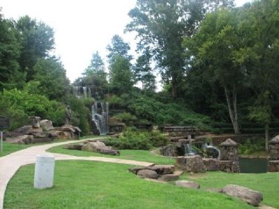
Tuscumbia Big Spring Park
| 101 ► Alabama, Colbert County, Tuscumbia — Tuscumbia Big Spring — |
| On Spring Park Road, on the left when traveling west. | |||
| 102 ► Alabama, Conecuh County, Bermuda — Old Federal Road — |
| On County Road 5 at County Road 20, on the right when traveling north on County Road 5. | |||
| 103 ► Alabama, Conecuh County, Evergreen — City of Evergreen — The Emerald City — |
| On East Front Street at Depot Square, on the right when traveling west on East Front Street. | |||
| 104 ► Alabama, Conecuh County, Midway — Midway — |
| On Alabama Route 83 at Alabama Route 47, on the right when traveling north on State Route 83. | |||
| 105 ► Alabama, Covington County, Florala — Lake Jackson — |
| On 3rd Street (Alabama Route 55) north of 2nd Avenue, on the right when traveling north. | |||
| 106 ► Alabama, Dale County, Daleville — Daleville, Alabama — |
| On South Daleville Avenue (Alabama Route 85) south of Jennifer Lynn Drive, on the right when traveling south. | |||
| 107 ► Alabama, Dale County, Ozark — Sam Dale — |
| On Unnamed road west of Myrtle Drive, in the median. | |||
| 108 ► Alabama, Dallas County, Beloit — Cahawba |
| On State Road 22 at County Route 9, on the right when traveling west on State Road 22. Reported missing. | |||
| 109 ► Alabama, Dallas County, Cahaba — Alabama's Native Prairie |
| On Capitol Street at Cahaba Road, on the right when traveling east on Capitol Street. Reported permanently removed. | |||
| 110 ► Alabama, Dallas County, Cahaba — Cahawba - circa 1500 — |
| Near Vine Street south of Capitol Avenue. | |||
| 111 ► Alabama, Dallas County, Cahaba — Cahawba's Changing Landscape — |
| On Capitol Street at Cahaba Road, on the right when traveling east on Capitol Street. | |||
| 112 ► Alabama, Dallas County, Cahaba — The Mound at Old Cahawba Archaeological Park — Alabama Indigenous Mound Trail — |
| On Vine Street at Capitol Avenue, on the right when traveling north on Vine Street. | |||
| 113 ► Alabama, Dallas County, Selma — Ecor Bienville — 1702-1743 — The first recorded name of Selma — |
| On Water Avenue at Lauderdale Street, on the left when traveling west on Water Avenue. | |||
| 114 ► Alabama, DeKalb County, Fort Payne — Cherokee Indian Removal — |
| On Godfrey Avenue at Logan Street Southeast, on the right when traveling north on Godfrey Avenue. | |||
| 115 ► Alabama, DeKalb County, Fort Payne — Fort Payne Cabin Historic Site — |
| Near 4th Street near Gault Avenue South (Alabama Route 35) when traveling east. | |||
| 116 ► Alabama, DeKalb County, Fort Payne — Fort Payne’s Fort — |
| On Gault Avenue North (U.S. 11) east of 4th Street, on the right when traveling east. | |||
| 117 ► Alabama, DeKalb County, Fort Payne — Indians, Settlers, and Tourists — Little River Canyon National Preserve — |
| Near Little River Falls Overlook Trail, 0.1 miles west of State Road 35. | |||
| 118 ► Alabama, DeKalb County, Fort Payne — Sequoyah — (1760-1843) — |
| On Gault Avenue North (U.S. 11) east of 4th Street, on the right when traveling east. | |||
| 119 ► Alabama, DeKalb County, Fort Payne — Sequoyah | Socks | Song | Scenery — 200 Years of Local History — |
| 120 ► Alabama, DeKalb County, Fort Payne — Site of the Willstown Mission — 1823-1839 — |
| On 38th Street Northeast south of Godfrey Avenue, on the right when traveling south. | |||
| 121 ► Alabama, DeKalb County, Fort Payne — Trail of Tears — John Benge Route — Fort Payne, Alabama to Oklahoma — |
| On Glenn Boulevard SW (Alabama Route 35) at Airport Road West, on the right when traveling west on Glenn Boulevard SW. | |||
| 122 ► Alabama, DeKalb County, Fort Payne — Trail of Tears – 1838 — Little River Canyon National Preserve — |
| Near Little River Falls Overlook Trail, 0.1 miles west of Alabama Route 35. | |||
| 123 ► Alabama, DeKalb County, Fort Payne — Wills Town Mission — |
| On Gault Avenue North (U.S. 11) east of 4th Street, on the right when traveling east. | |||
| 124 ► Alabama, DeKalb County, Sulphur Springs — Wills Town — |
| Near Interstate 59, 1 mile north of County Road 140, on the right when traveling south. | |||
| 125 ► Alabama, DeKalb County, Valley Head — Site of Cherokee Council Tree — |
| On Railroad Avenue at Mountain Street, on the right when traveling west on Railroad Avenue. | |||
| 126 ► Alabama, Elmore County, Millbrook — Robinson Springs Neighborhood — |
| On Monument Drive, 0.1 miles west of Main Street (Alabama Route 143), on the right when traveling west. | |||
| 127 ► Alabama, Elmore County, Tallassee — Tukabatchee / Tokvpvcce — |
| On Tukabatchee Road (State Highway 229) at Taylor Road, on the right when traveling south on Tukabatchee Road. | |||
| 128 ► Alabama, Elmore County, Wetumpka — Here Stood Fort Toulouse — |
| Near West Fort Toulouse Road, 0.3 miles west of Jackson Park Road, on the right when traveling west. | |||
| 129 ► Alabama, Elmore County, Wetumpka — McGillivray Plantation — Known As Little Tallase and "The Apple Grove" — 1740 - 1793 — |
| On Weoka Road (County Road 211) south of Grier Road, on the right when traveling south. | |||
| 130 ► Alabama, Elmore County, Wetumpka — The Mound at Fort Toulouse-Fort Jackson Park — Alabama Indigenous Mound Trail — |
| Near West Fort Toulouse Road, 0.6 miles west of Jackson Park Road. | |||
| 131 ► Alabama, Elmore County, Wetumpka — Wetumpka Historical Marker — |
| Near East Commerce Street at Court Street, on the right when traveling east. | |||
| 132 ► Alabama, Escambia County, East Brewton — Site of Fort Crawford — |
| On Shoffner Street (County Road 22) at Weaver Street, on the right when traveling east on Shoffner Street. | |||
| 133 ► Alabama, Etowah County, Attalla — “The Junction” — Attalla — |
| On 5th Avenue Northeast (U.S. 431) at Cleveland Avenue, on the right when traveling south on 5th Avenue Northeast. | |||
| 134 ► Alabama, Etowah County, Gadsden — The Legend Of Noccalula — |
| Near Noccalula Road (State Road 211). | |||
| 135 ► Alabama, Etowah County, Gadsden — Turkey Town Monument — Chief Turkey-Turkey Town Valley Expedition-May We Never Forget — |
| On U.S. 411, on the right when traveling west. | |||
| 136 ► Alabama, Greene County, Eutaw — A County Older Than The State, Greene County — |
| On Tuscaloosa Street (U.S. 11) east of Springfield Avenue, on the right when traveling east. | |||
| 137 ► Alabama, Greene County, Eutaw — Welcome to Eutaw, Alabama: The Gateway To The Black Belt — County Seat of Greene County — |
| On Main Street (U.S. 11) near Springfield Avenue, on the right when traveling west. | |||
| 138 ► Alabama, Hale County, Moundville — A Perspective of Power — Moundville Archaeological Park — |
| Near Mound State Parkway, 1.5 miles west of Alabama Route 69. | |||
| 139 ► Alabama, Hale County, Moundville — Earthlodge — Moundville Archaeological Park — |
| Near River Bank Road, 0.3 miles west of Mound Parkway, on the right when traveling west. | |||
| 140 ► Alabama, Hale County, Moundville — Mound Arrangement — Moundville Archaeological Park — |
| On River Bank Road, 0.5 miles north of Mound Parkway, on the left when traveling north. | |||
| 141 ► Alabama, Hale County, Moundville — Mound B — Moundville Archaeological Park — |
| Near River Bank Road, 0.3 miles west of Mound Parkway, on the right when traveling west. | |||
| 142 ► Alabama, Hale County, Moundville — Moundville — |
| On Mound Parkway at State Highway 69, on the right when traveling west on Mound Parkway. | |||
| 143 ► Alabama, Hale County, Moundville — Moundville Archaeological Park — Alabama Indigenous Mound Trail — |
| On Mound Parkway, 0.6 miles west of Alabama Route 69, on the right when traveling west. | |||
| 144 ► Alabama, Hale County, Moundville — Moundville Archaeological Park — Moundville Archaeological Park — |
| On Mound Parkway, 0.6 miles west of Alabama Route 69, on the right when traveling north. | |||
| 145 ► Alabama, Hale County, Moundville — Politics and Power — Moundville Archaeological Park — |
| On River Bank Road, 0.3 miles west of Mound Parkway, on the right when traveling west. | |||
| 146 ► Alabama, Hale County, Moundville — Politics and Power — Moundville Archaeological Park — |
| Near River Bank Road, 0.3 miles west of Mound Parkway, on the right when traveling west. | |||
| 147 ► Alabama, Hale County, Moundville — Protection and the Palisade — Moundville Archaeological Park — |
| Near River Bank Road, 0.9 miles west of Mound Parkway. | |||
| 148 ► Alabama, Hale County, Moundville — The CCC and Moundville — Moundville Archaeological Park — |
| Near River Bank Road, on the right when traveling south. | |||
| 149 ► Alabama, Henry County, Abbeville — Little Rock, Alabama — |
| On Henry County 194, on the left when traveling south. | |||
| 150 ► Alabama, Henry County, Screamer — Indian Treaty Boundary Line — |
| On Alabama Route 95, 0.4 miles south of County Road 48, on the left when traveling south. | |||
| 151 ► Alabama, Henry County, Screamer — Indian Treaty Boundary Line — |
| On County Road 97, 0.2 miles north of County Road 93, on the right when traveling north. | |||
| 152 ► Alabama, Henry County, Shorterville — "Irwin Empire" |
| On Alabama Route 10, 0.4 miles north of County Road 91, on the left when traveling north. Reported damaged. | |||
| 153 ► Alabama, Henry County, Shorterville — Franklin - First Beachhead into East Alabama — |
| On Hartford Road (Alabama Route 10) 0.6 miles east of County Road 46, on the left when traveling east. | |||
| 154 ► Alabama, Houston County, Columbia — Omussee Creek Mound and Mississippian Period Societies — Creek Heritage Trail — |
| On Omussee Creek Road, 0.5 miles north of Picnic Road, on the right when traveling north. | |||
| 155 ► Alabama, Houston County, Columbia — Omussee Creek Mound and the Ancestors of the Creeks — Creek Heritage Trail — |
| On Omussee Creek Road, 0.5 miles north of Picnic Road, on the right when traveling north. | |||
| 156 ► Alabama, Houston County, Columbia — The Chacato People — Creek Heritage Trail — |
| On Omussee Creek Road, 0.5 miles north of Picnic Road, on the right when traveling north. | |||
| 157 ► Alabama, Houston County, Dothan — Poplar Head Spring — |
| On East Main Street (Business U.S. 84) at Museum Avenue, on the right when traveling west on East Main Street. | |||
| 158 ► Alabama, Jackson County, Bridgeport — Trail of Tears — |
| On Bradley Avenue, 0.5 miles east of Hoffman Avenue, on the left when traveling east. | |||
| 159 ► Alabama, Jackson County, Rocky Springs — Trail of Tears — |
| On U.S. 72, 0.2 miles north of State Highway 2, on the right when traveling south. | |||
| 160 ► Alabama, Jackson County, Stevenson — Crow Town — |
| On U.S. 72 at Kentucky Ave. on U.S. 72. | |||
| 161 ► Alabama, Jefferson County, Bessemer — The Bessemer Site — Alabama Indigenous Mound Trail — |
| On Alabama Avenue north of 19th Street N, on the right when traveling north. | |||
| 162 ► Alabama, Jefferson County, Birmingham — Before Birmingham: Jones Valley — |
| Near Valley View Drive west of Richard Arrington Jr Boulevard South. | |||
| 163 ► Alabama, Jefferson County, Birmingham — East Lake Community — |
| On 1st Avenue North (U.S. 11), on the right when traveling north. | |||
| 164 ► Alabama, Lauderdale County, Center Star — Center (Centre) Star — |
| On Lee Highway (U.S. 72) at Big Oak (County Route 107), on the right when traveling east on Lee Highway. | |||
| 165 ► Alabama, Lauderdale County, Elgin — Cherokee Chief Doublehead's Village Around 1800 — |
| On Lee Highway (U.S. 72), on the right when traveling east. | |||
| 166 ► Alabama, Lauderdale County, Florence — Adaptation — |
| Near South Court Street at Canal Street, on the right when traveling south. | |||
| 167 ► Alabama, Lauderdale County, Florence — Andrew Jackson's Military Road — 1817 — |
| On County Route 47 at Cox Creek Parkway on County Route 47. | |||
| 168 ► Alabama, Lauderdale County, Florence — Continuity — |
| Near South Court Street at Canal Street, on the right when traveling south. | |||
| 169 ► Alabama, Lauderdale County, Florence — Culture — |
| Near South Court Street at Canal Street, on the right when traveling south. | |||
| 170 ► Alabama, Lauderdale County, Florence — Doublehead, Cherokee Chief — City of Florence Walk of Honor — |
| On Hightower Place. | |||
| 171 ► Alabama, Lauderdale County, Florence — Driven Up The Waters — Natchez Trace Parkway — |
| Near Natchez Trace Parkway (at milepost 328.7) west of County Route 2, on the left when traveling west. | |||
| 172 ► Alabama, Lauderdale County, Florence — Florence Indian Mound — Alabama Indigenous Mound Trail — |
| On South Court Street north of Canal Street, on the right when traveling south. | |||
| 173 ► Alabama, Lauderdale County, Florence — General John Coffee — Home Site and Grave — |
| On Cloverdale Road/Co Rd 157. | |||
| 174 ► Alabama, Lauderdale County, Florence — Prehistoric Mound — (Probably Built Between 100 B.C and 400 A.D.) — |
| On South Court Street. | |||
| 175 ► Alabama, Lauderdale County, Florence — Prehistoric Native Americans / Historic Native Americans — (Circa 8,000 B.C. ~1500 A.D.) / (Circa 1550 A.D.~ 1816 A.D.) — |
| On McFarland Park Road. | |||
| 176 ► Alabama, Lauderdale County, Florence — Removal — |
| Near South Court Street at Canal Street, on the right when traveling south. | |||
| 177 ► Alabama, Lauderdale County, Florence — Tate Springs Estate Early 1800’s — |
| On Bennett Road (County Road 27) north of County Road 22, on the left when traveling north. | |||
| 178 ► Alabama, Lauderdale County, Rogersville — Gabriel “Old Gabe” Butler — 1779~1856 — |
| On CR 421. | |||
| 179 ► Alabama, Lauderdale County, Rogersville — Heritage Park — |
| On Wheeler Street. | |||
| 180 ► Alabama, Lauderdale County, Rogersville — Lamb’s Ferry Road — |
| On Wheeler Street/Lambs Ferry Road (Alabama Route 207) south of Lee Street (County Route 66), on the left when traveling south. | |||
| 181 ► Alabama, Lauderdale County, Waterloo — Trail of Tears — |
| On Main Street. | |||
| 182 ► Alabama, Lawrence County, Moulton — A County Older Than The State — Lawrence County — |
| On Court Street (County Route 460) at Market Street (Alabama Route 33), on the right when traveling east on Court Street. | |||
| 183 ► Alabama, Lawrence County, Moulton — High Town Path — |
| On Ridge Road north of Alabama Route 33, on the right when traveling north. | |||
| 184 ► Alabama, Lawrence County, Moulton — Warrior Mountains — |
| On County Route 33. | |||
| 185 ► Alabama, Lawrence County, Oakville — Cherokee Council House Museum — |
| 186 ► Alabama, Lawrence County, Oakville — Cherokee Indian Removal — |
| 187 ► Alabama, Lawrence County, Oakville — Copena Burial Mound — |
| On County Route 187. | |||
| 188 ► Alabama, Lawrence County, Oakville — Creek Indian Removal — |
| 189 ► Alabama, Lawrence County, Oakville — Doublehead — |
| 190 ► Alabama, Lawrence County, Oakville — Historic Indians — |
| 191 ► Alabama, Lawrence County, Oakville — Oakville Indian Mound — |
| 192 ► Alabama, Lawrence County, Oakville — Town of Oakville — |
| Near County Road 187 when traveling north. | |||
| 193 ► Alabama, Lawrence County, Town Creek — Trail of Tears — |
| Near Foster Mill Road (County Road 314) 0.5 miles west of Wheeler Dam Road. | |||
| 194 ► Alabama, Lee County, Auburn — Auburn - Alabama — |
| On South College Street (Alabama Route 147) at Magnolia Avenue, in the median on South College Street. | |||
| 195 ► Alabama, Lee County, Cusseta — Fort Cusseta — Chambers County — |
| On Martin Luther King Drive (County Road 83) at County Road 82, on the right when traveling south on Martin Luther King Drive. | |||
| 196 ► Alabama, Lee County, Loachapoka — Loachapoka Historic District — |
| On Stage Road (Alabama Route 14) 0.2 miles east of Waverly Road, on the left when traveling east. | |||
| 197 ► Alabama, Limestone County, Athens — A County Older Than the State — Limestone County — |
| On South Jefferson Street at Market Street, on the right when traveling north on South Jefferson Street. | |||
| 198 ► Alabama, Limestone County, Athens — Copena Mound — |
| Near Bay Village Drive at Bay Hill Drive. | |||
| 199 ► Alabama, Limestone County, Athens — Fort Hampton — |
| On Lee Highway (U.S. 72) 0.2 miles west of Wright Road, on the right when traveling west. | |||
| 200 ► Alabama, Limestone County, Athens — Lucy's Branch / Legacy of The Little Elk Community — |
| On Snake Road. | |||
11629 entries matched your criteria. Entries 101 through 200 are listed above. ⊲ Previous 100 — Next 100 ⊳