On County Highway X west of Church Road, on the left when traveling west.
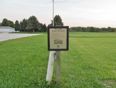
The fall harvest was in and excitement reigned in the community! Cleaning, cooking, baking, sewing — it was time to celebrate and thank the Lord for the good crops and other blessings. Hardships, homesickness, and loneliness were . . . — — Map (db m77485) HM
On County Highway AB at Pine Grove Road (Road R7), on the right when traveling north on County Highway AB.
In the early centuries of Christianity, the Western Church instituted the observation of Rogation Days to invoke God's mercy.
The word rogation is derived from the Latin word rogare, which means "to ask."
According to local . . . — — Map (db m77579) HM
On Knudson Road, 0.4 miles north of County Route D, on the right when traveling north.
Here
Luther College Decorah
Iowa was conducted during
its first year 1861 1862
in the Half Way Creek
Parsonage which was
later destroyed by fire — — Map (db m183053) HM
On County Highway D, 0.1 miles west of Knudson Road, on the left when traveling east.
The first college founded by Norwegian Lutheran pioneer immigrants in the United States opened in the parsonage of Halfway Creek Lutheran congregation, Sept. 1, 1861. Teachers were Laur. Larsen and F.A. Schmidt, who also served as pastors for area . . . — — Map (db m178493) HM
On 11th Street South at Cameron Avenue, on the right when traveling north on 11th Street South.
Aquinas High School at 315 South 11th Street was built to replace the two-year Catholic high school begun at Holy Trinity in 1916. Aquinas was designed by local architects Parkinson and Dockendorff in an English Gothic style. It was dedicated . . . — — Map (db m185930) HM
On 15th Street South at Winnebago Street, on the right when traveling north on 15th Street South.
The Colton Mission Chapel at 1502 Winnebago Street, built by the First Baptist Church in 1893, was used by the Norwegian Evangelical Free Church from 1918 until the 1940's. The Norwegian Methodist Evangelical Church, built at 1503 Winnebago Street . . . — — Map (db m185929) HM
On 8th Street South at King Street, on the right when traveling south on 8th Street South.
Methodist missionary and circuit-riding preachers served the community until the First Methodist Church was organized in 1852. The Methodist congregation moved from South 4th Street to this Romanesque Revival style church in 1886. They merged with . . . — — Map (db m185931) HM
Near Grandad Bluff Road, 0.9 miles west of Bliss Road.
This bluff (commonly called "Grandad Bluff") was the site of the first complete service of Christian Divine Worship to be conducted in La Crosse. The Reverend Father James Lloyd Breck and his company of pioneer missionaries, on the morning of June . . . — — Map (db m220320) HM
On North Chipmunk Road, 1.3 miles east of County Highway K, on the right when traveling east.
In the mid 1800's immigrants from Bohemia and Germany began to settle the Chipmunk Coulee area. Some of the early settlers were the Belling, Bendel, Hiekel, Herold, Kunerth, Lorenz, Meyer, Neumann, Paudler, Preidel, Ringel, Ritschel, Starch, Tietze . . . — — Map (db m9059) HM
Near Losey Boulevard south of Market Street, on the left when traveling south.
This property
Our Lady of Sorrows
Chapel
has been placed on the
National Register
of Historic Places
by the United States
Department of the Interior
Historic Site
City of La Crosse . . . — — Map (db m37179) HM
Near Main Street (State Highway 11) at County Highway J.
In 1847, Father Samuel Mazzuchelli, OP, founded the community of Dominican Sisters at Sinsinawa Mound. Buried here are fourteen of these Sisters.
In 1852, Father Samuel opened St. Clara Academy in Benton. The Sisters staffed the school, . . . — — Map (db m202814) HM
On State Highway 11, 0.3 miles west of Ridge Avenue, on the right when traveling west.
In 1835 Father Samuel Mazzuchelli, Dominican missionary, came to the lead region from the Green Bay-Mackinac frontier. One year later he addressed the opening session of the territorial legislature. Soon he was establishing schools and preparing . . . — — Map (db m55045) HM
On County Road F at Hill Road, on the left when traveling east on County Road F.
In 1850 Zenas Gurley and his family settled in this area. His charisma and leadership led several of this area's early settlers to convert to the Mormon faith. While worshiping on a site similar to this one, the scenic view led them to believe they . . . — — Map (db m33079) HM
On South Main Street (State Highway 78) at Mill Street, on the right when traveling south on South Main Street.
In 1843, the Cline and Newkirk families arrived in the area followed by the Wildermuths in 1846. All were related by marriage and drawn here by fertile land and the Pecatonica River. Disillusion with their current religion and family tragedies led . . . — — Map (db m32041) HM
On Oak Street (State Highway 78) at East Baker Street (County Road F), on the left when traveling north on Oak Street.
In 1850, Zenas Gurley, settled with his family in this area. His charisma and leadership drew other devout families to this area after he broke with Brigham Young because of his polygamy practices. This settlement was called “Zarahemla” . . . — — Map (db m33077) HM
On High Street, 0.1 miles east of County Road I, on the left when traveling south.
Striking in its classical simplicity, this little frame church 30x50 has stood on the New Diggings Hill since its construction in 1844-47 as a place of worship for the Irish mining families of the vicinity. A beautiful example of Greco-Gothic . . . — — Map (db m59534) HM
On Judgement Street at Truth Street, on the right when traveling north on Judgement Street.
St. Matthew Parish was founded by Father Samuel Mazzuchelli OP on August 27, 1835 with the baptism of Henrica Murphy. Worship was held in the cabins of members until 1841 when Father Samuel built the first church which was located on the SE corner . . . — — Map (db m68253) HM
At Gratiot's Grove
two-and-a-half miles
southeast from here the
first Methodist sermon
in Wisconsin was
delivered by the
Rev. John Dew
August 21, 1828 — — Map (db m55054) HM
Near State Highway 78, 1 mile south of County Route N.
Norwegian immigrants formed this congregation in 1844 and began constructing their church in 1847. This is the oldest Norwegian Lutheran church still in use in America. — — Map (db m55050) HM
On State Highway 107, 0.1 miles south of Big Hill Road, on the right when traveling north.
In honor of
Pere Rene
Menard
Born at Paris Sept. 7th, 1605
entered the Jesuit order
Nov. 7th, 1624.
Sailed for Quebec in March
1640. Lost hereabouts in
July 1661, while enroute
to Huron village to baptize
Indian refugees.
. . . — — Map (db m125043) HM
On West Birch Street at South 3rd Avenue on West Birch Street.
In 1854, Fr. Ambrose Oschwald and a group of settlers emigrated from Baden, Germany to found a Catholic religious colony in the spirit of early Christians. This communal settlement was named St. Nazianz, after St. Gregory of Nazianzus from . . . — — Map (db m32327) HM
On Jefferson Street at 19th Street, on the right when traveling south on Jefferson Street.
St. Luke Church Complex
St. Luke
Catholic Church
This property
has been placed on the
National Register
of Historic Places
by the United States
Department of the Interior
1891 — — Map (db m57608) HM
On Jefferson Street south of 19th Street, on the right when traveling south.
St. Luke Church Complex
St. Luke Convent
This property
has been placed on the
National Register
of Historic Places
by the United States
Department of the Interior
1903 — — Map (db m57607) HM
On Jefferson Street south of 19th Street, on the right when traveling south.
St. Luke Church Complex
St. Luke
Rectory
This property
has been placed on the
National Register
of Historic Places
by the United States
Department of the Interior
1895 — — Map (db m57609) HM
On Jefferson Street at 18th Street, on the right when traveling south on Jefferson Street.
St. Luke Church Complex
St. Luke
School
This property
has been placed on the
National Register
of Historic Places
by the United States
Department of the Interior
1909 — — Map (db m57610) HM
On County Highway S, 0.1 miles north of U.S. 151, on the right when traveling north.
Site
Gjerpen Evangelical
Lutheran Church
Founded 1850
Pastors
H. A. Stub 1850 - 1852
J. A. Otteson 1852 - 1860
L. M. Biorn 1862 - 1872
A. O. Alfsen 1872 - 1917
A. O. White 1917 - 1930
E. A. Fretheim 1931 - 1940
Martin . . . — — Map (db m11961) HM
On 13th Road, 0.1 miles north of County Highway O, on the left when traveling north.
The congregation of the United Presbyterian Church of North America was organized in 1851 in the town of Buffalo by a group of early Scotch settlers. At first meetings were held in homes and later, in the section schoolhouse.
In the year of . . . — — Map (db m121833) HM
On North Church Street (County Highway CX) south of North River Road, on the right when traveling north.
—Principal—
Christian Endeavor Academy
1902 — 1925
Born August 24, 1859, Nevinville, Iowa
Died November 10, 1945, Milwaukee, Wisconsin
Graduate B. A. Tabor College, 1882
Yale Divinity School B. D. 1887, . . . — — Map (db m28165) HM
On North Fox Lane, 0.2 miles south of East Dean Road, on the left when traveling south.
A hewn-log schoolhouse was erected on this site during the winter of 1852-53 by school district no. 9, Township of Milwaukee. The structure was also used as a public meeting house, and for church services by the Reformed Church of Bethlehem, a Dutch . . . — — Map (db m125613) HM
On W. Morgan Avenue at S. 51st Street, on the right when traveling west on W. Morgan Avenue.
The first congregation of the Evangelical United Brethren Church in Wisconsin worshipped God here.
The Centennial Historical Museum
Nearby, built in 1858, replaced the first log church erected in 1844. Dedicated in honor of John Lutz, . . . — — Map (db m110107) HM
On West Edgerton Avenue, 0.1 miles north of West Forest Home Avenue (Wisconsin Highway 24), on the right when traveling west.
Saint Mary’s, the oldest church in the area, has a recorded history dating from 1842. At that time Father Patrick O’Kelley was the priest in attendance and a log church had been constructed on the present cemetery site. The second church, a frame . . . — — Map (db m76063) HM
On West Forest Home Avenue, 0.1 miles east of South 108th Street (Wisconsin Highway 100), on the right when traveling east.
The German Evangelical Church
The first Protestant church in hales Corners was founded here in 1888 on land purchased from William Cobb. Services were held in German until that language became unpopular during World War I. The minister at . . . — — Map (db m76040) HM
St. Boniface and its campus at 1122 W. Clarke Street were the epicenter of Milwaukee’s civil rights movement. A Catholic church with a predominantly Black congregation, St. Boniface served as a hub during the 200 consecutive days of open housing . . . — — Map (db m235789) HM
On West Wisconsin Avenue west of North 20th Street, on the right when traveling west.
Of German birth, Pabst became a ship's captain in the 1850s and moved to Milwaukee in the 1860s. He later joined his father-in-law's brewery (founded 1844), which was renamed the Pabst Brewery in 1889. By the 1890s it was the world's largest lager . . . — — Map (db m8306) HM
On West Wisconsin Avenue at North 12th Street on West Wisconsin Avenue.
Designed by Henry C. Koch and Co., dedicated in 1894, and designated in 1975 as a Milwaukee landmark in recognition of its architectural and historical significance to the city. — — Map (db m43014) HM
On Broadway at Kilbourn Avenue, on the right when traveling north on Broadway.
Here have I stood these hundred years
Asking the busy passer-by
Whether he carries - even as I -
Christ in his heart
Centennial of Old Saint Mary's 1946
---------
Erected in 1846 and designated in 1970
as a Landmark of the City of . . . — — Map (db m38617) HM
On Jackson Road, on the left when traveling south.
The first church built in Wisconsin specifically as a Roman Catholic Cathedral, dedicated in 1853, and designated in 1974 as a Milwaukee Landmark in recognition of its architectural and historical significance to the community.
Original . . . — — Map (db m38433) HM
Pioneers in Christian Science.
Healers, Readers, Teachers
and Lecturer.
Founders of
First Church of Christ, Scientist
in Milwaukee. — — Map (db m98599) HM
On Van Buren Street Exit 1E Ramp (Interstate 794) at Jackson Street, on the right when traveling east on Van Buren Street Exit 1E Ramp.
West and across the street stood Milwaukee's first landmark, Blessed Virgin of Pompeii Church, built by the Italian community. Known as the Little Pink Church, 1904-1967.
Blessed Virgin of Pompeii Church, built in 1904 as the first church . . . — — Map (db m38477) HM
On West Lincoln Avenue at South 6th Street on West Lincoln Avenue.
This magnificent Temple of God is a monument of faith, erected by Polish immigrants at the close of the nineteenth century. Raised to the dignity of a Minor Basilica by Pope Pius XI, it was the third church to be so honored in the United States. Its . . . — — Map (db m32839) HM
On North 107th Street, 0.5 miles south of Fond DuLac Freeway (Wisconsin Highway 145), on the right when traveling north.
On Christmas Day 1847, a group of German-speaking settlers, mostly from Pennsylvania, met and founded the German Evangelical Lutheran and Reformed Church of Granville Township. By June 1849, these settlers had built and dedicated a log church on a . . . — — Map (db m68205) HM
On North 24th Street at West Cherry Street, on the right when traveling south on North 24th Street.
Designed by H.P. Schnetzky and E.R. Liebert, erected in 1891-93, and designated in 1973 as a landmark of the City of Milwaukee in recognition of its architectural and historical significance to the community. — — Map (db m43629) HM
On South 4th Street, 0.1 miles north of West National Avenue (Wisconsin Highway 59), on the right when traveling south.
Erected in 1849 and designated in 1970 as a landmark of the City of Milwaukee by the Milwaukee Landmarks Commission in recognition of its architectural and historical significance to the community. — — Map (db m76611) HM
On South 5th Street at West Scott Street, on the left when traveling south on South 5th Street.
Designed by Otto C. Uehling, erected in 1901-02, and designated in 1975 as a Milwaukee Landmark in recognition of its architectural and historical significance to the community. — — Map (db m47824) HM
Upon this site stood
B'Ne Jeshurun Synagogue
The First Jewish Congregation
in Milwaukee County
Dedicated Sept. 27, 1886
Razed March 1928 Before the Construction
of the Milwaukee County Court House
Cong. Emanu-El B'Ne Jeshurun - Sept. . . . — — Map (db m137033) HM
On West Kilbourn Avenue at North Plankinton Avenue, on the right when traveling west on West Kilbourn Avenue.
Father Jacques Marquette, the French Jesuit missionary who with Sieur Louis Jolliet discovered and first explored the upper Mississippi in 1673, stayed on this site November 23-27, 1674. Marquette, with two French Canadians, Pierre Porteret and . . . — — Map (db m30169) HM
On West Kilbourn Avenue at North 4th Street, on the right when traveling north on West Kilbourn Avenue.
St. Mark African Methodist Episcopal Church, the first African-American church built in Wisconsin, once stood on this site. The property was purchased in 1869, the year the congregation was organized. Construction on the St. Mark A.M.E. church . . . — — Map (db m35201) HM
Near West Kilbourn Avenue at North Plankinton Avenue, on the right when traveling west.
350th Anniversary of his birth
Statue dedicated July 9, 1987
Bronze cast donated by the
Milwaukee Sentinel, founded 1837,
in honor of its 150th anniversary.
Original statue donated by
Marquette University High School,
Class of . . . — — Map (db m93659) HM
Near West Kilbourn Avenue at North Plankinton Avenue, on the right when traveling west.
Statue en bronze offerte par le "Milwaukee Sentinel" en commèmoration de son 150 ème anniversaire.
Inaugurée le 9 Juillet 1987 à l'occasion du 350 ème anniversaire de la naissance du Père Marquette — — Map (db m93660) HM
On North 9th Street at West Highlands Avenue on North 9th Street.
Erected in 1878 and designated in 1967 as a landmark of the City of Milwaukee by the Milwaukee Landmarks Commission in recognition of its architectural and historical significance to the community. — — Map (db m43012) HM
On East Juneau Avenue at North Marshall Street, on the right when traveling west on East Juneau Avenue.
Comprising the Cathedral (1868-69), former Guild Hall – Cathedral Institute (1891), former Bishop’s House (1902-03), and landscaped grounds. Designated as a Milwaukee landmark in 1974 in recognition of its architectural and historical . . . — — Map (db m43011) HM
On North Astor Street, 0.1 miles south of East Juneau Avenue, on the right when traveling north.
Erected in 1873 and designated in 1969 as a landmark of the City of Milwaukee by the Milwaukee Landmarks Commission in recognition of its architectural and historical significance to the community. — — Map (db m42572) HM
On North Marshall Street at East Knapp Street, on the right when traveling north on North Marshall Street.
Designed by E.T. Mix, erected in 1882-90, and named a Milwaukee Landmark in 1972 in recognition of its architectural and historical significance. Noteworthy original elements include the exterior and the interior nave ceiling and stained glass. — — Map (db m42570) HM
On North Astor Street at East Ogden Avenue, on the right when traveling north on North Astor Street.
Erected in 1892 and designated in 1967 as a landmark of the City of Milwaukee by the Milwaukee Landmarks Commission in recognition of its architectural and historical significance to the community. — — Map (db m42573) HM
On Hillcrest Drive at North 75th Street, on the right when traveling east on Hillcrest Drive.
This Victorian Gothic church was constructed in 1887-88 as the second home of the FIRST BAPTIST CHURCH OF WAUWATOSA. In 1906-07, it was rededicated as the ENOCH D. UNDERWOOD MEMORIAL BAPTIST CHURCH to honor Enoch D. Underwood, pastor from 1849 to . . . — — Map (db m51462) HM
On Church Street north of North Menomonee River Parkway, on the right when traveling south.
The Congregationalists were the first to organize a church in Wauwatosa. In 1853 they purchased this lot for $50 and erected a small wooden church. The present structure, designed by architect Edwin O. Kuenzli, was begun in 1919 and enlarged in . . . — — Map (db m50838) HM
On Chicago Street at Main Street, on the left when traveling east on Chicago Street.
This church was organized June 10, 1886. The first service was held here October 31 of the same year. Seven years earlier Mary Baker Eddy, the Discoverer and Founder of Christian Science, had founded the Church of Christ, Scientist, in Boston, . . . — — Map (db m13164) HM
On Brazeau Avenue (U.S. 41) 0.1 miles south of Charles Street (State Highway 22), on the left when traveling north.
On December 2, 1669, the Eve of St. Francis, Father Claude Allouez arrived at Oconto, then a village of about 600 Indians. Here Allouez founded the Mission of St. Francois Xavier, the first mission in north eastern Wisconsin. Six French fur traders . . . — — Map (db m13440) HM
On South Lutz Drive at West Cedar Street, on the right when traveling north on South Lutz Drive.
In 1835, just west of this marker, Hippolyte Grignon, the first white settler in what was to become Appleton, built a log house known as “White Heron” with two attached wings for a trading post and quarters for travelers. Within the . . . — — Map (db m61791) HM
Near Church Place, 0.2 miles south of Freistadt Road, on the right when traveling south.
History of the Baesemann Log House
The Baesemann Log Cabin originally stood near the intersection of Highland Road and Wasaukee Road (about 1 mile west and 1 mile north of its present
site). The exact date of the building is unknown . . . — — Map (db m189853) HM
On Granville Road, 0.2 miles south of Freistadt Road, on the right when traveling south.
In early October 1839, approximately 20 families settled near this site to found the colony of Freistadt. Prompted by religious persecution in the homeland, the group sought and found religious haven in Wisconsin. The first log cabin was located . . . — — Map (db m31267) HM
Near Church Place, 0.2 miles south of Freistadt Road, on the right when traveling south.
History of the Parsonage Barn
The Parsonage Barn was built in 1867, and is the only building at this historical grounds to remain at its original location.
Construction
This is an original 'fachwerk' barn. 'Fachwerk' is a . . . — — Map (db m95668) HM
Near Church Place, 0.1 miles south of Freistadt Road, on the right when traveling south.
History of Trinity Horse Sheds
Trinity-Freistadt Congregation had horse sheds located on three different sites. The first horse sheds were located north of the present school building. The second sheds were west of Granville Road, south of . . . — — Map (db m95664) HM
On Buntrock Avenue at North Orchard Street, on the right when traveling west on Buntrock Avenue.
In 1919, reversing the long standing community sentiment against formal religion, a small wood-framed mission was built on this site and became Thiensville’s first church. In 1940, this neo-Gothic limestone church replaced it. A school building was . . . — — Map (db m157906) HM
On County Highway CC at 70th Avenue, on the left when traveling north on County Highway CC.
The restoration of this church and cemetery is in memory of the early pioneers who brought with them their Christian faith upon which they built their homes and communities.
Established 1872
Dedicated to early pioneers
This Swedish . . . — — Map (db m39752) HM
On 170th Street, 0.2 miles south of County Route N, on the right when traveling north.
On February 13, 1887, the Danish Evangelical Lutheran Church in America established its first seminary on this site with Pastor Thorvald Helveg as President, assisted by Pastor Jens Pederson and a layman, J.P. Petersen. In 1888 Pastor P.S. Vig . . . — — Map (db m68703) HM
On County Road T south of Trout Creek Road, on the left when traveling north.
Early Norwegian immigrants settled Central Wisconsin in the mid-1800s and brought with them the traditional church architecture still found in the hills and fjords of their native land. South New Hope Church was chartered in 1888 when synod debates . . . — — Map (db m156507) HM
Near State Highway 80, 0.4 miles north of County Highway CC, on the right when traveling north.
In 1858 the land for St. Patrick's Church and Cemetery was donated to the congregation by Charles and Catherine Shields. The first church was erected in 1867. In 1904 an addition was added to accommodate a growing congregation. In 1924 the old . . . — — Map (db m42000) HM
On Brown Church Drive at Wisconsin Highway 130, on the right when traveling west on Brown Church Drive.
This land was purchased from Benjamin Winterburn in three parcels; the first in 1863 for plat 1 of the cemetery.
This was divided into 45 lots which were sold at $5.00 each. Land for the church site was purchased and the church was built in . . . — — Map (db m66803) HM
On South County Road D just north of West 5th Street, on the left when traveling north.
In the early 1840s, most settlers in Afton were Baptist by denomination and met in various homes. The Town of Rock Baptist Church was founded in 1854 by Rev. H.H. Eddy to accommodate a growing population. This building was constructed in 1862 and . . . — — Map (db m151151) HM
Near South Bergen Road north of East State Line Road.
On this spot and in a small frame church known as the Norwegian Lutheran Church of Clinton, Rock County, Wisconsin, gathered on the Fifth Day of June, 1860, the following named ministers of the gospel:
L. P. Esbuörn · T. N. Hasselquist
P. . . . — — Map (db m26317) HM
On South Jackson Street at Dodge Street, on the right when traveling south on South Jackson Street.
On October 2, 1859
Abraham Lincoln
worshiped with the members of the First Congregational Church which stood on the site of this edifice, 1848 - 1868 — — Map (db m75658) HM
On South Jackson Street at Dodge Street, on the right when traveling south on South Jackson Street.
First Congregational Church
in
Janesville, Wisconsin
is listed in the
National Register of Historic Places
May 17, 1990
This plaque donated in loving memory of
Robert Rockenfield by his family
— — Map (db m75657) HM
Second-generation Protestants primarily from Ohio, Pennsylvania, and New York settled the area surrounding Plain in the late 1840s. Catholic immigrants from Bavaria, Germany arrived in the 1860s and their population grew rapidly. Fr. Charles . . . — — Map (db m229701) HM
On Polk Street west of John Adams Street, on the right when traveling west.
Organized in 1852 by German-American settlers, the Free Congregation (Freie Gemeinde) dominated the cultural, economic and intellectual life of Sauk City well into the twentieth century. This is one of two congregations surviving a once prominent . . . — — Map (db m67226) HM
The Salem Evangelical Church, now commonly known as the Honey Creek United Methodist Church, is listed in the National Register of Historic Places. This church and its site commemorate the settlers from Canton Graubuenden, Switzerland and their . . . — — Map (db m137084) HM
On County Highway E at Mission Road, on the right when traveling north on County Highway E.
Lac Courte Oreilles remains one of the earliest Ojibway (Chippewa) Indian settlements in Wisconsin. In 1796 John Baptiste Corbine, a French-Canadian fur trader, arrived at Little Lac Courte Oreilles and established a trading post here in . . . — — Map (db m23721) HM
On West Grand Avenue (County Highway Q) 0.1 miles west of South Webb Street, on the right when traveling west. Reported missing.
The Norwegian Lutheran Synod dedicated an Indian mission and boarding school on this site in 1887, the same year Congress passed the Dawes Severaty and General Allotment Act. The school boarded as many as 159 children at a time from the Indian . . . — — Map (db m29131) HM
This German Evangelical Church was built in 1890. At that time every church had its cemetery. This small collection of gravestones represents our Heritage Center Church Cemetery. The stones are all from New Richmond. The tall memorial marker for . . . — — Map (db m158278) HM
A search for a small, classic, wooden church with three side windows and a bell tower, the type built by pioneers as they pushed west, took Heritage Center volunteers several years. The perfect church was finally located in South Superior, . . . — — Map (db m158277) HM
On College Avenue west of South Twelfth Street, on the left when traveling west.
Founded in 1854, Galesville University (later known as Gale College) was one of the earliest institutions of higher education in Wisconsin and a notable attempt to bring higher education to the newly recognized state. Affiliated with four different . . . — — Map (db m66184) HM
On Irish Ridge Road, 0.5 miles west of Parker Road, on the left when traveling west.
In 1867-68, at this site, on land donated by Patrick Donohoe in 1861, early Irish immigrants built a white frame church dedicated to St. Patrick. The location was called "Bad Axe" the original name of Vernon County.
The Church was dedicated in . . . — — Map (db m39239) HM
On Baker Street east of Wrigley Drive, on the right when traveling west.
At the crest of the hill in this park overlooking Geneva Lake, the Lake Geneva Seminary (For Young Ladies) was built for its founder, Anna W. Moody, in December 1867. It served as a preparatory school for young women for almost three decades. In . . . — — Map (db m241420) HM
On State Highway 145 at Holy Hill Road, Maple Road, Hwy 145 on State Highway 145.
Center of the settlement established by German-Hunsruck pioneers, the Christ Evangelical Church was founded in 1842. This limestone edifice, replacing a log church, was completed in 1862 on land donated by Phillip Dhein. — — Map (db m30148) HM
On Donges Bay Road, 0.2 miles west of Fond du Lac Avenue (Wisconsin Highway 145), on the right when traveling east.
Founded on 1843 by German settlers from Hessen-Darmstadt and the Bavarian Palatinate, joined later by emigrants from Pomerania and Wurttemberg. Designed by architects Myrath and Koch for $30. 3 acre site purchased from Adam and Maria Stein for $150. . . . — — Map (db m31494) HM
On State Highway 175 at County Route K, on the right when traveling north on State Highway 175.
The congregation of St. Lawrence was organized in 1846 and is one of the oldest Roman Catholic parishes in Washington County. The first log church, located at the southwest corner of the cemetery, was blessed by Bishop Henni in October, 1846. This . . . — — Map (db m37808) HM
On W. Mill Road, 0.5 miles west of Division Road (County Route G), on the right when traveling west.
This historic site was a center of religious activity for German Lutherans who, fleeing religious persecution and economic privation, came to Kirchhayn in 1843 from the Kingdom of Prussia. In 1847 they formed the Evangelical Lutheran Congregation of . . . — — Map (db m38678) HM
Near Carmel Road, 0.2 miles south of Holy Hill Road (Wisconsin Highway 167).
Holy Hill stands 1340 feet above sea level and 250 feet above the surrounding country-side. It has been a place of inspiration and worship for many years. In 1857 Roman Goetz and Mathias Werner erected a 15 foot white oak cross on its summit. A log . . . — — Map (db m37238) HM
On Scenic Drive, 0.1 miles west of Bolton Drive (County Route DD), on the right when traveling west.
Yankee settlers organized the Free Will Baptist Society of Boltonville on February 22, 1872, and built this church which was dedicated June 3, 1873, at a cost of $2,103.80. In the 1880s, the building was home for a Sunday school for as many as 80 . . . — — Map (db m53324) HM
On East Newark Drive east of Harbor Court, on the right when traveling west.
St. Peter's Catholic Church was established in 1846. The first structure was a log church built in 1855. The present structure was built in 1861. The church is an outstanding example of fieldstone construction featuring an unusual half-octagonal . . . — — Map (db m48261) HM
Inspired by Bishop Jackson Kemper, James Lloyd Breck and his companions founded Nashotah Mission as a center for the Episcopal Church’s work in Wisconsin Territory. Preparation of candidates for the priesthood quickly became a major task, to meet . . . — — Map (db m32526) HM
On Church Strret at East Capitol Drive, on the right when traveling south on Church Strret.
Stephan Warren, founder of this community, walked to area in 1838 from Ann Arbor, Michigan and staked homesteader claim in the area that is central Hartland. The first church was founded in 1842. Early worshipers meeting in homes, voted to become . . . — — Map (db m199976) HM
On State Highway 74, 0.2 miles south of County Route V, on the right when traveling north.
Congregation began in Irish settlement between old Lannon Springs and Templeton about 1841. First mass was said in James Brogan’s log cabin.
Original church built of local stone and dedicated, 1848, by parishioners and Fr. James Colton, first . . . — — Map (db m43603) HM
Near County Line Road (County Route Q) at Pilgrim Road.
The first concern for the early frontier people who settled in Menomonee Falls was shelter and a structure for their freedom of worship. This house was built in 1842 by Irish immigrants and is a rare example of the primitive but sturdy dwellings . . . — — Map (db m76225) HM
On Main Street south of Huntington Street, on the left when traveling south.
Founded August 31, 1843 with nine members.
This edifice was erected in 1855. Its historic architecture is Greek Revival with Colonial features. It is a selection of the well known Historical American Buildings Survey.
The bell hung in 1886 . . . — — Map (db m43496) HM
On Main Street south of Hunington Street, on the left when traveling south.
This is the former site of the First Baptist Church of Merton founded August 31, 1843 with nine members. This edifice, erected in 1855, is of historic architecture of Greek Revival with Colonial features. It is a selection of the well-known . . . — — Map (db m82730) HM