On Main Street (New Brunswick Route 114) just south of Legion Street, on the left when traveling south.
Near this town on 3rd September 1755, a detachment of Major Frye's troops, sent from Fort Cumberland to destroy Acadian settlements on the river and compel the people to surrender for deportation, was defeated by a French force under Charles . . . — — Map (db m106630) HM
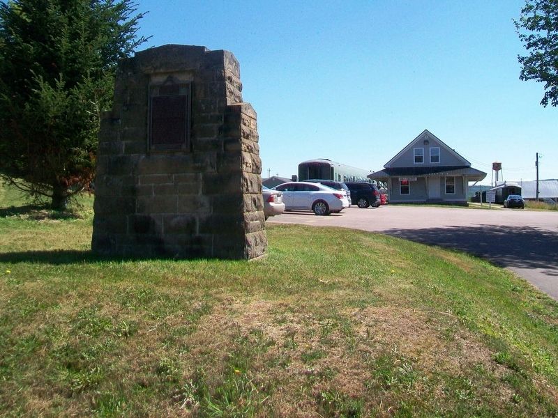
On Main Street (New Brunswick Route 114) at Hopewell Cross Road, on the left when traveling north on Main Street.
This 18th century anchor
retrieved from the
Petitcodiac River
at Hopewell Cape in 1981
by Jack Weldon
Donated to the
Albert County Historical Society
by
his wife Grace
and sons James, Thomas and Dale
This plaque was given as a . . . — — Map (db m106638) HM
Near New Brunswick Route 127, 9 kilometers south of New Brunswick Route 1, on the right when traveling south.
English:
In 1984, the United States Congress designated Saint Croix Island an international historic site in recognition of the historical significance of the Island to the United States and Canada.
The majestic Saint Croix . . . — — Map (db m144503) HM
Near New Brunswick Route 127, 9 kilometers south of New Brunswick Route 1, on the right when traveling south.
English:”Having found no place more suitable than this island... Sieur de Monts… allowed me to draw up the plan of our settlement."
Seventy-nine men, including noblemen, artisans, labourers, Catholic and . . . — — Map (db m144499) HM
Near New Brunswick Route 127, 9 kilometers south of New Brunswick Route 1, on the right when traveling south.
English:
Sieur de Monts named the island Saint Croix Island, and Champlain recorded that: "The island is covered with fir, birch, maple, and oak. It is naturally well located... and is easy to fortify... We considered this the . . . — — Map (db m144498) HM
Near New Brunswick Route 127, 9 kilometers south of New Brunswick Route 1, on the right when traveling south.
English:”It was difficult to know the country without having wintered there... Winter came upon us sooner than we had expected..."
Could you survive a winter on Saint Croix Island if...
• dangerous ice cut you . . . — — Map (db m144501) HM
Near New Brunswick Route 127, 9 kilometers south of New Brunswick Route 1, on the right when traveling south.
English:
The precise mapping of Acadie in the 17th century was the work of one individual — Samuel de Champlain.
Between May 1604 and August 1605, travelling by barque, pinnace, canoe or on foot, Champlain surveyed and . . . — — Map (db m144500) HM
Near New Brunswick Route 127, 9 kilometers south of New Brunswick Route 1, on the right when traveling south.
English:"In order to escape the cold and dreadful winter we experienced on Saint Croix Island, Sieur de Monts decided to move the settlement to another location. Having… found no port that was acceptable to us... we outfitted . . . — — Map (db m144502) HM
Near New Brunswick Route 127, 9 kilometers south of New Brunswick Route 1, on the right when traveling south.
English:
Welcome On Saint Croix Island in 1604, French nobleman-courtier Pierre Dugua Sieur de Monts established a settlement. This outpost was the first attempt by the French at year-round colonization in the territory they . . . — — Map (db m144495) HM
Near New Brunswick Route 127, 9 kilometers south of New Brunswick Route 1, on the right when traveling south.
English: Samuel de Champlain, explorer and geographer on Sieur de Monts' expedition, recorded in late June 1604 that:
”...we entered a river... wherein...we found two islands — one very small and near the western . . . — — Map (db m144496) HM
Near New Brunswick Route 127, 9 kilometers south of New Brunswick Route 1, on the right when traveling south.
English:
The Micmac, Maliseet, and Passamaquoddy hunters and traders provided a commercial lifeline for Sieur de Monts' colony. Their first-hand knowledge of the territory allowed these entrepreneurs to control the supply of furs. . . . — — Map (db m144497) HM
Near Lancaster Avenue, 0.2 kilometers east of Bridge Road (New Brunswick Route 100), on the left when traveling east.
English:
In 1741 Benedict Arnold was born in Connecticut to a prosperous family. Twice before he was 18 young Arnold ran away to join British forces fighting the French and Indian wars.
When the American revolution began . . . — — Map (db m141993) HM
Near Fort Latour Drive at Navy Way, on the right when traveling east.
English:
In 1631, Charles de Sainte-Étienne de La Tour built a fort here on ground traditionally used by First Nations people, for some 4000 years. The fort became one of the earliest centres of the French fur trade with the . . . — — Map (db m139998) HM
Near Fort Latour Drive at Navy Way, on the right when traveling east.
Français: Les peoples des Premières nations ont utilisé cet endroit comme lieu de rassemblement et de cérémonie pendant plus de 4000 ans. En 1631, Charles de Sainte-Étienne de La Tour a établi un poste de traite fortifié. Alors que . . . — — Map (db m152385) HM
Near Lancaster Avenue, 0.2 kilometers east of Bridge Road (New Brunswick Route 100), on the left when traveling east.
English:
In 1640 Françoise Marie Jacquelin from France stepped onto the shores of Acadia to marry Charles de Saint-Étienne, Sieur de La Tour, the 46 year-old Governor of Acadia. With her marriage the young bride joined the war for . . . — — Map (db m141988) HM
Near Lancaster Avenue, 0.2 kilometers east of Bridge Road (New Brunswick Route 100), on the left when traveling east.
English:
At age 16 John Robertson left Scotland for Saint John to work as his uncle's clerk. From his arrival in 1817 Robertson's energy, vision and shrewd business sense were combined with significant social skills. People liked . . . — — Map (db m141994) HM
On Union Street just west of Germain Street (Wellington Row), on the right when traveling east.
English:
This gracious building is a well-preserved example of the homes built by prosperous United Empire Loyalists and their descendants. Constructed before 1820 by the merchant David Merritt, this house was maintained with . . . — — Map (db m139999) HM
Near Chesley Drive (New Brunswick Route 100) at Bentley Street, on the right when traveling north.
English:
Through this viewing tube you can see a small patch of ground around one of the abutments of the Saint John Harbour Bridge. This is all that remains visible of a small island known as Navy Island. For centuries this . . . — — Map (db m147874) HM
Near Lancaster Avenue, 0.2 kilometers east of Bridge Road (New Brunswick Route 100), on the left when traveling east.
English:
Partnership at Portland Point
In August 1775 the 140 residents of Portland Point were attacked. A Machias war sloop burnt Fort Frederick, carried off its four soldiers and a ship full of supplies from the upriver . . . — — Map (db m141990) HM
On King Street just east of Prince William Street, on the right when traveling east.
English:This Clock commemorates the 225th Anniversary of the Incorporation of the City of Saint John on May 18th 1785 as Canada’s First Incorporated City.
It also recognizes May 18th, celebrated in Saint John as Loyalist Day, for . . . — — Map (db m147895) HM
Near Lancaster Avenue, 0.2 kilometers east of Bridge Road (New Brunswick Route 100), on the left when traveling east.
English:
On March 7th 1604, Samuel de Champlain, map-maker for Henry IV of France, sailed for L'Acadie with its newly appointed Lieutenant-General, Pierre du Gua de Monts. A second ship followed with Pont-Gravé who had explored . . . — — Map (db m141299) HM
Near Lancaster Avenue, 0.2 kilometers east of Bridge Road (New Brunswick Route 100), on the left when traveling east.
English:
In 1762 three young ex-officers of provincial regiments (units of Americans within the British army) joined in a trading venture. The Boston friends - James Simonds, James White and William Hazen - were attracted to the . . . — — Map (db m141991) HM
Near Lancaster Avenue, 0.2 kilometers east of Bridge Road (New Brunswick Route 100), on the left when traveling east.
English:
Born in 1818 at Gagetown, NB, Leonard Tilley apprenticed at age 13 to a pharmacist in the north end of Saint John known as Portland. As a certified pharmacist 7 years later, Tilley and his cousin opened "Peters and Tilley . . . — — Map (db m141997) HM
Near Lancaster Avenue, 0.2 kilometers east of Bridge Road (New Brunswick Route 100), on the left when traveling east.
English:
With the rebels controlling the New England timber trade in 1779, Hazen and White secured a contract to supply the Royal Navy with essential masts and spars. Their lumber camps fought battles with those of rival traders . . . — — Map (db m141989) HM
On Broadway Boulevard at Church Street, in the median on Broadway Boulevard.
This sculpture was erected
in memory of our ancestors
who were the founders of
Acadia of the Lands and Forests.
Commemorating the
2014 Congrès mondial acadien
which was held in our region. . . . — — Map (db m125346) HM
Near Champlain Street (New Brunswick Route 106) 0.1 kilometers east of Wheeler Boulevard, on the right when traveling east.
Français: Les Acadiens sont les premiers colons européens à s'établir à la baie de Fundy, au début du 17e siècle. Ils transforment le paysage en asséchant des marais salés et en construisant des levées et des aboiteaux pour créer . . . — — Map (db m150975) HM
Near Champlain Street (New Brunswick Route 106) 0.1 kilometers east of Wheeler Boulevard, on the right when traveling east.
English: The Grand Dérangement L’Acadie, established by France in 1604, was a strategically located and highly coveted colony. In 1713, it was handed over to England and renamed Nova Scotia. The foundation of Halifax, in 1749, . . . — — Map (db m150940) HM
On Main Street (New Brunswick Route 106) just north of Woodlawn Road, on the right when traveling north.
English:400th anniversary celebration of the 1st Acadian settlement. Dedicated to those Acadians who were part of the history of the Village of Dorchester and area. Français:Fêtes du 400e anniversaire de . . . — — Map (db m193196) HM
Near Main Street (New Brunswick Route 106) 0.1 kilometers west of Wheeler Boulevard, on the right when traveling east.
English: The Settlers of the Township of Monckton reached their destination after 44 days at sea, on June 3, 1766. Captain Jonathan Hall guided the sloop along Pennsylvania's Schuylkill River to the New England coast, then entered . . . — — Map (db m151002) HM
Near Main Street (New Brunswick Route 106) 0.1 kilometers west of Wheeler Boulevard, on the right when traveling east.
English: 1 • This journey began in Europe where eight families, seven of German origin, and one of Welsh origin, set out to seek a new homeland. It ended here, on these muddy Banks of the Petitcodiac River, when the families of . . . — — Map (db m151001) HM
Near Main Street (New Brunswick Route 106) 0.1 kilometers west of Wheeler Boulevard, on the right when traveling east.
English: In honour of the permanent settlers of the Monckton township, the Stief, Lutz, Treitz, Jones, Sommers, Copple, Ricker and Wortman families who came up the Petitcodiac River from Pennsylvania and landed on the bank of this . . . — — Map (db m151000) HM
Near Main Street (New Brunswick Route 106) 0.1 kilometers west of Wheeler Boulevard, on the right when traveling east.
English: When they first arrived, the settlers lived together in small, rough cabins. But soon, each family built its own home, as stipulated in the Articles of Agreement. Initially, all livestock was housed in a communal shed. The . . . — — Map (db m151003) HM
Near Queen Street (New Brunswick Route 102) west of Sainte Anne's Point Drive, on the right when traveling west.
English: Local Man Saves 200 Soldiers in the War of 1812 Courage and heroism are epitomized by Fredericton's Charles Rainsford, who led a risky mission to secure rations for a storm-stayed military regiment during an epic . . . — — Map (db m152398) HM
Near Queen Street (New Brunswick Route 102) west of Sainte Anne's Point Drive, on the right when traveling west.
English: During the War of 1812, as the colonies of British North America stood together to fend off attacks from the relatively new United States of America, close to 600 men undertook an epic trek. New Brunswick's 104th Regiment . . . — — Map (db m152395) HM
On Rue Carleton Street north of Queen Street (New Brunswick Route 102), on the left when traveling north.
English:
This building is one of four remaining structures of the British establishment which housed the garrison at Fredericton from 1784 until the withdrawal of Imperial troops in 1869. Occupying the area between York and Regent . . . — — Map (db m139996) HM
Near Queen Street (New Brunswick Route 102) west of Sainte Anne's Point Drive, on the right when traveling west.
English: The wife of the last British Officer stationed in New Brunswick, Mrs. Juliana Horatia Ewing wrote and published an impressive 32 children's books and numerous articles during her brief life, dying at age 44. Fredericton was . . . — — Map (db m152397) HM
Near Queen Street (New Brunswick Route 102) just west of Sainte Anne's Point Drive, on the right when traveling west.
English: In the winter of 1813, New Brunswick’s 104th Regiment of Foot marched over 1,100 km from Fredericton to Kingston, in present-day Ontario, to support the British effort during the War of 1812. This expedition is regarded as . . . — — Map (db m152393) HM
On Queen Street (New Brunswick Route 102) just west of Rue Carleton Street, on the right when traveling west.
English:
Six companies of this Fredericton-based regiment made a 700-mile, 52-day march to Quebec and Kingston between February and April 1813. The feat was accomplished in the face of hunger, cold and heavy snows, with remarkably . . . — — Map (db m139995) HM