By Don Morfe, June 23, 2012
Shirley Marker
GEOGRAPHIC SORT Title Sort Marker Number Sort Marker Number Sort N Marker Number Sort T Publication Order Sort Publication Order Sort A Erected Year Sort Most Viewed Sort Most Recent-Interest Sort Most Recently Changed Sort SEE FAQ #33 FOR DESCRIPTIONS
On John Tyler Memorial Highway (Virginia Route 5) at Shirley Plantation Road (Virginia Route 608), on the right when traveling west on John Tyler Memorial Highway.
On John Tyler Memorial Highway (Virginia Route 5) 0.2 miles east of Sturgeon Point Road (Virginia Route 614), on the right when traveling west.
On John Tyler Memorial Highway (Virginia Route 5) at Wilcox Wharf Road (Virginia Route 618), on the right when traveling east on John Tyler Memorial Highway.
On John Tyler Memorial Highway (Virginia Route 5) at Kimages Road, on the right when traveling east on John Tyler Memorial Highway.
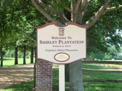
On John Tyler Memorial Highway (Virginia Route 5) 0.4 miles east of Barnetts Road (Route 609), on the right when traveling east.
On John Tyler Memorial Highway (Virginia Route 5) 1.4 miles east of Harrison Landing Road, on the right when traveling east.
Near Westover Road (Virginia Route 633) 2.1 miles east of Harrison Landing Road.
On John Tyler Memorial Highway (Virginia Route 5) at Sandy Point Road (Virginia Route 613), on the right when traveling east on John Tyler Memorial Highway.
On John Tyler Memorial Highway (Virginia Route 5) at Wayside Road (County Route 607), on the right when traveling east on John Tyler Memorial Highway. Reported missing.
On John Tyler Memorial Highway (Virginia Route 5) at Wayside Road (County Route 607), on the right when traveling east on John Tyler Memorial Highway.
On John Tyler Memorial Highway (Virginia Route 5) 0.1 miles east of Virginia Route 156, on the right when traveling east.
Near Lot Cary Road (Virginia Route 602) at Samaria Lane, on the left when traveling south.
On John Tyler Memorial Highway (State Highway 5) at Weyanoke Road (State Route 619), on the right when traveling east on John Tyler Memorial Highway.
On John Tyler Memorial Highway (State Highway 5) at Weyanoke Road (State Route 619), on the right when traveling east on John Tyler Memorial Highway.
Near Red Hill Road (Route 677) 1 mile Staunton Hill Road (Route 619), on the right when traveling west.
Paid Advertisement
Near Red Hill Road (County Route 677) 1 mile Staunton Hill Road (County Route 619).
Near Red Hill Road (County Route 677) 1 mile Staunton Hill Road (County Route 619).
Near Red Hill Road (County Route 677) 1 mile south of Staunton Hill Road (County Route 619).
On Patrick Henry Highway (Virginia Route 40) at Womacks Loop Road, on the right when traveling east on Patrick Henry Highway. Reported permanently removed.
On Patrick Henry Highway (Virginia Route 40) at Fearstown Road / Womacks Loop (County Road 649), on the left when traveling west on Patrick Henry Highway.
On George Washington Highway (Virginia Route 40) at Greenfield Road (County Route 656), on the right when traveling west on George Washington Highway.
On Jeb Stuart Highway (Virginia Route 92) at Godseys Lane, on the right when traveling west on Jeb Stuart Highway.
On Patrick Henry Highway (U.S. 360) at Cabbage Patch Road, in the median on Patrick Henry Highway.
On Four Locust Highway (Business U.S. 15) north of Crymes Orchard Road, on the left when traveling south. Reported permanently removed.
On Four Locust Highway (Business U.S. 15/360) 0.1 miles north of Crouch Lane, on the right when traveling north.
On Farmville Highway (U.S. 15) at Cabbage Patch Road (County Route 654), on the right on Farmville Highway.
On Red House Road (Virginia Route 727) at Rough Creek Road, on the right when traveling south on Red House Road.
On Barnesville Highway (U.S. 15) at Jackson-Vaughan Road (County Route 607), on the right when traveling south on Barnesville Highway.
On Main Street near 5th Street SE, in the median.
On Fontaine Avenue (Old U.S. 29) at Appletree Road, on the right when traveling east on Fontaine Avenue.
On East Jefferson Street at Farm Lane, on the left when traveling east on East Jefferson Street.
Paid Advertisement
On Park Street north of East Market Street, on the left when traveling north.
On East Jefferson Street at Park Street, on the right when traveling west on East Jefferson Street.
On Riverside Avenue, 0.2 miles north of Chesapeake Street, on the right when traveling north.
On Battlefield Boulevard South (Virginia Route 168) north of Albermarle Drive, on the right when traveling north.
On North Battlefield Boulevard (Virginia Route 168) at Great Bridge Boulevard (Virginia Route 190), on the right when traveling south on North Battlefield Boulevard.
On Battlefield Blvd S at St. Brides Road West, on the right when traveling south on Battlefield Blvd S.
On Cemetery Road, on the left when traveling east.
On Bermuda Hundred Road, 1.4 miles east of Allied Road, on the right when traveling east.
On Bermuda Hundred Road, 1.4 miles east of Allied Road, on the right when traveling east.
Near Henricus Park Road, 1.3 miles east of Coxendale Road.
Near Henricus Park Road, 1.3 miles east of Coxendale Road.
On East Hundred Road (Virginia Route 10) at Point of Rocks Road, on the right on East Hundred Road.
Near Henricus Park Road, 1.3 miles east of Coxendale Road.
On Jefferson Davis Highway (U.S. 1) 0.1 miles north of Osborne Road, on the right when traveling south.
Near Henricus Park Road, 1.3 miles east of Coxendale Road.
Near Henricus Park Road, 1.3 miles east of Coxendale Road.
Paid Advertisement
Near Henricus Park Road, 1.3 miles east of Coxendale Road.
Near Henricus Park Road, 1.3 miles east of Coxendale Road.
On East Hundred Road (Virginia Route 10) at Allied Road, on the right when traveling west on East Hundred Road.
On Jefferson Davis Highway (U.S. 1) 0.1 miles north of Osborne Road, on the right when traveling south.
Near Henricus Park Road, 1.3 miles east of Coxendale Road.
Near Iron Bridge Road (Virginia Route 10) west of Wagners Way, on the right when traveling west.
Near Iron Bridge Road at Wagners Way.
On Iron Bridge Road (Virginia Route 10) at Wagners Way, on the right when traveling west on Iron Bridge Road.
On River Road (Route 602) at Eppes Falls Road, on the left when traveling west on River Road.
On Henricus Park Road, 1.3 miles east of Coxendale Road, on the right when traveling east.
On Henricus Park Road, 1.3 miles east of Coxendale Road, on the right when traveling east.
On Henricus Park Road, 1.4 miles east of Coxendale Road, on the left when traveling east.
On Henricus Park Road, 1.3 miles east of Coxendale Road, on the right when traveling east.
On Henricus Park Road, 1.4 miles east of Coxendale Road, on the left when traveling east.
On Henricus Park Road, 1.4 miles east of Coxendale Road, on the left when traveling east.
Near Enon Church Road (Virginia Route 746) near Ramblewood Drive.
Paid Advertisement
On East Hundred Road (Virginia Route 10), on the right when traveling west.
Near North Woolridge Road, 0.1 miles north of Scotter Hills Lane, on the left when traveling north.
On Midlothian Turnpike (U.S. 60) at Grove Road, on the right when traveling east on Midlothian Turnpike.
Near North Woolridge Road, 0.3 miles south of Walton Park Road.
On River Road (Virginia Route 36) west of Winfree Avenue, on the left when traveling west.
On Jefferson Davis Highway (U.S. 1) at Cogbill Road, on the right when traveling north on Jefferson Davis Highway.
On Jefferson Davis Highway (U.S. 1) at Marina Drive, on the right when traveling north on Jefferson Davis Highway.
On Jefferson Davis Highway (U.S. 1) 0.4 miles south of Chippenham Parkway (Virginia Route 150), in the median.
Near Jefferson Davis Highway (U.S. 1) at Marina Drive, on the right when traveling north.
On Jefferson Davis Highway (U.S. 1) 0.4 miles Chippenham Parkway, in the median.
On Harry Byrd Highway (Virginia Route 7) at Quarry Road (Virginia Route 612), on the right when traveling east on Harry Byrd Highway.
On East Main Street (Virginia Route 7B) 0.1 miles west of Page Street, on the right when traveling west.
On Lord Fairfax Highway (U.S. 340) at Trapp Hill Road (County Route 729), on the right when traveling south on Lord Fairfax Highway.
On East Main Street (Virginia Route 7B) 0.1 miles west of Page Street, on the right when traveling west.
On Lord Fairfax Highway (U.S. 340) at Lewisville Road (County Route 641), in the median on Lord Fairfax Highway.
On John Mosby Highway (U.S. 17/50) at Gun Barrel Lane (County Route 644), on the right when traveling west on John Mosby Highway.
Paid Advertisement
On Lord Fairfax Parkway (U.S. 340) at John Mosby Highway (U.S. 17 / 50), on the right when traveling south on Lord Fairfax Parkway.
On Bishop Meade Road (Virginia Route 255) at Lord Fairfax Highway (U.S. 340), on the left when traveling north on Bishop Meade Road. Reported missing.
On Harry Byrd Highway (Route 7) at Blueridge Mountain Road (Virginia Route 601), on the right when traveling west on Harry Byrd Highway. Reported missing.
On John Mosby Highway (U.S. 50), on the right when traveling west.
On John Mosby Highway (U.S. 50), on the right when traveling east.
On John Mosby Highway (U.S. 17 / 50) at Bishop Meade Road (Virginia Route 255), on the right when traveling west on John Mosby Highway.
On Millwood Road / Old Route 50 (Virginia Route 723) at Bishop Meade Road (Virginia Route 255), on the right when traveling west on Millwood Road / Old Route 50.
On White Post Road at Berry’s Ferry Road, in the median on White Post Road.
On Front Royal Pike (U.S. 522) at Lord Fairfax Highway (U.S. 340), on the right when traveling south on Front Royal Pike.
Near White Post Road (Virginia Route 658) 0.7 miles Carters Line Road (Virginia Route 627), on the right when traveling south.
On Waterfront Drive east of Dunston Point Parkway, on the right when traveling east.
On Waterfront Drive east of Dunston Point Parkway, on the right when traveling east.
On Waterfront Drive east of Dunston Point Parkway, on the right when traveling east.
On Virginia Route 311 near the West Virginia State Line, on the right when traveling north. Reported missing.
On Lee Highway (U.S. 211) at Waterloo Road / Wildwood Circle (County Route 613), on the right when traveling east on Lee Highway.
On Brandy Road (Business U.S. 15/29) at James Madison Highway (U.S. 15/29), on the right when traveling east on Brandy Road.
Paid Advertisement
On Sperryville Pike (U.S. 522) west of Virginia Avenue, on the left when traveling west.
On West Cameron Street at North Main Street (U.S. 522), on the left when traveling west on West Cameron Street.
On Germanna Highway (State Highway 3), on the right when traveling east.
On South East Street at East Stevens Street, on the left when traveling north on South East Street.
On Zachary Taylor Highway (U.S. 522) at Twin Mountains Road (Virginia Route 647), on the right when traveling north on Zachary Taylor Highway.
1655 entries matched your criteria. Entries 201 through 300 are listed above.
⊲ Previous 100 —
Next 100 ⊳