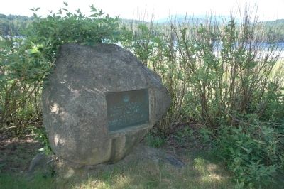
Lake Durant
Named in Honor Of
William West Durant
1850 - 1934
Who Devoted Much of his Life To
Developing the Adirondacks And
Making Known their Beauties
— — Map (db m46723) HM
Home of Gen. Jacob Brown
Commander Northern Frontier
Forces, War of 1812
Commanding General U.S. Army
1821 until his death in 1828
— — Map (db m100639) HM
This point of land was part of 600 acres patented to Captain John Tibbett of Troy, New York in 1799.
——————————
In 1827 three acres were deeded to the U.S. Government for a . . . — — Map (db m75691) HM
In memory of those who kept the light shining at Tibbetts Point Lighthouse, the harbor and buoy lights. Keepers and Assistants of the U.S. Lighthouse Service, and the U.S. Coast Guard.
Judah Williams • 1st Keep
Jonathan Madison • James H. . . . — — Map (db m75692) HM
In Memoriam
U.S.S. Maine
Destroyed in Havana Harbor
February 15, 1898
This tablet is cast from metal
recovered from the U.S.S. Maine — — Map (db m126379) HM WM
1st Battalion, 32nd Infantry
2nd Battalion, 87th Infantry
3rd Squadron, 71st Cavalry
4th Battalion [sic], 25th Field Artillery
710th Brigade Support Battalion
3rd Brigade Special Troops Battalion
"... nothing good in life comes
but at . . . — — Map (db m111748) WM
Soldiers of the 10th Mountain Division (LI)
stand to honor and grieve a fallen comrade
symbolized by the traditional helmet, boots,
and rifle. Two other soldiers in battle gear
move out for the next challenge, at the same
time extending . . . — — Map (db m111745) WM
The Citizens of Jefferson, Lewis and St. Lawrence Counties extend heartfelt welcome to the United States Army and to the men and women of Fort Drum. This standard, which flies our nation's flag, and the time capsule beneath this marker are . . . — — Map (db m110392) WM
In 1895 George Boldt acquired Heart Island for the reputed sum of $20,000.00 and work on the Island began shortly thereafter. The first three projects undertaken were the design and construction of Alster Tower, the construction of a boat lagoon . . . — — Map (db m126692) HM
It is believed that this structure was the first built by the Boldts while they were remodeling the original frame "cottage" on the Island in 1894. The stone tower was topped with a wooden structure designed for use as a dove house. It is said . . . — — Map (db m126654) HM
The most desirable orientation on the island has always been toward the main channel on the Southwest side and the Village of Alexandria Bay on the United States mainland. Taking their cue from the layout of the original Hart cottage, the Boldts . . . — — Map (db m126693) HM
Not many years ago the Thousand Islands, like the Adirondacks, were not considered of much value, except as a great hunting and fishing ground. In 1822 a boundary line and division of the Island Region was agreed upon between United States and . . . — — Map (db m126646) HM
The mighty St. Lawrence River was first explored by Jacques Cartier in 1535. As early as 1680 settlers were talking about building canals on the St. Lawrence River to aid navigation. It was 150 years later that the first navigational work began. . . . — — Map (db m126660) HM
Across the water on Wellesley Island is located the Boldt Yacht House. Mr. Boldt had several projects going on simultaneously with the construction of the castle, the Yacht House being the largest. Construction commenced in November of 1899 at a . . . — — Map (db m126645) HM
Early Mormon meeting home built from native limestone circa 1820. Land bought from William Henderson in 1824. Possible Underground RR site.
Home of T. O. Whitney — — Map (db m143149) HM
This Statue of Liberty was placed here in remembrance of 9/11 to honor all firefighters, policemen and rescue teams that put their lives at risk to help the innocent Americans on that unprecedented September day.
We also want to thank every man . . . — — Map (db m110163) HM WM
In grateful memory of the
Soldiers and Sailors of
Jefferson County
who fought or fell in defense of
the Union and the freedom of man.
This monument to witness
that these dead have not
died in vain and that
through them,
under God, . . . — — Map (db m110124) WM
Original 8 Towns [and] 1805 Town Supervisors
Town of Adams • Nicholas Salisbury
Town of Brownville • John Collins
Town of Champion • Noadiah Hubbard
Town of Ellisburgh • Lyman Ellis
Town of Harrison (Rodman) • Thomas White
Town of . . . — — Map (db m110082) HM
The founder of the
F. W. Woolworth Co.
began his retailing career
at this location in 1873.
After the experience with
the 5¢ counter here,
Frank W. Woolworth
established the first
5¢ and 10¢ stores.
This was the beginning of . . . — — Map (db m110127) HM
Born August 7 · 1835 · Died May 12, 1899
Representative in the Forty Seventh
and in the Fifty First Congress
Governor of the State of New York
MDCCCXCII - MDCCCXCIV
Erected in affectionate and
grateful remembrance of his
noble . . . — — Map (db m110161) HM
Built 1856-57 by the Genesee Valley RR to span the Conesus Outlet. The 200 ft. long x 12 ft. wide limestone bridge was part of the Rochester-Avon-Geneseo-Mt. Morris Line. Avon became a RR hub connecting Buffalo-Rochester-Corning-Hornell. The line . . . — — Map (db m58050) HM
Working Before Its Time On November 25, 1950 storm clouds covered the sky and heavy rains fell causing the water to rise in the upper Genesee River. Severe flooding inundated upstream towns and villages. Many families were rescued from their . . . — — Map (db m143300) HM
Dedicated to the men and women employed by the Mount Morris Dam Builders and U.S. Army Corps of Engineers, Buffalo District 1948-1952
Under the Flood Control Act of 1944, the United States Congress authorized the construction of a dam . . . — — Map (db m143298) HM
In reaction to the severe flooding that occurred almost every seven years in the Genesee Valley since the 1800s, Congress authorized the Mount Morris Dam project under the Flood Control Act of 1944. Completed in 1952 by the United States Army Corps . . . — — Map (db m143296) HM
(left panel) Looking Left – Upstream A Dry Dam… A Protected River Why is there no reservoir upstream of the dam? The Genesee River Basin provides beautiful scenic, natural, recreational, cultural, geological and ecological . . . — — Map (db m143299) HM
Mount Morris Dam was built to provide flood protection to the farm lands, residential areas, and commercial and industrial development in the Genesee River Valley from the dam site north through Metropolitan Rochester to Lake Ontario. Prior to its . . . — — Map (db m143297) HM
Genesee Valley Canal Rochester to Olean 1836-1878 ————————— This section of the Genesee Valley Canal opened as far as Mt. Morris on September 1, 1840. The canal provided a practical means of . . . — — Map (db m116989) HM
Towns sprouted along the length of the Erie Canal. Canal Street was Canastota's business district. Travelers stopped here for food and supplies or a bed for the night at a hotel or boarding house. Local farmers, merchants, and manufacturers shipped . . . — — Map (db m139500) HM
Its immediate success on opening from Albany to Buffalo in 1825 soon led to calls to enlarge the canal. From 1836 to 1862 the canal was deepened from 4 feet to 7 feet, with bigger locks and aqueducts, and canal boats grew threefold in capacity from . . . — — Map (db m139502) HM
Canal and street traffic came into conflict where Peterboro Street crossed the Erie Canal in Canastota's busy commercial district. Engineers fixed the problem with a hydraulic lift bridge. Raised, it let boats through and still carried foot traffic. . . . — — Map (db m139501) HM
Construction of the Erie Canal was hailed as the greatest engineering accomplishment to that time. Under the leadership of Governor De Witt Clinton, construction began July 4, 1817. With little technical knowledge, thousands of workers surveyed, . . . — — Map (db m65012) HM
When a canal boat needed repairs, the captain went to the nearest dry dock. A dry dock was a basin or bay that could be flooded to get a boat in, and then drained so that the boat could be repaired. Along the canal, at least 44 different dry docks . . . — — Map (db m144329) HM
The high ground from Syracuse to Rome, known as the Rome Summit Level, was the first completed section of the canal. Water does not naturally fill this section because of its elevation, but the canal needed to be full to be open. Construction of . . . — — Map (db m144328) HM
This bell was salvaged during the dismantling of the Union Meeting House (Presbyterian Church) in 1883.
It was mounted at the Union Hall on December 11, 1884 and used as a fire bell until the Union Hall was destroyed by fire on December 31, . . . — — Map (db m116797) HM
The opening of the Brockport to Buffalo section in October 1825 marked the completion of the 348 mile Erie Canal. By linking the Hudson River with the Great Lakes, the Canal provided the first economical means of transportation from the eastern . . . — — Map (db m75943) HM
1. Luther Gordon epitomized Brockport's involvement in canal commerce during its heyday. He owned a sawmill and 7,000 acres of timberland in Michigan and transported logs via the Great Lakes and the canal to his Brockport sawmill and planing . . . — — Map (db m75934) HM
1. Daniel Holmes (1828-1917) practiced law in offices on Main Street from 1852 until his death. He was Village Clerk for twenty years, Justice of the Peace for thirty years, Vestryman at St. Luke's Episcopal Church for fifty years, and member . . . — — Map (db m75804) HM
has been placed on the
National Register
of Historic Places
by the United States
Department of the Interior
Built 1854
———————
This structure has
been designated an
Historic . . . — — Map (db m75783) HM
This neighborhood of poured concrete houses was developed by Kate Gleason in the 1920s. These European-like structures were built to last 100 years. — — Map (db m65111) HM
Established in 1935 on this site, wells using the pre-glacial channel of the old Genesee River provided the Village of East Rochester with water until 1992. — — Map (db m56266) HM
Site of tunnel which took workers under the RR tracks to the car shops. Established in 1897 the Merchant Despatch Transportation Co. was largely responsible for the early growth of the village. — — Map (db m70706) HM
Erected in 1935 replacing a smaller tank on Lincoln Road and Filbert Place. It provided was to village for many years, ending in 1992. — — Map (db m70708) HM
Erected at Fullamtown 1822 by Elisha Fullan. Housed 1st Perinton Post Office. Moved here 1850. Site if the 1st Fairport Library. — — Map (db m57769) HM
The Erie Canal was the most important of America’s inland waterways. It facilitated the opening of the American frontier and provided a route west for tens of thousands of settlers and immigrants. Villages, towns, and cities were born along its . . . — — Map (db m65107) HM
The Great American Canal The Erie Canal was the most important of America’s inland waterways. It facilitated the opening of the American frontier and provided a route west for tens of thousands of settlers and immigrants. Villages, town, and . . . — — Map (db m110008) HM
The Great American Canal The Erie Canal was the most important of America’s inland waterways. It facilitated the opening of the American frontier and provided a route west for tens of thousands of settlers and immigrants. Villages, town, and . . . — — Map (db m110017) HM
Built where Indians camped and the William Hincher Family settled in 1792. Restored by the Lighthouse Historical Society in 1984. — — Map (db m39970) HM
These stones from the first aqueduct and the locks were set October 30, 1926 at the eastern widewaters to commemorate the first centenary of the Erie Canal presented to the City of Rochester — — Map (db m57403) HM
Beginning in the twentieth century, this historic neighborhood, now known as Grove Place, was home to some of the leading families of Rochester, including George Selden, an eminent Rochester patent attorney and inventor of the automobile gasoline . . . — — Map (db m62098) HM
Diagonally across Franklin Street stands a fine example of the work of esteemed Rochester architect J. Foster Warner. This traditional banking house was built in 20th century Byzantine Style in 1928 for the Rochester Savings Bank. It features . . . — — Map (db m56296) HM
From Seneca fording place to aqueduct and bridge — a perpetual crossing place
Erie Canal Rerouted South of the City and out of Downtown
The last canal boat passed through the Erie Canal in downtown Rochester in 1919. The city had . . . — — Map (db m65116) HM
Historic Marker
Pont de Rennes
Pedestrian Bridge
(Formerly Platt Street Bridge)
Originally Built - 1891
Rochester Bridge and Iron Works
Converted to Pedestrian Mall - 1980 — — Map (db m55773) HM
Rochester's first park, offered in 1883 by Ellwanger & Barry Nursery; Accepted Jan. 13, 1888. Park Commission formed May 1, 1888. — — Map (db m56107) HM
This plaque is dedicated to the original founders
of the Rochester Water Works, and the hundreds
of succeeding Water Bureau employees who have
carried on the design, construction, operation,
and maintenance of the City's water supply . . . — — Map (db m137308) HM
Canals provide an inexpensive way to move people and goods
1825 The Erie Canal
The Erie Canal connects the Hudson River and Lake Erie. The 363 miles of navigable waterway provided a cost-efficient way to transport goods to and from the . . . — — Map (db m61901) HM
Limestone was used to build locks, aqueducts, and other features throughout New York State's canal system both because of its availability and its durability. This limestone block was a capstone from the Schoharie Aqueduct. Local limestone formed . . . — — Map (db m64591) HM
The stone structure extending about halfway across Schoharie Creek in front of you is what remains of the Schoharie Aqueduct. Built between 1839 and 1841 as part of the Enlarged Erie Canal, the Schoharie Aqueduct was perhaps the single greatest . . . — — Map (db m142208) HM
Has Been Placed on The
National Register of
Historic Places in 2002
By the United States
Department of the Interior
William G. Pomeroy Foundation 2013
— — Map (db m76606) HM
Home of Enoch Ambler
Inventor of First
Mowing Machine
Patent Signed by Pres.
Andrew Jackson in 1834
Heritage & Genealogical Soc. of Montg. Co
— — Map (db m68671) HM
Water was pumped for the house by wind power. The windmill structure also offered a challenge to small gymnasts in the family who loved to clamber about it. — — Map (db m42976) HM
Pier A, a designated New York City landmark, was constructed by the Department of Docks' third Engineer-in-Chief, George S. Greene Jr. between 1884 and 1886.
The pier's two-story building served as the headquarters of the Department of Docks . . . — — Map (db m114673) HM
This line in the pavement represents the western edge of Manhattan in 1871. By that time, the shoreline had already been extended well to the west of the original location, which lay along present day Greenwich Street. The fill that expanded the . . . — — Map (db m154067) HM
This building, constructed in 1895, is among the best of the many eclectic firehouses built by Napoleon Le Brun & Sons. Today it seems surprising that such an elaborate design would be used for so utilitarian a structure. The entire spirit of the . . . — — Map (db m126953) HM
By 1796, a city engineer deemed Collect Pond to be stagnant and foul. A plan emerged to cleanse the pond and reconstruct it as a ship harbor with a channel to the Hudson River, but that plan was rejected. Instead, in 1803, the city decided to . . . — — Map (db m131783) HM
(Medallion)
The leveling of the hills • Fresh water pond filled 1802-1812
As early as 1780, draining the Collect Ponds was suggested to rid the area of pestilence thought to originate in this swampy land. The . . . — — Map (db m128686) HM
The long process of burying Collect Pond was completed by the mid-1810s, but its watery legacy remained. Streets laid over the former pond created a neighborhood that was briefly fashionable but quickly declined after the filled-in pond began to . . . — — Map (db m131785) HM
The Croton Fountain 1842-1870
This was the location of the Croton Fountain. It was fed by the Croton Aqueduct, which provided New York City with its first dependable supply of pure water. Considered one of the great engineering achievements of . . . — — Map (db m130147) HM
The American Immigrant Wall of Honor ® celebrates the peopling of America. The names of individuals and families are inscribed on the wall for posterity as gifts of remembrance through donations made to restore and maintain Ellis Island. The . . . — — Map (db m49817) HM
FishBridge Park is located on the south side of Dover Street, from Pearl to Water Streets. It is between the Fulton Fish Market, to the south, and the Brooklyn Bridge, to the north. Of the two distinguished New York institutions, Fulton Fish Market . . . — — Map (db m41322) HM
The design and layout of Governors Island National Historic District owes much of its development to changing times and roles. From early Dutch settlement to its incarnations as a military base to the US Army and the Coast Guard, Governors Island . . . — — Map (db m47183) HM
This dock is named in honor of the First United States Army soldiers who landed in Normandy during the invasion of France in World War II Dedicated by First United States Army 6 June 1964 — — Map (db m149153) HM
Above your head is nearly three million square feet of historic roofs. More than sixty percent of these roofs are covered in historic slate. In 2008, the Governors Island Preservation and Education Corporation (GIPEC) undertook the repair of these . . . — — Map (db m47205) HM
Yankee Pier is one of six docks and piers on Governors Island. It was built to hold large Coast Guard cutters. Cutters are vessels that are at least 65 feet long and can accommodate a crew living on board. The Y shape of the pier made it easier . . . — — Map (db m47202) HM
[ North Inscription ] To commemorate the one hundredth anniversary of the inauguration of George Washington as first President of the United States. [ South Inscription ] Let us raise a standard to which the wise and the honest can repair. . . . — — Map (db m41339) HM
Between 1886 and 1924, 14 million immigrants entered America through New York. The Statue of Liberty was a reassuring sign that they had arrived in the land of their dreams. To these anxious newcomers, the Statue’s uplifted torch did not suggest . . . — — Map (db m49321) HM
In 1883, a young writer, Emma Lazarus, donated a poem to an auction raising funds for the pedestal of the Statue of Liberty. “The New Colossus” vividly depicted the Statue of Liberty as offering refuge from the miseries of Europe. The . . . — — Map (db m49325) HM
The iron skeleton which supports the Statue was designed by this noted French engineer and bridge builder. He later designed and built the Eiffel Tower for the Paris World’s Fair of 1889. Dedicated by Mr. and Mrs. Marvin Kay Philip Rathner – . . . — — Map (db m49813) HM
The French sculptor, Frédéric Auguste Bartholdi designed the Statue of Liberty as a giant three-dimensional jigsaw puzzle. Over 300 thin sheets of copper, most of it from a copper mine in Karmoy, Norway, fit together to form the Statue’s outer . . . — — Map (db m49285) HM
He conceived this monument, showing the love of Liberty shared by France and America. This statue would be a gift from a people to a people. It was intended for the 1876 Centennial, but was delayed until 1886. De Laboulaye never saw his dream . . . — — Map (db m49811) HM
In 1883 this American poet and essayist wrote “The New Colossus” to aid the Pedestal Fund Campaign. Twenty years later her sonnet was cast in bronze and placed inside the Statue’s pedestal. “Give me your tired, your poor, . . . . . — — Map (db m49815) HM
A French sculptor and friend of De Laboulaye, he created the Statue of “Liberty Enlightening the World” and selected its site. Inspired by his first view of New York Harbor, Bartholdi later wrote “The Statue was born for this place which inspired . . . — — Map (db m49812) HM
As publisher of the New York World newspaper, this Hungarian immigrant conducted the editorial crusade that popularized the American Pedestal Fund Campaign. His last will and testament established the Pulitzer prizes for achievement in journalism, . . . — — Map (db m49814) HM
The Statue of Liberty conveys its message of freedom through a number of dramatic symbols. The broken shackles at her feet signify escape from tyranny. In her left arm, she holds a tablet of law inscribed in Roman numerals the date of the American . . . — — Map (db m49290) HM
Height from base to torch 151’ 1” (46.50m) Pedestal foundation to torch 305’ 1” (92.99m) Length of hand 16’ 5” (5.00m) Index finger 8’ 0” (2.44m) . . . — — Map (db m49332) HM
The Statue of Liberty was the first statue designed by Bartholdi to be completed. Earlier, in the 1850s, while traveling in Egypt, the Nubia and Ethiopia, he designed an immense lighthouse for the opening of the Suez Canal in Egypt, but the design . . . — — Map (db m49315) HM
The granite pedestal of the Statue was paid for entirely by private funds raised in the United States. It was designed by the eminent American architect, Richard Morris Hunt, and engineered by former Civil War General, Charles P. Stone. Its variety . . . — — Map (db m49287) HM
The answer is in the air. The Statue’s skin is made of copper, and when copper is exposed to oxygen in the air, it undergoes a chemical reaction called oxidation. The reaction causes a fine crust or film to develop that is usually green in . . . — — Map (db m49289) HM
This is the oldest synagogue building in continuous use in New York City. The congregation was established in 1839 and this temple, designed by Henry Fernbach, was completed in 1872. The style is Moorish Revival, the arrangement Gothic. . . . — — Map (db m147691) HM
The Hudson River was essential to the history and economic development of New York. The river provided food for early settlers and is still an important waterway for commerce, which led to the expansion and growth of the City. The recognized source . . . — — Map (db m41584) HM
3451 entries matched your criteria. Entries 201 through 300 are listed above. ⊲ Previous 100 — Next 100 ⊳