On Greenup Street (Kentucky Route 17) at East 9th Street, on the left when traveling north on Greenup Street.
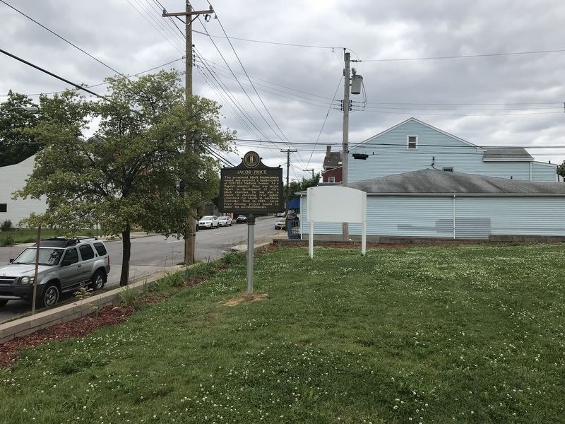
This prominent black businessman
owned and operated a lumberyard
at 426-428 Madison Avenue. As a
Baptist minister, Price was major
figure in development of city's
black churches. He was also a
leader in obtaining free public
education for . . . — — Map (db m174669) HM
On Russell Street south of West Robbins Street, on the left when traveling south.
Sandford House
Built in early 1800s by Major Alfred Sandford. Land originally owned by his father, Gen. Thomas Sandford, who was first member of Congress from Northern Ky. In 1835 house purchased by the Western Baptist Theological Institute . . . — — Map (db m174604) HM
On Madison Avenue just north of East 4th Street (Kentucky Route 8), on the left when traveling south.
Parish organized, Nov. 24, 1842. Cornerstone of first church laid June 24, 1843. Gothic windows of the church sanctuary dedicated vestryman John W. Stevenson, governor and U.S. senator. Bishop Benjamin B. Smith consecrated the building in 1860. Bell . . . — — Map (db m172555) HM
On Greenup Street (Kentucky Route 17) at East 9th Street, on the right when traveling north on Greenup Street.
William L. Grant
Wm. Grant (1820-82), Covington city clerk, councilman, and state rep., supported public education for black children. He deeded land on Seventh Street for elementary school, which opened 1880; renamed Lincoln School 1909. A . . . — — Map (db m174668) HM
On State Highway 550 at State Highway 1697, on the right when traveling north on State Highway 550.
Renowned mountain school located eight miles east. Alice Lloyd came from Boston, 1916, dedicating her life to education of youth in area. Caney Creek Community Center was organized, 1923. After her death, 1962, college renamed honoring founder, who . . . — — Map (db m97201) HM
On Lotts Creek Road (State Highway 1088) 1.1 miles west of State Highway 721, on the left when traveling west.
Lotts Creek Community School was founded by Alice Slone from Caney Creek, 1933. Sent to Cleveland, Ohio, by Alice Lloyd for education; returned home to teach. A year later she started the Cordia High School, uniting the people for a common goal . . . — — Map (db m97122) HM
On West Main Street (Kentucky Route 550) at May Street, on the right when traveling west on West Main Street.
For J. Proctor Knott during term as Governor of Kentucky, 1883-87. Knott born Marion Co., Ky., 1830. Missouri Legislature, 1851-59. Att. Gen., 1859-60. Returned Ky., 1863. U.S. Congress six terms. Famous as humorous and satirical orator. In the 1891 . . . — — Map (db m66931) HM
On Main Street East (Kentucky Route 160) at Fesser Clark Circle, on the right when traveling south on Main Street East.
(Obverse Side)
Dr. Josiah H. Combs, 1886-1960
Dr. Combs received Ph.D. degree from the Sorbonne in Paris, 1925. Married Charlotte Benard of France. He was a professor of foreign languages in many universities and a pioneer in . . . — — Map (db m66933) HM
On State Highway 160, 0.1 miles east of Main Street (State Highway 550), on the right when traveling east.
Founded 1902 by Kentuckians May Stone and Katherine Pettit in cooperation with the local community. The mission of this nondenominational school is to provide educational and service opportunities for the people of the mountains while keeping them . . . — — Map (db m84356) HM
On Main Street East (Kentucky Route 160) at Fesser Clark Circle, on the right when traveling south on Main Street East.
In 1889, George Clarke came to Hindman, licensed to practice law. Seeing the need of education, he established a subscription school with the help of the students and citizens. Educator, State School Inspector, member State Board of Examiners. Died, . . . — — Map (db m66934) HM
On State Highway 160 at Carr Creek Hill Road, on the right when traveling north on State Highway 160.
Olive V. Marsh and Ruth E. Watson from Mass., aided by the Daughters of the American Revolution, carved this center of learning out of a wooded hillside overlooking rustic “Singing Carr.” When organized, September 1, 1920, it was . . . — — Map (db m97058) HM
On Purpose Road, 0.3 miles east of Kentucky Route 899, on the left when traveling east.
Built for Alice Geddes Lloyd by
Caney Creek residents to educate
their children. Mrs. Lloyd worked
to educate leaders for service to
the people of this area. Friends
helped, and through Mrs. Lloyd’s
leadership, the Caney Creek
Community . . . — — Map (db m146283) HM
In this shack was founded The Caney Creek Community Center, October 10, 1916, by Mrs. Alice S. G. Lloyd — A symbol of faith, American democracy, and public service.
As her dollars vanished, she began to count over her friends back in . . . — — Map (db m146340) HM
On Cumberland Gap Parkway (U.S. 25E) at Daniel Boone Drive (State Highway 11), on the right when traveling south on Cumberland Gap Parkway.
For Henry Knox, U.S. Sec. of War, 1785-96. Born Boston, 1750. Joined Continental Army, 1775. Battles of Bunker Hill, Brandywine, Yorktown, and others. Command of artillery, 1775. Commissioned Major-General, 1781. Proposed a military academy in 1779, . . . — — Map (db m35774) HM
On College Street at Corgi Lane, on the right when traveling north on College Street.
The Union College Bell was preceded by five others. The first being installed in the original administration building in 1880.
This memorial honors Nola E. Minton, 1884-1975, for her contributions to agriculture, livestock, lumbering, and saddle . . . — — Map (db m233505) HM
On College Street at Corgi Lane, on the right when traveling north on College Street.
Union College was incorporated in October 1879. The first degrees were conferred here June 8, 1893. Centennial Hall, formerly known as Classroom Building, was named to the National Register of Historic Places in 1975. Also named to the Register were . . . — — Map (db m233506) HM
On Bardstown Road (U.S. 31E) south of North Spalding Road, on the right when traveling south.
Lincoln's formal education began
in a primitive log cabin near this
site. While the Lincoln family
was living in Knob Creek, he and
his sister Sarah attended ABC
schools for a short period of time.
First school taught by Zachariah
Riney; the . . . — — Map (db m203549) HM
Abraham Lincoln, sixteenth
president of the United States,
lived five years,1811 to 1816, on
this Knob Creek farm.
Reference to his Kentucky years,
Abraham stated “My earliest
recollection however, is of the
Knob Creek . . . — — Map (db m6039) HM
This building was erected by the Lincoln Farm Association from funds obtained by popular subscription, mostly by American school children. The building, designed by John Russell Pope, was constructed 1909-1911 of Connecticut pink granite and . . . — — Map (db m13259) HM
On N. Main Street (U.S. 25) north of E. Maple Street, on the right when traveling north.
In 1826, the legislature granted land to Laurel and some other counties for educational purposes. Land sold; Seminary opened, 1858. Used for hospital in Civil War. Gov. W.S. Taylor called special session of legislature here, 1900. Common school, . . . — — Map (db m87754) HM
On College Street at W. 5th Street, on the right when traveling south on College Street.
(Side One)
Sue Bennett Memorial School, named for Madison Co. promoter, opened 1897 to educated mountain children. Funded by local people and the Methodists, school taught all grades. Commercial Dept. Opened 1901; county high school, . . . — — Map (db m87753) HM
Near Swiss Colony Lane at Hawk Creek Road, on the right when traveling west.
Bernstadt, Kentucky, also known as Swiss Colony, was founded in 1881 by Swiss immigrants from Bern, Switzerland, through efforts of Paul Schenk.
The First Evangelical Protestant Church of Bernstadt was pastored by Rev. Melchior Denny. It was . . . — — Map (db m88213) HM
On Dryhill Road (State Highway 257) at Main Street (State Highway 80), on the right when traveling south on Dryhill Road.
Mary Breckinridge founded the Frontier Nursing Service, 1925. Midwives from England helped to bring medical service that saved hundreds of mothers and babies of “remote hollows and hills of Clay, Leslie and Perry counties.” 1928, a . . . — — Map (db m84393) HM
On Highway 805 (Kentucky Route 805) at No. 4 Hill, on the right when traveling south on Highway 805.
In the early 1900s, Jenkins and other coal towns saw an increase in their black populations, as African Americans from the rural South moved to the region seeking work in the coal mines. To segregate the children of these families from the white . . . — — Map (db m212050) HM
On Highway 805 (Kentucky Route 805) at No. 4 Hill, on the right when traveling south on Highway 805.
Dunham High School opened in 1931 as the only high school for black students in Letcher County. The school educated students from the Jenkins, McRoberts, Fleming, and Haymond areas. Dunham High School remained open until 1964, a decade after . . . — — Map (db m212103) HM
Near U.S. 119 at KY-1679, on the right when traveling south.
Historian and social critic Harry Monroe Caudill was an eloquent and courageous spokesman for Kentucky's Appalachian region. Subtitled A Biography of a Depressed Area, Caudill's first book, Night Comes to the Cumberlands (1963), . . . — — Map (db m212409) HM
On Danville Avenue (County Route 300), on the right when traveling south.
Alcorn Homestead Former home of Sophia K. Alcorn. Born in Lincoln County in 1883, she invented the Tadoma method to teach deaf~blind individuals to speak through the feel of sound vibrations from the lips and cheeks. The method was named for . . . — — Map (db m105362) HM
Side 1 The Stanford Female Seminary was incorporated by the Ky. Legislature on Feb. 26, 1869, but the name was changed to the Stanford Female College in 1871. The original brick structure (west side of building) was completed & the college . . . — — Map (db m105358) HM
On South Bethel Street at College Street, on the right when traveling south on South Bethel Street.
Bethel College
The school began as a Baptist-sponsored high school for boys in 1854 and was chartered as a college in 1856. It closed in 1861 due to the Civil War but reopened two years later. It continued as a four-year college until . . . — — Map (db m123350) HM
On Artisan Way, 0.3 miles west of Walnut Meadow Road (Kentucky Route 595), on the left when traveling west.
By the late 1700’s, manufactured products of the Industrial Revolution were replacing handcrafted items, but in Berea and other pockets of Central Appalachia, handicraft traditions continued. The celebration of traditional loomed weavings by Berea . . . — — Map (db m151757) HM
On Main Street S at Prospect Street (Kentucky Route 21) on Main Street S.
Founded 1853 by the Rev. John G. Fee of Bracken County on the invitation of local citizens and Cassius M. Clay, who projected an antislavery community here. Open in full equality to all races and nonsectarian, the church had a leading part in . . . — — Map (db m9726) HM
On Chestnut Street (U.S. 25) at Prospect Street (Kentucky Route 21) on Chestnut Street. Reported permanently removed.
Berea College, founded 1855 by John G. Fee with the support of Cassius M. Clay in a one-room school built by the community. Its constitution, 1858, made it Christian, non-sectarian, anti-slavery. Compelled to close 1859 by pro-slavery factions, . . . — — Map (db m9873) HM
On Artisan Way, 0.3 miles west of Walnut Meadow Road (Kentucky Route 595), on the left when traveling west.
This regions earliest artist and craftspeople called this land home some 10,000 years ago – long before settler and explorers like Daniel Boone arrived. Drawn to fertile soil and running water, early Native Americans settled around the salt . . . — — Map (db m151758) HM
On Chestnut Street (U.S. 25) at Boone Street, on the left when traveling west on Chestnut Street.
(front): Civil War troop movements through Berea were common prior to the Aug. 29-30, 1862, Battle of Richmond. Military traffic in and near Berea caused villagers to hear the Civil War "knocking at their east door." At Big Hill on the Old . . . — — Map (db m30428) HM
On University Drive, 0.1 miles east of Lancaster Avenue (Kentucky Road 52), on the right when traveling east.
(Front) Eastern Kentucky State Normal School was created by act of the Ky. legislature on March 21, 1906. First classes were held at the new institution in 1907. The Richmond campus was first used in 1874 by Central University & from 1901 . . . — — Map (db m30881) HM
On North Spalding Avenue at J T Whitlock Avenue, on the right when traveling north on North Spalding Avenue.
Bishop John Lancaster Spalding, also sociologist and writer, born here on June 2, 1840. Graduated St. Mary's College, 1856, at age 16. He was ordained at American College, Louvain, Belgium, 1863. Organized first Louisville Negro parish, St. . . . — — Map (db m99409) HM
On Kentucky Route 327, on the left when traveling north.
In a log cabin on this site Rev. Charles Nerinckx, a pioneer missionary founded the Sisters of Loretto at the foot of the cross, April, 1812. Since that time, their educational work has expanded to many parts of the United States and South America. — — Map (db m205023) HM
On East Main Street at South Harrison Street, on the right when traveling east on East Main Street.
This Rosenwald School (1931-1961) is one of 158 schools built in Ky., 1917-1932. The building projects were initiated by the African American community and funded with aid of Julius Rosenwald and philanthropists to provide quality education to the . . . — — Map (db m99429) HM
On RaywickRoad (Kentucky Route 84) 0.1 miles south of Ikes Lane, on the right when traveling north.
Oldest extant Catholic College for men west of the Alleghanies and third oldest in the nation. Founded in 1821 by the Reverend William Byrne. Conducted by the Jesuit Fathers, 1833~1846, by the Holy Cross Fathers, 1846~1848, by the Diocesan Fathers, . . . — — Map (db m152641) HM
On East 17th Street at Park Avenue, on the right when traveling west on East 17th Street.
Born in 1882 near Jonathan Creek,
he graduated from Southern Normal
School (now WKU) in 1902. After
teaching in rural districts, he was
elected head of Benton schools in
1905. Four years later, he helped
estab. first high school in . . . — — Map (db m170158) HM
On Main Street (Kentucky Route 40) west of Holy Street, on the right when traveling west.
County Named, 1870
For Col. John P. Martin, born Va. 1811, came to Kentucky in 1828. State House of Representatives, 1841-43; U.S. Congress, 1845-47. State Senator, 1857-61. Delegate from State at large to Democratic National Convention, . . . — — Map (db m136957) HM
On Main Street (Kentucky Route 40) at Holy Street, on the right when traveling west on Main Street.
Pioneer Ward
James Ward born in Virginia, 1758. He settled on Rockcastle Creek, three miles south of here, where he lived 50 years and died, 1848. Private, Virginia regiments, War of the Revolution, 1775-76, 1778. Came to Kentucky, 1779. . . . — — Map (db m136959) HM
On Main Street (Kentucky Route 40) at Shop Street, on the right when traveling west on Main Street.
William McCoy, Sr.
Noted local attorney. Born at Pleasant, 1873. Read law, was admitted to bar in 1896. Martin County attorney, 1906-1914. Considered an expert on old land patents and deeds of eastern Ky. Interest in education led to . . . — — Map (db m136953) HM
On Parker Lane at Raymond Road (Kentucky Route 324), on the left when traveling north on Parker Lane.
Placed on the
National Register
of Historic Places
by the United States
Department of the Interior
The school is the only surviving Rosenwald school of its type in northern Kentucky and was the first consolidated Negro school for Mason . . . — — Map (db m218020) HM
On Helena Road (Kentucky Route 324) 1.1 miles west of Kentucky Route 170, on the right when traveling west.
Third Negro to graduate from West Point Military Academy. Colonel, United States Army. Distinguished for his service in Haiti and Liberia as a military organizer, map maker and road builder. — — Map (db m83552) HM
On West 3rd Street at Short Street, on the right when traveling north on West 3rd Street.
Built 1834 by the editor of Maysville's first newspaper and a Kentucky historian. Designated a landmark by the Kentucky Heritage Commission. — — Map (db m217871) HM
On West 4th Street (Kentucky Route 2516) at Maddox Alley, on the right when traveling west on West 4th Street.
Ulysses S. Grant entered this academy in fall of 1836, at the age of 14. Grant's home was in Georgetown, Ohio; he stayed with his uncle nearby while attending school. One of the most famous institutions in Ohio Valley, it was taught by two eminent . . . — — Map (db m83678) HM
On West 3rd Street north of Short Street, on the right when traveling north.
Henry Peers worked for the “Maysville Eagle” newspaper owned by his brother-in-law Lewis Collins.
Henry's research laid the foundation for the first “History of Kentucky” published in 1848 by Lewis Collins. This book is still a valuable resource . . . — — Map (db m217874) HM
On West 3rd Street, 0.1 miles north of Short Street, on the right when traveling north.
Built in 1831 for the John Brett Richeson family, founders of the famed Rand-Richeson Academy.
Childhood home of movie and singing star Rosemary Clooney.
Listed on the National register of Historic Places — — Map (db m217877) HM
On Old Main Street (Kentucky Route 2515) north of Jail Street, on the right when traveling north.
In the 1795 home of Marshall Key, Mason County
Clerk. Museum explorers (sic) the local tradition that
Harriet Beecher visited this home in the 1830-40's,
and drew upon her experience as a witness to slavery
when writing her novel Uncle . . . — — Map (db m217962) HM
On Paxton Street east of Old Main Street (Kentucky Route 2515), on the right when traveling east.
A favorite meeting place for lawyers and
citizens to discuss politics and other issues
of the day, including slavery. The Kentucky
Telephone Company opened an exchange
in the old inn after it passed through several
owners. In 1966, the . . . — — Map (db m217972) HM
On South Court Street east of Old Main Street (Kentucky Route 2515), on the right when traveling east.
Built by Dr. Basil Duke, Zerelda Pillsbury
purchased this building with $500 and
opened a boy's school in 1865. Home has
four fireplace original mantels, walls are
three bricks thick. When present restored
home in 1976 they found initials . . . — — Map (db m217977) HM
On South Nelson Park Road, on the right when traveling north.
Front
Dr. Nelson was born in Paris, Ky. and graduated from Lincoln High School in Paducah. During World War I he served in combat as a 1st lieutenant. Returning to his studies, he earned a Bachelor of Arts degree from Howard University in . . . — — Map (db m146182) HM
On Park Avenue (Business U.S. 60) at North 16th Street, on the right when traveling west on Park Avenue.
Grave of John T. Scopes
Here is buried the man who, at age 24, taught Darwin's theory of evolution to a Dayton, Tennessee, biology class. The Paducah native and University of Kentucky graduate violated a Tennessee law forbidding the . . . — — Map (db m47216) HM
On North 3rd Street (Business U.S. 60) near Jefferson Street, on the left when traveling east. Reported missing.
Museum of the American Quilters Society opened April 25, 1991. Meredith and Bill Schroeder dedicated this facility to promote, preserve and perpetuate quilting. Paducah, Kentucky, home of the American Quilters Society, is visited by thousands of . . . — — Map (db m203410) HM
On North 3rd Street (Business U.S. 60) west of Jefferson Street, on the left when traveling south.
The National Quilt Museum opened on April 25, 1991. The museum was founded by Meredith and Bill Schroeder and works to honor and promote the work of today's quiltmaker. The museum is a destination for quilters and art enthusiasts, receiving visitors . . . — — Map (db m147877) HM
On Alben Barkley Drive (U.S. 62) at Clint Hill Boulevard, on the right when traveling east on Alben Barkley Drive.
Founded at 707 Broadway in 1932, this is oldest non-denominational two-year college in Ky. Originally private, Paducah. Jr. College was a municipal institution, 1936-1968. In 1949-53 college became focal point of NAACP's successful . . . — — Map (db m158847) HM
On St. John Church Road at Mayfield Road (Kentucky Highway 1241), on the right when traveling east on St. John Church Road.
St. John the Evangelist Church
Roots of the first Catholic parish in McCracken Co. go back to German immigrants who settled in this area about 1839. Fr. Elisha Durbin said Mass in homes until log church
was built in 1849. A frame church was . . . — — Map (db m158893) HM
Nelson was a graduate of Lincoln High School, commissioned officer in WWI, and president of several major universities. He marched with Ghandi in India and with Dr. King in Alabama.
Burks Chapel AME,7th and Ohio, ran the first school for Negro . . . — — Map (db m49753) HM
On H C Mathis Drive (U.S. 45) at North 14th Street, on the right when traveling north on H C Mathis Drive.
Ground broken for this college on Dec. 9, 1909, by Dr. Dennis H. Anderson, who had a determination to improve education for Negroes in Kentucky. Cornerstone for first building laid, 1911. Dr. Anderson failed to get bill passed in 1912 legislature . . . — — Map (db m158816) HM
On Aspen Hall Drive at Aspen Hall Court, on the right when traveling south on Aspen Hall Drive.
Built on land originally part of Greenville Springs, this imposing Greek Revival house was built in 1840 by Dr. James Shannon, President of Bacon College. Later the residence of John Bryan Bowman, Mercer County farmer and crusader for higher . . . — — Map (db m152934) HM
On Beaumont Inn Drive, 0.1 miles south of Beaumont Avenue, on the right when traveling south.
Beaumont College 1895 - 1915
Col. and Mrs. Thomas Smith owned and ran this famous girls' school, which offered "art, eloqution, a conservatory of music and the strongest of literary courses in preparation for the best American and European . . . — — Map (db m152652) HM
On East Factory Street at North East Street, on the right when traveling east on East Factory Street.
Wattle, daub and hewn log house built in the early 1800s by Samuel Hogue containing much of its original woodwork and cabinetry. Purchased as a residence in 1856 by John Augustus Williams, President of Daughters’ College. — — Map (db m153073) HM
On East Poplar Street at South Greenville Street, on the left when traveling west on East Poplar Street.
This house has been the residence of two Mercer County literary figures. It was built in the mid 1800s by Maria Thompson Daviess the author of “The History of Mercer and Boyle Counties”. Elizabeth Pendleton Hardin, who penned “The . . . — — Map (db m152930) HM
On Short Street just west of South Main Street, on the left when traveling west.
Harrodsburg
1774 ~ Laid off as Harrodstown by James Harrod and companions. First permanent English settlement west of the Alleghany Mountains.
1776 ~ Virginia Legislature formed Kentucky County, the area now Commonwealth of Kentucky, . . . — — Map (db m152644) HM
On West Lexington Street (U.S. 68) just east of North College Street (U.S. 127), on the right when traveling west.
This congregation was formed circa 1839. In 1885 they founded Wayman Institute to provide higher education for African American youth. The present Classical Revival building was erected in 1917 with much of the labor being provided by church members. — — Map (db m152875) HM
On South Main Street at Mooreland Avenue & Beaumont Avenue, on the left when traveling north on South Main Street.
In 1847, under the supervision of Rev. John Montgomery, the Presbyterian Church hired James Curry to construct the Harrodsburg Female Academy on land purchased from Christopher Columbus Graham. Housed Civil War wounded from the Battle of Perryville. — — Map (db m152869) HM
On Beaumont Avenue just north of Dedman Street, on the left when traveling north.
This Beaux Arts style home was built in 1905 for G. Alfred Curry. In 1919, it was purchased by Dr. Condit B. VanArsdall, Sr. whose daughter Elizabeth married Forest “Aggie” Sale. Mr. Sale was a Captain of the 1933 University of Kentucky . . . — — Map (db m152939) HM
On South Magnolia Street at West Lexington Street, on the left when traveling north on South Magnolia Street.
This African American School was erected on this property in 1930, thanks to a donation from the Julius Rosenwald Fund. west Side was the only elementary and high school for African American children in Mercer County. It united the faculty, . . . — — Map (db m153033) HM
On Louisville Road (U.S. 127), on the left when traveling north.
Pioneer Teacher, 1779
John May, first teacher in school at McAfee Station, 1779. One of four Ky. Dist. delegates, 1781, to Va. House of Burgesses. First clerk of Supreme Court, Ky. Dist. and one of original trustees of Transylvania Seminary, . . . — — Map (db m105541) HM
On State Highway 314 at State Highway 1048, on the left when traveling north on State Highway 314.
Born near Center, Metcalfe Co., 1834. Elected Kentucky Superintendent of Public Instruction, 1891 to 95. Noted educator; mathematician, and linguist, the author of 6 books, including 2 state-adopted texts: “Academic Arithmetic” and . . . — — Map (db m96999) HM
On North 3rd Street (U.S. 31E/150), on the right when traveling south.
A priest for 62 years, the "First Bishop of the West" became Bishop of Bardstown, 1810; of Louisville, 1841. Jurisdiction embraced area of Ky., Tenn., and old Northwest Territory. Flaget directed founding of colleges, congregations, and St. Joseph's . . . — — Map (db m74281) HM
On West Stephen Foster Avenue (U.S. 62) at Cathedral Manor (U.S. 31E), on the right when traveling east on West Stephen Foster Avenue.
Began 1819, when Bishop Flaget asked the Sisters of Charity of Nazareth to open elementary school in Bardstown area. Sisters Harriet Gardiner, Polly Beaven, and Nancy Lynch started school which Father David named Bethlehem. Served as elementary and . . . — — Map (db m171372) HM
On Louisville Road (U.S. 150) at Nazareth Road, on the right when traveling south on Louisville Road.
Mother House of the Sisters of Charity of Nazareth since 1822. The first establishment was made in 1812 at St. Thomas Plantation five miles southwest of Bardstown. The site of Nazareth Academy, now Nazareth College of Kentucky, founded 1814, . . . — — Map (db m72336) HM
On South 4th Street south of West Stephen Foster Avenue, on the left when traveling south.
This log school house (circa 1840) was located 1 mile from Cox's Station which was the first fort built in Nelson County. The 1882 Precinct Map shows the original location of school in the midst of agricultural fields, not in town. The location . . . — — Map (db m242481) HM
On North 3rd Street (U.S. 150) north of Beall Street, on the left when traveling south.
Bardstown's first school, 1788, formed by Va. act. James Priestley, the noted educator, in charge. One class of Kentuckians later noted in life consisted of John Rowan, Judge and US Senator; Joe Daveiss, lawyer and hero in Battle of Tippecanoe; John . . . — — Map (db m325) HM
On North 5th Street at West Flaget Street, on the right when traveling south on North 5th Street.
Erected 1826 and later named for Bishop M. J. Spalding. Until 1889, it was part of St. Joseph College, founded by Bishop B. J. Flaget. Jesuits took charge of celebrated college, 1848-68. During Civil War, St. Joseph was a military hospital. Spalding . . . — — Map (db m171419) HM
George Nicholas, 1743-99, born in Virginia. Colonel, Revolutionary War. Zealous advocate of Virginia adoption of Federal Constitution, 1788. He came to Kentucky, 1790. "Brightest luminary" in Kentucky's first constitutional convention. First . . . — — Map (db m137219) HM
On East Main Street (Kentucky Route 36) at North Locust Street, on the right when traveling west on East Main Street.
Dr. Charles W. Mathers
1856-1937
This Nicholas Co. native served as county judge; state representative, 1888 and 1890; and state senator, 1908. He was a medical doctor, extensive landowner, agriculturist, pres. of Farmers Bank of . . . — — Map (db m137216) HM
On U.S. 231, 0.1 miles south of Cromwell Road, on the right when traveling north.
Built in 1921 by Sublett & Hafner contractors for a sum of $9.000. Consisted of four classrooms with basement housing a coal furnace. School originally had grades 1-10; grades 11 & 12 were added in 1924. In 1929, a gym, two classrooms, & stage . . . — — Map (db m159219) HM
On Washington Street east of 1st Avenue (Kentucky Route 53), on the left when traveling east.
Home of Dr. Rob Morris, 1818-88. In 1884 "crowned Poet Laureate of Freemasonry." Founded the Order of the Eastern Star. He was born near Boston, Mass., lived 28 years here. From 1861 to 1865 president of the Masonic College, located in La Grange, . . . — — Map (db m96058) HM
On North 1st Street (Kentucky Route 53) at West Jefferson Street, on the right when traveling south on North 1st Street.
In 1841 William M. Funk bequeathed
$10,000 to establish seminary. It
was chartered by Legislature and
erected here, 1842. In 1844 Grand
Lodge of Ky. assumed control and
changed it to Masonic College. In
1852 changed to Masonic University of . . . — — Map (db m136169) HM
On North 1st Street (Kentucky Route 53) south of Woodcreek Drive, on the left when traveling south.
Built in 1921-22, it was the ninth
school in Ky. for African Americans
supported by the Julius Rosenwald
Grant. After completing the first 8
years of school, students were
bussed 25 miles to the Lincoln
Institute in Shelby Co. to attend
high . . . — — Map (db m136159) HM
Near North 2nd Avenue north of West Main Street, on the left when traveling north.
Town lots for LaGrange were laid out by 1827 and the population of the town in 1830 was listed as 27. By 1850 there were 400 residents as the railroad attracted new businesses. The older frame buildings on the campus reflect the typical architecture . . . — — Map (db m223385) HM
On U.S. 127 just north of State Route 607, on the right when traveling north.
Harry Clark Karsner (1914-1971).
Served Owen Court as a magistrate,
the director of First Farmers Bank,
Owen County Board of Education,
deacon Old Cedar Baptist Church,
and served as state Aeronautics
Commissioner. He flew his . . . — — Map (db m205233) HM
On Kentucky Route 36/227 at Two Mile Road, on the right when traveling west on State Route 36/227.
Old New Liberty
Settled before 1800, incorporated, 1827. Owen County formed, 1819.
"Church on the Twins", organized 1801, first in the County. Now the New Liberty Baptist Church.
One of the earliest log cabins, built 1806 by John . . . — — Map (db m175120) HM
On Kentucky Route 29 at Buckhorn Lane, on the left when traveling east on State Route 29.
Harvey Short Murdoch, 1871-1935, came from Brooklyn, N.Y. and, as Field Secretary of E. O. Guerrant’s
Society of Soul Winners founded Witherspoon College, 1902. Became Presbyterian Child Welfare Agency.
Log Cathedral built 1907. Murdoch was pastor . . . — — Map (db m39150) HM
On Hambley Boulevard (Business U.S. 460) at Huffman Avenue, on the left when traveling north on Hambley Boulevard.
Established by the Presbyterian
Church in 1889 for the education
of youth from the mountains of
Southern Appalachia. It now draws
students from many states and
foreign lands. The Celtic Cross,
visible from many points of wide
area, symbolizes . . . — — Map (db m146167) HM
On College Street north of Hibbard Street, on the left when traveling south.
Established by the Presbyterian Church. Building erected, 1889. The brick was fired on the site, using clay from nearby riverbank. Structure served as school, chapel, and community center for many years. Designated on National Register, 1974; used . . . — — Map (db m50816) HM
On University Boulevard, on the left when traveling north.
Thomas F. Hargis, a native of Morehead and chief judge of the Kentucky Court of Appeals, donated four acres of land and $500 in cash to Morehead Normal School in 1889 for the institution’s first classroom building. Hargis Hall, a wooden structure, . . . — — Map (db m110203) HM
President Frank C. Button employed nine persons to constitute the faculty and administrative staff of Morehead State Normal School when it reopened in 1923-24 as a public institution. They included Charles D. Lewis, Academic Dean; Inez F. Humphrey, . . . — — Map (db m110206) HM
Established in Rowan County, Ky., in 1911, by Mrs. Cora W. Stewart, “to emancipate from illiteracy those enslaved in its bondage.” Because the people had to labor by day it was decided to have the schools on moonlight nights so the moon . . . — — Map (db m73816) HM
On University Boulevard, on the right when traveling south.
As its primary support of the war effort in World War II, this campus hosted the training of more than 4,400 sailors as shipboard electricians between June 1942 and July 1944. The U.S. Navy Training School (Electrical) had 600 trainees at a time, . . . — — Map (db m110205) HM
On University Boulevard south of Battson-Oates Drive, on the right when traveling south.
Founded as a laboratory school for teacher training, served the community well by providing a quality education for children grades kindergarten through twelve — — Map (db m120062) HM
On Cardome Center South, 0.2 miles east of Cincinnati Pike (U.S. 25).
Home of Governor James F. Robinson, 1844 until death, age 82, in 1882. He succeeded Beriah Magoffin who resigned as Governor, August 1862, after refusing Lincoln's call for troops. Robinson supported Union during year as Governor. Lawyer, jurist of . . . — — Map (db m84808) HM
On Chambers Avenue just north of Marks Street, on the left when traveling north.
Site of school built in 1894 for African American students. First principal, Charles Steele was founder of the school and of black education in Georgetown. He served until his death in 1908. Edward B. Davis, principal 1908-34, added a two-year . . . — — Map (db m163154) HM