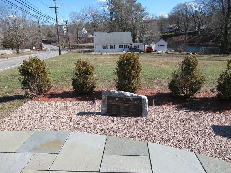
This memorial will forever honor the men and women who
bravely served during the Revolutionary War and War of 1812 era
The actions of those who answered the call to duty will be remembered for their
sacrifice in defense of freedom and liberty . . . — — Map (db m101736) WM
In 1808, Congress again approved funds to fortify the coastline, prompted by the prospect of another war with England. England was at war with France, which was ruled by Napoleon Bonaparte at the time, and although the United States had not taken . . . — — Map (db m48283) HM
In Memory of
Captain Samuel Chester Reid
1783 — 1861
Born at Norwich, Conn. Aug. 25, 1783.
During the War of 1812 commander of the
American privateer General Armstrong.
Captain Reid planned the United States
Flag which was . . . — — Map (db m101775) HM
This Is To Remember
Here the Brave Men of Stonington
Defeated a Landing Force From
His Majesty’s ship “Ramillies”
Bent on Burning the Town and its Shipping
August 10, 1814
The Warden and Burgesses of the
Borough of . . . — — Map (db m68420) WM
The
defenders of
the fort
Aug. 10, 1814.
Geo. Howe Fellowes.
who nailed the flag to the mast.
Amos Denison, Jr.
Jere. Haley.
Simeon Haley.
Jere. Holmes.
Seth C. Leonard.
Asa Lee.
Thos. Wilcox.
William Potter.
Hotatio G. . . . — — Map (db m68421) HM WM
This 7,000 anchor was salvaged off Newport, Rhode Island. Its size and shape match British Admiralty specifications for a bower anchor of a 74-gun ship of the line during the American Revolution and War of 1812. It was probably lost by one of . . . — — Map (db m68308) HM
[ central pedestal ]
Lest We Forget
Within this pedestal is placed a time
capsule recording for all time
those residents of Stamford who responded
to the call, some giving their lives
while serving in our past wars.
In future . . . — — Map (db m38754) WM
[ inscription around the top ]
In Everlasting Memory of Stamford's Patriots 1641 – 1918
[ battle names inscribed in the panel between the fluted columns ]
1689 – 1763
Port Royal • Schenectady • Haverhill • . . . — — Map (db m38430) HM
Born 1768, near this site. Commanded U.S. Sloop Wasp in notable victory over superior British sloop Frolic, October, 1812, off Cape Hatteras. Commanded frigate Constitution 1818-1829. Died August, 1850. Buried at Cecilton, Maryland. Reinterred in . . . — — Map (db m39031) HM
The British attack on Lewes, Delaware, during the War of 1812 demonstrated the need for forts to protect the Delaware River and the ports of Wilmington and Philadelphia. The War Department recognized Pea Patch Island's strategic location and . . . — — Map (db m174520) HM
Early home of Commodore Thomas Macdonough. Hero of Battle of Lake Champlain 1814. Born 1783. Died 1825. Commodore 1813. Assisted Commodore Decatur in capturing and burning the "Philadelphia" off the coast of Tripoli, 1804. Original name of village . . . — — Map (db m10305) HM
Built about 1760. Home of Gunning Bedford, eleventh governor of Delaware, born 1742. Lieut-Col. in Haslet's Delaware Regiment. Wounded in Battle of White Plains 1776. Presidential Elector 1788. Also home of Caleb P. Bennett, twenty-ninth governor of . . . — — Map (db m25558) HM
Wounded in Battle
of Lake Ontario May 28th
Died at Kingston Canada
May 30th 1813 aged 26 years
[Also on monument]
John Stockton
Born 1755, Died Oct. 29, 1822
An Officer of the Revolution.
Thomas Stockton
Born April 4, . . . — — Map (db m102608) WM
Originally called "Marettico", meaning hill of hard stone, by the Indians who inhabited this area. Known as Iron Hill as early as 1661 when three Englishmen were reportedly killed there by Minquas Indians. Indians frequented Iron Hill to obtain . . . — — Map (db m155424) HM
Organized about the year 1769. Early meetings held in academy woods, Gilpin’s Wharf and Thelwell’s School. Church Built in 1789.
Dedicated to Bishop Francis Asbury. Here is buried Allen McLane, Lieutenant in Caesar Rodney’s Regiment 1779; . . . — — Map (db m92275) HM
A stone on the facade inscribed with the initials "I.M" and a date of "1789" suggests that construction of this dwelling occurred during the late 18th and early 19th centuries, a period of early industrialization in Delaware. Evidence of a stone . . . — — Map (db m145726) HM
The Washington Street bridge, completed in 1921, was dedicated to the "sons of Delaware who joined forces of their country in The Great War" on Memorial Day, 1922. The 250 foot, open spandrel arch bridge serves as a lasting and rare example of . . . — — Map (db m131164) HM
Born 14 December 1739 in Paris, France,
Died 7 August 1817 at Eleutherian Mills.
Leading Figure of the Enlightenment •
Educational Pioneer •
Physiocrat, Political Visionary, and Diplomat •
Knight of the Order of Vasa •
Devoted Patriot of . . . — — Map (db m225913) HM
Eleutherian Mills was built about half-a-million upstream from where you are now standing. By 1803, the complex included the du Pont family home which also served as the DuPont Company offices. Soon, there were extensive gardens and orchards . . . — — Map (db m271524) HM
These French families fled a slave insurrection in Santo Domingo in 1791 and relocated to Wilmington. Peter Bauduy helped convince his friend Éleuthère Irénée duPont to settle here, and was an early partner of duPont's.
Some members of these . . . — — Map (db m174910) HM
Block House Pond, a natural spring-fed pond, has provided fresh water, ice, and recreation to the City of Lewes for several centuries. The pond was likely named for a nearby blockhouse built to protect Lewes in the 1670s, where the town residents . . . — — Map (db m232744) HM
In March of 1813, the Royal Navy established a blockade of the Delaware Bay and River. The British squadron, under the command of Commodore John P. Beresford, RN, took up stations off Lewes and the Delaware Capes, and began to conduct raids along . . . — — Map (db m19308) HM
In March 1813, the Royal Navy under the command of Commodore John P. Beresford established a blockade of the Delaware Bay and River, conducting raids along the coast to disrupt maritime commerce and shipping. On this location was one of two . . . — — Map (db m244907) HM
Last remaining Lewes House bearing the scar of the War of 1812. Patch on foundation shows where a cannonball struck on April 6th or 7th, in the year 1813. Restored by Lewes Historical Society. — — Map (db m164152) HM
The War of 1812 had a major impact on the town of Lewes and surrounding area. The naval blockade that was initiated by the British in March of 1813 lasted for most of the next two years. With maritime commerce limited, the local economy suffered. . . . — — Map (db m30358) HM
During the War of 1812, British vessels blockaded the mouth of Delaware Bay in an effort to disrupt shipping patterns and supply lines and cause economic hardship in the Mid-Atlantic. But when crews attempted to land at Lewes to replenish their . . . — — Map (db m38598) HM
Born on May 18, 1781, he was the son of local residents John and Mary Houston Hazzard. Like his father, he engaged in extensive mercantile and agricultural pursuits. As a young man he was a local magistrate and an officer in the State Militia during . . . — — Map (db m37561) HM
Born on May 18, 1781, to John and Mary Houston Hazzard, David Hazzard, like his father, engaged in mercantile and agricultural pursuits, going on to serve as local magistrate and an officer in the State Militia during the War of 1812. He was elected . . . — — Map (db m232596) HM
Born in Lewes on September 6, 1781, he was the son of John and Mary Marsh Maull. Choosing to become a physician, he studied medicine with Doctor Jacob Wolfe. By 1803 he had moved to Milton, where he served the medical needs of local residents for . . . — — Map (db m228449) HM
Born in Lewes in 1781, Joseph Maull would become a physician and move to Milton by 1803. Appointed to serve as Sussex County Trustee of the Poor in 1810, he would join the State Militia during the War of 1812 and help defend Lewes during the British . . . — — Map (db m232594) HM
The starburst intersection of five major roads marks this spot as a transportation hub for the neighborhood and the region. Shortly after Congress arrived in Washington in 1800, city leaders chose an old farm road to create a private toll . . . — — Map (db m71688) HM
“[The British] put a slow match to the [Sewall] house … and those rockets burst until … they made the rafters fly East and West.” — Enslaved African American diarist and eyewitness, Michael Shiner.
As the British . . . — — Map (db m87856) HM
Residence of Albert Gallatin, Peace Negotiator and Secretary of the Treasury 1801-1814, who negotiated the treaty of Ghent, 1814. When the British marched on Washington in the summer of 1814, some American patriots with Commodore Joshua Barney and . . . — — Map (db m61571) HM
It is perhaps no surprise that Commodore David Porter, hero of the War of 1812, chose Meridian Hill on which to build his estate. From this knoll, Porter had a direct line of sight to the President's mansion. Though no match for the grand buildings . . . — — Map (db m63740) HM
The Embassy of Mexico incorporates the two surviving facades of a set of seven row houses known as “The Seven Buildings”. This complex has an intimate relationship with American history, and the government of Mexico is proud to honor and preserve . . . — — Map (db m89348) HM
On August 24, 1814, President James Madison rode out to Bladensburg, Maryland, to observe the state of the American troops defending the nation's capital. U.S. General William Winder, now sure of the direction of the British approach, marched . . . — — Map (db m87590) HM
Daniel Webster "Liberty and Union, Now and Forever, One and Inseparable." Expounder and Defender of the Constitution Born at Salisbury, N.H., Jan 18, 1772 Died at Marshfield, Mass., Oct 24, 1852 "Our Country, Our Whole Country, and nothing . . . — — Map (db m81729) HM
The Octagon once was the city residence of wealthy Virginia landowner Colonel John Tayloe III. After the British burned the White House and other government buildings, President James Madison accepted Tayloe's invitation to use the Octagon as . . . — — Map (db m87563) HM
Built between 1799 and 1802 by Colonel John Tayloe III (1771-1828) and his wife Ann Ogle Tayloe (1772-1855)
Dr. William Thornton (1759-1828)
Architect
Occupied by President and Mrs. Madison from August 1814 to March 1815 after the burning . . . — — Map (db m40225) HM
This building known as the Octagon built in 1800 for Col. John Tayloe of Mount Airy, Virginia, was occupied by President Madison after the burning of the President's House by the British on August 14, 1814. Here the Treaty of Ghent was ratified by . . . — — Map (db m117643) HM
The author of our National Anthem was a lawyer, patriot, community leader and poet. His home and law office stood approximately 100 yards west of here. Francis Scott Key lived there from 1803 to about 1833 with his wife, the former Mary Taylor Lloyd . . . — — Map (db m120) HM
This Bridge is named in honor of
Francis Scott Key
Author of the Star Spangled Banner
September 14, 1814
Then conquer we must for our cause it is just
And this be our Motto In God is our Trust
Erected by the National Society . . . — — Map (db m111006) HM
In 1814 this was the home of the Charles Carroll family, fiends of President James Madison and his wife, Dolley. Carroll came to the President’s House on August 24, as Madison was returning from the defeat at Battle of Bladensburg. Soon word arrived . . . — — Map (db m95914) HM
You are standing in the heart of a once thriving African American community. At the time of the American Revolution in 1776, one third of Georgetown's population was African American. By the time of the Civil War in the 1860s, many former slaves . . . — — Map (db m110018) HM
The Flag. The immortal words "star-spangled Banner" refer to the magnificent flag which Francis Scott Key saw "by the dawn's early light" after the British bombardment of Fort McHenry on September 14, 1814. It is the largest flag ever flown in . . . — — Map (db m82470) HM
On August 24, 1814, as word spread that the British were coming, Dr. William Thornton and his wife Anna Marie fled their downtown F Street home and took refuge here at Tudor Place, home of their friend Martha Parke Custis Peter. That night, Mrs. . . . — — Map (db m95949) WM
In 1805, Francis Scott key, his family, and their enslaved servants moved into a two-story brick house 200 feet from here. A rising lawyer, Key had a small addition next to his home that served as his law office. During the next 25 years, Key . . . — — Map (db m237632) HM
[The Great Seal of the United States]
In 1800, the building erected on this site by Samuel Blodget was the scene of the first theatrical performance given in Washington.
From 1812 to 1836 it sheltered the city post office and, for part of . . . — — Map (db m103077) HM
Welcome to downtown Washington, DC — an area rich in history, culture, and places to see. You will enjoy visiting the following sites located in the vicinity of this sign.
Clockwise from top left:
St. John's Church
Every . . . — — Map (db m113345) HM
Built in 1799, in the hope that the new capital would become a great city.
Opened as a tavern and inn by William Rhodes, 1801.
Washington's first 'town hall,' where White House architect James Hoban and other citizens met to petition . . . — — Map (db m39618) HM
For Americans, August 24, 1814, was one of the darkest days of the War of 1812. After a victory at nearby Bladensburg, Maryland, British soldiers marched on Washington, destroying the U.S. Capitol and many other public buildings. . . . — — Map (db m130366) HM
The National Museum of American History is home to the Star-Spangled Banner, the flag that inspired our national anthem. That flag's "broad stripes and bright stars" have shaped the Museum and its mission, as have the flags for every U.S. state and . . . — — Map (db m111539) HM
On August 24, 1814, the British brought the war to the streets of Washington. After soundly defeating the Americans at nearby Bladensburg, enemy soldiers invaded the Nation's Capital—burning the President's House, U.S. Capitol, and other public . . . — — Map (db m74939) HM
Building the Nation
The use of live oaks played a critical role in helping the nation grow from a colony to what it became—the United States of America. Ships were an essential means of transportation for moving people and products, and . . . — — Map (db m143312) HM
Barney Circle honors U.S. Navy Commodore Joshua Barney. In August 1814, Barney, his Chesapeake Flotillamen, and a contingent of U.S. Marines guarded a bridge over the Eastern Branch (Anacostia River) on today's Bladensburg Road, NE. When it became . . . — — Map (db m80473) HM
Established in 1836 by hotelier John Gadsby, this structure was built to house many members of his family. An immigrant from England, Gadsby started his career in Alexandria in 1795. His reputation for fine hospitality was sealed at the City . . . — — Map (db m211921) HM
Congressional Cemetery, founded 1807, is the resting ground for many War of 1812 figures. Among them are Navy Yard Commandant Thomas Tingey, the first architect of the Capitol, Dr. William Thornton, State Department Clerk Stephen Pleasonton, and . . . — — Map (db m80481) HM
Brigadier General Pushmataha (1764-1824) was a Choctaw chief, warrior, hunter, and great friend of many, including President Andrew Jackson. In 1812, Pushmataha led 1,000 warriors of Choctaw Nation to fight alongside Jackson at the Battle of New . . . — — Map (db m141889) HM
Since 1936 Friendship House, across the street, has operated an array of social service programs from this grand Federal style house, also known as "The Maples." Friendship House is the city's oldest such agency. It was founded in 1904 by . . . — — Map (db m166999) HM
The original Library of Congress occupied a room in the U.S. Capitol. When British troops burned the Capitol in 1814, the collection was destroyed. After the war Thomas Jefferson helped re-establish the library by selling to Congress at a . . . — — Map (db m80848) HM
On your left is Marine Barracks Washington, D.C., the oldest continuously manned post in the U.S. Marine Corps. The installation was originally designed by architect George Hadfield in 1801 with a central parade ground and housing for 500 . . . — — Map (db m130737) HM
The U.S. Capitol was the British troop's first target when they arrived in Washington on August 24, 1814, only hours after their afternoon victory at the Battle of Bladensburg. The invaders fired rockets through the Capitol's windows. When the . . . — — Map (db m80844) HM
In front of you is the main gate of the Washington Navy Yard, established in 1799. It is the U.S. Navy's oldest shore facility in continuous use. Over time, workers here have built and repaired ships and their fittings, designed and developed . . . — — Map (db m130740) HM
As war with Britain wore on, some U.S. military leaders believed the nation's capital, with its inland location and military defenses, was safe. So Washingtonians were cruelly surprised when the British invaded on August 24, 1814. As the enemy . . . — — Map (db m97215) HM
Fort Leslie J. McNair, to your right, honors the commander, Army Ground Forces during World War II who died in battle. It is the U.S. Army’s third oldest installation (after West Point and Carlisle Barracks).
The fort dates back to 1791. . . . — — Map (db m130912) HM
The War of 1812 was conducted shortly after America had won its independence from England. The British tried to entice America back into a battle over the Canadian border issues. War was declared on England by President James Madison on June 10, . . . — — Map (db m195346) HM WM
Side 1
Sawpit Bluff Plantation, located on Black Hammock Island, was built in the 1750s by Edmund Gray. The plantation was named for the sawpit excavated to accommodate the up and down motion of a vertical saw blade. The plantation house . . . — — Map (db m92973) HM
Born 1784-Died 1854. Captain Mounted Rangers, War of 1812.
1813-1815, U.S. Congressman from Kentucky
1821-1822, U.S. Judge, Eastern Florida.
1822-1834, First Civil Governor of Territory of Florida.
1838-1839, Member, Constitutional . . . — — Map (db m57597) HM
General John McIntosh (c.) 1756-1826 was born in Darien Georgia. He assisted botanist William Bartram 1773-1774, and in 1774 they explored along the St. Johns River. His activities during the Revolutionary War included serving as a captain, . . . — — Map (db m138114) HM
The US Army built Fort Barrancas in the 1840s as one of four fortifications to protect Pensacola Bay and the navy yard from attack. Fort Pickens on Santa Rosa Island and Fort McRee on Perdido Key guarded the channel. Fort Barrancas and its water . . . — — Map (db m252626) HM
A native of Maine, Ebenezer Dorr spent fourteen months as a prisoner of war in England during the War of 1812. He was captain of his own ship for many years, trading at ports around the world. In about 1827,
Dorr moved his family to Escambia County . . . — — Map (db m80050) HM
Site of Fort George - headquarters of British West Florida - Suwannee to the Mississippi. From 1763 until captured by Spanish Gen. Bernardo de Galvez in 1781 and renamed San Miguel. Seized by Andrew Jackson in 1814 and 1818 and delivered to him as . . . — — Map (db m72271) HM
Site of plantation La Punta Gabaron owned 1814-1849 by Carlos Lavalle (Lavallet, Lavallette), born in 1772 of French parents in British Mobile. After Redcoats routed here in 1781, mother brought family to Spanish Pensacola. Carlos became a . . . — — Map (db m269048) HM
Archaeology of Nicolls' Outpost
The exact site of Nicolls Outpost was lost in the early 19th century and was not located again and nearly 200 years later.
An archaeological team from Pre-Columbian Archaeological Research Group, . . . — — Map (db m312840) HM
This prehistoric mound is the largest of seven that once stood here at River Landing Park. Believed to date from the Fort Walton time period (A.D. 900-A.D. 1500), its original appearance was that of a flat-topped pyramid. Archaeologists believe that . . . — — Map (db m110893) HM
The United States launched a campaign to drive British forces from the Apalachicola River during the winter of 1814-1815. Comprised of three planned wings, the American army was entrusted to the command of Brig. Gen. David Blackshear.
The . . . — — Map (db m312532) HM
British troops arrived here in June 1814 as the War of 1812 entered its closing months. Initially, they worked to recruit and train Native American (Red Stick Creek, Seminole, Miccosukee, and Yuchi) warriors as auxiliaries.
The Apalachicola River . . . — — Map (db m231607) HM
Atop this large prehistoric mound stood Nicolls' Outpost, a British fort of the War of 1812. Built in the fall of 1814, it was a rectangular earthen redoubt with a surrounding stockade and was armed with two small cannons. Garrisoned by 180 white . . . — — Map (db m79455) HM
The signing of the Treaty of Nicolls' Outpost on March 10, 1815, was the final major event in the history of the British fort. It was evacuated by order of Lt. Col. Nicolls approximately one month later.
By the time of its evacuation, the . . . — — Map (db m312626) HM
Nicolls' Outpost
Nicolls' Outpost and its sister fort at Prospect Bluff were home to three Colonial Marines companies. These units were comprised largely of self-liberated Black men who marched away from slavery to fight for the freedom of . . . — — Map (db m312474) HM
Forging A New Alliance
British activity at Nicolls' Outpost did not conclude with news that the War of 1812 was over. Lt. Col. Nicolls convened a council here on March 10, 1815. The purpose was to forge a new alliance between Great Britain . . . — — Map (db m312583) HM
The Statue The 6-foot tall bronze statue perched atop the 5½ foot high concrete pedestal is entitled, “The Price of Freedom.” It was sculpted by L’Deane Trueblood of St. George, Utah and cast by Metal Arts Foundry of Lehi, Utah. It . . . — — Map (db m299399) HM WM
Star Spangled Banner
Sept. 14, 1814
Adopted as National Anthem in 1931
Written by Francis Scott Key seeing the flag flying over Fort McHenry
after bombardment, later set to music. Flag is on display in Smithsonian. . . . — — Map (db m198613) HM WM
Interesting Details about Zachary Taylor
• In 1837, He was promoted to Brigadier General and earned the nickname, "Old Rough and Ready"
• Zachary Taylor was the second President to die in office. Within months of his death, this fort, . . . — — Map (db m240143) HM
During the War of 1812, Georgia settlers invaded Spanish East Florida in an attempt to destabilize Spanish control and prevent British forces from using the region as a military staging ground. This conflict was known as the Patriot War. In March . . . — — Map (db m150640) HM
What trees can you find at the park? Lake Lorna Doone Park is the home to 4 species of mature trees that are native to the State of Florida, meaning that these trees naturally occur in the state. Can you identify all 4 of them from where . . . — — Map (db m207888) HM
Lakeview cemetery, established on January 14, 1883, by the Sanford Cemetery Company was acquired by the city of Sanford in 1937. The cemetery contains the gravesites of Sanford's early pioneers. John Hughey and Elias Woodruff, veterans of the War . . . — — Map (db m245240) HM
The War of 1812 resulted from British attempts to restrict the United States' transatlantic trade and from the seizing and pressing of American sailors into the British Navy. On June 18, 1812, the United States declared war on Great Britain. By . . . — — Map (db m173859) HM
Launched in 1797 and named by President George Washington, she is the oldest commissioned naval vessel afloat in the world. These two non-firing cannons were part of the armament on board the U.S.S. Constitution — also known as "Old Ironsides" . . . — — Map (db m188790) HM
2901 entries matched your criteria. Entries 101 through 200 are listed above. ⊲ Previous 100 — Next 100 ⊳