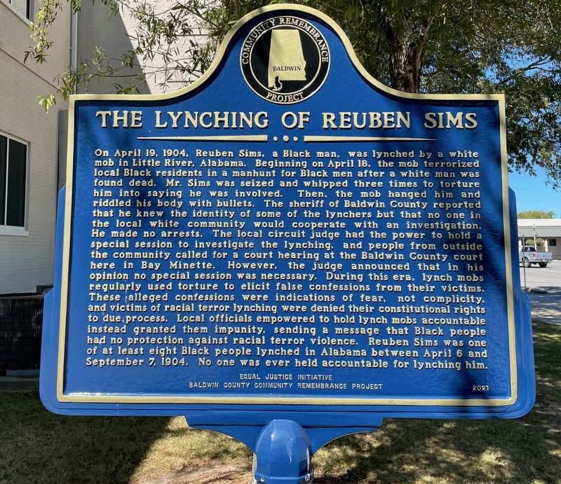
On Courthouse Square at U.S. 31, on the left when traveling north on Courthouse Square.
Lynching in America
Between 1865 and 1950, at least 6,500 African Americans were victims
of lynch mob violence in the United States. After the Civil War, an
ongoing commitment to white supremacy led to organized resistance to
Black . . . — — Map (db m207065) HM
On 24 N Section Street at Fairhope Avenue, on the right when traveling north on 24 N Section Street.
Dedicated 2008
A gift to the people of Fairhope from
The Fairhope Single Tax Corporation
& the City of Fairhope
Dedicated April 5, 2008
The Front Section of this structure was carefully restored to reflect its original
use as Fairhope's . . . — — Map (db m128887) HM
On Franklin Street 0.1 miles Washington Street, on the left when traveling north.
Courts met under "Jury Oak" early 1800s. Judge presided while sitting on tree limb. Public executions held at nearby "hanging tree". — — Map (db m221963) HM
On East Broad Street at Riverside Drive, on the left when traveling east on East Broad Street.
The Lynching of William "Willie Lee" Jenkins. On January 10, 1922, a mob of white people brutally lynched a 26-year-old Black World War I veteran named William "Willie Lee Jenkins near Eufaula. Mob members abducted Mr. Jenkins, tortured him, . . . — — Map (db m306132) HM
Near Gurnee Avenue south of West 11th Street, on the left when traveling south.
Pursuit: 1:25 p.m. - 1:35 p.m.
Heading to Birmingham, the battered bus turned south on Gurnee from the station and west on 10th St. while men rushed to their cars to follow. Police escorted the bus to the city limits where they turned back, . . . — — Map (db m217416) HM
Near Gurnee Avenue south of West 11th Street, on the left when traveling south.
Rescue
Once there, all of the injured were treated at the urging of an FBI agent on the scene. In the meantime, the crowd outside the hospital grew larger and more menacing, with some Klansmen threatening to burn the building to the ground. At . . . — — Map (db m217420) HM
Near Gurnee Avenue south of West 11th Street, on the left when traveling south.
The Ambush: 12:54 p.m. - 1:10 p.m.
The silence didn't last long. Anniston Klansman William Chappell and a screaming mob of about 50 white men surrounded the bus. An 18-year-old Klansman, Roger Couch, lay on the pavement in front of the bus to . . . — — Map (db m217413) HM
Near Gurnee Avenue south of West 11th Street, on the left when traveling south.
While the Riders awaited rescue, the bus continued to burn. The Anniston Fire Department extinguished the flames and administered oxygen. A state trooper called an ambulance, but it took Cowling to force the driver to carry the injured black Riders . . . — — Map (db m217419) HM
Near Gurnee Avenue south of West 11th Street, on the left when traveling south.
But the Ride didn't end. The national newspaper and television coverage of what had happened galvanized the Nashville Student Movement, which already had experience successfully challenging segregationist practices through lunch counter sit-ins, . . . — — Map (db m217421) HM
On Noble Street at East 12th Street, on the right when traveling north on Noble Street.
This property
has been placed on the
National Register
of Historic Places
by the United States
Department of the Interior
United States Federal Building - Courthouse
Built 1906 — — Map (db m217266) HM
On County Road 388 at County Road 267, on the right when traveling west on County Road 388.
Pat Garrett and Billy the Kid
As sheriff of Lincoln County, Pat Garrett was charged with tracking down and arresting Billy the Kid, a friend from Garrett's saloon keeping days in Fort Sumner, New Mexico. He was captured in December 1880 . . . — — Map (db m83262) HM
On State Highway 273 at County Road 81, on the left when traveling north on State Highway 273.
David was born 4 of 12 children, served in combat in Vietnam, was wounded and is a highly decorated war veteran. David is a best selling author, a veteran advocate, and State Commander of the American Legion. He is a former college instructor and . . . — — Map (db m114742) HM
On 2nd Avenue North, on the right when traveling west.
Fallen officers of Chilton County, Alabama
This is a memorial to the officers who have dedicated their lives for the citizens of Chilton County.
Clyde W. Gregg 1907-1959
Gerald L Horn 1950-1981
William O. (Bill) Wilson 1934-1984
Richard H. . . . — — Map (db m224708) HM
On College Avenue (Alabama Route 177) south of West Rose Street, on the left when traveling south.
On March 22, 1971, 10 members of the Allman Brothers Band &
crew were arrested by Jackson Police Officer Jethro Richardson
& brought here, 118 College Ave, at that time the city jail.
Headed to a Montevallo, AL gig, they stopped in Jackson to . . . — — Map (db m293749) HM
On North Water Street at West 4th Street, on the left when traveling north on North Water Street.
Born in Tennessee on October 22, 1818, Charles Womble was the son of Amos and Sarah (Jarman) Womble. By 1850, Womble owned a farm near the town of Frankfort, which he helped select as the new seat of government for Franklin County, Alabama. Involved . . . — — Map (db m192076) HM
On Alabama Route 22 at Jackson Street, on the right when traveling west on Alabama Route 22.
Coosa County
Named for the river on its western border, Coosa County was created by the Alabama Legislature on December 18, 1832, from land ceded by the Creek Nation in the Treaty of Cusseta. The name is taken from the Native American word . . . — — Map (db m131716) HM
Lynching in America
Thousands of African Americans were victims of lynching and racial violence in the United States between the Civil War and World War II. The lynching of African Americans during this era was a form of racial terrorism used . . . — — Map (db m132071) HM
On County Road 52 at County Road 293, on the left when traveling west on County Road 52.
Lebanon Courthouse was constructed during the 1840s when Lebanon, the county seat of
DeKalb County, was a thriving community with inns, taverns, and government offices. This building, built for courthouse use, remained in use as a courthouse until . . . — — Map (db m156255) HM
On Glenn Boulevard SW (Alabama Route 35) at Airport Road West, on the right when traveling west on Glenn Boulevard SW. Reported missing.
The first detachment of 1,103 Cherokees to emigrate under their own officers, prior to leaving for the west held a final council at Rattlesnake Springs (near present-day Charleston, TN) and, by unanimous vote, declared their intentions to . . . — — Map (db m261860) HM
On Jackson Trace Road at Hospital Drive, on the right when traveling south on Jackson Trace Road.
In January 1839, Governor Arthur P. Bagby and the State
Legislature enacted a criminal code authorizing a state penitentiary
system for Alabama. A cornerstone was laid in October 1839 on
property purchased adjacent to the Coosa River in Wetumpka . . . — — Map (db m222614) HM
On North 1st Street at Locust Street, on the right when traveling north on North 1st Street.
Lynching in America.
Thousands of Black people were the victims of lynching and racial violence in the United States between 1877 and 1950. The lynching of African Americans during this era was a form of racial terrorism intended to intimidate . . . — — Map (db m116817) HM
On 2nd Street Southeast at 4th Avenue South ( Route 24), on the left when traveling north on 2nd Street Southeast.
You are standing near the site of “The Calaboose”, Red Bay's only jail until 1949 when the city hall was built.
The Calaboose was a small brick building, approximately 10 feet by 20 feet, built over a small ditch. At that time, . . . — — Map (db m68983) HM
On Tuscaloosa Street (Alabama Route 14) east of Springfield Avenue, on the right when traveling east.
On this site, in January 1971, Thomas Earl Gilmore, Sr. was sworn in as Sheriff of Greene County. He was the first African American Sheriff in the county's history and served three consecutive terms until he retired from local politics.
Gilmore, . . . — — Map (db m203630) HM
On Kirkland Street (Alabama Route 27), on the left when traveling south.
William Irvin Nordan and Lewis Washington Nordan were
brothers and partners in a mercantile business in
Abbeville, Alabama prior to 1901. In 1901, William Irvine and Lewis Washington deeded a "brick store house" in the present location to Charlie . . . — — Map (db m216613) HM
On Eastern Valley Road south of Elrie Boulevard, on the right when traveling south.
Thomas McAdory Owen, son of Dr. William Marmaduke
Owen and Nancy Lucretia McAdory Owen, was born
here on December 15, 1866, at the home of his maternal
grandparents, Thomas and Emily McAdory. A University
of Alabama graduate and lawyer, Owen . . . — — Map (db m215738) HM
On 21st Way South south of Highland Avenue, on the right when traveling south.
Congregation Beth-El was founded in 1907 on Birmingham's north side. Its leadership came from Knesseth Israel, the city's Orthodox Jewish congregation. Beth-El was established as a modern. yet traditional congregation. Construction on the synagogue . . . — — Map (db m216067) HM
On 6th Avenue North west of 19th Street North, on the left when traveling west.
On nightly news programs and in newspapers, the images of Birmingham
children under police attack shocked and sickened the nation. It was the
reaction that “Project C” organizers had hoped for. The "Children's Crusade” revived the Birmingham . . . — — Map (db m187837) HM
On 5th Avenue North at 16th Street North, on the right when traveling east on 5th Avenue North.
Built 1924 (remodeled for offices in 1995), 413 16th St. N.
Judge Helen Shores Lee bought this one-story building, a
garage from the U.S. Post Office, in 1995 and turned into a law
center to honor her father, pioneer civil rights lawyer . . . — — Map (db m188192) HM
Racial Terrorism and Convict Leasing. Thousands of black people were the victims of lynching and racial violence in the United States between 1877 and 1950 Lynching was
a form of racial terrorism that went beyond only hanging, . . . — — Map (db m173372) HM
On Lee Highway (County Route 72) at Houstontown raod (Route 33), on the right when traveling east on Lee Highway.
Jesse James Gang
Canal Payroll Robbery
March 1881
In, 1881, approximately three miles south of here, the U.S. Corps of Engineers was constructing the Muscle Shoals Canal along the north side of the Tennessee River. On March 11, 1881, . . . — — Map (db m99897) HM
On Waterloo Road 0.1 miles east of Cypress Bend Dr..
John A. Murrell, known as the "Great Western Land Pirate," was captured near this site in the winter of 1834. He was said to have killed over 400 people, including many kidnapped slaves. His arrest was brought about through the clever maneuvering of . . . — — Map (db m154394) HM
An advocate for criminal justice reform, Carla Crowder received the Thurgood Marshall Award for Excellence in Print Journalism in 2005. She was named Woman of the Year by USA Today in 2024. — — Map (db m285772) HM
On County Route 59 at County Route 7, on the right when traveling west on County Route 59.
Youngtown was earlier known as Egypt. The community's name changed after 1915 to recognize the Young family. By 1857, Reason Young owned land and slaves in this area. Newspapers in 1891 speak of Joseph Young and in 1915 of Arthur Young living "in . . . — — Map (db m274336) HM
On Avenue A just south of South 7th Street, on the left when traveling south.
Entered on the National Register of Historic Places November 18, 1976 George W. Andrews Federal Building U. S. Courthouse Opelika, Alabama James A. Wetmore Architect 1915 This property significantly contributes to the nation’s . . . — — Map (db m296572) HM
On North Jefferson Street north of West Washington Street, on the right when traveling north.
On June 22, 1933, Judge James Horton of Athens set aside the verdict and death sentence of an all-white jury that found Haywood Patterson, an African American, guilty of raping two white women. Patterson was one of nine black youths falsely accused . . . — — Map (db m154195) HM
On South Broad Street 0.1 miles south of Shawnee Street, on the right when traveling south.
Restoring Justice
Henry Williams, Johnny Williams, Ennis Bell, Theodore Wesley Samuels, Prentiss McCann, and Rayfield Davis all died at the height of the segregation era in Mobile. Mobile's Black community protested each of these deaths at the . . . — — Map (db m188735) HM
On Lake Street west of Hall Street, on the right when traveling west.
Hale Infirmary
On this site for nearly seven decades stood Hale Infirmary. It was
among 25 hospitals in Alabama, and the first in Montgomery, established during the Black Hospital Movement, an effort to overcome
healthcare inequities for . . . — — Map (db m240686) HM
On Holcombe Street south of Mildred Street, on the right when traveling south.
Montgomery: Learning from the Past
The Whitehurst Case has proven transformative in Montgomery and is part of the body of events and individuals that have shaped both the struggle for civil rights and the relationship between the Montgomery . . . — — Map (db m242522) HM
On Ferry Street Northeast south of Cain Street Northeast, on the right when traveling south.
"Scottsboro Boys" Case Landmark Decisions
A series of racially charged trials where nine African American males ages 13 to 20 were falsely accused of raping two white women on a freight train in Alabama produced a pair of landmark civil . . . — — Map (db m309153) HM
On North Main Street at East Troy Street, on the right when traveling north on North Main Street.
Built in 1940 by the Works Project Administration
(WPA), this building was a cornerstone of the
city and initially served as the home of the
Brundidge City Hall, Police Department, and Jail.
This unique building features decorative
brickwork . . . — — Map (db m274305) HM
On South Railroad Street west of Holland Court, on the right when traveling west.
Built in 1950, Fort Jabe Brassell has served as a hub for military training and arms storage for the local community by the Alabama Army National Guard and the Armory Commission of Alabama. Between July 1954 and January 1955, the Alabama Army . . . — — Map (db m165538) HM
The history of Alabaster is proudly rooted in industrial development.
During the mid-to-late 19th century, cotton mills were built along
rivers for their hydropower, usually in rural areas and near
railroads, both of which made the Siluria . . . — — Map (db m295139) HM
On 11th Avenue (Alabama Route 13) north of 19th Street, on the right when traveling north.
The first 9-1-1 emergency services telephone call
was made from the office of the mayor on
February 16, 1968. Earlier in the year, AT&T,
which had a near monopoly in the telephone
industry at the time, had announced its plans
for launching the . . . — — Map (db m153209) HM
On County Road 63 at County Road 61, on the left when traveling south on County Road 63.
Willis Farris was appointed the first sheriff of Hancock County, Alabama, serving from August 31, 1850 to September 19, 1853. Hancock County was renamed Winston County in 1858. Farris then served another term as sheriff from 1859 until 1865. He was . . . — — Map (db m182872) HM
In the spring of 1905 a rash of armed robberies occurred along the trail that led from the gold mines into Fairbanks. Miners bringing their gold into Fairbanks to deposit into the bank suddenly found themselves looking down the barrel of a gun . . . — — Map (db m257550) HM
On Central Avenue, on the left when traveling south.
This building served as the Guard Shack for Eielson Air Force Base's Hursey Gate between 1963 and 2007. In January 2007, the main gate was upgraded and moved to accommodate force protection measures as well as modernize traffic flow onto and off . . . — — Map (db m256129) HM
In tribute to the memory of
James Wickersham
Author - Pioneer Jurist
Alaska Delegate to Congress
Introduced first Alaska Statehood bill in
64th Congress, March 30, 1916
Dedicated on the eve of Alaska Statehood at . . . — — Map (db m256715) HM
Ketchikan's notorious Creek Street, early Alaska's most infamous red-light district, still retains traces of the gaudy rouge of a half-century of speakeasies and sporting women. Here the fame of Black Mary, Thelma Baker and Dolly Arthur . . . — — Map (db m182103) HM
The Politics of Prohibition pitted the U. S. Constitution's well-meaning 18th Amendment — which banned the manufacture, sale or transportation of liquor — against the ingenuity of the moonshiners and bootleggers who found ways to satisfy the . . . — — Map (db m182102) HM
Near South San Pedro Street north of East 5th Street.
These doors and windows were used to build a jail on the Northwest corner of Huachuca & 5th Street during April – May 1938. Needing jail material, Benson obtained approval to remove cell doors & windows from the no longer used jail in Courtland, . . . — — Map (db m48508) HM
Near East 14th Street at 14th Street & Pan American Ave..
Elizabeth W. Ames, Mayor
City Council
Hector M. Salinas, Ward 1
Richard A. Arzate, Ward 2
Ramon H. Jordan, Ward 3
Harry F. Ames , Ward 4
Margaret Shannon, Ward 5
Rudy Quinonez, Ward 6
R. Delbert Self, City Manager . . . — — Map (db m28295) HM
On North High Lonesome Road at West Gleeson Road, on the right when traveling south on North High Lonesome Road.
This jail, built in 1910, replaced a tiny wooden jail which once stood nearby. Constructed entirely of reinforced concrete, it has withstood a hundred years of weather, escape attempts, vandals, neglect, and pillagers (official and otherwise): It . . . — — Map (db m64206) HM
"Buckskin" Frank Leslie killed Billy Claiborne here on November 14th, 1882.
Luke Short killed Charlie Storms here on February 25th, 1881. — — Map (db m269189) HM
On East Toughnut Street at South 3rd Street, on the right when traveling west on East Toughnut Street.
March 28, 1884
Dan Dowd •
Dan Kelly •
Red Sample •
James Howard •
William Delaney
November 16, 1900
William Halderman •
Thomas Halderman
This gallows is a reconstruction. The original was burned in 1912 at the time . . . — — Map (db m249785) HM
On East Toughnut Street at South 3rd Street, on the right when traveling west on East Toughnut Street.
Born in Saginaw, Mich., in 1860, English, a law graduate, moved to Tombstone in 1880. He first worked as a miner, then became a partner in Smith & Goodrich law firm. He also served 3 terms as Cochise County District Attorney.
English's . . . — — Map (db m131100) HM
Johnny Ringo was a proud member of the Cowboy gang and a business partner of their outlaw leader, Ike Clanton. In March 1882, five months after the Gunfight
at the O.K. Corral, Wyatt Earp's younger brother Morgan was murdered in Tombstone — and . . . — — Map (db m269185) HM
These “Cowboys” were killed in the Gunfight at the O.K. Corral. Shot in the head, Frank McLaury died instantly on the Fremont Street sidewalk. Wounded, Tom
McLaury and Billy Clanton were carried into this building.
Tom died in minutes, hit by a . . . — — Map (db m269184) HM
On East Maley Street (Arizona Route 186) at North Railroad Avenue, on the left when traveling east on East Maley Street.
It was at this location the Headquarters Saloon stood from the 1890's until it burned down in 1940. Warren Earp was shot and killed at the Saloon on July 6, 1900. — — Map (db m28179) HM
On The Coronado Trail (U.S. 191 at milepost 164), on the left when traveling north.
Blasted from living rock this jail confined many of the bad men who crowed into the district in the boom days. Local tradition says that the first inmate in 1881 was the miner who built the jail. It was contributed to the town by the Lesinsky . . . — — Map (db m36373) HM
On Mohave Road 11.7 miles south of Route 95, on the right when traveling north.
[ The single 30 foot concrete pillar of the monument symbolizes "unity of spirit". The hexagonal base represents a Japanese stone lantern. The 12 small pillars situated around the monument make it a working sundial. Mounted on the 30 foot pillar . . . — — Map (db m32258) HM
This building has been placed on
The National Register of
Historic Places
By the United States Department of the Interior
Mohave County Jail
Built 1910
Noteworthy as one of the first cast-in-place concrete structures in . . . — — Map (db m29404) HM
Near North Toole Avenue near East Pennington Street.
Wyatt Earp joined his four brothers in the silver-boom town of Tombstone in 1879 where brother Virgil was deputy U.S. marshal. Wyatt was a sometimes-lawman himself, and hoped to become sheriff of the newly formed Cochise County in 1881. . . . — — Map (db m28929) HM
On Arizona Route 84 at milepost 181, on the right when traveling west.
James Addison Peralta Reavis was a brazen forger who claimed over 12 million acres of Central Arizona and Western New Mexico as an Old Spanish Land grant. He and his family lived here in royal style until his fraud was exposed. From the barony he . . . — — Map (db m27209) HM
On North Main Street north of 12th Street, on the left when traveling north.
Built in 1948, this Contemporary Pueblo Revival building initially housed all town government administration and the Town Council chambers. The Town had a mayor and council-commissioner form of government. With limited staff, each Councilmember was . . . — — Map (db m195851) HM
On Main Street at 9th Street, on the right when traveling east on Main Street.
On Thursday June 21st, 1928,
Clarkdale was robbed.
At 11:00 A.M., Willard Forrester and Earl Nelson stopped in front of Clarkdale's
Bank of Arizona.
Forrester stepped into the bank and emerged shortly carrying $50,000 dollars. As . . . — — Map (db m307467) HM
Near Hull Avenue near Diaz Street, on the right when traveling north.
Back in 1905, the town jail was in the basement of what was then the Tony Kauzlarich House below the Dicus and Wagner Garage. Louis St. James was the magistrate and conservator of the peace.
What is believed to be Jerome's 3rd jail was located . . . — — Map (db m71963) HM
All water for the prison came from the river. Inmates dug a network of tunnels at the base of the hill which would fill with river water. From there water was pumped up into the 85,000 gallon granite-walled tank, also of inmate construction. In . . . — — Map (db m185955) HM
Near Prison Hill Road 0.5 miles north of Harold C. Giss Parkway.
In 1904 an incorrigible ward, consisting of five steel cages, was constructed on this site. The total budget for the building, including steel cages, corrugated iron roofing and lumber, was five hundred dollars. Approximately 4,000 adobe bricks, . . . — — Map (db m158296) HM
Near Prison Hill Road 0.5 miles north of Harold C. Giss Parkway.
The main cellblock was built to house up to 204 prisoners, but at times the Superintendent's report stated that up to 240 prisoners were kept here. Each cell was approximately 9 foot X 12 foot and could hold six prisoners. When space became limited, . . . — — Map (db m158292) HM
The "New Yard" was constructed in 1900 to help relieve overcrowding. The entrance to the library was closed and the first four cells were made from the library excavation in the south bank. Eight more cells were dug into the east side of the same . . . — — Map (db m185959) HM
Near Prison Hill Road 0.5 miles north of Harold C. Giss Parkway.
Anything a prisoner could not make himself or barter for, he had to do without. As an inmate, forty-eight hours a week were spent working in the fields, quarry, adobe yard, or on assignment in a shop. Whether you needed a tin cup or a new . . . — — Map (db m158293) HM
On Prison Hill Road west of South Levee Road, on the right when traveling south.
The concrete slabs in front of you were the floors of the shop buildings constructed in 1895. The shops housed the electric generating plant, shoe/ tailor shops and the laundry/bathhouse. The 33 foot x 100 foot adobe building had a corrugated iron . . . — — Map (db m191835) HM
• Cast in 1875
• Stands approximately 3 feet high
• Weighs approximately 800 lbs. with carriage
This bell was cast by W.T. Garratt's Brass and Bell Foundry in San Francisco, California in 1875. A sailing ship brought the bell up the . . . — — Map (db m185957) HM
Near Prison Hill Road 0.5 miles north of Harold C. Giss Parkway.
Yuma of the 1870's had limited marketplaces. Goods were brought in by steamships or many days' journey through hostile country. Calamities along the journey claimed belongings and supplies more than once. The government compensated by stocking as . . . — — Map (db m158298) HM
Near Prison Hill Road 0.5 miles north of Harold C. Giss Parkway.
The concrete slabs before you are all that remain of an early adobe structure. Originally, this building was where prisoners were processed, ate meals, and received medical attention. Later it housed offices, storerooms, barbershop and the two cells . . . — — Map (db m158297) HM
On Jackson Street south of Johnson Avenue, on the right when traveling south. Reported missing.
Location: West of the railroad tracks on Lincoln Street between McClure & Monroe, almost directly across from Allen Canning Company Warehouse. It was about 12' x 12', made of native stone, cemented together. One small window on the north side was . . . — — Map (db m93282) HM
On Jackson Street south of McClure Avenue (County Road 923), on the right when traveling south.
Location: West of the railroad tracks on Lincoln Street between McClure & Monroe, almost directly across from Allen Canning Company Warehouse.
It was about 12' x 12', made of native stone, cemented together. One small window on the north side was . . . — — Map (db m224840) HM
This fourth County Jail building was originally a two-story brick framed structure. Some of its hardware and cell materials were used in the construction of the 1911 jail built west of the courthouse. Abandoned and vacant from 1919, it was purchased . . . — — Map (db m234418) HM
On Central Avenue (U.S. 7) just south of Spring Street, on the right when traveling south.
In the late 1800s, gunfights and brawls occurred frequently in downtown Hot Springs. In 1889, five men were killed in a shootout on Central Avenue, just north of Spencer’s Corner. The Chief of Police was among those killed, and several others were . . . — — Map (db m264286) HM
On Central Avenue (State Highway 7) just north of Spring Street, on the right when traveling north.
The “Arkansas Hummingbird” • Led National League as a Chicago Cub in 1932 with 22 wins, 4 shutouts and ERA of .237 • Only person to play in and umpire World Series and All Star games, 2 World Series and 3 All Star games • No hit Reds in 1941 • . . . — — Map (db m264766) HM
On Spring Street at Central Avenue (State Highway 7), on the right when traveling west on Spring Street.
Served 25 years with the Dallas Police • Officer McDonald is known worldwide as the “Captor of Oswald” the cold blooded assassin of U.S. President John F. Kennedy and Officer J.D. Tippit in Dallas, Texas on Nov. 22, 1963. • He arrested Oswald . . . — — Map (db m265290) HM
On Central Avenue (Arkansas Route 7) at Fountain Street when traveling north on Central Avenue.
The old Arlington Hotel, located across the
street on the Arlington Lawn, was the site of
the infamous arrest of New York Giants manager
John “Mugsy” McGraw. Apprehended by a
U.S. Marshal for unlawful gambling when he
was caught pitching silver . . . — — Map (db m211044) HM
On Reserve Street at Central Avenue ( Route 7), on the left when traveling east on Reserve Street.
On March 12, 1927 U.S. Park Ranger James Alexander Cary was killed by bootleggers while patrolling on West Mountain in Hot Springs National Park.
Cary was the first National Park Service Ranger to be murdered in the line of duty.
His service . . . — — Map (db m211011) HM
On East Main Street at Broad Street, on the left when traveling west on East Main Street.
This site has been the location of three Independence
County courthouses. The first, built in 1857, was
destroyed by fire in the 1880's and replaced by a
Gothic style structure. Batesville's finest example of
Art Deco style building . . . — — Map (db m221135) HM
On Agriplex Drive north of East 1st Street, on the left when traveling north.
Old jail, built circa 1830, at first
seat of LaFayette County at
Chickaninny Prairie. Moved by
Payne brothers to present
seat and restored by Lafayette
County historical society in
memory of Ralph M. Burton who
owned the building — — Map (db m286191) HM
Near State Road 25, on the right when traveling east.
In 1897, county officials ordered that the jail be remodeled.
The wood floor was replaced with cement. Hammocks
replaced straw bedding. Sewer lines, water closets and
wash basins were installed.
Bunks
4 hammocks, to be 28 . . . — — Map (db m242657) HM
Near State Highway 25, on the right when traveling east.
You are facing the Powhatan Jail
Designed by John D. Edwards, this is a rare example
of a stone military blockhouse.
Lawrence County, is known as the "Mother of Counties". In 1815,
Lawrence County formed this northern region of . . . — — Map (db m242636) HM
On State Highway 25 just west of 3rd Street, on the right when traveling east.
The Powhatan jail housed prisoners for 57 years. Due to increasing security problems, the jail closed in the 1920s A new jail at Walnut Ridge replaced this one after World War 1.
From 1850 an 1935 this building was a canning kitchen. From . . . — — Map (db m242656) HM
On North Vine Street at W Short Mountain Street, on the left when traveling north on North Vine Street.
The Logan County Jail, built in 1903, served as an active jail until 1971, before becoming the Logan County Museum in 1972. Contractor and local attorney Anthony Hall combined jailer’s living quarters, incarceration cells, and administrative space . . . — — Map (db m311701) HM
On Greenlawn Street (U.S. 371) at De Ann Street, on the left when traveling west on Greenlawn Street.
Thomas Chipman McRae, born in Mount Holly (Union County), Arkansas, became a courier for the Confederate Army at age twelve, following his father's early death. He attended area schools and later graduated from Washington & Lee University law . . . — — Map (db m184504) HM
On West 12th Street at Westpark Drive, on the right when traveling west on West 12th Street.
Lynching in America. Racial terror lynching between 1877 and 1950 claimed the lives of
thousands of African Americans and created a legacy of injustice that can still be felt today. Following the Civil War and the premature end of . . . — — Map (db m258635) HM
2910 entries matched your criteria. The first 100 are listed above. Next 100 ⊳