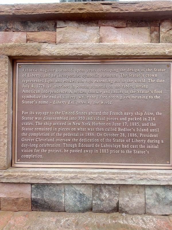
In 1865, Frenchman Édouard de Laboulaye proposed the idea of presenting a monumental gift from the people of France to the people of the United States. A prominent political thinker in his time, Laboulaye had spent much of his political career . . . — — Map (db m214431) HM
On South Royal Street at Church Street, on the left when traveling south on South Royal Street.
The Pelican Girls, so named for the ship Pélican upon which they traveled, were young women of good character sent by King Louis XIV to Mobile (capital of French Louisiana) in 1704 in response to colonial officials' pleas for marriageable French . . . — — Map (db m300445) HM
On Old Shell Road 0.1 miles east of N McGregor Ave, on the right when traveling west.
Spring Hill, originally a Spanish land grant, was once named "The City of Refuge” by Napoleonic exiles. Spring Hill gained prominence when Mobilians built summer homes in Spring Hill to escape yellow fever epidemics. — — Map (db m302915) HM
By 1943 [sic-probably 1948] Anchorage had 50 airlines. Most consisted of surplus DC-3 aircraft, based at Merrill Field. Customers would write their name on a sign-up sheet for a specific destination. When the plane was full it would leave. The . . . — — Map (db m260232) HM
Alphonso L'Kievicz was a man well calculated for frontier life, for to him all
things seem easy and nothing to be excited about. He came to Fairbanks in the
early days and brought the first suction dredge here in 1908, which he set up . . . — — Map (db m257540) HM
My husband William Foster and I, decided to try our luck in the gold rush for Alaska, so set out in January 1898 aboard the vessel "Corona" on her maiden voyage. On the way North, she veered off her course, and struck a rock and sank in about . . . — — Map (db m257517) HM
Fairbanks Daily Times October 2, 1906
Dome Creek Has a Woman Who Runs Hoist on the Claim
"Out on Dome Creek there is a devoted little woman who is a heroine in the eyes of the miners out there, and, perhaps, one could search all . . . — — Map (db m257495) HM
On Clay Street north of 7th Street, on the left when traveling north.
The City of Fairbanks was incorporated on November 10, 1903,
after the discovery of gold in the Tanana Valley in 1902. This
location, originally identified as the Fairbanks Cemetery, was
later renamed Clay Street Cemetery after the adjacent . . . — — Map (db m256398) HM
The passage to Tanacross was not possible due to low water levels. Captain Adams dropped Barnette, his trade goods and family on the banks of the Chena Slough. Captain Adams stayed long enough to construct two cabins. One was for . . . — — Map (db m256897) HM
Wife of Felix Pedro
The Discoverer of Gold on Pedro Creek
It Was His Discovery That Started The
Development of the Vast Interior of Alaska
And The Beginning of Fairbanks.
Mary Lived in Fairbanks For Over 25 Years.
She Was Born In . . . — — Map (db m256456) HM
On 1st Avenue west of Cushman Street, on the right when traveling west.
Eight hundred people lived in Fairbanks in the winter of 1903. By the summer of 1904 the population had swelled to 5,000.
The thriving town had two newspapers and numerous hotels, like the two story
Pioneer. It featured 100 rooms, steam heat, . . . — — Map (db m256490) HM
On Lacey Street north of 1st Avenue, on the right when traveling north.
Gradually, prospectors drifted into the Interior. By 1900 about 100 hardy souls searched the hills and valleys of the Tanana Valley for precious metal. In 1902 Felix Pedro, an immigrant coal miner from Italy, struck gold.
He reported his find . . . — — Map (db m257139) HM
On Marine Way (Alaska Route 7) at South Franklin Street ( Route 7), on the left when traveling west on Marine Way.
The City and Borough of Juneau Assembly Honors the Contributions of Filipinos in Juneau by naming this downtown location Manila Square.
Juneau Assembly Members: Dale Anderson - Don Etheridge, Jr. - Jeannie Johnson - Ken Koelsch - Frankie . . . — — Map (db m68849) HM
When a Tlingit leader, Kawa.ée (Kowee), in 1880 guided Joe Juneau and Richard Harris to gold deposits near here, the resulting gold rush put a new town on the map. Named for Joe Juneau, it was the first new settlement after Russia sold . . . — — Map (db m257958) HM
On Marine Way at Admiral Way, on the right when traveling south on Marine Way.
[Totem pole effigies, top to bottom]
• EAGLE
• BERNERS BAY MOUNTAIN
• SHARK
The Wooshkeetaan clan is of the Eagle moiety. A living history and legendary migration persists in the story of a name, Wooshdaxk'i Tláa (Mother . . . — — Map (db m257973) HM
On Schoenbar Road south of Water Street, on the right when traveling south.
Businesses Flourished in Newtown with the Fleet of Fishing Boats
The old saying goes . . . A boat is a hole in the ocean where a skipper throws money
That's what made Northern Machine Works a long-lived success in Ketchikan's . . . — — Map (db m308970) HM
On Alaska Street south of Dahlia Street, on the left when traveling south.
This park is dedicated to the agricultural pioneers of the
Matanuska Valley and particularly to those that participated
in the Matanuska Valley Colonization Project of 1935,
who by their labor and perseverance gave birth to
the City of . . . — — Map (db m254849) HM
On East Elmwood Avenue east of South Valley Way, on the left when traveling east.
Honoring the 202 families from Michigan, Wisconsin, and Minnesota who braved the migratory transition from the Depression-torn years of strife and struggle to the promised land of fertile Matanuska Valley, and in their endeavor, with faith, hope, . . . — — Map (db m254739) HM
On Glenn Highway (State Highway 1 at milepost 61.6) east of Chickaloon Way, on the left when traveling east.
The Glenn Highway is the main
connection for the people of this valley.
Can you imagine this place without it?
Nature's Highway
The Matanuska Glacier helped carve a wide path through the Chugach and
Talkeetna mountain ranges. As the . . . — — Map (db m255121) HM
On Broadway north of 1st Avenue, on the left when traveling north.
Hoping to prevent a famine, the Canadian government refused to permit anyone to enter Canada without a year's supply of food. This farsighted measure probably worked, but it burdened every stampeder with a load which weighed nearly a ton. . . . — — Map (db m257813) HM
On Broadway south of the railroad grade crossing, on the left when traveling south.
"I fully expect before many years to see a pack trail through
this pass, followed by a wagon road, and I would not be at all surprised to see a railroad through to the lakes."
—Captain William Moore, quoted by Ben Moore
The Alaskan . . . — — Map (db m257884) HM
On Congress Way, on the right when traveling south.
"There ain't no choice,' said an oldtimer of choosing between the Chilkoot and the White Pass. 'One's hell. The other's damnation.'"
—Martha Ferguson McKeown
Most stampeders never became rich, but they counted their . . . — — Map (db m257829) HM
On Broadway near the railroad grade crossing, on the left when traveling south.
"There ain't no choice,' said an oldtimer of choosing between the Chilkoot and the White Pass. 'One's hell. The other's damnation.'"
—Martha Ferguson McKeown
Most stampeders never became rich, but they counted their . . . — — Map (db m257886) HM
On Route 66 at South Beaver Street, on the right when traveling east on Route 66.
Named for a pine tree stripped of its branches by a party of immigrants and used as a flagpole for a patriotic celebration on July 4, 1876. Nearby Antelope or Old Town Spring provided water and led to the establishment of a railroad construction . . . — — Map (db m33330) HM
On Scottsdale Road at Virginia Avenue, on the right when traveling south on Scottsdale Road.
Sky Harbor Airport is the eighth-busiest in the
United States, with 461,989 airplanes carrying 40,591,949 passengers a year to and from the Valley. The inbound flight paths for these passengers cross above Scottsdale Road at Buckeye and those of . . . — — Map (db m271026) HM
Olive Ann Fairchild, Indian captive and lecturer, daughter of Royse (Royce) and Mary Ann (Sperry) Oatman, was born in Illinois is September 1837 or 1839. In 1850 the family joined a wagon train bound for the part of the Colorado River now in . . . — — Map (db m297410) HM
Near East 2nd Street 0.1 miles east of North Kinsley Avenue.
In 1863, the United States government created the Arizona Territory from land it acquired during the Mexican-American War and the 1848 Treaty of Guadalupe-Hidalgo. Its northern region remained isolated and undeveloped until the railroad arrived. . . . — — Map (db m209689) HM
On East Front 0 miles east of North Hazen Avenue, on the right when traveling east.
John Kocourek was born in 1862 in Bohemia. He immigrated to Chicago in 1881, where he married and had three children. Around 1890, the family moved to Hazen, Arkansas, where Kocourek established himself as a land agent. Through his promotional . . . — — Map (db m294941) HM
On Dixon Road (State Highway 338), on the right when traveling west.
During the nineteenth century, waves of German-speaking immigrants settled in Pulaski County. Establishing themselves here as early as 1833, these families had a significant impact on the development of the area through their work as farmers, . . . — — Map (db m220389) HM
On Park Street east of Pacific Avenue, on the right when traveling east.
Traces of Alameda Japantown
Opening up shops on Park Street
Traces of a small close-knit Japanese community remain, yet little is known of the Japantown that once thrived in Alameda. At the turn of the 20th century, Issei, first generation . . . — — Map (db m220123) HM
On City Center Drive near 2nd Street, on the right when traveling north.
Near this site, an Ohlone man traveling along a well-worn path encountered a group of armed men riding large four-legged beasts. The man, having never seen such men or horses, was startled. To show that he would not resist or threaten them, he lay . . . — — Map (db m207584) HM
On Main Street east of 8th Street, on the right when traveling east.
In the 1850s, Chinese came to California, a land they called Gum Shan, meaning Mountain of Gold, for the same reason as other nationalities: to seek their fortune. As the placer gold played out, Chinese took jobs building railroads, dams, levees, . . . — — Map (db m54986) HM
Born in Italy, Beniamino Bufano immigrated to the United States when he was three years old, and settled in San Francisco in 1915. A popular figure of the San Francisco art scene, Bufano was well known for his signature Modern style and . . . — — Map (db m91551) HM
Near Coloma Road (California Route 49) north of Mt Murphy Road.
In the years leading up to the Gold Rush, life changed dramatically for the Nisenan who called this valley home.
Cullumah
To the Nisenan, “Cullumah” was home. For generations, they thrived in the valley and mountains, building large . . . — — Map (db m214607) HM
On Monument Road (California Route 153) at Marshall Park Way on Monument Road.
Panel One:
New Jersey-born James Wilson Marshall came to John Sutter’s fort at Sacramento in July 1845, just a year before the American conquest of California. Trained as a carpenter and wheelwright by his father, Marshall quickly found . . . — — Map (db m215533) HM
Near Coloma Road (California Route 49) north of Mt Murphy Road.
Caught up in the frenzied news about the gold discovery, thousand of gold seekers from all corners of the world flooded into Coloma.
Fortune Seekers
California’s gold fields offered boundless opportunity and the hop of a brighter future. . . . — — Map (db m214879) HM
On Los Gatos Creek Road 14 miles west of Derrick Avenue, on the right when traveling west.
On the morning of January 28, 1948, a plane went down
across the road from this memorial Killing 28 Bracero
workers, 3 crew members and an immigration officer.
The plane crash was observed by convicts from the
Fresno County Road . . . — — Map (db m310096) HM
On F Street at Route 101, on the right when traveling south on F Street.
The last home-owned department store to survive in California occupied one-half city block in Eureka, as well as stores in Fortuna, Crescent City, Fort Bragg and Brookings, Oregon.
This is a tribute to Cornelius and John Daly, who emigrated to . . . — — Map (db m233362) HM
On Casey Road 0.2 miles north of Worthington Road, on the left when traveling north.
Emil Schaffner arrived from Rufenach, Switzerland, through Ellis Island, in 1914, bound for Imperial Valley. He began working in Calexico for Judge Towland, insisting on being paid in cattle. In 1921, Emil established "Schaffner Dairy" and it has . . . — — Map (db m219773) HM
On Chester Avenue, on the left when traveling north.
Basque immigrants from the Pyrenees mountains of France and Spain were drawn to California by the Gold Rush. They found providing the miners with lamb and wool more profitable than digging for gold.
Young Basque men would follow their sheep . . . — — Map (db m237371) HM
Kern County had a surge of Italian immigrants in the 19th century engaged in farming, ranching, and working on the railroad.
Kern’s Italians prospered in the Mediterranean climate making their own wine, olive oil, sausage and cheese. They . . . — — Map (db m297324) HM
Italian Settlers
The pueblo's warm Mediterranean climate
and growing opportunities were a major
attraction to Italian immigrants who came
to the United States in large numbers in
the early 20th century. Giovanni Batista
Leandri . . . — — Map (db m261690) HM
On South Fair Oaks Avenue, on the left when traveling north.
Dedicated to the memory of Yuen Kee Laundry and the early Chinese settlers of Pasadena, who helped build the railroads, labored on the citrus and grape farms, and established successful businesses. On November 6, 1885 a mob threw stones into the . . . — — Map (db m308031) HM
In 1910, the Immigration Station was moved from the San Francisco waterfront to Angel Island. Like Ellis Island in New York, Angel Island offered an isolated location that could be tightly controlled. Unlike Ellis Island, Angel Island came to . . . — — Map (db m203482) HM
The search for freedom and opportunities brings people to America. California has been a primary Pacific Coast destination since the 1800s. Between 1910 and 1940, about one million people from 80 countries were processed through the Angel Island . . . — — Map (db m203479) HM
Near North Ridge Road, on the left when traveling north.
Marker One:
The Chinese Exclusion Act
In 1882, Congress passed the Chinese Exclusion Act. The only law to target immigrants of a specific race, it barred Chinese laborers from entering the United States.
To get around this . . . — — Map (db m203541) HM
First called Johnsonville, Bear Valley had a population of 3,000 including Chinese, Cornish and Mexicans during 1850-60 when Col. John C Fremont's Pine Tree and Josephine mines were producing. Fremont's elegant hotel "Oso House", built with lumber . . . — — Map (db m129139) HM
On 17th Street south of Fournier Road, on the right when traveling south.
Also known as "The Grave Yard on the Hill", the date the Mariposa Town Cemetery was founded is unknown, but it is believed to be as early as 1850. The location of many of the earliest graves have been lost to time.
Two fraternal . . . — — Map (db m298784) HM
On 3rd Avenue at Nelander Road, on the right when traveling west on 3rd Avenue.
Portuguese people from the Azores, as well as mainland Portugal, have a long and honored history in California. The first Europeans to land on the West Coast of the new world were Portuguese. Joao Rodrigues Cabrilho explored the coast in 1542 and . . . — — Map (db m243829) HM
One of the best examples of Monterey Colonial architecture in California. Finished about 1850 by Jose Amesti who came from Spain in 1822. — — Map (db m63449) HM
Kalisa Moore, known as "Queen of Cannery Row," was born in Latvia and came to America after WWII. She bridged the eras, opening her gourmet restaurant when most of the canneries had closed.
Over the years "Kalisa's" became a bohemian coffee . . . — — Map (db m81817) HM
This Monument pays tribute to the many diverse characters vital to the evolution of Cannery Row. Perched atop the rocky outcropping sits Nobel Prize winning author John Steinbeck, who immortalized Cannery Row with his novel of the same name. He . . . — — Map (db m81813) HM
On Spreckels Boulevard at Nacional Street, on the left when traveling west on Spreckels Boulevard.
Claus Spreckels, a German immigrant, at the age of 70 constructed the worlds largest sugar beet factory. The building consisted of 3500 tons of steel framing, 4.5 million brick, a 74,500 sq. ft. slate roof, 6.5 inside stories. The brick walls . . . — — Map (db m247975) HM
In constructing the transcontinental railroad Central Pacific found there was not enough labor and turned to importing Chinese labor. The Chinese eventually made up 80% of the work force of up to 12,000 workers. The Chinese were extremely . . . — — Map (db m284660) HM
On West Street near Sycamore Street, on the right when traveling north.
This house was built in 1857 by Mr. Geo. Hansen the promoter of that little colony of Germans who founded what is now the City of Anaheim, and originally stood on N. Los Angeles St. between Chartres & Cypress Sts.
The building was a gift . . . — — Map (db m241957) HM
On Camino Capistrano, on the right when traveling south.
Built in the 1840's by Manuel Garcia, a Portuguese merchant, this is the only surviving Monterey style adobe in Orange County. Owned by the Oyharzabal family since 1880, its uses have included: French Hotel, a general store and the town's first . . . — — Map (db m50007) HM
On East 3rd Street at North Bush Street, on the right when traveling west on East 3rd Street. Reported missing.
This monument memorializes the contributions, resilience, and strength of the early Chinese immigrants, their descendants, and today's Chinese-American community who continue to be an integral part of Santa Ana.
On May 17, 2022, the Santa Ana . . . — — Map (db m313489) HM
"We came to Mammoth Spring. This is the most delicious water. Finding some good grass about a mile from here we camped for the night, this being our last camp on the journey."
[to Little York Diggings] - Eliza Ann Mcauley, Sep 18, 1852 — — Map (db m308630) HM
In 1857, the Whitney’s arrival in Rocklin signaled the start of the Spring Valley Ranch. In the early 1900’s another important chapter of Rocklin’s agricultural history began with the arrival of Japanese and Spanish immigrants.
Both the . . . — — Map (db m243176) HM
On Orange Street just north of Mission Inn Avenue, on the right when traveling north.
This pavilion is a memorial dedicated to the spirit and courage of the Chinese pioneers who came to Riverside.
The culture and heritage contributed by them exemplifies the diversity that is an integral part of the magnificence of this land. — — Map (db m304507) HM
On Main Street at University Avenue, on the right when traveling north on Main Street.
Dosan Ahn Chang-Ho
1878-1938
Pioneer · Educator · Orange Picker · Patriot
Freedom was his life, and he gave his life to freedom. Dosan Ahn Chang Ho believed that an individual could make a difference in the course of human . . . — — Map (db m304173) HM
On University Avenue, on the right when traveling west.
This building was an important place for Japanese immigrants in Riverside, with offices and mostly Japanese lodgings above various specialty shops. The Japanese-owned Washington restaurant (1905-1942) operated here until 1925, offering American fare . . . — — Map (db m304429) HM
On Palm Avenue at Tequesquite Avenue, on the right when traveling west on Palm Avenue.
This garden honors the many contributions of the Chinese community throughout the history of Riverside. The second Chinatown site in Riverside was situated along Tequesquite Avenue between Brockton Avenue and Pine Street.
The . . . — — Map (db m303987) HM
On Main Street south of Locke Road, on the right when traveling north.
Long ago in China, small communities would hire a night watchman, called a Geng Fu, to patrol their villages after dark. He would mark the hour by hitting a gong or hollowed wood block while looking out for fire and thieves.
This centuries . . . — — Map (db m272076) HM
On Etiwanda Avenue 0.2 miles north of Base Line Road, on the left when traveling north.
The city's second oldest house was built in 1874 by Joseph
Garcia, a retired Portuguese sea captain, at what was then
the intersection of the Santa Fe Trail and Mission Road.
Sold to Etiwanda founder George B. Chaffey in 1831, it
became the . . . — — Map (db m257419) HM
Near Foothill Boulevard 0.1 miles west of Rochester Avenue, on the right when traveling east.
Born in 1859 in the Piemonte region of Italy, Secundo Guasti had been surrounded by vines and wines throughout his childhood. Coming to America in 1884, he assimilated into the Italian community in Los Angeles and soon began growing grapes there. . . . — — Map (db m149463) HM
On India Street, on the right when traveling north.
Pietro and Cristina (LaRosa) Busalacchi were married in their hometown of Porticello, Sicily in May 1950.
In 1966 they immigrated to San Diego with their 7 children: Anna, Tony, Sal, Frank, Joe, Leonora and Vince to begin a new life in America . . . — — Map (db m278192) HM
From the native Ohlone and Miwok peoples’ tule reed canoes to today’s immense cargo ships, vessels have plied San Francisco Bay for many centuries.
In 1775, the Spanish ship San Carlos sailed through the Golden Gate to become the . . . — — Map (db m210704) HM
On Collier Road East west of Mackville Road, on the left when traveling west.
Quarter of a mile due north of Glenview Cemetery and west of Justice School was a pioneer town called Mackville. Later the town's name was changed to Dogtown because of the numerous stray dogs that were let loose by their retirement from the . . . — — Map (db m220290) HM
On North Ocean Avenue at Cayucos Drive, on the right when traveling west on North Ocean Avenue.
Built of lumber shipped from San Francisco 1867-1875. Capt. Cass, an Englishman, came to California in 1849, settling in Cayucos in 1867 he built the wharf & warehouse in 1875. He was responsible for the early growth of Cayucos. He is recognized & . . . — — Map (db m68607) HM
Morro Bay Abalone Divers
Morro Bay abalone divers led in the development of commercial diving gear that took them far beyond abalone to deep water oil fields. Their inventions were creative solutions to problems they faced - they learned by . . . — — Map (db m299932) HM
On Embarcadero south of Coleman Drive, on the left when traveling north.
"The Manila-Acapulco Galleon Trade Route"
By Anna L. Pearman, M.A.
More than four and a half centuries ago (1571-1815), the bustling Manila-Acapulco Galleon Trade Route between Manila, Philippines (then a Spanish colony) . . . — — Map (db m299302) HM
On Palm Street at Chorro Street, on the right when traveling west on Palm Street.
Here in 1874 was established Ah Louis Store. The first Chinese store in the county, it sold general merchandise and herbs and served as a bank counting house and post office for the numerous Chinese coolies who dug the eight tunnels through the . . . — — Map (db m16369) HM
On Cabrillo Highway (State Highway 1) at 1st Street, on the right when traveling south on Cabrillo Highway.
Remembering the First People of Montara
Native Americans tell us they lived in their homelands since the creator placed them here. Archaeology confirms their presence for over 12,000 years. Over time they had to meet the challenges of changing . . . — — Map (db m229651) HM
Spain claimed Alta California after its conquest of Mexico (1519-1521) When reports of British and Russian encroachment in Northern California began to circulate in the 1760s, Spain expanded its colonial settlements to defend the California . . . — — Map (db m206740) HM
The discovery of gold at Sutter’s Fort in 1848 ushered in a period of rapid change in California as thousands of immigrants flooded into the state and the non-native population grew from 20,000 to 100,000 in one year. Mexico ceded California to . . . — — Map (db m206644) HM
On Copenhagen Drive at 1st Street, on the right when traveling east on Copenhagen Drive.
Solvang (Danish for 'sunny field') was founded in 1911 by
three Danish immigrants: Reverend Benedict Nordentoft,
Reverend Jens M. Gregersen, and Professor Peder P. Hornsyld
who all shared a dream of establishing a Danish town.
THE COPENHAGEN . . . — — Map (db m310411) HM
Near Gourmet Alley south of 5th Street when traveling east.
Settlers from many countries came to Gilroy and brought their traditions and skills with them, contributing to Gilroy’s growth and vitality.
Germans Adam Riehl founded Gilroy Brewery and was one of Gilroy’s early City Mayors.
The . . . — — Map (db m218874) HM
Near Casa de Fruta Parkway near Pacheco Pass Highway ( Route 152).
California had an ancient system of Paths made by migrating herd as they searched for food and salt. Native Americans later used these trails to hunt, gather, and trade for survival. European colonists improved these roads as they settled here. The . . . — — Map (db m209016) HM
Near Monterey Highway south of Wright Avenue, on the right when traveling north.
Born in Wexford, Ireland, immigrated to Canada and in 1851 married Bernard Murphy in Quebec. Following his father, Martin Murphy Sr., the couple moved to California. She was widowed when there was a boiler explosion on the steamboat “Jenny Lind” . . . — — Map (db m213067) HM
Italian immigrants came to Morgan Hill in the years of the great Mediterranean migration to the United States between 1880-1930. Their commitment to family, strong work ethic and passion to succeed laid the cultural foundation for a strong agrarian . . . — — Map (db m213167) HM
On Paseo De San Antonio at South Market Street on Paseo De San Antonio.
In Memory of
The Burning of San Jose Chinatown
May 4, 1887
On this site on May 4, 1887 a mysterious fire, deliberately set, destroyed San Jose's Chinatown. This was the largest Chinatown South of San Francisco. A community of bachelors and . . . — — Map (db m26215) HM
Near Phelan Avenue east of Senter Road, on the left when traveling east.
The Vietnam War (1964-75) was America's longest war. For the Vietnamese, the war had begun in 1945 with the fight for independence from French colonial rule. In that struggle, the U.S. supported the French forces.
In 1975, South Vietnam's . . . — — Map (db m231601) HM
Near Phelan Avenue near Senter Road, on the left when traveling east.
Seventh graders from Quimby Oak Middle School's Lobo School of Innovation (LSI) honor Lee's Sandwiches, the popular Vietnamese-American fast-food franchise specializing in banh mi sandwiches and other Vietnamese cuisine items.
Chieu Le (Lê . . . — — Map (db m226845) HM
Near Old Winery Road east of Lovall Valley Road, on the left when traveling east.
Marker One:
Hidden within our maze are several private spaces; you may walk along our circuitous paths to find them. Inside these private spaces are signposts describing the astonishing life and journeys of Count Agoston Haraszthy, who . . . — — Map (db m231511) HM
On Trinity Lake Boulevard (California Route 3), on the right when traveling east.
In the year 1854 on this site two belligerent Chinese Tongs fought a pitched battle, 2000 participated, 26 lost their lives, and many were wounded. — — Map (db m56084) HM
Founded in the early 1900, by Armenian immigrants seeking new beginnings, Yettem became one of California's earliest Armenian settlements drawn to the fertile soil and a landscape reminiscent of their homeland. These families established a . . . — — Map (db m298308) HM
On Highway 120 at Main Street, on the left when traveling west on Highway 120.
Reportedly founded about 1849 by group of Englishmen who employed Chinese as miners. Much surface gold found on hills and flats. Headquarters for stage lines in early 1850’s, and for several California Chinese mining companies. First Chinese Tong . . . — — Map (db m301037) HM
On River Street at West 5th Avenue, on the right when traveling south on River Street.
Fred Warshauer was born in the Province of Posen in 1859 — a part of modern day Germany and Poland. He was Jewish and fled Europe to avoid being drafted into the Prussian army. He lived in poverty until coming to the United States and settling in . . . — — Map (db m282911) HM
On 19th Street just south of Platte Street, on the right when traveling south.
The rich bottomlands between the South Platte River and the rail yards have been called “the Bottoms” for over a century. At times, the site occupied a lowly place in Denver’s history. Today, however, the Bottoms are coming up. Life on . . . — — Map (db m289397) HM
On 19th Street at Larimer Street, on the right when traveling west on 19th Street.
A native of Toyama-ken, Japan, the Rev. Tamai came to Denver in June of 1930. He devoted the rest of his life - 53 years - to the spiritual, cultural and social needs of Buddhists in Colorado, Wyoming, Nebraska, Montana, Kansas, Oklahoma, Texas . . . — — Map (db m231831) HM
Near 17th Street, on the left when traveling south.
Charles Boettcher (1852-1948) was a German immigrant who played several key roles in the state’s economic development. He introduced the sugar beet industry to Colorado and established the Great Western Sugar Company.
While building sugar . . . — — Map (db m135478) HM
Near Enderud Boulevard, on the right when traveling west.
Founders' Founding
Frank X. Flierl and Frank Hagg were neighboring homesteaders on the southern portion of the land that would become Founders Village in the late 20th century. They, like many other residents of the Ridge Road-Lower Lake . . . — — Map (db m120794) HM
On Fountain Valley Trail 1.6 miles north of Roxborough Drive.
“But it's here I've built my cabin, Far from strife-filled cities hum.”
-Excerpt from a poem by Henry Persse
Born in Albany, NY, Henry Persse came to Colorado with his wife, Roby and their children. John, Horace, Amelia and Mary . . . — — Map (db m289371) HM
Near Zerex Street (U.S. 40) at Clayton Avenue, on the right when traveling north.
The Indian and Eagle are highly regarded symbols of Americana. Prized by the Indian, eagle feathers guided arrows to their targets, and feathers served in civil, military, and religious displays. To capture these noble rulers of the heavens, . . . — — Map (db m288498) HM
On Main Street (Business Interstate 25) just north of East 5th Street (U.S. 160), on the right when traveling north.
Walsenburg is named for Fred Walsen, a German immigrant who settled here in 1870 and leased the land for the first major coal mine. But the community was actually founded by Don Miguel Antonio Leon, a rancher who led several dozen Mexican . . . — — Map (db m281301) HM
On Main Avenue just north of East 10th Street, on the right when traveling north.
The right side of Main's 900 block housed many of Durango's saloons. Proper women would not walk on the west side of this block, except for the south end, where the First National Bank stood. Also, at various times restaurants, cigar stores, and . . . — — Map (db m291389) HM
1619 entries matched your criteria. The first 100 are listed above. Next 100 ⊳