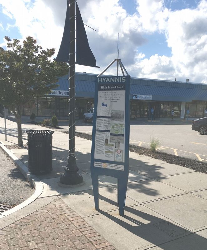
Hyannis holds a special spot in the hearts of residents & visitors, who love to live, work & play in Cape Cod’s Downtown year round.
The carousel at 541 Main Street was built in 1957 by the Allen Herschell company, one of the . . . — — Map (db m162629) HM
In the 1800s more than 150 Sea Captains called Hyannis home. Tree lined streets, such as Pleasant Street, or Sea Captain Row, link Main Street to the Harbor. The Old Colony Railroad originally extended to a wharf in The Outer Harbor along what is . . . — — Map (db m162589) HM
Original Campus and Buildings
Hyannis Normal School
1897 – 1932
Hyannis State Teachers College
1932 – 1944
Gift of
The Class of 1940 — — Map (db m142710) HM
Through Historic Events &
and ever changing times,
Hyannis Main Street
Continues to be a center
For recreation,
commerce & culture
The Mayflower Block
The block containing the Federated Church is known . . . — — Map (db m162615) HM
Established in 1865 by
Mrs. Rosella Ford Baxter and 14 women.
In 1908 this classic Cape Cod house,
circa 1750, with lovely grounds, was
purchased for library use for $2,500
from James Otis of Hyannis Port.
Ora Adams . . . — — Map (db m142673) HM
The Town Center of Hyannis - where town business & commerce meet culture & history
Walkway to the Sea
The Village Green was originally designed as a common for the school buildings that are now town offices. It is a place to . . . — — Map (db m162551) HM
In Recognition Of The Men From
Hyannis
Who Served In The
1914 World War 1919
★ Paul Howland Sherman Jr
Clarence Albert Crowell D.S.C.
Army
Arenovski, Louis Vivian • Baoaka Arthur Harry • Baker Everett Davis . . . — — Map (db m143817) WM
Hyannis Harbor, Then …
The sandy peninsula of Cape Cod, a distinctive “arm and elbow” reaching into the Atlantic Ocean, was created by glacial deposits during the ice age more than 23,000 years ago. The Cape offered a . . . — — Map (db m166627) HM
The 35th President of the United States, 1961 - 1963
John Fitzgerald “Jack” Kennedy (JFK) was the 35th President of the United States, serving from 1961 until his assassination in 1963. At age 43, he was the youngest . . . — — Map (db m144082) HM
In Loving Memory
SOC (SEAL)
Kevin Arthur Houston
20 September, 1975 – 6 August, 2011
“Greater Love has no one than this: to lay down one’s life for one’s friend.”
John 15.13 — — Map (db m142707) WM
Main Street, Hyannis in the 1960s was filled with activity. Shops were bustling, and supporters of John F. Kennedy, running for president, lined the streets. Since JFK based much of his campaigning out of the Kennedy Compound in Hyannis Port, . . . — — Map (db m144001) HM
The Kennedy’s Contribution to Maritime Heritage
The Cape Cod maritime Museum, to the east, and it’s 1886 Crosby catboat replica, Sarah, docked here at Gateway Marina, was made possible by funding obtained by Senator Edward . . . — — Map (db m157317) HM
President John F. Kennedy loved Cape Cod and its unique natural environment. In 1961, he signed legislation establishing an American treasure, the Cape Cod National Seashore, protecting the fragile coastline from Chatham to Provincetown. The . . . — — Map (db m144005) HM
Engaging The Next Generation
The Peace Corps was established by President John F. Kennedy on March 1, 1961. JFK sought to encourage mutual understanding between Americans and people of nations and cultures by sending volunteers . . . — — Map (db m144009) HM
Bismore Park
Was Named in Honor of
Barnstable Resident
Army Air Corps Sergeant
Ralph P. Bismore.
1914 Ralph Bismore was born in Boston on April 28, 1914. The family later moved to the village of Hyannis on Cape Cod. He was best . . . — — Map (db m166529) HM WM
Rose Fitzgerald Kennedy, Matriarch of the Kennedy Family.
Did you notice the amount of roses on Main Street and Pearl Street in Hyannis? Many people on Cape Cod associate roses here with Rose Fitzgerald Kennedy, the matriarch of the . . . — — Map (db m157310) HM
In Memory of
SGT. Mark Vecchione
01-11-81 to 07-18-06
Assigned to U.S. Army 1st Battalion, 37th Armor Regiment, 1st Armored Division out of Friedberg, Germany. — — Map (db m185104) WM
The ‘Kennedy Church’
St. Francis Xavier Church, located on South Street in Hyannis, was the church Rose and Joe Kennedy chose to attend after buying their home in Hyannis Port in the 1920’s. St. Francis Xavier became the summer parish . . . — — Map (db m157311) HM
This memorial honors the Korean War veterans from Cape Cod and the Islands. The white bricks in the pathway immortalize those who were killed in action or died while missing.
One and one half million Americans served in Korea; 129,000 were . . . — — Map (db m142955) HM
Early tenants included the U.S. Post Office, New England Telephone and Telegraph, Cape and Vineyard Electric Co., Barnstable County National Bank, F.W. Woolworth, & W.T. Grant. The West Barnstable Brick Company provided Many Of The Original . . . — — Map (db m142677) HM
This Stone Was Provided By
The Republic Of South Korea
As A Tangible Reminder
Of The Sacrifices Made
By The United States Military
To Protect The Freedom
Of A Sovereign Country — — Map (db m143004) WM
In Honor Of
Those Who Gave Their Services
In The Defense Of
Their Country And The Free World,
So That Peace, Justice And Liberty
Might Be The Heritage Of All. — — Map (db m143002) WM
Dedicated To All Who Believe In Freedom
To Honor Those Who Came Home
As Well As Those Left Behind
Americans Will Not Forget
November 11, 1983 — — Map (db m142709) WM
A Grateful Nation Remembers
and honors
The men and womem who trained for WWII
at this field Marstons Mills
Mass. 26th Division Aviation, Massachusetts
National Guard and aviation pioreers
B. Gen. Harold R. Harris
Chief of Staff, Air . . . — — Map (db m190405) HM WM
This is the site of Chatham Radio/WCC. Maritime wireless communications flourished here, one of the 20th century’s premier wireless telegraphy stations.
The Marconi Wireless Telegraph Company of America built the Chatham receiver station in . . . — — Map (db m78441) HM
On November 27, 1898
The Steamer
Portland
With 176 persons aboard
Sank with No Survivors
About Seven Miles Out To
Sea From This Station
At Cape Cod Light
_____ ___ _______
This Memorial Dedicated November 27, 1948
By . . . — — Map (db m141449) HM
This small unassuming patch of land harbors two treasures in the rich historical fabric of our town, the Rock Harbor Academy and the original Snow Library.
Rock Harbor Academy
In 1827, a group of citizens who wanted a place of higher . . . — — Map (db m141702) HM
Here, Dec. 19, 1814 Orleans Militia repulsed British landing from H.M.S. Newcastle, - intent; burning village and vessels, War of 1812. Town's early commercial and maritime center. Packet's Landing; passengers and freight between here, Plymouth, . . . — — Map (db m61489) HM
All nine of the Cape Cod Lifesaving Stations were a part of the USLSS District 2. In 1872, Sumner I. Kimball, then Chief of the Treasury Department’s Revenue Marine Division, appointed Orleans resident Benjamin Sparrow as Superintendent of . . . — — Map (db m158783) HM
In early 1814, the arrival of British naval ships released from European war duties brought economic hardships to Cape Cod. Provincetown became the headquarters for the H.M.S. Newcastle, captained by Lord George Stuart, as well as the Acasta, . . . — — Map (db m158455) HM WM
East Orleans Country Store, built prior to 1835 by William Myrick. Later owned by Myrick, Doane & Crosby. Sold in 1858 to lot Higgins and moved to the present site. Run until 1935 by Samuel Higgins. — — Map (db m141678) HM
French – Atlantic cable company Cape Cod station 1890 – 1959. Oldest cable on Atlantic bed. From storm isolated Cape, first world news of steamer Portland lost off Truro with 200 lives; flashed from Orleans to Brest, France and back over . . . — — Map (db m77557) HM
Built circa 1720 in South Orleans, later moved to the center of town. It was moved to Hyannisport in 1897. In 1983, the structure was given to the Orleans Historical Society by the Groves family. The society then donated it to the town. Dismantled . . . — — Map (db m59979) HM
”All the towers leaking bad. Everything all wet and in poor order
Log entry by Keeper Nathan Gill, 1874
Taking care of a lighthouse was demanding. The keeper was tasked with keeping the lights burning no . . . — — Map (db m141388) HM
The history of the town of Orleans is closely linked to the town of Eastham, and has deep roots in the original Plymouth Colony established in 1620. For some time, the colonists there had considered moving the colony to a better location due to . . . — — Map (db m158924) HM
Honor Roll
Dedicated to the Men of the
Town of Orleans Who Served In
1917 – The World War – 1919
Army
Bailey George · Baker Warren W. · Betts Charley E. · Chase Fred N. · Childs Adelbert A. · Crowell George E. · . . . — — Map (db m144444) WM
In honor of the veterans from the town of Orleans who served during the Korean War and
Vietnam War
Bryant Harland Besse • Richard Sewell Burling • Donald Allen Clifton • Moncrieff M Cochran III • Robert William Corrigan • Charles Abbott . . . — — Map (db m165415) WM
Dedicated in veneration for those who died gratitude to those who served with honor, confidence in the patriotism of those who follow
Died In Service
S. Hilton Atwood •
Albert P. Nassi •
Allen B. Walker
Erected In Memory Of . . . — — Map (db m166817) WM
Orleans’ First Resident?
Strictly speaking, each of the nearly 1000 persons residing in Orleans at the time of the incorporating act were among the first residents of Orleans. But did they have a predecessor? The historical record . . . — — Map (db m158929) HM
Both the lighthouse standing here and the cliff in front of you have had to give away to the power of the Atlantic Ocean.
The first lighthouses built here in 1838 were placed over 600 feet east of where you are standing now. As ocean waves ate away . . . — — Map (db m63398)
On January 28, 1915, President Woodrow Wilson signed the law creating the US Coast Guard by combining the Lifesaving Service with the Revenue Cutter Service. The law put the Coast Guard under the Treasury Department in peacetime and under the . . . — — Map (db m158839) HM
The submarine telegraph cable known as Le Direct provided communication between Europe and North America without intermediate relaying. In a remarkable feat of oceanic engineering, the cable was laid in the deepest waters of the Atlantic Ocean . . . — — Map (db m141616) HM
The Incorporation of Orleans
The Town of Orleans was born in 1797. On March 1, both houses of the Massachusetts legislature passed, and on March 3 Governor Samuel Adams signed “An act to divide the town of Eastham in the County of . . . — — Map (db m158944) HM
Shipwrecks and Lifesaving in Orleans date back to the winter of 1626, approximately 170 years before the incorporation of the Town. During that winter, the Sparrow-hawk, carrying passengers bound for Jamestown from England, was wrecked in the . . . — — Map (db m158793) HM
For nearly two centuries after the Sparrow-hawk rescue, there were no organized efforts to aid those who were involved in shipwrecks off Cape Cod shores. Those who found themselves cast up on the shores or sandbars of Cape Cod were at the mercy . . . — — Map (db m158807) HM
In the years following World War I, the profession of lifesaving changed significantly. The widening of the Cape Cod Canal and the removal of the substantial tolls greatly reduced the amount of shipping traffic off our dangerous eastern shore. . . . — — Map (db m158911) HM
The long, black cable has carried countless thousands of messages of international finance, personal hope and disaster, and news of war and peace.
Now it lies cold and dormant on the deep floor of the wide Atlantic.
If you stood here on November . . . — — Map (db m63399)
In 1838 the United States Government took action to reduce the number of shipwrecks along this dangerous coast by establishing the Nauset Light.
To make the signal easily recognizable three separate lanterns were set on small brick towers about 150 . . . — — Map (db m234957)
In 1872, the United States Lifesaving Service (USLSS), a unit of the US Treasury Department, established nine lifesaving stations on Cape Cod. One of these stations was in Orleans, on Nauset Beach just opposite the south end of Ponchet (now . . . — — Map (db m158775) HM
Whales and humans have long shared the coastline of Cape Cod. Native Americans harvested whales the washed up on the beaches, almost exclusively for food, long before the arrival of European colonists. While anchored in what would become . . . — — Map (db m141867) HM
These three lighthouses were part of the Nauset Beach Light Station, which originally stood a quarter mile away, overlooking the Atlantic Ocean. Nicknamed the Three Sisters, this trio of lights provided a landmark for sailors making their way along . . . — — Map (db m63400)
In 1912 the "Star” was born, Provincetown's first movie theater, in time converted into "Bowlaway" Candlepin Lanes, where the tid-bit diner was a favorite of Capt. Manuel "Sea Fox" Zora, a legendary rumrunner. In 1983 Isaac Saada (aka Zukie) . . . — — Map (db m234504) HM
Of all the enemy ships that haunted Provincetown Harbor during the Revolutionary War, perhaps the most fearsome was the huge British man-of-war H.M.S. Somerset. With her 64 mounted guns and crew of 400, she symbolized British tyranny where-ever she . . . — — Map (db m111670) HM
In memory of the five Mayflower passengers who died at sea and while the ship lay in Cape Cod Harbour
William Butten Nov 16th, 1620
Edward Thomson Dec 14th, 1620
Jasper More Dec 16th, 1620
Dorothy Bradford Dec 17th, 1620
James Chilton . . . — — Map (db m234955) HM
This memorial stone is erected by the Commonwealth of Massachusetts to commemorate the Compact, or Constitution of Government, signed by the Pilgrims, on board the Mayflower in Provincetown Harbor, November 11, 1620, old style.
On the reverse . . . — — Map (db m234505) HM
On November 20, 1620 the Pilgrims dropped the Mayflower’s anchor for the first time in the new world- not at Plymouth where they later settled, but in the harbor ahead. Just off the shores of today’s Provincetown they drafted and signed a pioneering . . . — — Map (db m111673) HM
The Provincetown AIDS Memorial is a horizontal monument, a unique monument in the living ocean. This memorial is a reminder of the lives lost to AIDS and the humanitarian achievements of the caregivers who responded to the crisis. It is also a . . . — — Map (db m142335) HM
• Established – November 5 1816
• Keeper's house built – about 1876
• Fog bell installed – 1852
• Present fog signal building built – 1876
• Steam fog whistle installed – 1876
• Keeper's house added on to – Approx. 1900
• Present . . . — — Map (db m198218) HM
This Stone Commemorates the Victory of the Schooner “Rose Dorothea” Captained by Marion Perry and Crew, at the Old Home Week Celebration in Boston 1907. This Cup Given by Sir Thomas Lipton for the Winner of this Race can be Seen in . . . — — Map (db m141932) HM
This Monument
Records the Devotion Of The
Sons Of Provincetown
Who Gave Their Service
To Their Country In The
Great World War 1917-1918
In The Hour Of Need They
Made The Supreme Gift Of
Themselves, Going To Meet
Toil, . . . — — Map (db m142901) WM
A siren pierces the air! A German submarine is sighted! Soldiers scramble to their respective positions to defend the eastern entrance of the Cape Cod Canal from enemy attack.
This was only a drill. Enemy vessels were sighted along these shores, . . . — — Map (db m57393) HM
In Memory
Dec. 16, 1944 - Jan. 25, 1945
Dedicated to those
men and women who
fought in the historic
World War II
Battle of the Bulge
in the Ardennes, Belgium
Cape Cod & Islands Chapter 58
Veterans Of The Battle Of . . . — — Map (db m140414) WM
The name Sagamore is defined as "Chief" of an Indian tribe. It was on Sagamore Hill that chiefs of the Wampanoag and Manomet Indians would hold tribal meetings. As you look out toward Cape Cod Bay, the land before you has undergone many changes . . . — — Map (db m57397) HM
Thomas Dexter began building gristmills on this site in 1637.
The mill you see here today started operating in about 1654.
The early settlers of Sandwich brought their corn to “The Grist Mill”
to be ground into meal, . . . — — Map (db m140436) HM
Edmond Freeman Born in England 1590 Died in Sandwich 1682 A Founder of the Town of Sandwich in 1637 Assistant to Governor Bradford 1640 - 1647 — — Map (db m120748) HM
First Church of Christ
A congregational chapel was first built on this site in 1813 and replaced in 1847 with this lovely Greek revival with a spire said to be reminiscent of the London spires designed by Christopher Wren. It is one of . . . — — Map (db m234497) HM
In memory of those who made the supreme sacrifice while serving our country upon the sea and now rest beneath the waves
Dedicated A.D. 1968
By the People of Sandwich — — Map (db m234498) WM
1917 - 1919
In Memoriam
Of
Our Fallen Heroes
In
The World War
“They Are In Some Special Sense
Soldiers Of Freedom”
Alden Clark
Michael S. Haddad
Erected by the citizens of Sandwich
November . . . — — Map (db m140439) WM
The 241st Coastal Artillery Battery C used this Panama Gun Mount as a firing base. At the onset of World War II, the United States Army positioned 155 MM Field Artillery pieces at critical coastal locations. The defense of the easterly entrance to . . . — — Map (db m57396) HM
Before you are "Ready Rooms". A series off underground tunnels connected the plotting rooms and ammunition storage rooms behind the hill to the observation and battery command station atop the hill. Side tunnels allowed movement of ammunition to the . . . — — Map (db m57395) HM
By looking at the present landscape, one can see into the past. Sagamore Hill is rich in cultural and natural history. What was once a Indian Council gathering place later became a World War II Coastal Military Installation. The land is now a . . . — — Map (db m57307) HM
Presented By William Eaton
To His Native Town Of
Sandwich Mass.
As A Memorial To His Father
James R. Eaton
May 30, 1911
Erected In Memory Of The
Soldiers And Sailors
From This Town,
Brave Defenders Of The Union
And . . . — — Map (db m140412) WM
Sandwich Town Hall
Built in 1834, this columned Greek Revival, continues to serve as the seat of town government and is one of the oldest town halls in New England. In 2009, the building was beautifully and accurately restored and received . . . — — Map (db m140508) HM
The first private school
of higher learning
in Barnstable County
Incorporated by the State Legislature
Feb. 21, 1804
Placed by the Sandwich Historical Society 1971 — — Map (db m234496) HM
Railroad Timeline
1846
Cape Cod Branch of Old Colony Railroad introduced. It began in Middleborough Four Corners and stopped in Sandwich, uniting with the Fall River Railroad in Middleborough.
1848 . . . — — Map (db m160404) HM
Italian-born Guglielmo Marconi was an inventor who dreamed of a world where signals could be sent wirelessly. He drew upon research, experimentation, and his business acumen to make it happen. From this site on January 18, 1903, Marconi sent the . . . — — Map (db m141493) HM
Technological innovation constantly reshapes our experience of the world- in less than a century, we advanced from wireless telegraph to wireless internet. On Cape Cod, the North Atlantic Ocean is a powerful force for change to the landscape. . . . — — Map (db m141487) HM
Site of first United States
Transatlantic Wireless Telegraph Station
Built in 1901-1902
Marconi Wireless Telegraph Company of America
Predecessor of RCA Transmitted January 19, 1903
The First U.S. Transatlantic Wireless Telegram . . . — — Map (db m141100) HM
Duty – Honor – Country
Dedicated to All Cape Cod Veterans
Who Served, and Those Who Gave
Their Lives in Support of
Operation Desert Storm,
Operation Iraqi Freedom,
and Operation Enduring Freedom
in Afghanistan . . . — — Map (db m157962) WM
These tall cliffs seemed like solid ground when President Washington authorized the construction of Cape Cod’s first lighthouse here in 1797. But over the years, the waves of powerful winter storms have battered the base of this cliff. From time to . . . — — Map (db m141553) HM
Ralph S. Barnaby, on a flight from Corn Hill of 15 minutes, 6 seconds, became the first American to win an International Soaring Certificate, August 18, 1929.
This flight was the first to exceed the American record for motorless flight of 9 . . . — — Map (db m156416) HM
Sixteen Pilgrims led by Myles Standish, William Bradford, Stephen Hopkins and Edward Tilley found the precious Indian corn on this spot which they called Corn Hill, November 16, 1620.
Old style.
And sure it was God’s good . . . — — Map (db m156633) HM
The original Highland House was the Small family farmhouse. The Smalls ran a farm on the property in the 1700s. By the 1800s they began taking in guests as Cape Cod tourism grew. The business thrived, and the Smalls added cottages. They removed the . . . — — Map (db m141544) HM
I have a room all to myself it is Nature.
Henry David Thoreau
The land comprising the Truro Highlands District included an early 1700s farm owned by the Small family, with a windmill for grinding grain. . . . — — Map (db m141541) HM
2954 entries matched your criteria. Entries 201 through 300 are listed above. ⊲ Previous 100 — Next 100 ⊳