The Rose Garden was a joint creation of the City of Berkeley and the Federal Works Progress Administration (WPA), whose public works provided employment during the Depression. Vernon M. Dean, the City's landscape architect, designed the garden in a . . . — — Map (db m18618) HM
On Milvia Street just south of Lincoln Street, on the right when traveling south.
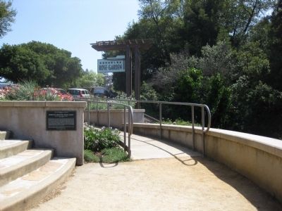
This garden honors Berkeley’s many innovative poets, poetry presses and publications, and their creative legacy. It was dedicated in 1999 on the second anniversary of “Beat” poet Allen Ginsberg’s death. Through their writings, the nonconformist . . . — — Map (db m54191) HM
The first vineyards in the East Bay were planted at Mission San Jose in the late 18th century, tended by Spanish missionaries and Native Americans. Around 1850, after the Mission was secularized, landowners expended vineyards and began . . . — — Map (db m212653) HM
Boxed Tree Forest
These oak trees were planted in boxes waiting to be sold when the Roedings operated California Nursery Company. Eventually the trees rooted into the ground creating a unique forest of boxed trees. Over the years, local . . . — — Map (db m208707) HM
The historic buildings on the property – the Vallejo Adobe, President’s House, Office Building and Packing Shed - make up the historic core of the site, and were the center of the nursery operation; the place where orders were placed, materials . . . — — Map (db m208904) HM
Overview of History
California Nursery Historical Park is 20 acres of prime agricultural land. People who inhabited the area included the Muwekma Ohlone, Spanish (Mission San Jose), Mexicans (Rancho Arroyo de la Alameda), and “Californios.” . . . — — Map (db m208723) HM
The primary purpose of the California Nursery Historical Park Master Plan is to tell the story of the California Nursery Company to current and future generations through the sharing of the site’s remaining historic buildings, majestic . . . — — Map (db m208557) HM
For many years the California Nursery was one of the state’s leading nurseries. Established in 1884 by John Rock, the nursery originally covered 463 acres. Through constant experimentation, including the introduction of new fruits, Rock made a . . . — — Map (db m208908) HM
The California Nursery is closely associated with John Rock and George C. Roeding. In 1884, a German immigrant named John Rock purchased 463 acres on a site that is today known as the community of Niles in Fremont. He moved his start-up nursery . . . — — Map (db m208919) HM
The California Nursery property includes noteworthy landscape features, such as the many mature trees, in addition to historically and architecturally significant buildings like the garden store. Unfortunately, due to years of use and multiple . . . — — Map (db m208714) HM
On Peralta Boulevard at Robert Fisher Drive, on the right when traveling west on Peralta Boulevard.
James and Lucy Shinn established a nursery and ranch here in 1856. Joseph Clark and Florence Mayhew Shinn and their children carried it on until 1978. In 1962, Florence Shinn gave the City of Fremont this park with the 1876 ranch house and office, . . . — — Map (db m194709) HM
Between 1860 and the 1920s, the Meeks grew grains, green peas, corn, sugar beets, cucumbers, blackberries, and currants. Most of their land was in orchards of almonds, oranges, apricots, peaches, prunes, plums, and cherries. Meek’s land was . . . — — Map (db m210340) HM
“…is a handsome mode of architecture, and symmetrically planted ground, sinuous walks and drives, the sturdy, primeval oaks, the rare and ever looming exotics, and the large attractive fountain surround the place with and air of elegance, wealth, . . . — — Map (db m210886) HM
Near Arroyo Road south of Superior Drive, on the right when traveling south.
1890
Buckley's Vineyard
Christopher Augustine Buckley's Winery was built in 1890 and a brandy distillery was added in 1897. The original 100 acre site was one of the larger early vineyards in the Livermore Valley. After its expansion . . . — — Map (db m233018) HM
This wagon was built in 1849 by Martin Luther Marsh for M.L. and D. Marsh Lumber Co. in Nevada City. It was used until 1917; abandoned in Meeker Canyon; then trucked to Livermore in 1931 and used in the rodeo parades until 1936. It was displayed . . . — — Map (db m194541) HM
Near Skyline Boulevard, 0.5 miles north of Joaquin Miller Road.
Until at least 1851, Redwood trees on this site were used as landmarks to avoid striking the treacherous submerged Blossom Rock in San Francisco Bay west of Yerba Buena Island. Although by 1855 the original stems had been logged, today's trees are . . . — — Map (db m100564) HM
Near Highland Avenue, on the right when traveling south.
In her memoir about life in Piedmont, Elsie Whitaker Martinez remembered fishing with her brothers in the Piedmont Heights in the 1880s. A myriad of streams found their way from Alta, Scenic, Pacific and Mountain Avenues. Most fed into the city’s . . . — — Map (db m72321) HM
Near Wildwood Avenue near Prospect Road, on the right when traveling west.
One of the first improvements made by Frank Havens to Piedmont Springs Park was the construction of a living hedge maze modeled on those like Hampton Court in England. An article in the Oakland Herald in December 1904 shows a winding drive . . . — — Map (db m72376) HM
Near Estudillo Avenue, on the right when traveling east.
Many of the trees surrounding you have foreign roots, each with its own tale. In 1868 the Hayward Journal described Chabot’s plans to encircle the reservoir with “walnut, hickory nuts, butternuts, and other eastern and foreign nut trees.” These . . . — — Map (db m71650) HM
Near State Highway 49, on the right when traveling south.
The Foothill Station became the first University of California qualifying outlying station funded jointly by federal, state and local county sources in March 1888. The station was developed under the patronage of Senator A. Caminetti of Jackson. . . . — — Map (db m72065) HM
On Plymouth - Shenandoah Road, on the right when traveling north.
D’Agostini Winery was started in 1856 by Adam Uhlinger, a Swiss immigrant. The original wine cellar, with walls made from rock quarried from nearby hills, hand hewn beams, and oak casks, is still in use and part of the present winery. Some original . . . — — Map (db m100585) HM
In 1888, the State Board of Forestry established an experimental forestry station and nursery, a companion to the Santa Monica Station established in 1887. The two were the first such stations in the nation. Exotic and native trees were tested and . . . — — Map (db m100602) HM
The massive and majestic Hooker Oak, which occupied this site, was named in honor of renowned British Botanist Sir Joseph Dalton Hooker. The Hooker Oak was acclaimed to be the largest Valley Oak in the world before it fell on May 1, 1977.
Age . . . — — Map (db m100595) HM
This peaceful community, gateway to the remote regions of the High Lakes of Butte and Plumas Counties, owes its origin and subsequent development to the entrance of the Diamond Match Company to California. With the purchase of about 40,000 acres of . . . — — Map (db m61764) HM
On South Main Street (California Route 49), on the left when traveling south.
This Best 110 hp steam traction engine, built 1903-1906, was originally used by Pacific Borax Co. to pull ore wagons. The next owner was the Dixie Mill, near Sheep Ranch, where it was used to haul logs down the steep hillsides to the loading deck. . . . — — Map (db m101613) HM
Near Big Trees Parkway near Ebbetts Pass Scenic Byway (California Highway 4).
In the spring of 1852, Augustus T. Dowd, while hunting, discovered a grove of truly immense trees, now known as the Calaveras North Grove. Several stockholders of the Union Water Company (who employed Augustus as a hunter) developed a plan to . . . — — Map (db m34120) HM
On Big Tree Parkway, on the left when traveling east.
You are not the first to explore these forests. Generations of Miwok and Washoe Indians knew these trees.
The rest of the world met the big trees in 1852 when hunter Augustus T. Dowd stumbled upon the North Grove. His discovery brought both . . . — — Map (db m95185) HM
On North Grove Trail, on the left when traveling west.
Here at Calaveras Big Tree State Park, it's a regrettable fact that the most famous trees are those most harmed by human action. Both the Mother of the Forest and the Big Stump remind us of how people placed their own curiosity and pleasure above . . . — — Map (db m95184) HM
Near Blagen Road / Forest Route 7N08, 0.9 miles north of Ebbetts Pass Scenic Byway (California Highway 4).
White Pines was constructed by American Forest Properties, Inc. at the site of former White Pines operation of Blagen Lumber Co.
The community of White Pines, which was founded by Frank Blagen, the company president, came into being during . . . — — Map (db m34571) HM
Joel Clayton owned the property facing Morris Street from 1857 to 1870. His estate sold the lots to J. H. Keller in 1877 who built a house, slaughter house, butcher shop, and barn.
George Scammon owed most of the remaining lots and planted . . . — — Map (db m150416) HM
This grove of trees is dedicated to the pioneers Charles Gardner Goold [and] Allie Johnson Goold who acquired this property for a home in the year 1900 and planted these trees in 1913 — — Map (db m202117) HM
On San Pablo Avenue, on the right when traveling north.
(front or street side:)
"At four in the morning they would
start preparing the flowers for market.
Grandfather would carefully put the
flowers in a basket and sling it over
his shoulder. Grandmother, carrying
a lantern, would lead him . . . — — Map (db m156299) HM
On San Pablo Avenue at Wall Avenue, on the left when traveling north on San Pablo Avenue.
In the early 1900s, Japanese immigrants planted the seeds of a remarkable nursery community in El Cerrito and Richmond. These nurseries were located mostly west of San Pablo Avenue and north of Portrero Avenue. After interment during World War II, . . . — — Map (db m94249) HM
Near Alhambra Avenue, on the right when traveling south.
Ranch home of John Muir 1838- 1914, explorer, naturalist, author and foremost advocate of forest protection and of national parks. The John Muir Trail through the High Sierra, Muir Woods National Monument and Muir Glacier in Alaska are named for . . . — — Map (db m51132) HM
Through the collective recognition of the Community of Nations
expressed within the Principles of the
Convention concerning Protection of the World
Cultural and Natural Heritage, Redwood National Park
has been designated a
World Heritage . . . — — Map (db m182011) HM
On Redwood Highway (US 199) at Walker Road on Redwood Highway (US 199).
Discovery the unique features of an old-growth redwood forest. Welcome to the Simpson-Reed Discovery Trail!
You are in the midst of an ancient redwood forest. Here, you will see trees of many ages that create a multi-layered forest ceiling or . . . — — Map (db m87814)
On Redwood Highway (US 199) at Walker Road on Redwood Highway (US 199).
Simpson-Reed Grove for the perpetual enjoyment of all--This grove was presented to the State of California by the Simpson Timber Company in memory of Mark E. Reed, its president from 1914 to 1955. — — Map (db m87815) HM
On Howland Hill Road, on the left when traveling east.
This grove is given to the State of California for the preservation of these ancient trees by Mr. and Mrs. Jesse H. Metcalf of Rhode Island. — — Map (db m1510) HM
Near Carson Road, 0.3 miles east of Union Ridge Road.
Whose deep concern for the conservation and improvement of our forests led him to establish the Eddy Tree Breeding Station on this site in 1925. His own effort and funds created this oldest forest genetics research institution in the Western . . . — — Map (db m105854) HM
Born Nebraska 1887. Educated Biltmore Forest School, North Carolina. Began career 1908 in California with U.S.F.S.
Major U.S. Army A.E.F. 1917 – 1919
General Manager
Michigan California Lumber Co. 1925 – 1949
California State . . . — — Map (db m57974) HM
On Pony Express Trail (Lincoln Highway) at Forebay Road, on the right when traveling east on Pony Express Trail (Lincoln Highway).
By the end of the war with Mexico in 1847, California’s non-native population was a mere 15,000. The 49ers pushed the population of El Dorado County beyond 20,000 by 1850. As winter approached, the minors replaced their tents and shanties with . . . — — Map (db m94634) HM
This giant Jeffrey pine, the Old Veteran, is 350 to 400 years old. Although this tree still stands, most of the pines of the same age fell to loggers in the late 1800s. This tree is the only one of its kind near the visitor center.
Notice that . . . — — Map (db m212297) HM
On Elm Avenue (California Route 33.198) at Phelps Avenue, on the right when traveling north on Elm Avenue.
Harry Watanabe was 19 years old when he came to Coalinga from Japan in 1915. Watanabe first worked at Ayers Drug Store and the Sullivan Hotel. It was in 1928 that Watanabe found his niche in life and the vocation that left his mark on Coalinga. . . . — — Map (db m64107) HM
On State Highway 180 at Forest Service Road 13S03, on the left when traveling north on State Highway 180.
One of the largest stands of Giant Sequoias, it contained some of the finest Big Trees. The grove was logged as a private land between 1897 and 1907, first by the Sanger Lumber Company and later by Hume-Bennett Lumber Company, which in 1909 . . . — — Map (db m52239) HM
On South Elm Avenue at West Lincoln Avenue, on the right when traveling south on South Elm Avenue.
[Side A:]
Easton
In 1878, O.W. Easton and J.P. Whitney, San Francisco entrepreneurs, bought a total of 12 sections of land in this area (7680 acres), formed the Washington Irrigated Colony and began selling 20-acre farms. Allen T. . . . — — Map (db m229962) HM
On Shaw Avenue near Forestiere Avenue, on the right when traveling east.
Here, beneath the hot, arid surface of the San Joaquin Valley, Baldasare Forestiere (1879-1946) began in the early 1900's to sculpt a fantastic retreat. Excavating the hardpan by hand, he created a unique complex of underground rooms, passages and . . . — — Map (db m41003) HM
On FS 14S11, 5 miles north of Generals Highway, on the left when traveling north.
The Birth of Lookouts
From the days of the old west, through the trials of World
War II, to our current high-tech world, the story of the fire
lookout is laced with history, heroics and romance. The
history of fire lookouts in . . . — — Map (db m213281) HM
Near Pine Flat Road, 1.5 miles north of Elwood Road.
Its waters made possible the irrigation of a million fertile acres, despite a 39 year battle over water rights. From 1882 forward, 150 lawsuits were filed and early irrigators often used armed force to open headgates to water their crops. L. A. . . . — — Map (db m27996) HM
On East Front Street, 0.2 miles west of Park Street, on the left.
On this 6 1/4 acre site, Libby, McNeill and Libby opened the San Joaquin Valley's largest cannery on July 18, 1911, less than four hectic months after the site was acquired and construction plans were announced. The initial construction cost was . . . — — Map (db m52240) HM
On Highway 180 at National Forest Road 13S97, on the right when traveling west on Highway 180.
Two miles northwest of here astride Mill Flat Creek is the site of old Millwood. A sawmill town established in 1891. Railroads brought logs here for milling and later lumber from other nearby mills including that which cut the privately owned . . . — — Map (db m2979) HM
On County Road G at Airport Road on County Road G.
The first operational air tanker was developed in Willows, by the Willows Flying Service in 1955, at the
request of the Fire Control Officer for the Mendocino National Forest. A Boeing Stearman 75 “Caydet” Agricultural
Aircraft was modified . . . — — Map (db m230783) HM
Near Mattole Road (Lower Bull Creek Flats Road), 4.3 miles west of U.S. 101, on the left when traveling west.
Recognized by the American Forestry Association as the National Champion Coast Redwood, Sequoia sempervirens, November 1991. Height • 363 feet Circumference • 53.2 feet Average crown spread • 62 feet — — Map (db m165464) HM
The drag saw was the predecessor of today's modern chain saw. It was used at the turn of the century to "buck" fallen trees into lengths the mills could handle. Some of these saws, however, were used to fell the trees. The power for this saw is an . . . — — Map (db m190795) HM
Notice that this tree is hollow and 3/4 of the wood is dead. However, 1/4 of the tree refuses to die. The limbs on the tree are evidence of the living material still within. Higher up a double top reaches toward the sky. The tree itself continues to . . . — — Map (db m87848)
On Newton B. Drury Scenic Parkway, on the left when traveling north.
Conservationist, author, anthropologist, a founder of the Save-the-Redwoods League.
This area of 1600 acres, habitat of the last surviving herd in California of Roosevelt Elk is established as a memorial by
· De Forest Grant
· John D. . . . — — Map (db m32569) HM
Near Newton B. Drury Scenic Parkway, on the right when traveling north.
Your journey along the Newton B. Drury Scenic Parkway follows the historic Redwood Highway. When the highway reached this area in the early 1920s, a new era of automobile-based tourism was booming. Then, just as today, iconic Big Tree was an . . . — — Map (db m176816) HM
Near Tall Trees Access Road, 6 miles south of Bald Hills Road.
Rumors of “great timber” by area loggers led National Geographic Society naturalist, Paul Zahl, to this remote creek valley in 1963. On one of his trips, Zahl stopped on the cut-over ridge just across from this grove to take some pictures. . . . — — Map (db m169542) HM
On Avenue of the Giants (Route 254), on the right when traveling west.
• Ancient Redwood - Age 950-1000 Years
• Original height 298 ft Current height 248 ft.
• Survived lightning which removed its top, loggers axe &
forest fire in 1908, flood of 1964
• Trunk diameter is 14.5 ft. top diameter is 3 ft.
• . . . — — Map (db m231675) HM
This is the last lumber camp style cookhouse in operation in North America. This cookhouse was originally opened as part of Samoa, one of the last company owned towns in the United States, established by the Vance Lumber Company. The original . . . — — Map (db m65422) HM
Top marker: Welcome to Humboldt Redwoods State Park. As you travel either U.S. Highway 101 or the Avenue of the Giants for the next 32 miles, you will pass through the largest redwood park of all California State Parks. Preserved here are over . . . — — Map (db m87843) HM
Their first sawmill was built in 1887 at their current location and employed 150 men to turn the giant redwoods into shingles and other products.
Originally named Forestville, the town name was changed to Scotia in 1888. Scotia is one of the last . . . — — Map (db m71988) HM
On Avenue of the Giants (California Route 254) at Lum Street, on the right when traveling north on Avenue of the Giants.
A World class Forest Preserve
Containing over 53,000-acres, Humboldt Redwoods State Park includes some of the world's most impressive redwood forests, many miles of river frontage, and nearly 100 miles of hiking, riding and mountain bike . . . — — Map (db m176731) HM
In 1148 this tree began growing near Jordan Creek at the north end of the “Avenue of the Giants”. It was 839 years old when it fell in 1897. Average Diameter at Base—9 feet; Height of Tree—300 Feet; Age of Cross . . . — — Map (db m87846) HM
On Three Flags Highway (Highway 395) at County Route 168, on the right when traveling north on Three Flags Highway.
This Giant Sequoia is reported to have been planted to commemorate the opening of Westgaard Pass to automobile traffic. The tree was named in honor of President Theodore "Teddy" Roosevelt. — — Map (db m54428) HM
On U.S. 395, 0.3 miles south of Pangborne Lane, on the right when traveling south.
This English Pedunculate Oak tree
originated in Sherwood Forest England.
Around the turn of the century a small
sprout was sent to Lone Pine. A member
of the Fred French family planted the
sprout on this original site, a part of the
old Harvey . . . — — Map (db m221404) HM
Owens Lake is now a Key Migratory Stopover
In the late 1800s, the shoreline of Owens Lake shifted at the hands of people. Even before the City of Los Angeles began diverting water from Owens River, farmers had tapped its tributaries, . . . — — Map (db m221862) HM
Near China Ranch Road south of Furnace Creek Road.
In the 1890's a Chinese man named Ah Foo came to this canyon from the Borax Works in Death Valley. He developed a successful ranch, raising livestock, hay, fruits and vegetables to help feed the local silver miners and their draft animals. The . . . — — Map (db m72929) HM
On Main Street south of First Street, on the right when traveling north.
The original building was destroyed in the fire of 1924. Six months later the present building opened as a hardware store. It has the pressed concrete walls and pressed tin ceiling typical of fire measures taken when the town was rebuilt.
As . . . — — Map (db m49116) HM
On Santa Rosa Avenue at Alameda Street, on the right when traveling north on Santa Rosa Avenue.
The 135 Deodar Cedar trees were planted in 1885 by the Woodbury Family, the founders of Altadena. First organized by F.C. Nash in 1920, the "Mile of Christmas Trees" has been strung with 10,000 lights each holiday season through the efforts of . . . — — Map (db m143798) HM
Near Angeles Crest Highway (California Route 2) 26 miles north of Interstate 210.
Built in 1900 alongside the West Fork of the San Gabriel River and north of Mt. Wilson, the historic cabin was the first ranger station built in California with federal government funds — $75. In the late 1920's, new roads into the mountains . . . — — Map (db m154560) HM
Near Baldwin Avenue, 0.3 miles south of Colorado Boulevard, on the right when traveling south.
Once common across the globe, cycads are now
threatened or endangered in the wild. Explore our
diverse collection and learn about these impressive plants.
Age of Cycads
The Jurassic Period is famous for its fantastically large . . . — — Map (db m198164) HM
Near Baldwin Avenue south of Interstate 210, on the right when traveling south.
Today’s Los Angeles County Arboretum & Botanic Garden blends history and horticulture in a landscape ripe with cultural nuance, allowing history to be sampled in its native setting and savored as an integral link between humans and the land they . . . — — Map (db m143271) HM
Near Baldwin Avenue, 0.3 miles south of Interstate 210, on the right when traveling south.
Constructed by Elias Jackson ('Lucky') Baldwin in 1881. Designed by A.A. Bennett, and intended for entertaining. There being no kitchen, meals were served from the nearby adobe (built by Hugo Reid in 1839) where Baldwin actually lived. Restored and . . . — — Map (db m153410) HM
On Elden Way, 0.1 miles north of North Crescent Drive, on the right when traveling north.
United States Department of the Interior National Register of Historic Places.
Beverly Hills Local Landmark.
Constructed in 1911. — — Map (db m148656) HM
On Indian Hill Boulevard north of 8th Street, on the right when traveling north.
Once an orange grove and home of the Herman and Bess Garner
family, this site was purchased in 1946 to serve as the city's first
community park. The Garners were business and educational leaders
and owners of the Padua Hills Theatre. The citizens . . . — — Map (db m149926) HM
On 162nd Street at Harvard Boulevard, on the right when traveling east on 162nd Street.
This is a fourth generation of the elm tree under which General
George Washington took command of the Continental Army on July 3, 1775;
and the Declaration of Independence was first read to the people of Cambridge, Massachusetts. — — Map (db m164425) HM
On Mountain Street, on the right when traveling west.
Miss American Green Cross was originally dedicated on May 4, 1928 to represent the American Green Cross Society. The early environmental organization was dedicated to the "saving of American's greatest asset-trees". The first chapter of the Society . . . — — Map (db m56198) HM
On South Santa Fe Avenue at West Colorado Avenue, on the right when traveling south on South Santa Fe Avenue.
The Big Tree was planted in the late 1880’s by Mr. Edgar J. Owens, one of Glendora’s early residents. The tree, botanical name Ficus Macrophylla, is commonly called Moreton Bay Fig and is named after the Moreton Bay region of Australia where the . . . — — Map (db m127852) HM
On East Bennett Avenue at Minnesota Avenue, on the left when traveling east on East Bennett Avenue.
Planted in 1901 by the R.W. Hamlins, early citrus growers, the Glendora bougainvillea is the largest growth of this exotic plant in the United States. The parent stock was brought to California by a whaling ship about 1870, and the vines survive as . . . — — Map (db m127847) HM
Near Mauna Loa Avenue, 0.5 miles east of Glendora Avenue.
The Rain Bird horizontal action impact drive sprinkler head was invented in
1933 by Orton Englehardt, a citrus grower and native of Glendora. The design
offered slow rotation and uniform watering, benefits long sought by local
irrigators. . . . — — Map (db m146402) HM
Near Descanso Drive south of Verdugo Boulevard, on the right when traveling south.
Dedicated in memory of Helen Steele Pratt, 1883-1965. Devoted naturalist, nature teacher and counselor, whose efforts led to the
adoption of the California Quail as the California State Bird. — — Map (db m118494) HM
Near Descanso Drive, 0.1 miles south of Verdugo Boulevard, on the right when traveling south.
Private estate becomes public treasure
Newspaperman E. Manchester Boddy (1891-1967) purchased the land that is now Descanso Gardens in 1939. The 165-acre Boddy estate became a public botanical garden when LA County acquired it in . . . — — Map (db m152511) HM
Near Angeles Crest Highway (California Route 2) 8.3 miles north of the Foothill Freeway (Interstate 210), on the left when traveling north.
This was the first National Forest in the State of California, second in the United States. Created by proclamation, December 20, 1892, by President Benjamin Harrison. The first name given to the forest was "San Gabriel Timberland Reserve." It was . . . — — Map (db m143501) HM
On 3rd Street at G Street, on the right when traveling east on 3rd Street.
These deodar cedar trees which were planted on Third Street by Hubert “Scubie” Mills have been designated heritage trees in his honor. — — Map (db m190921) HM
On 3rd Street at G Street, on the right when traveling east on 3rd Street.
This Craftsman home, built
in 1912 by Mace and Adele
Doutt, was purchased in 1918
by Isaac Eikenberry and
remained in the Eikenberry
family until 1974, a total of
56 years. The large bur oak
tree grew from an acorn
which Eikenberry . . . — — Map (db m190938) HM
This large wiry creosote bush (Larrea tridentata) before you, the only creosote bush in this woodland, is about 10 feet high and 20 feet in diameter; it has been estimated to be nearly 800 years old by botanists. This may be the oldest . . . — — Map (db m145769) HM
Near Topanga Canyon Boulevard at Vanowen Street, on the right when traveling north.
Trees have always been an important consideration at Canoga Park High School since its founding in 1915. Many varieties of beautiful trees have been planted on campus over the years including the majestic Coast Redwood, (Sequoia Sempervirens), the . . . — — Map (db m135071) HM
Near Glendale Boulevard at Park Avenue, on the right when traveling north.
Aimee Semple McPherson (1890-1944) founded the International Church of the Foursquare Gospel and was a well-known figure in Los Angeles. After her founding of the Angelus Temple in 1923, the population of the Echo Park neighborhood greatly . . . — — Map (db m122445) HM
After a fire in 1971, which left this hilltop scorched and blackened, Amir Dialameh
climbed to the top of this hill, carrying by hand most of the plants and trees we
enjoy in the garden today. Over the years, some of those trees Amir hauled . . . — — Map (db m177491) HM
On Selma Avenue east of Vine Street, on the right when traveling east.
The Squaw Man — a six reel western melodrama — is the first feature
length film to be shot literally in Hollywood. Several of the scenes
were filmed in the Lasky Barn on this location. It was first released
in 1914. DeMille successfully . . . — — Map (db m240150) HM
Near Latimer Road north of Hilltree Road, on the left when traveling north.
This grove was planted ca 1880 by Abbot Kinney, the founder of Venice, CA and developer of the Venice Canals. This land was acquired for the City of Los Angeles, spurred by fundraising by the Santa Monica Canyon Civic Association (SMCCA) in the . . . — — Map (db m179981) HM
On Latimer Road at Hilltree Road, on the left when traveling north on Latimer Road.
In 1887, the State Board of Forestry established the nation's first experimental forestry station. Located in Rustic Canyon, the station tested exotic trees for planting in California, established plantations for management studies, and produced . . . — — Map (db m119875) HM
3443 entries matched your criteria. Entries 101 through 200 are listed above. ⊲ Previous 100 — Next 100 ⊳