Near Eastport Drive, 0.4 kilometers north of Beach Boulevard, on the right when traveling north.
The Burlington Canal was completed in 1832. In 1837, the canal's first lighthouse shone its beacon across the lake. The wooden structure guided many ships into the canal.
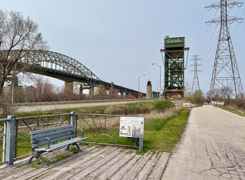
George Thompson was the lighthouse's first keeper. His journal captured . . . — — Map (db m222838) HM
On Eastport Drive, 0.1 kilometers north of Beach Boulevard, on the right when traveling north.
The first public walkway along the lakefront was built in 1910. The Burlington Beach Commission planned the promenade. The Commission looked after the area's health, park development, policing, street lighting, and garbage
collection.
The . . . — — Map (db m222965) HM
On Beach Boulevard, on the right when traveling north.
Victorian summer homes
In the 1870s, prominent, wealthy Hamiltonians began building summer
homes on the Beach Strip. Three surviving examples, all built in the early 1890s, are described here. These homes were distinguished by their wood . . . — — Map (db m241489) HM
On Beach Boulevard, 0.2 kilometers south of Eastport Drive, on the right when traveling south.
Even on the Beach Strip, a community known for its characters and mavericks, Jimmy Lomax stood apart as a true original - a lion-hearted philanthropist whose dedication to helping children and the less fortunate was legendary.
He was one of . . . — — Map (db m241458) HM
On Beach Boulevard, on the right when traveling north.
Hamilton's Around the Bay Road Race, established 1894, is the oldest road race in North America, three years older than Boston Marathon. The race remained closed to women for 85 years, until Tersilla Komac came along. Born in Castelfranco Veneto, . . . — — Map (db m241609) HM
On Beach Boulevard, 0.2 kilometers Van Wagner’s Beach Road, on the right when traveling south.
Back in the days when the Beach Strip was more isolated from the heart of the city, motorsport legend Jimmy Howard
(1920-2015) made a name for himself with a ratchet in his hand and a cigar in his mouth. His iconic shop in a garage at 147 Beach . . . — — Map (db m235801) HM
On Beach Boulevard, 0.4 kilometers north of Van Wagner’s Beach Road, on the right when traveling north.
They called him "Mr. Hamilton," and with good reason. It is hard to think of anyone who embodied the spirit of the city more than Reg Wheeler
(1918-2012). Whether it was working in a gritty steel mill, chasing down a quarterback, or going to bat . . . — — Map (db m235802) HM
On Mountain Brow Boulevard, 0.3 kilometers north of Mohawk Road East, on the left when traveling south.
This property was donated to the Hamilton Board of Park Management by Ethel Armes in memory of her late Husband Jospeph Dalton Armes who was for many years a dairy farmer, the reeve of the Township of Barton and warden of the County of Wentworth. . . . — — Map (db m242935) HM
On Kennedy Avenue, 0.3 kilometers west of Christie Street, on the right when traveling west.
Jacob Smith (1739-1821) came to Canada from New Jersey in August of 1788 with his wife, Elizabeth (nee Lewis), and 13 surviving children. As a member of the Jersey Volunteers, who fought with the British during the American Revolution, he is . . . — — Map (db m246376) HM
On Jackson Street West at Locke Street South, on the right when traveling west on Jackson Street West.
This plaque commemorates the historic homesite of
Richard Beasley
United Empire Loyalist Merchant Soldier Politician
Member of the Legislative Assembly of Upper Canada 1791
Appointed Justice of the Peace 1795, Magistrate 1796 . . . — — Map (db m231253) HM
On Charlton Avenue West at Kent Street, on the right when traveling west on Charlton Avenue West.
The original 1874 plans for this six and one-half acre site, owned by the Hamilton Cricket Club, Included an eight-foot board fence, a dining room, dressing room and grandstand. In addition to cricket, lacrosse and rugby football were played . . . — — Map (db m220653) HM
On King Street East at Wellington Street North, on the right when traveling west on King Street East.
In the 1790s, many of Hamilton's first United Empire Loyalist families settled around this site where the head of an extended inlet from Burlington Bay intersected a prehistoric trail from Niagara.
Smith's Tavern, the first public house in . . . — — Map (db m224070) HM
On East 37th Street at 7th Avenue, on the left when traveling south on East 37th Street.
On the morning of June 25, 1958, His Excellency, the Governor General of Canada arrived in Hamilton by train from Union Station. His itinerary for the day was full but not difficult; officially open Vincent Massey Public School and the Royal . . . — — Map (db m236568) HM
The Honourable William McMaster (1811-1887), a
prominent banker and member of the first Senate of Canada, bequeathed funds which enabled Baptists of Ontario and Quebec to found this university. Incorporated in 1887, it was the culmination of . . . — — Map (db m219428) HM
On Upper James Street, 0.3 kilometers south of English Church Road, on the right when traveling north.
The British Commonwealth Air Training Plan (B.C.A.T.P.) was inaugurated in 1939 at the onset of the Second World War to provide air training for Commonwealth airmen, safely removed from active war zones. The Canadian Government sponsored this . . . — — Map (db m246368) HM
On Airport Road West, 1.2 kilometers west of Upper James Street, on the right when traveling west.
Canada's first licensed woman pilot, Eileen Vollick was born in Wiarton and came to Hamilton about 1911. She was fascinated by aviation and in 1927 enrolled in the flying school established near her home on Hamilton Bay by Jack V Elliot, a . . . — — Map (db m228685) HM
On Sanatorium Road at Rice Avenue, on the right when traveling south on Sanatorium Road.
The year 2006 marks the centennial of the Hamilton Health Association's opening of the city's tuberculosis hospital on the west mountain known as the Sanatorium. At the turn of the twentieth century tuberculosis was a disease of
pandemic . . . — — Map (db m232317) HM
On Waterfront Trail/ E. Guise Street just north of Catherine Street, N. - Dock Service Road, on the right when traveling north.
HMCS Haida is the last of the Tribal class destroyers which saw heavy action with the Australian, British and Canadian navies during World War II. Built for the Royal Canadian Navy at Newcastle, England, , in 1942, this ship served on the frigid . . . — — Map (db m67343) WM
From the early 1800s to the 1920s, many of Hamilton's working families survived the harsh winter months by spearing fish through the ice-covered harbour.
European settlers learned to spear fish from the Iroquois and Mississauga peoples. By . . . — — Map (db m220538) HM
Hamiltonians first developed a passion for rowing in the 1870s. Sportsmen found the natural beauty and unpredictable waters of the bay irresistible and summertime regattas drew huge crowds.
Two of the earliest and most successful clubs were . . . — — Map (db m220533) HM
On Burlington Street West at MacNab Street North, on the right when traveling west on Burlington Street West.
The Burlington Glass Works, formerly situated here, was one of the most important 19th century glass houses in Canada in terms of the variety and quality of its production. From 1874 to about 1897 skilled artisans produced lamps, tablewares and . . . — — Map (db m220301) HM
On Bay Street North at MacNab Street North, on the left when traveling east on Bay Street North.
The Royal Hamilton Yacht Club (RHYC) has long promoted a love of sailing throughout the community and beyond.
Aemilius Jarvis is widely thought of as the father of the Royal Hamilton Yacht Club. Jarvis was an important financier and . . . — — Map (db m227768) HM
On Woodward Avenue, 0.3 kilometers south of Nikola Tesla Boulevard, on the right when traveling north.
The Hamilton Waterworks
This dignified building, reminiscent of the style of a Roman aqueduct, houses one of Canada's greatest surviving engineering achievements of the mid-19th century, the Hamilton Waterworks. Built between 1857 . . . — — Map (db m227140) HM
On East 36th Street at Munn Street, on the left when traveling south on East 36th Street.
PEACE MEMORIAL SCHOOL
1919 - 2003
Peace Memorial School was built in 1919 on donated land in the former Township of Barton, County of Wentworth. This school was named as a tribute to those who died on the battlefields of the First World War. . . . — — Map (db m223835) HM
On Sunshine Court, 0.1 kilometers east of Garth Street.
Jacob Hess (1766-1823) served as a Private in Captain Charles Depew's company of the 5th Regiment Lincoln Militia during the War of 1812. His brothers Samuel and Peter, and his son-in-law David Almas, Sr. also served in the same unit. Jacob's . . . — — Map (db m246635) HM WM
On Arcade Crescent at Claremont Drive, on the right when traveling north on Arcade Crescent.
This gate lodge was built for the Hon. Isaac Buchanan (1810-1883) who was born in Glasgow. He emigrated to Toronto in 1830, became a successful wholesale merchant, represented Toronto in the first Legislative Assembly of the Province of Canada, . . . — — Map (db m219592) HM
On Clairmont Access at Inverness Avenue west, on the right when traveling south on Clairmont Access.
By 1850, a four storey building called the Mountain View Hotel was erected on this site. Its proximity to the escarpment's edge provided an unobstructed view of the city, harbour and lake. Two hundred pine steps at the base of the escarpment . . . — — Map (db m226084) HM
On Fennell Avenue West at West 5th Street, on the right when traveling west on Fennell Avenue West.
The Honourable Isaac Buchanan and Auchmar
Isaac Buchanan was born in 1810 in Glasgow into a family that owned the Auchmar estate on the shores of Loch Lomond. At the age of 19 he was sent to Montreal to open a branch of an importing firm. . . . — — Map (db m225887) HM
On Clairmont Access, 0.1 kilometers north of Inverness Avenue West, on the right when traveling south.
Known locally as "the mountain", the Niagara escarpment is Hamilton's most prominent geographic feature. While providing a scenic panorama of the city, it was also a significant impediment to travel. To address this
situation a group of local . . . — — Map (db m225934) HM
On Mountain Park Avenue at Upper Wentworth Street, on the right when traveling west on Mountain Park Avenue.
Comedian, actor and theatrical manager, George Summers
established the Mountain Park Theatre here in 1902. It
was one of the earliest theatres of its kind in Ontario. For
twelve successful seasons, "Geo. H. Summers . . . — — Map (db m246517) HM
On King Street East at Jones Street, on the right when traveling west on King Street East.
Augustus Jones (C. 1757-1836)
Augustus Jones was born of Welsh ancestry in the Hudson River valley circa 1757. He received survey training in New York City in 1786 and he moved to Niagara in 1787. From then until 1789, to meet the needs of . . . — — Map (db m232645) HM
On Locke Street North, 0.1 kilometers north of King Street West, on the left when traveling north.
Quick Facts: Two hotels patronized by users of Crystal Palace and Victoria Park
The opening of the Crystal Palace on the Victoria Park grounds in 1860 inspired West End population growth and the creation of new businesses. Two hotels were . . . — — Map (db m229384) HM
On King Street West at Margaret Street, on the right when traveling west on King Street West.
Quick Facts: Baseball since 1860
- Grandstand 1914-2005 - Natural rink in winter
The opening of the Crystal Palace Grounds in 1860 provided a venue for the sport of baseball. A diamond was located at the south end of the grounds and has . . . — — Map (db m229627) HM
On King Street West at Ray Street South, on the left when traveling west on King Street West.
Sir Allan Napier MacNab, Provincial Grand Master under patent from Scotland, was also appointed Provincial Grand Master for Upper Canada under patent from England in 1844. Due to much dissatisfaction with the Grand Lodge of England, a protest . . . — — Map (db m219746) HM
On Locke Street North, 0.2 kilometers north of King Street West, on the left when traveling north.
Quick Facts: Site of 1860, 1864, 1872 Provincial Expositions - Queen Victoria's Jubilee
Built in 1860 to host the Provincial Exposition, the Crystal Palace was constructed on a 22 acre site as a modern facility capable of hosting the fair. The . . . — — Map (db m228564) HM
On Waterfront Trail, on the right when traveling west.
The Mississaugas (Anishinaabe Peoples) have lived in the Niagara and Great Lakes region since the late 17th century. Known as Head-of-the-Lake on the North shore of Lake Ontario, this site was a strategic communication and trade junction. A . . . — — Map (db m246969) HM
On Locke Street North at Morden Street, on the left when traveling north on Locke Street North.
Erskine Presbyterian Church
Quick Facts: Opened in 1874 - Renamed Erskine 1880
- Memorial Hall dedicated 1923
In 1874 the Pearl Street Presbyterian Mission opened on Pearl Street, north of Florence Street. It was renamed Erskine by its first . . . — — Map (db m229295) HM
On Strathcona Avenue North at King Street West, on the right when traveling north on Strathcona Avenue North.
Quick Facts: Family business 1875-1963 - George R. Allan School, Westdale testing grounds
The name "Hand" is synonymous with fireworks in Canada and
North America. In 1872 William Hand arrived in Newark, New
Jersey from Hereford, England. . . . — — Map (db m229623) HM
On Locke Street North at Peter Street, on the left on Locke Street North.
Quick Facts: Glacial feature - 12,000 years old. - Former shoreline of Lake Iroquois
You are standing on the Iroquois Bar, a long, low hill that extends from the base of the Niagara Escarpment at John Street through downtown Hamilton. It . . . — — Map (db m229423) HM
On Florence street at Inchbury Street, on the left when traveling west on Florence street.
Quick Facts: Family business started in 1868 - Employed 100 - Demolished in 1972
In 1868, Semmens and Sons was a family-owned building firm, located on the east side of Sophia Street (Strathcona Avenue North), north of Florence Street. By . . . — — Map (db m229476) HM
On Strathcona Avenue North at Florence Street, on the right when traveling north on Strathcona Avenue North.
Quick Facts: Opened 1890 - Successful basketball teams - 900 in Sunday School 1930
In response to a growing West End population, All Saints Anglican Church on King Street West opened the St. George's Chapel of Ease at Sophia (Strathcona) and . . . — — Map (db m229575) HM
On Strathcona Avenue North at Head Street, on the right when traveling north on Strathcona Avenue North.
Quick Facts: Construction completed 1897 • In use January 2, 1902 - August 31, 1959
In the 1880s Hamilton's West End community was growing rapidly.
The closest fire protection was a volunteer station on the northeast
corner of the Crystal . . . — — Map (db m229483) HM
On Strathcona Avenue North at Lamoreaux Street, on the right when traveling north on Strathcona Avenue North.
Quick Facts: Cornerstone laid 1894. - First sanitary drinking fountain - Model School
By the 1890s increased residential development resulted in the Hamilton Board of Education purchasing a portion of the former Crystal Palace Grounds for a . . . — — Map (db m229479) HM
On Strathcona Avenue North near King Street West, on the right when traveling north.
When Edward, Prince of Wales, the future King Edward VII, made the first official state visit of British royalty to Canada, Hamilton was the last stop on the tour. The Prince arrived in the afternoon of September 18th, 1860 and was welcomed by . . . — — Map (db m228595) HM
On King Street West at Locke Street North, on the right when traveling west on King Street West.
In the mid-nineteenth century industrial workers laboured ten to twelve hours a day, six days a week. Inspired by British and American examples, Hamilton unionists launched a crusade for a shorter workday in January of 1872. The workingman, they . . . — — Map (db m220361) HM
On Locke Street North at Morden Street, on the left when traveling north on Locke Street North.
Quick Facts: West End's first church - Opened 1855 - Home of champion sports teams
Zion Church became a focal point for the West End
community. (Image courtesy City of Hamilton)
The West End's first church opened in 1855 when a . . . — — Map (db m229387) HM
On Concession Street, 0.1 kilometers east of East 43rd Street, on the left when traveling east.
John William Kerr emigrated from Ireland to Canada in the 1840s and settled a crown grant on the Hamilton Mountain in the 1850s. Kerr was made the first provincial fisheries overseer by royal warrant in 1864. From a telescope on the escarpment . . . — — Map (db m223692) HM
On Hamilton Street North at White Oak Drive on Hamilton Street North.
Born near Waterdown, Ontario, Leo Clarke moved to Winnipeg
in 1903. He enlisted with the 27th Battalion, C. E. F. in
February 1915 and transferred to the 2nd Canadian Battalion later that year. On September 9, 1916, on the Somme battlefront, . . . — — Map (db m243636) HM
On Hamilton Street North at White Oak Drive, on the left when traveling north on Hamilton Street North.
Lieutenant Leslie Howard Miller, a soldier with the Canadian Expeditionary Force (3rd Division, Signal Corps) fought at the Battle of Vimy Ridge. Originally from Ontario, Miller was a school teacher in Saskatchewan at the outbreak of war, but left . . . — — Map (db m246177) HM WM
On Dundas Street East (Hamilton Regional Road 5), 0.1 kilometers east of Main Street North, on the right when traveling west.
In 1919 a "Community League" was organized with the goal of constructing a building to function as both a memorial to citizens who had enlisted in World War I (1914-1918) and as a community hall.
The Waterdown Women's Institute purchased this . . . — — Map (db m243593) HM
On Main Street North at Kelly Street, on the right when traveling south on Main Street North.
Waterdown Memorial Park was established on the outskirts of the village in 1946 by the Waterdown Amateur Athletic Association, the Waterdown Women's Institute, and the Waterdown Board of Trade as a memorial to World War II (1939-1945) veterans and a . . . — — Map (db m243664) HM
On Mohawk Road West at Upper Paradise Road, on the right when traveling west on Mohawk Road West.
William Rymal (1759-1852), his wife Barbara and his younger brother along with their family members obtained, through crown grants and purchases, 800 acres of land on either side of Upper Paradise Road from the escarpment to Rymal Road. Arriving . . . — — Map (db m233115) HM
On Oak Knoll Drive at Dalewood Crescent, on the right when traveling west on Oak Knoll Drive.
"In the autumn of 1944, me and my family were destined to die… if it wasn't for Raoul Wallenberg,who personally took us by hand, my children and my grandchildren and I couldn't be here today."
--Ernie Mason, Holocaust . . . — — Map (db m235325) HM
On Longwood Road North at Macklin Street North on Longwood Road North.
The Hamilton Naturalists' Club (HNC) has promoted environmental protection,
research and education in the Hamilton area since its founding in 1919 as the Hamilton
Bird Protection Society (HBPS). By 1959, the HBPS had evolved into the . . . — — Map (db m227114) HM
Near King Street West east of Centennial Parkway South.
On June 5, 1813, an invading United States army of about 3,000 men, commanded by Brigadier - General John Chandler, camped in this vicinity. That evening some 700 British regulars of the 8th and 49th Regiments, under the command of Lieutenant - . . . — — Map (db m56720) HM
Near King Street West east of Centennial Parkway South.
[English Text]: Battle of Stoney Creek
During 1813 the Americans planned to invade Upper Canada from Detroit and the Niagara Peninsula. In late May, an American force crossed the Niagara River, seized Fort George, and with about . . . — — Map (db m56762) HM
Near King Street West south of Centennial Parkway South.
[Text on First Historic Marker]:
Battlefield House
and
Fifteen and one-half acres of
Parkland
Property of
The women's Wentworth Historical Society
1899-1962
Given by this society to the
Niagara Parks Commission
as a . . . — — Map (db m56805) HM
On King Street East west of Centennial Parkway South, on the left when traveling west.
[Text on West Side of Monument]:
In Memory Of
Billy Green
"The Scout"
Who led British troops
in surprise night
attack winning decisive
Battle of Stoney Creek.
Born Feb. 4, 1794
Died Mar. 15, . . . — — Map (db m56822) HM
On Kings Street West at Battlefield Drive, on the left when traveling east on Kings Street West.
The Battlefield of Stoney Creek
6th June 1813
In memory of 20 good and true King's Men who,
in fighting in defence of their country, died
and were buried on this knoll.
This revised inscription and stone re-dedicated
June 6th . . . — — Map (db m56798) HM
Near King Street West east of Centennial Parkway South.
Originally located at the north-east corner of king Street East and Nash Road in the city of Hamilton, the house known as the Nash=Jackson House was built in 1818. The property on which the house stood, part of William Gage's original land grant, . . . — — Map (db m56859) HM
Near King Street West north of Centennial Parkway South.
Canada Remembers
Lieutenant Samuel Hooker,
Sergeant Joseph Hunt, Pri-
vates James Daig, Thomas
Fearnsides, Richard Hugill,
George Longley, Laurence
Meade, John Pegler, John Smith,
and John Wale of the First
Battalion of the . . . — — Map (db m56819) HM
161 entries matched your criteria. Entries 101 through 161 are listed above. ⊲ Previous 100