A Friendly Encounter with People from an Ancient Village
For thousands of years, a Nimiipuu ("the people") village was located a few miles west of here, near the Álpáha (Alpowa) Creek - Snake River confluence. For a . . . — — Map (db m159257) HM
Log Building Completed 1898 Architect: Kirtland Kelsey Cutter, Spokane
Placed on National Register of Historic Places, 1992
Organized by the Rt. Rev. Lemuel H. Wells,
Bishop of the Spokane Missionary District
who presided at confirmations . . . — — Map (db m129263) HM
To commemorate the work and achievement of Judge Thomas Burke founder of Wenatchee, and Washington’s first citizen, this enduring tablet is affectionately dedicated by the citizens of Chelan County, to honor him while he is still living among . . . — — Map (db m153400) HM
In the early 19th century what is today the northwest coast of Washington State might have become a Russian colony, an extension of Alaska, if the Sv. Nikolai voyage had been successful. This could have led to this section of New Albion, the . . . — — Map (db m129579) HM
Hudson’s Bay Company established Fort Vancouver in 1824 within the area of present-day Vancouver, 83 nautical miles from the Pacific Ocean. Forty Wooden buildings were enclosed within a 20-foot high log palisade until the treaty of 1846 set the . . . — — Map (db m8400) HM
You are standing on the site of a once-bustling riverfront complex at Fort Vancouver. A boat building operation, blacksmith shop, and tannery filled the air with the sights, sounds, and smells of industry.
A busy place is this. The . . . — — Map (db m12292) HM
Before 1846 American immigrants traveling the Oregon Trail to Fort Vancouver had to make a choice at The Dalles (80 miles upriver from here). They could navigate their own handmade raft or take a Hudson's Bay Company boat down the Columbia River to . . . — — Map (db m12295) HM
Look around you. The scenic spot where you now stand was once the heart of one of the busiest shipping ports west of the Rocky Mountains. From 1825 to 1846, Fort Vancouver's waterfront served as the western economic artery of the Hudson's Bay . . . — — Map (db m12293) HM
On May 13, 1849, the United States steamer Massachusetts arrived off the Hudson's Bay Company wharf and unloaded Batteries L and M of the First Regiment of United States Artillery. The first permanent official American presence in the Pacific . . . — — Map (db m12289) HM
[Panel 1]:
Capt. George Vancouver, from King’s Lynn, England, at age 35 and with orders from the British Admiralty to explore and chart the West Coast of America, charted hundreds of miles of coast line from California to Alaska. His maps . . . — — Map (db m8515) HM
After marrying Amos Short in 1829, Esther (Clark) Short set out on the adventure of her life! Originally from Tioga County, Pennsylvania, Esther Short, who was ½ Algonquin Indian, her husband Amos and 10 children traveled west to Linton, Oregon . . . — — Map (db m64239) HM
When the U.S. Army arrived in 1849 to establish a new post on the western frontier, few of the officers could afford to bring their families out to such a remote and lonely command. A thriving community of soldiers, officers, wives, and children . . . — — Map (db m8527) HM
Officers Row, a procession of homes for officers and their families, began during the early frontier years when Vancouver Barracks was considered by many to be a remote and lonely assignment. The first officer’s quarters on the Row wer log cabins . . . — — Map (db m8529) HM
Many employees of Fort Vancouver were of French-Canadian descent, and had been raised as Roman Catholics. Separated by thousands of miles from their home parishe, these men pleaded with the Bishop of Quebec to send them priests.
The Reverend . . . — — Map (db m8964) HM
In 1824 the Hudson's Bay Company chose this place as the site for a new fort which they named Vancouver in honor of the British explorer, George Vancouver. Little is knowns of this fort as it was moved early in 1829 to its now well-known location . . . — — Map (db m8403) HM
[Side one of six]: Under the influence of Dr. John McLaughlin, Manager of the Hudson Bay Co., civilization of Washington started at Vancouver, A.D. 1825.
[Side two of six]: The first school in Washington was taught by John Ball, at . . . — — Map (db m8383) HM
Erected 1848 by Richard and Anne Charlotte Covington on Fourth Plain. Boarding school was conducted herein in 1850. This building housed first piano in the Oregon Country and was center of social activity in entire region. — — Map (db m8517) HM
Columbia County Courthouse: 1887 Washington’s Oldest Courthouse.
Construction of the Territorial Courthouse was completed two years before Washington became a state in 1889.
Designed by local architect W.H. Burrows, the courthouse was . . . — — Map (db m129474) HM
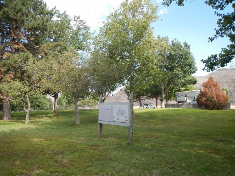
Palouse Indians To supplement a diet of salmon, families migrated from riverside “mat lodge” villages to the mountains for game, roots, and berries. “Appaloosa” horses played a paramount role in tribal life.
. . . — — Map (db m129473) HM
In early May of 1806, Lewis and Clark and the Corps of Discovery passed through here on their return from the Pacific Ocean heading eastward. They would complete their epoch making journey with their arrival in the frontier town of St. Louis on . . . — — Map (db m158959) HM
The Celilo Falls Trail, now known as The Nez Perce Trail passed through Dayton near this site. For centuries this was the path used by the Indians, trappers, missionaries and the new settlers. Most notable was the Lewis and Clark Corps of Discovery. . . . — — Map (db m158967) HM
In 1916 Finnish immigrants constructed a hall near this site under the name of a literary association (Kirjallixuus Seura), forming a lending library. Although they brought their diet, language, and saunas with them, some old country beliefs were . . . — — Map (db m8382) HM
One of the most colorful of the early Northwest railroad towns once existed near junction of the Snake and Columbia Rivers. Ainsworth was founded, 1879, when the railroad bridge was building over the Snake River.
In its heyday it was a wild, . . . — — Map (db m34519) HM
Indians lived in this coulee many centuries ago. You are standing on an ancient Indian camp site. The Indian trail came down the steep hill behind you and crossed the coulee to the east. The famous Cariboo Cattle Trail crossed the coulee here going . . . — — Map (db m208186) HM
Ephrata was a summer Indian camp. Hundreds of Indians spent weeks gathering roots at the springs west of here. Ephrata was the gateway between Walla Walla & Okanogan. Indians, military expeditions, and wagons traveled here in 1880. The first . . . — — Map (db m129093) HM
Chief Moses and many Indians from miles around came to gather food, trade & race horses each summer at the great encampment 3/4 mile east of here on Rocky Ford Creek. During the Nez Perce War of 1877, Chief Joseph sent runners to Chief Moses camp . . . — — Map (db m208206) HM
Indians camped along Crab Creek in Stratford to gather roots and other food. The main Indian trail came past Stratford across the creek. The Indian trail branched here and one went past Pinto Dam. Lt. Symons came past here while laying out military . . . — — Map (db m129096) HM
History Of Camano/Camano City
(Early records often interchanged these place names)
In 1898 the Esary brothers with assistance from
Porter Garrison and sons established one of
Camano's major logging companies, in the area
surrounding the . . . — — Map (db m143255) HM
We extend you a warm and friendly welcome to Coupeville in the heart of Ebey's Landing National Historical Reserve!
In 1792, Captain George Vancouver sailed the HMS Discovery into Puget Sound. His first mate, Joseph Whidbey then . . . — — Map (db m179345) HM
In honor of the founder
of Island County and his wife
Col. Isaac Neff Ebey – Rebecca Whitey Ebey
1818 – 1857 1822-1858
Whidbey Island’s first permanent settler 1850.
Proposed the separation of Island County from Thurston County . . . — — Map (db m61038) HM
You are standing in the nation's first historical reserve, a unique unit of the National Park Service.
The Reserve was originally championed by a group of concerned residents in the 1970s when Ebey's Prairie was subdivided for large-scale . . . — — Map (db m179320) HM
Ebey's Landing, the nation's first National Historical Reserve, was established by Congress in 1978 "in order to preserve a rural community which provides an unbroken historical record from nineteenth century exploration and settlement in Puget . . . — — Map (db m179349) HM
Places to visit
1 Island County Museum
908 NW Alexander Street
The Island County Museum features local and regional history. Ice Age relics, woolly mammoth remains, a Native American collection that includes . . . — — Map (db m179321) HM
...came to Whidbey Island in 1895 as a young lawyer and stayed, having been struck with a life-long love of its beauty. Served as Island County Prosecuting Attorney 1896-1907, and Superior Court Judge for Clallam, Island, and Jefferson Counties . . . — — Map (db m179283) HM
History
The Alexander Block house is one of four blockhouses remaining in Central Whidbey Island. Few original blockhouses of this type remain throughout the United States. John Alexander, Sr. built this blockhouse on his donation land claim . . . — — Map (db m60986) HM
Left side of marker is written in Gaelic and right side is in English
Died here. April, 9 AD 1861
One year ten and twenty
(years) of age
Born at Mineth, Ireland
Gentle wife (of) Sam’l Maylor
They married in Liverpool
At the . . . — — Map (db m60979) HM
Saved Blockhouse
In 1921 a local civic group, the Ladies of the Round Table (LORT) began a ten year effort to restore the decaying Davis Blockhouse. Local carpenter Fred Krueger handled the project carefully replacing rotting beams while . . . — — Map (db m60991) HM
Donation claim of Jacob Ebey.
Served in War of 1812, the Black Hawk War and the Mexican War.
When 61 yrs old led company across plains with covered wagons.
Settled on Whidbey Island and built this home, four blockhouses and stockade in 1856 . . . — — Map (db m60977) HM
The swirling waters that pass in and out of the narrow channels between Whidbey Island and Fidalgo Island have captivated visitors to this area for thousands of years. Salish Native American tribes were the first human inhabitants of these . . . — — Map (db m74012) HM
Family Origins
This park is named after the family of Egbert and Betty Beeksma in recognition of the business they started on the site of park and their contribution to the development of Oak Harbor.
Egbert Beeksma was born the Netherlands . . . — — Map (db m60940) HM
Oak Harbor’s early “town” was built along the waterfront, and stretched from Maylor’s store along Pioneer Way to about a block east of the junction of Flintstone Freeway and Midway and Pioneer.
The east end of the town burned in a . . . — — Map (db m60938) HM
'Why do we love the sea? Because she has the power to make us think things we like to think.'
- Robert Henry
The Old Wharf and Steamships
Look offshore toward Maylor's Point and you will see a concrete block that remains from Oak . . . — — Map (db m73991) HM
Sv. Nikolai Mission In September 1808 the Russian American Company (RAC) schooner Sv. Nikolai (Saint Nicholas) set sail from the Russian American Company's fort in Sitka, which was then in Russian territory (now part of the State . . . — — Map (db m129574) HM
Anna Petrovna Anna Petrovna Bulygin, a Russian woman notable for being the first European woman known to live in what is now Washington State, landed with the crew of the Sv. Nikolai. Anna was eighteen years old, the attractive wife of . . . — — Map (db m129585) HM
Escape to the Hoh River Leads to Captivity At dawn following a harrowing, fearful night awaiting retribution, the Russian party reconnoiters, but finds only dense forest growing down to the high-tide surf line. Captain Bulygin decides to take . . . — — Map (db m129588) HM
The čičməhán Trail is comprised of 16 sites that naturally divide into a 3-mile, a 6-mile, or a 12-mile loop. The 3-mile loop includes downtown historical sites; the 6 mile loop extends uptown; and the 12-mile loop (best for . . . — — Map (db m179367) HM
Early settlers to the Port Townsend area found a S'Klallam Indian community well established on the protected shores of Port Townsend Bay. This settlement, known as Kah Tai, meaning "to carry" or "pass through," was located on the portage route . . . — — Map (db m179612) HM
Chief of the Clallam Indians
A Friend of the White People
From this rock
he gave warning of danger
and saved them
from massacre in 1856 — — Map (db m179770) HM
Many in Port Townsend have heard of Chief Chetzemoka (Cheech-Ma-Ham), chief of the S'Klallam. At Point No Point in 1855, he signed the treaty giving up all S'Klallam land for a reservation to be shared with another tribe. Such treaties, pushed . . . — — Map (db m179408) HM
"Blessed are the peacemakers:
for they shall be called
the children of God." Matthew 5:9
"If I am seen coming to you I will not be able to help you further. But each morning I will sit on top of the big rock on the east side of Kai Tai . . . — — Map (db m179771) HM
What was the Chinese Exclusion Act of 1882?
Like many other cultural communities in early Port Townsend, Chinese and Chinese American merchants, families, farmers, and laborers were an important part of the cultural and economic . . . — — Map (db m179707) HM
What did Port Townsend look like in the 1860s?
You are standing near the site of Port Townsend's first settler cabin. The area was often flooded with seawater. Alfred A. Plummer, age 29, arrived in 1851 with Charles Bachelder and . . . — — Map (db m179690) HM
How was early Port Townsend affected by fire?
Port Townsend's earliest buildings were tightly packed wooden structures, that were both lit and heated by fire. The threat of disastrous, multi-building fire was ever-present. Entire . . . — — Map (db m179736) HM
Chetzemoka's Big Heart, a story by Mary Ann Lambert (1879-1966, also the author of The 7 Brothers of the House of Ste-Tee-Thlum) of the Jamestown S'Klallam Tribe's Lambert/Reyes family, illustrates Chetzemoka's heart, and the power and respect . . . — — Map (db m179745) HM
Here in the wind-buffeted rain shadow of the Olympic Mountains grow colorful relics of the last ice age. The tiny prairie before you is a remnant of once extensive grasslands that followed the retreat of continental ice over 10,000 years ago. . . . — — Map (db m179767) HM
For over 8,000 years Native Americans camped at Point Hudson while migrating from summer camps to winter lodges.
The American explorer, Captain Charles Wilkes, named the area in honor of Commander William L. Hudson in 1841. . . . — — Map (db m179370) HM
Before the shoreline was filled to create the marina, Point Hudson was a popular clamming beach for S'Klallams and a landing point for tribes from locations across the Olympic Peninsula.
Change began as soon as settlers arrived, but grew . . . — — Map (db m179751) HM
It is believed that for thousands of years Point Hudson was used as a seasonal home by the Native American tribes, particularly Klallam and Chemakum. Presence of a freshwater lagoon, a wide variety of shellfish and other seafood easily obtained . . . — — Map (db m179746) HM
This point of land is formed of rocks and sand constantly in motion carried here by wind and waves. These sediments, eroding from nearby glacial bluffs, converge here from the northwest and the south before moving along the spit into deeper . . . — — Map (db m179749) HM
In the early 1890s, Port Townsend expected to be the major seaport for the northwest coast, and built to serve a huge population that never came. By 1896, the economic tide reserved, and the town was left high and dry. A century later, historic . . . — — Map (db m179624) HM
Why are there so many Victorian buildings here?
Many of the historical buildings around you were built in the 1880s and 1890s. The facades of these ornate stone, brick, and cast iron structures memorialize the names of their . . . — — Map (db m179442) HM
Port Townsend's strategic location at the entrance to Puget Sound won it the U.S. Customs Service headquarters in 1854, just three years after the town was established.
Every vessel entering Puget Sound from any foreign port was . . . — — Map (db m179374) HM
After signing the 1855 Point No Point Treaty, it was clear that there had been some misunderstandings, and the federal government was failing to follow through on its funding promises. Some of the Tribes of Washington rose up against what they saw . . . — — Map (db m179769) HM
In 1885, George Sterming realized his lifelong dream. On this site he erected the building which still bears his name. The upper floor was devoted to office suites and the ground floor housed the soon to be famous Belmont Restaurant and . . . — — Map (db m179673) HM
The village of qatáy once sat near the bluff at what is now the corner of Monroe and Water Streets. It was the principal village of S'Klallam people at the time of the treaty signing, and home to their Chief, čičməhán . . . — — Map (db m179731) HM
Where does your water come from?
Nestled in the "rainshadow" of the Olympic Mountains, Port Townsend gets surprisingly little rain and is surrounded by salt water. In the late 1800s water was scarce and expensive. Early residents . . . — — Map (db m179693) HM
In 1792, Captain George Vancouver sailed his ship, the HMS Discovery, up the Strait of Juan de Fuca. He named this harbor Port Townshend, in honor of the English Marquis of Townshend.
Originally a small settlement, Port Townsend . . . — — Map (db m179633) HM
The Ballard Avenue Landmark District holds a significant place in Seattle history. The uniquely-preserved state of Ballard Avenue provides visitors with a window into the heyday of Ballard’s industrial and commercial era.
The City of Ballard . . . — — Map (db m27976) HM
Purser, mate, trader, Shipowner, venturer, Joshua Green began his waterfront career on Puget Sound in 1888 when steamboating was in its infancy. He founded the LA Conner Trading and Transportation Company, operating freight and passenger steamers, . . . — — Map (db m118081) HM
The Ballard Historical Society and the Seattle-Bergen Sister City Association joined together to create this mural in 1995 to commemorate our community’s rich and prosperous history, and to celebrate our economic and cultural ties to . . . — — Map (db m27794) HM
First Pastor
Dr. George F. Whitworth.
Charter Members
Mary E. Whitworth • Clara Whitworth York
Lida Whitworth • Ruth J. McCarty
Rebecca Jones • Samuel Kenny
Jessie Kenny
Erected on the Fiftieth
Anniversary of the
founding of . . . — — Map (db m81459) HM
[Right side of the monument]
Kitsap sights Vancouver’s vessel 1792 – First vessel on Puget Sound
[Left side of the monument]
Seattle
Chief of the Suquamish
A firm friend of the whites
For him the city of . . . — — Map (db m47938) HM
Seattle has had three Chinatowns since the 1860s. The
present, third Chinatown was established in the early 1900s. This gate, or
Pai-Lau, marks the western entrance to Seattle's Chinatown.
For many years, the Seattle Chinese community . . . — — Map (db m142220) HM
Organized December 12, A.D. 1869
by Rev. George F. Whitworth, D.D.
Membership 8
This edifice
erected A.D. 1906
Rev. M. A. Matthews, D.D.
Pastor
Dedicated to the Worship
of the Triune God — — Map (db m81458) HM
Welcome to downtown Seattle's neighborhood market. Pike Place Market is the city's center for fresh, local produce, specialty food and small independent businesses. Established in 1907 to connect citizens and farmers, the Market continues its . . . — — Map (db m235024) HM
At its peak, nearly 14,000 people, many of them U.S. citizens,
lived and worked from here on up the hill.
This is the original edge of Japantown, a large and energetic community from the 1890s to 1942. The Japanese influence in Seattle . . . — — Map (db m142039) HM
Lou Graham, Seattle’s best known madam, opened her establishment on this site in 1888. Rebuilt in brick and expanded after the Great Fire in 1889, Graham’s parlor became the most elegant of Seattle’s bordellos during the city’s rough pioneer era. . . . — — Map (db m22499) HM
The Pioneer Building is one of the finest and most ornate buildings in the District, characteristic of the Richardsonian Romanesque style prevalent throughout Pioneer Square. Constructed in 1889 on the site of Henry Yesler’s first home. This . . . — — Map (db m22495) HM
[This marker is consists of seven panels and a map which deal with various aspects to the history of Pioneer Square. The panels are clustered together in Occidental Park in the heart of Seattle’s Pioneer Square Historic District.]
[Panel . . . — — Map (db m168619) HM
This was the site of Seattle’s first civic and entertainment center. Built by Henry Yesler in 1865, in a corner of his private orchard, the Pavilion hosted town meetings, musicals, and theatrical performances. Remodeled into offices in 1887, it was . . . — — Map (db m120816) HM
Near this site
in the autumn of 1851
David Denny and Lee Terry
erected first log cabin at Alki
Birthplace of Seattle
This plaque placed April 21, 1962
by the West Seattle
Rotary Club — — Map (db m181255) HM
In 1890 when James J. Hill decided to extend his Great Northern Railway to the Pacific coast from Montana, he hired John F. Stevens as chief locating engineer to determine the route of the railroad. After locating Marias Pass in Montana, Stevens . . . — — Map (db m129319) HM
Flat-bottomed boats carried passengers and goods on the Duwamish River to and from the Green and Black rivers from 1854 to 1886. Names of the boats were the Minehaha, the Black Diamond, the Decatur, the Comet, and the Gem. A landing for the . . . — — Map (db m181561) HM
— In memoriam —
Joseph Foster. Came to the state
of Washington from Sheboygan, Wis
arriving Vancouver, Wash. by ox team,
July 1, 1852
Arriving Alki Point and Seattle
by boat, April 4, 1853
locating here May 1, 1853
Gov. scout . . . — — Map (db m181555) HM
Built of cotton wood logs
from Yakima River Canyon
by
1843 Samuel Bedient Olmstead 1881
Union Soldier 1865
Descendant of Captain Richard Olmstead
Hartford Connecticut 1632
Cabin used as a fort during
the Nez Pierce Indian War . . . — — Map (db m235212) HM
It’s hard to imagine, but you are about to enter a fertile valley. Named for the Indians who lived here from time immemorial, the Kittitas Valley was the destination of many American settlers who came to the Washington Territory in the 1860s. Rich, . . . — — Map (db m113496) HM
In 1886, Northern Pacific Railroad mining engineers located large seams of coal and the town of Roslyn was founded.
Coal mining, though dirty and dangerous work, attracted large numbers of immigrants to Roslyn – Serbians, Croatians, Poles, . . . — — Map (db m38422) HM
In 1908 Samuel Hill (1857-1931) bought 7,000 acres on these slopes. He planned a Quaker farming colony, surveyed a 34-block tounsite and built a church, hotel, store, offices, garage and shops. His engineers built ten miles of experimental roads; as . . . — — Map (db m34471) HM
The structure before you is the first monument in our nation to military personnel who gave their lives in World War I. (unreadable) 13 young Klickitat County men, it also serves as lasting reminder of the works of Samuel Hill, patron of this . . . — — Map (db m64447) HM WM
This trail connects the Sandborn Road to the town of Husum. Originally named as the Weldon-Hyndman Road by the petitioners and builders, Elwin Weldon and Henry Hyndman. Prior to construction of this wagon road, the people of the Sandborn area used . . . — — Map (db m129500) HM
204 entries matched your criteria. The first 100 are listed above. Next 100 ⊳