8476 entries match your criteria. The first 100 are listed. ⊳
US Revolutionary War Topic
By Sandra Hughes, June 1, 2018
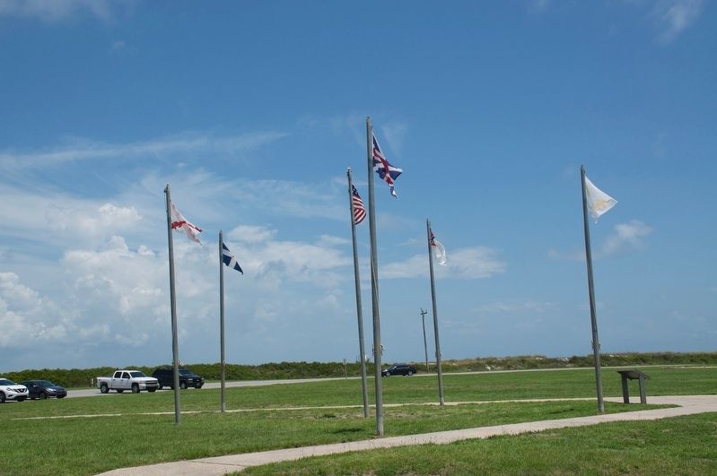
Colors of Significance Historic Flags of Mobile Point Marker
| 1 ► Alabama, Baldwin County, Fort Morgan — Colors of Significance: Historic Flags of Mobile Point — |
| Near Fort Morgan Road (Alabama Route 180) 2 miles west of Dune Drive, on the left when traveling west. | |||
| 2 ► Alabama, Baldwin County, Spanish Fort — Revolutionary War Battlefield and Burial Ground at Spanish Fort (1780-1781) — |
| On Larry Dee Cawyer Drive at Old Spanish Trail (U.S. 98), on the left when traveling north on Larry Dee Cawyer Drive. | |||
| 3 ► Alabama, Baldwin County, Stockton — Gen. Bernardo de Galvez — 1746 - 1786 — |
| Near Alabama Route 225, on the left when traveling north. | |||
| 4 ► Alabama, Baldwin County, Stockton — Major Robert Farmar Plantation — |
| On Alabama Route 225 just north of Lower Bryants Landing Road, on the left when traveling north. | |||
| 5 ► Alabama, Calhoun County, Jacksonville — Forney’s Corner — |
| On Public Square West (State Highway 21) south of Clinton Street Southwest, on the left when traveling south. | |||
| 6 ► Alabama, Chambers County, LaFayette — LaFayette Cemetery — Chambers County — |
| On Southeast Avenue A (County Route 50) 0.1 miles east of Southeast 3rd Street, on the right when traveling east. | |||
| 7 ► Alabama, Chilton County, Verbena — Moore Cemetery — |
| On County Road 752, 0.2 miles south of County Road 480, on the right when traveling north. | |||
| 8 ► Alabama, Clarke County, Grove Hill — Clarke County Soldiers Of The American Revolution — |
| Near West Cobb Street. | |||
| 9 ► Alabama, Clarke County, Grove Hill — Elijah & Isaac Pugh — |
| On U.S. 84 at milepost 40 at Crescent Road, on the right when traveling east on U.S. 84. | |||
| 10 ► Alabama, Colbert County, Leighton — Alabama's Historic Byler Road — Alabama's First Road — |
| On Main Street at King Street (Old Alabama Route 20), on the right when traveling north on Main Street. | |||
| 11 ► Alabama, Colbert County, Leighton — William Leigh — Founder of Leighton — |
| On Old Hwy 20 east of Morgan Drive, on the right when traveling east. | |||
| 12 ► Alabama, Colbert County, Tuscumbia — Tuscumbia's Oakwood Cemetery — |
| On South Commons Street at South Hickory Street, on the right when traveling west on South Commons Street. | |||
| 13 ► Alabama, Colbert County, Tuscumbia — Winston Cemetery — |
| On SW 14th Avenue near SW 7th Street, on the right when traveling east. | |||
| 14 ► Alabama, Conecuh County, Burnt Corn — James Salter — |
| On County Road 5, 2 miles north of Conecuh County (County Road 30), on the right when traveling north. | |||
| 15 ► Alabama, Dallas County, Cahaba — General Lafayette Visits Cahawba — |
| On Second North Street east of Vine Street, on the left when traveling east. | |||
| 16 ► Alabama, Dallas County, Selma — This Tablet Commemorates the Visit of Lafayette — |
| On Water Avenue at Washington Street, on the right when traveling east on Water Avenue. | |||
| 17 ► Alabama, Greene County, Eutaw — A County Older Than The State, Greene County — |
| On Tuscaloosa Street (U.S. 11) east of Springfield Avenue, on the right when traveling east. | |||
| 18 ► Alabama, Greene County, Eutaw — Welcome to Eutaw, Alabama: The Gateway To The Black Belt — County Seat of Greene County — |
| On Main Street (U.S. 11) near Springfield Avenue, on the right when traveling west. | |||
| 19 ► Alabama, Hale County, Greensboro — Greensboro Presbyterian Church — |
| On Main Street at Demopolis Street, on the right when traveling east on Main Street. | |||
| 20 ► Alabama, Henry County, Abbeville — A Revolutionary Soldier — |
| Near County Road 92, 0.2 miles north of State Route 95. | |||
| 21 ► Alabama, Henry County, Newville — Old Center Methodist Church / Old Center Cemetery — |
| On County Road 89 at County Road 109, on the right when traveling south on County Road 89. | |||
| 22 ► Alabama, Houston County, Rehobeth — Big Creek United Methodist Church / Joseph Watford Revolutionary War Veteran — |
| On Alabama Route 605, 0.5 miles south of Boys Club Road, on the left when traveling south. | |||
| 23 ► Alabama, Jefferson County, Birmingham — Lane Park — |
| On Cahaba Road at Park Lane, on the right when traveling north on Cahaba Road. | |||
| 24 ► Alabama, Jefferson County, Clay — Wear Cemetery — |
| On Old Springville Road / County Road 30, on the left when traveling north. | |||
| 25 ► Alabama, Lauderdale County, Florence — Kennedy Gun Factory — (1823 - 1837) — |
| On County Road 47, on the right when traveling north. | |||
| 26 ► Alabama, Lauderdale County, Greenhill — Tabernacle Cemetery — Lauderdale County — |
| On County Road 47 at County Road 140, on the left when traveling north on County Road 47. | |||
| 27 ► Alabama, Lauderdale County, Lexington — French-Glover Farm — 1837 — |
| On County Route 136, 0.6 miles east of County Road 640, on the right when traveling east. | |||
| 28 ► Alabama, Lauderdale County, Rogersville — Gabriel “Old Gabe” Butler — 1779~1856 — |
| On CR 421. | |||
| 29 ► Alabama, Lauderdale County, Rogersville — Samuel Burney: 1763-1849 Revolutionary War Veteran / Burneys Creek/First Creek Wheeler Lake — |
| On Lee Highway (U.S. 72) at County Route 66, on the right when traveling west on Lee Highway. | |||
| 30 ► Alabama, Lawrence County, Courtland — Courtland Cemetery — -1819- — |
| On Van Buren Street, 0.1 miles north of Jefferson Street. | |||
| 31 ► Alabama, Limestone County, Athens — Lentzville Cemetery — |
| On Lentzville Road, 0.7 miles south of Barker Road, on the right when traveling south. | |||
| 32 ► Alabama, Limestone County, Gourdsville — Gourdsville / Gilbertsboro |
| Near Gardner Hollow Road west of Shoal Creek Road, on the right when traveling west. Reported missing. | |||
| 33 ► Alabama, Limestone County, Salem — Abner Alloway Strange, Sr. — 1761-1835 — Veteran of the American Revolution — |
| On Buck Island Road (State Highway 99) north of Sugar Way, on the left when traveling south. | |||
| 34 ► Alabama, Macon County, Creek Stand — In Memory of Phoebe Tolbert Key — |
| Near County Road 10. | |||
| 35 ► Alabama, Madison County, Fisk — 2F3 — Tennessee / Alabama — Lincoln County / — |
| On Huntsville Highway (U.S. 231/431) at Hunter Road, on the left when traveling north on Huntsville Highway. | |||
| 36 ► Alabama, Madison County, Huntsville — Harris Hill Cemetery — |
| On Moores Mill Road at Old Gurley Road NE, on the left when traveling south on Moores Mill Road. | |||
| 37 ► Alabama, Madison County, Huntsville — Revolutionary War — 1775 - 1783 — |
| On Monroe Street Northwest at Washington Street Northwest, on the left when traveling east on Monroe Street Northwest. | |||
| 38 ► Alabama, Madison County, New Hope — Whitaker Cemetery — Madison County — |
| On Ikard Road, 0.3 miles north of Nebo Road, in the median. | |||
| 39 ► Alabama, Marengo County, Jefferson — Jefferson Baptist Church — |
| On Alabama Route 28, 0.1 miles west of Jefferson Road (County Road 57), on the right when traveling west. | |||
| 40 ► Alabama, Marshall County, Albertville — Liberty Tree Memorial — |
| Near Jackson Street at Baltimore Avenue. | |||
| 41 ► Alabama, Mobile County, Mobile — Le Marquis de Lafayette visited Mobile — |
| On Government Street (U.S. 98) at South Jackson Street, on the right when traveling east on Government Street. | |||
| 42 ► Alabama, Montgomery County, Montgomery — Abram Mordecai / Mordecai's Cotton Gin — |
| On Columbus Street, 0.1 miles west of North Decatur Street, on the left when traveling west. | |||
| 43 ► Alabama, Montgomery County, Montgomery — Encanchata — |
| On Water Street at Commerce Street, on the right when traveling east on Water Street. | |||
| 44 ► Alabama, Montgomery County, Montgomery — General Richard Montgomery Statue — |
| On North Perry Street south of Monroe Street, on the right when traveling south. | |||
| 45 ► Alabama, Montgomery County, Montgomery — Marquis de Lafayette — |
| Near Commerce Street at Tallapoosa Street, on the right when traveling south. | |||
| 46 ► Alabama, Montgomery County, Montgomery — Naming the City of Montgomery / Brigadier General Richard Montgomery |
| On Court Square at Montgomery Street, on the right when traveling east on Court Square. Reported missing. | |||
| 47 ► Alabama, Montgomery County, Montgomery — Washington Elm Tree — |
| Near North Bainbridge Street at Monroe Street. | |||
| 48 ► Alabama, Pickens County, Aliceville — In Memory of James McCrory — |
| Near Lower Vienna Road west of State Highway 14, on the right when traveling west. | |||
| 49 ► Alabama, Shelby County, Maylene — David Lindsay — Historical Cemetery Site — |
| On County Road 17 north of Longmeadow Road, on the right when traveling north. | |||
| 50 ► Alabama, Shelby County, Montevallo — The Liberty Bell — |
| Near Montevallo Road (Alabama Route 119) 0.3 miles south of Alex Mill Road, on the right when traveling south. | |||
| 51 ► Alabama, Shelby County, Montevallo — The Liberty Bell Garden — Honors Liberty, Its Defenders, and Our Constitution — |
| Near Montevallo Road (Alabama Route 119) 0.3 miles south of Alex Mill Road, on the right when traveling south. | |||
| 52 ► Alabama, St. Clair County, Ashville — A County Older Than The State, St. Clair — |
| On 6th Avenue at Court Street West, on the left when traveling east on 6th Avenue. | |||
| 53 ► Alabama, Tuscaloosa County, Tuscaloosa — Honor Roll of Soldiers and Patriots — of the American Revolution — 1775 1783 — |
| On 6th Street at 29th Avenue, on the right when traveling west on 6th Street. | |||
| 54 ► Alabama, Walker County, Jasper — Revolutionary War Hero Sergeant William Jasper — |
| On 4th Avenue at 4th Street, on the right when traveling north on 4th Avenue. | |||
| 55 ► Alabama, Washington County, Chatom — Washington County — First County in Alabama — |
| On Court Street north of Central Avenue (Alabama Route 56), on the left when traveling north. | |||
| 56 ► Alabama, Winston County, Haleyville — Jacob Pruet’s Stand — |
| On Alabama Route 195 near Layne Hill Drive. | |||
| 57 ► Arkansas, Arkansas County, Arkansas Post National Memorial — Edge of Empires — |
| Near Old Post Road, 0.8 miles south of State Route 169. | |||
| 58 ► Arkansas, Arkansas County, Arkansas Post National Memorial — The Colbert Raid — April 17, 1783 — Arkansas Post in the American Revolution — |
| Near Old Post Road, 0.8 miles south of State Route 169. | |||
| 59 ► Arkansas, Benton County, Bella Vista — Purple Heart — |
| 60 ► Arkansas, Benton County, Bella Vista — Revolutionary War — |
| 61 ► Arkansas, Benton County, Bella Vista — United States Commanders in Chief — |
| 62 ► Arkansas, Benton County, Lowell — The Butterfield Stagecoach Road — Established 1858 — |
| On Jackson Place at McClure Avenue (Route 923), on the right when traveling north on Jackson Place. | |||
| 63 ► Arkansas, Garland County, Hot Springs — First Hotel and Bath House in the Hot Springs Territory — |
| On Spring Street just east of Post Office Court, on the right when traveling east. | |||
| 64 ► Arkansas, Jefferson County, Pine Bluff — Auguste La noir de Serville — |
| On West Barraque Street close to North Main Street, on the right when traveling west. | |||
| 65 ► Arkansas, Pulaski County, Jacksonville — Shared Gray Jacob Gray — 1758-1836 1762-1837 — |
| Near East Trickey Lane at Military Road. | |||
| 66 ► Arkansas, Pulaski County, Little Rock, Downtown — Casimir Pulaski — 1748 - 1779 — S.S. Schnittmann, Sculptor, Fecit — |
| Near President Clinton Avenue north of La Harpe Boulevard. | |||
| 67 ► Arkansas, Saline County, Benton — Saline County Revolutionary War Soldiers — |
| On W. Sevier Street at N. Main Street, on the right when traveling west on W. Sevier Street. | |||
| 68 ► Arkansas, Washington County, Fayetteville — Fayetteville National Cemetery — |
| Near South Government Avenue at South Lt Col Leroy Pond Avenue. | |||
| 69 ► Arkansas, Washington County, Fayetteville — Revolutionary War Soldier Memorial — (1775-1783) — |
| On Cemetery Circle, on the right when traveling east. | |||
| 70 ► California, Los Angeles County, Cerritos — Paul Revere — |
| Near Bloomfield Avenue, 0.8 miles south of the Artesia Freeway (California Route 91), on the left when traveling south. | |||
| 71 ► California, Los Angeles County, Los Angeles, Glassell Park — The Liberty Chain — |
| On Cathedral Drive west of Arlington Road, on the left when traveling east. | |||
| 72 ► California, Los Angeles County, Los Angeles, Hollywood Hills — Church of the Hills — Henry Wadsworth Longfellow — |
| On Evergreen Drive just east of Memorial Drive, on the left when traveling east. | |||
| 73 ► California, Los Angeles County, Los Angeles, Hollywood Hills — Old North Church — |
| On Memory Lane just east of Memorial Drive, on the left when traveling east. | |||
| 74 ► California, Los Angeles County, Los Angeles, Hollywood Hills — The Washington Memorial — Thomas Ball - Sculptor — 1819 - 1911 — |
| On Memory Lane just east of Memorial Drive, on the right when traveling east. | |||
| 75 ► California, Los Angeles County, Santa Clarita, Newhall — American Revolution — 1775-1783 — |
| Near Walnut Street near Newhall Avenue. | |||
| 76 ► California, Monterey County, Monterey — American Revolutionary War Historical Site — 1779-1783 — |
| Near Church Streeet, on the left when traveling east. | |||
| 77 ► California, Placer County, Loomis — Liberty Tree Memorial — |
| On Library Drive. | |||
| 78 ► California, Sonoma County, Sonoma — Founding Fathers of America — |
| Near Old Winery Road east of Lovall Valley Road, on the right when traveling east. | |||
| 79 ► California, Sonoma County, Sonoma — In This Cemetery is Buried Capt. William Smith — |
| Near 1st Street West. | |||
| 80 ► Colorado, Phillips County, Holyoke — Liberty Tree Memorial — |
| On East Kellogg Street, 0.1 miles east of South Interocean Avenue (U.S. 385), on the right when traveling east. | |||
| 81 ► Connecticut, Fairfield County, Danbury — Danbury — |
| On Main Street at Wooster Street, on the left when traveling north on Main Street. | |||
| 82 ► Connecticut, Fairfield County, Danbury — 19 — Danbury During the Revolutionary War — Danbury, Connecticut — The Museum in the Streets® — |
| On Main Street, 0.1 miles north of South Street, on the right when traveling north. | |||
| 83 ► Connecticut, Fairfield County, Danbury — David Wooster Monument — |
| On Ellsworth Avenue, 0.1 miles west of Summit Street, on the left when traveling north. | |||
| 84 ► Connecticut, Fairfield County, Danbury — Historic Site — Danbury’s First Episcopal Church — |
| On South Street at Main Street, on the left when traveling east on South Street. | |||
| 85 ► Connecticut, Fairfield County, Danbury — Soldiers and Sailors Memorial — |
| On West Street at Division Street, on the left when traveling west on West Street. | |||
| 86 ► Connecticut, Fairfield County, Danbury — Sybil Ludington — |
| On Main Street at West Street, on the right when traveling south on Main Street. | |||
| 87 ► Connecticut, Fairfield County, Danbury — The Danbury Raid — |
| On Main Street at Wooster Street, on the left when traveling south on Main Street. | |||
| 88 ► Connecticut, Fairfield County, Danbury — Washington-Rochambeau Revolutionary Route — |
| On Main Street, 0.1 miles north of South Street, on the right when traveling north. | |||
| 89 ► Connecticut, Fairfield County, Darien — Museum of Darien — Darien Heritage Trail — |
| On Old Kings Highway North south of Pine Brook Lane, on the right when traveling north. | |||
| 90 ► Connecticut, Fairfield County, Darien — Rev. Dr. Moses Mather — |
| On Brookside Road just north of Old Kings Highway North, on the right when traveling north. | |||
| 91 ► Connecticut, Fairfield County, Darien — The First Congregational Church — Darien Heritage Trail — |
| On Old Kings Highway North just east of Brookside Road, on the right when traveling west. | |||
| 92 ► Connecticut, Fairfield County, Darien — The Mather Homestead — Darien Heritage Trail — |
| On Brookside Road north of Stephen Mather Road, on the left when traveling north. | |||
| 93 ► Connecticut, Fairfield County, Fairfield — A House That Witnessed History — |
| Near Old Post Road at Penfield Road, on the right when traveling north. | |||
| 94 ► Connecticut, Fairfield County, Fairfield — Andrew Roland House — |
| On Old Post Road at Oldfield Road, on the right when traveling west on Old Post Road. | |||
| 95 ► Connecticut, Fairfield County, Fairfield — Burr Homestead — |
| On Old Post Road, 0.1 miles west of Beach Road, on the right when traveling east. | |||
| 96 ► Connecticut, Fairfield County, Fairfield — Dr. Hosea Hurlburt House — |
| On Hillside Road, 0.1 miles north of Cherry Lane, on the left when traveling north. | |||
| 97 ► Connecticut, Fairfield County, Fairfield — Fairfield Boulder — |
| On Old Post Road at Beach Road, on the left when traveling south on Old Post Road. | |||
| 98 ► Connecticut, Fairfield County, Fairfield — Fairfield Revolutionary War Memorial — |
| On Beach Road at Sunnieholm Drive, on the left when traveling west on Beach Road. | |||
| 99 ► Connecticut, Fairfield County, Fairfield — Fairfield’s Historic Green — |
| Near Old Post Road at Beach Road, on the right when traveling north. | |||
| 100 ► Connecticut, Fairfield County, Fairfield — Isaac Tucker House — |
| On Beach Road, 0.1 miles west of Sunnieholm Drive, on the right when traveling west. | |||
8476 entries matched your criteria. The first 100 are listed above. Next 100 ⊳