By Devry Becker Jones (CC0), January 6, 2024
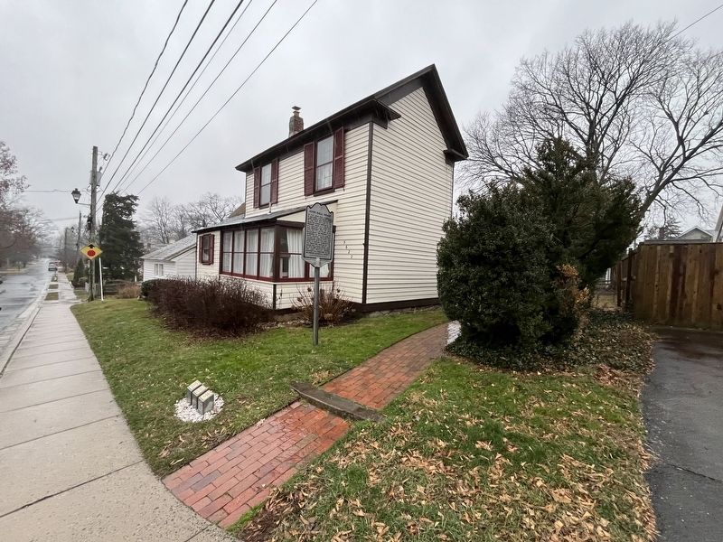
The John Ball House
GEOGRAPHIC SORT Title Sort Marker Number Sort Marker Number Sort N Marker Number Sort T Publication Order Sort Publication Order Sort A Erected Year Sort Most Viewed Sort Most Recent-Interest Sort Most Recently Changed Sort SEE FAQ #33 FOR DESCRIPTIONS
On 3rd Street South east of South Kensington Street, on the right when traveling east.
On Shirlington Road south of 24th Street South, on the left when traveling north.
On South Four Mile Run Drive at South Nelson Street, on the left when traveling west on South Four Mile Run Drive.
On Shirlington Road just south of 22nd Street South, on the right when traveling south.
Near South Kenmore Street north of 24th Street South, on the right when traveling south.
On South Glebe Road (Virginia Route 120) south of 20th Street South, on the right when traveling south.
Near South 23rd Street at South Kenmore Street, on the left when traveling west.
On Shirlington Road at 24th Road South, on the right when traveling north on Shirlington Road.
On South Four Mile Run Drive just east of South Nelson Street, on the left when traveling west.
Near South Kenmore Street north of 24th Street South, on the right when traveling south.
On 24th Road South west of South Glebe Road (Virginia Route 120), on the right when traveling east.
On 22nd Street South at South Kenmore Street, on the right when traveling east on 22nd Street South.
On South Kenmore Street at South 19th Street, on the right when traveling south on South Kenmore Street.
On Shirlington Road south of 24th Street South, on the right when traveling south. Reported permanently removed.
Near South Kenmore STreet just north of 24th Street South, on the right when traveling south.
Paid Advertisement
Near South Kenmore Street just north of 24th Street South, on the right when traveling south.
Near South Kenmore Street just north of 24th Street South, on the right when traveling south.
On South Four Mile Run Drive west of Shirlington Road, in the median.
On 27th Street South east of South Nelson Street, on the left when traveling west.
On 27th Street South east of South Nelson Street, on the left when traveling west.
On South Nelson Street south of South Four Mile Run Drive, on the left when traveling south.
On South Nelson Street south of South Four Mile Run Drive, on the right when traveling north.
On 17th Road North west of North Culpeper Street, on the left when traveling west.
Near Long Bridge Drive east of 6th Street South, on the right when traveling east.
On North Old Glebe Road north of North Ridgeview Road, on the right when traveling north.
On 1st Street South at South Cleveland Street, on the left when traveling east on 1st Street South.
On Columbia Pike (Virginia Route 244) at South Scott Street on Columbia Pike.
On Marcey Road, 0.3 miles north of North Beechwood Place, on the left when traveling north.
On Marshall Drive west of North Meade Street, on the right when traveling west.
Near Blue Ridge Parkway (at milepost 8.8).
On Cedar Green Road, 0.2 miles Parkersburg Turnpike (Virginia Route 254), on the right when traveling west.
Paid Advertisement
Near Three Notched Mountain Highway (U.S. 250) 0.8 miles north of Interstate 64.
On Virginia Route 39 at T. C. Walker Road (County Route 635), on the left when traveling west on State Route 39.
On Main Street (County Route 615) just east of Pinehurst Heights Road (County Road 616), on the right when traveling west.
On U.S. 220 at Virginia Route 39, on the right when traveling north on U.S. 220.
On Mountain Valley Road (Virginia Route 39) just west of Edgewood Lane, on the left when traveling west.
On Mountain Valley Road (Virginia Route 39) just west of Edgewood Lane (County Route 622), on the left when traveling west.
Near Overlord Circle, 0.4 miles west of Burks Hill Road.
Near Overlord Circle, 0.4 miles west of Burks Hill Road.
On Burks Hill Road (Virginia Route 122) at Tiger Trail, on the left when traveling north on Burks Hill Road.
Near Poplar Forest Drive at Foxhall Drive, on the left when traveling east.
Near Poplar Forest Drive at Foxhall Drive, on the left when traveling east.
Near Poplar Forest Drive at Foxhall Drive, on the left when traveling east.
Near Poplar Forest Drive at Foxhall Drive, on the left when traveling east.
Near Poplar Forest Drive at Foxhall Drive, on the left when traveling east.
On Lee Highway (U.S. 11) north of Updike Lane, on the right when traveling north.
Paid Advertisement
On Botetourt Road (U.S. 220) north of Gala Loop Road (County Route 622), on the right when traveling north.
On Lee Street north of Cumberland Street (Virginia Route 113), on the left when traveling north.
On Lee Street north of Cumberland Street (Virginia Route 113), on the left when traveling north.
Near East Hill Cemetery Drive north of East State Street, on the left when traveling north.
On Lee Highway (U.S. 11/19) 0.1 miles west of Forsythe Road, on the right when traveling west.
On Pleasant Grove Road (County Road 681) 0.2 miles west of Governor Harrison Parkway (U.S. 58), on the right when traveling west.
On Pleasant Grove Road (County Route 681) 0.3 miles north of Governor Harrison Parkway (U.S. 58), on the right when traveling north. Reported permanently removed.
On Christanna Highway (Virginia Route 46) at Boydton Plank Road (U.S. 1), on the right when traveling south on Christanna Highway.
On Christanna Highway (Virginia Route 46) 0.1 miles east of Walkers Wood Lane, on the right when traveling east.
On Christanna Highway (Virginia Route 46) 0.1 miles east of Walkers Wood Lane, on the right when traveling east.
On College Drive, 0.1 miles north of Windsor Avenue (Virginia Route 46), on the right when traveling north. Reported permanently removed.
On North Main Street (Business U.S. 58) at Athletic Field Road, on the right when traveling west on North Main Street.
On Athletic Field Road at Lawrenceville Plank Road (Business U.S. 58), on the right when traveling north on Athletic Field Road.
On Brunswick Drive (County Route 644) at Exit 24 (Interstate 85) on Brunswick Drive.
Near Lee Wayside Road near Anderson Highway (U.S. 60). Reported permanently removed.
Near Lee Wayside Road, 0.1 miles east of West James Anderson Highway (U.S. 60), on the left when traveling west.
Paid Advertisement
Near Camden Street (Virginia Route 1001) 0.1 miles south of Hancock Street (Virginia Route 1001), on the left when traveling south.
On North Madison Road (U.S. 15) at South Constitution Route (State Highway 20), on the right when traveling south on North Madison Road.
On North James Madison Highway (U.S. 15) 0.1 miles south of Bell Road (Virginia Route 650), on the right when traveling north.
On Camden Street (Virginia Route 1001) 0.1 miles south of Hancock Street (Virginia Route 1001), on the right when traveling south.
On James Madison Highway (U.S. 15) at Toney Lane, on the right when traveling north on James Madison Highway.
On C G Woodson Road (Virginia Route 670) 0.2 miles north of Liberty Road (Virginia Route 759), on the right when traveling north. Reported permanently removed.
On C G Woodson Road (Virginia Route 670) 0.2 miles south of Bolling Woodson Lane, on the right when traveling north.
On James Madison Highway (U.S. 15) at C. G. Woodson Drive (County Route 670), on the right when traveling north on James Madison Highway.
On C G Woodson Road (Virginia Route 670) 0.2 miles south of Bolling Woodson Lane, on the right when traveling north.
On C G Woodson Road (Virginia Route 670) 0.2 miles south of Bolling Woodson Lane, on the right when traveling north.
Near Red Hill Road (County Route 677) 1 mile Staunton Hill Road (County Route 619), on the right when traveling south.
Near Red Hill Road (County Route 677) 1 mile Staunton Hill Road (County Route 619).
On Village Highway (Virginia Route 24) just west of Red House Road (County Road 615), on the right when traveling west.
On Village Highway (Virginia Route 24) 0.1 miles east of County Road 9074, on the right when traveling east.
On Courthouse Lane, on the right when traveling east.
Near Stonewall Jackson Road (Virginia Route 606) near Guinea Station Road (Virginia Route 634).
Paid Advertisement
On Richmond Highway (U.S. 301) 3 miles south of Dawn Boulevard (Virginia Route 30), on the right when traveling south.
On Jefferson Davis Highway (U.S. 1) 0.2 miles north of Ladysmith Road (Virginia Route 639), on the right when traveling south.
On Richmond Turnpike (U.S. 301) at New Market Lane, on the right when traveling south on Richmond Turnpike.
On Richmond Turnpike (U.S. 301) at Sparta Road (Virginia Route 721), on the right when traveling north on Richmond Turnpike.
On Tidewater Trail (U.S. 17) 0.1 miles north of Hazelwood Lane (Virginia Route 675), on the right when traveling north.
Near The Glebe Lane (Virginia Route 615) 0.1 miles west of Ruthville Road (Virginia Route 612).
On John Tyler Memorial Highway (Virginia Route 5) 0.3 miles west of Kimages Road (Virginia Route 658), on the right when traveling east.
On John Tyler Memorial Highway (Virginia Route 5) east of County Route 614, on the left when traveling east.
On John Tyler Memorial Highway (Virginia Route 5) at Kimages Road, on the right when traveling east on John Tyler Memorial Highway.
On Courthouse Road (Route 644) at Courthouse Green Way (Route 628), on the right when traveling east on Courthouse Road.
On Courthouse Road (Virginia Route 155) at Spoth Lott Cary road (Virginia Route 602) on Courthouse Road.
On The Glebe Lane, 0.1 miles west of Southall Plantation Lane, on the left when traveling east.
On Old Union Road (Virginia Route 603) 0.1 miles east of Roxbury Road (Virginia Route 106), on the right when traveling east.
On The Glebe Lane (Virginia Route 615) 0.1 miles west of Ruthville Road (Virginia Route 612), on the right when traveling west.
On Virginia Route 5 at Virginia Route 619 on State Route 5.
Near Red Hill Road (Route 677) 1 mile Staunton Hill Road (Route 619), on the right when traveling west.
Paid Advertisement
Near Red Hill Road (County Route 677) 1 mile south of Staunton Hill Road (County Route 619).
On Thomas Jefferson Highway (Route 47) north of Union Cemetery Road (Virginia Route 709), on the left when traveling north.
On Legrande Avenue (Virginia Route 47) at David Bruce Avenue (Virginia Route 40) on Legrande Avenue. Reported permanently removed.
On Legrande Avenue (Virginia Route 47) just south of David Bruce Avenue (Virginia Route 40), on the right when traveling south.
On Tech Lane at Lunenburg Highway (Virginia Route 40) on Tech Lane. Reported permanently removed.
1625 entries matched your criteria. Entries 201 through 300 are listed above.
⊲ Previous 100 —
Next 100 ⊳