Enslaved here
Nancy
Female
Born ca. 1775
Died ca. 1831 - 1840
Enslaved here
Name unknown
Male
Born ca. 1806 - 1820
Enslaved here
Name unknown
Male
Born 1844 — — Map (db m238963) HM
Artist and landscape designer Walter Hood took inspiration for the design of the John Robinson, Jr. Town Square from the surrounding history of Green Valley. Over the course of six years, Hood engaged residents and community leaders in the design . . . — — Map (db m214447) HM
Wheelhouse explores the industrial history of the Jennie Dean Park site through the lens of the great American pastime—baseball. Inspired by the mill that stood in this location in the early 1700's and the park's rich recreational . . . — — Map (db m214512) HM
In 1775, Prince Hall (a freed slave) and fourteen other African Americans joined Lodge No. 441, Grand Lodge of Ireland (a military lodge in Boston. After the British vacated Boston, the black masons were left with limited powers but . . . — — Map (db m184532) HM
The entrepreneurial spirit of Green Valley was born of necessity. Businesses emerged in the shadow of segregation as owners supplied services that otherwise were denied to their community.
[Captions:]
James Chinn established . . . — — Map (db m214454) HM
Dr. Roland Herman Bruner, born on March 7, 1902 in Burkittsville, Maryland, served Arlington County for over 40 years. He should be remembered not only for his commitment to medicine and generosity to the community and his patients, but also for . . . — — Map (db m130993) HM
In 1945 a new segregated elementary school was built for Arlington’s African American population in the Green Valley, now Nauck, neighborhood. It was the only Arlington school to be built in the Art Moderne architectural style. Originally called . . . — — Map (db m69192) HM
As a business and civil rights leader, Leonard "Doc" Muse established Arlington County's first African-American owned and operated pharmacy at 2415 Shirlington Road in 1952. He overcame the challenges of racism, segregation, and inequality to bring . . . — — Map (db m130989) HM
Green Valley is one of Arlington's oldest African American communities.
Mid-Late 1800's Emancipated African Americans settle in Green Valley.
Late 1800's John D. Nauck, Jr. buys and subdivides 69 acres of land that became known . . . — — Map (db m214465) HM
African American residents struggled through segregation and also faced challenges during the integration of Arlington Public Schools. Therefore, leaders sought solutions to accommodate the increasing population as schools and housing were . . . — — Map (db m214459) HM
The Little Zion Congregation was organized in 1866 by residents of Freedman's Village. The congregation purchased this site in 1874. In 1867, T.H. Lomax was elected Bishop of the AME Zion Church and assigned to the Washington, D.C. area. The Little . . . — — Map (db m130988) HM
Macedonia Baptist Church was the first African-American church established by residents in the Nauck community. Founded in 1911, the church traces its origins to prayer meetings held in 1908 at the home of Bonder and Amanda Johnson at 22nd Street . . . — — Map (db m69190) HM
As soon as the smoking guns of the Civil War were finally silenced, a group of former slaves banded themselves together in what was then known as Freedmen’s Village, a government reservation in the area of Arlington National Cemetery, and founded a . . . — — Map (db m69189) HM
Freedman's Village, established by the federal government in 1863, was intended to provide temporary accommodation for newly freed slaves, but it survived as a community for over thirty years. When the government closed it, many residents . . . — — Map (db m130991) HM
Green Valley, formerly Nauck, is a traditionally African American neighborhood. Levi Jones first settled in this area and was later joined by other African American families such as Thornton and Selina Gray, William Augustus and Ellen Rowe, and . . . — — Map (db m214449) HM
Churches fulfilled a critical role in the growth and development of Green Valley. They served as social and spiritual anchors while providing sanctuary for generations of residents.
[Captions:]
The Methodists were the first . . . — — Map (db m214455) HM
County facilities for African Americans during segregation were limited. Jennie Dean Park offered outdoor play fields and tennis courts. Neighbors also gathered to enjoy seasonal sports, express support for local teams, and participate in social . . . — — Map (db m214457) HM
The 100-ft wide W&OD has been called "the skinniest park" in Virginia. But it is also one of the longest parks, 45 miles of paved trail for walking, running cycling and skating and more. Built on the roadbed of the former Washington & Old . . . — — Map (db m131543) HM
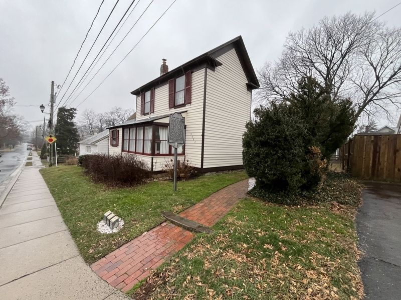
The surrounding neighborhood of Nauck, also known as Green Valley, is one of the oldest African American communities in Arlington County. Its history traces to 1844, when freedman Levi Jones purchased land to build a home and farm . . . — — Map (db m131544) HM
Ernest E. Johnson: His work let Arlington play.
In 1949, Arlington County formally established a Department of Recreation. Mirroring the public school system, all classes, clubs and activities sponsored by the Department were . . . — — Map (db m131545) HM
In the early part of the 20th century, due to widespread racial segregation, the residents of Green Valley relied upon each other's generosity and community spirit to access recreational amenities which were otherwise forbidden to them. Community . . . — — Map (db m214520) HM
After the purchase by the County, the County Board delegated Anna P. Belcher, a member of the Arlington Interracial Commission, to name the playground. She named it after Jennie Serepta Dean, who founded the Manassas Industrial School for Colored . . . — — Map (db m214522) HM
This wall is a reminder of racial segregation in the historically African American community of Hall's Hill. During construction of the Woodlawn Village subdivision in the 1930s, a wall of various materials and heights was built here to separate . . . — — Map (db m157671) HM
This stretch of riverside has hosted many diverse communities over time. Nameroughquena tribal homes, the large estates of the Lees and other prominent families, raucous Jackson City, and historic African-American neighborhoods have all existed in . . . — — Map (db m134978) HM
Company M, 2nd New York Heavy Artillery, August 1865
The war ended in April 1865, but troops continued to occupy the fort temporarily. With their guns cleaned and polished, Company M would be mustered out in Washington, D.C., on September 29. . . . — — Map (db m129232) HM
Dr. Charles R. Drew lived in this house from 1920 to 1939. His groundbreaking research led to the modern-day blood bank and proved that blood plasma could be used in place of whole blood transfusions. He served as director of the Red Cross Blood . . . — — Map (db m134967) HM
Founded in 1903, the congregation of St. John's Baptist Church proudly recalls African-American heritage in Arlington County. Some of the early members were emancipated slaves or relatives of emancipated slaves who either lived in slave quarters at . . . — — Map (db m134970) HM
Barns were an integral part of life for early farmers who once tilled the local soils. They housed livestock and were used for storing feed, produce, and farm equipment. Though the farmers are now gone, the remains of the old barns can still be . . . — — Map (db m197941) HM
Following the Civil War four regiments (9th and 10th Cavalry; 24th and 25th Infantry) of African-American enlisted men, under the command of white officers, were formed to fight on the Western frontier. They did so with distinction being . . . — — Map (db m41108) HM
The rambling stone walls seen nearby are remnants of “hog-walls.” Built in the early 1800’s they provided winter work for slaves of valley plantations and were mended yearly to control the wanderings of half-wild hogs that foraged for . . . — — Map (db m161496) HM
A rural African-American school stood here by 1874. In 1927 a two-room elementary school serving Cedar Green and Smokey Row communities was built. The Augusta County Training School (Cedar Green School), the county’s first black consolidated school, . . . — — Map (db m59711) HM
Deaths of laborers and their family members were frequent along the Blue Ridge Railroad. Pneumonia, tuberculosis, and heart disease took a heavy toll. About thirty-three Irish men, women, and children living in shanties near the tunnel perished . . . — — Map (db m237793) HM
T.C. Walker School, which opened in 1930, was named for Thomas Calhoun Walker a former slave from Gloucester County who became the first African American attorney in Virginia. It cost $4,600, and was underwritten with $500 from the Julius Rosenwald . . . — — Map (db m69471) HM
Union Hurst, a school for African Americans, was built near here on Pine Hurst Heights Road between 1924 and 1925. The school was built with the assistance of the Julius Rosenwald Fund, a program that helped build some 5,000 schools for African . . . — — Map (db m70245) HM
Born in Waynesboro to former slaves, William H. Sheppard became a Presbyterian missionary to the Belgian colony of Congo Free State in 1890. He and others opposed King Leopold II of Belgium, who encouraged such atrocities as the amputation of . . . — — Map (db m5607) HM
The community of West Warms Springs was settled in the 1870s by Black residents who purchased
tracts of land on the west side of Little Mountain. A road that extended over the mountain connected
West Warm Springs with the pools. Many of the early . . . — — Map (db m208526) HM
African Americans, exercising newfound autonomy
after the Civil War, purchased land here on the
western slope of Little Mountain and established
the community of West Warm Springs. Many early
residents worked at nearby resorts, including . . . — — Map (db m208441) HM
320th Anti-Aircraft Balloon Battalion
Very Low Altitude (VLA)
The 320th Coast Artillery Barrage Balloon Battalion (Colored) was activated at Camp Tyson, Tennessee, on 10 December 1942. All the enlisted men and seventeen of the . . . — — Map (db m240367) HM WM
On 15 March 1942, the War Department activated the 761st Tank Battalion (Light) at Camp Claiborne, Louisiana. The battalion's 36 officers and 593 enlisted men moved to Camp Hood, Texas, to train and convert to M4A3 Sherman tanks. On 10 October 1944, . . . — — Map (db m240462) HM WM
Susie G. Gibson (1878-1949), teacher and community activist, was Bedford County's supervisor of African American education for 22 years. Her work was sponsored by the Jeanes Fund, established in 1907 to enhance opportunities for Black students in . . . — — Map (db m243627) HM
Long before Jefferson built his retreat house here, he had enslaved men, women and older children working the tobacco and wheat fields—going "into the ground," as he called it. They planted up to 300,000 hillocks of tobacco each year. It took 18 . . . — — Map (db m198081) HM
The Wing of Offices was constructed on the east side of Jefferson's retreat home in 1814, “110 feet long, in the manner of those at Monticello, with a flat roof in the level of the floor of the house." Hannah, the enslaved cook, spent many of her . . . — — Map (db m198085) HM
Except for Jefferson himself, no one deserves more credit for the ornate character of the retreat house than his enslaved craftsman John Hemings. He apprenticed as a joiner under James Dinsmore, an Irish immigrant. "There is nothing superior in the . . . — — Map (db m198084) HM
"If you would engage the negroes to dig and remove the earth South of the house, 90 feet wide, down to a foot below the lower floor, & descending from thence due South 1 inch in every 10 ft. ...l would gladly pay them for it, but it is only with . . . — — Map (db m198083) HM
When Jefferson became president in 1801, Poplar Forest was a 4,500-acre plantation with at least 60 enslaved men, women and children living and working on the property. In August 1806, President Jefferson visited Poplar Forest to help his . . . — — Map (db m198082) HM
These two brick buildings, constructed in the mid-19th century by the Hutter family, served as housing for their plantation workers. Family recollections say that the northern building was a residence for the overseer, while the southern one was . . . — — Map (db m99787) HM
Robert Harvey established an agricultural and industrial complex here about 1790 that processed iron ore. The operation, known as Cloverdale Furnace, expanded in the 19th century under the ownership of John Tayloe III. About 150 enslaved African . . . — — Map (db m140513) HM
Norvel Lee was born in Botetourt County and grew
up two miles northeast of here. He joined the Army
Air Forces in 1943, was trained in Tuskegee, AL.
and later retired from the Air Force Reserve as a
lieutenant colonel. In 1948. Lee was arrested . . . — — Map (db m207830) HM
Charles S. Johnson, sociologist, author, and civil rights leader, was born in Bristol, son of a 42-year pastor of Lee Street Baptist Church. He attended Virginia Union University and the University of Chicago and served in combat during World War I. . . . — — Map (db m210163) HM
In 1865, at the dawn of their freedom from slavery, 42 former members of the white-led Goodson (now First) Baptist Church organized the Anglo African Baptist Church. The congregation met in a series of buildings until, under the leadership of the . . . — — Map (db m210167) HM
This site was established in 1857 by Bristol founder Joseph Rhea Anderson for the purpose of a slave cemetery. Buried nearby are twelve slaves including Old Si Goodson, who died in 1862, purportedly at the age of 132, reputed to be the oldest man in . . . — — Map (db m67287) HM
Col. Robert Preston (1750-1833) acquired 720 acres here in the 1780s and established Walnut Grove. Preston had emigrated from Ireland in 1773 and worked as assistant surveyor under his relative William Preston, who laid out vast areas of western . . . — — Map (db m210159) HM
Though many freed African Americans continued after the Civil War to work the same farms on which they had been slaves, many also left their homes in search of better opportunities elsewhere. Often the sick, elderly, and very young were left . . . — — Map (db m180524) HM
Though many freed African Americans continued after the Civil War to work the same farms on which they had been slaves, many also left their homes in search of better opportunities elsewhere. Often the sick, elderly and very young were left . . . — — Map (db m30873) HM
Nellie Pratt Russell, educator, attended Howard
University and was one of six incorporators of
Alpha Kappa Alpha Sorority, the first Greek
letter organization founded by African American
women. The sorority, established in 1908, . . . — — Map (db m107412) HM
Oak Grove School was originally a one-room log building located here on the grounds of Oak Grove Baptist Church. Between 1923 and 1924, for the sum of $3,000, a new, three-room school was built on the same site. The school is an example of . . . — — Map (db m180530) HM
Erected in loving memory of the Rev. Jesse C. Byrd D.D. as builder of present structure and pastor of Oak Grove 1943 - 1964 by the members. — — Map (db m180531) HM
Saint Paul’s College began as a small parochial school founded by a newly ordained Episcopal deacon, the Rev. James Solomon Russell. Born into slavery, Russell attended seminary school in Petersburg. Within a year of graduation he had managed . . . — — Map (db m30870) HM
Saint Paul's College was established in 1883 by the Venerable James Solomon Russell (1857-1935) as an Episcopal mission school to serve the black community of Southside Virginia. Born into slavery in Mecklenburg County, Russell was educated at . . . — — Map (db m20187) HM
Saint Paul's College began as a small parochial school founded by a newly ordained Episcopal deacon, the Rev. James Solomon Russell. Born into slavery, Russell attended the Bishop Payne Divinity School in Petersburg. Within a year of graduation, . . . — — Map (db m180528) HM
Among the earliest of the more than a dozen
Julius Rosenwald Schools built in Brunswick
County, Saint Paul’s Chapel School was constructed
as a one-teacher standard plan in 1920 under
the initial wave of Tuskegee Institute-administered building . . . — — Map (db m107433) HM
Union Grove School is representative of the many one-room schools for African-American students in Buckingham County and throughout the area. The African-American members of the community built Union Grove around 1925, and like most schools, . . . — — Map (db m21148) HM
Union Grove School is representative of the many one-room school for African American students that could be found in the first half of the 20th century in Buckingham County and the surrounding area. The African American members of the . . . — — Map (db m181212) HM
The Buckingham Training School sits on 9.25 acres and was established as a result of Stephen J. Ellis' longtime efforts to establish a secondary school for African American students in the Buckingham County area. Ellis first organized the . . . — — Map (db m181214) HM
One mile southeast stood Buckingham Training School, the first high school in the county for African American students. In 1919 the Rev. Stephen J. Ellis organized the County-Wide League for School Improvement to persuade the Buckingham County . . . — — Map (db m29157) HM
African Americans had established Chief Cornerstone Baptist Church by 1876, during a period when many Black southerners worked to build independent community institutions in the wake of Emancipation. John and Harriet Gregory, who had formerly been . . . — — Map (db m239969) HM
Rev. Stephen J. Ellis (1865-1937)
This park is the site of the first high school for Black Students in Buckingham County, founded by Rev. Ellis.
Buckingham Training School Campus, 1924-1954. National Register of Historic Places, . . . — — Map (db m181213) HM
Three miles east is the birthplace of the noted teacher, educator and historian, Dr. Carter G. Woodson. He was the founder of the Association for the Study of Negro Life and History, Journal of Negro History, originated negro history week and . . . — — Map (db m28972) HM
North of this sign is the birthplace of Dr. Carter G. Woodson. Dr. Woodson was born December 19, 1875, to former slaves, James Henry and Eliza Ann Riddle Woodson. Young carter left Buckingham to work in West Virginia when he was 17 years old. . . . — — Map (db m31608) HM
North of this sign is the birthplace of Dr. Carter G. Woodson. Dr. Woodson was born December 19, 1875, to former slaves James Henry and Eliza Ann Riddle Woodson. Young Carter left Buckingham to work in West Virginia when he was 17 years old. . . . — — Map (db m181221) HM
Carter Godwin Woodson was born about three miles east on 19 December 1875. As a youth he mined coal near Huntington, W. Va. He earned degrees at Berea College (B.L., 1903), University of Chicago (B.A. and M.A., 1908), and Harvard (Ph. D., 1912) -- . . . — — Map (db m28977) HM
These simple fieldstones mark the resting place of slaves and African Americans who worked at Red Hill, making it among the most productive tobacco plantations along the Staunton River during the 18th and 19th centuries.
When Patrick Henry . . . — — Map (db m128704) HM
Home of Harrison and his wife, Milly, longtime servants of the Henry family. Harrison, when a small boy, is believed to have been Patrick Henry's slave and later, coachman for his son, John. Restored in 1961 using some of the original logs.
"Let . . . — — Map (db m128705) HM
Campbell County Training School (CCTS) opened here ca. 1923 after African American citizens campaigned for better schools. The black community, the county, and the Julius Rosenwald Fund paid for its construction. Rosenwald, inspired . . . — — Map (db m181140) HM
(front of marker) The first African-American slaves were brought to Caroline County around 1700. Few records were kept of their existence, except for their status and value as property and the occasional brush with the law. Many slaves of . . . — — Map (db m34350) HM
The farm office across the lawn is all that remains of the once-sprawling plantation called “Fairfield.” Thomas Coleman Chandler purchased Fairfield Plantation in 1845. For the next 17 years it prospered and evolved – largely at . . . — — Map (db m5604) HM
On 24 Aug. 1800, slave Ben Woolfolk met with other slaves at nearby Littlepage’s Bridge to recruit individuals for an insurrection planned for 30 Aug. The insurgents led by Gabriel, a slave owned by Thomas Henry Prosser of Henrico County, intended . . . — — Map (db m5611) HM
Born in Caroline County in 1770, York was a slave of the William Clark family and the only African American on the 1803-1806 Lewis and Clark Expedition. Approximately 34 years old at the time, York was one of the hunters and also accompanied groups . . . — — Map (db m47378) HM
Lt. Col. George Armistead (1780-1818). Known for his service in the War of 1812, George Armistead was born here at Newmarket plantation. Armistead distinguished himself in 1813 during the capture of Fort George, Canada, but is best known as . . . — — Map (db m82167) HM
Richard Loving and Mildred Jeter, of different racial backgrounds, grew up near Central Point, 11 miles east of here. They fell in love and in June 1958 were married in Washington, D.C. After returning to Central Point, they were arrested for . . . — — Map (db m119182) HM
Hazelwood was the home plantation of John Taylor of Caroline (1753-1824), agricultural reformer and political theorist. Taylor studied law under his uncle, the jurist Edmund Pendleton, and was an officer in the Revolutionary War. He served in the . . . — — Map (db m186681) HM
Schools were precious to a community denied education for centuries. Following the Civil War one and two-room schools for "colored" children were established around the county. It was here in Ruthville, however, that a commitment to learning first . . . — — Map (db m26335) HM
Emanuel Quivers was born into slavery on Berkeley Plantation to Jonathan and Sarah Quivers. Trained as a blacksmith, in 1845 Quivers became an enslaved wage earner at the Tredegar Iron Works in Richmond. There he learned the closely guarded puddling . . . — — Map (db m233739) HM
South of here, on a bluff overlooking the James River, stands the half-mile-long Fort Pocahontas, built in the spring of 1864 by Union soldiers during the Civil War. The fort protected Union vessels on the river and guarded the landing at Wilson’s . . . — — Map (db m9520) HM
The Herring Creek area was settled in 1619, as a portion of Westover, and a portion of Berkeley Hundred. The point where the James River Road, present-day Route 5, crossed Herring Creek was known as "The Wade." Landmarks have included Harrison's . . . — — Map (db m9288) HM
A mob of about 75 masked men dragged Isaac Brandon from a cell in the old Charles City County jail and hanged him from a tree on this hillside on the night of 6 April 1892. Brandon, a 43-year-old black man, had been held in jail on a charge of . . . — — Map (db m244424) HM
A mile and a half northwest, Lott Cary was born in slavery about 1780. In 1804 his owner, John Bowry, a Methodist minister, hired him out to a Richmond tobacco firm. Cary joined the First Baptist Church in 1807. He purchased his freedom and became a . . . — — Map (db m26338) HM
During the 18th century this property was established as a Southall family seat. Notable family members include James Barrett Southall, owner of Williamsburg's Raleigh Tavern, Turner Southall, member of the committee to build Thomas Jefferson's . . . — — Map (db m18588) HM
Roxbury was named for a nearby plantation in New Kent County and reached by Longbridge over the Chickahominy. This community was the site of a colonial era tavern and the only railroad station in Charles City County . Roxbury post office (1883-1953) . . . — — Map (db m29158) HM
This area was one of the centers of Charles City's free black community before the Civil War and was named for Ruth Brown with the establishment of the post office in 1880. Abraham Brown, a major landowner of the area, founded Elam Church in 1810, . . . — — Map (db m26334) HM
The Weanoc Indians gave this area its name. The Minge family settled much of the Weyanoke peninsula during the eighteenth and nineteenth centuries. Landmarks have included Weyanoke Parish Church, Tyler’s Mill, a steamboat landing, a post office at . . . — — Map (db m59618) HM
The Quarter Place Trail is a half mile long, culminating at the Slave & African American Cemetery. The terrain slopes at the trailhead, levels off, and then steepens as it descends to the cemetery. The one-mile round trip walk is of moderate . . . — — Map (db m128689) HM
Red Hill, 2930 acres at Patrick Henry's death, was named by its previous owners after the red clay soil so common to the area. Henry reportedly referred to it as "one of the garden spots of Virginia." The view from here overlooking the Staunton . . . — — Map (db m128691) HM
Central High School opened in 1939 as Charlotte County's first African American high school. Before its construction, African American students attended the Charlotte Training School, which had been built between 1928 and 1929 with . . . — — Map (db m182502) HM
Beginning in 1937, Ambassador and Mrs. David K. E. Bruce anonymously gave money to 11 sites in Southside Virginia to build libraries. The Bruce libraries, as they were called, became the first public libraries to allow access to African . . . — — Map (db m31019) HM
Beginning in 1937, Ambassador and Mrs. David K.E. Bruce anonymously gave money to 11 sites in Southside Virginia to build libraries. The Bruce libraries, as they were called, became the first public libraries to allow access to African . . . — — Map (db m182496) HM
Southside Virginia Community College has two campuses: the Christanna Campus in Alberta, which opened in 1970, and the John H. Daniel campus in Keysville, which opened in 1971. The college is part of the statewide system of community colleges . . . — — Map (db m31025) HM
1625 entries matched your criteria. Entries 201 through 300 are listed above. ⊲ Previous 100 — Next 100 ⊳