On Pleasant Ridge Avenue at Main Street (U.S. 40), on the left when traveling north on Pleasant Ridge Avenue.
Founded in 1830 as a Lutheran Seminary and chartered as a University in 1850, Capital University offers diverse undergraduate and graduate programs in the arts, sciences and professional studies.
Ethical, moral and religious values essential to . . . — — Map (db m15784) HM
On Washington Street just north of Franklin Street, on the left when traveling north.
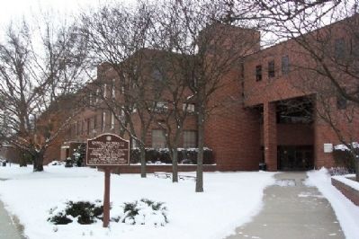
Over its 145 years, the Old Canal Winchester School building played a significant role in the community. The original four-room building opened in 1862 and its first high school class graduated seven in 1886. Canal Winchester's growth is . . . — — Map (db m223471) HM
On West Oak Street near North High Street, on the right when traveling west.
This building was generously donated to the
Village of Canal Winchester
in the interest of historic preservation by the following businessmen: Lloyd Stebelton, Dick Weiser, Don Weiser, Robert Wood, Neil Wyman.
It was moved from its previous . . . — — Map (db m12180) HM
On High Street, 0.1 miles south of Waterloo Street, on the right when traveling south.
In Honor of
Dr. Bland L. Stradley
1889-1957
Dr. Stradley was a noted educator whose career began in 1913 as principal of the Canal Winchester High School. He spent 38 consecutive years at the Ohio State University where he was Vice President in . . . — — Map (db m12532) HM
On High Street (U.S. 23) at Stimmel Street, on the right when traveling south on High Street.
The German Seminary of the Evangelical Lutheran Synod of Ohio, the first Lutheran theological seminary west of the Appalachian Mountains, began instruction under Pastor Wilhelm Schmidt in Canton in 1830. The seminary relocated to Columbus at this . . . — — Map (db m80014) HM
On East North Broadway, on the right when traveling east.
Clinton Township High School
The first school in Clinton Township was opened in 1809. That
school was located on the west side of the Olentangy River and
children had to wade across to attend. The 1872 map of the
township shows a school . . . — — Map (db m108022) HM
On High Street (U.S. 23) at the Pontifical College Josephinum entrance road, on the right when traveling south on High Street.
Monsignor John Joseph Jessing, founder of the Pontifical College Josephinum, was born in Germany in 1836. He immigrated to America and, in 1870, was ordained a priest in Columbus. He published a newspaper, the Ohio Waisenfreund (Ohio Orphans' . . . — — Map (db m12870) HM
On King Avenue at the Olentangy River, on the right when traveling east on King Avenue.
Streams are both a principal economic resource and a natural hazard in Ohio. Accurate and systematic streamflow records are crucial in protecting lives and property and ensuring an adequate water supply. At this site in 1892 and 1893, engineering . . . — — Map (db m12763) HM
On Library Park North, on the right when traveling east.
Columbus Main Library. The first tax supported free public library in Columbus was formed in 1873 and housed in City Hall. In 1901, City Librarian John Pugh petitioned Andrew Carnegie for funding and was granted $200,000. In 1903, the Swayne . . . — — Map (db m12927) HM
This ten acre site was purchased in 1829 for the Ohio School for the Education of the Deaf. The first school building opened here in 1834; the school was enlarged in 1845. In 1868 the original school was replaced. Another school building was added . . . — — Map (db m12934) HM
On East Broad Street (U.S. 40) at Washington Avenue, on the right when traveling west on East Broad Street. Reported permanently removed.
George Bellows. George Bellows (1882-1925) is widely recognized as one of America's premier artists. His vivid portrayals of modern urban life have become indelible icons of American art. Born and reared in Columbus, he retained close ties . . . — — Map (db m221445) HM
On North 9th Street at East Broad Street (U.S. 40/62), on the right when traveling north on North 9th Street.
George Bellows – George Bellows (1882-1925) is widely recognized as one of America's premier artists. His vivid portrayals of modern urban life have become indelible icons of American art. Born and reared in Columbus, he retained close ties here . . . — — Map (db m247606) HM
On North 9th Street at Old National Road (U.S. 40), on the left when traveling north on North 9th Street.
He preserved for posterity the story
of the brave men and women who founded
this great state. He traveled Ohio in
1846 and again in 1886 and twice published his
Howe’s Historical Collections of Ohio — — Map (db m98741) HM
On Grant Street at Naghten Street, on the right when traveling north on Grant Street.
Side A:St. Patrick Church
Built in 1852 and dedicated a year later, St. Patrick Church is the second oldest Roman Catholic Church in Columbus. Founded as the English speaking parish, this church of Norman Gothic design served as the home . . . — — Map (db m17474) HM
On East Rich Street, on the left when traveling west.
Miss Caroline Louise Frankenberg (1806- 1882)
brought the kindergarten concept from Germany to
Columbus in 1836. She returned to Germany for
further study, then established the school at the
S.E. corner of Rich and Pearl Alley in 1858.
The . . . — — Map (db m94247) HM
On West Broad Street Old National Road (U.S. 40) at Washington Blvd, on the right when traveling east on West Broad Street Old National Road.
On the west bank of the Scioto River stands the former Central High School, now the core building of the Center of Science and Industry (COSI). The Plan of the City of Columbus, released in 1908, was developed to create a vision for the city in line . . . — — Map (db m96393) HM
On Broad Street at 5th Street, on the right when traveling east on Broad Street.
Is the first park developed specifically to honor Ohio's public educators. It was created by members and friends of the State Teachers Retirement System of Ohio as part of the system's 80th anniversary celebration. Included in the park are the names . . . — — Map (db m14491) HM
On East State Street at South 5th Street, on the right when traveling east on East State Street.
In 1920, a writer for the Architectural Forum wrote about this rambling structure. “To find an interesting piece of architecture in a medium size, Middle West town was likened to chancing
on an oasis in a none-too-fertile country.” He especially . . . — — Map (db m248253) HM
On Long Street (U.S. 33) at Neil Avenue, on the left when traveling east on Long Street.
William Neil and his wife Hannah Schwing Neil each played significant roles in the early development of Columbus.
William was a large, outgoing, and ambitious man determined to make a fortune. His first successful business was a tavern on High . . . — — Map (db m29957) HM
Dedicated July 4, 1992 by the Citizens of Columbus
Maynard E. Sensenbrenner served four terms as mayor of the City of Columbus, 1954-1959 and 1964-1971, longer than any other mayor. During this time he was responsible for the farsighted . . . — — Map (db m16960) HM
On North High Street just north of West Dominion Boulevard, on the left when traveling north.
Beechwold
In 1800 John Rathbone acquired 4,000 acres of the northwest quadrant of Clinton Township. His daughter Eliza and her husband, Dr. Charles Whetmore, established residence on 262 acres of that land. They called their home Locust . . . — — Map (db m201004) HM
On Hamlet Street at Lincoln Street, on the left when traveling south on Hamlet Street.
Reverend Father Alexander Cestelli. The National Italian Catholic parish of Saint John the Baptist was founded in October 1896 by the Reverend Father Alexander Cestelli, D.D. Father Cestelli was born in Fiesole, Italy and came to America in . . . — — Map (db m14487) HM
On East Long Street at Taylor Avenue, on the right when traveling east on East Long Street.
Martin Luther King Jr. Library On November 19. 1968, the Columbus Metropolitan Library dedicated the first public library in the nation named after Dr. Martin Luther King Jr. After King's assassination on April 4. 1968, the East Side Community . . . — — Map (db m221232) HM
Second Baptist Church - Columbus' Oldest Black Baptist Church, 1836. Second Baptist Church cordially received its independence as a mission church from the First Baptist Church on January 7, 1836. Rev. Ezekiel Fields was chosen as pastor . . . — — Map (db m17174) HM
On Emerald Avenue at Taylor Avenue, on the right when traveling east on Emerald Avenue.
Side A Until the 1970s, Pilgrim Elementary school was different from today. Pilgrim had a smaller playground with a brick wall around it. The gym was used only for physical education classes and most students went home for lunch, while . . . — — Map (db m94623) HM
On Parsons Avenue, on the right when traveling north.
This nine acres of land was purchased by the citizens of Columbus in 1837, and deeded to the state for use as the Ohio School for the Blind. The first building, designed by N. B. Kelly and occupied in October 1839, was replaced by the current . . . — — Map (db m17178) HM
On Fred Taylor Drive at Borror Dr., on the left when traveling north on Fred Taylor Drive.
A.B. Graham and the 4-H Movement. In 1902, Albert Belmont Graham (1868-1960), a school teacher and superintendent, established the Boys and Girls Agricultural Experiment Club in Springfield, Ohio. Graham believed in learning by doing, a concept . . . — — Map (db m94110) HM
On Irving Schottenstein Dr, on the left when traveling north.
“You can never pay back, but you can pay forward”
Wayne Woodrow “Woody” Hayes was a buckeye from birth. born in
Clifton, Ohio, he spent his entire life giving back to the state he
loved. Woody earned a bachelor’s . . . — — Map (db m94098) HM
On Irving Schottenstein Dr, on the left when traveling west.
Over his 28-year coaching career, Woody Hayes (1913-1987) cemented The Ohio State University's tradition of football excellence while amassing one of the most impressive records in college football. Wayne Woodrow Hayes grew up in Newcomerstown and . . . — — Map (db m94097) HM
On Fred Taylor Drive, on the right when traveling north.
James Cleveland (Jesse) Owens, 1913-1980, Ohio State University Track and Field Star, Olympic Champion, Ambassador of Sports, Humanitarian, Friend of Youth.
Jesse Owens' incomparable achievements as an Ohio State and Olympic athlete are . . . — — Map (db m12773) HM
On West Lane Avenue at Olentangy River Road, on the right when traveling east on West Lane Avenue.
• In the late 1800's a steel truss was constructed across the Olentangy River at Lane Avenue. Its primary function was to gain access across the Olentangy River from the main campus of The Ohio State University to the agricultural land on the west . . . — — Map (db m200920) HM
The Ohio School for the Deaf was established in 1829 by an act of the Ohio Legislature. Although the fifth school for the deaf in the country, it was the first school to be 100% funded by the state. The school first opened in a small rented building . . . — — Map (db m12869) HM
On High Street (U.S. 23), on the right when traveling north.
In 1835, Dr. William Awl of Columbus and Dr. Daniel Drake of
Cincinnati presented recommendations to the Ohio General Assembly
to establish a school for the blind. Legislation, signed by then
governor of Ohio Duncan McArthur on April 3, 1837, . . . — — Map (db m94099) HM
On Sunbury Road at Willamont Avenue, on the right when traveling south on Sunbury Road.
Aminah Brenda Lynn Robinson (1940-2015) and her son Sydney moved into this home in 1974. The artist, a visual historian, lived and worked here in the Shepard community until her passing. Raised in Columbus’s Poindexter Village and educated in the . . . — — Map (db m184219) HM
On Mohawk Street south of East Sycamore Street, on the right when traveling south.
For over a century, this site was part of St. Mary Catholic Church, established to serve the many German families moving into the area in the 1860s.
A primary mission of St. Mary's parish has been the education of its children. The first . . . — — Map (db m141818) HM
On Southwood Avenue at 4th Street, on the left when traveling west on Southwood Avenue.
Built in 1894, the original eight-room Southwood Elementary School cost
$16,000 to construct on this site purchased from a local family for
$3,000. The school originally had five teachers and a teacher-pupil
ratio of 50-1. Mary Esper was the . . . — — Map (db m94245) HM
Side A: Saint Mary of the Springs Academy On this site stood St. Mary of the Springs Academy, a school for girls first founded by the Dominican Sisters in 1830 in Somerset, Ohio, to respond to the educational needs of frontier Catholics. The . . . — — Map (db m17387) HM
On Sunbury Road, on the left when traveling south.
Ohio Dominican University Est. 1911 The Dominican Sisters of St. Mary of the Springs founded Ohio Dominican University on this site on October 5, 1911. It was incorporated that year as the Ladies Literary Institute of St. Mary of the Springs, . . . — — Map (db m94624) HM
On Sunbury Road, on the right when traveling north.
Honoring the history of
Saint Mary of the Springs Academy
founded 1830
flourished on this site
1868- 1966
Dedicated to the alumnae
and the Dominican Sisters
in celebration of
the spirit that they have
carried into the world — — Map (db m94625) HM
On Woody Hayes Drive just east of Cannon Drive, on the right when traveling east.
The Ohio State University Buckeye football team first played in autumn 1890 on a field immediately to the south of where Ohio Stadium now stands. Buckeye football games were later played at other locations, including Ohio Field, constructed in . . . — — Map (db m200994) HM
On North High Street at West 18th Avenue, on the right when traveling south on North High Street.
Pete Stinchcomb
1917 - 1921
Gaylord Roscoe "Pete" Stinchcomb lettered in 1917, 1919 and 1920, being selected as an All-American in 1919 and 1920.
During his senior year, Stinchcomb won the NCAA track and field broad jump, . . . — — Map (db m200930) HM
On West 12th Avenue west of North High Street, on the right when traveling west. Reported damaged.
On the eve of graduation in 1891, a group of Ohio State students planted five elm trees on the Oval. Since that time, students have continued to collectively present a token of appreciation to the University to celebrate the group's graduation. The . . . — — Map (db m200862) HM
Browning Amphitheatre Dedicated June 11, 1926 for the encouragement of drama, dance and music. Seating restored October 12 1985.
Browning Dramatic Society
Originally organized 1882 as The Young Ladies’ Literary Society. Founded 1908 as . . . — — Map (db m16950) HM
On West 18th Avenue west of North High Street, on the right when traveling west.
The East Regional Chilled Water Plant began operating in 2014 and supplies the Academic Core North and the North Residential District. Large campuses often use centralized chiller plants for cost effectiveness, safety and reliability. . . . — — Map (db m200923) HM
On Woody Hayes Drive east of Cannon Drive, on the right when traveling east.
Initial plans for Ohio Stadium were met with resistance. Critics regarded a 60,000-seat as folly and an outrageous financial risk. In the face of opposition, the Athletic Board proceeded with planning, University Architect Joseph N. Bradford . . . — — Map (db m200995) HM
On Woody Hayes Drive east of Cannon Drive, on the right when traveling east.
Dedicated on Oct. 21. 1922, Ohio Stadium was the largest west of the Alleghenies and preeminent among football stadia of the day. Innovations such as curved seat rows and an upper seating deck increased capacity and provided . . . — — Map (db m200998) HM
On Jesse Owens Plaza just south of Woody Hayes Drive, in the median.
Jesse Owens' incomparable achievements as an Ohio State and Olympic athlete are legendary. He carried the name of this university and this country to world acclaim.
He personified the sportsmanship ideal. He cared for people and challenged . . . — — Map (db m200992) HM
On North High Street just north of West 18th Avenue, on the left when traveling north.
John Wilce
1913 - 1928
Hired as head football coach at the age of 25 in 1913, Wilce served through the 1928 season. John "Jack" Wilce coached Ohio State's football team in its first victory against the University of Michigan in . . . — — Map (db m200941) HM
On 8th Avenue at Perry Street, on the left when traveling east on 8th Avenue.
Welcome to the
NECKO Neighborhood
The NECKO neighborhood, a section of the historic E. J. McMillen Homestead Addition, is a part of the Near North Side Historic District as designated in the Historic Register in 1980. It is recognized as a . . . — — Map (db m17424) HM
On Neil Avenue at West 11th Avenue, on the left when traveling north on Neil Avenue.
Construction of these brick columns was authorized by the Board of Trustees of the University on November 6, 1915. The columns later supported iron gates bearing the University seal, which were used to close this south entrance to the campus. . . . — — Map (db m49788) HM
On Neil Avenue at West 12th Avenue, on the left when traveling north on Neil Avenue.
Ohio Farm Bureau Founded
On January 27, 1919, the first meeting of the Ohio Farm Bureau Federation took place
on this campus at the former Botany and Zoology Building, now Jennings Hall. Farm
Bureau members representing 76 counties along . . . — — Map (db m130445) HM
On Cannon Drive south of Woody Hayes Drive, on the left when traveling south.
Ohio Stadium, built between August 1921 and October 1922, received immediate acclaim for its innovative architectural features. Its reinforced concrete construction, double-deck seating, and open-ended horseshoe design were so imaginative that . . . — — Map (db m221018) HM
On 12th Avenue, on the right when traveling west. Reported missing.
Built in 1910, the old Ohio Union was the first student union building constructed on a public university campus and the fourth to be built in the United States. Made possible by a direct appropriation from the 77th Ohio General Assembly and private . . . — — Map (db m223483) HM
On Woody Hayes Drive east of Cannon Drive, on the right when traveling east.
The Ohio State University gratefully acknowledges support from The Motorists Insurance Group during the 1998-2001 renovation of Ohio Stadium. The art glass panels in the rotunda of Ohio Stadium are a gift from The Motorists Insurance Group . . . — — Map (db m200993) HM
Roy J. Plunkett was born in New Carlisle, Ohio, and graduated from Newton Township High School in Pleasant Hill. He received his B.A. degree from Manchester College before enrolling as a graduate student in chemistry at The Ohio State University, . . . — — Map (db m17412) HM
On North High Street just north of West 18th Avenue, on the left when traveling north.
Site of Ohio Field (1903-21) where Charles W. "Chic" Harley, All-American Halfback in 1916-17-19, performed those feats which made him an Ohio State Football legend and sparked the public enthusiasm which led to the construction of Ohio Stadium. — — Map (db m200940) HM
Near Cannon Drive, 0.1 miles south of Woody Hayes Dr..
Ohio Stadium was once the site of the Stadium Scholarship Dormitory, a cooperative scholarship housing facility serving students with outstanding academic ability and limited financial resources.
The program was the brainchild of Joseph A. . . . — — Map (db m221016) HM
On West Woodruff Avenue east of Neil Avenue, on the right when traveling west.
"There isn't a magic formula of knowledge and personal characteristics that can insure success in the business world. That is the beauty of entrepreneurship. It doesn't close its doors to anyone." — Bert Wolstein Crossing The Road To . . . — — Map (db m201002) HM
The Ohio Agricultural and Mechanical College grew out of the Cannon Act of March 22, 1870. “But let it be started,” Governor Rutherford B. Hayes told the Legislature in 1873, “with the intention of making it a great State . . . — — Map (db m16944) HM
After 1856, escapees on the Freedom Train followed Neil Run past the Neil Farm and through the swampy hollow that is now Mirror Lake. The stream forked, with the northeastern branch emerging from the marshy land where the Ohio Union now stands, to . . . — — Map (db m16952) HM
Joseph Sullivant, a member of the first Board of Trustees of Ohio State, was known as a “friend of the colored race.” He grew up in Kentucky but developed a distaste for slavery after witnessing a slave auction. Another Ohio State board . . . — — Map (db m16953) HM
On College Road at Hagerty Drive, on the left when traveling north on College Road.
Along Lake Erie, Toledo, Sandusky, Cleveland, Fairport Harbor, and Ashtabula Harbor were major routes from slavery to freedom in Canada. Even though African Americans lived throughout the state, Ohio itself was not really safe. Slavery was . . . — — Map (db m16954) HM
On North High Street south of West 18th Avenue, on the left when traveling north.
The Field
Ohio Field was first constructed in 1898 with a seating capacity of approximately, 5,000. The field was used for athletics and a variety of events for Ohio State students and residents of Columbus. Ohio Field was also the backdrop . . . — — Map (db m200926) HM
Near West 17th Avenue east of Neil Avenue, on the right when traveling east.
Site of original University Hall. Completed 1874. First campus building housing library, administrative offices, graduate school, dormitory, classics and philosophy. Demolished 1971. Reconstructed 1976. — — Map (db m43010) HM
On West Woodruff Avenue at North High Street, on the left when traveling west on West Woodruff Avenue.
University School, a K-12 teaching laboratory, opened in 1932. Time Magazine called it America's Most Famous School.
Designed by Stadium architect Howard Dwight Smith, University School was organized around the progressive theories of John . . . — — Map (db m200942) HM
Dr. Wilbur Henry Siebert (1866-1961) organized one of the most extensive historical collections on the Underground Railroad in the United States. Siebert served as a professor of history at the Ohio State University, 1893-1935. His collection on . . . — — Map (db m17416) HM
On West Woodruff Avenue west of North High Street, on the left when traveling west.
In memory of those University High School Students who made the supreme sacrifice in World War II
Robert M. Bennett - 1940 •
Harold Fisher - 1937 •
John B. Gillespie III - 1935 •
William Jennings - 1940 •
Howard H. Knight - 1937 • . . . — — Map (db m200943) WM
Near Annie and John Glenn Avenue west of Tuttle Park Place, on the right when traveling west.
Game days and campus events are some of the largest producers of waste At Ohio State, we work to make events "zero waste" by diverting nearly all disposed materials away from the land. During the football season, nearly all disposables collected . . . — — Map (db m221027) HM
On East Broad Street (U.S. 40) west of 3rd Street (U.S. 62), on the right when traveling west.
He served as Governor for 16 years—longer than any other state governor in the history of the Union.
Governor of the State of Ohio, 1975–1983, 1963–1971 • Auditor of the State of Ohio, 1953–1963 • Major of the City of . . . — — Map (db m88644) HM
This bronze bust was created in 1888 by Ohio scupltor J. Q. A. Ward in memory of Dr. Lincoln Goodale, the area's first physician.
Dr. Goodale was also a successful businessman whose wealth and generosity allowed him to provide free medical . . . — — Map (db m16922) HM
On Carmack Road, 0.2 miles north of West Lane Avenue, on the right when traveling north.
The Ohio General Assembly established the Ohio Agricultural Experiment Station in 1882. From its inception until 1892, the Station occupied 17 acres on the Columbus campus of The Ohio State University before relocating to 470 acres in Wayne County. . . . — — Map (db m46136) HM
The Dublin Branch stands on the site of the Washington Township school
built in 1871. This corner wall and arched windows replicate the many
windows that provided light to the classrooms of that school in the
days before electricity. The . . . — — Map (db m233944) HM
On Park Street at Broadway (U.S. 62), on the left when traveling west on Park Street.
Dr. Leslie A. Bostic served 40 consecutive years as the founding executive director of the Buckeye Ranch (formerly Buckeye Boys Ranch) in Grove City. He earned his undergraduate degree and Master of Social Work from the Richmond . . . — — Map (db m137678) HM
On Orders Road, 0.4 miles east of Harrisburg Pike (U.S. 62), on the right when traveling east.
Side A: Orders Road SchoolEducational standards for rural children did not exist during the early 1800s, but by the 1870s most states had enacted compulsory education laws. In rural areas, township school districts built schools like this . . . — — Map (db m12922) HM
On Park Street at Broadway (U.S. 62), on the left when traveling west on Park Street.
Sherol was a Gold Star Daughter, whose support for the men and women of our military was rarely matched throughout her career. She served on the USO of Ohio Board of Directors.
Sherol was a business leader in our community that was a . . . — — Map (db m137679) HM
On Broadway (U.S. 62) at Columbus Street, on the right when traveling north on Broadway.
Site of Wm. Breck's 2nd Store &
Pilgar's Harness & Saddle Shop.
Built as First National Bank of
Grove City, the Women's Civic
Club established first public
library in the Director's Room.
The Telephone Company was on
the 2nd . . . — — Map (db m137635) HM
John S. Rarey (1827-66) of Groveport gained international fame in the mid 19th century for his humane methods of horse training, which involved talking to the horse and using a gentle, but firm, touch.
Rarey's horsemanship attracted people . . . — — Map (db m12660) HM
Incorporated Nov. 11, 1966
Founding trustees:
Bassel L. Johnson Pres.
Eldon M. Schatz V. Pres.
Mildred Hart Treas.
Raymond K. Bradley
Delmar J. Kunz
James D. Knick
Ruth E. Mast
Richard L. Kuhn
Lester T. Porter
Mary Weaver . . . — — Map (db m13861) HM
On Central College Road (County Road 18) at Cedar Brook Drive, on the left when traveling east on Central College Road.
In 1820, Mark Evans, John Davis, and Jacob Waggoner acquired from Daniel Triplett an 18-rod-square parcel (approximately two acres) at this location on which to build the first school in Plain Township. Education was not publicly funded at the . . . — — Map (db m40646) HM
Near Market Street south of Dublin-Granville Road (Ohio Route 161).
This branch library was made possible
through a unique collaboration between
The Columbus Metropolitan Library
(CML) and The New Albany Community
Foundation.
Early on, community planners envisioned a library in the historic . . . — — Map (db m226568) HM
On Tremont Road south of Kenny Road, on the right when traveling north.
Dr. Bertha Bouroncle was ahead of her time. Internationally revered for her legacy in cancer research and treatment, she played the lead role at OSU in identifying "hairy cell leukemia," then assisted in development of an effective therapy that . . . — — Map (db m224140) HM
On Tremont Road at Kenny Road, on the right when traveling north on Tremont Road.
Dr. Perry gave others the gift of sight through the many roles he held in addition to running his opthalmology practice, where he often provided services free of charge.
Early in his career, Dr. Perry played a significant role in enactment of . . . — — Map (db m224232) HM
On Tremont Road south of Kenny Road, on the right when traveling north.
Dr. Robert W. Wagner was a professor, historian and producer/director of cinema and photography who taught and mentored hundreds of photographers and filmmakers over his 70-year career. He developed the department of photography and cinema at The . . . — — Map (db m224735) HM
On Tremont Road south of Kenny Road, on the right when traveling north.
Born in Zanesville, served in the Army and Air Force during WWII. 1950 graduate of The Ohio State University. Starter on OSU's 1950 Big Ten basketball championship team which finished third in the nation. 1950 All American baseball player. Played . . . — — Map (db m222897) HM
On Tremont Road south of Kenny Road, on the right when traveling north.
Born and raised in Saskatchewan, Canada, George received his first piano teaching degree at the age of 13 from the University of Toronto and went on to graduate from the Royal College of Music at the University of Toronto. He continued his . . . — — Map (db m224034) HM
On Tremont Road south of Kenny Road, on the right when traveling north.
An architect and educator, Howard Dwight Smith made a significant impact on the built environment of central Ohio. Probably his best-known work is Ohio Stadium, for which he won an American Institute of Architects gold medal in 1921. As OSU's . . . — — Map (db m222261) HM
On Tremont Road south of Kenny Road, on the right when traveling north.
Born in Columbus, Ohio. Lived most of his life in Upper Arlington. Honor roll student in Upper
Arlington schools, graduate of Ohio State University majoring in philosophy.
Loved the outdoors, managed the old Arlington golf course and Indian . . . — — Map (db m223688) HM
On Tremont Road south of Kenny Road, on the right when traveling north.
Known by his students as Mr. Jones, beloved by those students and respected by his peers, his sense of humor, warm understanding, kindness and patience were never in doubt.
A resident for 22 years, J.W. Jones came into the community in 1920 as . . . — — Map (db m224376) HM
On Tremont Road south of Kenny Road, on the right when traveling north.
John Austin Dunkel was a lifelong resident of Upper Arlington. He received his juris doctorate from the Ohio State University in 1956, a master of law and taxation from New York University in 1960, and as a practicing attorney rose through the . . . — — Map (db m224292) HM
On Tremont Road at Kenny Road, on the right when traveling north on Tremont Road.
John was born in Indiana, served in WWII, and graduated from the University of Michigan. He moved to Columbus in 1949 to join Vorys, Sater, Seymour & Pease, and was presiding partner 1963-1994. Under his leadership, the firm grew from 22 to 278 . . . — — Map (db m223803) HM
On Tremont Road south of Kenny Road, on the right when traveling north.
Dr. Minton, a physician at The Ohio State University from 1960-1990, was a pioneer in many aspects of cancer research and treatment. He developed the laser as a surgical tool, used CGA antigen levels to detect malignancies and developed . . . — — Map (db m223667) HM
On Tremont Road south of Kenny Road, on the right when traveling north.
Born in Dayton, Ohio. B.S. in agriculture from Ohio State University in 1908. Owned Cedar Crest Farms near Dayton.
Returned to Ohio State in 1918 as professor of animal husbandry. Wuichets were 12th family to settle in Upper Arlington. In . . . — — Map (db m222416) HM
On Tremont Road at Kenny Road, on the right when traveling north on Tremont Road.
Born in Derby, Ohio, and raised in Mt. Sterling. Received degree from Ohio University and served in the U.S. Army during WWI. Lived in Upper Arlington for 23 years with wife Helen, son Dan and daughter Joby (Phillips). Established and resided at . . . — — Map (db m222407) HM
He led the way in achieving varsity sport status for swimming and diving at Ohio State. His teams won eleven (11) national collegiate championships, twelve (12) Big Ten championships and one (1) AAU championship in his 32 years as a coach at Ohio . . . — — Map (db m222057) HM
On Tremont Road south of Kenny Road, on the right when traveling north.
Founding pastor of Saint Agatha Catholic Church: the first church built within the young community of Upper Arlington. Developed on 10 acres of swampland and forest at the northern boundary of the village of Upper Arlington in 1940, Saint Agatha . . . — — Map (db m222659) HM
On Tremont Road south of Kenny Road, on the right when traveling north.
As a young rheumatologist, Dr. Rothermich had big dreams of helping people suffering from the debilitating pain of arthritis, but he knew that they needed more than just medical attention. They needed support, education, and research. A man with . . . — — Map (db m224372) HM
713 entries matched your criteria. Entries 201 through 300 are listed above. ⊲ Previous 100 — Next 100 ⊳