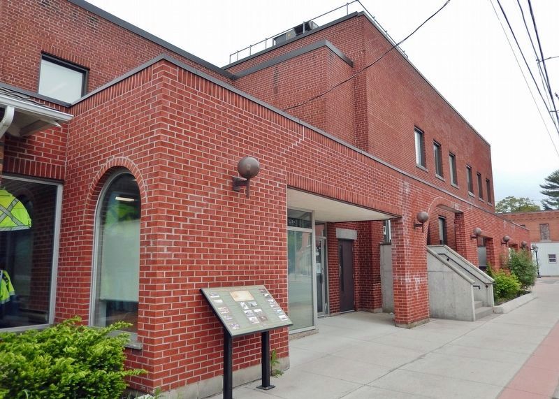
On Church Street West just east of Main Street of Delhi, on the right when traveling east.
The exact starting date of the Delhi Fire Brigade (later the Delhi Fire Department), is unclear, but in 1895, an 1860s hand drawn pumper was purchased at a cost of $200, including 200 feet/61m of hose. With the firemen taking turns, they would pump . . . — — Map (db m236474) HM
On James Street (Provincial Highway 3) at Argyle Avenue, on the right when traveling north on James Street.
Two distinct groups founded the German Home and continue to be part of the Hall. They are the Saxons and Swabians (Schwaben). Although their histories are separated by time, the resolve and courage of both groups are remarkably similar. In the . . . — — Map (db m236372) HM
On Main Street of Delhi just south of Church Street West, on the right when traveling north.
[photo captions] 1. Circa 1900, west side of Main Street, Ross Eitel, the butcher, with his delivery of meat, is leading a team of horses in front of the office of "The Delhi Reporter". The cash and carry grocery store of Sam and Charlie . . . — — Map (db m236968) HM
On Main Street of Delhi at Eagle Street, on the left when traveling north on Main Street of Delhi.
[photo captions] 1. Circa 1958, looking east, many of the stores built circa early 1950s. First store from left, Taggarts Ladies Wear (previously Coni's Photography). Second from left, Mayberry S. (Stewart) Shoes. Third from left, Liquor . . . — — Map (db m237200) HM
On Main Street of Delhi at King Street (Provincial Highway 3), on the right when traveling south on Main Street of Delhi.
Frederick Sovereign is credited to the founding of the hamlet of “Sovereign’s Corners” changed later to Fredericksburg in around 1828. The railway in 1880 referred to the first station as Delhi. [photo captions] 1. Post-dated 1910, . . . — — Map (db m243592) HM
On Main Street of Delhi just north of Eagle Street, on the left when traveling north.
Mission Statement "In a spirit of goodwill and understanding, the purpose of the Multicultural Heritage Association of Norfolk is to promote and encourage cultural awareness in the community. To this end, the Association organizes Heritage . . . — — Map (db m236551) HM
On Mill lane 0.1 kilometers south of Front Road, on the left when traveling south.
Normandale Blast Furnace
One of Upper Canada's most important industrial
enterprises, the Normandale ironworks and its blast furnace played a significant role in the early economic
development of the province. Built in . . . — — Map (db m234325) HM
On Old Hill Road 0.2 kilometers south of Front Road, on the left when traveling south.
As early as 1798, Lieutenant Governor Simcoe planned to fortify this point. By 1813 nothing had yet been done, and following Procter’s retreat from Amherstburg the British decided to construct a navy yard and covering fort here. . . . — — Map (db m258149) HM
On Harbour Street at St. Andrew Street, on the right when traveling north on Harbour Street.
“Midnight Herring”
(Rum-Running 1920-1933)
In 1919 the commercial fishermen of Lake Erie were experiencing one of their industry's cyclical downturns. On Jan. 1, 1920 the Volstead Act introduced prohibition across the United States and created . . . — — Map (db m236371) HM
On Main Street (County Highway 6) at Prospect Street, on the left when traveling east on Main Street.
On May 14, 1814, about 800 American regulars and militia under Lieutenant Colonel John Campbell disembarked nearby at the mouth of the Lynn River. The following day, meeting no opposition, they burnt the settlements of Dover and Ryerse’s Mills and . . . — — Map (db m198920) HM
On Brown Street 0.1 kilometers west of John Street, on the right when traveling west.
Near this spot, March 23rd,
1670, was erected a cross with
arms of France and inscription claiming sovereignty in
the name of King Louis XIV
over the Lake Erie region, as
shown in procès-verbal reproduced on this memorial
placed . . . — — Map (db m236355) HM
On Harbour Street south of St. George Street when traveling south.
This monument is dedicated to those commercial fishermen who have lost their lives on the lake. It will serve as a lasting memorial celebrating the heritage of our fishing ports and the unique and hazardous way of life of our fishermen. — — Map (db m236364) HM
On Donjon Boulevard at Somerset Drive, on the right when traveling west on Donjon Boulevard.
Here, 1669-1670, wintered Dollier and Galinée with seven other Frenchmen, the first Europeans
known to have ascended the
Great Lakes to Sault Ste. Marie.
The earthen mounds are the remains
of their hut, which was at . . . — — Map (db m236329) HM
On Harbour Street at St. Andrew Street, on the right when traveling north on Harbour Street.
Although vessels had come to the mouth of the Lynn River since the 1790s, there was no proper harbour here until the 1840s. At that time the mouth of the river was dredged and the first piers and lighthouse were built, This project was initiated . . . — — Map (db m236376) HM
On Harbour Street at St. Andrew Street, on the right when traveling north on Harbour Street.
The story of this 3-cylinder Kahlenberg engine intertwines three communities:
Port Dover, Ontario; Cellardyke, Scotland; Two Rivers, Wisconsin.
From 1912 to 1931, Scottish communities experienced an exodus of commercial fisherman, migrating . . . — — Map (db m236565) HM
On Harbour Street at St. Andrew Street, on the right when traveling north on Harbour Street.
With Peggy Scruton's aid, I located a working three cylinder Kahlenberg engine in Albion, Maine, U.S.A
When I explained to the owner, William Alexander, a Kahlenberg descendant, that I wished to display it as representing the transition to . . . — — Map (db m236566) HM
On Harbour Street 0.1 kilometers south of St. George Street, on the right when traveling south.
The first Port Dover lighthouse was a 7.3 metre (24 foot) high wooden structure built on the west pier at the mouth of the Lynn River in 1845 as a small harbour light for the active shipbuilding, square timber trade, inshore fishery and, later, . . . — — Map (db m236339) HM
On Main Street at Market Street East, on the right when traveling west on Main Street.
In 1835 Israel Wood Powell purchased land at the mouth of the Lynn River for the town site of Port Dover. A representative of Norfolk in the Canadian legislature (1841 - 1848), warden of Talbot District (1842) and reeve of Woodhouse Township . . . — — Map (db m236337) HM
The Capture of Detroit
To counter the American invasion of the Detroit frontier,
Major General Isaac Brock mustered a force of about 50
regulars and 250 militia here at Port Dover. They embarked
on 8 August 1812 and, proceeding . . . — — Map (db m237003) HM
On Harbour Street at St. Andrew Street, on the right when traveling north on Harbour Street.
For much of the twentieth century, Port Dover was the heart of Canada's freshwater fishing industry. The industry had already begun to grow by 1911 when William "Cap" Kolbe came from Eric, Pennsylvania to establish the town's first large scale . . . — — Map (db m236363) HM
On Main Street (Highway 6) just west of Clinton Street, on the right when traveling west.
The original name of the hotel was the Royal Exchange. The back section of the hotel dates back to 1812 and the front was built between 1835 and 1840. During the Wm. Lyon Mackenzie Rebellion of 1837, the hotel served as the headquarters for . . . — — Map (db m217671) HM
On Saint George Street just west of Harbour Street, on the left when traveling west.
Port Dover joined Canada’s railway boom in the late 1800s. The Port Dover & Lake Huron was the first train to enter the village in 1875. The Hamilton & Lake Erie Railway, completed in 1878, linked the harbour communities of Port Dover and Hamilton, . . . — — Map (db m236359) HM
On Walker Street just south of St. George Street when traveling south.
During the Roaring Twenties, dance halls grew in popularity. Port Dover's first pavilion was built by businessman Ben Ivey. The building extended over the lake and opened on Saturday, June 18, 1921, to the music of Charlie Cody and his Singing . . . — — Map (db m236340) HM
On Main Steet at Market Street East, on the right when traveling west on Main Steet.
During the War of 1812, Long Point Bay
provided a safe harbour for the vessels
of the British Provincial Marine, and
later the Royal Navy. Port Ryerse,
Turkey Point (Fort Norfolk) and the site
of present-day Port Dover were all
transfer . . . — — Map (db m236332) HM
On King Street South 0.2 kilometers south of Commercial Road, on the right when traveling south.
To Honour the Pioneers
who first braved the loneliness, privations and perils of the unknown wilderness of upper Canada, to create new homes in a strange land for themselves and their children: who cleared the forests, blazed the roads, . . . — — Map (db m263289) HM
On Main Street (County Highway 6) at Market Street East, on the right when traveling north on Main Street.
[World War I Memorial Plaque]1917 — 1919 In Memory of Port Dover and Woodhouse Boys who gave their lives in the Great War DT Abbot • Leonard Blake • Alfred L Blake • Walter Bradbury • Lea Boughner • Milton Cruise • William Faulkner • . . . — — Map (db m236342) WM
On Main Street (County Highway 6) at Park Street, on the right when traveling north on Main Street.
Major General Isaac Brock with 40 men of His Majesty’s 41st Regiment and 260 of the York, Lincoln, Oxford and Norfolk militia, set out from Port Dover on the 8th August, 1812, to relieve the invaded western frontier. His brilliant capture of . . . — — Map (db m199073) HM
On Front Road 0.1 kilometers south of Wolven Street, on the right when traveling east.
There are many excellent birding hotspots throughout Norfolk County. The Long Point area - which includes a UNESCO World Biosphere Reserve and a Ramsar Wetland of International Importance - is one of Canada's greatest birdwatching destinations. . . . — — Map (db m234316) HM
On Front Road at Dock Street, on the right when traveling east on Front Road.
During the 19th century, literally thousands of wooden schooners and steam-powered vessels plied the waters of Lake Erie. Dozens of these vessels were built within Long Point Bay and many were sailed by crews drawn from local ports. In the days . . . — — Map (db m234241) HM
On Front Road at Dock Street, on the right when traveling east on Front Road.
Long Point Bay
Looking across Long Point Bay
1) Long Point Lighthouse at the tip of the peninsula. First built in 1830, rebuilt in 1843 and 1916.
2) Bluff Point. Home of the Bluff Shooting and Fishing Club, established in 1919. . . . — — Map (db m234275) HM
On Front Road at Dock Street, on the right when traveling east on Front Road.
Long Point, a 40 km sand spit that projects into the deepest part of Lake Erie, was designated as an outstanding example of a Great Lakes coastal ecosystem by the United Nations Educational, Scientific and Cultural Organization in 1986 (UNESCO) . . . — — Map (db m234314) HM
On Erie Boulevard east of Long Point Road, on the right when traveling east.
Long Point Portage
This portage, which crossed the isthmus joining Long Point to the mainland, was used by travellers in small craft following the north shore of Lake Erie in order to avoid the open waters and the length of the . . . — — Map (db m251083) HM
On Front Road 0.1 kilometers south of Wolven Street, on the right when traveling west.
Port Rowan
Lake Erie Inner and Outer Long Point Bay
Commercial Fishermen and Punters
Our Oldest Heritage
In the early seventeen hundreds, this area was well noted for its abundance of waterfowl and fish. Punting and commercial . . . — — Map (db m234200) HM
On Front Road 0.1 kilometers west of Ellis Street, on the right when traveling west.
Lest We Forget
Dedicated to the memory
of the men of Port Rowan
and district who served
and died in -
World War I
1914 - 1918
World War II
1939 - 1945
Korean War
1950 - 1953
Merchant Marines 1939-45
(names not . . . — — Map (db m273213) WM
On Front Road at Wolven Street, on the left when traveling west on Front Road.
The first white settlers in this area arrived from New England in the 1790s and 25 years later Port Rowan townsite was surveyed on land owned by the Ellis and
Wolven families.
The town was named for Col. Sir William Rowan (1789-1879) . . . — — Map (db m234205) HM
On Front Road 0.1 kilometers west of Ellis Street, on the right when traveling west.
In November, 1854, the schooner "Conductor" was wrecked off this shore during one of Lake Eries many violent storms. Jeremiah Becker, who resided nearby, was away on the mainland but his courageous wife, Abigail, risked her life by repeatedly . . . — — Map (db m258749) HM
On Norfolk County Highway 59 South 0.4 kilometers north of 1st Concession Road, on the left when traveling north.
Long Point was known to traders and travellers before the area was purchased from the Mississauga Indians in 1784. In this unsurveyed area twenty to thirty "squatters" had settled by 1791, some of whom were allowed to remain following surveys and . . . — — Map (db m250982) HM
On King Street South 0.2 kilometers south of Commercial Road (County Road 57), on the right when traveling south.
A United Empire Loyalist, Ryerse was commissioned in the
4th New Jersey Volunteers during the American Revolution,
following which he took refuge in New Brunswick. In 1794
he came to Upper Canada, and the following year received
3,000 acres . . . — — Map (db m234354) HM
On King Street South 0.2 kilometers south of Commercial Road (Norfolk Road 57), on the right when traveling south.
This memorial commemorates the bicentennial of Port Ryerse
and its residents, past and present. The local shipping
industry was the foundation for the village and prospered
most during the mid - 1800's, exporting lumber and grain. The forged . . . — — Map (db m262411) HM
On Front Road 0.2 kilometers east of Chilian Road, on the right.
William Pope grew up in the lush countryside of southern England and studied painting at the Academy of Art, London. Reports of abundant wildlife drew the keen sportsman and naturalist to Upper Canada in 1834. After three extended . . . — — Map (db m284013) HM
Near Norfolk Street North (Highway 24) close to Union Street, on the right when traveling north.
Lieutenant-Governor Simcoe's visit to this locality in 1795 led to a grant to Aaron Culver, one of the districts earliest settlers, on condition of building mills. By 1812, a hamlet had formed near these mills, but they were burnt and adjacent . . . — — Map (db m217600) HM
On Lynn Park Drive just east of Norfolk Street North (Highway 24), on the left when traveling east.
This park ”Lynnwood” was presented to the people of Simcoe in the year 1902 by J. Lorne Campbell, (1857-1917) an illustrious citizen and ex-mayor of Simcoe The people of Simcoe request you to assist in the protection . . . — — Map (db m217601) HM
On Norfolk Street South (Highway 24) just north of St. John's Road East (Highway 3), on the right when traveling north.
[English] William Mercer Wilson was born in Scotland and immigrated to Upper Canada at the age of 19. He moved to Simcoe where he worked as a court clerk, lawyer, Crown attorney and finally judge for Norfolk County. During the . . . — — Map (db m217669) HM
On Colborne Street South at Peel Street, on the right when traveling south on Colborne Street South.
The original court-house was built on this site by 1842, and the gaol, designed by the prominent Toronto architect William Thomas, was constructed in 1848. Following a fire in 1863 which destroyed the court-house, the present structure was designed . . . — — Map (db m217592) HM
On Robinson Street just east of Talbot Street North, on the left when traveling east.
An Englishman, Frederick Hobson emigrated to Canada in 1904 after serving in the South African War. Hobson, who had been an employee of Canadian Canners, was one of the first to enlist in Simcoe for the First World War. He joined the 39th Regiment . . . — — Map (db m217588) HM
On Norfolk Street North (Highway 24) just north of Lynn Park Drive, on the right when traveling north.
This cairn commemorates the 100th Anniversary of the Town of Simcoe and is reverently dedicated to those pioneers who laid truly and well the foundations of this community. — — Map (db m217590) HM
On Lamport Street 0.1 kilometers south of Vittoria Road.
Architecturally, Christ Church is one of the most significant church buildings left in all of Canada. It was built in 1844 on the site of the original Court House of the London District, the church is special because, although built of wood, it . . . — — Map (db m258142) HM
On Lamport Street 0.1 kilometers south of Vittoria Road, on the left when traveling south.
In 1800 the London District was formed and justices of the peace possessing administrative and judicial powers were appointed for this area. In 1815 the courts, then held at Charlotteville (Turkey Point), were moved to the new judicial centre at . . . — — Map (db m258140) HM
On Old Brock Street at Lamport Street on Old Brock Street.
The American Revolution (1775-1783) was an armed conflict between England and thirteen of her North American colonies. People living there had to choose to either remain loyal to the British Crown, George III, or fight to create their own . . . — — Map (db m258165) HM
On Regional Road 24 0.5 kilometers west of Forestry Farm Road (Norfolk Road 16), on the right when traveling west.
Here, on 100 acres of wind-eroded sandy land, the Ontario government established Canada's first provincial forestry station. The father of reforestation in Ontario, Edmund John Zavitz, was born July 9, 1875, graduated from McMaster, Yale and the . . . — — Map (db m251099) HM
On Highway 24 West 0.5 kilometers west of Forestry Farm Road, on the right.
I grew from an acorn in 1723 along the bank of the Lynn River, when there were only native people in this region. Probably a friendly squirrel planted me. I was lucky those first few years: nobody stepped on me or ate me. I did have to fight for my . . . — — Map (db m262162) HM
On Main Street South at Alice Street, on the left when traveling north on Main Street South.
In 1797, Job Slaght and Paul Averill constructed the first grist-mill in Waterford on Nanticoke Creek. A pond formed and became the staging area for floating logs downstream to the sawmill.
The mill was an important community building and was used . . . — — Map (db m299818) HM
On Alice Street 0.1 kilometers west of St. James Street South, on the right when traveling west.
Looking west from this spot everything you see before you was once a busy railway yard. Multiple sets of tracks filled the entire area of this park and beyond to the west. Coal hoppers fueled the trains, engine boilers were filled and trains . . . — — Map (db m299707) HM
On Alice Street 0.2 kilometers west of St. James Street South, on the right when traveling west.
These are three of four vents which were located on the roof of the building located across the street. The vents were installed in 1918 when the building was purchased by Penman's Limited of Paris, Ontario, as a branch factory which produced . . . — — Map (db m299709) HM
On Alice Street 0.1 kilometers west of Wellington Street, on the right when traveling west.
Some 11,000 years ago the last of the great glaciers of the Ice Age retreated from this area. As the ice receded it left behind massive deposits of rock and sand that covered vast areas. Much of the rock left in this area was dolomite, pushed here . . . — — Map (db m299729) HM
Near L.E. & North Trail, on the right when traveling north.
Affectionately known as the Late, Early or Never, the Lake Erie and Northern Railway (LE&N) began operation in 1916. It provided freight and passenger service between Port Dover and Galt (now part of Cambridge) on a line 80 kilometres in length. At . . . — — Map (db m299822) HM
The place where you now stand was once a busy railway stop for passenger travel and commercial exchange of merchandise and cargo. Since the railway's establishment in the late 1800's to the removal of the tracks in early 1990's, these lands were . . . — — Map (db m299845) HM
In 1916 the Lake Erie & Northern Railway began offering passenger and freight service on a north-south route between Port Dover and Galt.
The Black Bridge was constructed to enable service on the line to move freely across the heavy east-west . . . — — Map (db m299841) HM
On Main Street South (Norfolk County Road 24) 0.1 kilometers south of Sylvia Street, on the right when traveling south.
Settlement of Townsend Township began in 1794 and within six years Paul Averill was operating saw and grist-mills
on Nanticoke Creek where it met an established trail. Here
grew a community, known successively as Sayles' Mills,
Sovereign's Mills, . . . — — Map (db m299681) HM