After Congress passed the Indian Removal Act, May 28, 1830, the Government forceably relocated about 60,000 Indians from the southeastern U.S. to what is now Oklahoma. This included the five (5) civilized tribes Cherokee, Chickasaw, Creek, Choctaw, . . . — — Map (db m97912) HM
The Hernando De Soto expedition is believed to have passed near Cadron en route to points west. Some researchers think the expedition crossed the Arkansas River
(River of Cayas) near what is now Dardanelle. — — Map (db m96641) HM
The blockhouse is a replica of a structure that was built on this site in the late 18th century. The building was a multiple use structure, but constructed originally for defense purposes. It was used as a trading post, as a residence, and as a . . . — — Map (db m96645) HM
Confederate forces used Cadron as a base in the war’s early years, and Union troops were here after taking Little Rock in September 1863. The site was valuable for the saw and grist mills nearby, the telegraph line that ran to Little Rock, and the . . . — — Map (db m96452) HM
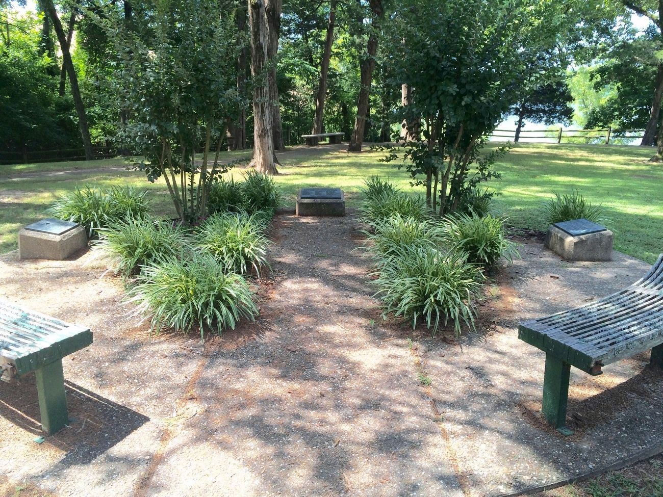
Following is a partial list of persons who died and were buried at Cadron. They perished from cholera while being relocated by the Army in 1834. Graves were marked with native stones with no inscriptions. Some of the Indians had adopted . . . — — Map (db m96643) HM
1861-65
Dedicated to the memory
of our Confederate soldiers
the bravest of the brave
Erected by
Robert E. Lee Chapter
No. 718, U.D.C.
Oct. 1925 — — Map (db m237103) WM
Shanksville, PA New York, NY Arlington, VAThe Conway Fire Department and the citizens of Conway with gratitude dedicate this memorial to the Firefighters, EMS Personnel and Police Officers who died trying to save lives and to the memory of . . . — — Map (db m305300) HM
The first court house in Faulkner County was erected in 1873 on this site, the town of Conway then being known as Conway Station, on the Little Rock and Ft. Smith Railroad. The county was named for “Sandy” Faulkner of “Arkansas Traveler” fame. — — Map (db m229576) HM
Faulkner County had divided loyalties during the Civil War. Soon after the war started, Col. A.R. Witt helped organize several companies for the 10th Arkansas Infantry (C.S.). After fighting at Shiloh, the 10th was captured at Port Hudson, La. . . . — — Map (db m119987) HM
In remembrance of those who made the ultimate sacrifice that we might be free
World War I
Alexander, Luther • Barr, Roscoe M. • Campbell, Theodore • Cartwright, Lester • Clark, Lee • Ford, John E. • Fulmer, William L. • Galyon, Daniel P. . . . — — Map (db m237072) WM
Lines Cemetery is the last visible remnant of early communities that existed in the vicinity of Gold Creek south of Conway in the late 19th century. Beginning in the 1870s, families moved into this sparsely populated district; the earliest . . . — — Map (db m290933) HM
Joseph W. Harris of New Hampshire, received appointment to the Military Academy at West Point at the age of 17 and graduated in 1825. He was assigned to accompany a group of 750 Cherokees aboard the steamboat Yeatman. They were forced to land at . . . — — Map (db m97914) HM
Named in honor of Simon’s Grocery & Bakery and the Simon family who owned and operated the store for over 52 years on Front Street. Brothers George and Fritz Simon, along with other family members and employees, helped make the store a special part . . . — — Map (db m237134) HM
In 1883 a bell was installed in the tower of the new three-story brick building at Altus, Arkansas, which housed Central Collegiate Institute (later Hendrix College). It is believed this is the bell which hung in the tower until the building burned . . . — — Map (db m237133) HM
Erected in memory of the soldiers of the Confederacy, who gave their lives for the cause at the Battle of Jenkins Ferry, April 30, 1864, Dedicated September 19, 1928, by the James F. Fagan and Jenkins Ferry Chapters of the United Daughters of the . . . — — Map (db m37303) WM
Confederate Headquarters
Confederate Gen. Edmund Kirby Smith led troops from Louisiana on a forced march to attack Gen. Frederick Steele’s Union army as it crossed the Saline River to retreat to Little Rock. He arrived here on April 29, . . . — — Map (db m121215) HM
General Samuel Rice
Samuel A. Rice, then Iowa’s attorney general, organized the 33rd Iowa Infantry Regiment in the summer of 1862 and was named its colonel. Stationed in Helena, Rice played a prominent role in the July 4, 1863 battle there . . . — — Map (db m121203) HM
Jenkins Ferry
In 1846, Thomas Jenkins paid the Saline County clerk $1 to register to “keep a ferry” and charge travelers to cross the Saline near the mouth of Cox’s Creek when the river was at flood stage. Gen. Frederick . . . — — Map (db m121204) HM
Officers Killed
Gen. J.G. Walker’s Texas Division made the final Confederate attack in the April 30, 1864, battle of Jenkins’ Ferry. Its three brigades, led by Gen. William Read Scurry, Gen. Thomas N. Waul and Col. Horace Randal, charged . . . — — Map (db m121207) HM
Tablet #1 Jenkins' Ferry State Park Act 10 of 1961 authorized this 37-acre state park as a commemorative site and recreation area. The park includes the ferry site where you are standing. The ferry was operated by the Jenkins' family . . . — — Map (db m37304) HM
Refugee Children
Many African Americans fleeing slavery were with Gen. Frederick Steele’s Union army as it retreated to Little Rock. As army wagons became stuck in the thick mud, so too did wagons with refugee children. Some were . . . — — Map (db m121183) HM
Front
Both Union and Confederate cavalry moved north of Jenkins’ Ferry on April 29, 1864. Lt. Col. Benjamin Elliott’s 1st Missouri Cavalry Battalion had been sent to Princeton on the 28th to seek Gen. Frederick Steele’s army as it . . . — — Map (db m121182) HM
2nd. Lt. George H. Davis
Dubuque. Ia. Pilot
2nd. Lt. Robt. V. Turchetto
Nutley, N. J. Co-Pilot
T/Sgt Peter K. Ikanovich
Bisbee, Ariz.
S/Sgt Arthur N. Potter
Sutton, Mass.
2nd Lt. Philip E. Niewolak
Dunkirk, N.Y., . . . — — Map (db m228715) HM WM
On March 12, 1943 a B-17 Flying Fortress exploded mid-air while trying to
land in the field on the West side of this road. The B-17 replica marks the site
where the Flying Fortress came to rest. Over the years the gray monument
marking the crash . . . — — Map (db m227739) HM WM
Grant County Casualties
World War 2
Sgt. Herman L. Caple · Sgt. Watson Kemp ·
Sgt. Garlin Stout ·
Sgt. Marvin Allen ·
Sgt. Thomas D. Littes ·
S/Sgt. J. C. Callison Jr. ·
Sgt. J. C. Crabb ·
S/Sgt. Jewel T. Davis ·
T/5 . . . — — Map (db m229494) WM
In memory of Union Soldiers who lie in unmarked graves at Jenkins Ferry battlefield Union Commander Major General Frederick Steele 4 Divisions 9 Brigades estimated casualties 700 — — Map (db m227590) WM
In memory of Confederate Soldiers who lie in unmarked graves at Jenkins Ferry Battlefield
Battle of Jenkins Ferry
Grant County Arkansas Confederate Commander General Edmund Kirby Smith
3 Divisions
7 Brigades
Estimated . . . — — Map (db m227588) WM
In 1828 the town of Oakland Grove was founded. By 1861 the name had been changed to Austin, according to a false local legend the once thriving town of over 30 residences was almost selected as the state capitol beginning in 1858 the town was a . . . — — Map (db m116644) HM
As the Civil War began, the Caroline Home Guard formed at Austin on June 29, 1861. The “Austin Rifles” became Co. I, 5th Arkansas Infantry, C.S.A. Both Union and Confederate troops camped at Austin during the war and Federal troops tore . . . — — Map (db m116330) HM
In 1807, citizens of Crystal Hill built a road to connect Cadron and Arkansas Post. From Cadron the road was built almost due east and continued until they reached the Wattensaw. At the Wattensaw swamps they found an Indian path that led south to . . . — — Map (db m116694) HM
Thousands of Arkansas and Texas Confederates were camped near this spot in 1862. The camp, named in honor of Brigadier General Allison Nelson, was stricken by disease resulting in 1,500 deaths including Nelson. The dead were buried among these hills . . . — — Map (db m211554) HM
WII
The inscribed names on this monument dedicated their services in defense of America 1941 -1945 and dedicated this park to the youth of North Lonoke County Day is done gone the sun from the valley from the mountain all is well safety rest . . . — — Map (db m212338) WM
On Aug. 24, 1864, Confederate Gen. J.O. Shelby and his men, wearing captured Union uniforms, attacked a series of forts protecting hay-cutting operations between modern-day Carlisle and Hazen. Confederate artillery blasted the forts held by the 54th . . . — — Map (db m96453) HM
In 1897 on the NW 1/4 Sect. 8 1N 7W Fuller planted the first rice on the Grand Prairie. The venture failed. Having learned about rice production in Louisiana, he returned for more information. In 1903 he returned to Lonoke County. The citizens of . . . — — Map (db m96636) HM
The 3-inch Ordnance Rifle was also known as the ordnance rifle, the ordnance gun, the Griffen gun, and was sometimes erroneously referred to as the Rodman rifle. The gun was invented by John Griffen, superintendent of the Safe Harbor Iron Works in . . . — — Map (db m65711) HM
On August 25, 1863 U.S. and Confederate Cavalry clashed near here. The initial battle involving approximately 7,000 men occurred east of the town. After a brief artillery duel, Col. Geiger's US troopers forced the retreat of Gen. Marmaduke's CS . . . — — Map (db m116458) HM
The Army Aviation Commission in 1917 accepted these 960 acres from Lonoke citizens to establish an aviators school. Approximately 2,500 enlisted men and officers were stationed here from 1918 to 1919. A thousand planes, sometimes known as "flying . . . — — Map (db m218159) HM
Hicks' Station, located on the Memphis & Little Rock Railroad between DeValls Bluff and Huntersville (N Little Rock), guarded the eastern approaches to the capital city. During the Little Rock Campaign, Confederate cavalry used it as a staging area . . . — — Map (db m72142) HM WM
This property
has been placed on the
National Register
of Historic Places
by the United States
Department of the Interior
Arkansas Historic Preservation Program
Department of Arkansas Heritage — — Map (db m282965) HM
West SideBelow an image of two crossed flags and the dates 1861-1865 In memory of our Confederate Soldiers North Side Erected by the T.C. Hindman Chapter U.D.C. Lonoke, Ark. East Side Lonoke County commends the . . . — — Map (db m65714) WM
World War I Honor Roll
Ray A. Martin • Walter M. Brawley • Clayton Stevenson • Joe Nelson • Jesse Brashears • Ross H. Robinson • Pat Petty • John Hall • Edward L. Dardenne • Jack Clayton • Charles C. Coulson • James H. Folks • Robert Dowdle • . . . — — Map (db m211571) WM
Joseph Taylor Robinson Home - 204 NE Front St. Practiced law in Lonoke - 1893-1912 U.S. Congressman - 1902-1913. Governor of Arkansas - January - March 1913. U.S. Senator - 1913-1937. Lonoke was named for lone oak tree, surveyor's landmark for . . . — — Map (db m65710) HM
Senator Joseph Taylor Robinson, Arkansas' outstanding statesman was born six miles northwest of this place in 1872. He lived in Lonoke and practiced law; was elected to Congress and served ten years; moved to Little Rock in 1912; served as Governor . . . — — Map (db m65713) HM
On the morning of August 25, 1863, at Bayou Two Prairie (east of where you are standing), Confederate Brigadier General John Marmaduke's troops skirmished with advance elements of Union forces under Brigadier General John Davidson. Marmaduke's . . . — — Map (db m116392) HM
The Lonoke Depot has been placed on the National Register of Historic Places by the United States Department of the Interior. Built in 1912, it was an important stop on Arkansas' oldest railroad, the Memphis to Little Rock line. The depot is a . . . — — Map (db m211575) HM
This site was the year-round home to tribal leaders and their families, and it was the capital city of a large population living throughout the surrounding area. Daily routines here were interrupted when the site was transformed into a busy capital . . . — — Map (db m213788) HM
Just as pottery, stone tool, mounds are critical for understanding the Plum Bayou culture, so too are plants.
Through specialized techniques archeologist recover and analyze plant remains from archeological sites like Toltec Mounds. One . . . — — Map (db m213797) HM
Long before domesticated maize and beans were introduced into the Southeast, Indians of Arkansas had begun tending and caring for native plants.
The archeological record of Arkansas demonstrates that by 3000 years ago, people's use of some . . . — — Map (db m213828) HM
Plants of the past rooted early people to this land. European farmers were not the first to cultivate plants
here on these lands. People were here long before who
survived, told stories about, and even celebrated these
humble resources around . . . — — Map (db m215880) HM
North of where you are standing, Union troops on September 10, 1863, constructed a wooden pontoon bridge across the Arkansas River allowing Union Brigadier General John W. Davidson's cavalry division to proceed to Little Rock. Major General . . . — — Map (db m116523) HM
As Gen. John Davidson saw flames erupting from the only bridge across Bayou Meto, he ordered Lt. Col. Daniel Anderson to take his First Iowa Cavalry Regiment and save the bridge, if possible. Anderson and his men thundered down the Memphis to . . . — — Map (db m116543) HM
Missouri, a border state, never seceded from the Union but her people were nevertheless divided and tens of thousands of Missourians wore both blue and gray between 1861 and 1865. Missouri is credited with supplying 109,111 men to Union forces, of . . . — — Map (db m117264) HM
Bayou Meto, "a steep-banked and miry stream," provided a natural barrier and defensive position for the Confederates on August 27, 1863. The primary means of crossing the bayou was Reed's Bridge on the Memphis to Little Rock Road. As the . . . — — Map (db m116538) HM
You are standing near where Battery K
Second Missouri Light Artillery under
Lieutenant T.S. Clarkson, Battery M,
Second Missouri Light Artillery under
Captain Gustave Stange and the Twenty-Fifth
Ohio Battery under Captain Julius L. . . . — — Map (db m197285) HM
The first action of the Battle of Reed's Bridge occurred east
of where you are standing when 125 Missouri Confederates
opened fire on Brigadier General John Wynn Davidson's
Union cavalry division at about 11 a.m. on August 27, 1863.
The . . . — — Map (db m116603) HM
Well to the east of Reed's Bridge, a shallow ford offered the best crossing of Bayou Meto, and the best position from which Union attackers could roll up the Confederate lines and open the road to Little Rock.
As a squadron of the First Iowa . . . — — Map (db m211550) HM
Looking northwest fifty yards to your left, the old military road crossed Bayou Meto over Reed's Bridge. Confederate troops fell back to this location from the August 25, 1863, Brownsville skirmish to establish a strong position to stop the Union . . . — — Map (db m116516) HM
As Reed's Bridge burned and Confederate artillery broke up
the charge of the First Iowa Cavalry Regiment, Union artillery
opened fire on Brigadier General John S. Marmaduke at his
position near Lt. Charlie Bell's "little teaser" prairie gun. . . . — — Map (db m116569) HM
More than 100 different bomb parts were made in Jacksonville at the AOP during World War II (1941 - 1945). There were entrances to the 6,950 acre AOP. Shacks like this housed guards to monitor persons entering and leaving the AOP. This Guard Shack . . . — — Map (db m183214) HM
On August 27, 1863 the Federal army was advancing along the Military Road toward Little Rock when its Cavalry Division of 6,000 men under Gen. John W. Davidson attempted a crossing here and was met by a Confederate force of 4,000 under Gen. John S. . . . — — Map (db m116508) HM
In 1845 the Russell Beall family donated land for Bayou Meto Cemetery. Soon afterward a two story log building was erected in a grove of oaks. Known as Bayou Meto Chapel, the structure served as church, public school and meeting place for Jacinto . . . — — Map (db m116645) HM
The 4th Arkansas Infantry Battalion (C.S.) enlisted at Little Rock on Nov. 10, 1861. It included Capt. T.F. Murff’s Co. A, the ‘Bayou Metre Hornets,’ which had received a flag at an Oct. 18 barbecue at modern-day Jacksonville. The regiment fought at . . . — — Map (db m116350) HM
(Continued from other side)
William Thomas Graham
John Robert Hall
Newton Fredrick Harpole
Martin Christian Herman
Alfred W. Johnson
John Thomas Lucas
George H. McCain
Ben McHenry
Lewellyn McHenry
M. J. McHenry
James S. Merritt . . . — — Map (db m205821) HM
Following their defeat at the July 4, 1863, Battle of Helena, Confederate Gen. Sterling Price’s infantry division fell back to Des Arc and Searcy. Price assumed command of the Confederate army in Arkansas on July 23 and Gen. James Fagan took over . . . — — Map (db m116472) HM
Although earlier schools existed, this first permanent Jacksonville school site was donated town founder Nicholas W. Jackson in 1880 to the Jacksonville Academy Association By 1881, all eight grades were taught here in a one room log building. The . . . — — Map (db m183540) HM
The 32nd Governor of the State of Arkansas (Dem. 1941 - 34) was born near Jacksonville on October 15, 1890 in the community of Piedmont, spent his childhood here and attended Bayou Metro public School. Gov. Adkins was largely responsible for . . . — — Map (db m183524) HM
Coming of the railroad led to the naming of Jacksonville in 1870 for Nicholas W. "Nick" Jackson (1832 - 1916), a land owner and mule owner who donated the depot site to the Old Cairo & Fulton Railroad with the provision that the new station be named . . . — — Map (db m183518) HM
Following the Aug. 27, 1863, battle at Bayou Meto, Confederate Gen. John Marmaduke asked to be removed from under Gen. Lucius M. Walker’s command. The two generals were at odds over actions at Helena and Brownsville earlier in 1863. Marmaduke’s . . . — — Map (db m116265) HM
Not all soldiers wear uniforms and carry rifles. Those civilian workers who went into the Titan II Missile complex near Searcy August 9, 1965, were dressed in work clothes, wore hard hats, carried hammers and paint brushes, but who's to say they . . . — — Map (db m184023) HM
Construction of this earliest road connecting Memphis with Little Rock began in 1826 under the supervision of Lt. Frederick L. Griffith, U.S. Army. It was completed in 1828 under Lt. Charles Thomas. Miles of swamps and numerous streams made the road . . . — — Map (db m116509) HM
Revolutionary War soldiers and brothers, Shared fought for North Carolina and Jacob fought for both North and South Carolina. In the winter of 1820-1821 they brought their families here from Williamson County, Tennessee and settled near this site. — — Map (db m116507) HM
After the Confederate defeat at Helena, Arkansas, and the surrender of Vicksburg, Mississippi, on July 4, 1863 U.S. leaders dedcided to capture Little Rock, placing another Confederate state capital under Union control.
Bridg. Gen. John Wayne . . . — — Map (db m204641) HM
One of the largest public works projects to take place in territorial Arkansas was construction of the Memphis to Little Rock Road, an ambitious effort to allow travelers to cross the dense swamps and Grand Prairie of east Arkansas to reach the . . . — — Map (db m116571) HM
"The route which the Choctaws and Chickasaws will
travel, in emigrating to their new homes, is not yet, we
believe, fully determined on; but it is quite probable
that a large proportion of them will cross the Mississippi
at Helena, and White . . . — — Map (db m116572) HM
"Long time we travel on way to new land.... Womens
cry.... Children cry and men cry...but they say nothing
and just put heads down and keep on go towards
West. Many days pass and people die very much."
-Recollection of a . . . — — Map (db m116602) HM
Tom Cory came to Jacksonville in 1968 and along with Paul Ramm and Brad Blakeway, formed Arkansas precast corporation.
His hard work and leadership helped enable their company to prosper and to employ over 100 people, precast concrete from . . . — — Map (db m183543) HM
From Predators to Patrons
This historic Works Progress Administration (WPA) building
constructed in 1934 once housed majestic big cats,
including lions, tigers, and jaguars. Though these animals
have moved to modern habitats better suited . . . — — Map (db m288195) HM
Near this spot stood the substantial brick home of Alexander George (1812-1877), a wealthy German immigrant active in Little Rock's business, civic, social and political circles. Built during the 1858 to 1859 period, the George House with its . . . — — Map (db m121455) HM
Arkansas seceded from the Union on May 6, 1861. Over the next four years more than 60,000 Arkansans fought in the Confederate service while 15,000 others fought for the Union cause. More than 770 military actions occurred in Arkansas during . . . — — Map (db m117086) HM
Constructed in 1899, the Choctaw Route Station served as a passenger depot for the Choctaw, Oklahoma and Gulf Railroad Company, before becoming the property of the Rock Island Railroad in 1902.
The station served as a major passenger terminal on . . . — — Map (db m121451) HM
1898-Choctaw, Oklahoma & Gulf Railrod (CO&G) entered the Little Rock market by leasing (and later buying) the Little Rock & Memphis Railroad.
1899-CO&G built the Choctaw Station and the railroad bridge over the Arkansas River at . . . — — Map (db m208851) HM
Frank Moore, a WWI veteran buried at Little Rock National Cemetery in 1932, moved to Phillips County, Arkansas, after being honorably discharged in December of 1918 from service as a private in the 162nd Depot Brigade, There he worked on a farm and . . . — — Map (db m210364) HM
In memory of all who served on the Island of Oahu Territory of Hawaii 7 Dec. 1941 during the attack by Japan. Placed by Pearl Harbor Survivors 7 Dec. 1993. — — Map (db m180276) WM
In the early days of Little Rock, the Arkansas River
was the lifeblood of the community. The Little Rock
extended out into the river, pulling the current around
it to form a natural landing basin for boats. The earliest
ferry across the . . . — — Map (db m116539) HM
Dedicated to the men and women of Arkansas who gave their lives in the Great Wars, 1917-1918 and 1941-1945.
Ben Laney, Governor
C.G. Hall, Sec. of State
Stadium Commission
Ed Keith, Chairman
Gordon H. Campbell, Sec.
Maurine . . . — — Map (db m208840) WM
La Petite Roche ("the Little Rock") refers to the
rock outcropping on the Arkansas River used as a
navigation point during the early exploration of what
would become the state of Arkansas. Sometimes called
the Point of Rocks, it is the first . . . — — Map (db m116556) HM
HISTORY
Built in the 1920s and first exhibited at the 1924 Arkansas State Fair, it is
believed to be the last operating "over-the-jumps” carousel in the world, with
an original undulating wooden platform mounted on a 1960s-vintage
caterpillar . . . — — Map (db m212071) HM
During the nineteenth century, waves of German-speaking immigrants settled in Pulaski County. Establishing themselves here as early as 1833, these families had a significant impact on the development of the area through their work as farmers, . . . — — Map (db m220389) HM
Ferries: Early ferry services were established as a ford on the
Southwest Trail at "the point of rocks" between 1812 and 1819.
Eventually, there were ferries in at least three locations serving
the city, one just above the Old State House, . . . — — Map (db m117432) HM
Post-Civil War, railroads became vital to the Arkansas
economy. Point of Rocks was a natural support for
a railroad bridge on the river. In October 1872,
construction began at the Little Rock with several
tons of rock removed from the . . . — — Map (db m116541) HM
275 entries matched your criteria. The first 100 are listed above. Next 100 ⊳