On John Cochran Drive at Guy Park Drive, on the right when traveling north on John Cochran Drive.
(front:)
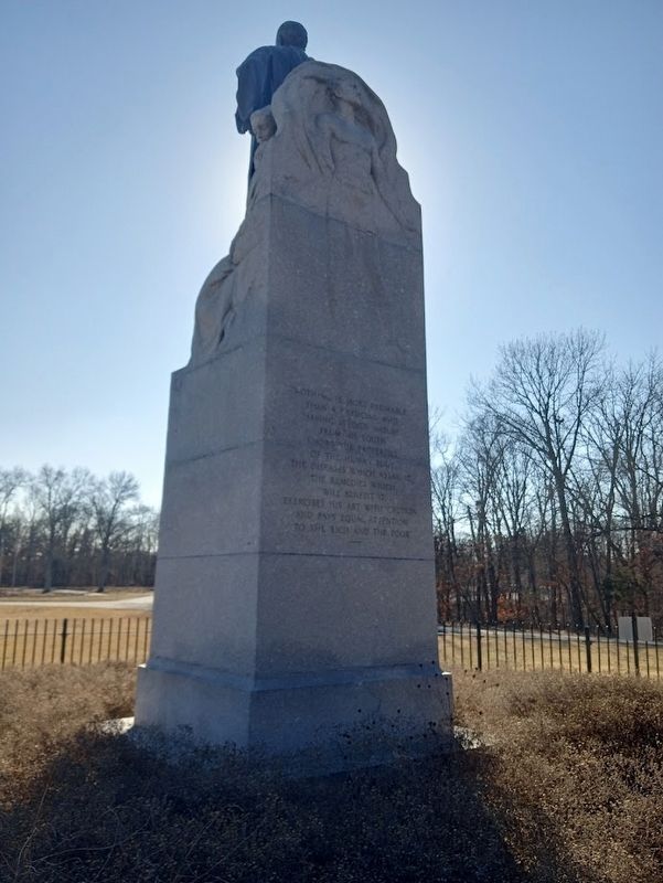
Dedicated to the memory of a great surgeon and humanitarian
"He that careth for the sick and the wounded watcheth not alone. There are three in the darkness together and the third is the Lord"
(reverse:) . . . — — Map (db m241244) HM
On Main Street (State Highway 269) near 3rd Street, on the right when traveling south.
The Independent Order of Odd Fellows building was built during the period of optimism and growth in Stevensville.
The IOOF Hall played a significant humanitarian and social roll in the community.
The upper level was . . . — — Map (db m123390) HM
On East Water Street, on the right when traveling east.
After the Toms River Blockhouse fight, British sailors and soldiers hunted for Captain Joshua Huddy who had escaped into the surrounding area. The Associated Loyalists, a unit organized by the former Tory Governor of New Jersey, William Franklin . . . — — Map (db m139169) HM
On Third Avenue just north of Willis Avenue, on the right when traveling north.
Dedicated to Puerto Rican humanitarian and Hall of Fame baseball player, Roberto Clemente, this sculpture pays homage to Roberto's humble beginnings, outstanding athleticism and philanthropic spirit.
Dedicada al jugador . . . — — Map (db m241501) HM
On Thompson Park east of Thompson Blvd., on the right when traveling east.
The September 11, 2001 attacks led our Nation to respond. Soldiers from the 10th Mountain Division were immediately ordered to secure key sites within the United States. In October 2001, 10th Mountain Soldiers deployed as the initial conventional . . . — — Map (db m179341) HM
On New York State Route 23 at Pegg Road, on the left when traveling east on State Route 23.
Baronet, humanitarian, noted
doctor, from Sapperton, Eng.
Introduced vaccination in
America in Philadelphia in
1799. Died, Morris, Mar. 1857 — — Map (db m144271) HM
On South Sandusky Street (Ohio Route 4), on the right when traveling north.
Side A Runaway slaves used a web of routes through Crawford County, most going through the city of Bucyrus. Present-day State Route 98 to State Route 4, laid out in 1822 from Norton in northern Delaware County through Bucyrus to Sandusky in . . . — — Map (db m107079) HM
On South Henry Street, 0.2 miles north of Wilmer Street, on the right when traveling north.
• Athlete, teacher, coach, lawyer, baseball legend, and humanitarian
• Credited with breaking the color barrier in Major League Baseball by signing Jackie Robinson
• Responsible for the formation of the All-American Women's Baseball League . . . — — Map (db m203330) HM
On East Shoreline Drive, on the left when traveling east.
Marker Front: The Underground Railroad was neither underground nor a railroad, but a system of loosely connected safe havens where those escaping the brutal conditions of slavery were sheltered, fed, clothed, nursed, concealed, disguised, and . . . — — Map (db m241233) HM
On Fred Taylor Drive, on the right when traveling north.
James Cleveland (Jesse) Owens, 1913-1980, Ohio State University Track and Field Star, Olympic Champion, Ambassador of Sports, Humanitarian, Friend of Youth.
Jesse Owens' incomparable achievements as an Ohio State and Olympic athlete are . . . — — Map (db m12773) HM
Alum Creek & The Underground Railroad
The fifty-eight miles of Alum Creek run north to south originating in Morrow County and continues through Delaware County into Franklin County, where it empties into the Big Walnut Creek, draining into . . . — — Map (db m103301) HM
On North Superior Street north of Chestnut Street, on the left when traveling south.
Judge Paul William Alexander
8 December 1888 - 29 June 1967
Judge Paul William Alexander founded Y's Men International in Toledo in 1922. He was a family court judge, a leader of the YMCA, and a humanitarian. He strived to make the world . . . — — Map (db m217107) HM
On Columbus-Sandusky Pike (Ohio Route 4) at Scottwood Road (County Route 9), on the right when traveling south on Columbus-Sandusky Pike.
The Underground Railroat. The Underground Railroad was neither underground nor a railroad, but a system of loosely connected safe havens where those escaping the brutal conditions of slavery were sheltered, fed, clothed, nursed, concealed, . . . — — Map (db m221322) HM
On Tuscarawas Street West east of Cleveland Avenue Southwest, on the right when traveling east.
When William McKinley returned to Canton after serving in the Civil War, he joined the First Methodist Church and became very active. He was a member of the Board of Trustees, served as a Sunday School teacher, and a Sunday School superintendent. . . . — — Map (db m204185) HM
Near Route 2025, 0.3 miles west of Cochrans Mills.
May 5, 1867 - Jan. 27, 1922
Journalist and Humanitarian
In 1889 she traveled around the world in 72 days, 6 hours and 11 minutes, establishing a world record. Elected to Penna. Newspaper Hall of Fame in 1972.
Born at Cochrans Mills . . . — — Map (db m79284) HM
On Birch Street west of South Fraley Street, on the right when traveling west.
Welcome to Kane, Pennsylvania
Nestled in the heart of the Allegheny National Forest, Kane is known as the Black Cherry Capital of the World for the exceptional veneer milled from local trees and crafted into fine furniture and cabinets. In . . . — — Map (db m179061) HM
(Inscription under the statue) Rhode Island National Guard
(Left Panel) Army National Guard-Since 1638-The Rhode Island Army National Guard was formed as a State Militia for the protection of the people. It always answers the call to arms when . . . — — Map (db m66428) WM
On Washington Street (State Highway 203) at Clarence E. Pressley Place on Washington Street.
In Memory of
Clarence E. Pressley
A Son of Abbeville, South Carolina
Businessman - Humanitarian - Leader
Friend - Mentor - Family Protector — — Map (db m25197) HM
On Washington Street at Zion Street, on the right when traveling east on Washington Street.
Born in this house on May 24, 1825, the son of William and Mary Ann Carlisle, this noted teacher received his education at Mount Zion Institute and South Carolina College. A delegate in 1860 to the Secession Convention and a legislator in 1864, his . . . — — Map (db m14323) HM
Named in Honor of
Alester Garden Furman, Jr.
Humanitarian, Master Planner, Friend of Youth, Champion of Education, Guiding Light in Building the New South.
This administration building is named to honor Mr. Furman in grateful . . . — — Map (db m123600) HM
Near Cedar Street, 0.1 miles south of Church Street, on the right when traveling south.
House built in 1888 by Nathan G. Brandon
W.D. Sykes became the 4th owner in 1919. He was a successful businessman during the Depression years, a staunch Democrat who entertained Governor Austin Peay, U.S. Secretary of State Cordell Hull and . . . — — Map (db m155824) HM
On Oak Lawn Avenue, on the right when traveling east.
The effort for pediatric orthopedic care in Dallas began when the Shriners (Ancient Arabic Order of the Nobles of the Mystic Shrine) organized a board with the idea of creating a system of charity hospitals across the U.S. Samuel P. Cochran, . . . — — Map (db m149047) HM
On 22nd Street at Sealy Avenue, on the left when traveling south on 22nd Street.
By the late 1800's, thousands of Jews began fleeing their homes in Russia and Eastern Europe to escape anti-Semitic policies and violent pogroms. Many immigrated to the U.S., establishing communities in New York City and elsewhere along the East . . . — — Map (db m201962) HM
Born in Cleveland, Ohio, on December 8, 1906, Sidney Wolf spent his childhood developing his skills as a pianist. In high school, he conceived the idea of using his musical talent to enhance a career as a rabbi. He studied music at the Cincinnati . . . — — Map (db m182913) HM
Near Seventh Street near West Green Avenue, on the right when traveling north.
The Orange, Texas USA Rotary Club was admitted to Rotary International on 1 June 1919. Its first President was H.J.L. Stark. Mr. Stark, together with other influential members of the City of Orange, believed that the community would benefit from . . . — — Map (db m116336) HM
The world's first service club, the Rotary Club of Chicago, Illinois, USA, was formed on 23 February 1905 by Paul P. Harris, an attorney who wished to recapture in a professional club the same friendly spirit he had felt in the small towns of his . . . — — Map (db m116335) HM
On US Marine Memorial Circle north of North Marshall Drive.
Since World War II, the Marine Corps and the US Navy have performed countless humanitarian missions.
Perhaps General James Mattis said it best in 2003: "we will treat all others with decency, demonstrating chivalry and soldierly compassion . . . — — Map (db m129461)
Near Fort Hunt Park Loop, on the left when traveling west.
The United States engaged in World War II (WWII) at home and on foreign soil. With formal entry of the United States into WWII, the Military Intelligence Service (MIS) began two top-secret programs, known as MIS-Y and MIS-X, at Fort Hunt. Under the . . . — — Map (db m41161) HM
On Leigh Street (County Route 33) at Adams Street, on the left when traveling east on Leigh Street.
December 14, 1878 – November 25, 1949.
Dancer •
Actor •
Humanitarian
Native Son of Richmond ———
Internationally famous actor and dancer rendered many kindnesses to the citizens of Richmond. — — Map (db m1915) HM
Marie Schmolka was the only Czechoslovak representative at the Evian conference of July 1938, which focused on the Jewish refugee crisis. After the Munich agreement of September 1938, together with Doreen Warriner, she organised the . . . — — Map (db m188406) HM
On 2nd Avenue North west of 5th Avenue South, on the right when traveling west.
Constructed by the Western Pipe and Steel Company of San Francisco. the Bayfield-class attack transport ship was launched on December 29, 1942, as the SS Sea Needle. The vessel was retrofitted at the Brooklyn Naval Shipyard in New York for . . . — — Map (db m224688) HM
On Painter Avenue at Owens Street, on the right when traveling south on Painter Avenue.
Member of the United State Congress 1944-1971
Dedicated Family Man and Humanitarian
Loyal Alabamian
Outstanding District Attorney
Vigilant Legislator
Supporter of State's Rights
Conserver of Nation's Resources
Ardent Advocate of . . . — — Map (db m184478) HM
On Shoffner Street (County Road 22) at Snowden Street, on the right when traveling west on Shoffner Street.
Dr. J. M. Shofner (1863-1926) founder, dedicated his life to - "Give the boys and girls a chance."
Mr. Elisha Downing - Humanitarian.
First building erected named in
honor of Mrs. Esther Downing.
Trustees-1906: J. M. Shofner,
D. . . . — — Map (db m84374) HM
On Northwest 278 Avenue (County Road NW 241) at NW 278 Avenue, on the right when traveling south on Northwest 278 Avenue.
Bland Community and Ogden School
Settled in the 1840s by cotton planters from Georgia and South Carolina, Bland became a diverse agrarian area where farmers and sharecroppers raised cattle and grew cotton and a variety of fruits and . . . — — Map (db m64715) HM
Violence in Somalia was precipitated by a series of civil war, famine, and disease which cost the lives of an estimated 350,000 people. In December 1992, US troops were sent to help contain the lawlessness in Somalia and create a safe . . . — — Map (db m99782) HM
On Main Street at Pennsylvania Avenue, on the left when traveling south on Main Street.
Joseph J. "Joe" Herrmann
Lucius Herrmann, a baker, who emigrated from Germany in 1900, married Helen Veronica McSweeney in Ohio in 1911. They settled in San Antonio, Florida, in 1925. In 1935, their son, Joe Herrmann, married Rose, the . . . — — Map (db m136017) HM
On E.E. Butler Parkway (U.S. 129) at Myrtle Street (Georgia Route 11 Conn), on the right when traveling north on E.E. Butler Parkway.
This marker and plaza proudly acknowledges the significant contributions of John William Morrow, Jr., and countless citizens for the betterment of this community.
Born in 1918 in Hall County, John W. Morrow, Jr., graduated Booker T. Washington . . . — — Map (db m25993) HM
On Veterans Honor Parkway at Trestle Road, on the right when traveling north on Veterans Honor Parkway.
January 8, 1987 to March 18, 2013
Aaron Ripperda was born to Kent and Tina Ripperda. Kind, rambunctious and enthusiastic, he could easily make his sister Kendall laugh. Aaron added those in need early in his school life, shaping his . . . — — Map (db m187777) HM WM
On Lafayette Street at North Gilbert Street, on the right when traveling west on Lafayette Street.
(Left marker): These building stones were preserved from the Danville Law Office of Abraham Lincoln and the Vermilion County Courthouse where he practiced law.
This kettle was used from 1824 to 1831 at the Salt Works of Major Vance. The . . . — — Map (db m4747) HM
On West Michigan Street west of Barnhill Drive, on the right when traveling east.
Serologist, researcher, humanitarian, he was given the name "Indiana's Mazzini" by Dr. Thurman B. Rice, Indiana State Board of Health Commissioner during World War II, for hid development of an inexpensive rapid sensitive and dependable slide . . . — — Map (db m132755) HM
On E. Washington Street (State Road 32) at S. East Street, on the right when traveling east on E. Washington Street.
(Side One)
When this meeting house was dedicated 1898, membership in Quarterly Meeting of Friends at Winchester was largest in the world. Migration of the Religious Society of Friends (Quakers) into this area began 1814 with the arrival . . . — — Map (db m69283) HM
Near Robert D. Ray Drive at E. Center Street, on the right when traveling south.
The Robert D. Ray Asian Garden not only highlights the importance of diversity in our community and acknowledges the contributions that Asian Americans have made to Iowa, but also serves as a lasting monument honoring Governor Ray's visionary . . . — — Map (db m237927) HM
On Danville Road (U.S. 27) at Hall Road, on the right when traveling south on Danville Road.
(obverse)
Camp Nelson Refugee Camp
Established in 1863 to house families of African American soldiers, Camp Nelson became the chief center issuing emancipation papers to former slaves. Army's withdrawal from camp in 1866 exposed . . . — — Map (db m70629) HM
On Brooke Road west of Chandlee Mill Road, on the right when traveling west.
Teacher, activist, historian, author, lecturer, humanitarian, and model.
The granddaughter of enslaved people that reached the pinnacle for achievement in heritage education; chronicler of the history of black public schools and churches in . . . — — Map (db m197809) HM
Near Pearl Street Northwest at Scribner Avenue Northwest, on the right when traveling west.
Elizabeth Anne "Betty" Bloomer was born in Chicago and raised in Grand Rapids. She became an accomplished dancer and was fashion coordinator for Herpolsheimer's Department Store. On October 15, 1948, she married Gerald R. Ford. Together they had . . . — — Map (db m176431) HM
On North Indiana Avenue just south of Huron Avenue, on the right when traveling north. Reported unreadable.
Negro League 1906 - 1932
He was the finest Shortstop in Atlantic City Negro Baseball
Baseball Hall of Fame 1977
He [unreadable] the dignity of the game and helped advance the opportunities of African Americans in the Major Leagues . . . — — Map (db m208343) HM
Near Clinton Street west of South Delaware Avenue, on the right when traveling west.
"I think the greatest thing about America is the American Dream."
- Wyclef Jean
Born: October 17, 1969
Lived in: Newark, New Jersey
Inducted to New Jersey Hall of Fame: 2016
On Frederick Douglass Boulevard at West 122nd Street on Frederick Douglass Boulevard.
This larger-than-life bronze sculpture depicts abolitionist organizer and Underground Railroad leader Harriet Tubman (c. 1822-1913), and stands at the crossroads of St. Nicholas Avenue, West 122nd Street and Frederick Douglass Boulevard in Harlem. . . . — — Map (db m105284) HM
On West Forest Hills Boulevard north of Westwood Drive, on the right when traveling north.
Mother, activist, politician, and philanthropist, Mary was the granddaughter of Benjamin N. Duke and the great-granddaughter of Washington Duke.
In 1951, Mary Semans was the first woman elected to the Durham City Council, and she served as . . . — — Map (db m232514) HM
On East Main Street (U.S. 40) at Rosemore Avenue, on the right when traveling east on East Main Street.
The Underground Railroad (UGRR) was neither underground nor a railroad, but a system of loosely connected safe havens where those escaping the brutal conditions of slavery were sheltered, fed, clothed, nursed, concealed, disguised, and instructed . . . — — Map (db m189451) HM
Near Ohio Route 4, 0.3 miles south of Ohio Route 113, on the right when traveling south.
The Underground Railroad In Lyme Township, Huron County
Historic Lyme Village is helping to preserve some of the local history related to the Underground Railroad. The Seymour House, which is now located in this recreated village, was one . . . — — Map (db m204760) HM
On Court Street at Mound Street, on the left when traveling south on Court Street.
The Underground Railroad
The Underground Railroad was neither underground nor a railroad, but a system of loosely connected safe havens where those escaping the brutal conditions of slavery were sheltered, fed, clothed, nursed, concealed, . . . — — Map (db m21994) HM
On East Grand Avenue at South 5th Street, on the left when traveling west on East Grand Avenue.
Pioneer Oil Developer
Philanthropist & Humanitarian
Leader in Developing the Economy
Culture and Beauty of Ponca City
Donor of Pioneer Woman Statue
Governor of Oklahoma
United States Congressman — — Map (db m55712) HM
On N. Front Street at Locust Street, on the right when traveling south on N. Front Street.
The origins of the mansion at 105 N. Front Street can be attributed to William Calder, Jr. (1821-1880), Simon Cameron's business partner, banker and manufacturer. Calder's father had been a preeminent Harrisburg stage coach operator and helped to . . . — — Map (db m6341) HM
Near Arch Street, on the left when traveling west.
Father of American Psychiatry
Signer of the Declaration of Independence
Heroic Physician, Teacher, Humanitarian
Physician General of the Continental Army
Physician to the Pennsylvania Hospital
Professor of Physic, University of . . . — — Map (db m106480) HM
On Cranston Street at Dodge Street, on the right when traveling east on Cranston Street.
First tabernacle
1905
This edifice erected 1965
by
Rabbi Levi S. Plummer
Renaissance man - Humanitarian - Spiritual guide
Builder — — Map (db m223073) HM
On County Road 182, on the left when traveling north.
President and Treasurer of the
Piedmont Manufacturing Company
President 1905-1923
Director 1896-1935
Industralist • Humanitarian • Friendly
Just — — Map (db m40137) HM
Operation Iraqi Freedom (OIF) is the official name of the War in Iraq under the umbrella of the Global War on Terrorism in March 2003, the president of the United States authorized the mission to rid Iraq of the tyrannical dictator Saddam Hussein . . . — — Map (db m207178) HM
On Taylor Street north of 3rd Street/East Martin Street, on the left when traveling north.
The three-story limestone Maverick-Carter house was constructed on the north side of San Antonio’s central business district in 1893 for real estate developer William Harvey Maverick, son of Texas Declaration of Independence signer Samuel Augustus . . . — — Map (db m235155) HM
On Warren Avenue just north of Atlanta Street, on the right when traveling north.
Juanita Jewel (Shanks) Craft (1902-1985) was born in Round Rock and attended schools there and in Austin before earning certificates from Prairie View and Samuel Huston Colleges. She joined the Dallas Branch of the National Association for the . . . — — Map (db m156223) HM
Near Fannin Monument Road east of S. Jefferson Street (U.S. 183/77), on the left when traveling east.
Amid the cruelties of the Texas War for Independence, one notable woman committed acts of bravery and compassion. Francisca Alavez (also known by similar names) accompanied Mexican Army Captain Telesforo Alavez to Texas in March 1836. In seven . . . — — Map (db m36263) HM
On South Main Street at Route 66, on the right when traveling north on South Main Street.
Oldham County's first physician. A civic leader, weather researcher and humanitarian. Born in Kansas, he attended medical school in Missouri, and in 1907 moved to Vega with his wife, Lulu Mills Loyd.
Despite opposition from ranchers, he . . . — — Map (db m91756) HM
On U.S. 83, 9.7 miles north of U.S. 57, on the left when traveling north.
In the 16th century, northern Mexico was torn by strife as the Indian inhabitants resisted Spanish efforts to enslave them. A century later, wealthy humanitarian Antonio Balcarcel set out to invoke justice and help missionaries Christianize the . . . — — Map (db m111419) HM
On Arlington Cemetery south of Wilson Avenue, on the right when traveling north.
This Amelanchier tree was planted by
No Greater Love,
a humanitarian organization,
to honor POWs-MIAs of all wars
we will never forget you
April 9, 1983 — — Map (db m137209) WM
On Leahy Drive east of Eisenhower Drive, on the right when traveling east.
This living memorial is dedicated to the brave men and women of the United States Armed Forces who have perished during training accidents, peacekeeping missions, humanitarian efforts, covert operations and terrorist attacks.
Dedicated in . . . — — Map (db m137240) WM
On U.S. 58, 0.2 miles east of Jefferson Street, on the right when traveling east.
Boydton Academic and Bible Institute was opened in 1879 in what had been the main building of Randolph-Macon College, before the college abandoned it and relocated to Ashland in 1868. Dr. Charles Cullis, a humanitarian from Boston, purchased . . . — — Map (db m180592) HM
On Highway Fifty Eight (U.S. 58) 0.1 miles east of Jefferson Street, on the right when traveling east. Reported permanently removed.
Boydton Academic and Bible Institute was opened in 1879 in building that had been abandoned by Randolph-Macon College when it moved to Ashland in 1868. Dr. Charles Cullis, a humanitarian from Boston, purchased the property in 1878 and opened . . . — — Map (db m30917) HM
Near Washington Boulevard, 0.1 miles north of Jefferson Avenue, on the right when traveling north.
The United States Army has been using watercraft since 1775 to assist with transportation. During the American Revolution, waterways provided the quickest way to transport men and supplies around the thirteen colonies.
During the . . . — — Map (db m167614) HM
On Monument Avenue at Roseneath Road, in the median on Monument Avenue.
[Inscription on east face of monument:]Arthur R. Ashe, Jr. 1943 - 1993
World Champion, Author, Humanitarian,
Founder of Virginia Heroes, Incorporated,
Native of Richmond, Virginia.
This Monument was placed at Monument Avenue and . . . — — Map (db m22823) HM
On Oak Knoll Drive at Dalewood Crescent, on the right when traveling west on Oak Knoll Drive.
"In the autumn of 1944, me and my family were destined to die… if it wasn't for Raoul Wallenberg,who personally took us by hand, my children and my grandchildren and I couldn't be here today."
--Ernie Mason, Holocaust . . . — — Map (db m235325) HM
On The Black Gate at Side, on the right when traveling north on The Black Gate.
Milburn House
Admiral Lord Collingwood
1748 – 1810
Victor of Trafalgar, diplomat, wit
and humanitarian.
Nelson's friend and comrade.
Born in a house on this site
“Since heaven made gentlemen
there is no record of a . . . — — Map (db m126702) HM
On South Main Street at West 6th Street, on the right when traveling south on South Main Street.
(Obverse):
The area around the Big Spring was inhabited by prehistoric Native Americans as early as 10,000 years ago. The first settlement was a French trading post and Indian village about 1780 on Cold Water Creek (Spring Creek) near the . . . — — Map (db m83396) HM
On Alternate U.S. 72 at County Road 377 on U.S. 72Alternate .
Born July 31, 1868 ~ Died April 10, 1955
Daughter of General Joseph Wheeler
Gallantly served her country three times on foreign soil.
Volunteer nurse, Santiago, Cuba~1898.
Spanish~American War and Manila, P.I. ~1899
during Philippine . . . — — Map (db m29558) HM
On Telegraph Avenue near Broadway, on the right when traveling south.
Edith Latham and her brother Milton had been gathering the memory of their parents in drawers, cabinets and living rooms until there was no longer space. Their need for a permanent storage site and longing to share the memories led them to imagine a . . . — — Map (db m72711) HM
In English
World famous pianist, composer, statesman, humanitarian, major California Central Coast land holder, vineyard owner, winemaker and almond grower.
Polish by birth and a citizen of the world, Paderewski felt at home in . . . — — Map (db m71909) HM
Near Mohegan Ave. Pkwy. north of Williams Street, on the right when traveling north.
U.S. Coast Guard in Vietnam War, 1965 - 1973
They Died That Others Might Live in Peace
ENC Morris S. Beeson - LTJG David C. Brostrom - FN Heriberto S. Hernandez - LTJG Michael W. Kirkpatrick - ENI Michael H. Painter - EN2 Jerry Phillips - LT. . . . — — Map (db m205829) WM
On South Palafox Street just south of South Jefferson Street, on the left when traveling south.
Side 1:
This berth was once the home of the 255 foot Owasco class patrol gunboat, Sebago (WPG 42), which was commissioned in September 1945 as the United States’ most heavily armed war vessel per foot. The ship carried an initial . . . — — Map (db m110471) HM
On North Eola Drive at East Washington Street, on the right when traveling south on North Eola Drive.
Built in 1920, the former house at 528 E. Washington Street was once home to Nobel Peace Prize winner John Raleigh Mott (1869-1955). As general secretary of the National War Work Council, a World War I era Young Men’s Christian Association . . . — — Map (db m111212) HM
On North Halsted Street, on the left when traveling north.
David Kato Kisule
Ugandan LGBT Activist
(1964 - 2011)
David Kato was born to the Kisule clan in its ancestral village of Nakawala. He first acknowledged his sexual orientation while teaching in Johannesburg. In 2005 he became . . . — — Map (db m181523) HM
On West Magnolia Avenue at North Illinois, on the right when traveling west on West Magnolia Avenue.
Kenneth Leon “Tug” Wilson was a collegiate athlete, Olympian, educator, Rotarian and amateur sports administrator who promoted physical fitness, sportsmanship and humanitarian service around the world.
Born March 27, 1896 in Atwood, Wilson grew . . . — — Map (db m226052) HM
On South Apperson Way, on the right when traveling north.
Chicago businessman Paul Harris formed the first Rotary Club on Feb. 23, 1905. He named the club "Rotary" because members met in rotation at their various places of business. The Rotary Club of Kokomo received its charter in 1919, and The Rotary . . . — — Map (db m230669) HM
On Robert D. Ray Drive at Maple Street, on the right when traveling south on Robert D. Ray Drive.
A dark era befell Cambodia when the Khmer Rouge, under the dictator Pol Pot, ruled the country from 1975 to 1979. Pol Pot's genocidal regime led to the deaths of nearly 2 million people out of a population of just 7 million. So many people were . . . — — Map (db m237953) HM
Near Corporate Center Drive, 0.7 miles north of Stoney Run Road, on the right when traveling north.
This 19th century ticket booth, formerly known to local residents as "The Stoney Run Train Station," has been restored, preserved and re-dedicated by the Maryland Department of Transportation (MDOT) as a pedestrian gateway to the BWI Rail . . . — — Map (db m68389) HM
On Covington Street south of Key Highway, on the right when traveling south.
In joyful recognition of LeRoy E. Hoffberger's unique role as co-founder with Rebecca Hoffberger of the American Visionary Art Museum, and for his lifelong extraordinary and passionate leadership as both humanitarian and cultural philanthropist, . . . — — Map (db m202979) HM
On New Street at Pine Street, on the right when traveling north on New Street.
Side 1
Organized on July 3, 1854, Zion Evangelical Lutheran Church was the first German Protestant congregation in Mount Clemens. Its founding trustees were John Rossow and Abraham Devantier from Prussia, John William Miller and Carsten . . . — — Map (db m85723) HM
On Market Street near Main Street, on the right when traveling south.
Daniel Boone, universal symbol of the American frontier, was 65 when he came to Upper Louisiana, now Missouri, 1799. His wife Rebecca was 60. The Spanish lieutenant governor granted Boone 845 acres nearby here on Femme Osage Creek.
Boone did . . . — — Map (db m42564) HM
On Heroes Boulevard south of Flanagan Boulevard, on the left when traveling north.
In memory of
Rt. Rev. Monsignor
Edward J. Flanagan
Founder of Boys Town and
Recipient of Variety Clubs
First Humanitarian Award
His dictum:
"There is no such thing as a bad boy" — — Map (db m58481) HM
Restored by
US Army White Sands Missile Range
US Department of Energy
National Park Service
1984
In the front room of this humble ranch house the world's first nuclear device was assembled on 13 July 1945. The device was then taken to Trinity . . . — — Map (db m15072) HM
Near Main Street close to Church Street (New York State Route 5), on the right when traveling south.
St. Paul’s Episcopal Church was the first permanent house of worship erected in Buffalo; the cornerstone was laid june 24, 1819. Being one of the largest public buildings in the village, St. Paul’s was the scene of numerous religious and civic . . . — — Map (db m65916) HM
On River Terrace at Chambers Street, on the right on River Terrace.
Dedicated by Governor • Dedicado por el Gobernador
Andrew M. Cuomo March • Marzo 2021
Segundo Cardona, FAIA, Archetect • Arquitecto
Antonio Martorell, Artist • Artista
On September 20, 2017, Hurricane Maria, the strongest hurricane to . . . — — Map (db m235466) HM
On 37th Avenue just west of Parsons Boulevard, on the right when traveling west.
The Weeping Beech Tree that once stood in this park was the first of its species to grow in this country. It was planted in 1847 by Samuel Bowne Parsons, a Flushing nursery owner. Parsons, who provided Manhattan's Central Park with many of its . . . — — Map (db m193351) HM
On East Main Street (U.S. 40) west of Sugar Street, on the left when traveling west.
On January 4, 1816, the date of his 27th birthday, Benjamin Lundy invited several friends to his home in St. Clairsville to lay the groundwork for a national anti-slavery society. St. Clairsville served as an Underground Railroad headquarters, . . . — — Map (db m214489) HM
On William Street at Columbus Pike (U.S. 23), on the right when traveling west on William Street.
Delaware County: Anti-Slavery Stronghold
A unique combintation of strong-principled religous communities, free black settlements, and tightly knit extended families fostered a wide-spread attitude of willful defiance that made Delaware one of . . . — — Map (db m12829) HM
On Ohio Turnpike (Interstate 80 at milepost 197), 3 miles east of Painesville Ravenna Road (Ohio Route 44), on the right when traveling west.
The Underground Railroad
The Underground Railroad was neither underground nor a railroad, but a system of loosely connected safe havens where those escaping the brutal conditions of slavery were sheltered, fed, clothed, nursed, concealed, . . . — — Map (db m189183) HM
428 entries matched your criteria. Entries 201 through 300 are listed above. ⊲ Previous 100 — Next 100 ⊳
* Inflectional forms of words are their plurals, singulars, and possessives as well as gramatical tenses and similar variations.