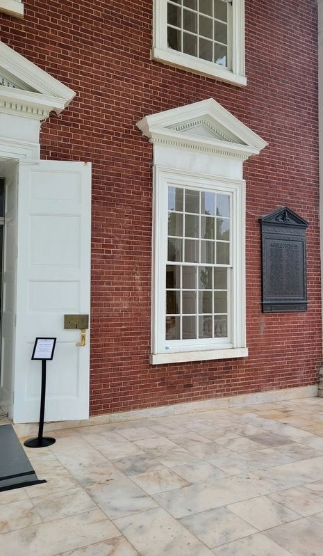
Near University Avenue (Business U.S. 250) east of McCormick Road, on the left when traveling west.
In memory of the sons of this University who gave their lives for freedom in the World War
Robert Dunaway Adams •
George Wayne Anderson, Jr. •
Adair Pleasants Archer •
Samuel Chandler Baker •
Andrew Beirne Blair, Jr. •
William Ewing . . . — — Map (db m230736) WM
On Advance Mills Road (County Route 743) at Frays Mill Road (County Route 641), on the left when traveling west on Advance Mills Road.
Villages such as Advance Mills were once common features of rural Virginia, serving as economic and social centers. Advance Mills grew around a single mill that John Fray constructed in 1833 on the north fork of the Rivanna River. By the twentieth . . . — — Map (db m55785) HM
Near Hydraulic Road (County Road 743) at Hydraulic Ridge Road, on the left when traveling north.
On 3 Sept. 1963, nine years after the U.S. Supreme Court declared racial segregation of public schools unconstitutional, 26 African-American students formerly enrolled at all-black schools desegregated Albemarle High School, Stone-Robinson . . . — — Map (db m170167) HM
On East Main Street west of 6th Street, in the median.
The Virginia Discovery Museum carousel is one of the oldest remaining self-propelled carousels in America. Its seven horses are 1910 castings by amusement park ride manufacturer William F. Mangels from carvings by master carver Marcus C. Illions. . . . — — Map (db m246909) HM
On West Main Street at 1st Street North, on the left when traveling east on West Main Street.
The name Jefferson School has a long association with African American education in Charlottesville. It was first used in the 1860s in a Freedmen's Bureau school and then for a public grade school by 1894. Jefferson High School opened here in 1926 . . . — — Map (db m246922) HM
On Barracks Farm Road (County Route 658) east of Garthfield Lane, on the right when traveling east.
In Jan. 1779, during the American Revolution, 4,000 British troops and German mercenaries (commonly known as “Hessians”) captured following the Battle of Saratoga in New York arrived here after marching from Massachusetts. It was called . . . — — Map (db m55784) HM
On Ivy Farm Road (County Route 1015), on the left when traveling east.
"In 1779 4,000 prisoners, British and their German auxiliaries, captured at the Battle of Saratoga in 1777, marched over 600 miles to quarters, called 'The Barracks', situated a half mile north of this site. Traditionally, some of these prisoners . . . — — Map (db m37586) HM
On Emmet Street (Business U.S. 29) at Sprigg Lane, on the right when traveling south on Emmet Street.
W. W. Yen (also known as Yan Huiqing). Chinese diplomat and political leader, was born in Shanghai. He graduated in 1900 from the University of Virginia as the first international student to earn a bachelor of arts degree and the first Chinese . . . — — Map (db m208960) HM
On Emmet Street North (Business U.S. 29) at University Avenue and Ivy Road (Business U.S. 250), on the left when traveling south on Emmet Street North.
Born at Esmont on 10 April 1915, Frank D. Peregory enlisted in May 1931 in Charlottesville’s Co. K (Monticello Guard), 116th Inf. Regt., 29th Inf. Div. On D-Day, 6 June 1944, T. Sgt. Peregory landed in the assault on Omaha Beach, Normandy, France. . . . — — Map (db m18584) HM
Near Earlysville Road at Woodlands Road, on the right when traveling south.
This is a spring that was used by the Carr family when they lived here in 1870. The spring provided a source of clean drinking water and was also used as a storage location to keep perishable foods cool — — Map (db m170175) HM
On Earlysville Road, 0.2 miles south of Woodlands Road, on the right when traveling south.
Legacy of Hugh Carr
The Ivy Creek Natural Area was once the home of Hugh Carr, born into slavery around 1840 in Albemarle County. The end of the Civil War in 1865 was for Hugh the start of a new life founded in freedom.
In 1870, Hugh . . . — — Map (db m170172) HM
Near Earlysville Road (County Road 743) 0.3 miles south of Woodlands Road, on the right when traveling south.
A network of more than six miles of walking trails leaves large areas of natural habitat undisturbed. The 1.5 mile Central Red Trail leads back to the parking lot and barn. All other trails stem from the Red Trail.
A 0.75-mile paved trail . . . — — Map (db m170174) HM
Near Earlysville Road, 0.3 miles south of Woodlands Road, on the right when traveling south.
1975: Red Flags
For years, Elizabeth (Babs) Conant had canoed the relatively new South Fork Rivanna Reservoir and enjoyed its abundant wildlife. Then one autumn day in 1975, she rounded a bend and saw something ominous. Survey stakes . . . — — Map (db m170170) HM
On McCormick Road at Poe Alley, on the right when traveling south on McCormick Road.
"I feel fortunate to have had the opportunity to be a part of this suit and to watch it unfold. I am grateful for the outcome which enabled me to receive an education that enriched my life across many dimensions."
-Virginia . . . — — Map (db m246897) HM
Near West Pavilion just north of Constantine Path, on the left when traveling north.
In a Washington Post article covering the Rebellion, Hayes said "we want to preserve…the dignity of those who work here… We must end racism, we must end bigotry. In this school, in Virginia and in the country.
Near McCormick Road north of Mews Alley, on the right when traveling south.
Au Sergent pilote aviatéur Américain
Jacques Mac Connell
engagé volontaire
dans l'Aviation Française le 27 décembre
tombé au Champ d'Honneur
le 19 mars 1917
don un combat aérien
La France Reconnaissante . . . — — Map (db m246899) HM WM
On Rotunda Drive west of Hospital Drive, on the right when traveling west.
As it enters its third century, the University of Virginia remembers the enslaved people whose labor and talents made possible the construction and operation of the Academical Village. Forced labor, incalculable suffering, and the struggle to . . . — — Map (db m246928) HM
Near McCormick Road south of University Avenue (Business U.S. 250), on the left when traveling south.
These garden walls,
included by Thomas Jefferson in his original designs for the academical village, were built by enslaved laborers.
The walls were reconstructed and enclosed gardens planted by
The Garden Club of Virginia
1952 . . . — — Map (db m230924) HM
On University Avenue (Business U.S. 250) at Rugby Road on University Avenue.
Thomas Jefferson founded the University of Virginia. The cornerstone of its first building was laid on October 6, 1817, in the presence of three presidents of the United States—Jefferson, James Madison, and James Monroe. In 1825, the . . . — — Map (db m61101) HM
On Scottsville Road (Virginia Route 20) 0.5 miles south of Frys Path (Virginia Route 627), on the right when traveling north.
Built before 1744 by
Col. Joshua Fry
1699-1754
Surveyor, Mathematician, Pioneer
Commander-in-Chief of Virginia Forces
French and Indian War
George Washington Inscribed over his Grave
“Here lies the good, the just
and the noble . . . — — Map (db m23244) HM
On Scottsville Road (Virginia Route 20) just south of Carters Mountain Road (Route 627), on the left when traveling south.
Bounded by the James River to the south and the Rivanna River to the north, this nationally significant district encompasses 83,627 acres. Listed on the National Register of Historic Places in 2007, it includes buildings influenced by Jefferson’s . . . — — Map (db m23240) HM
Near Woodbrook Drive west of Seminole Trail (U.S. 29).
Civil War relic collectors found Stuart’s winter camp and skirmish site (shaded area of map) long before the Rio Hill Shopping Center opened in 1989.
Metal detectors were used to search the area and artifacts—bullets, buttons, belt and . . . — — Map (db m7692) HM
Near Woodbrook Drive west of Seminole Trail (U.S. 29).
In December 1863, Confederate troops established winter quarters here. The approximately 200 soldiers, under the command of Capt. Marcellus N. Moorman, were from Stuart’s Horse Artillery Battalion and were equipped with 16 cannons. The men built . . . — — Map (db m7690) HM
Near Woodbrook Drive west of Seminole Trail (U.S. 29).
On February 29, 1864, General George A. Custer and 1500 cavalrymen made a diversionary raid Into Albemarle County. Here, north of Charlottesville, he attacked the Confederate winter camp of four batteries of the Stuart Horse Artillery commanded by . . . — — Map (db m7685) HM
On East Market Street (County Road 1105) 0.2 miles south of Riverside Avenue, on the right when traveling east.
The Woolen Mills area of Charlottesville traces its roots back to the late 1700s. It was Thomas Jefferson who realized the Rivanna River's vitality was the key to economic growth in the area.
Originally a grist mill was started on . . . — — Map (db m172975) HM
On Louisa Road (Virginia Route 22) 0.2 miles east of Cobham Station Lane (Virginia Route 640), on the right when traveling north.
After reinforcements from Brig. Gen "Mad" Anthony Wayne arrived on 10 June 1781, the Marquis de Lafayette moved south from his camp on the Rapidan River to prevent further raids by Gen. Charles Cornwallis British troops encamped at Elk Hill. By 13 . . . — — Map (db m248174) HM
On St John Road (Virginia Route 640) 1 mile south of Gordonsville Road (Route 231), on the right when traveling south.
The St. John School, built here in 1922–1923, served African-American students during the segregation era. Julius Rosenwald, president of Sears Roebuck and Co., collaborated with Booker T. Washington in a school-building campaign begining in . . . — — Map (db m102560) HM
On Monacan Trail Road (U.S. 29) at Lackey Lane (County Route 838), on the right when traveling south on Monacan Trail Road.
In 1866 Dr. William D. Boaz established the first commercial apple orchard in Covesville. These orchards specialized in the Albemarle Pippin, which became one of the most prized and profitable apple varieties grown in Virginia. By 1890 the success . . . — — Map (db m25473) HM
On Crozet Avenue (Virginia Route 240) at The Square (Local Route 1217), on the left when traveling south on Crozet Avenue.
The town grew around a rail stop established on Wayland’s farm in 1878. It was named for Col. B. Claudius Crozet, (1789–1864)—Napoleonic Army officer, and Virginia’s Engineer and Cartographer—he built this pioneer railway through the Blue Ridge. . . . — — Map (db m1798) HM
On Earlysville Road (County Route 743) just south of Advance Mills Road (County Route 663), on the left when traveling north.
Earlysville Union Church is a rare surviving
early-19th-century interdenominational church
constructed in Albemarle County. Built in
1833, this frame structure served as a
meetinghouse for all Christian denominations
on land deeded by John . . . — — Map (db m21650) HM
On Earlysville Road (County Route 743) south of Advance Mills Road (County Route 663), on the right when traveling north.
This tablet placed here by the Colonial Dames of America in the State of Virginia in the year 1930, commemorates the founding of the First Buck Mountain Church established under the authority of The Church of England and builded one mile west of . . . — — Map (db m21690) HM
On Rio Mills Road (County Route 643) at Seminole Trail (U.S. 29), on the right when traveling west on Rio Mills Road.
Near here, on both sides of the Rivanna River, was located the Monacan Indian village of Monasukapanough. This village was one of five Monacan towns that Captain John Smith recorded by name on his 1612 Map of Virginia, though many more . . . — — Map (db m106829) HM
On Rio Mills Road (County Route 643) at Seminole Road (U.S. 29), on the right when traveling west on Rio Mills Road.
The 19th-century mill village of Rio Mills stood 600 yards west of here, where the former Harrisonburg-Charlottesville Turnpike crossed the South Fork of the Rivanna River. Following the Battle of Rio Hill on 29 February 1864, Union General George . . . — — Map (db m106830) HM
On James River Road (County Route 626) 0.6 miles east of Chestnut Grove Road (County Route 723), on the right when traveling east.
Shortly after the formation of St. Anne's Parish in 1745, this established church stood on a knoll 100 yards north on nearby Ballenger Creek. Not used regularly after the old parish was dissolved in 1785, the building was in ruins by 1820 and was . . . — — Map (db m29953) HM
On Langhorne Road (County Route 626), on the right.
In 1762 the vestry of St. Anne's Parish purchased from William Burton 400 acres here for the residence and lands of the rector of the parish, established in 1745. This glebe was so used almost until the dissolution of the old parish. It was sold in . . . — — Map (db m29951) HM
On Louisa Road (Virginia Route 22) 0.1 miles west of Whitlock Road (Virginia Route 616), on the left when traveling west.
Albemarle County. Albemarle County was formed in 1744 from Goochland County and named for William Anne Keppel, the second Earl of Albemarle, titular governor of Virginia from 1737 to 1754. A portion of Louisa County was later added to . . . — — Map (db m22780) HM
On Greenwood Road (County Route 691) 0.2 miles north of Greenwood Station Road (County Route 690), on the right when traveling north.
On 3 Sept. 1963, nine years after the U.S. Supreme Court
declared racial segregation of public schools unconstitutional,
26 African-American students formerly enrolled at all-black
schools desegregated Albemarle High School, . . . — — Map (db m234288) HM
On Rockfish Gap Turnpike (U.S. 250), on the right when traveling west.
This was the girlhood home of Viscountess Nancy Astor, first woman member of the British Parliament. She was a daughter of Chiswell Dabney Langhorne, who bought “Mirador” in 1892. The house was built sometime after 1832 for James M. . . . — — Map (db m1536) HM
On Rockfish Gap Turnpike (U.S. 250) east of Plank Road, on the right when traveling east.
Nearby stands Mirador the childhood home of Nancy, Viscountess Astor, the first woman member of Parliament. Born Nancy Witcher Langhorne in 1879, she lived here from 1892 to 1897. In 1906 she married Waldorf Astor and moved to England permanently. . . . — — Map (db m1535) HM
On Interstate 64 at milepost 103.5, on the right when traveling east.
The monument before you honors Virginia state highway workers who lost their lives while serving the Commonwealth’s travelers. No public funds were used to build this memorial. It was built entirely with donations from Virginia Department of . . . — — Map (db m26332) HM
On Ivy Road (U.S. 250) at Owensville Road (County Route 678) on Ivy Road.
Half a mile north was born, 1774, Meriwether Lewis, of the Lewis and Clark Expedition, sent by Jefferson to explore the far west, 1804–1806. The expedition reached the mouth of the Columbia River, November 15, 1805. — — Map (db m1795) HM
On Ivy Road (U.S. 250) east of Three Notched Road (Virginia Route 240). Reported missing.
Late in April 1862, Maj. Gen. Thomas J. “Stonewall” Jackson marched his army out of the Shenandoah Valley through the Blue Ridge Mountains to deceive Union Maj. Gen. John C. Fremont into thinking he was headed for Richmond. On 3 May, Jackson . . . — — Map (db m230172) HM
On Ivy Road (U.S. 250) 0.1 miles west of Gillums Ridge Road (Virginia Route 787), on the right when traveling west.
During the Shenandoah Valley Campaign (March - June 1862) Confederate Maj. Gen. Thomas J. "Stonewall" Jackson used deceptive maneuvers and sharp attacks to divert Union forces from the Peninsula Campaign against Richmond. Late in April, Jackson's . . . — — Map (db m209781) HM
On Gordonsville Road (Route 231) 0.1 miles south of Millwood Lane (County Road 783), on the left when traveling south.
The vestry of Fredericksville Parish commissioned a church for this site in 1745. First known as Middle Church, the wood-frame building was later called Walker's Church. Thomas Jefferson attended the nearby classical school of the Rev. James Maury, . . . — — Map (db m170120) HM
On Louisa Road (Route 22) just west of Keswick Road (County Road 731), on the left when traveling west.
Beautification in memory of
Marjorie S. Twohey
Founding member of the
Keswick Garden Club
First president of Charlottesville Council of Garden Clubs
[Lower plaque:]
This plaque commemorates the 50th anniversary of the . . . — — Map (db m170121) HM
On Louisa Road (U.S. 22) at Keswick Road (County Route 731), on the right when traveling west on Louisa Road.
Extending from the Orange County line on the north to the outskirts of Charlottesville with the Southwest Mountains forming its spine, this historic district encompasses more than 31,000 acres and contains some of the Piedmont’s most pristine and . . . — — Map (db m17447) HM
On Virginia Route 231 north of Lindsay Road, on the left when traveling north.
Just north was a classical school conducted by the Rev. James Maury, rector of Fredericksville Parish from 1754 to 1769. Thomas Jefferson was one of Maury’s students. Matthew Fontaine Maury, the “Pathfinder of the Seas,” was Maury’s . . . — — Map (db m17459) HM
On Miller School Road (County Route 635) close to Dick Woods Road (County Route 637), on the left when traveling south.
A bequest of Samuel Miller (1792–1869) provided funds to found the Miller School in 1878. Miller, a Lynchburg businessman born in poverty in Albemarle County, envisioned a regional school for children who could not afford an education. The school . . . — — Map (db m21699) HM
On Plank Road (County Route 692) at Monacan Trail Road (U.S. 29), on the right when traveling west on Plank Road.
Named for the community it served. This established church of old St. Anne’s Parish was built on a hill about one half mile east as early as 1769. In 1776 there were plans to build nearby a new, brick church. This new church had not been completed . . . — — Map (db m158048) HM
On Proffit Road (County Route 649) near Mossing Ford Lane (County Route 741), on the right when traveling south.
Ben Brown and other newly freed slaves, who
founded the community after the Civil
War, first named the settlement Egypt and then Bethel.
About 1881, the community became known as Proffit when the Virginia Midland Railway placed
a stop here, . . . — — Map (db m16946) HM
On Belvedere Boulevard, 0.1 miles east of Belvedere Place, on the right when traveling east.
Free State, a community of free African Americans, stood here. Its nucleus was a 224-acre tract that Amy Farrow, a free black woman, purchased in 1788. Her son Zachariah Bowles lived here and married Critta Hemings of Monticello, an older sister of . . . — — Map (db m170663) HM
On East Main Street (Virginia Route 6) east of Valley Street (Virginia Route 20), on the left when traveling east.
Here stands the Barclay House, built about 1830, later the home of Dr. James Turner Barclay, inventor for the U. S. Mint and missionary to Jerusalem. He founded the adjacent Diciples Church in 1846 and served as its first preacher. It is now the . . . — — Map (db m17995) HM
On Irish Road (Virginia Route 6) at James River Road, on the right when traveling west on Irish Road.
Five miles southwest of here is the Hatton Ferry on the James River which began operating in the 1870s. James A. Brown established the ferry and a store on land first rented and then purchased from S.P. Gantt in 1881. In 1883 when a post office was . . . — — Map (db m88501) HM
On Valley Street (Virginia Route 20) at Main Street (Virginia Route 6), on the left on Valley Street.
In 1745 old Albemarle County was organized at Scott’s landing, its first county seat, here on the great horseshoe bend of the James River. In 1818 the town was incorporated as Scottsville, beginning in 1840 it flourished as the chief port above . . . — — Map (db m17894) HM
On West Main Street just west of Valley Street (Virginia Route 20), on the left.
On August 20, 1969, flood waters of the James River rose to this point as an aftermath of Hurricane Camille causing great loss to the people of Scottsville.
This plaque was erected to remind all who read it of the vulnerability of mortal man to . . . — — Map (db m17948) HM
On East Main Street (Virginia Route 6) just east of Valley Street (Virginia Route 20), on the right when traveling east.
At 3 p.m. on Monday, March 6, 1865, the first of Union Gen. Philip H. Sheridan’s 10,000 cavalrymen under Gens. Wesley Merritt, Thomas Devin, and George A. Custer entered Scottsville unopposed. To accomplish their mission—destroy the
James . . . — — Map (db m17844) HM
On Hardware Street (Virginia Route 795) 0 miles north of Valley Street (Virginia Route 20).
In memory of the soldiers who died in the Confederate General Hospital in Scottsville
1862-1863
Beattie, F.M. Co. H 23 NC
Boyle, Andrew Co. D 41 VA
Brashear, Denis P. Co. E 4 AL
Clark, Henry Co. E 15 AL
Clark, Hosey L. Co. F 2 MS . . . — — Map (db m22784) HM
On James River Road (Virginia Route 742) 0.2 miles east of Warren Ferry Road, on the right when traveling east.
Just to the south was Mount Warren, the home of Wilson Cary Nicholas. He served in the Continental army, represented Albemarle County in the General Assembly (1784–1789, 1794–1799), and was a delegate to the Virginia Convention of 1788 . . . — — Map (db m19406) HM
On Hatton Ferry Road, 0.5 miles south of Hatton Ferry Lane, on the right when traveling south. Reported missing.
Ferries In Virginia
The James, York, Rappahannock and smaller rivers were the primary means of commercial transportation in Virginia until the advent of railroads in the mid-1800’s. In most locations ferries provided the only way to cross . . . — — Map (db m14527) HM
On Hatton Ferry Road, 0.5 miles south of Hatton Ferry Lane.
History of Hatton Ferry.
The Hatton Ferry began operation in 1870, when Buckingham County authorities issued a court order to construct a public ferry across the James River to the Albemarle County lands of Thomas P. Gantt (ca. 1846-1896), a . . . — — Map (db m99392) HM
On Hatton Ferry Road, 0.2 miles south of Hatton Ferry Lane, on the left when traveling south.
James A. Brown began operating a store and ferry at this site on rented property in the late 1870’s. In 1881 he bought the land from S. P. Gantt at which time the store became a stop on the Richmond and Alleghany Railroad. Two years later, Brown was . . . — — Map (db m12882) HM
On Richmond Road (U.S. 250) at Louisa Road (Virginia Route 22), on the right when traveling west on Richmond Road. Reported permanently removed.
The land was patented in 1735. The old house was built in 1790; the new in 1828. Here lived Thomas Mann Randolph, governor of Virginia 1819–1922, who married Martha, daughter of Thomas Jefferson. — — Map (db m17335) HM
On Richmond Road (U.S. 250) east of Exit 124 (Interstate 64), on the right when traveling east.
Thomas Jefferson—author of the Declaration of Independence, third president of the United States, and founder of the University of Virginia—was born near this site on 13 April 1743. His father, Peter Jefferson (1708–1757), a surveyor, planter, and . . . — — Map (db m17306) HM
On James Monroe Parkway (County Route 795) 0.8 miles south of Thomas Jefferson Parkway (Virginia Route 53), on the left when traveling south.
This estate was the home of James Monroe, fifth president of the United States. In 1793, James and Elizabeth Kortright Monroe purchased 1,000 acres adjoining Jefferson’s Monticello. Called Highland, the plantation, eventually totaling 3,500 acres, . . . — — Map (db m23437) HM
On Thomas Jefferson Highway (Virginia Route 53) just east of Milton Road (County Route 732), on the right when traveling east. Reported permanently removed.
The house was built about 1770 by workmen engaged in building Monticello. Mazzei, an Italian, lived here for some years adapting grape culture to Virginia. Baron de Riedesel, captured at Saratoga in 1777, lived here with his family, 1779–1780. . . . — — Map (db m21952) HM
On Thomas Jefferson Parkway (Virginia Route 53) just south of Colle Lane, on the right when traveling south.
Philip Mazzei, a Tuscan merchant and horticulturalist, arrived in Virginia in 1775 and was persuaded by Thomas Jefferson to settle here. Jefferson gave him 193 acres of land, and Mazzei named his property Colle (meaning "hill"). He built a house ca. . . . — — Map (db m170655) HM
On Mark Center Avenue at Mark Center Drive, on the left when traveling west on Mark Center Avenue.
Small groups of people occupied a temporary camp here between 4,500 and 3,200 years ago. This era, called the Late Archaic by archaeologists, is characterized by changes in lifestyle. Growing numbers of people seasonally gathered in larger . . . — — Map (db m214232) HM
On Mark Center Avenue at Mark Center Drive, on the left when traveling west on Mark Center Avenue.
This land was once part of more than 1,100 acres acquired by the Terrett family by the mid-19th century. Within Fairfax County until annexed by the City of Alexandria in 1952, the area was primarily agricultural fieldsd and woodlands here before . . . — — Map (db m214230) HM
On Holland Lane at Jamieson Avenue, on the right when traveling north on Holland Lane.
[Plaque on the left side of the entrance:]
From the establishment of Alexandria in 1749 to the present time, African Americans have been a vibrant part of this city's history. The City of Alexandria would not exist in its present form were . . . — — Map (db m131547) HM
On Hoffman Street just south of Mandeville Lane, on the right when traveling south.
"This will always be the Land of Opportunity."
Dutch Hoffman was born in Washington, D.C. He was orphaned at the age of 16 when his only living relative, his sister Mildred, died during childbirth. After his death, . . . — — Map (db m239756) HM
On Eisenhower Avenue, on the right when traveling west.
The area west of the Mill Race complex once was a sloping meadow through which ran the meandering tail race of the Cameron Mills. The mill site itself was located beneath what is now the parking garage of the Hoffman Center complex. Built in the . . . — — Map (db m27230) HM
Near Duke Street (Virginia Route 236) at Daingerfield Road, on the right when traveling east.
Peter Wise, a city councilman and tanner, established the Duke Street Tanyard in 1797. The Business was situated near the stone bridge on the east bank of Hooff's Run by West End Village. The tannery's ownership and name changed many times; Quakers . . . — — Map (db m72479) HM
On Eisenhower Avenue, 0.8 miles east of Metro Road, on the right when traveling east.
Josiah Watson, a wealthy merchant and postmaster of Alexandria, established his 272-acre plantation, “Bush Hill”, in 1791. Richard Marshall Scott purchased the plantation in 1791; his family stayed here for 200 years. Scott was an . . . — — Map (db m2610) HM
On North Paxton Street at Cloude's Mill Drive, on the right on North Paxton Street.
This historic site is a section of the mill race that provided water power to Cloud's Mill which stood directly across Paxton street.
At the intersection of Beauregard and Morgan Streets, water diverted from the Holmes Run ran through the . . . — — Map (db m150801) HM
Near Brenman Park Drive south of Duke Street (Virginia Route 236), on the left when traveling west.
Archaeologists excavated four ship hull remnants along the Alexandria waterfront — one from the Hotel Indigo Site (44AX229) and three from the Robinson Landing Site (44AX235). Over 200 years ago, Alexandrians repurposed these old merchant ships . . . — — Map (db m216125) HM
On Eisenhower Avenue, 0.7 miles west of Cameron Parke Court, on the left when traveling west.
This park is named for Joseph M. Hensley, the City of Alexandria's Director of Recreation, Parks and Cultural Activities from 1977 until his retirement in 1986.
Joe devoted 33 years to improving the quality of life in Alexandria. Among the . . . — — Map (db m197471) HM
Near Brenman Park Drive south of Duke Street (Virginia Route 236), on the left when traveling west.
Archaeologists excavated four ship hull remnants along the Alexandria waterfront — one from the Hotel Indigo Site (44AX229) and three from the Robinson Landing Site (44AX235). Over 200 years ago, Alexandrians repurposed these old merchant ships . . . — — Map (db m216130) HM
Near Brenman Park Drive south of Duke Street (Virginia Route 236), on the left when traveling west.
Archaeologists excavated four ship hull remnants along the Alexandria Waterfront — one from the Hotel Indigo Site (44AX229) and three from the Robinson Landing Site (44AX235). Over 200 years ago, Alexandrians repurposed these old merchant ships . . . — — Map (db m216126) HM
On King Street (Virginia Route 7) 0.1 miles east of Marlee Way, on the right when traveling east.
Three roads formed this Fairfax County intersection by the early 19th century. Braddock Road, Middle Turnpike (later called Leesburg Pike/King Street/Route 7) and Quaker Lane were the wagon routes for trade between the port town of Alexandria and . . . — — Map (db m150816) HM
On King Street (Virginia Route 7) near South Taylor Street, on the right when traveling east.
Episcopal High School, on the hill to the southwest, was founded in 1839 as a boys' preparatory school, one of the first in the South; girls were admitted in 1991. The school was a pioneer in the establishment of student honor codes in preparatory . . . — — Map (db m7559) HM
On West Braddock Road just east of Kenwood Avenue, on the right when traveling east.
This flag flies in honor of all the men and women whose gallant service and courageous efforts have kept this nation free and safe for all Americans — — Map (db m150815) WM
On King Street (Virginia Route 7) near South Taylor Street, on the right when traveling east.
Half mile to the southwest. The idea for such an institution was conceived by a group of Alexandria and Washington clergymen in 1818. Among those interested was Francis Scott Key, author of the Star Spangled Banner. Originally at corner of . . . — — Map (db m7561) HM
In Loving Memory of Kate Waller Barrett, 1859-1925 First President American Legion Auxiliary Department of Virginia 1922 National President American Legion Auxiliary 1923
▼▲▼▲▼
This Tablet . . . — — Map (db m72401) HM
On Prince Street west of South Union Street, on the right when traveling west.
George Washington's 1749 Survey shows this lot fronting the Potomac River.
The original house on this site was built in 1783. It was destroyed in the great fire of January 18, 1827, which consumed 53 houses and numerous outbuildings in Old Town. . . . — — Map (db m71794) HM
On South Royal Street south of Prince Street, on the right when traveling north.
Built in 1880, 204 South Royal Street was originally the site of the Concordia Hotel. Commissioned by Jacob Borhaus, the Concordia incorporated every modern convenience. The original hotel entrance was located on Royal Street. A two story wing . . . — — Map (db m131347) HM
On Prince Street just east of South Pitt Street, on the right when traveling east.
In 1850, William N. McVeigh bought a frame house on this site at public auction. Soon after the purchase, McVeigh had the small house demolished, and construction began on a pair of three-story brick houses. The Alexandria Gazette and . . . — — Map (db m146441) HM
On The Strand just south of Prince Street, on the left when traveling south.
1880
On September 1, 1880 the Old Dominion Boat Club (ODBC) was organized to combine physical fitness and sport with a social atmosphere. The members built their first clubhouse on May 1, 1881 located on the Strand between Duke and . . . — — Map (db m195594) HM
Near Capital Beltway (Interstate 95/495) 0.8 miles east of Richmond Highway (U.S. 1), on the left when traveling north.
Did you know that you traverse the District of Columbia, Maryland, and Virginia when you cross this bridge? The brass lines in the walkway mark the boundaries. They also commemorate the cooperation required to build this bridge.
Follow the . . . — — Map (db m140997) HM
Near North Lee Street south of Cameron Street, on the left when traveling north.
Alexandria's Changing Shoreline
In 1749 the town of Alexandria was laid out on 10 to 15 foot bluffs around a crescent of shallow water. The back edge of John Carlyle's property, where you are standing now, was about 15 feet above the Potomac . . . — — Map (db m129171) HM
During World War I (1914-1918), the U.S. government targeted Jones Point as the site for a private shipyard, one of 111 built to aid the war effort. The Virginia Shipbuilding Corporation yard, constructed just before war's end, was designed to build . . . — — Map (db m127780) HM
On South Lee Street just south of Wilkes Street, on the left when traveling south.
During the Civil War, thousands of formerly enslaved individuals came to Union-controlled Alexandria to seek refuge and freedom. As a result, several new African American neighborhoods developed during and after the Civil War, including four in . . . — — Map (db m239750) HM
Near Thompsons Alley east of North Union Street, on the right when traveling east.
The African American Heritage Trail along the waterfront consists of two interconnecting routes. Both begin at Waterfront Park. Together, these trails illuminate the history of the African American community in Alexandria over a span of several . . . — — Map (db m239718) HM
Near North Union Street east of Fayette Alley, on the right when traveling north. Reported missing.
13,000 years ago
The Paleoindian Period
A Native American hunter during the Paleoindian period discards a broken spear point, on a bluff overlooking a tributary to the Potomac River at the southern edge of present-day Alexandria. . . . — — Map (db m166409) HM
13056 entries matched your criteria. Entries 201 through 300 are listed above. ⊲ Previous 100 — Next 100 ⊳