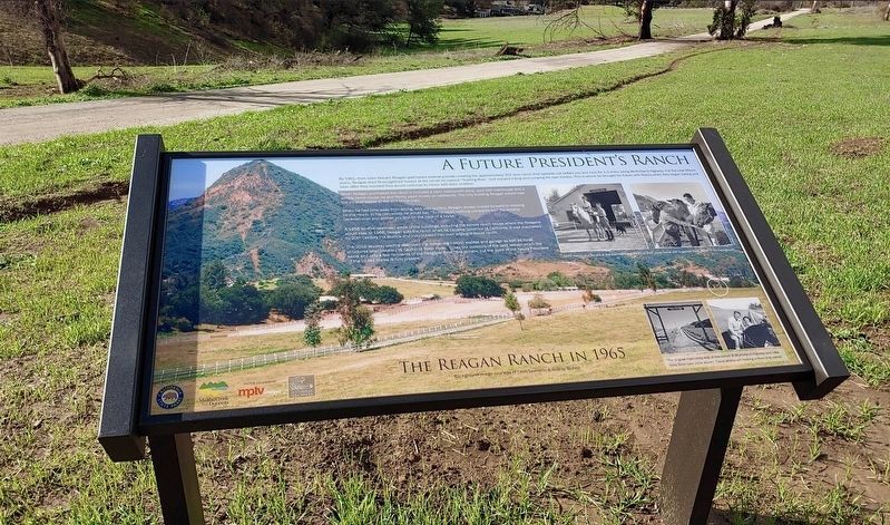
Near Lake Vista Drive just south of Mulholland Highway, on the left when traveling south.
A Future President’s Ranch
By 1951, then actor Ronald Reagan purchased several parcels creating the approximately 357-acre ranch that spreads out before you and runs for 1.5 miles along Mulholland Highway. For the next ten
years, . . . — — Map (db m236739) HM
Near Little Tujunga Canyon Road 5 miles north of U.S. 210.
In dedication to the Firefighters who heroically defended Wildlife Waystation throughout the entire December 2017 Creek Fire. Our eternal gratitude for their selfless act of bravery - Cal Fire, Contra Costa County Fire, Los Angeles County Fire Dept, . . . — — Map (db m138093) HM
On Gold Creek Road 1 mile east of Little Tujunga Canyon Road, on the left when traveling east.
In memory of
Cecil B. DeMille,
his Paradise Ranch
was given by
the Cecil B. DeMille Trust
with the hope that it would be a
Paradise for children. — — Map (db m218483) HM
On Buena Vista Street at Verdugo Avenue, on the left when traveling south on Buena Vista Street.
Abraham Lincoln Park was named in recognition of the former use of this site
as the Abraham Lincoln Elementary School which opened its doors in 1923.
Originally, Abraham Lincoln Elementary School consisted of two classrooms
and one kindergarten . . . — — Map (db m230358) HM
On Verdugo Avenue at Buena Vista Street, on the left when traveling west on Verdugo Avenue.
Amelia Earhart was an American aviation pioneer, author and
women's rights activist. She was the 16th woman in the world to be
issued a pilot's license and was the first woman to fly solo across
the Atlantic Ocean. In 1936, she flew a customized . . . — — Map (db m230361) HM
On West Riverside Drive west of North Pass Avenue, on the right when traveling west.
This restaurant was built in 1949 by locals Scott MacDonald and Ward Albert and is the oldest remaining Bob's Family Restaurant in America. It was designed by respected architect Wayne McAllister incorporating the 1940s Transitional design of . . . — — Map (db m144320) HM
On Chandler Boulevard west of Mariposa Street, in the median.
When early settlers migrated to Southern California in the late 1800s, they saw the future potential of the fertile
valley located twelve miles north of Los Angeles. In 1867, Dr. David Burbank purchased the land, which, in
1911, would become . . . — — Map (db m137688) HM
On Olive Avenue at 3rd Street, on the left when traveling east on Olive Avenue.
Burbank City Hall - April 18, 1996.
This Property has been placed on the National Register of Historic Places by the United States Department of the Interior. — — Map (db m55763) HM
On February 28th, 1873, Doctor David Burbank sold a right-of-way through his property for one dollar, in anticipation
of the benefit that railway transportation would have on his property. This right-of-way provided the connection to
Los . . . — — Map (db m246759) HM
On Riverside Drive east of Bob Hope Drive, on the right when traveling east.
Burbank's tribute to
great Americans,
the Defenders of the Constitution,
yesterday, today and tomorrow.
Funded by:
A collection of proud patriots
assembled by Mr. Bob Hope and
Mayor Michael R. Hastings.
May 27, 1988.
. . . — — Map (db m246613) WM
On Olive Avenue at Third Street, on the right when traveling east on Olive Avenue.
Burbank's first City Hall was built here in 1916. The building housed the offices of the City Council and City Manager, and was also home to the Police and Fire Departments. In 1943, these offices were relocated to the present-day City Hall across . . . — — Map (db m57665) HM
This marks the spot where
Joseph Barbera
christened the
Cartoon Network Studios
building with a bottle of
champagne on 5/22/00. — — Map (db m249060) HM
On Olive Avenue at Glenoaks Boulevard on Olive Avenue.
City of Burbank
time capsule,
sealed on July 4, 1977, by the
Burbank Bicentennial Committee.
Dedicated to the citizens of Burbank
in the year 2001.
To be opened during their
Independence Day celebration.
City of Burbank
time . . . — — Map (db m312304) HM
On Lake Street at Providencia Avenue, on the right when traveling south on Lake Street.
In 1817, Spanish Padres planted four golden
sycamore trees at a nearby location to mark
the halfway point between the Los Angeles and
San Fernando missions. It was customary for
travelers to rely on natural features to reach their
destinations . . . — — Map (db m238247) HM
On Olive Avenue west of Lomita Street, on the right when traveling west.
The record-breaking F-104 Starfighter was created by Clarence L “Kelly" Johnson and his Advanced Development Projects engineering unit (the "Skunk Works") at the Lockheed-California Company in Burbank. Johnson received the Collier Trophy in 1959 . . . — — Map (db m118434) HM
On Tulare Avenue west of Hollywood Way, on the left when traveling west.
Designed by C.L. Kelly Johnson in 1952, the F-104 Starfighter made its initial flight in 1954 as the XF-104. It was the first
production aircraft to fly at twice the speed of sound and held numerous airspeed and altitude records. On May 18, . . . — — Map (db m272604) HM
[Contrary to] sleek aircraft designs preferred by Skunk Works founder Kelly Johnson, the F-117 Nighthawk's unique design
enabled it to reflect radar waves. With its angular panels bolstered by an external coating of radar-absorbent
material, . . . — — Map (db m272624) HM
After nearly 44,000 wind tunnel test hours, 13,000 material sample tests, six years of
development, and a trio of program rephasings mandated by Congress, the F-22 was
finally airborne. The Raptor 4001, the first F-22 air dominance fighter, . . . — — Map (db m272623) HM
Near Olive Avenue 0.1 miles west of South Victory Boulevard, on the right when traveling west.
This Grangetto Winery sign was dug up when the owner who
purchased a piece of the old winery property was digging for a
swimming pool. Found in 1995, the sign had been buried for
over 50 years.
John Grangetto was born in Italy in . . . — — Map (db m272674) HM
Near Buena Vista Street at Alameda Avenue, on the right when traveling north.
“Huey”, designed by Walt Disney Productions, bears the distinction of being the first of three Mobile Motor Generators built by the studio. The control unit was built from a full-scale mockup by Disney technicians in 1949.
Being state . . . — — Map (db m174821) HM
On San Fernando Boulevard at Amherst Drive, on the right when traveling north on San Fernando Boulevard.
In memory of those founders and patriots
of this country
who served and gave their lives
with unselfish bravery and devotion
destroying tyranny and oppression
thereby establishing and defending
liberty and justice for all mankind. . . . — — Map (db m249984) WM
This site once housed The Walt Disney Studios'
original film vaults, which were built in 1939. These
three original vaults were used as storage for the daily
activities in the adjacent Cutting Building, playing an
important role supporting . . . — — Map (db m246541) HM
This official Olympic Flagpole
was used at Squaw Valley, California
in the pageantry ceremonies
of the VIII Olympic Winter Games
held in February 18-28, 1960.
Walt Disney, Chairman of Pageantry. — — Map (db m246540) HM
First conceived in 1937 by Lockheed chief engineer Hall L. Hibbard and his then assistant, Clarence "Kelly" Johnson, the twin-boomed P-38 was the
most innovative plane of its day. With its distinctive design, the P-38 was sleek but its twin . . . — — Map (db m272618) HM
Conceived in 1943, the Skunk Works division in Burbank, CA was formed by innovator Kelly Johnson to build America's first jet fighter.
German jets had appeared over Europe. Uncle Sam needed a counterpunch, and Johnson got a call. As with . . . — — Map (db m272621) HM
Setting records nearly every time it flew, the Blackbird achieved a sustained speed above Mach 3 on July 20, 1963,
at an astounding altitude of 78,000 feet. The Blackbird was and remains the world's fastest and highest-flying manned
aircraft. . . . — — Map (db m272625) HM
Sound Stage A was constructed in the summer of 1939 for live orchestra
recording. Because of the studio's location near the Burbank Airport, special
priority was given to soundproofing the building with state-of-the-art acoustics,
including a . . . — — Map (db m246545) HM
Near Buena Vista Street at Alameda Avenue, on the right when traveling north.
Stage three was built from 1953-1954 specifically for the scene in “20,000 Leagues Under the Sea” in which “Nautilus” was attacked by a giant squid. The complex filming involved using wind, rain and waves to create a storm.
The stage . . . — — Map (db m174848) HM
Near Buena Vista Street near Alameda Avenue, on the right when traveling north.
Stage Two, built from 1947-1949 in cooperation with Jack Webb,
was utilized as the production facility for the filming of the TV series
"Dragnet". Construction of the stage was completed in April, 1949.
Being one of the largest stages on . . . — — Map (db m174818) HM
Sound Stages B and C were constructed in the summer of 1939 as
the sound recording facility for animated films. Because of the
studio's location near the Burbank Airport, special priority was
given to soundproofing the building with . . . — — Map (db m246538) HM
Completed in 1958, Stage 4 was first used in the filming of "Darby
O'Gill and the Little People." Designed for special effects
productions, the stage is equipped with special roof vents needed
to compensate for extremely high lighting . . . — — Map (db m246580) HM
On San Fernando Boulevard south of Olive Avenue, on the left when traveling south.
On this site in 1915, Thomas Story with sons Henry and Walter opened Story & Sons Hardware store. Thomas Story was one of Burbank’s earliest pioneers, arriving here in 1877. He opened Burbank’s first livery stable in 1899, and also farmed and sold . . . — — Map (db m144314) HM
On Country Club Drive at Sunset Canyon Drive, on the left when traveling east on Country Club Drive.
The Sunset Canyon Country Club opened in 1921
as a private nine-hole golf course and country club.
In 1927 fire destroyed many club buildings. This
arch was built in 1927 as an entrance gate for a new
clubhouse. The City of Burbank owned the . . . — — Map (db m154850) HM
Near Buena Vista Street at Alameda Avenue, on the right when traveling north.
The Animation Building, erected in 1939, served as the architectural
and functional centerpiece of the studio. Designed in the “Art
Moderne” style by architect Kent Weber, the building housed the
animators and story staffs on the lot.
. . . — — Map (db m168288) HM
The Ink and Paint, Camera, and Cutting Buildings were constructed
in 1939 as part of the original studio facililty. Conceptualized by
Walt Disney and architect Ken Weber, they were designed for
function and flow of the animation production . . . — — Map (db m246579) HM
Near Buena Vista Street at Alameda Avenue, on the right when traveling north.
Stage One was the only production sound stage built as part of
the original Walt Disney Burbank Studios constructed during
1939-1940. The stage replaced a single smaller stage located at the
Hyperion studios.
Since the original focus . . . — — Map (db m174816) HM
Near Buena Vista Street at Alameda Avenue, on the right when traveling north.
The Bungalow was built in 1935 as the original home of the
Disney Publicity and Comic Strip Departments. It was
constructed at the Disney Studios on Hyperion Avenue in
Hollywood and moved to the Burbank location as part of the
construction in . . . — — Map (db m174808) HM
The Ink and Paint, Camera, and Cutting Buildings were constructed
in 1939 as part of the original studio facililty. Conceptualized by
Walt Disney and architect Ken Weber, they were designed for
function and flow of the animation production . . . — — Map (db m246543) HM
Near Olive Avenue 0.1 miles west of South Victory Boulevard, on the right when traveling west.
Built 1887. Relocated in 1977.
Original address 321 East Orange Grove.
Historic designation June 20, 2013.
Burbank Register of
Residential Historic Resources #7.
1887 Mentzer House
Built by the Providencia Land and
Water . . . — — Map (db m246736) HM
On San Fernando Boulevard at Amherst Drive, on the right when traveling north on San Fernando Boulevard.
The City of Burbank was proud and privileged to host the Moving Wall Vietnam Veterans Memorial
at McCambridge Park from February 16 to February 22, 1998 under the leadership of
Mayor Bob Kramer, a Vietnam Veteran.
This monument marks . . . — — Map (db m249985) HM
Near Buena Vista Street at Alameda Avenue, on the right when traveling north.
The Shorts Building was constructed from the two original
Animation Buildings located at the Disney Studios on
Hyperion Avenue in Hollywood. The two sections were
moved to the Burbank site in 1939-1940 as part of the Studio
construction . . . — — Map (db m174812) HM
The T.E.A.M. Building (Technical, Engineering and Manufacturing)
was constructed in 1955 as a machine shop and construction
facility.
It was here that the first "Imagineers" created the steam
locomotives, the original monorail system, . . . — — Map (db m246542) HM
Near Olive Avenue at Pass Avenue, on the right when traveling north.
Constructed in 1935 by
Harry, Jack and Albert Warner,
this building has been home to such
celebrated Warner Bros.
writers and filmmakers as
William Faulkner ·
Howard Koch ·
Delmer Daves ·
Lillian Hellman ·
John Huston ·
Philip and . . . — — Map (db m177206) HM
Near Olive Avenue 0.1 miles west of South Victory Boulevard, on the right when traveling west.
Tropico (South Glendale area) was the
center of strawberries
raised in Burbank, Glendale
and Tropico from 1904 to 1908.
Strawberry growers organized
an association in 1904. Near 600
acres had been signed up and
Burbank receipts . . . — — Map (db m246737) HM
The initial designs for what would become the U-2 were created by Lockheed engineering guru Clarence "Kelly" Johnson in 1953.
Working under the cloak of secrecy in the famed Skunk Works division, Johnson envisioned a light high-altitude . . . — — Map (db m272629) HM
Walt Disney once said, "We should never
forget that it was all started by a mouse." But we at
The Walt Disney Company know it was all started by
a man. He was born 100 years ago today, but his
legacy as a storyteller and entertainer lives . . . — — Map (db m246544) HM
Features:
The Life of Emile Zola, 1937. Jezebel, 1938. Dark Victory, 1939. The Letter, 1940. Now Voyager, 1942. Yankee Doodle Dandy, 1942. Princess O’Rourke, 1943. This is the Army, 1943. Mildred Pierce, 1945. The Treasure of the . . . — — Map (db m251146) HM
On June 27, 1942, the First Motion Picture Unit,
U.S. Air Force, was officially constituted and
activated by orders of the Adjutant General of
the United States Army.
The First Motion Picture Unit produced films
for our soldiers . . . — — Map (db m217303) WM
Near Thousand Oaks Boulevard 0.6 miles east of Las Virgenes Road, on the left when traveling east.
This amazing playground has been made possible
by the generous contributions of so many amazing
people.
Brandon was born on February 9, 1994 to Dina and
Michael Kaplan. It was soon apparent that he had
many physical and developmental . . . — — Map (db m261871) HM
Near Las Virgenes Road south of Mulholland Highway.
It wasn't only the hit TV series M*A*S*H that made this place famous. Hundreds of films, TV shows, and commercials have been filmed on location at Malibu Creek State Park. Such dramatic vistas, natural beauty, and versatile open space have beckoned . . . — — Map (db m145620) HM
Near Las Virgenes Road south of Mulholland Highway.
M*A*S*H, a brilliant blend of drama and comedy — incorporating the universal theme of making do under difficult circumstances — drew a faithful audience that grew every year and landed the show in the pantheon of classic television.
Four . . . — — Map (db m167580) HM
On Calabasas Road near El Canon Avenue, on the right when traveling east.
Original El Camino Bell,
erected 1913 by
Board of Supervision,
and Oak Tree used to
dispense justice.
City of Calabasas
Erected 1913 by Los Angeles County
Board of Supervisors. — — Map (db m246167) HM
Near Las Virgenes Road south of Mulholland Highway.
Close your eyes. Use your imagination. Listen carefully. Can you hear a director yelling, "CUT!"? Perhaps you hear the echoes of helicopters bringing in the "wounded" for medical treatment or the thunder of apes riding horses across the plains. . . . — — Map (db m303216) HM
On Las Virgenes Road 0.2 miles south of Willow Glen Street, on the right when traveling south.
The Schoolhouse Bell once hung in the original Calabasas School, a one
room Victorian style building with a bell tower, which was constructed in
1890 at 24454 Calabasas Road. Around 1925, a new Spanish Colonial
Revival style structure was built . . . — — Map (db m156909) HM
On Mulholland Highway at Old Topanga Canyon Road, on the right when traveling west on Mulholland Highway.
William C. Masson received a land patent in 1904 for 160
acres during the "Homesteading Days” of the early 1900s.
The Masson House was strategically located on Old Topanga
Canyon Road, the only route to Santa Monica, where the
Port of Los . . . — — Map (db m156885) HM
On Clover Trail just east of Canyon Drive, on the left when traveling east. Reported missing.
Completed in 1984 for Robert Benson, this dwelling was designed by renowned architect Frank Gehry in the Deconstructivism style. This architectural style is characterized by its use of unrelated, disharmonious abstract forms, and experimental . . . — — Map (db m156936) HM
On Park Belmonte 0.5 miles west of Park Sienna, on the right when traveling west.
Jerold Lomax, FAIA, designed and built this single family residence for Mr. & Mrs. Arthur Rouse in 1973. The structure is constructed of 40-foot and 25-foot-long glue-laminated wood beams, supported by eight concrete pillars. For the time, this was . . . — — Map (db m156912) HM
On Black Bird Way 0.1 miles south of Blue Bird Drive, on the right when traveling south.
Designed by the architect Jock Peters, the Park Moderne Fountain is the only remaining fountain constructed as part of the artists colony known as Park Moderne — a residential subdivision created in 1927 with 174 lots. The Art Deco era . . . — — Map (db m156932) HM
On Black Bird Way 0.1 miles south of Blue Bird Drive, on the right when traveling south.
The Bird Path is part of the original Park Moderne housing subdivision created in 1927. With long narrow streets named for various birds, the tract was envisioned as an artist colony featuring footpaths, pools, fountains, and a pump house. The Bird . . . — — Map (db m156927) HM
Near Mulholland Highway 0.1 miles east of Las Virgenes Road, on the right when traveling east.
Now the hub of Santa Monica Mountains National
Recreation Area, the King Gillette Ranch was once
an estate belonging to King Camp Gillette, who
invented the disposable razor blade. Gillette bought
the
property
in 1926 and commissioned . . . — — Map (db m191215) HM
On Mulholland Highway 1.4 miles east of Las Virgenes Road, on the right when traveling east.
Mulholland road was built in the 1920s "to take Angelinos
from the city to the ocean.” From parkway vista points you
can see panoramas of the city, mountains and beaches, or
hike trails into pockets of wilderness hidden in the . . . — — Map (db m167575) HM
On Manhattan Avenue west of La Crescenta Avenue, on the right when traveling west.
Historic Thomas and Florence Bonetto
House, 2819 Manhattan Avenue,
constructed in 1931, Glendale Register of Historic Resources No. 62.
The Bonettos were true community leaders and
instrumental in the growth of the Crescenta Valley. — — Map (db m198188) HM
On Mountain Street west of Geneva Street, on the right when traveling west.
Glendale Register of Historic Resources No. 141,
711 E. Mountain Street,
built 1923.
Excellent example of the
Spanish Colonial Revival style due to its
outstanding design and retention of
character-defining features. — — Map (db m311401) HM
Near East Palmer Avenue at South Adams Street, on the left when traveling south.
Built in 1936 by Richfield Oil Corporation. Rare surviving example of a
streamline moderne gas station, significant for its association with
the development of Southern California car culture. — — Map (db m140830) HM
This picturesque little church takes us back to the night when
Douglas of Finland stood beneath Annie Laurie's window and sang
to her the romantic love song which has since been sung and loved
the world over. The Wee Kirk o’ the Heather pays . . . — — Map (db m232610) HM
On Chevy Chase Drive just east of St Andrews Drive, on the left when traveling east.
This property, Derby House,
has been placed on the
National Register
of Historic Places
by the United States
Department of the Interior.
The Derby House - 1926.
Lloyd Wright, architect.
City of Glendale Historical . . . — — Map (db m209237) HM
On Cedar Street north of Broadway, on the left when traveling north.
Built in the 1880’s. One of the last remaining examples of Queen Anne-Eastlake architectural style in Glendale. Home of Ed Goode, 1897-1917, outstanding community leader. — — Map (db m143602) HM
On El Camino Real north of Mountain Street, on the right when traveling north.
Generations that know us not
and that we know not of,
heart-drawn to see where and
by whom great things were
suffered and done for them,
shall come to this deathless
field, to ponder and dream; and
the shadow of a mighty
presence shall . . . — — Map (db m293551) HM
On Pennsylvania Avenue at Markridge Road, on the left when traveling north on Pennsylvania Avenue.
Ananda Ashrama was founded
in 1923 as an extension
of the Vedanta Centre, Boston,
established by Swami Paramananda
in 1909.
Vedanta, India's ancient philosophy,
teaches that our true nature is
divine. All paths lead to the
same . . . — — Map (db m239531) HM
On New York Avenue 0.3 miles north of Foothill Boulevard, on the left when traveling north.
In 1922, Anderson W. Clark, a retired Baptist minister and
humanitarian, came to the Crescenta Valley. His plans to
quietly retire were quickly altered. As the Great Depression
began, Dr. Clark founded an organization, Crescenta . . . — — Map (db m275850) HM
Near Dunsmore Avenue south of Honolulu Avenue, on the right when traveling south.
Between 1934 and 1957, most of this area in Crescenta Valley Community Regional Park, west of Dunsmore Avenue and south of Honolulu Avenue, was a private park owned by the German-American League. The private park, named Hindenburg Park in memorial . . . — — Map (db m156524) HM WM
Near Dunsmore Avenue 0.5 miles north of Markridge Road, on the left when traveling north.
In recognition of the leadership of Assistant City
Manager Bob McFall to preserve this heritage oak
during the 2009 Station Fire, the Community Services
& Parks Department has designated this stately tree as
"The McFall Oak." — — Map (db m239335) HM
On Brand Boulevard south of California Avenue, on the left when traveling south.
Alex Theatre has been placed on the National Register of Historic Places by the United States Department of the Interior.
1925 Theatre Building — Arthur G. Lindley & Charles R. Selkirk, architects.
1940 Marquee & Tower — S. Charles Lee, . . . — — Map (db m145347) HM
On Broadway just west of Kenwood Street, on the right when traveling west.
This property has been
placed on the
National Register
of Historic Places
by the United States
Department of the Interior.
This building
is named in
honor of
Carlos J.
Moorhead
by Act of
Congress,
Public Law 105-88,
November . . . — — Map (db m209982) HM
On Louise Street 0.1 miles north of Broadway, on the right when traveling north.
Established in 1919. Constructed in 1926. Designed by Clarence L. Jay and Lincoln Rogers.
Spanish Colonial Revival architecture.
City of Glendale Historical Landmark. — — Map (db m210004) HM
In Memory of more than 200,000 Asian and Dutch women who were removed from their homes in Korea, China, Taiwan, Japan, the Philippines, Thailand, Vietnam, Malaysia, East Timor, and Indonesia, to be coerced into sexual slavery by the Imperial Armed . . . — — Map (db m138945) HM WM
On Brand Boulevard just north of Colorado Street, on the right when traveling north.
The Masonic Temple was dedicated on June 11, 1929 and served as a
meeting place for several Masonic Lodges for nearly three decades.
The building, constructed by J.V. McNeil, was designed by architect and
engineer Arthur Lindley who was also . . . — — Map (db m214526) HM
On Brand Boulevard at Broadway, on the right when traveling north on Brand Boulevard.
Site of Glendale Depot of the
Los Angeles Interurban Railway, 1904-1923,
first six-story building in the city.
Constructed by Security Trust
and Savings Bank in 1923.
Original property occupied by
First Savings Bank of Glendale. — — Map (db m158123) HM
On Grandview Avenue at Mountain Street, on the right when traveling north on Grandview Avenue.
Built in 1925. Exemplary Spanish Colonial Revival home
with elements of Moorish and Pueblo Revival styles. Built for local businessman Robert Jensen.
Named for Mrs. Carmen Issai Ovanesian, noted
local philanthropist for children's causes. — — Map (db m173515) HM
On Brand Park Drive 0.2 miles north of West Mountain Street, on the left when traveling north.
The Doctors’ House, a Glendale Landmark, is named for the three prominent physicians Dr. G.V. Bogue, Dr. D.W. Hunt, and Dr. A.L. Bryant, and for Dr. L.H. Hurtt, chemist, who made it their home. One of the few remaining residences of Queen Anne . . . — — Map (db m156338) HM
On Ard Eevin Avenue at Cumberland Road, on the left when traveling north on Ard Eevin Avenue.
Glendale Register of
Historic Resources No. 77. Built in 1924. Tudor revival-style residence designed
by Alfred F. Priest, one of Glendale's
most important early architects. — — Map (db m214552) HM
On Mountain Street at Ard Eevin Avenue on Mountain Street.
City of Glendale Register of Historic Places No. 45. Manor home of Daniel & Margaret McPeak Campbell,
a 25 to 50 acre early citrus ranch.
Pioneer city banker, developer of area in 20's/30's,
and community philanthropist.
Children: Daniel . . . — — Map (db m214542) HM
On Kenneth Road just west of Virginia Avenue, on the right when traveling west.
Built in 1922 by Mattison Boyd Jones, businessman, politician, and community leader. Home and gardens frequently used as background for motion pictures, television, and commercial filming. — — Map (db m163467) HM
On Air Way 0.2 miles south of Sonora Avenue, on the right when traveling south.
Grand Central Air Terminal is an intact example of an early airport
passenger terminal and serves as a physical record of pivotal events that helped shape the development of air travel and the aviation industry in Southern California.
The air . . . — — Map (db m137664) HM
On Royal Boulevard just west of Moreno Drive, on the left when traveling west.
Built in 1936. French revival-style design adapted by
local architect Merrill Baird and featured
as the “Home of the Month” in the
September 1936 issue of McCall's magazine. — — Map (db m173521) HM
On Royal Boulevard at Imperial Dr, on the left when traveling west on Royal Boulevard.
Built in 1931. Excellent example of Spanish Colonial Revival style architecture due to its
outstanding design and retention of character-defining features. — — Map (db m174062) HM
On Royal Boulevard north of Del Monte Drive, on the left when traveling north.
Built in 1927. Excellent example of Mediterranean Revival architecture. Residence of world heavyweight wrestling champion Ed “Strangler” Lewis between 1933 and 1940. — — Map (db m137362) HM
On Royal Boulevard west of Verdugo Boulevard, on the right when traveling west.
Built in 1928.
Built by Robert E. Wian.
Childhood home of Robert C. Wian,
founder of "Bob's Big Boy", 1928-1933.
Home of Stirling Silliphant,
screenwriter, 1955-1964.
Glendale Historical Landmark No. 43 — — Map (db m311411) HM
On East Mountain Street at Greenbrier Road, on the right when traveling east on East Mountain Street.
Mansion built by W. F. Markham, developer and inventor of the Markham Air Rifle at Plymouth, Michigan in 1886. Gardens formerly used as bird sanctuary. — — Map (db m137558) HM
The General Andres Pico Oak Tree once stood in Rancho San Rafael in an area that later became part of the City of Glendale. This tree played a significant role in the history of California. On January 11, 1847, representatives of Los Estados Unidos . . . — — Map (db m128302) HM
302 entries matched your criteria. The first 100 are listed above. Next 100 ⊳