On Stephen Street Upper east of Ship Street Great, on the right when traveling east.
The past lies beneath our feet. During the development of the aparto site, archaeological investigators discovered medieval remains that unlock Dublin's vibrant history.
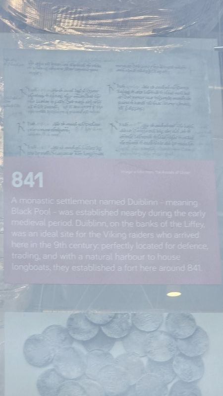
841 A monastic settlement named Duiblinn — meaning Black Pool — was . . . — — Map (db m307781) HM
Near Saint Stephen's Green east of Grafton Street, on the left when traveling west.
[Gaeilge:] Ag Cosaint Pháirc Fhaiche Stiabhna Fhaiche Stiabhna, thosaigh na hÓglaigh, faoi orduithe ón gCaptaen Christopher Poole, ag tochailt trinsí ag na ceithre phríomhbhealach isteach agus ag bealaí isteach os comhair . . . — — Map (db m307081) HM
Near Saint Stephen's Green at York Street, on the right when traveling north.
[Gaeilge:] Maidin Dé Máirt an 25 Aibreán, agus na hÓglaigh faoi chith trom na n-urchar ó mheaisínghunnaí a bhí suite ar dhíon an United Service Club agus Óstán Shelbourne, d’eisigh an Ceannfort Michael Mallin orduithe chun tarraingt . . . — — Map (db m307307) HM
Near Saint Stephen's Green south of King Street, on the left when traveling south.
[Gaeilge:] Bhí both in aice leis an áit seo, a d’úsáid an Ceannfort Michael Mallin mar a phost ceannais i rith fhorghabháil Fhaiche Stiabhna mar chuid d’Éirí Amach 1916. Rugadh Michael Mallin i mBaile Átha Cliath in 1874 agus bhí sé ar . . . — — Map (db m307309) HM
Near Saint Stephen's Green south of King Street, on the left when traveling south.
[Gaeilge:] Rugadh í ag Geata Buckingham, Londain, agus ba é Henry Gore-Booth a hathair, ar Tiarna Talún Angla-Éireannach a bhí ann, a sholáthair bia saor in aisce dá chuid tionóntaí i rith an ghorta ag a eastát ag Teach Lios an . . . — — Map (db m307311) HM
Near Saint Stephen's Green north of Cuffe Street, on the right when traveling north.
[Gaeilge:]
Gar don áit seo, bhí an Constábla Michael Lahiff (125B) den Dublin Metropolitan Police ar dhuine de na chéad daoine a maraíodh ar an gcéad lá den Éirí Amach. Bhí an Constábla Lahiff (28 bliain d’aois) gan arm agus . . . — — Map (db m307284) HM
On Merrion Square West at Merrion Square South, on the left when traveling south on Merrion Square West.
[Gaeilge:] An Cuimhneachán Náisiúnta in ómós do chomhaltaí Óglaigh na hÉireann a fuair bás i mbun seirbhíse don Stát. An Dún Cuimhneacháin Áit mhachnaimh agus chuimhneacháin é an Cuimhneachán Náisiúnta in ómós do chomhaltaí . . . — — Map (db m307425) WM
Near Castle Street just south of Lord Edward Street (National Road N81).
Castle Hall
The causeway entrance to the 13th century Dublin Castle lies under this building on the North/South axis. The Bedford Tower was built on the medieval entrance towers. This building, comprising of the former Genealogical . . . — — Map (db m22435) HM
On Nicholas Street (National Route 81) at Ross Road, on the left when traveling south on Nicholas Street.
Chris Reid completed a public artwork consisting of 20 bronze plaques and a printed book. The texts are based on recordings the artist made from 2004 to 2008 with residents and people associated with Nicholas Street, Ross Road, Bride Street and . . . — — Map (db m22480) HM
Near Saint Stephen's Green at York Street, on the right when traveling north.
[Gaeilge:] Tráthnóna Dé Máirt, ghabh scuad beag d’Óglaigh ó Pháirc Fhaiche Stiabhna, faoi cheannas Frank Robbins, seilbh ar Choláiste Ríoga na Máinleá in Éirinn, le horduithe na hairm a bhí i seilbh Chór Oiliúna Oifigeach an . . . — — Map (db m307290) HM
On Kildare Street (Route R138) at Molesworth Street, on the right when traveling south on Kildare Street.
Construction of Georgian Leinster House began in 1745. It was commissioned by James FitzGerald (1722-1773), the twentieth Earl of Kildare, who became the Duke of Leinster in 1766, and is the original and oldest part of modern day . . . — — Map (db m241141) HM
On Clare Street at Clare Lane, on the left when traveling east on Clare Street.
[Gaeilge:] Chónaigh an Dr. Seoirse Mac Síoghair (1836–1925) agus a chlann anseo ó 1877 go dtí 1925. File agus Gael, Eolaí agus Ollamh, agus an tOllamh ollscoile a bhronn Corn Mhic Síoghair i 1911. Arna tógáil ag Comhairle . . . — — Map (db m307632) HM
Near Leinster Street South at Leinster Lane, on the left when traveling east.
In Remembrance This stone marks the site where the last of three no-warning car-bomb explosions occurred on 17th May 1974, in which 2 people lost their lives. Installed by Justice for the Forgotten. May 2008 — — Map (db m307772) HM
One of Dublin's major contributions to European civilisation has been in the area of literature. It is remarkable that so many writers of world renown were born here including three winners of the Nobel Prize for Literature. This Literary Parade . . . — — Map (db m22472) HM
On Chancery Lane east of Bride Street, on the left when traveling south.
After the Act of Union in 1801, Chancery Lane declined into overcrowded tenements, with poor living conditions and frequent disease. Among the resilient communities who settled here were Italian immigrants, skilled craftsmen who later became known . . . — — Map (db m307807) HM
Near Merrion Square East at Merrion Square North, on the left when traveling north.
This sculpture was presented by Joseph Downes and Son Ltd. in December 1976 to commemorate the centenary of the Butterkrust Bakery, Dublin, and honour its founder Sir Joseph Downes, J.P., High Sheriff of Dublin. Also to record appreciation for . . . — — Map (db m311966) HM
Near Saint Stephen's Green at Grafton Street, on the left when traveling south.
[Gaeilge:] Tugtar cur síos sa taispeántas seo ar an ról suntasach a bhí ag Páirc Fhaiche Stiabhna i rith Éirí Amach na Cásca 1916, nuair a bhí Éire ag iarraidh neamhspleáchas ó riail na Breataine. Tharla ceann de na cathanna ab . . . — — Map (db m307011) HM
On Fishamble Street, on the right when traveling north.
This bronze commemorates the first performance of George Frideric Handel's Oratorio Messiah, given in the Old Musick Hall in Fishamble Street at noon on Tuesday April 13th 1742 — — Map (db m22450) HM
On Stephen Street Upper east of Ship Street Great, on the left when traveling east.
The first pneumatic tyre factory in the world was started here in 1889, to make tyres under John Boyd Dunlop’s patent of the 7th December, 1888. — — Map (db m307778) HM
Near R138 north of Leeson Street Lower, on the left when traveling north.
[Gaeilge:] Luan Cásca an 24 Aibreán ag 12.15 i.n., chuir Constáblaí na Páirce, Delaney agus Murphy, in iúl do Stiúrthóir na Páirce, James Kearney, gur thóg Óglaigh na hÉireann seilbh ar an bhFaiche. Chuir an tUas. Kearney síos ar na . . . — — Map (db m307108) HM
On Chancery Lane east of Bride Street, on the left when traveling south.
Chancery Lane, where you stand now, was once among Dublin’s most fashionable addresses in the 1700s. It was home to the Lord Chancellor, Ireland’s most senior legal figure, and many prominent lawyers. Following the Act of Union in 1801, wealth and . . . — — Map (db m307801) HM
On St. Stephen's Green at Grafton Street, on the left when traveling west on St. Stephen's Green.
In memory of the officers, non-commissioned officers and men of the Royal Dublin Fusiliers who fell in the South African War A.D.1899·1900
Fortissimis suis militibus hoc monumentum eblana dedicavit MCMVII
Hartshill•Ladysmith•Talana•Colenso• . . . — — Map (db m22470) WM
Near no nearby street. Reported permanently removed.
Anna Marie, 1829 - 1922 and Thomas Haslam, 1825 - 1917. This seat is erected in honour of their long years of public service, chiefly devoted to the enfranchisement of women. — — Map (db m307009) HM
Acknowledged as a world figure in literature. He dismantled the English language and put it together again so that it became music. The sculpture in bronze was unveiled on June 16, (Bloomsday) 1982. — — Map (db m27047) HM
On Kildare Street (Route R138) at Molesworth Street, on the right when traveling south on Kildare Street.
This pub has been granted the
James Joyce Pub Award
for being an authentic Irish pub
'A good puzzle would be to cross Ireland
without passing a pub.' Ulysses
James Joyce identified and described the . . . — — Map (db m241142) HM
Near Chancery Lane east of Bride Street, on the left when traveling south.
Founded around 1100 AD, the Church of St Michael le Pole was built to serve recently Christianised Hiberno-Norse occupants who lived in the area. Its original round tower stood for over 700 years until 1775. After the church was deconsecrated in . . . — — Map (db m307790) HM
Near Chancery Lane east of Bride Street, on the left when traveling south.
It was long suspected that the grounds you stand on had great archaeological potential, but the unearthing of Le Pole Square proved it to be one of the most significant undertakings in Dublin, uncovering the largest assemblage of Viking and . . . — — Map (db m307787) HM
On Kildare Street (National Route 11) just south of Molesworth Street, on the left when traveling south.
Since 1924, Leinster House has been the seat of the two houses of the Oireachtas, Dail and Seanad (Irish Parliament and Senate), who meet here a total of 90 days a year.
Designed in 1745 by the architect Richard Cassels, who also designed the . . . — — Map (db m22459) HM
On Lower Mercer Street at York Street, on the right when traveling north on Lower Mercer Street.
Margaret Anna Cusack was born on this site on May 6th 1829. At the time York Street was a centre of medicine. She was the daughter of Sara and Dr. Samuel Cusack. Her uncle was the interationally renowned surgeon James William Cusack, 3-times . . . — — Map (db m22454) HM
Near Chancery Lane east of Bride Street, on the left when traveling south.
Formed in 1836, the Dublin Metropolitan Police (DMP) was an unarmed force serving the city, distinct from the Royal Irish Constabulary which covered the rest of Ireland. DMP officers wore dark green uniforms and London-style helmets. Though focused . . . — — Map (db m307788) HM
On Merrion Square West (National Route 11), on the right when traveling north.
The National Memorial to members of the Defence Forces is a place of contemplation and remembrance, providing a focal point where families, relatives and members of the public can reflect on the contribution and sacrifice made by members of the . . . — — Map (db m26868) HM
Near Saint Stephen's Green west of Merrion Row, on the left when traveling west.
[Gaeilge:] Óstán Shelbourne Sonraíodh Óstán Shelbourne mar fhoirgneamh straitéiseach d’Óglaigh na hÉireann le seilbh a ghabháil air. Bhí an t-óstán lán le haíonna lenár áiríodh oifigigh na Breataine nach raibh ar dualgas agus . . . — — Map (db m307091) HM
Near Saint Stephen's Green at Merrion Row, on the left when traveling west.
Páirc Fhaiche Stiabhna | Saint Stephen’s Green Park [Gaeilge:] Fáilte chuig Páirc Fhaiche Stiabhna Is féidir an pháirc phoiblí is ársa i mbaile Átha Cliath a rianú siar go dtí na meánaoiseanna. Ghac Tionól na Cathrach le . . . — — Map (db m307007) HM
Near Saint Stephen's Green at Grafton Street, on the left when traveling west.
Páirc Fhaiche Stiabhna | Saint Stephen’s Green Park [Gaeilge:] Fáilte chuig Páirc Fhaiche Stiabhna Is féidir an pháirc phoiblí is ársa i mbaile Átha Cliath a rianú siar go dtí na meánaoiseanna. Ghac Tionól na Cathrach le . . . — — Map (db m307316) HM
Presented to the People
of Ireland
by
The Robert Emmet
Statue Committee
of the
United States of America
April 13, 1966
Francis J. Kane, Chairman
Ambassador Scott McLeod
Devlin W. Dormer, Esq.
Hon. Michael J. Kirwan, M.C. . . . — — Map (db m25304) HM WM
On Patrick Street (National Route 81), on the left when traveling south.
Tradition has it that Saint Patrick baptised the first Irish Christians in a well, situated here in St. Patrick's Park, with water from the River Poddle, which still flows underground. A small wooden church was erected here to commemorate the . . . — — Map (db m22468) HM
On Ship Street Little at Ship Street Great, on the right when traveling east on Ship Street Little.
In 1534, at the age of 21 years, “Silken Thomas”, of the Fitzgeralds of Kildare, laid siege to Dublin Castle from this vicinity. The rebellion failed, and he was executed in London together with all of his uncles, by order of Henry VIII. The Fall . . . — — Map (db m307818) HM
On Lower Merrion Street (National Road 11) at Merrion Square (Road 118), on the right when traveling north on Lower Merrion Street.
aural and ophthalmic surgeon, archaeologist, ethnologist, antiquarian, biographer, statistician, naturalist, topographer, historian, folklorist, lived in this house from 1855 to 1876 — — Map (db m24755) HM
On Patrick Street (National Route 81) at St. Patrick's Close, on the left when traveling south on Patrick Street.
This majestic view of St. Patrick's Cathedral, Dublin is a colour reproduction from a series of original aquatints etched by James Malton, whose work, A Picturesque and Descriptive View of the City of Dublin, gives us a glimpse of Dublin at the . . . — — Map (db m22465) HM
Near Saint Stephen's Green east of Dawson Street, on the left when traveling west.
[Gaeilge:] Go moch ar maidin Dé Máirt, an 25 Aibreán, gar don phointe seo ar an mbóthar amuigh, chuaigh an Ceannfort Michael Mallin, ceannfort fhórsaí Óglaigh na hÉireann i bhFaiche Stiabhna, chun Óglach gortaithe de chuid Arm Cathartha na . . . — — Map (db m307082) HM
Near Saint Stephen's Green west of Kildare Street, on the left when traveling west.
[Gaeilge:] Úsáideadh an Teach Samhraidh seo mar chistin an chatha do bhreis is céad fear agus breis is dosaen ban arbh iad an garastún i bhFaiche Stiabhna iad i rith Éirí Amach na Cásca 1916. Ba iad Mary Hyland agus Kathleen Cleary a bhí ag . . . — — Map (db m307085) HM
[English:]
This fountain, designed by the sculptor Josef Wackerle, is the gift of the people of the German Federal Republic to mark their gratitude for Ireland's help after the war of 1939-45. The bronze group portrays the three . . . — — Map (db m25306) HM
On Merrion Row east of Saint Stephen's Green, on the left when traveling east.
Founded in 1693 by the French Huguenot non-conformist churches of Dublin and now belonging to the French Huguenot Fund. Restored in 1988 through a grant from the French Ministry of Foreign Affairs in association with FÁS. — — Map (db m307423) HM
Near Saint Stephen's Green at Grafton Street, on the left when traveling west.
[Gaeilge:]
Thaitin an Hibernian United Service Club stairiúil, os comhair na háite seo, go mór le hOifigigh Arm na Breataine mar chlub d’Fhir Uaisle.
Maidin Dé Máirt, an 25 Aibreán, ghabh Ceannaire agus tríocha fear ón 3ú . . . — — Map (db m307318) HM
Sunday Independent journalist,
was murdered on 26th June 1996.
Be Not Afraid
Greater justice was her ideal and it was her ultimate achievement
Her courage and sacrifice saved many from the scourge of drugs and other crime.
Her . . . — — Map (db m24078) HM
On Golden Lane at Chancery Lane, on the left when traveling east on Golden Lane.
Step into the history of Dublin and discover the rich heritage surrounding the Radisson Blu Royal Hotel, Dublin. Follow a self-guided trail through Le Pole Square, tracing Dublin’s story from its Viking roots to the lively tenement life of the 19th . . . — — Map (db m307808) HM
On The Square south of Haddington Road, on the left when traveling south.
Beggars Bush Barracks close to this location Volunteer Joseph Spooner 1901–1922 Dublin Brigade Oglaigh na nEireann of 67 McCaffrey Lane Mount Brown, Dublin was executed by The Free State Army on the 30th Nov. 1922 After being shot by . . . — — Map (db m304830) HM
On Anne Street South at Anne's Lane, on the left when traveling west on Anne Street South.
In the late 70’s DJ Dave Fanning performed weekly at this site, formerly McGonagles — which was the main venue for all major punk and new wave acts. — — Map (db m307775) HM
Near Ship Street Great south of Ship Street Little, on the left when traveling north.
Close to where you stand, Dublin’s name originated from ‘Dubhlinn’, meaning ‘Black Pool’ in Irish. This tidal pool was vital in shaping Dublin’s development. In 841, the Vikings established a harbour here, known as a longphort. The River Poddle, . . . — — Map (db m307786) HM
On Ship Street Great south of Ship Street Little, on the left when traveling north.
Entrance to S. Michael’s le Pole Church Yard Here anciently stood the church and the round tower. Adjacent lay the mill pond or “pool” which gave name to these buildings and to the old city gate in Bride Street. S. Bride’s Widows’ Alms . . . — — Map (db m307809) HM
Near Chancery Lane east of Bride Street, on the left when traveling south.
One of Dublin’s oldest parishes, a church is believed to have stood here even before the Vikings arrived. The churchyard once featured the city’s only round tower and gave the area its name, with “le Pole” referring to a pool from the nearby River . . . — — Map (db m307789) HM
On Custom House Quay (Leinster Route 801) 0.2 kilometers west of the Sean O'Casey Bridge, on the left when traveling west.
Commissioned and Donated to the People of Ireland
by Norma Smurfit
29th May 1997
'A procession fraught with most striking and most melancholy interest, wending its painful and mournful way along the whole line of the river, to . . . — — Map (db m269528) HM
On Custom House Quay (Leinster Route 801) 0.2 kilometers west of the Sean O'Casey Bridge, on the left when traveling west.
The Dublin Docklands comprises 520 hectares of land on the north and south banks of the River Liffey.
THE DIVING BELL
①950m←
Just a short walk from here stands the recently refurbished Diving Bell. Designed by . . . — — Map (db m269592) HM
On Custom House Quay (Leinster Route 801) 0.2 kilometers west of the Sean O'Casey Bridge, on the left when traveling west.
In memory of the victims of the Great Famine and for
their descendants who have done so much to build Canada.
En mémoire des victimes de la Grande Famine, et en hommage à
leurs descendants qui ont tant contribué à bâtir le . . . — — Map (db m269553) HM
On Custom House Quay (Leinster Route 801) at the Scherzer Rolling Lift Bridges, on the left when traveling west on Custom House Quay.
The Human Rights and Poverty Stone was inaugurated on 17 October 2008, the UN Day for the Eradication of Poverty. It was created by the Irish sculptor Stuart McGrath.
17 October Stones can be found in over 50 meeting places worldwide. They all . . . — — Map (db m269605) HM
On Custom House Quay (Leinster Route 801) at the Scherzer Rolling Lift Bridges, on the left when traveling west on Custom House Quay.
The Human Rights and Poverty Stone was inaugurated on 17 October 2008, the UN Day for the Eradication of Poverty. It was created by the Irish sculptor Stuart McGrath.
17 October Stones can be found in over 50 meeting places worldwide. They all . . . — — Map (db m269606) HM
On City Quay (Leinster Route 813) at Lombard Street East ( Route 814), on the right when traveling east on City Quay.
In honour of the Seamen lost
while serving on Irish merchant ships
1939 - 1945
City of Limerick 15-7-40
Brennan H. · Sullivan J.
Kerry Head 22-10-40
Begley T. · Byrne R. · Davidson W. · Drummond G. · McMahon M. · . . . — — Map (db m269632) HM WM
On Custom House Quay (Leinster Route 801) 0.2 kilometers west of the Sean O'Casey Bridge, on the left when traveling west.
In late May 1847, at the height of the Great
Famine, 1,490 tenants from the Mahon
Estate embarked on the gruelling 100 mile
(165 km) walk from Strokestown, County
Roscommon to Dublin Docks.
They were part of an assisted emigration . . . — — Map (db m269554) HM
On City Quay (Leinster Route 813) at Lombard Street East ( Route 814), on the right when traveling east on City Quay.
This park is named after Elizabeth O'Farrell
who was born here at 42 City Quay
Elizabeth played a full and active role
in the Easter Rising of 1916
Her life was dedicated to the cause of Irish Freedom
———————————————————
Tá . . . — — Map (db m269610) HM
On Sir John Rogerson’s Quay just east of Creighton Street, on the left when traveling east.
Sunk by U-boat
with twenty-four lives lost
27th December 1917
Chuir U-bhád go tóin poill í
Cailleadh ceithre dhuine is fiche
27 NoHaig 1917 — — Map (db m269684) HM WM
On Guild Street at North Wall Quay ( Route 801) when traveling south on Guild Street.
"But the general appearance of the river,
flowing between its quays and under its bridges,
has not changed. Yes, the river still gave the
impression it was flowing in the wrong direction."
The End.
———————————————
"Mais . . . — — Map (db m269692) HM
On Guild Street at North Wall Quay ( Route 801), on the left when traveling south on Guild Street.
Scherzer Bridges
In 1817 the Royal Canal was opened, connecting the River Shannon with
Dublin. The canal entered the River Liffey at North Wall Quay. A cast-iron single track swivel bridge was constructed to carry traffic on . . . — — Map (db m269703) HM
Near Inchicore Road west of South Circular Road, on the left when traveling west.
[Gaeilge:] Anseo, tar éis seachtain na Cásca, 1916, básaíodh na cinnirí seo a leanas [English:] Here, after Easter Week, 1916, the following leaders were executed P. H. Pearse • Thomas J. Clarke • Thomas MacDonagh — . . . — — Map (db m306841) HM
On Inchicore Road west of South Circular Road, on the left when traveling west.
[English:] Kilmainham Gaol & Courthouse Opened as the county gaol for Dublin in 1796, Kilmainham Gaol soon held a surge of Irish revolutionaries. From its first political prisoner, United Irishman Henry Joy McCracken, to its . . . — — Map (db m306835) HM
On Winetavern Street at High Street, on the left when traveling north on Winetavern Street.
1100’s Dublin Defends Itself by Building Outer Stone Walls [Français:] Dublin se défend en construisant des murs de pierre extérieurs [Deutsch:] Dublin verteidigt sich, indem Außenmauern aus Stein errichtet . . . — — Map (db m304824) HM
On Christchurch Place north of High Street, on the left when traveling south.
1500’s Silken Thomas Revolts Against the King of England [Français:] Silken Thomas se révolte contre le roi d’Angleterre [Deutsch:] Silken Thomas revoltiert gegen den König von England . . . — — Map (db m304828) HM
On Abbey Street Lower at O'Connell Street Upper, on the left when traveling east on Abbey Street Lower.
2nd Battalion Dublin Brigade
Irish Volunteers
who was shot and burned in these premises
Easter 1916
[Balance of marker in Cló Gaelach script is not transcribed] — — Map (db m240758) WM
On Parnell Street (Leinster Route 803) at Parnell Place, on the left when traveling east on Parnell Street.
"No man has a right to fix the boundary of the march of a nation; no man has a right to say to his country, thus far shalt thou go and no further."
Parnell Street
Formerly Great Britain Street, the street was renamed after Charles . . . — — Map (db m270490) HM
On Frederick Street North just south of Dorset Street Upper (National Route 1), on the left when traveling south.
This Building Housed the
Department of Labour
1919 - 1921
Countess Markievicz
First Minister for Labour
Dáil Éireann
Erected April 2016 — — Map (db m269811) HM
On Parnell Square North just east of Parnell Square West, on the left when traveling east.
Here on the 9th September 1914, the
Supreme Council of the Irish Republican Brotherhood
and other leaders decided upon a Rising
against British rule.
Anseo ar an 9 Meán Fómhair 1914, bhí
an Ard-Chomhairle Bhráithreachas . . . — — Map (db m269764) HM WM
On Frederick Street North at Frederick Lane North, on the left when traveling north on Frederick Street North.
I gcuimhe an dhglaigh, Diarmuid Ó Duidir, an
cúighiú cathán inneallcóirí, Driogáio Daile
Átha Cliath, Óglaigh na Éireann, a rugaoi Ros Mór,
Co. Chioora Arann, agus oa mhac léinn i Scoil Éanna,
Rath Fearnáin. Maraíodh e i . . . — — Map (db m269939) WM
On Parnell Square East just south of Parnell Square North, on the right when traveling south.
Sa Rotunda Rink a raibh a shuíomh sna gairdíní taobh leis sea
a bun aíodh oglaigh na hEireann 25 samhain 1913
The Irish Volunteers were founded in the Rotunda Rink, which was
located in the gardens next to [here], on . . . — — Map (db m269805) HM WM
On Parnell Square East at Parnell Square North, on the right when traveling south on Parnell Square East.
i ndorchacht an éadóchais rinneadh aisling dúinn.
lasamar solas an dóchais.
agus níor múchadh é.
i bhfásach an lagmhisnigh rinneadh aisling dúinn.
chuireamar crann na crógachta.
agus tháing bláth air.
i ngeimhreadh na . . . — — Map (db m269802) HM WM
On Grattan Bridge north of Essex Quay, on the right when traveling south.
Essex Bridge Erected 1755 Rebuilt by the Dublin Port and Docks Board 1875 Renamed Grattan Bridge By the Municipal Council 1875 Right Honble. Peter Paul M’Swiney, J.P., Lord Mayor Robert Warren, D.L., J.P., High Sheriff Bindon B. Stoney, . . . — — Map (db m304666) HM