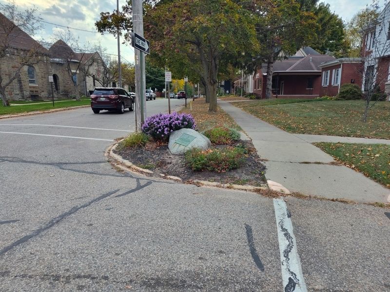
On Chestnut Street at Hubbard Street, on the right when traveling south on Chestnut Street.
Allegan County's name was coined by the noted student of the Indians, Henry Schoolcraft. The county was set off in 1831 and organized in 1835. Settlement of the county seat, Allegan, was promoted in 1835 by eastern capitalists who were attracted by . . . — — Map (db m69891) HM
On North Walnut Street 0.3 miles south of Trowbridge Street, on the right when traveling south.
Michigan semicentennial organization this plaque is issued by the Historical Society of Michigan in recognition of the Allegan County Historical Society founded in 1954. For more than 50 years of continuous operation in service to the people of . . . — — Map (db m258814) HM
On Walnut Street at Hubbard Street, on the right when traveling south on Walnut Street.
On June 15, 1858, the Episcopal Church of the Good Shepherd was organized; its parish was admitted into the Diocese of Michigan two years later. Built in 1866-69, this Gothic structure was designed by Gordon W. Lloyd and first used for Divine . . . — — Map (db m69890) HM
Near Brady Street east of Riverfront Plaza, on the right when traveling east.
By resolution of the Allegan City Council, this park is dedicated to the memory of
JAMES E. MAHAN, M.D.
1895–1984
Dr. Mahan ministered to the needs of the Allegan area -- both in the personal and public health fields -- from 1931 . . . — — Map (db m69900) HM
On State Street (2nd Street) south of Brady Street, on the left when traveling south.
This simply ornamented wrought-iron bridge was built in 1886. It replaced an earlier wooden one that had begun to fall into disrepair. Designed by the King Iron Bridge and Manufacturing Company of Cleveland, Ohio, the double-intersection Pratt . . . — — Map (db m69901) HM
On Riverfront Plaza west of Brady Street, on the right when traveling east.
"MEET ME AT COOK PARK, ALLEGAN, MICHIGAN"
The steamer Mildred carried passengers to and from Cook Park until about the time of W.W.I. The park was located at Cady's Grove, about three miles upriver from the dock behind the bank in Allegan, . . . — — Map (db m69899) HM
On Center Street at Mixer Street, on the left when traveling east on Center Street.
Side 1
In 1866, faced with the growth of what were then the separate villages of Douglas and Dudleyville, Saugatauk Township Districts No. 3 and 4 merged forming Union District No. 3. The Douglas Union School opened for classes in . . . — — Map (db m45325) HM
On Center Street at Union Street, on the left when traveling east on Center Street.
Dutcher Lodge No. 193
Masons from Douglas, Fennville, and Saugatauk chartered Dutcher Lodge No. 193 on January 19, 1867. From 1867 to 1870 they held meetings in a building owned by Worshipful Master Thomas Dutcher. In 1875, the western . . . — — Map (db m45393) HM
On Center Street west of North Union Street, on the right when traveling west.
From about 1854 to at least 1863, this surfboat was used for lifesaving purposes near the Saugatuck Lighthouse. It was one of 48 used on the Great Lakes and one of 137 used nationally. Joseph Francis, owner of the Francis Metallic Lifeboat Company, . . . — — Map (db m182126) HM
Mt. Baldhead is one of Michigan’s tallest dunes. Local Indians used it for their White Dog ceremonial sacrifice. In 1884 it became a park with camping at the foot and observation tower on top. In 1890, the first Fat Mans Club dune climb took place, . . . — — Map (db m73645) HM
On Hamilton Street west of North Union Street, on the right when traveling east.
Just north of here, where the river enters Lake nMichigan (the "n"
is silent), the once proud island nation of Singapore washed ashore
in the same storm that took the Edmund Fitzgerald, which may
explain the unusual devotion of Singapore's . . . — — Map (db m160034) HM
On Lakeshore Drive south of 123rd Avenue, on the right when traveling south.
Surveyed in 1839, the village of Pier Cove was once hailed as "the busiest port between St. Joseph and Muskegon." Before the Civil War, Pier Cove was a bustling community and a major point for lumber distribution, with ships departing daily carrying . . . — — Map (db m73498) HM
Near W. Center Street west of N. Union Street, on the right when traveling west.
The School House opened its doors in 1867, replacing a one-room school nearby. Known then as the Douglas Union School and part of a new public school consolidation movement in Michigan, the school offered classes at all grades—pioneering in . . . — — Map (db m73644) HM
On W. Center Street west of N. Union Street, on the right when traveling west.
On its winding path to Lake Michigan, the Kalamazoo River separates the land of Saugatuck and Douglas. While the north bank pioneer settlements of Saugatuck and Singapore got their start in the 1830's, it was not until the 1850's that the opposite . . . — — Map (db m73643) HM
Near Old Allegan Road 0.3 miles east of 58th Street.
Spanning the Kalamazoo River, this 422-foot bridge is one of Michigan’s longest pony truss highway bridges, and among the oldest surviving swing bridges in the United States. The Milwaukee Bridge and Iron Company fabricated the $5,000 structure, . . . — — Map (db m73574) HM
Near Old Allegan Road 0.2 miles north of 57th Street, on the left when traveling north.
1825 - Trading post established by Louis Campau (a Frenchman) at the mouth of the Rabbit River approximately one mile upstream from what is now New Richmond.
1825 - Mack’s Landing trading post established where Purdy’s Landing is now . . . — — Map (db m73571) HM
Near Old Allegan Road 0.3 miles east of 58th Street.
New Richmond got its start in 1836, when three eastern investors, led by John Allen of Ann Arbor, arranged to found a city here. John Allen, a Virginian by birth, purchased 2240 acres in Allegan County on the north side of the Kalamazoo River just . . . — — Map (db m73573) HM
Near Old Allegan Road 0.3 miles east of 58th Street.
The railroad has been a central component of New Richmond’s history from the very beginning. The first railroad bridge crossing the Kalamazoo River at New Richmond was completed in 1871. It was originally built for the Chicago & Michigan Lake Shore . . . — — Map (db m73572) HM
On W. Main Street (State Highway 89) west of Maple Street, on the right when traveling west.
The early settlement that eventually became Fennville was established where two log roads crossed at a low place along the town line road between Manlius and Clyde Townships. Early maps show a church and sawmill on the high ground to the west of . . . — — Map (db m73526) HM
On 38th Street 0.3 miles north of 144th Avenue, on the left when traveling north.
A Dutch settlement known as Oakland sprang up in this area about a decade after the founding of nearby Holland in 1847. Many residents worshipped with the Vriesland and Drenthe congregations until they formed their own churches. One group, North . . . — — Map (db m73681) HM
On Lincoln Road (Michigan Route 40) 1 mile north of 143rd Street.
O say can you see, by the dawn's early light,
What so proudly we hailed at the twilight's last gleaming,
Whose broad stripes and bright stars through the perilous fight,
O'er the ramparts we watched, were so gallantly streaming?
And the . . . — — Map (db m258772) WM
On Ottogan Street (E. 32nd Street) 0.2 miles east of 52nd Street, on the right when traveling east.
Members of the First Reformed Church in Holland founded this congregation in 1866 to provide a place of worship for the settlers living southeast of town. Heavy immigration from the Netherlands prompted this move. The Dutch language was used . . . — — Map (db m73682) HM
On Church Street 0.1 miles south of 146th Avenue, on the left when traveling south.
(Side One)
Erected in 1862, this church was the center of the Dutch immigrant community. The first settlers in this area arrived in early 1847 led by the Reverend Albertus C. V. Raalte. In June of that year a separate group of seventy . . . — — Map (db m73685) HM
On East 147th Avenue 0.5 miles east of South Waverly Road (54th Street), on the right when traveling east. Reported damaged.
The main portion of this building was the residence of George N. Smith, a Congregational missionary to the Indians in this area and at Waukazoo's Village on nearby Lake Macatawa. The mission was named after an Indian convert. Built in 1844-45 by . . . — — Map (db m73683) HM
Near Church Street 0.1 miles south of 146th Avenue, on the left when traveling south.
In memory of the First Pioneers of Graafschaap of which the following are buried here
Lambert Tinholt 1849
Infant Neerken 1850
Geesje Kropschot 1850
Geert Kamps 1850
Roelafje Schrow 1850 . . . — — Map (db m73687) HM
On 142nd Avenue 0.1 miles west of Beeline Road, on the right when traveling east.
Laketown Township was settled by Dutch immigrants who arrived in the area in 1847. Originally part of Newark Township, Laketown was set off in 1858 and named for its proximity to Lake Michigan. Officials did not have a meeting hall until 1884 when . . . — — Map (db m73641) HM
On E. Main Street at Franklin Street, on the right when traveling east on E. Main Street.
In Memory of Hopkins Township Veterans Lost in Wars
Civil War
Frederick A. Brewer 6-17-1865 • Darwin E. Calloway POW • William Everhart 3-28-1863 • Reuben Grommon 6-21-1865 • Reuben Hoffmaster 2-19-1865 • Homer . . . — — Map (db m74605) HM
On E. Main Street at Clark Street, on the right when traveling east on E. Main Street.
In Memoriam
U.S.S. Maine
Destroyed in Havana Harbor February 15th 1898
This tablet is cast from metal recovered from the U.S.S. Maine — — Map (db m74606) WM
On E. Main Street at Franklin Street, on the right when traveling east on E. Main Street.
Jonathan Olin Round built the first log cabin in the area known as Hopkinsburg in 1837. His family came to join him in 1838. Other settlers soon followed. They settled in Hopkinsburg due to the good farmland the creek flowing through, providing . . . — — Map (db m74604) HM
On 10th Street at Templeton Street, on the right when traveling north on 10th Street.
On the 8th day of January, 1836, Mumford Eldred along with his second wife, Jane, and five children, settled on 40 acres in section 29 of Martin Township. The land included a 30 acre clearing on which the northern edge lived a small band of . . . — — Map (db m74657) HM
Near 10th Street north of Lee Street, on the right when traveling north.
We honor these Veterans who gave their lives while serving our Country. Their sacrifice and devotion helped preserve our freedom.
William Cornelius - 1862 - Army • Amasa Carpenter - 1863 - Army • Alvah Green - 1863 - Army • Alfred Leonard - . . . — — Map (db m74650) WM
On E. Allegan Street (State Highway 89) east of N. Fair Street, on the left when traveling east.
The Otsego Methodist Church was organized in 1842 and served by a traveling minister. The first church was built on this site in 1847. On December 22, 1889, over 900 townspeople attended the dedication of the present church. Many donated money . . . — — Map (db m69960) HM
On Jefferson Road 0.1 miles west of 19th Street, on the right when traveling west.
Settled in 1831 by the Hull Sherwood and Giles Scott families of Rochester, New York, the Pine Creek area was first called “New Rochester.” Allegan County’s first grist mill was constructed here in 1834, attracting customers from miles around, and . . . — — Map (db m74596) HM
Near N. Farmer Street south of Helen Avenue, on the left when traveling north.
Dr. Samuel Foster and his family built the first frame structure just west of here on the banks of the Kalamazoo River in the fall of 1831. First called “Allegan,” the name was changed officially to Otsego in 1835 when land developer Horace . . . — — Map (db m73761) HM
On 142nd Avenue at 47th Street, on the right when traveling east on 142nd Avenue.
(Side One)
Overisel
Seeking religious liberty and better economic opportunity in a new land, the Reverend Seine Bolks and a congregation of about two dozen families, left Hellendoorn, Province of Overisel, The Netherlands, on . . . — — Map (db m73646) HM
Near N. Main Street north of E. Bannister Street, on the right when traveling south. Reported permanently removed.
Plainwell, formerly know as Plainfield, became an incorporated municipality in 1869, and later became designated as a city on March 12, 1934. The community is nestled along the banks of the Kalamazoo River and the Mill Race giving it the unique . . . — — Map (db m74530) HM
Near North Main Street just north of East Bannister Street, on the left when traveling north.
On January 26, 1886. twenty-five
businessmen founded the Michigan
Paper Company. Daniel Albertson, a
mill designer from Kalamazoo, built
the mill complex using slow-burn
construction methods. Supports were
made of concrete, steel or timber. . . . — — Map (db m230023) HM
Near W. Allegan Street (State Highway 89) at W. Bridge Street, on the right when traveling east.
The Soule Memorial Fountain was built in 1907, donated by Mrs. Carrie Soule in memory of her late husband, George Gary Soule.
The fountain was destroyed in 1953 when a truck driver from the Grand Rapids Hide Company was on his way to the . . . — — Map (db m74673) HM
On Grand Street at Hoffman Street, on the left when traveling north on Grand Street.
All Saints Episcopal Church An Episcopal parish was organized in Saugatauk on All Saints Day, November 1, 1868. Services were held at various locations until 1873. In 1871 the parish purchased property. Detroit architect Gordon W. Lloyd . . . — — Map (db m45324) HM
Near Shore Acres Drive 0.2 miles west of 138th Avenue.
Chicago inventor and businessman Dorr Felt built this house as a summer home for his wife, Agnes. Felt held numerous patents, mostly notably for the Comptometer, the first machine to do complex calculations. In 1919 Felt purchased more than 750 . . . — — Map (db m73640) HM
On Hoffman Street at Griffith Street, on the left when traveling east on Hoffman Street.
On January 11, 1860, eight years before Saugatuck was incorporated as a village, a council of area Congregational leaders met in the Pine Grove schoolhouse and organized a church. During the summer the congregation built a church on this site, which . . . — — Map (db m45457) HM
On Culver Street at Griffith Street, on the right when traveling west on Culver Street.
Roger E. Reed, whose father was a blacksmith and carriage maker, built this structure in 1905. The front of the building housed an office and carriages, while the back was a stable of 25 stalls. Here travelers boarded stages bound for Holland, Grand . . . — — Map (db m45238) HM
The village of Saugatuck built this structure in 1904
to house the community’s first water pumps. The
building’s construction cost about $720.
The pumps were part of a water system designed by
John W. Alvord, an engineer from Chicago. The
two . . . — — Map (db m154313) HM
On Butler Street at Culver Street, on the left when traveling north on Butler Street.
Beneath the sands near the mouth of the Kalamazoo River lies the site of Singapore, one of Michigan's most famous ghost towns. Founded in the 1830's by New York land speculators, who hoped it would rival Chicago or Milwaukee as a lake port, . . . — — Map (db m45269) HM
On Old Allegan Road 0.1 miles west of New Richmond Road, on the right when traveling east.
When Allegan county was organized in 1835, the only road from the interior to Lake Michigan followed an Indian Trail along the Kalamazoo River. In 1838 Ralph Mann of Connecticut was supervising improvements at the short-lived town of Richmond. He . . . — — Map (db m73603) HM
Near Old Allegan Road 0.1 miles west of New Richmond Road.
You are near the center of Historic Saugatuck Township in River Bluff Park. The first settlers came here to a howling wilderness in the early 1830's. Within the township, Saugatuck is a half-mile to the west on the Old Allegan Road. Across the . . . — — Map (db m73604) HM
For hundreds of years, Native Americans tapped the nearby maple trees for sap to make syrup and molasses. The local tribes perfected the collection of sap and syrup making. After studying their methods, Dorr Felt began tapping the trees to make his . . . — — Map (db m281708) HM
Patty Birkholz (1944-2018)
Patty was a passionate conservationist, state legislator, and local leader. Patty dedicated her life to conserving and honoring the natural resources of Michigan with a zeal for protecting our waters, our dunes and . . . — — Map (db m281766) HM
Dorr Felt's horses, donkeys, and other livestock stayed in this horse barn, the oldest building remaining on the Felt Estate. Because automobiles were already popular in the 1920s, the carriage house on the Felt Estate, located west of this barn, . . . — — Map (db m281706) HM
1963
(T)his s(t)o(n)e was blessed by the
Associate Provincials
Very Rev. Fr. J.L. Seary, O.S.A.
Very Rev. Fr. C.C. McHale, O.S.A.
Very Rev. Fr. R.P. Fink, O.S.A.
In memory of
The Most Reverend Joseph A. Hickey, O.S.A.
First . . . — — Map (db m281407) HM
On 138th Avenue, on the right when traveling west.
This trail sits on a former two-track road through the Felt Estate, formerly known as Shore Acres Farm. Because Dorr Felt initially bought five farms and joined them into one estate, many roads went through the estate connecting the different . . . — — Map (db m281710) HM
On 124th Avenue east of Pearl Street, on the right when traveling east.
In the 1870's the Village of Shelbyville was created by the arrival of the Grand Rapids and Indiana Railroad. Shelbyville was named after the first railroad station agent, Mr. Shelby. Since there was already a Michigan town named Shelby, the . . . — — Map (db m74594) HM
On S. Main Street at Pine Street, on the right when traveling north on S. Main Street.
Upon her death in April 1899, Julia Robinson Henika bequeathed two thousand dollars to the Wayland Ladies Library Association for construction of a library building. Her husband George H. Henika, and mother, Mary Forbes, later donated additional . . . — — Map (db m73679) HM
On N. Main Street at E. Superior Street, on the right when traveling north on N. Main Street.
It is hard to imagine now, but 200 years ago, the place we know as Wayland was densely forested and the people who lived here, the Match-E-Be-Nash-She-Wish Band of the Pottawatomi, lived in settled villages, farming, hunting, and gathering the rich . . . — — Map (db m73677) HM
On Michigan Avenue (U.S. 31) north of Traverse Avenue, on the left when traveling north.
In 1858, in what was then a remote wilderness, the Rev. Charles E. Bailey and four families from his Ohio Congregational parish founded Benzonia colony. It was to be an "educational Christian colony" modeled after the earlier Congregational . . . — — Map (db m97478) HM
On Michigan Avenue (U.S. 31) north of Traverse Avenue, on the right when traveling north.
Historian, author, editor, Bruce Catton (1899-1978) is best known for his two Civil War trilogies -- The Army of the Potomac and The Centennial History of the Civil War. Born in Petoskey, Catton spent most of his childhood in Benzonia, . . . — — Map (db m97480) HM
On Michigan Avenue (U.S. 31) north of Traverse Avenue, on the right when traveling north.
This building was a girls dormitory erected in 1909 for the Benzonia Academy. Named Mills Cottage in honor of the Reverend Harlow S. Mills, pastor of Benzonia Congregational Church from 1896 to 1916, it became property of that church when the . . . — — Map (db m97479) HM
On Michigan Avenue (U.S. 31) at Traverse Avenue, on the right when traveling south on Michigan Avenue.
Dedicated to the memory of the pioneers, who, in 1858, came to this region, then an unbroken forest, to establish a Christian community and college. Here they founded the earliest institution of higher learning in northern Michigan which was a . . . — — Map (db m228944) HM
On Benzie Highway (U.S. 31) south of King Road, on the right when traveling south.
William Davis. the son of
a plantation owner and a
slave woman, came here
with his wife. Mildred
Brand, and their children
in 1863. They were among
the area's first black
landowners. Upon the
death of his daughter in
1870, William Davis . . . — — Map (db m192394) HM
On Prospect Avenue at Lake Street, on the left when traveling west on Prospect Avenue.
In 1873 an ambitious but ill-advised project was put through in an effort to connect Crystal Lake and Lake Michigan with a navigable channel. The original level of Crystal Lake was, at that time, much higher than its present level. The project was a . . . — — Map (db m97481) HM
On Forest Avenue at 5th Street, on the right when traveling west on Forest Avenue.
On January 26, 1868, twenty-three early Frankfort residents founded First Congregational Church of Frankfort. They received guidance from an established Congregational Church in Benzonia, Michigan. In accordance with the practices of . . . — — Map (db m168222) HM
On December 12, 1891, the Lighthouse Board issued a "Notice to Mariners" informing them that a long sought steam-powered fog signal, featuring two 10-inch whistles similar to those then used on locomotives, had been installed at Point Betsie. . . . — — Map (db m98327) HM
Yes, we have a gravestone at Point Betsie but alas no grave. Edward Wheaton, Keeper 1934 to 1946, made this gravestone to honor his mother, Martha Madsen Wheaton, 1857 to 1941. She died in Cheboygan.
Keeper Edward Wheaton could not lift the . . . — — Map (db m98323) HM
On 2nd Street south of Father Marquette Circle, on the left when traveling south.
On May 18, 1675, Father Jacques Marquette, the great Jesuit missionary and explorer, died and was buried by two French companions somewhere along the Lake Michigan shore of the lower peninsula. Marquette had been returning to his mission at St. . . . — — Map (db m97466) HM
Prior to 1892, large quantities of kerosene that fueled Point Betsie's beacon and apartment lamps, etc., was kept at the base of the lighthouses tower. As at other light stations, a separate building was erected here in 1892 to provide safer . . . — — Map (db m98330) HM
On Thompson Avenue 0.1 miles Michigan Avenue, on the right when traveling east.
Thompsonville Junction
Constructed in 1889, Thompsonville Junction’s diamond crossing formed the intersection of the Chicago and Western Michigan Railroad (eventually the Chesapeake and Ohio) and the Frankfort and Southeastern Railroad . . . — — Map (db m228950) HM
Near Territorial Road 0.2 miles east of North Crystal Avenue, on the left when traveling east.
Relocated and constructed on this site 1967-1968 by authority of Benton Harbor City Commission, as of June 20, 1968.
This agricultural marketing facility was originally created by the city of Benton Harbor in 1870 at its original location at . . . — — Map (db m85364) HM
On East Britain Avenue at Eastman Avenue, on the left when traveling west on East Britain Avenue.
(Obverse Side)
Israelite House of David
Based on the teachings of the Christian Israelite tradition begun by Joanna Southcott in England in 1792. Benjamin and Mary Purnell founded the House of David communal religious community in . . . — — Map (db m64809) HM
On Territorial Road east of Benton Street, on the left when traveling east.
On April 13, 1836 Eleazar Morton (1786-1864) purchased land here for $1,000. Before long, he set aside a family cemetery plot. Other families asked to purchase adjacent plots. The cemetery grew, and in 1884, Eleazar’s son Henry C. and surveyor Ross . . . — — Map (db m184096) HM
Near Territorial Road 0.2 miles east of North Crystal Avenue, on the left when traveling east.
Because of Lake Michigan's moderating effect, a narrow coastal strip from Indiana to Grand Traverse Bay, 300 miles north, is blessed by a climate uniquely suited to fruit growing. This fact was observed by the 1840's when peaches already were being . . . — — Map (db m64812) HM
On Eastman Avenue south of E. Britain Avenue, on the right when traveling south.
Officially beginning on 14 March, 1930, Mary Purnell’s reorganization of the Israelite House of David began in a very humble fashion on newly acquired properties along Britain and Eastman Avenues. With four agricultural properties, an unfinished and . . . — — Map (db m81805) HM
On Territorial Road 0.1 miles east of Paw Paw Ave., on the left when traveling east.
This house built in 1849, by Eleazar Morton and his son Henry, was occupied until 1936 by four generations of Mortons. The oak-framed barn was built in 1840. Members of the Morton family, pioneers in this area, were prominent in Benton Harbor's . . . — — Map (db m43844) HM
Near North Kimmel Street south of West Union Street, on the left when traveling south.
A Unique Jail
Gilbert B. Avery, architect of the 1839 Courthouse next door, also designed the 1870 Berrien County Jail and Sheriff's Residence. The brick jail appeared from the outside as a conventional square structure with a ventilator . . . — — Map (db m64919) HM
On JN Andrews Boulevard at Old US 31 ( Highway 139), on the right when traveling north on JN Andrews Boulevard.
This, the oldest Seventh-day Adventist college and the pioneer in a world-wide system of Christian education, was chartered in 1874 at Battle Creek as Battle Creek College. It was moved to Berrien Springs in 1901 where its name was changed to . . . — — Map (db m64917) HM
Near North Cass Street (State Highway 139) at West Union Street, on the right when traveling south.
The county courthouse is an iconic symbol of the American legal system. Its importance in Michigan is established in the Michigan Constitution of 1835, which authorized county courts and the laws that followed, requiring counties to provide . . . — — Map (db m69920) HM
On North Cass Street (State Highway 139) at West Union Street, on the right when traveling south on North Cass Street.
This building, a fine example of the Greek Revival style, was designed by Gilbert B. Avery in 1838. James Lewis, the contractor, agreed to complete the building by April, 1839. Built almost entirely of whitewood, the courthouse has hand-hewn . . . — — Map (db m64918) HM
Built in 1829 by Francis Murdock, the two story log cabin is the oldest home in Berrien County and of the five oldest homes still in existence in the state of Michigan. Murdock, a lawyer, was one of the first to argue a case in the new county . . . — — Map (db m226581) HM
On Pokagon Road at State Highway 140, on the right when traveling east on Pokagon Road.
In 1857 Protestants of different denominations established a church and cemetery on property purchased from Zera and Eliza Wright. They dedicated the Greek Revival-style Union Church on July 4, 1858. The denominations held services on alternating . . . — — Map (db m64939) HM
Nearby French and English trading posts were known as parc aux vaches or “cowpens” for the wild buffalo once found here. Joseph Bertrand, an early trader, married the daughter of a Potawatomi chief and through her acquired land in various . . . — — Map (db m261108) HM
Near Adams Road 0.3 miles north of State Line Road, on the left when traveling north.
Known as Parc aux Vaches, or “cow pasture,” this area was named by the French for the wild buffalo that once grazed here. Two major Indian trails crossed here: the Sauk Trail, also called the old Chicago Trail, which linked Detroit and . . . — — Map (db m64552) HM
Near Madaline Street 0.1 miles west of Adams Road, on the right when traveling west.
Here, in 1837, in the then flourishing settlement of Bertrand, a fine brick church, dedicated to St. Joseph, was built to serve the Catholics of this area. In this church, on September 8, 1844, the habit of the Sisters of the Holy Cross was given . . . — — Map (db m64931) HM
On East Front Street west of Main Street, on the right when traveling east.
Commerce and Industry have characterized the Buchanan Downtown Historic District since mill owner Charles Cowles settled here in the 1830s. McCoy's Creek supplied millraces for fifteen mills. The circa 1840 Day and Hamilton Race supported William . . . — — Map (db m155293) HM
On West Front Street at South Detroit Street, on the left when traveling west on West Front Street.
This historic district dates to
1842, when mill owner John
Hamilton platted Buchanan.
Many early residents worked
in milling. Late 19th and 20th
century industries, including
Zinc Collar Pad, furniture
factories, Electro-Voice and
Clark . . . — — Map (db m246673) HM
On East Front Street at Main Street, on the right when traveling east on East Front Street.
Downtown Buchanan National Register Historic District.
This Historic District has served as the city's commercial, civic and cultural center since Buchanan's 1830s founding, and includes properties from as early as the 1840s.
In 1862, a . . . — — Map (db m155294) HM
On Orange Road 0.2 miles south of West Chicago Road, on the right when traveling south.
(Side 1)
Persuaded by reports of good land from the Reverend John Seybert, Bishop of the Ohio Conference, the Jacob and David Rough families came to Portage Prairie from Pennsylvania in the spring of 1849. In 1851 they organized the Zion . . . — — Map (db m64835) HM
On Moccasin Bluff 0.4 miles south of Red Bud Trail.
People have lived on the terrace between Moccasin Bluff and the St. Joseph River for eight thousand years. The first inhabitants stayed in small temporary camps as early as 6300 B.C. The residents of A.D. 500 traded with groups in Indiana and . . . — — Map (db m217846) HM
On North Paw Paw Street at East Center Street, on the right when traveling north on North Paw Paw Street.
Dr. William A. Baker, 19th century physician and teacher, a lifetime civic leader and community builder, purchased this land and presented it to Coloma in 1885 for a public park. — — Map (db m64892) HM
696 entries matched your criteria. The first 100 are listed above. Next 100 ⊳