After filtering for United States of America, 286 entries match your criteria. Entries 101 through 200 are listed.⊲ Previous 100 — The final 86 ⊳
Historical Markers and War Memorials in Alexandria VA 22314
By Devry Becker Jones (CC0), September 27, 2020
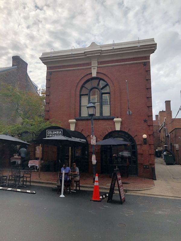
Portner's Building
| 101 ► Virginia, Alexandria, Old Town — Portner's — |
| On South St. Asaph Street just south of King Street, on the right when traveling south. | |||
| 102 ► Virginia, Alexandria, Old Town — Potomac Connections — Tidewater and the Atlantic Coastal Plain — Potomac Heritage National Scenic Trail — |
| Near Jones Point Drive east of South Royal Street, on the right when traveling east. | |||
| 103 ► Virginia, Alexandria, Old Town — E-91 — Potts-Fitzhugh-Lee House — |
| On Oronoco Street just east of North Washington Street, on the right when traveling west. | |||
| 104 ► Virginia, Alexandria, Old Town — Prehistory to Colonial Settlement — Jones Point Park — National Park Service, U.S. Department of the Interior — |
| Near Jones Point Drive, 0.2 miles east of South Royal Street, on the right when traveling east. | |||
| 105 ► Virginia, Alexandria, Old Town — Raise the White Flag — Star-Spangled Banner National Historic Trail — War of 1812 — |
| On The Strand south of King Street, on the left when traveling south. | |||
| 106 ► Virginia, Alexandria, Old Town — Residence of General William Brown, M.D. — Born 1748. Died 1792. — |
| On South Fairfax Street south of Prince Street, on the right when traveling north. | |||
| 107 ► Virginia, Alexandria, Old Town — E-156 — Restored Government of Virginia — |
| On North Royal Street at Cameron Street, on the right when traveling north on North Royal Street. | |||
| 108 ► Virginia, Alexandria, Old Town — Retail in Alexandria — City of Alexandria Est. 1749 — |
| On King Street west of Saint Asaph Street, on the right when traveling east. | |||
| 109 ► Virginia, Alexandria, Old Town — 3 — Retrocession — City of Alexandria, Est. 1749 — Alexandria Heritage Trail — |
| On North Union Street at Queen Street, on the right when traveling north on North Union Street. | |||
| 110 ► Virginia, Alexandria, Old Town — River Ferries — City of Alexandria Est. 1749 — |
| On King Street at Strand Street, on the left when traveling west on King Street. | |||
| 111 ► Virginia, Alexandria, Old Town — Saint Mary's Catholic Parish — |
| On South Royal Street north of Wolfe Street, on the right when traveling north. | |||
| 112 ► Virginia, Alexandria, Old Town — Saint Paul's Episcopal Church — 228 Pitt Street — |
| On S. Pitt Street north of Duke Street, on the right when traveling north. | |||
| 113 ► Virginia, Alexandria, Old Town — 8 — Shipbuilding at Point Lumley — City of Alexandria, est. 1749 — Alexandria Heritage Trail — |
| On Duke Street east of The Strand, on the left when traveling east. | |||
| 114 ► Virginia, Alexandria, Old Town — Shipyard Park — Harborside — |
| Near Wolfe Street, 0.1 miles east of South Union Street, on the right when traveling east. | |||
| 115 ► Virginia, Alexandria, Old Town — Shuter's Hill and the West End — Old Town — |
| On Diagonal Road west of Daingerfield Road, on the right when traveling west. | |||
| 116 ► Virginia, Alexandria, Old Town — Site of Alexandria's First Sugar Refinery — 1804-1828 — |
| Near Cameron Street at North Columbus Street, on the left when traveling west. | |||
| 117 ► Virginia, Alexandria, Old Town — Site of Assembly Hall — Alexandria City Hall — |
| On North Fairfax Street at Cameron Street, on the right when traveling south on North Fairfax Street. | |||
| 118 ► Virginia, Alexandria, Old Town — Site of First Services of the Salvation Army — Alexandria, Virginia — May 1885 — |
| On King Street near Royal Street. | |||
| 119 ► Virginia, Alexandria, Old Town — Site of the First Lot Sold at Auction — |
| On Cameron Street west of North Lee Street, on the right when traveling west. | |||
| 120 ► Virginia, Alexandria, Old Town — Stabler-Leadbeater Apothecary — |
| On South Fairfax Street south of King Street, on the right when traveling south. | |||
| 121 ► Virginia, Alexandria, Old Town — Stabler-Leadbeater Apothecary Museum — City of Alexandria Est. 1749 — |
| On King Street at South Fairfax Street, on the right when traveling east on King Street. | |||
| 122 ► Virginia, Alexandria, Old Town — Stabler-Leadbeater House — (1847 - 1933) — |
| On South Pitt Street south of Prince Street, on the right when traveling south. | |||
| 123 ► Virginia, Alexandria, Old Town — Submarine Screw (Propeller) — USS Pompon (SS 267) — |
| On Thompsons Alley east of North Union Street, on the right when traveling east. | |||
| 124 ► Virginia, Alexandria, Old Town — Suffragists and a Courtroom Decision in Alexandria — Alexandria Heritage Trail — City of Alexandria, est. 1749 — |
| On South St. Asaph Street just south of Prince Street, on the right when traveling south. | |||
| 125 ► Virginia, Alexandria, Old Town — Swann-Daingerfield House |
| On Prince Street east of South Columbus Street, on the right when traveling east. Reported permanently removed. | |||
| 126 ► Virginia, Alexandria, Old Town — Swann-Daingerfield House — 1802 — |
| On Prince Street east of South Columbus Street, on the right when traveling east. | |||
| 127 ► Virginia, Alexandria, Old Town — 7 — The Alexandria Ford Plant — [Ford's Landing Park] — |
| Near Ford's Landing Way east of Franklin Street, on the left when traveling south. | |||
| 128 ► Virginia, Alexandria, Old Town — The Alexandria Furniture District — City of Alexandia, Est. 1749 — |
| On King Street (Virginia Route 7) at South Columbus Street, on the right when traveling east on King Street. | |||
| 129 ► Virginia, Alexandria, Old Town — The Alexandria Lyceum — City of Alexandria Est. 1749 — |
| On King Street (Virginia Route 7) at North Washington Street (Virginia Route 400), on the right when traveling east on King Street. | |||
| 130 ► Virginia, Alexandria, Old Town — The Alexandria Marine Railway |
| On Wharf Street east of Ford's Landing Way, on the right when traveling west. Reported unreadable. | |||
| 131 ► Virginia, Alexandria, Old Town — The Athenaeum — City of Alexandria Est. 1749 — |
| On King Street at South Lee Street, on the right when traveling east on King Street. | |||
| 132 ► Virginia, Alexandria, Old Town — The Bank of Potomac Building — Built 1804-07 — |
| On Prince Street just west of South Royal Street, on the right when traveling west. | |||
| 133 ► Virginia, Alexandria, Old Town — The Braddock Campaign and Carlyle House — |
| On North Fairfax Street south of Cameron Street, on the left when traveling south. | |||
| 134 ► Virginia, Alexandria, Old Town — The Carlyle House and the 18th-Century Site |
| Near North Fairfax Street north of King Street, on the right when traveling north. Reported permanently removed. | |||
| 135 ► Virginia, Alexandria, Old Town — 4 — The Civil War and Battery Rodgers — Ford's Landing City Park — |
| Near Ford's Landing Way at Franklin Street, on the left when traveling south. | |||
| 136 ► Virginia, Alexandria, Old Town — The Civil War Comes to Alexandria — City of Alexandria Est. 1749 — |
| On North Union Street at Cameron Street, on the right when traveling north on North Union Street. | |||
| 137 ► Virginia, Alexandria, Old Town — The Confederate Statue |
| On South Washington Street (Virginia Route 400) at Prince Street, on the right when traveling south on South Washington Street. Reported permanently removed. | |||
| 138 ► Virginia, Alexandria, Old Town — 5 — The Domestic Slave Trade — City of Alexandia, Est. 1749 — Alexandria Heritage Trail — |
| On Strand Street just south of King Street, on the right when traveling north. | |||
| 139 ► Virginia, Alexandria, Old Town — The Earliest Inhabitants |
| Near Wharf Street near Ford's Landing Way, on the right when traveling west. Reported unreadable. | |||
| 140 ► Virginia, Alexandria, Old Town — The Edmonson Sisters — Alexandria Heritage Trail — City of Alexandria, est. 1749 — |
| On Duke Street (Virginia Route 236) at Holland Lane, on the right when traveling west on Duke Street. | |||
| 141 ► Virginia, Alexandria, Old Town — The Emerging Nation — Jones Point Park — National Park Service, U.S. Department of the Interior — |
| Near Jones Point Drive, 0.2 miles South Royal Street, on the right when traveling east. | |||
| 142 ► Virginia, Alexandria, Old Town — The Fairfax House — 1749 ▿ 1771 — |
| Near Prince Street. | |||
| 143 ► Virginia, Alexandria, Old Town — The Federal District and Alexandria |
| On Wharf Street east of Ford's Landing Way, on the right when traveling west. Reported unreadable. | |||
| 144 ► Virginia, Alexandria, Old Town — The First People on Jones Point — In Pursuit of Fur, Fish and Fowl — Jones Point Park — |
| Near Mount Vernon Trail. | |||
| 145 ► Virginia, Alexandria, Old Town — The Fitting-Out Dock — Shipshape and Cargo-Ready — 1918-1921 — |
| Near Jones Point Drive, 0.3 miles east of South Royal Street, on the left when traveling east. | |||
| 146 ► Virginia, Alexandria, Old Town — The Front Door of Gadsby's Tavern — |
| On North Royal Street at Caneron Street, on the right when traveling south on North Royal Street. | |||
| 147 ► Virginia, Alexandria, Old Town — The Gadsby's Tavern Ice Well |
| Near Cameron Street at North Royal Street, on the left when traveling west. Reported permanently removed. | |||
| 148 ► Virginia, Alexandria, Old Town — The Gadsby's Tavern Ice Well — |
| On Cameron Street at North Royal Street, on the right when traveling east on Cameron Street. | |||
| 149 ► Virginia, Alexandria, Old Town — The Garden — Past and Present — |
| Near North Fairfax Street. | |||
| 150 ► Virginia, Alexandria, Old Town — The Growth of Upper King Street — Alexandria Heritage Trail — City of Alexandria, Est. 1749 — |
| On King Street (Virginia Route 7) west of South Payne Street, on the left when traveling west. | |||
| 151 ► Virginia, Alexandria, Old Town — The History of the Pineapple — 🍍 — |
| On South Union Street just north of Wales Alley, on the right when traveling north. | |||
| 152 ► Virginia, Alexandria, Old Town — The Jones Point Lighthouse — Shedding Light on a Landmark — Jones Point Park, National Park Service, U.S. Department of the Interior — |
| Near Jones Point Drive east of South Royal Street, on the right when traveling east. | |||
| 153 ► Virginia, Alexandria, Old Town — The Law Office of Cohen, Cohen, and Hirschkop — Loving v. Virginia — City of Alexandria, est. 1749 — |
| On King Street at North Pitt Street when traveling west on King Street. | |||
| 154 ► Virginia, Alexandria, Old Town — The Long Story of The Jones Point Ropewalk — 1833-1850 — Jones Point Park — |
| Near Mount Vernon Trail. | |||
| 155 ► Virginia, Alexandria, Old Town — The Lost Village of Cameron at Great Hunting Creek — Jones Point Park — National Park Service, U.S. Department of the Interior — |
| Near Jones Point Drive at South Royal Street. | |||
| 156 ► Virginia, Alexandria, Old Town — The Lyceum — The Jean E. Keith Memorial — |
| On South Washington Street (Virginia Route 400) south of Prince Street, on the right when traveling south. | |||
| 157 ► Virginia, Alexandria, Old Town — The Lynching of Benjamin Thomas — August 8, 1899 — |
| On King Street at South Fairfax Street, on the right when traveling east on King Street. | |||
| 158 ► Virginia, Alexandria, Old Town — The Marshall House |
| On King Street, on the right when traveling east. Reported permanently removed. | |||
| 159 ► Virginia, Alexandria, Old Town — The Memorial Fountain — |
| On North Royal Street south of Cameron Street, on the right when traveling south. | |||
| 160 ► Virginia, Alexandria, Old Town — The Methodist Episcopal Congregation of Alexandria — |
| On George Washington Memorial Parkway north of Prince Street, on the right when traveling north. | |||
| 161 ► Virginia, Alexandria, Old Town — The Nation's Capital Begins Here 1791-1793 — Jones Point Park — National Park Service, U.S. Department of the Interior — |
| Near Jones Point Drive east of South Royal Street, on the right when traveling east. | |||
| 162 ► Virginia, Alexandria, Old Town — The Original Saint Mary's Church — |
| On Church Street east of South Washington Street, on the right when traveling east. | |||
| 163 ► Virginia, Alexandria, Old Town — The Patton-Fowle House — 711 Prince Street — c. 1806 — |
| On Prince Street east of South Columbus Street, on the left when traveling east. | |||
| 164 ► Virginia, Alexandria, Old Town — The Port City — City of Alexandria Est. 1749 — |
| On King Street at North Lee Street, on the left when traveling east on King Street. | |||
| 165 ► Virginia, Alexandria, Old Town — The Race to Build Ships on Jones Point — Alexandria Goes to War — 1918 - 1921 — |
| Near Jones Point Drive, 0.3 miles South Royal Street, on the right when traveling east. | |||
| 166 ► Virginia, Alexandria, Old Town — The Ramsay House — |
| On King Street at Fairfax Street, on the left when traveling east on King Street. | |||
| 167 ► Virginia, Alexandria, Old Town — The Ramsay House — Built Circa 1724 — |
| On King Street east of North Fairfax Street, on the right when traveling west. | |||
| 168 ► Virginia, Alexandria, Old Town — The Remarkable Margaret Brent — Landowner, Lawyer, Suffragette — 1601 - 1671 — |
| Near Jones Point Drive, 0.2 miles east of South Royal Street, on the right when traveling east. | |||
| 169 ► Virginia, Alexandria, Old Town — 7 — The River Queen — City of Alexandria, Virginia — Alexandria Heritage Trail — |
| On Prince Street east of The Strand, on the right when traveling west. | |||
| 170 ► Virginia, Alexandria, Old Town — The Ticer House — |
| On Prince Street just east of St. Asaph Street, on the right when traveling east. | |||
| 171 ► Virginia, Alexandria, Old Town — Timberman Brothers — City of Alexandria Est. 1749 — |
| On King Street at South Washington Street (Virginia Route 400), on the right when traveling east on King Street. | |||
| 172 ► Virginia, Alexandria, Old Town — Torpedo Factory Art Center — City of Alexandria, Virginia — Dedicated April 30, 1983 — |
| On North Union Street north of Fayette Alley, on the right when traveling north. | |||
| 173 ► Virginia, Alexandria, Old Town — Torpedo Factory Art Center — City of Alexandria Est. 1749 — |
| On North Union Street south of Cameron Street, on the right when traveling south. | |||
| 174 ► Virginia, Alexandria, Old Town — United States Naval Torpedo Station (Building Two) — |
| On North Union Street north of Fayette Alley, on the right when traveling north. | |||
| 175 ► Virginia, Alexandria, Old Town — Visiting Old Town |
| Near Diagonal Road (Virginia Route 7) south of King Street (Virginia Route 7), on the right when traveling south. Reported permanently removed. | |||
| 176 ► Virginia, Alexandria, Old Town — Visiting Old Town |
| Near Cameron Street east of North Union Street, on the right when traveling east. Reported permanently removed. | |||
| 177 ► Virginia, Alexandria, Old Town — War of 1812 — City of Alexandria Est. 1749 — |
| On King Street at South Union Street, on the right when traveling east on King Street. | |||
| 178 ► Virginia, Alexandria, Old Town — Washington’s Town House — |
| On Cameron Street near North St. Asaph Street, on the left when traveling west. | |||
| 179 ► Virginia, Alexandria, Old Town — Washington's Tenement House — |
| On South Pitt Street north of Prince Street, on the right when traveling south. | |||
| 180 ► Virginia, Alexandria, Old Town — Waterfront Archaeology — Alexandria Heritage Trail — City of Alexandria, est. 1749 — |
| Near Strand Street just south of Prince Street, on the right when traveling south. | |||
| 181 ► Virginia, Alexandria, Old Town — Waterfront Walk — |
| Near The Strand at King Street, on the right when traveling north. | |||
| 182 ► Virginia, Alexandria, Old Town — Welcome to Christ Church — A historic church and living congregation |
| On North Columbus Street at Cameron Street on North Columbus Street. Reported permanently removed. | |||
| 183 ► Virginia, Alexandria, Old Town — Welcome to Jones Point Park — National Park Service — U.S. Department of the Interior — |
| On Jones Point Drive east of South Royal Street, on the right when traveling east. | |||
| 184 ► Virginia, Alexandria, Old Town — Who Owns the River? — |
| Near Jones Point Drive east of South Royal Street, on the right when traveling east. | |||
| 185 ► Virginia, Alexandria, Old Town — Wilkes Street Tunnel — |
| Near Wilkes Street at South Royal Street, in the median. | |||
| 186 ► Virginia, Alexandria, Old Town — Wilkes Street Tunnel — City of Alexandria Est. 1749 — Alexandria Heritage Trail — |
| On South Union Street, 0.1 miles south of Wolfe Street, on the right when traveling south. | |||
| 187 ► Virginia, Alexandria, Old Town — Windmill Hill — City of Alexandria Est. 1749 — Alexandria Heritage Trail — |
| On South Union Street just north of Gibbon Street, on the left when traveling north. | |||
| 188 ► Virginia, Alexandria, Old Town — Wise's Tavern — 1788 - 1792 — |
| On North Fairfax Street at Cameron Street, on the right when traveling north on North Fairfax Street. | |||
| 189 ► Virginia, Alexandria, Old Town — World War I Memorial — |
| On Cameron Street east of North Pitt Street, on the right when traveling east. | |||
| 190 ► Virginia, Alexandria, Old Town — World War I-Era Rudder — Evidence of the Shipyard at Jones Point — |
| Near Jones Point Drive, 0.2 miles east of South Royal Street, on the right when traveling east. | |||
| 191 ► Virginia, Alexandria, Old Town — World Wars to the Present — |
| Near Jones Point Drive, 0.2 miles South Royal Street, on the right when traveling east. | |||
| 192 ► Virginia, Alexandria, Old Town — 11 — Zion Baptist Church — City of Alexandria, est. 1749 — Alexandria Heritage Trail — |
| On South Lee Street south of Franklin Street, on the right when traveling north. | |||
| 193 ► Virginia, Alexandria, Old Town North — 1 — African American Neighborhoods — City of Alexandria, Est. 1749 — Alexandria Heritage Trail — |
| Near Madison Street east of Mt. Vernon Trail, on the right when traveling east. | |||
| 194 ► Virginia, Alexandria, Old Town North — Alexandria Canal (1843 - 1886) — Lock #3 — |
| On North Royal Street north of Montgomery Street, on the right when traveling north. | |||
| 195 ► Virginia, Alexandria, Old Town North — Alexandria Canal Turning Basin — (1843-1886) — Alexandria Heritage Trail, City of Alexandria, Virginia — |
| On Montgomery Street just west of North Pitt Street, on the right when traveling west. | |||
| 196 ► Virginia, Alexandria, Old Town North — American Red Cross — |
| On North St. Asaph Street north of Pendleton Street, on the right when traveling north. | |||
| 197 ► Virginia, Alexandria, Old Town North — Cross Canal — Historic Site — |
| On Montgomery Street at North Fairfax Street, on the right when traveling west on Montgomery Street. | |||
| 198 ► Virginia, Alexandria, Old Town North — Cross Canal Neighborhood, 1860s - 1960s — Alexandria Heritage Trail — City of Alexandria, Est. 1749 — |
| On Mt. Vernon Trail at Canal Center Plaza (First Street), on the right when traveling south on Mt. Vernon Trail. | |||
| 199 ► Virginia, Alexandria, Old Town North — Life in "The Berg" — Alexandria Heritage Trail — City of Alexandria, est. 1749 — |
| On Wythe Street just east of North Pitt Street, on the right when traveling east. | |||
| 200 ► Virginia, Alexandria, Old Town North — Next Door Neighbors — Alexandria Heritage Trail — City of Alexandria, est. 1749 — |
| On Wythe Street just east of North Pitt Street, on the right when traveling east. | |||
286 entries matched your criteria. Entries 101 through 200 are listed above. ⊲ Previous 100 — The final 86 ⊳