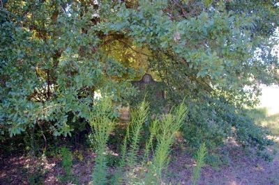
By David Seibert, September 5, 2010
Campsite of Union Army Marker
GEOGRAPHIC SORT Title Sort Marker Number Sort Marker Number Sort for Trails Publication Order Sort Publication Order Sort A Erected Year Sort Most Viewed Sort Most Recent-Interest Sort Most Recently Changed Sort SEE FAQ #33 FOR DESCRIPTIONS
On Georgia Route 22/24 at Old River Bridge Road, on the right when traveling east on Georgia Route 22/24.
On Old Monticello Road NW at Nelson Road, on the right when traveling west on Old Monticello Road NW.
On West Hancock Street (Georgia Route 49) west of North Wilkinson Street, on the right when traveling west.
On Old Monticello Road NW at Nelson Road, on the right when traveling west on Old Monticello Road NW.
On Kinderhook Road (Georgia Route 212) at Glynn Street ( Route 22), on the right when traveling south on Kinderhook Road.
On East Greene Street at North Jefferson Street, on the right when traveling east on East Greene Street. Reported missing.
On West Greene Street at South Jackson Street, on the left when traveling east on West Greene Street.
On East Greene Street at South Jefferson Street, on the right when traveling east on East Greene Street.
On Clark Street (Georgia Route 243) 0 miles south of West Montgomery Street (U.S. 441), on the right when traveling south. Reported missing.
On South Clarke Street (Business U.S. 441) south of East Hancock Street, on the left when traveling south.
On Irwinton Road (Ga 29) (U.S. 441) at Route 243, on the right when traveling north on Irwinton Road (Ga 29).
On Ocmulgee National Park Road 0.2 miles Emery Highway ( Route 80), on the right when traveling south.
On Ocmulgee National Park Road 0.2 miles Emery Highway (U.S. 80), on the right when traveling south.
On Mulberry Street 0 miles west of 1st Street, in the median.
On U.S. 80, on the right when traveling east.
Paid Advertisement
On U.S. 280 at Black Creek Church Road, on the left when traveling south on U.S. 280.
On Ford Avenue (State Highway 144) at Coastal Highway (U.S. 17), on the right when traveling east on Ford Avenue.
Near Fort McAllister Road.
On State Highway 144 at County Route 67, on the right when traveling west on State Highway 144.
On Fort McAllister Road (State Highway 144 Spur) at Bryan Neck Road (State Highway 144), on the right when traveling east on Fort McAllister Road. Reported permanently removed.
Near Cedar Street 0.2 miles east of Richard Davis Drive.
On Northside Drive West (U.S. 80) near Miller Street, on the right when traveling north.
On Courtland Street near North Main Street (U.S. 301), on the left when traveling west.
On Old Quaker Road (State Highway 24) at Munnerlyn-Alexander Road, on the right when traveling east on Old Quaker Road.
Near Bark Camp Church Road, on the left when traveling west.
On Jones Street (Georgia Route 56) at Lee Street ( Highway 17), on the right when traveling north on Jones Street.
On Old Savannah Road at Noah Ark Circle, on the right when traveling south on Old Savannah Road.
Near Porter Carswell Road at Bellevue Plantation Road.
On West Quaker Road 1.9 miles west of Cohen Road, on the right when traveling west.
On Georgia Route 24 at Rocky Creek Church Road, on the left when traveling west on Georgia Route 24.
Paid Advertisement
On South Liberty Street (U.S. 25) at State Highway 24 on South Liberty Street.
On South Liberty Street (U.S. 25) south of 6th Street, on the left when traveling south.
On Munnerlyn Alexander Road 0.6 miles east of U.S. 25, on the right when traveling east.
On U.S. 23 at Mount Pleasant Church Road, on the left when traveling south on U.S. 23.
On South Mulberry Street north of Third Street, on the left when traveling north.
On Georgia Route 16 at Pratt Smith Road, on the right when traveling east on Georgia Route 16.
On South Mulberry Street near 3rd Street (U.S. 23), on the right when traveling south.
On Georgia Route 42 south of Lake Clark Road, on the right when traveling south.
On McDonough Road 0.2 miles south of Brookwood Avenue (U.S. 23), on the right when traveling north.
On Keys Ferry Road at Winding Way (County Route 293), on the right when traveling east on Keys Ferry Road.
On North Oak Street north of Third Street, on the right when traveling north.
On Fort Argyle Road (State Highway 204) at Bush Drive, on the left when traveling west on Fort Argyle Road.
Near Triplett Park Drive (U.S. 80) 0.2 miles south of U.S. 80.
On U.S. 80 near Rogers Street, on the left when traveling west.
On South Coastal Highway (State Highway 25) near Oxnard Drive, on the right when traveling north.
On Ocean Highway (Route 17) at Basin Road on Ocean Highway.
Paid Advertisement
On Chatham Parkway, on the right when traveling south.
On Fort Argyle Road (Georgia Route 204) at Bush Road, on the right when traveling east on Fort Argyle Road.
On West Bay Street near Jefferson Street, on the right when traveling west.
On Bull Street at Macon Street, on the right when traveling south on Bull Street.
On Ogeechee Road (U.S. 17) at Silk Hope Road when traveling north on Ogeechee Road.
On Tara Boulevard (U.S. 41) at McDonough Road, on the right when traveling north on Tara Boulevard.
On North Main Street (Georgia Route 54) at Stockbridge Road ( Route 138), on the right when traveling south on North Main Street.
On Tara Boulevard (U.S. 41) at North Avenue ( Route 138), on the right when traveling north on Tara Boulevard.
On Moreland Avenue NE (U.S. 23) at North Avenue NE, on the right when traveling north on Moreland Avenue NE.
On Covington Highway (U.S. 278) 0.1 miles east of Panola Road, on the right when traveling east.
On Norris Lake Road at Norris Lake Drive, on the right when traveling south on Norris Lake Road.
On Cemetery Circle north of East Ponce de Leon Avenue, on the right when traveling north.
On Stone Mountain Lithonia Road at Rockbridge Road, on the right when traveling south on Stone Mountain Lithonia Road. Reported missing.
On Louisville Road (U.S. 80) at Fox Bow Drive, on the right when traveling east on Louisville Road.
On Noel C Conaway Road (State Highway 30) at State Highway 17, on the right when traveling north on Noel C Conaway Road.
On Ebenezer Road (Georgia Route 275).
Paid Advertisement
On South Laurel Street (State Highway 21) at East 3rd Street, on the right when traveling north on South Laurel Street.
On Old Savannah Road at East Main Street ( Route 56), on the left when traveling east on Old Savannah Road.
On Washington Street SW at Mitchell Street SW, on the right when traveling south on Washington Street SW.
On Broad Street (Georgia Route 15/16) 0 miles east of Boland Street, on the right when traveling east.
On U.S. 23 at Locust Road, on the right when traveling south on U.S. 23.
On Atlanta Street (U.S. 23) at Park Circle, on the right when traveling south on Atlanta Street.
On North Henry Boulevard (U.S. 23) at Tye Street, on the right when traveling west on North Henry Boulevard.
On North Henry Boulevard (U.S. 23) at McCain Creek Trail, on the right when traveling east on North Henry Boulevard.
On Georgia Route 11 0.1 miles south of Plum Street, on the right when traveling south.
On Georgia Route 11 south of Henry Jones Road, on the right when traveling south.
On Georgia Route 16 at Buggy Road (County Route 170), on the right when traveling east on Georgia Route 16.
On Main Street (Georgia Route 83) north of Eatonton Highway ( Route 142), on the right when traveling north.
Near Depot Street east of North Railroad Avenue, on the right when traveling east.
On Church Street (U.S. 221) near Wadley Road (U.S. 319), on the right when traveling south.
On Fenns Bridge Road (Georgia Route 88) at Grange Road ( Route 171), on the right when traveling north on Fenns Bridge Road.
Near T E Buchanan Road 0.3 miles north of U.S. 221.
Paid Advertisement
On Georgia Route 17 1.5 miles north of Malloy Road (County Route 172), on the left when traveling south.
On U.S. 221 0.1 miles east of Grange Road ( Route 171), on the right when traveling east.
On U.S. 221 0.2 miles east of Bostic Mill Road, on the right when traveling east.
On East Broad Street east of Mulberry Street ( Route 24), on the right when traveling west.
On Georgia Route 296 at Fenns Bridge Road ( Route 88), on the right when traveling north on Georgia Route 296.
On North Main Street (U.S. 1) near U.S. 319, on the left when traveling north.
Near Magnolia Springs Drive.
On Cotton Avenue west of North Daniel Street, on the right when traveling east.
On West Winthrope Road (State Highway 17) at Old Louisville Road, on the right when traveling east on West Winthrope Road.
On Georgia Route 17 at Morris Road, on the left when traveling east on Georgia Route 17.
On Big Buckhead Church Road 3.5 miles west of U.S. 25, on the right when traveling west.
On Big Buckhead Church Road 0.2 miles south of Porter Road, on the right when traveling south.
On U.S. 25 at Big Buckhead Church Road, on the left when traveling north on U.S. 25.
On Georgia Route 17 at Scarboro Church Road, on the right when traveling east on Georgia Route 17.
On East Elm Street (U.S. 319) near North Marcus Street (State Highway 15), on the right when traveling west.
Near Pulaski Street 0.2 miles east of Greene Settlement Road, on the right when traveling east.
Paid Advertisement
On Pulaski Street 0.1 miles west of Washington Street, on the right when traveling east.
On Georgia Route 18 at Griswoldville Road, on the right when traveling east on Georgia Route 18.
On Old Griswoldville Road 1 mile east of Henderson Road, on the left when traveling east.
On Eatonton Highway (U.S. 129) at Blounts Chapel Road, on the left when traveling north on Eatonton Highway.
On Old Griswoldville Road 0 miles west of Baker Road, on the right when traveling east.
︽
161 entries matched your criteria. The first 100 are listed above.
The final 61 ⊳